Where to start with planning which South Island hikes you want to do?
There’s a lot of variables to consider when deciding what hikes and walks in the South Island you should do:
- length of your trip
- ability
- likes/dislikes
- itineraries, etc.
I was starting to whittle this post down to about 20 of the best hikes in the South Island, but things got confusing fast.
But if you want me to give you the top five must-do South Island walks/hikes (that aren’t Great Walks) I’ve done (and written about), I’ll go with:
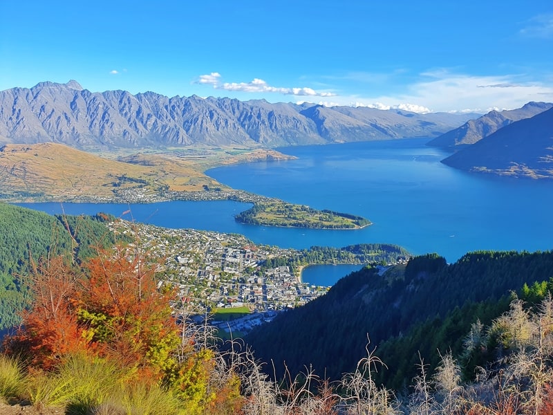
1. Ben Lomond Track
2. Earnslaw Burn Track
3. Mount John
4. Mueller Hut Track
5. Kaikoura Peninsula Track
Wowwee, even that was hard to choose. And if I had to choose five again tomorrow, I’m sure the answer would be different…and I even attempted to list my best hikes in New Zealand.
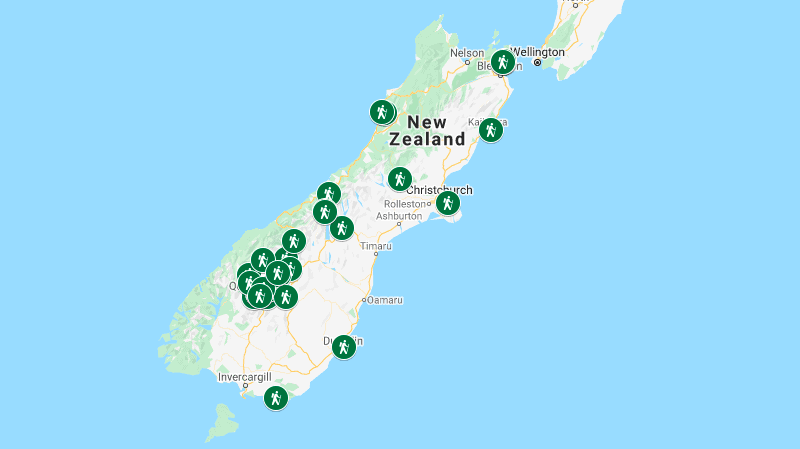
Here are the walks in this post on a map. Afterward, I’ll get into the descriptions, etc.
A MAP OF THE WALKS AND HIKES IN THE SOUTH ISLAND
Note: the map will open in a new window/tab where you can then zoom in, out, and whatnot. You’ll notice a concentration in Otago as that’s where I’ve spent the most time in the South Island.
40 SOUTH ISLAND WALKS & HIKES
1. Ben Lomond Track
2. Queenstown Hill Walk
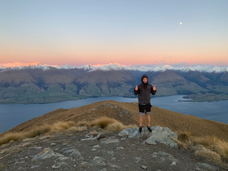
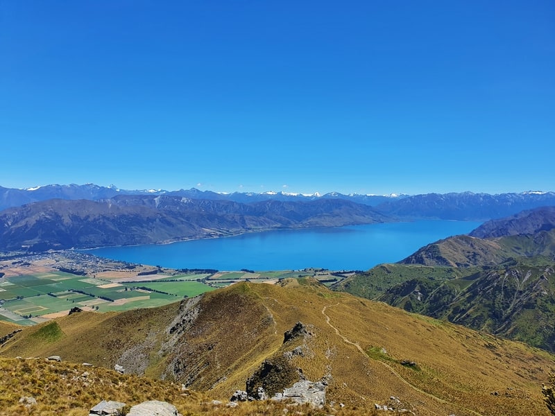
3. Roys Peak Track
4. Earnslaw Burn Track
5. Mount McIntosh Track
6. Moke Lake Track
7. Fernhill Loop Track
8. Jan’s Peak
9. Tiki Trail
10. Queenstown Gardens
11. Moonlight Track
12. Wye Creek to Lake Alta
13. Mount Horn Track
14. Meg Hut Track
15. Nichols Falls
16. Rob Roy Glacier Track
17. Skyline Track Wanaka
18. Isthmus Peak Track
19. Grandview Mountain Track
20. Coronet Peak Hiking Trail
21. Brow Peak Track
22. Sawpit Gully Track
23. New Chum Gully Track
24. Tobins Track
25. Crown Peak Track
26. Waipohatu Falls Walk
27. Roberts Point Track
28. Mueller Hut Route
29. Hooker Valley Track
30. Mount John Walk
31. Cave Stream Scenic Walk
32. Godley Head Loop Walk
33. Pororari-Punakaiki Loop Track
34. Pororari River Track
35. Kaikoura Peninsula Track
36. Snout Track
37. Tirohanga Track
38. Esson Valley Track
39. Bob’s Cove Track
40. Mount Judah Track
41. Lake Marian Track
40 AMAZING SOUTH ISLAND HIKES AND WALKS
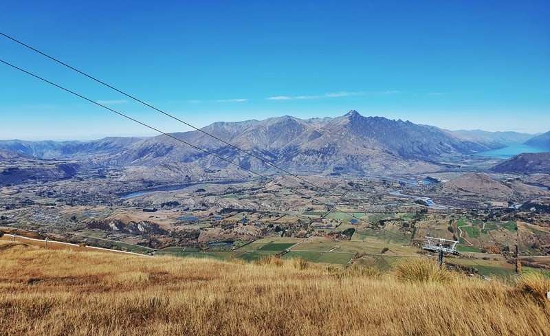
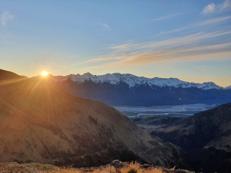
1. BEN LOMOND TRACK
- Difficulty: Hard
- Distance: 15-16km return
If you’re looking for a challenging hike right next to Queenstown, the Ben Lomond Track is what you’re looking for.
It’s a steep climb with over 1200 metres of elevation gain on the way up to the summit which is just over 1700 metres above sea level. Though you can take the gondola up to Bob’s Peak which cuts off 400 metres or so of elevation.
The views throughout the hike are awesome with views of Lake Wakatipu and up towards the summit. It does look steep heading up to the summit!
And from the summit, you’ve got epic 360-degree views and if you’re lucky you might see a kea or two hanging around. If you can, make your way up for sunrise! This is definitely one of the best hikes in the South Island.
READ THE FULL POST: THE BEN LOMOND TRACK
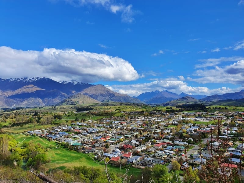
2. QUEENSTOWN HILL WALK
- Difficulty: Easy – Medium
- Distance: 5.5 – 6km return
If you’re looking for a good value hike, you can’t go past the Queenstown Hill Walk.
It’s less than 3km to the summit (if you’re driving to the trailhead) and while it’s steep, you’ll don’t have to rush to get there…take your time and enjoy.
You don’t have views all the way, but the forest track is well maintained (if you turn left at the junction you’ll have a technical section) until you get to the Basket of Dreams.
You can get some good views from here, and if you’re short on time you might want to turn back…but keep going!
It gets more technical after the basket of dreams, but it’s not a long walk to the summit and the views are that much better. This is a great sunset hike or for an afternoon picnic. And you can do it year-round.
READ THE FULL POST: THE QUEENSTOWN HILL WALK
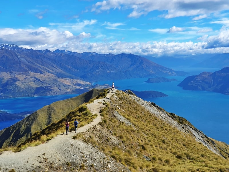
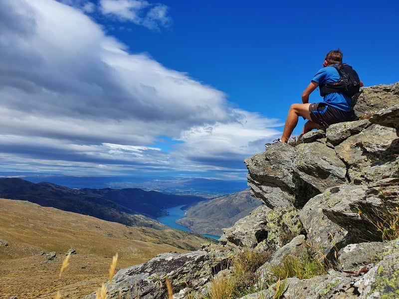
3. ROYS PEAK TRACK
- Difficulty: Medium
- Distance: 13km return
The famous Roys Peak Track!
I can understand why it’s popular, the views are gorgeous all the way up with Lake Wanaka and the famous viewpoint.
But all the switchbacks keep it from being a super interesting hike. The sheep can be fun to watch though?
That said, if it’s on your must-do things in NZ, I can’t blame you. But do try and make it to the summit beyond the viewpoint! The ridgeline from there is cool.
If you’re looking for a hike in Wanaka that’s similar, go with Isthmus Peak.
And for those who are curious, Ben Lomond is my favourite out of these two.
READ THE FULL POST: ROYS PEAK TRACK
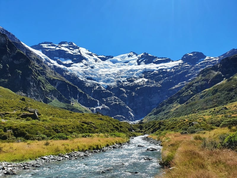
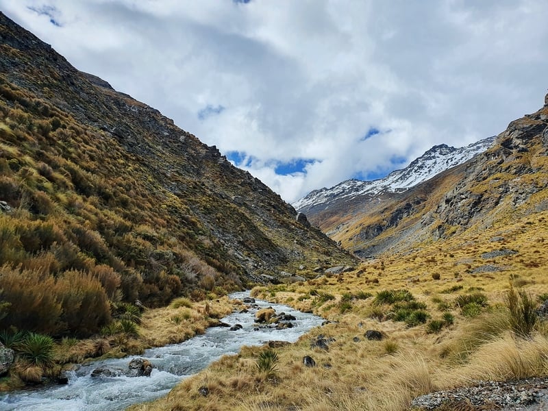
4. EARNSLAW BURN TRACK
- Difficulty: Medium – Hard
- Distance: 26-27km return
What a beauty of a hike this is! This is one of the most underrated hikes in Otago, though word is starting to spread about how good the Earnslaw Burn Track is.
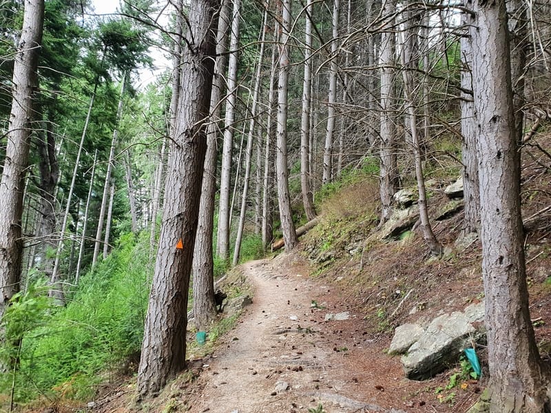
You’ve got two distinct sections of this hike. The first part of the track is through the forest on some pretty technical terrain with lots of roots and little twists and a bit of elevation.
Once you exit the forest, you follow the Earnlsaw Burn River through the valley. This is a beautiful walk, and you can get right up close to the glacier. A picture paints 1000 words for this one.
You can also camp near the glacier which is awesome! While some people fly in via helicopter to get some wedding photos, then leave…it’s a way better experience to hike in and spend extended time out of reception.
You can do this hike in winter, just make sure you have high-quality gear and check with DOC in Queenstown for the latest info to make sure it’s safe (and get/hire a PLB).
READ THE FULL POST: THE EARNSLAW BURN TRACK
5. MOUNT MCINTOSH TRACK
- Difficulty: Medium – Hard
- Distance: ~18km return
So I guess it’s fair to say that walks in Glenorchy are underrated. Mount McIntosh is one of them. The trail starts a couple of kilometres before Glenorchy on the Queenstown-Glenorchy Scenic Road.
When working at Macpac this was a hike a few people asked about and I managed to convince them to go. One person came back and said they loved it which is nice…people don’t often give feedback after a recommendation, even if they loved it.
The hike is quite steep the whole way, but the track is fairly well maintained so as long as you start early enough just keep up the relentless forward motion.
There’s one river crossing to get across a valley but other than that, you’ve got a marked trail. The views? Amazing, and quite different from other views in the region.
You can stay at the McIntosh Hut too which is a beautiful rustic-like thing. This gives you a bigger window to try and reach Black Peak for those who are super keen 🙂
READ THE FULL POST: THE MOUNT MCINTOSH TRACK
6. MOKE LAKE TRACK
- Difficulty: Easy
- Distance: 7 – 8km
I find myself recommending Moke Lake as a place to visit in Queenstown (well close to) more and more. There’s something quite magical about it.
You generally don’t get any reception which is a win and it’s only like a 15-minute drive from town so it’s easy to access.
The lake isn’t massive, but on a calm day has some beautiful reflections. And it gets sun for a good portion of the day so after your walk around Moke Lake you can hang out, eat, play…or even take a swim in the water 😮
You can visit Moke Lake in winter. If you’re planning to do the walk during winter, you might need to take your shoes off at a couple of points.
READ THE FULL POST: THE MOKE LAKE LOOP TRACK
7. FERNHILL LOOP TRACK
- Difficulty: Medium
- Distance: 7 – 8km
Some people really like the Fernhill Loop Track, but it’s certainly not going to make my any best hikes in the South Island list of mine.
It’s a solid ascent and descent with a lovely section in the middle where you go through some beech forest before escaping the treeline for some great views. But the navigation is tricky.
The lack of signage is annoying at a few points with the track winding throughout the mountain bike tracks.
READ THE FULL POST: THE FERNHILL LOOP TRACK
8. JAN’S PEAK
- Difficulty: Medium
- Distance: ~7km return
This is one of best hikes in Queenstown I reckon and is better value than Queenstown Hill (that may be controversial).
It’s not that far above Bob’s Peak, but it’s a route most people aren’t aware of. And you get different Queenstown views from the norm, somewhat unique too.
And the ridgeline back towards Skyline is absolutely stunning.
READ THE FULL POST: JANS PEAK
9. TIKI TRAIL
- Difficulty: Easy – Medium
- Distance: 4km return
I love to hate the Tiki Trail. It’s steep and technical…a great place to test your uphill fitness close to Queenstown.
If you’ve got a bunch of multiday hikes around the South Island planned, going up here is a great way to gauge your fitness levels/and or break in new shoes. Or if you don’t want to pay for the gondola 😉
READ THE FULL POST: THE TIKI TRAIL
10. QUEENSTOWN GARDENS
- Difficulty: Easy
- Distance: 2km+
You can easily walk around the Queenstown Gardens without a plan and see what you stumble upon. But make sure you do a lap around the outside of the gardens at a minimum.
You get to see all the mountains surrounding Queenstown which is the highlight. But to be honest, any walk next to Lake Wakatipu is going to be lovely.
READ THE FULL POST: THE QUEENSTOWN GARDENS WALKWAY
11. MOONLIGHT TRACK
- Difficulty: Medium
- Distance: 18km
The Moonlight Track can be tackled in a couple of different ways:
- If you’re hiking Ben Lomond and have lots of time to spare, rather than an out and back you can do drop down the other side of the saddle to Arthurs Point via the Moonlight Track.
- Or you can complete an end-to-end hike between Moke Lake and Arthurs Point (you can even walk to both from Queenstown to complete a full loop about 32km long).
Either way, they’re both scenic spots and you get to see all the valleys out towards Skippers Canyon, an off-the-beaten-track destination in its own right.
READ THE FULL POST: MOONLIGHT TRACK (VIA THE BEN LOMOND SADDLE)
12. WYE CREEK TO LAKE ALTA
- Difficulty: Medium – Hard.
- Distance: ~16km
If you’re looking for a challenging hike, and don’t mind tackling logistics, walking from Wye Creek to Lake Alta makes for one of the best day hikes in the South Island.
This is a hike you’ll want to do in summer ideally so you have maximum daylight, but you’ve got such a variety of terrains on this hike.
There are three sections to this, the forested Wye Creek, the tussock-filled valley, and the snow Remarks. Love it!
READ THE FULL POST: THE WYE CREEK TRACK UP TO LAKE ALTA
13. MOUNT HORN TRACK
- Difficulty: Medium
- Distance: 18 – 19km
If you’ve decided to spend a few days in Cromwell, adding in a couple of nearby hikes isn’t the worst idea.
Mount Horn is an low key hike that takes you through Northburn Station. You’ll be on 4wd tracks a lot, but you get to see plenty along the way:
- cool shrubbery (yes, really)
- funky rock formations
- the Upper Clutha
- panoramic views
A sneaky good hike!
It’s on private land so make sure you ring to get permission first.
READ THE FULL POST: MOUNT HORN TRACK
14. MEG HUT TRACK
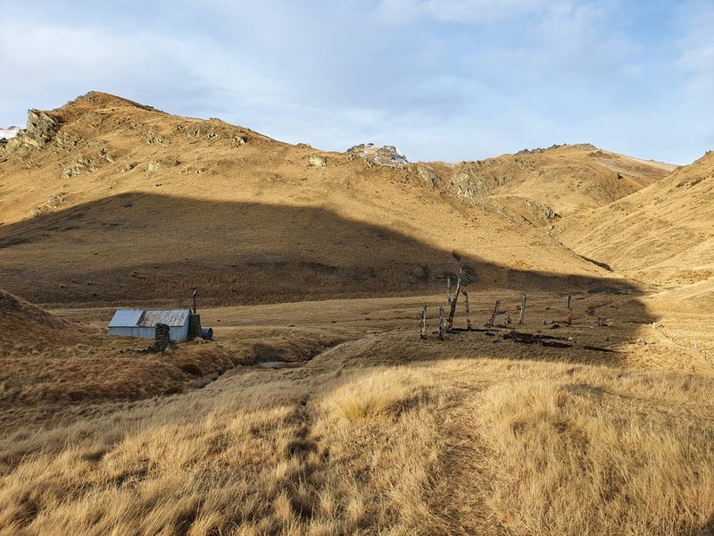
- Difficulty: Medium
- Distance: 14km return
If you’ve never stayed in a DOC Hut before, the Meg Hut Track to Meg Hut is a good option for a first-timer.
The track is easy to follow 7km each way (there’s some elevation) and there’s a decent chance you won’t be sharing the hut with anyone else.
From the hut, there are lots of trails to chose from before you decide to head back down to Cardrona.
READ THE FULL POST: THE MEG HUT TRACK
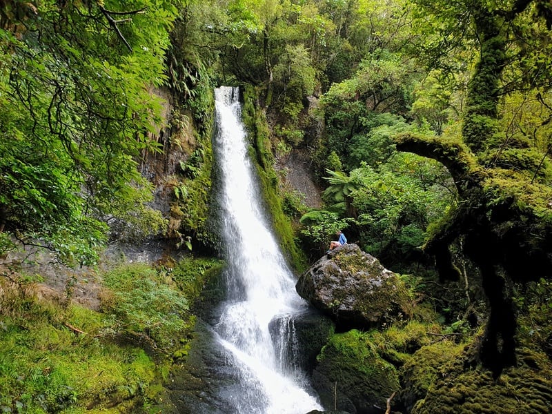
15. NICHOLS FALLS TRACK
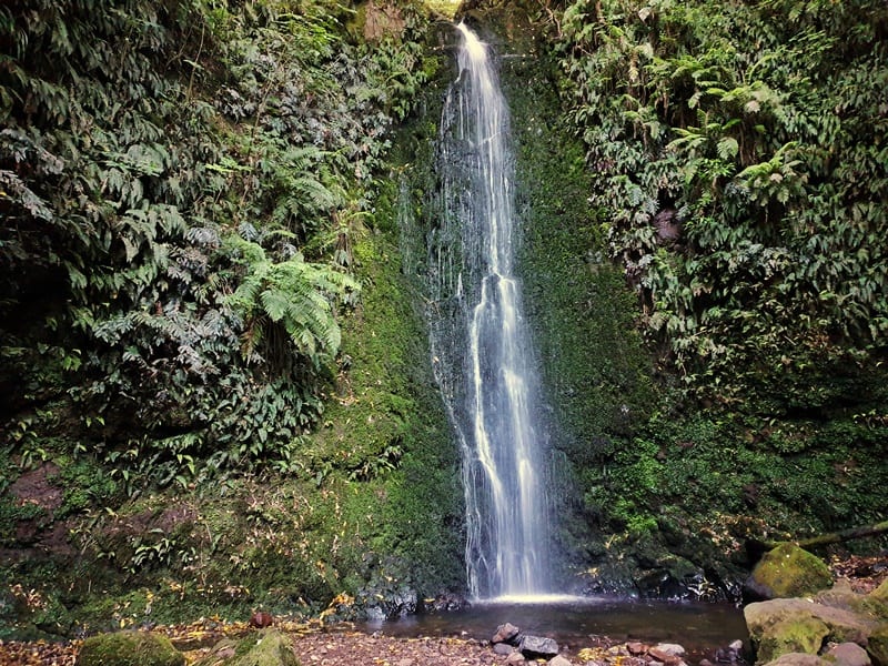
- Difficulty: Easy
- Distance: <5km
If you’re looking for a nifty little getaway spot close to Dunedin, go for a stroll along the Nichols Falls Track.
It’s a short drive from the city centre, and you’ll feel like you’re a long way away as you wander through the tree-lined track to a small, yet picturesque waterfall.
This is a short walk but I did manage to get lost, so make sure you read the post below so you don’t make the same mistakes 🙂 And if you go at night, you get bonus glowworms.
READ THE FULL POST: THE WALK TO NICHOLS FALLS
16. ROB ROY GLACIER TRACK
- Difficulty: Easy – Medium
- Distance: 11 – 12km
The Rob Roy Glacier Track is the most popular hike in Mount Aspiring National Park.
There’s some elevation on the hike, but this is one of the hikes in the South Island that takes you up close to a glacier which is awesome (also read: walks with glacier views in NZ).
You’ll also get some views along the way…which considering you’re in a national park are never going to be too shabby 😉
READ THE FULL POST: THE ROB ROY GLACIER TRACK
17. SKYLINE TRACK WANAKA
- Difficulty: Medium
- Distance: ~23 – 24km
The Skyline Track in Wanaka is a fun route if you’re spending a decent amount of time in Wanaka.
The track starts by going up Roys Peak, where you can get the famous photo before continuing up to Mount Roy.
The traverse along the ridgeline from here is awesome as you cross over Mount Alpha which can be technical. From there the rest of the ridgeline is nice as you walk back towards Wanaka.
But you don’t drop back down into Wanaka, instead, you head south through a couple of valleys and end up on the Crown Range Road.
To get back, you’ll need to either hitch or preplan a key swap/manage cars etc.
READ THE FULL POST: WANAKA’S SKYLINE TRACK
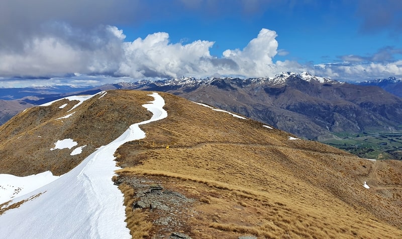
18. ISTHMUS PEAK TRACK
- Difficulty: Hard
- Distance: 15 – 16km
Isthmus Peak rivals both Roys Peak and Ben Lomond. In a perfect world, you’d do all three…for sunrise.
This is a steep track with few flat sections on the way. It doesn’t take long until you get above the tree line, and when you do you’ll get epic views of Lake Hawea.
It’s not until you get to the summit until you can see Lake Wanaka, but the views there on a nice day are super fun.
It’s an out and back, but it’s hard to get sick of the Lake Hawea views!
And unlike Roys Peak, there’s only a part of this hike that involves switchbacks which makes it a much more interesting hike.
READ THE FULL POST: THE ISTHMUS PEAK TRACK
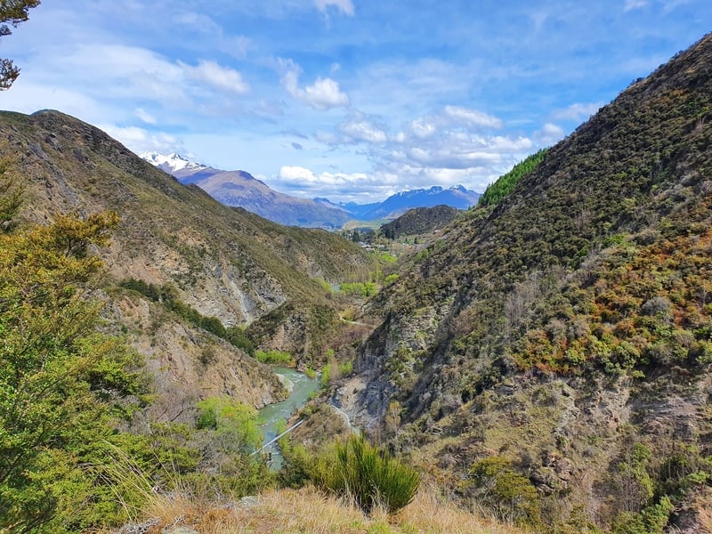
19. GRANDVIEW MOUNTAIN TRACK
- Difficulty: 18km
- Distance: Easy – Medium
This is a walk that goes to show that Lake Hawea is pretty spectacular.
A friend mentioned that the Lake Hawea walks are great as they’re not super popular leaving some amazing places for locals to explore free of massive foot traffic.
The Grandview Mountain Track starts by taking you into a valley, then starts to make its way up towards the summit with varying views throughout. And as you can see from the photo above, the summit rewards are pretty great.
READ THE FULL POST: THE GRANDVIEW MOUNTAIN TRACK
20. CORONET PEAK HIKING TRAIL
- Difficulty: Medium
- Distance: 4 – 5km return
Coronet Peak is known for its ski fields, but you can still access the place during summer. They’ve got a few activities you can do up there, but hiking to the summit is always fun.
It’s a short and sharp hike with rewarding panoramic views at the top.
If you’re planning to bring a picnic to enjoy the summit, that’s a great idea!
READ THE FULL POST: THE CORONET PEAK HIKING TRAIL
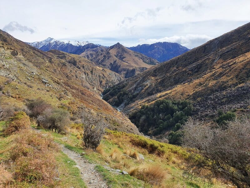
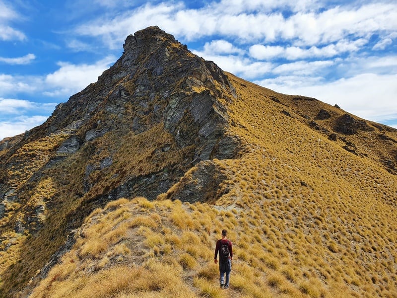
21. BROW PEAK TRACK
- Difficulty: Medium – Hard
- Distance: 19 – 20km
This is another one of the South Island hikes that fills me with joy and was close to making the top five South Island hikes list at the top of the post.
The walk to the ridgeline can be completed on various trails from Arrowtown, but the real fun begins once you’re on the ridge. You can see from the photo above how different the two sides of the ridge are.
Other than a small cairn, it’s hard to know when you’re actually at Brow Peak, but the joy is in the ridgeline before you drop back down to Arrowtown.
There’s a few routes you can take, but I like the one in the post below. This is a hike you’ll want to have a good level of fitness for…it surprised me how tired I was at the end of the day.
READ THE FULL POST: THE BROW PEAK TRACK
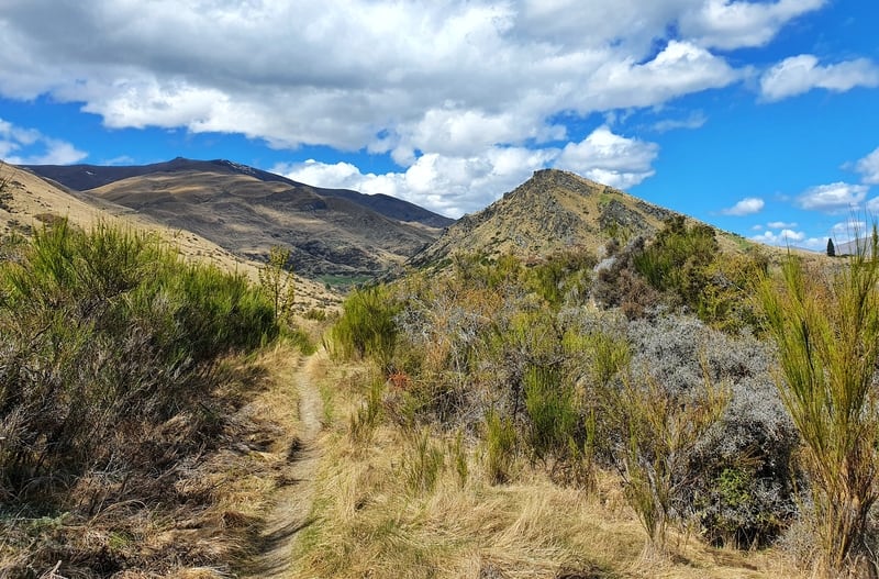
22. SAWPIT GULLY TRACK
- Difficulty: Easy – Medium
- Distance: 7 – 8km
The Sawpit Gully Track is a go-to track for Arrowtown locals who want to get some fresh air.
The track takes you around and up German Hill which gets you some nice views over the Wakatipu Basin. And you’ll get a taste of walking along the rivers that were home to the gold mining era.
I’ve only ever done this track in the anti-clockwise direction, but I’ve spoken to a few local friends and they all said they prefer the clockwise direction for the fun descent.
READ THE FULL POST: THE SAWPIT GULLY TRACK
23. NEW CHUM GULLY TRACK
- Difficulty: Easy – Medium
- Distance: 7 – 8km
This is a walk I think I could grow to love if I did it more often. It incorporates parts of Tobins Track and Sawpit Gully but has a somewhat unruly section of its own between the two tracks.
This is definitely a good weather day walk as some of the track is quite slippery and can be overgrown.
READ THE FULL POST: THE NEW CHUM GULLY TRACK
24. TOBINS TRACK
- Difficulty: Easy – Medium
- Distance: 8km return (including Mount Beetham)
If you’re looking for a walk where you can get some views, easily chat with friends and not have to think too much, Tobins Track is a good choice.
You start by following the Arrow River, and once you cross the bridge, make the steady climb up a gravel 4WD track. And it doesn’t take long until you’ve got views over Arrowtown and Wakatipu Basin where you can point out various landmarks.
Once you get to the seat at the top, you can choose your poison, head back the way you came, or venture up the super steep Mount Beetham.
READ THE FULL POST: TOBINS TRACK
25. CROWN PEAK TRACK
- Difficulty: Medium – Hard
- Distance: 24 – 25km
This is a glorious hike that follows a few of the different trails in Arrowtown before you begin the steady ascent up to Crown Peak.
It’s got some steep sections, some flat sections, and everything in between. You’ll see the summit from a few km out, but it’s still a sneaky climb to get there. The views are pretty sweet throughout, so you can’t complain too much.
This is one for the experienced South Island hikers who are looking to see a different part of the region.
READ THE FULL POST: CROWN PEAK HIKE
26. WAIPOHATU FALLS WALK
- Difficulty: Easy – Medium
- Distance: 5 – 6km
There are lots of short walks to see when you visit the Catlins, but this walk is slightly longer but has two waterfalls to see which is cool.
And as it’s not such a short walk there are fewer people which is always nice. Always zag when others are zigging 😉
READ THE FULL POST: THE WAIPOHATU FALLS WALK
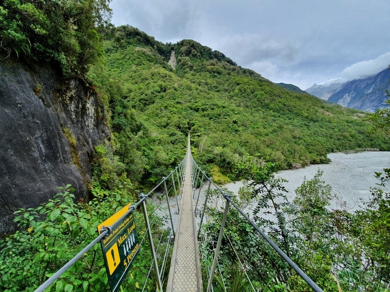
27. ROBERTS POINT TRACK
- Difficulty: Medium
- Distance: 11km return
The two popular longer walks near Franz Josef are Roberts Point Track and Alex Knob. If the weather plays nice, the views of the glacier are superior from the summit of Alex Knob.
But you do get glacier views from the top of the Roberts Point Track and the hike is super interesting.
I remember the hostel receptionist told me it’s a technical trail, and while it’s not super hard there are some sections that are slippery and probably shouldn’t be attempted by someone totally new to hiking.
In an ideal world, you’d do both Roberts Point and Alex Knob 🙂 But I’ll let you make your own decision.
READ THE FULL POST: THE ROBERTS POINT TRACK
28. MUELLER HUT TRACK
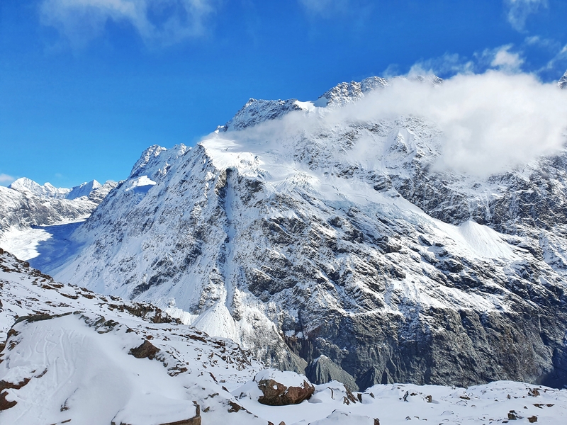
- Difficulty: Hard
- Distance: 10 – 11km
One of the Insta-famous South Island hikes for its iconic hut, this is one of the best for more reason than the hut alone.
The red hut is located up a steep hike from Mount Cook Village. It’s a hike best suited in the summer (you can do it in the inter if you’ve got the skills).
You get great views on the way up (people aren’t a fan of the stairs…but after that, you’re on a regular track), and then from the ridgeline where the hut is you get to see some spectacular glacier action which is amazing.
This is a hike you can do in one day, but if you’ve got the time, make it one of your overnight hikes on the South Island for the full experience.
READ THE FULL POST: A DAY HIKE TO MUELLER HUT
29. HOOKER VALLEY TRACK
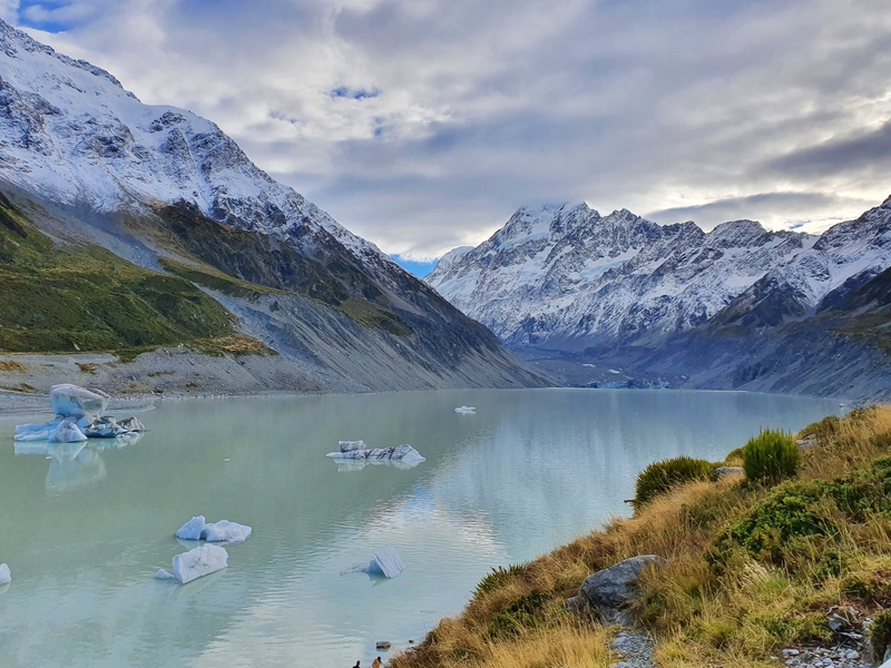
- Difficulty: Easy
- Distance: 10km return
This is one popular walk! Start as early as possible if you don’t want to be walking with 100’s of others on any given day.
The walk is more or less flat as you navigate a few bridges crisscrossing the river towards Hooker Lake.
And once you’re at the end of the track, you’ve got the beautiful lake that has icebergs in it year-round. Are you brave enough to get in the water?
An out-and-back walk is never ideal, but this one is pretty spectacular.
READ THE FULL POST: THE HOOKER VALLEY TRACK
30. MOUNT JOHN WALK
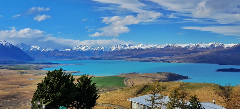
- Difficulty: Easy
- Distance: 10km
Wow, after doing the Mount John Walk when I first arrived in Tekapo, I quickly understood why people love this place so much!
The walk is relatively easy, and you get some epic views all around but looking down at the colour of Lake Tekapo is something I’ll never forget.
I have this in my top South Island walks as the whole surroundings are spectacular…you can see for miles in every direction (including Mount Cook), and you can’t help but feel inspired.
READ THE FULL POST: MOUNT JOHN WALK
31. CAVE STREAM SCENIC RESERVE
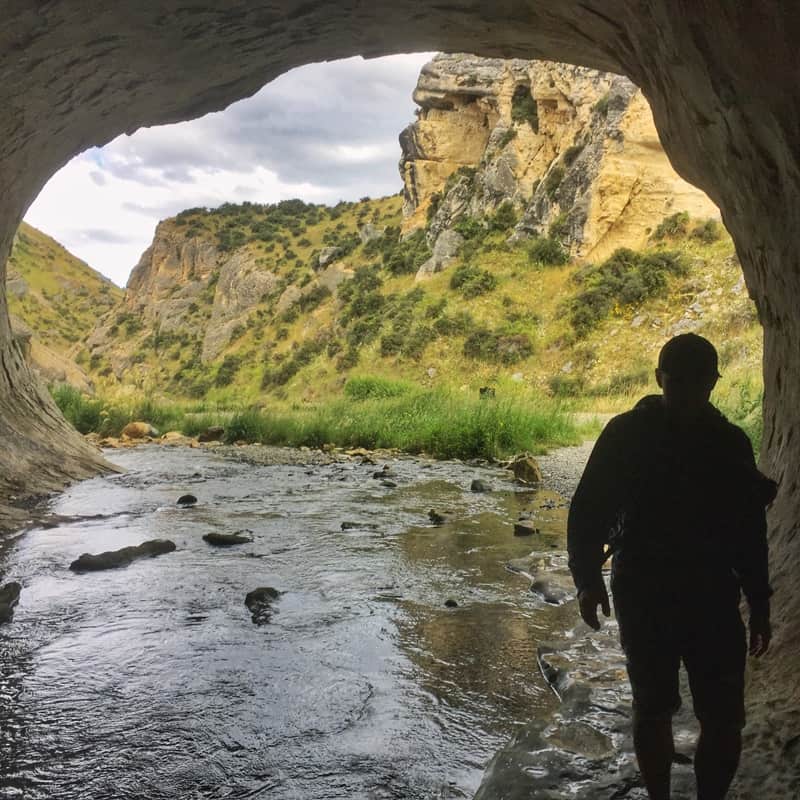
- Difficulty: Medium
- Distance: ~2km
This is a different kind of walk…it’s more like caving I guess.
You enter Cave Stream and make your way upstream unguided for upwards of an hour before you emerge from the other end.
If there’s been heavy rain this is too dangerous, and the same goes in spring if there’s lots of snowmelt making hypothermia a risk.
But don’t let me put you off, this is awesome fun. It’s one of those experiences where you get a bit of an adrenaline rush…and knowing you’ve got to climb a ladder at the end to escape keeps the suspense going. Will you make it?
READ THE FULL POST: CAVE STREAM SCENIC RESERVE
32. GODLEY HEAD LOOP TRACK
- Difficulty: Easy – Medium
- Distance: 8 – 10km
The Godley Head Track is one of the best walks near Christchurch.
It’s a loop track following the peninsula so you get to see different angles of the surrounding terrain. And with no trees getting in the way, the views never stop.
There’s even some history along the way as you pass through an old fort which is cool.
I can see why locals love heading to this walk in the summer regularly. Maybe skip this walk on a windy day though, it’s exposed!
READ THE FULL POST: GODLEY HEAD LOOP TRACK
33. PORORARI-PUNAKAIKI LOOP TRACK
- Difficulty: Easy – Medium
- Distance: 11.6km
Punakaiki is home to one end of the Great Walks in New Zealand, the Paparoa Track in Paparoa National Park.
But if you don’t have the chance one of the newest South Island hikes, consider this loop track which starts and finishes on each edge of the small town.
You’ll get to experience a slice of the great walk as you follow the river, and the full loop has some variation which is always nice.
READ THE FULL POST: PORORARI-PUNAKAIKI LOOP TRACK
34. PORORARI RIVER TRACK
- Difficulty: Easy
- Distance: 7km return
This is an out and back section of the walk above, following the river the whole way.
If you don’t mind an out-and-back walk, this is a pretty awesome walk. And it’s flatter so there’s nothing to worry about there really.
You’ll get a small taste of that Jurassic Park feeling on this trail.
READ THE FULL POST: PORORARI RIVER TRACK
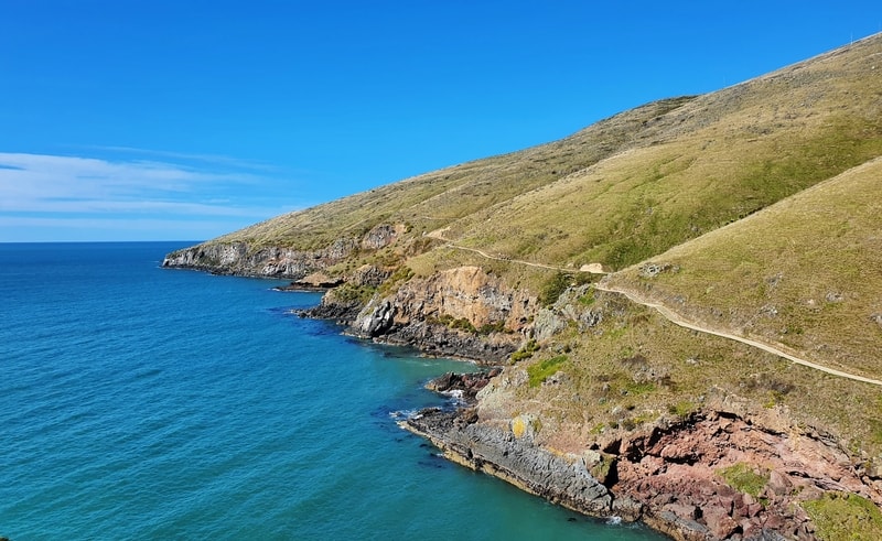
35. KAIKOURA PENINSULA TRACK
- Difficulty: Easy – Medium
- Distance: 12km
The scene in the photo above that I’ll never forget and when I see something similar, it always makes me happy thinking about this track.
This is an awesome South Island walk as you get to see seals (obviously), but also it gives you a chance to see some of the crazy landscapes that changed after the major earthquake.
The views are phenomenal throughout, and you don’t have to walk the whole route if you don’t want to. But for a coastal walk, the variety of the views is impressive.
READ THE FULL POST: KAIKOURA PENINSULA WALKWAY
36. SNOUT TRACK
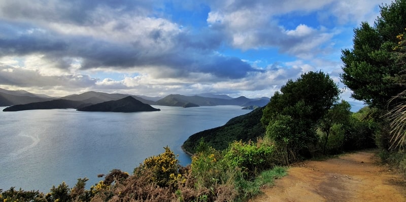
- Difficulty: Easy – Medium
- Distance: 12 – 13km
This is another peninsula, this time it’s one of, if not the most popular of the walks in Picton.
You get some fun views and a chance to visit a beach on this walk as you head to the end of the peninsular. The track gets messy towards the end if there’s been some recent rain, but it’s not a long walk so you may as well keep going if you’ve committed.
At the end, it’s a bit off as the view is amazing, but there’s nothing to really gauge just how beautiful this place is as all the land is just far enough away. It’s hard to explain!
READ THE FULL POST: THE SNOUT TRACK
37. TIROHANGA TRACK
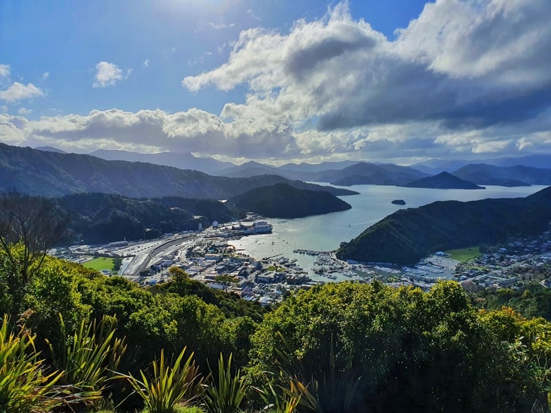
- Difficulty: Easy
- Distance: 7 – 7.5km
If you’ve got a couple of hours to wait for your ferry, a walk over the Tirohanga Track is a nice way to fill in a couple of hours.
You’ve got a fun little climb up through the bush which leads to a beautiful view of Picton from the summit.
You can go back the way you came, but completing the full loop has a nice little ring to it.
READ THE FULL POST: THE TIROHANGA TRACK
38. ESSON VALLEY TRACKS
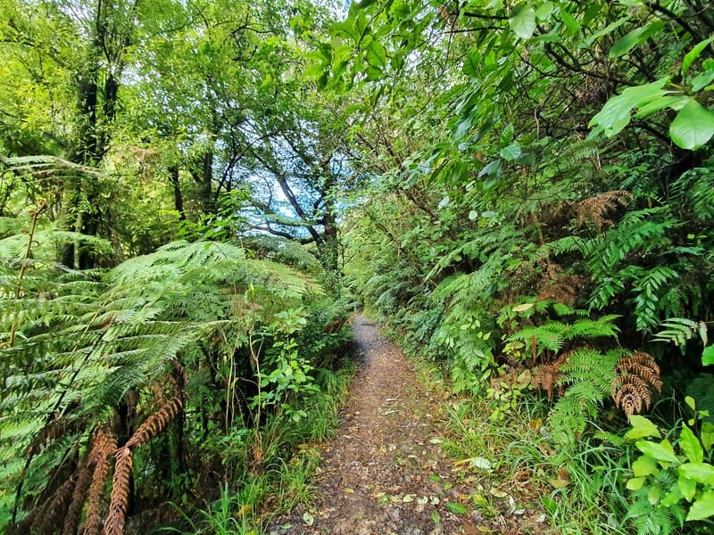
- Difficulty: Easy
- Distance: 8.5km
There are two trails in the Esson Valley and they’re both enjoyed by locals who want to take their dog for a walk on a local track but not be surrounded by people.
Once you enter the forested tracks you’ll feel like you’re a million miles away from town.
I loved how quiet the place was, and the trees just felt so lush. It’s a walk that caught me by surprise! If you think Picton is only a place to spend a couple of hours while in transit, think again!
READ THE FULL POST: ESSON VALLEY TRACKS
39. BOB’S COVE TRACK
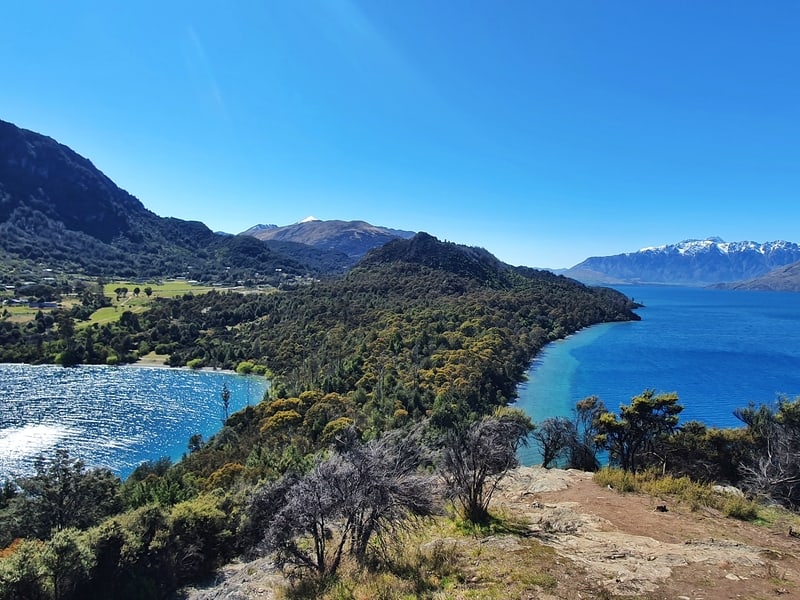
- Difficulty: Easy
- Distance: Less than 4km
Bob’s Cove is a must-visit place in Queenstown for lots of people. And while you’re here you could just walk to the beach, but you may as well complete the full loop to the viewpoint and stop at the beach on the way back.
The views along the walk are amazing, and the ones from the top are really spectacular as you can see from above…that’s just one of the angles.
This is another one of the best South Island walks in winter as it’s right by the lake so you’ll very rarely have to deal with snow.
READ THE FULL POST: BOB’S COVE TRACK
40. MOUNT JUDAH TRACK
- Difficulty: Medium
- Distance: 16 – 17km
The Mount Judah Track is a fun track that can be done as a day hike, or you can stay overnight at Heather Jock Hut.
The hike is rather steep, but only has a few short technical sections which make it doable for the majority. The fun part about this hike is the loop section which takes you past a few historic day huts:
- Boozer Hut
- Bonnie Jean Hut
- Jean Hut
These are historic huts left from the mining era. You’ll find a few other mining bits and pieces throughout the walk too.
READ THE FULL POST: MOUNT JUDAH TRACK
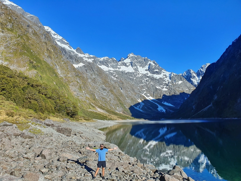
41. LAKE MARIAN TRACK
- Difficulty: Medium
- Distance: 6.2km
The Lake Marian Track is one of the most popular tracks along the Milford Highway, with the rewards of an alpine lake at the end worthy enough of walking for a few hours.
The track starts of smooth as it takes you past some waterfalls, but soon turns more technical as you navigate the forest filled with native trees and ferns.
Once you get to the lake, you could easily hang out here for a couple of hours in the serenity. But for those who can’t sit still you can swim…remember it’s an ALPINE lake or walk next to the lake to the other end.
READ THE FULL POST: THE LAKE MARIAN TRACK
And there you go, some of the best hikes on the South Island you can do.
I’ve been lucky to do a host of great hikes down here, but there are still so many I’m excited to do! Especially some of the ones in Mount Aspiring National Park, Nelson Lakes area, and Kahurangi National Park.
If you’re visiting the South Island for hiking, you’re in for a treat!

Hey, it’s Jub here. I’m the guy behind Chur New Zealand, helping you have the best time hiking, trekking, walking…whatever you want to call it…in NZ. I’m based in Queenstown and am always out and about exploring trails, old & new. If you have any questions, reach out.