If you click on a pin, you can click on the link that pops up to be taken to the post about that hike.
This post covers everything you need to know about the New Zealand hiking scene. If I’ve missed anything, or you’ve got other questions, send an email to jub@churnewzealand.com and/or leave a comment below.
Note: I’m not going to distinguish between hiking, trekking, backpacking, walking, and tramping. I’ll be using hiking only.
TABLE OF CONTENTS
1. Best Day Hikes
2. Best Overnight Hikes
3. Best Multiday Hikes
4. NZ’s National Parks
5. The 10 Great Walks
6. Guided Walks Information
7. Packing Lists
8. Where To Stay When Hiking In NZ
9. Hiking Food In NZ
10. Trail Etiquette
11. Hiking FAQs
1. THE BEST DAY HIKES
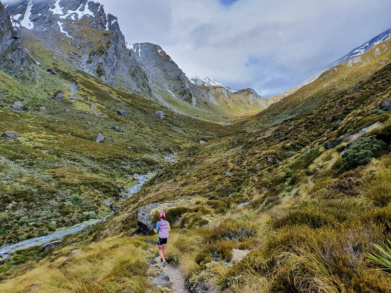
There are so many amazing day hikes in New Zealand, and some make my list of best hikes in New Zealand. And some of them are close to towns/cities making them easily accessible to all.
NORTH ISLAND
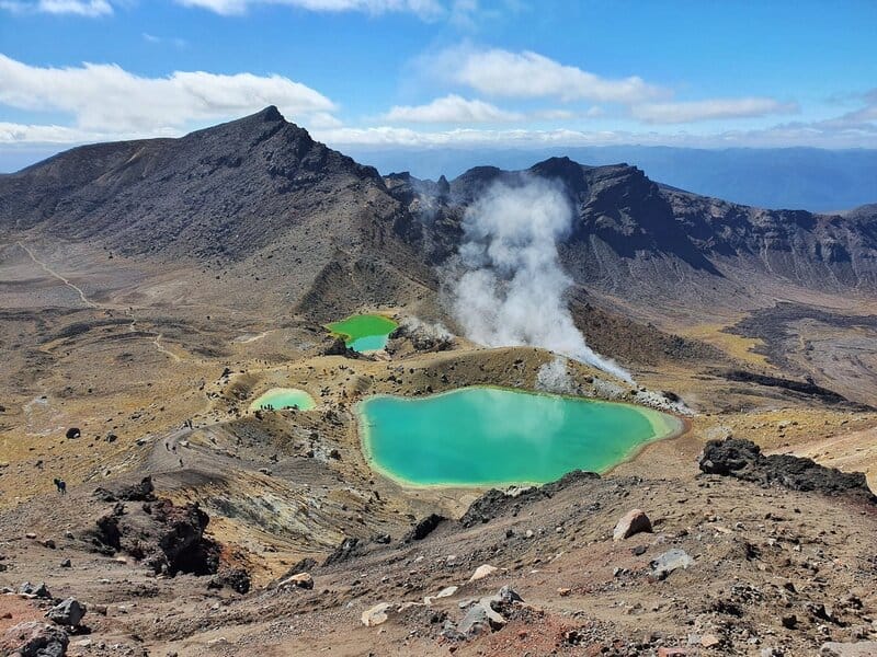
TONGARIRO ALPINE CROSSING
- Region: Tongariro National Park
- Distance: 19.4km
- Elevation Gain: 1120 metres
- Time: 6 to 8 hours
- Difficulty: Medium to hard
The Tongariro Alpine Crossing is perhaps the most famous day hike in NZ, especially on the North Island with up to 2,000 people hiking the crossing every day in peak times. This is a hike you’ll need to plan in advance due to the end-to-end nature of the hike and the limited parking hours available.
It’s usually easiest to book one of NZ’s many shuttles for hikers to get you to and from the trailheads.
This really is an amazing hike through Tongariro National Park with a lot of variety, and of course the volcanic lakes being one of the most recognisable photo spots in NZ.
PAEKAKARIKI ESCARPMENT TRACK
- Region: Wellington
- Distance: 10km
- Elevation Gain: ~420 metres
- Time: 2 to 3.5 hours
- Difficulty: Medium to Hard
The Paekakariki Escarpment Track is one of the best day hikes for the combination of views, variety, location, and accessibility. For a hike so close to a highway, it doesn’t feel that way as you’re traversing the side of the hill.
You get awesome views over the Tasman Sea, Kapiti Island, and the coastline. It’s a goodie! And accessible by train!
MOUNT TARAWERA
- Region: Rotorua
- Distance: 3km
- Elevation Gain: ~200 metres
- Time: 2 to 2.5 hours
- Difficulty: Easy
Yes, this is a guided hike. But if you’re looking for a fun hike somewhere that’s not easy to access, the Mount Tarawera hike might be for you. It’s a stunning spot, and even the drive out there is fun on the back of the truck.
Access is via a road that’s closed to the public, and its soon clear you’re going somewhere magical. The walk takes you around and into the volcano, where you’ll get some epic photos! And you’ll learn a bunch along the way thanks to the guides.
I’m not much for guided hikes, but if this was open to the public, it’d get busy and chaotic, so I think it’s good value.
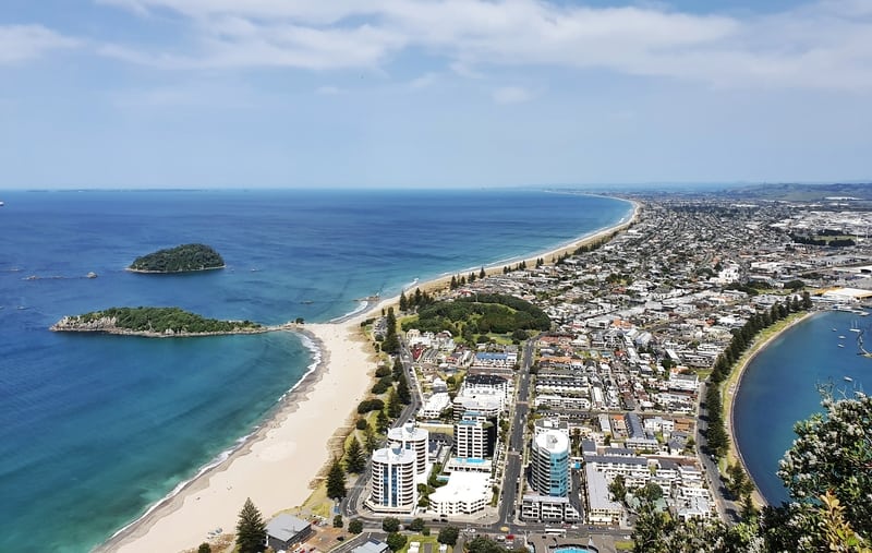
THE MOUNT MAUNGANUI SUMMIT WALK
*Details based on the route I think you should take.
- Region: Bay of Plenty
- Distance: ~4km
- Elevation Gain: 220 metres
- Time: 1 – 2 hours
- Difficulty: Easy to medium.
As a popular tourist destination, the Mount gets its fair share of people who will do the Mount Maunganui hike as their one ‘hike’ of the year. You’ll see people coming up here throughout the day from sunrise to sunset.
There are multiple routes to the summit, including a route around the base of the mount. The views from the top are awesome, thanks to being right on the coast in addition to there being no other highpoints nearby. If you’re visiting the Mount, you really do need to go up here. Ieally for sunrise or sunset.
SOUTH ISLAND
ROBERTS POINT TRACK
- Region: West Coast
- Distance: 11km
- Elevation Gain: 550 metres
- Time: 3 hours 45 minutes to 5 hours 20 minutes
- Difficulty: Medium
The Roberts Point hike is one that people who do it love, but it doesn’t get lots of love. It’s in Franz Josef Glacier, and does give you a better view of the glacier than the regular lookout. But it does compete with the Alex Knob hike on the other side of the valley.
The Roberts Point hike has lots of variety on the way which I like, including awesome swingbridges. But it’s a hike you’ll want to do in dry weather, there are some super slippery spots when it’s wet. Bring a picnic to enjoy at the turnaround point.
KAIKOURA PENINSULA WALKWAY
- Region: Canterburyi
- Distance: 12 to 14km
- Elevation Gain: 100 metres
- Time: 2.5 to 4 hours
- Difficulty: Easy
Kaikoura is well known for its whale watching, but the seals are a massive drawcard too. The Kaikoura Peninsula Walkway gives you a good glimpse of everything Kaikoura which I like. And you can start hiking from the township.
BEN LOMOND TRACK
- Region: Otago
- Distance: ~15.1km
- Elevation Gain: 1480 metres
- Time: 3 to 6 hours
- Difficulty: Medium to Hard
The Ben Lomond Track right on the doorstep of Queenstown and that makes it one of the best day hikes in New Zealand for me. It’s not just the location, the track has some easier terrain mixed with some technical stuff, but you get views right throughout. And the summit has insane 360-degree views…they’re simply epic.
There are various routes and ways you can hike Ben Lomond outside of the ‘usual’ route. But for first-timers, the usual route via the Tiki Trail has to be the goto option.
GERTRUDE SADDLE
- Region: Southland
- Distance: 7 to 9km return
- Elevation Gain: 650 metres
- Time: 2 to 3 hours each way
- Difficulty: Medium
Gertrude Saddle is a popular hike that can be done as a day hike or an overnight hike. It’s not long in terms of distance, but it’s one you really need to do in dry conditions as the rocks are crazy slippery when wet.
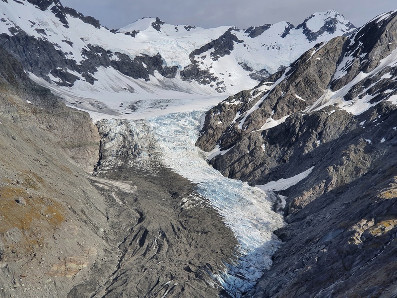
ROB ROY GLACIER
- Region: Otago
- Distance: 10 to 12km
- Elevation Gain: 450 metres
- Time: 3 to 4 hours
- Difficulty: Easy to medium
The hike to the Rob Roy Glacier viewpoint is a very popular hike in Mt Aspiring National Park. There’s not many hikes that are so accessible and give you a great view of a glacier.
The track itself is beautiful as you’d expect, with some stunning scenery along the way. The drive into the trailhead isn’t so bad either!
2. THE BEST OVERNIGHT HIKES
An overnight hike is a natural progression between day hikes and multiday hikes. Provided the weathers half decent, you can’t have too many issues go wrong with overnight hikes. These are some of the awesome ones to look into.
NORTH ISLAND
PINNACLES TRACK
- Region: Coromandel
- Distance: 12km return
- Elevation Gain: 800 metres
- Time: 2 days
- Difficulty: Medium
With 80 beds in the Pinnacles Hut, this is a busy track! It’s 6km on the regular route via the Webb Creek Track but there’s some elevation involved. You won’t get lost on this track, but prepare for lots of stairs and metal rungs to climb on. Those who aren’t a favourite of exposire/vertigo won’t love parts but it should be alright. The hut vibe can be great, but I’d suggest getting there early to secure a good bed spot.
The views on this walk are epic over the peninsula. Not bad for being less than 1000 metres above sea level.
POUAKAI CIRCUIT
- Region: Egmont National Park
- Distance: 25km
- Elevation Gain:
- Time: 2 days
- Difficulty: Medium
The Pouakai Circuit can be completed in 3 days, but most people do it in two days with a night at a hut, ideally Pouakai Hut which is about halfway through the track. Like most of the tracks in Egmont National Park, this one isn’t easy but there’s plenty of variety in the terrain to keep you interested. The Pouakai Tarns are one of the most famous photo spots for hikers in NZ, and it is easy to see why with Mount Taranaki in the background. This is a hike you’ll want to do on nice sunny days if possible.
Terrain: Dirt, some boardwalks, wooden steps, tree roots, muddy in many sections… It varied but nothing difficult.
SOUTH ISLAND
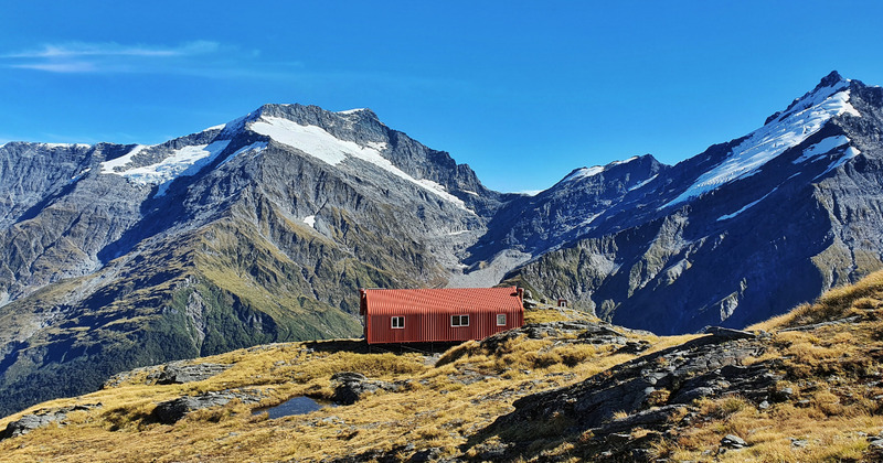
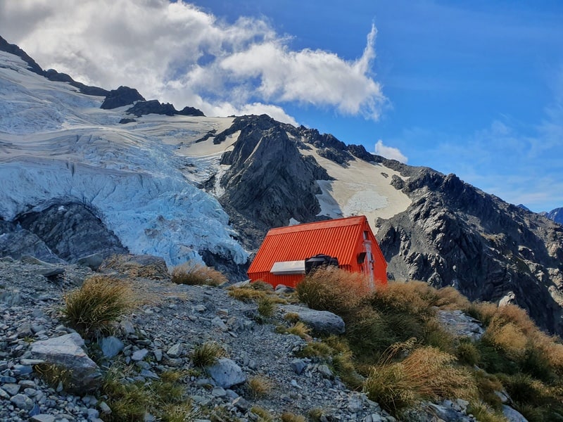
French Ridge Hut in Mount Aspiring National Park
COPLAND TRACK
- Region: West Coast
- Distance: ~34km return
- Elevation Gain: ~1000 metres
- Time: 4.5 to 6 hours one way
- Difficulty: Medium
The Copland Track is a great overnight hike on the West Coast, which leads to a pretty cool feature…the hot pools which are right by Welcome Hut where most people stay on their adventure here.
FRENCH RIDGE
- Region: Mount Aspiring National Park
- Distance: 34km return
- Elevation Gain: ~1300 mwrewa
- Time: 2 days
- Difficulty: Medium
The French Ridge Hut Track narrowly wins out over the Liverpool Hut Track for me, though neither are bad.
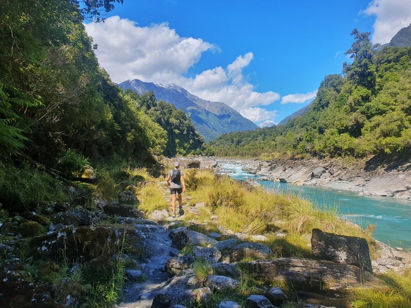
The first 9km of the hike takes you through the Matukituki Valley to Aspiring Hut. You’ll then dog leg through the next section for a few km before crossing the river before starting the climb. The climb is the tough part as it’s steep and will require grabbing roots and scrambling. Once you’re above the treeline though, worth it!
3. THE BEST MULTIDAY HIKES
There are so many multiday hikes in New Zealand. There are lots of well-known tracks which you’ll read about below, but as you get to know the backcountry more, you’ll learn more about the tracks that aren’t necessarily on tracks, and/or you’ll connect up different tracks to create multiday journeys.
Anyway, here are seven awesome multiday hikes to look into.
NORTH ISLAND
JUMBO HOLDSWORTH CIRCUIT
- Region: Tararua Ranges
- Distance: 24km
- Elevation Gain: 1500 metres
- Time: 2 to 3 days
- Difficulty: Medium
The Tararua Ranges are an underrated place for hiking in New Zealand. Provided you’ve got a good weather window, the Jumbo Holdsworth Circuit is a great 3 day hike. It’s relatively short for 3 days, but that gives you a chance to explore a little of the tops of the ranges.
It’s crazy to think you’re not far from Wellington, but you feel like you’re miles away from everything up here.
ROUND THE MOUNTAIN TRACK
- Region: Tongariro National Park
- Distance: 66km
- Elevation Gain: 3100 metres
- Time: 4 to 6 days
- Difficulty: Medium to Hard
The Round The Mountain Track loops around Mount Ruapehu in Tongariro National Park. While you’re in the vicinity of the Tongariro Northern Circuit and Alpine Crossing, this is a lot more remote. There’s a variety of terrains, and the huts are super cute. The terrain is slow going though!
This is a track where you’ll want to get a good weather window. And there’s the side track to Tama Lakes which is pretty awesome!
SOUTH ISLAND
OLD GHOST ROAD
- Region: West Coast
- Distance: 85km
- Elevation Gain: 2700 metres
- Time: 3 to 4 days
- Difficulty: Tough
The Old Ghost Road is a relatively new track having opened in 2015. The trail goes through a previously inaccessible part of the mountains, but thanks to dozens of volunteers, perseverance, and creativity there’s now a beautiful 85km trail of single track for both hikers and bikers to experience.
The huts are cute too. This is a trail where the positivity of all is infectious. And if you’re looking for a book to read while on the trail, the book available on the Old Ghost Road website about the trails construction is fitting.
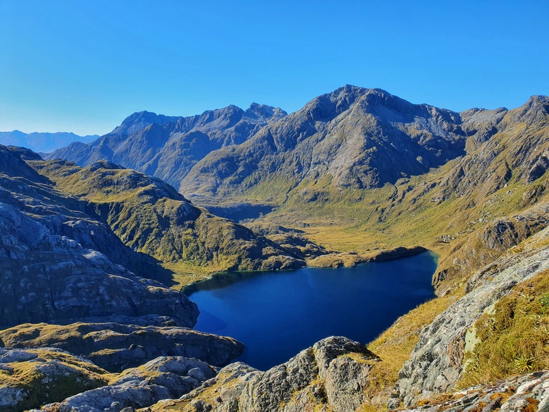
REES DART TRACK
- Region: Otago
- Distance: 85km
- Elevation Gain: 3000 metres
- Time: 4 to 5 days
- Difficulty: Medium to Hard
The Rees Dart Track is gaining a great reputation for an awesome 3 to 4 day hike that takes you into Mount Aspiring National Park. There are three huts you can stay at, and the side trip to Cascade Saddle is magic!
QUEEN CHARLOTTE TRACK
- Region: Marlborough Sounds
- Distance: 73.5km
- Elevation Gain: 2500 metres
- Time: 3 to 5 days
- Difficulty: Medium
The Marlborough Sounds are the gateway to the SOuth Island for many as they arrive onto the South Island by either the Interislander or Bluebridge.
The Queen Charlotte Track takes you along through the sounds on an undulating track with plenty of greenery and stunning blue waters. The hills aren’t overly steep, but they’ll add up over the few days you’re on the trail.
4. NZ NATIONAL PARKS
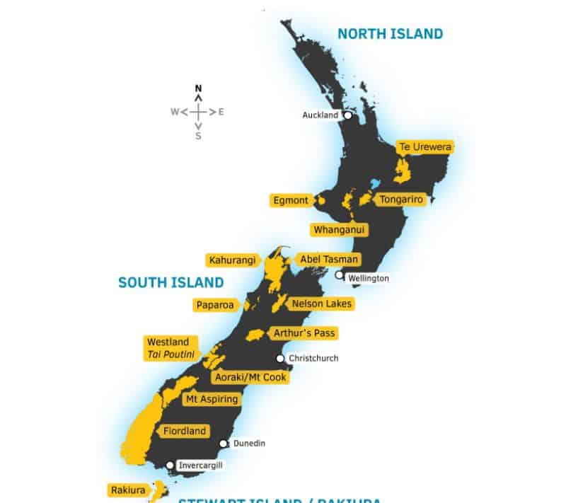
Map Source: DOC.govt.nz
There are 13 of them in New Zealand.
- Tongariro
- Whanganui
- Egmont
- Abe Tasman
- Kahurangi
- Nelson Lakes
- Paparoa
- Arthur’s Pass
- Westland Tai Poutini
- Aoraki/Mount Cook
- Aspiring
- Fiordland
- Rakiura
Te Urewera was disestablished in 2014.
National Parks are protected natural areas administered by the Department of Conservation (DOC). Interestingly, National Parks were established in areas that were naturally beautifully. But now, any new National Park is established to reflect the diversity of NZ’s landscapes.
The National Parks Act 1980 ensures the public has freedom to enter and access all National Parks, meaning you can enjoy hiking throughout the parks which have some amazing hikes, and where all the Great Walks are found (except Lake Waikaremoana).
5. THE 10 GREAT WALKS
The Great Walks are the most famous multiday hikes in New Zealand. With world-class hut facilities and well-maintained tracks, they’re a great introduction for those who are new to multiday hiking.
The Great Walk season for most hikes is from late October/early November to the end of April. If you want to secure accommodation on particular dates, you need to book early.
The dates that the huts are open for booking are usually announced in early April. You’ll need to keep an eye out for when the dates are announced.
The 10 Great Walks are:
North Island
- Tongariro Northern Circuit | 44.9 km loop, 3 to 4 days
- Whanganui River | 88 km or 145 km, 3 or 5 days
- Lake Waikaremoana | 46km, 3 to 4 days
South Island
- Abel Tasman Track | 60km, 3 to 5 days
- Heaphy Track | 78.4km, 4 to 6 days
- Paparoa Track | 55km, 3 days
- Kepler Track | 60km loop, 3 to 4 days
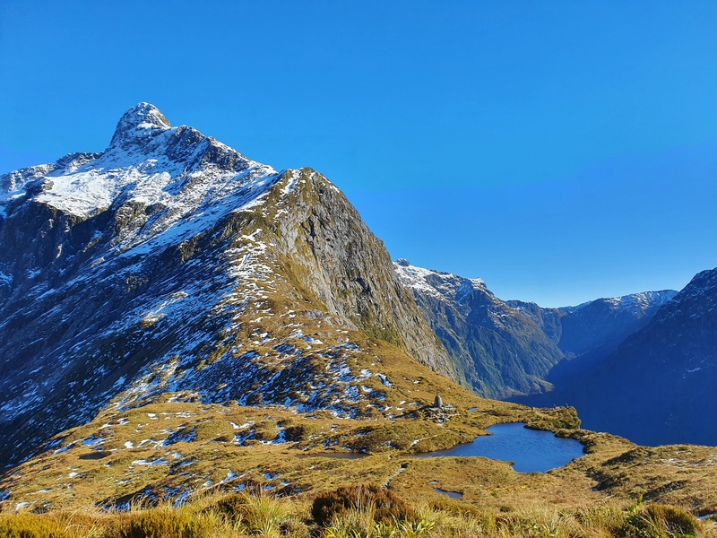
- Routeburn Track | 30km, 2 to 4 days (My favourite Great Walk)
- Milford Track | 53.5km, 4 days
Stewart Island
- Rakiura Track | 32km loop, 3 days
6. GUIDED WALKS IN NZ
If you’re not confident about carrying a bag on a hike, or at least, like the idea of having someone there to help you learn more about the area you’re walking through, a guided walk can be a great option.
There are lots of options around the country, with Ultimate Hikes being the most popular guided walk company. They offer guided walks across two of the best Great Walks, The Milford Track and the Routeburn.
Some other companies and hikes where you can have a guided walk include:
- Ultimate Hikes
- Trips and Tramps
- New Zealand Walks
- Ben Lomond Saddle/Summit with Skyline
- Queen Charlotte Track with Wilderness Guides
There are plenty more options, for everything from one day guided walks on the Routeburn to multi-day hikes on private land like the Tora Coastal Walk in the Wairarapa.
7. PACKING LIST
What people pack on a hike differs a lot. A LOT A LOT. From person to person, hike to hike, season to season etc.
Here are some of pieces of equipment you’ll need to consider taking on a hike. I’ve included some links to some items I use all the time.
- Hiking shorts (I always wear Macpac Fast Track Shorts)
- Hiking pants
- Technical shirt (i usually wear the Macpac Trail Shirt)
- Hiking shoes/boots
- Sleeping bag
- sleeping bag liner
- Tent
- Wind Breaker
- Emergency blanket/bag
- Rain jacket and pants (Macpac rain hacket)
- Thermal top and bottoms
- Socks
- Undies
- Headwear
- Buff
- Portable Power Banks
- PLB
- Hiking poles
- Gas and cooker
- Cutlery and tuppeware
- Phone
- Food
- Water
- Water filter
- Good Pack
- Dry bags
- Sunscreen
- Toilet paper
Fortunately, if you need to buy hiking gear, there are shops throughout the country that’ll stock the gear you need. I’ll mention some of the common shops in the FAQ.
If you enjoy reading gear reviews, I have some for you.
8. WHERE TO STAY WHEN HIKING IN NZ
Depending on where you’re from, you might be used to packing your tent on every hike you do. However, in New Zealand we have an amazing backcountry hut system where you can hike all day and then sleep in a beautiful hut. Sometimes they’re free, most are $5 to $20 per night unless you’re booking them during the great walk season in which case they’re a small fortune.
But they’re great value.
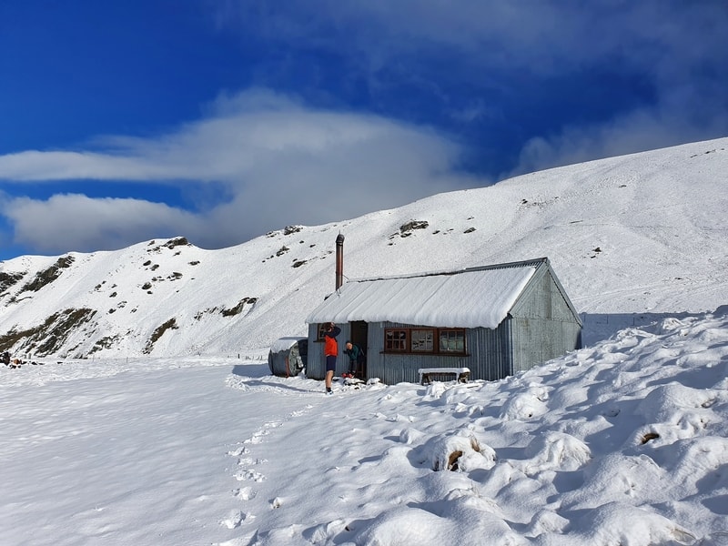
BACKCOUNTRY HUTS
In terms of the total number of huts around NZ, Samuel Demas of Hut2Hut.info estimated upwards of 1300 huts across the country.
Most of the backcountry huts are operated by the Department of Conservation (DOC). They list all of the huts they’re in charge of on the DOC website, along with the latest information about accessing them, fees, and whether you need to book them in advance.
There are some other huts out there owned by clubs, like the New Zealand Alpine Club among others. And then you’ve got others like the hut on Pigeon Island run by Queenstown Lakes District Council. It gets confusing!
Staying in a hut is a rite of passage for Kiwis. There’s nothing quite like it, especially ones that are in the middle of nowhere and you can disconnect from the outside world.
If you think you’ll be staying at lots of huts around the country, you might be best to invest in a Backcountry Hut Pass. Otherwise, make sure to always carry enough DOC Hut Tickets for each hut you’re planning to stay in.
CAMPING ON NZ TRAILS
While huts are awesome, camping also has its benefits. Sometimes the huts have more people staying in them than capacity. While you can squeeze two on a mattress, sometimes it’s easier to just take a tent an camp by the hut if need be.
In general, you can usually camp on DOC land, which means you can camp in a lot of places in NZ!
9. FOOD FOR HIKING IN NEW ZEALAND
Like most hiking destinations around the world, you’ve got the option of eating your usual kind of options, real food, and dehydrated/freeze-dried meals. And of course, you’ve got to think about snacks!
If you head to the regular New Zealand supermarkets, you’ll find more than enough options to create your own fun hiking meals. But if you’re planning to food designed for hiking, there’s a few options you can try in NZ.
FREEZE-DRIED/DEHYDRATED MEALS
The four prominent options that target hikers specifically are:
And while they’re not targeting hikers, friends will often take MTR Meals to heat up on a hike…you can get them at most supermarkets in NZ.
SNACKS
The majority of good hiking snacks are focused on carbs. A few of my favourites include:
- Energy/bliss balls
- Peanut butter, banana, and date wraps
- Bhuja
And I almost always have Vita Sport on me. Each sachet has 125 calories, which with electrolytes lets me get good things in and they never upset my stomach.
It’s not a popular option for hikers, but NZ does have gels available in various outdoor/sports stores.
10. NZ TRAIL ETIQUETTE
If you’re arriving into NZ, you’ve probably come across the Tiaki Promise. In short, we are all responsible for taking care of New Zealand. That means following good hiking etiquette. If you’ve hiked in the places around the world, you’ll probably know the majority of these. Heres a quick list for you:
- Do research on the trail you’re going to enjoy in advance and prepare accordingly
- Follow best pooing practices
- Follow the rules of the individual trails (no dogs etc)
- Stay on the tracks as much as possible.
- Don’t feed the birds/wildlife
- Give way to faster hikers and those coming uphill
- Step out of trail when taking a break
- Let someone know your plan (and sign into the hut books)
- Be a nice, friendly hiker to others
- Leave only footprints
11. HIKING FAQ’S
What are the best shops to buy hiking gear in NZ?
Are dogs allowed on the trails?
Dogs are not allowed in National Parks. On other hiking trails, the rules vary and the best way to know is to visit the DOC website for the specific trail you’re looking into (you can filter for tracks that allow dogs). There’s also the Hiking with Dogs New Zealand Facebook Group that’s useful.
Where can I find other people to hike with?
Hiking in NZ is funny. If you’re in a circle of hikers, it can feel like everyone in the country is hiking. But most people still don’t go hiking regularly, and convincing people who aren’t regular hikers to go out with you can be tricky.
A few places you can find people who are willing to hike with you in NZ:
- Local Facebook Groups
- Hostels, lots of people staying at hostels look for hiking buddies
- Local hiking groups
Where can I buy hiking maps?
It’s not as easy to find physical maps as it once was, especially trying to find the exact maps you need. In general, the two goto options are DOC visitor centres and Bivoauc. But there are over 400 retailers you can buy them from which are listed on the Linz.govt.nz website.
Any dangerous animals on the trails in NZ?
No! Well, nothing that’s out to kill you. I still hesitate walking through herds of cows. Ive heard abut a few bad encounters with wild boar, but that’s rare.
What’s the water situation like on the trails?
This will vary from hike to hike and person to person. In short, the situation is good. In general I don’t mind drinking water straight from streams if they’re in National Parks or in places where I know there’s unlikely to be cows/sheep/farmland upstream. And water tanks at huts will always have signs saying to boil the water first, but I haven’t had any issues thus far. But it’s definitely a personal thing.
What’s the best time to go hiking in New Zealand?
Summer is the peak hiking season as expected. The daylight hours are highest, the temperatures are warmer. But depending on what you’re looking for, other times of the year may be the best for you.
The summer school holidays are the peak hiking season in New Zealand, which is from mid-January through to the end of February. This is the time when the trails are busiest, with up to 2000 people hiking the Tongariro Alpine Crossing every day.
February until the end of March, even through to the end of the Easter weekend are some of the best times to hike in NZ as the days are still long enough and the weather can be calmer in a lot of parts of the country.
Once you hit May, many hikes are no longer viable due to weather conditions. But there are lots of hikes, especially shorter hikes that you can do in low-lying areas. You’ll just need to be better prepared for cooler conditions.
September and October, spring can be good for the lower hikes. But there’ll be many in the South Island that are still out of bounds due to avalanche risk.
Regardless of the time of year, you go hiking in New Zealand, make sure you’re looking at the weather in advance. Even if it looks like things will be perfect, remember NZ often experiences four seasons in one day.
What apps should I download?
If you’re looking to get some hiking apps to download, these are ones I recommend:
1. Maps.me (free)
2. YR.no (free)
3. NZ Topo 50 (paid) | LOVE THIS APP
4. Kindle (free)
5. Strava (free and paid)
If you’re serious about hiking in New Zealand at all, getting the third option, the NZ Topo 50 Paid app is a no-brainer. It’s worth its weight in gold.
And there we go. My guide to hiking in New Zealand…or is it tramping? Whatever it is, have fun!
If you’ve got any questions about planning your hikes in New Zealand, email jub@churnewzealand.com.

Hey, it’s Jub here. I’m the guy behind Chur New Zealand, helping you have the best time hiking, trekking, walking…whatever you want to call it…in NZ. I’m based in Queenstown and am always out and about exploring trails, old & new. If you have any questions, reach out.
Hi Jub,
I just came across your site which has great information.
Being a New Zealander myself I am interested to know why you have favoured the word hiking over tramping?
I prefer using tramping as it is a uniquely New Zealand word which we can be proud to use.
Interested in your comments.
Regards
Tom.
Hey Tom,
It’s always a debate right? I guess because most people reading this are international readers and hiking is the most universal? Personally I never use tramp, but think of tramping as a tougher 3 – 5 day mission. But then we have the Americans who call it ‘backpacking’, which is super confusing to me!
Basically, I use hiking and feel like it’s the term most people can relate too. Could well be wrong though! I work at Macpac and I’ve very rarely heard any customers say tramping now that I think of it.
It’s a fun kiwi term though aye.
Hi Jub ,Is there anywhere to see Mt Aspiring without crampons. I mean closer than Cascade saddle?
Secondly is there no boat service going from Queenstown to the Caples track?
Lastly what is considered the best application against sandflies?
Best wishes
Hey Eddy,
Thanks for the questions.
1. You can see it from Liverpool Hut I believe (double check this). I’ve heard some of the best views are from Sisyphus Peak…but I haven’t been there yet.
2. No boat service, correct. The jetty isn’t large enough for boats to dock.
3. Best application. Well DEET is the most effective in general, but is harmful to the skin. Picaridin is a good alternative, but needs to be applied more frequently.
Hope that helps!
Cheers,
Jub
Hi Jub, love your website btw! Thanks so much! I was wondering why you don’t have many hikes suggested for Fiordland. Is it not so good? Or is that area just next on the list? Heading to the Te Anau amongst other places and thought there would be a ton of great hikes?
Hey Chris,
Great question. I honestly just don’t get down that way too often for whatever reason. I’ll be doing Dore Pass in early January, and hopefully Dusky Track at some point in Jan. There’s heaps down there that I WANT to check out…just need to make it happen.
Shoot me a message on Whatsapp +64 20 4170 2764 with some snaps from places you head to. Would be awesome to see. Mitre Peak is also on the list haha.
Have fun!
Cheers,
Jub
Hi Jub, thanks for all the info. Your reviews are amazing. I was wondering if you have any suggestions for hikes to do around Queenstown in the rain?
Hey Nat,
Thanks for the kind words. In the rain, Queenstown Hill to the basket of dreams still goes alright and Mount Crichton Loop Track (provided the creek is alright to cross – should be fine unless it’s bucketing down). And then Bush Creek in Arrowtown could be good too (it used to get really muddy but is better now).
Thats a few options where they rain doesn’t make the tracks horrendous in my experience.
Cheers,
Jub 😀