The Roberts Point Track is an ~11km out-and-back hike near Franz Josef. It’s a track with lots of variations in terrain, swing bridges, a cool staircase, and gives you a view of Franz Josef Glacier.
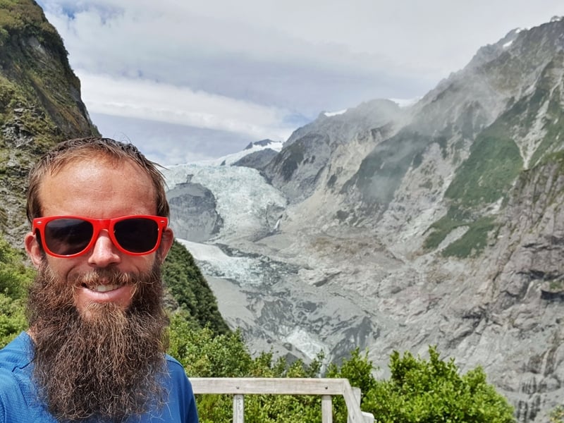
Proof I’ve done the track so I can give advice based on real experiences.
Despite being relatively short, this is a hike that’s best done in good weather, like many South Island hikes. While the terrain is fun, on a wet weather day, it’ll play havoc with you.
This post will give you all the details you need to know about hiking the Roberts Point Track.
Quick note: Before you set out on this hike, check-in with the National Park Visitor Centre for up to the date tips regarding the weather and track conditions. Your accommodation provider is likely a good source of info too.
TABLE OF CONTENTS
1. Details About The Roberts Point Track
2. Roberts Point Track Map
3. How To Get To The Trailhead
4. My Experience On The Roberts Point Track Hike
5. More Photos From The Track
DETAILS ABOUT THE ROBERTS POINT TRACK
When1: February 2021
Difficulty2: Medium. Given what people said beforehand (I’ll go into more detail later), I was in the mindset this was going to be a difficult hike. It was thaaaat bad at all. On a wet day things would be different.
Hike Distance3: From the main Franz Josef Glacier car park (there are two car parks) My Strava recording has the hike at 11.05km return. This is in the same range as DOC.
Incline4: Strava measured 547 metres of elevation, the majority of this was on the outward section.
Here’s Roberts Point Track elevation profile (from Strava):
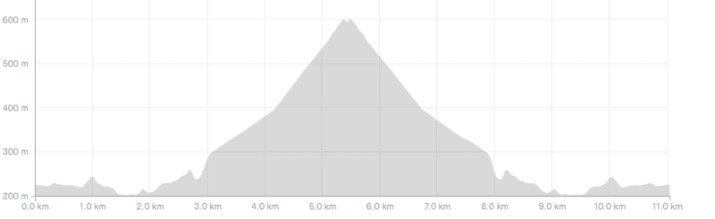
Hike Duration5: It took me 3 hours and 48 minutes to complete the Roberts Point Hike from start to finish. That includes a 20-minute break at the viewpoint. DOC gives a very precise 5 hours and 20 minutes…I’d think 95% of people would return under 5 hours 20 minutes.
ROBERTS POINT TRACK MAP
The track above is the GPX file from Strava on a topo map. But you shouldn’t have any trouble following the track, even in low cloud as there are markers throughout.
You can see the map on Maps.me app so it’s always agood idea to have that downloaded on your phone before beginning. The track isn’t on Google Maps.
HOW TO GET TO THE TRAILHEAD
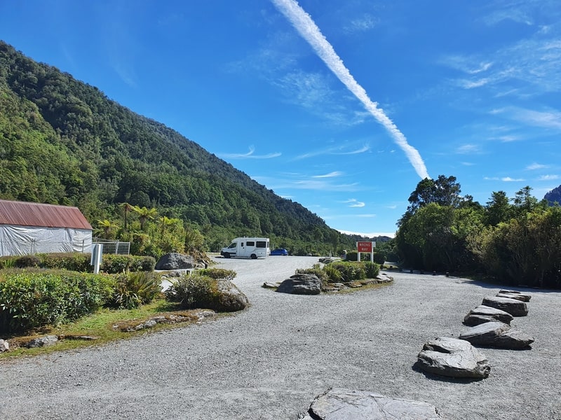
There are two starting points for the Roberts Point Track. The Main glacier car park (4.4km from the Four Square) or the Lake Wombat/Alex Knox car park (3km from Four Square).
The track from the glacier car park is slightly longer but more convenient for people driving and biking.
Driving: Start from the glacier car park as the car park is bigger, and there are more facilities (toilet). You’ve also got access to other short walks from this car park. The car park is 4.4km from
Walking: If you’re walking from Franz Josef town, you may as well start from the Lake Wombat/Alex Knob car park to save an extra couple of kilometres of walking. You can always return to the other trailhead at the end of the walk.
Biking: If you’ve rented a bike, there are places to lock up your bike at the main glacier car park.
MY EXPERIENCE ON THE ROBERTS POINT TRACK HIKE
Note: I started from the main glacier car park.
When I was looking into the Roberts Point Track and Alex Knob, the owner of my accommodation convinced me to do the Roberts Point Track. With the way the weather was at the time, I’d need to be very lucky to get any views from Alex Knob before the cloud rolled in.
And he said the Roberts Point Track was the more interesting track. Another hostel guest had completed the Roberts Point Track earlier that day and he loved it, mentioning the rock scrambling towards the top of the hike was exhilarating.
Rock scrambling? That sounded like a win to me.
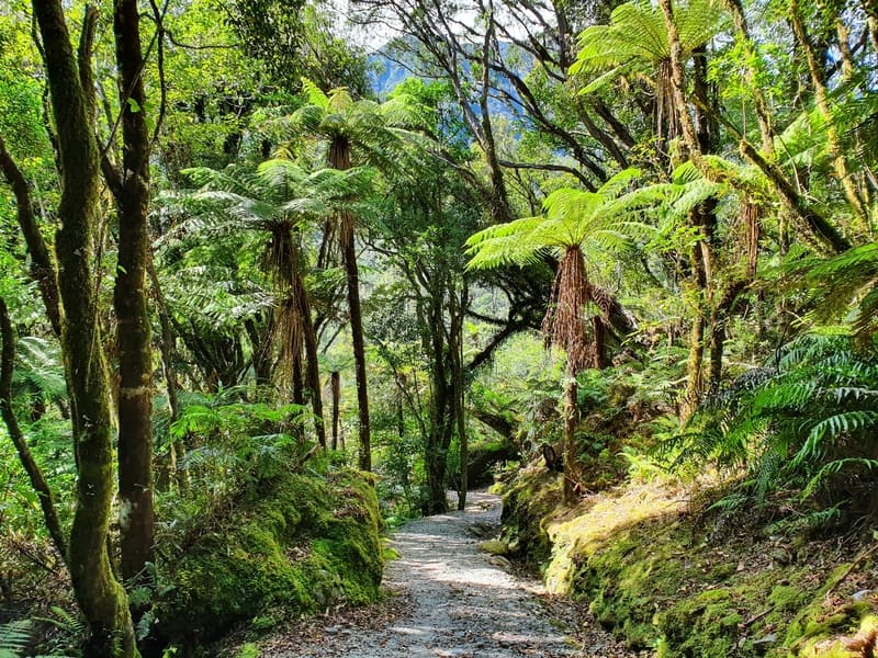
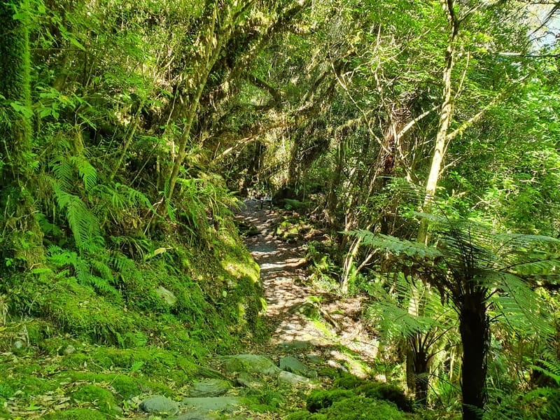
I had a solid morning for the hike, and there weren’t too many cars in the car park. The start of the hike is cruisey as you follow the Douglas Walk for about 1.4km along gentle undulating terrain.
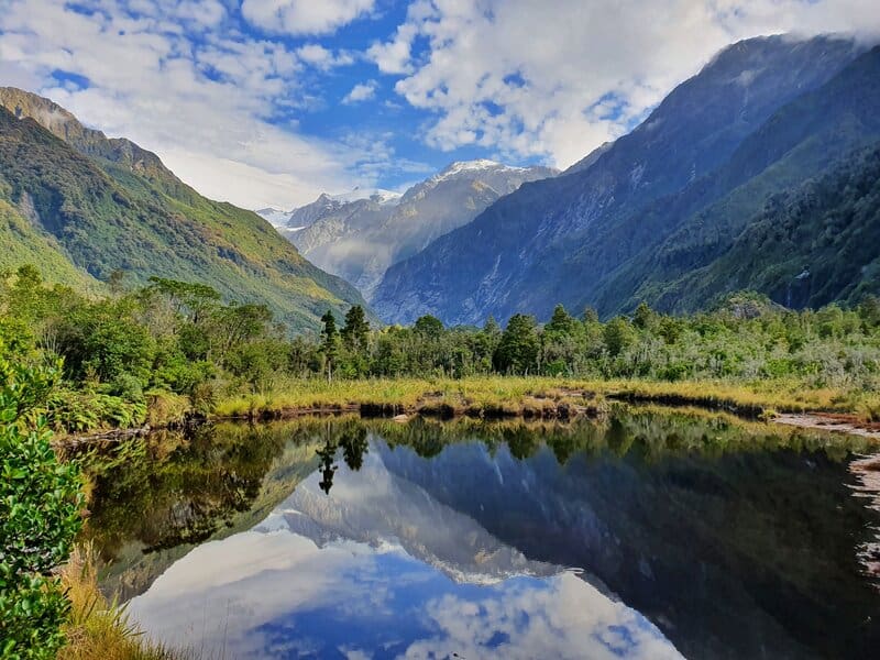
The Douglas Walk is a gravel track lined with native bush, and you’ll pass by the reflections on Peter’s Pool, a small lake that offers your first glimpse of the glacier. Hopefully, you’ll get a wicked reflection.
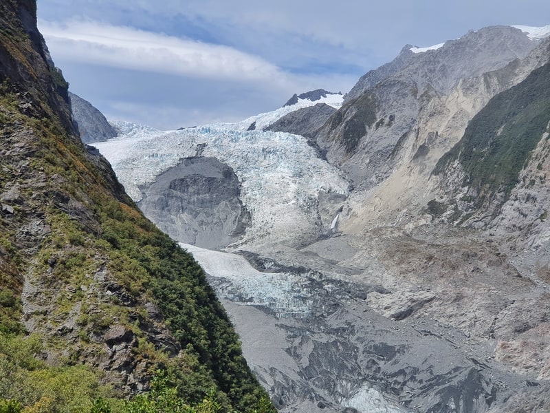
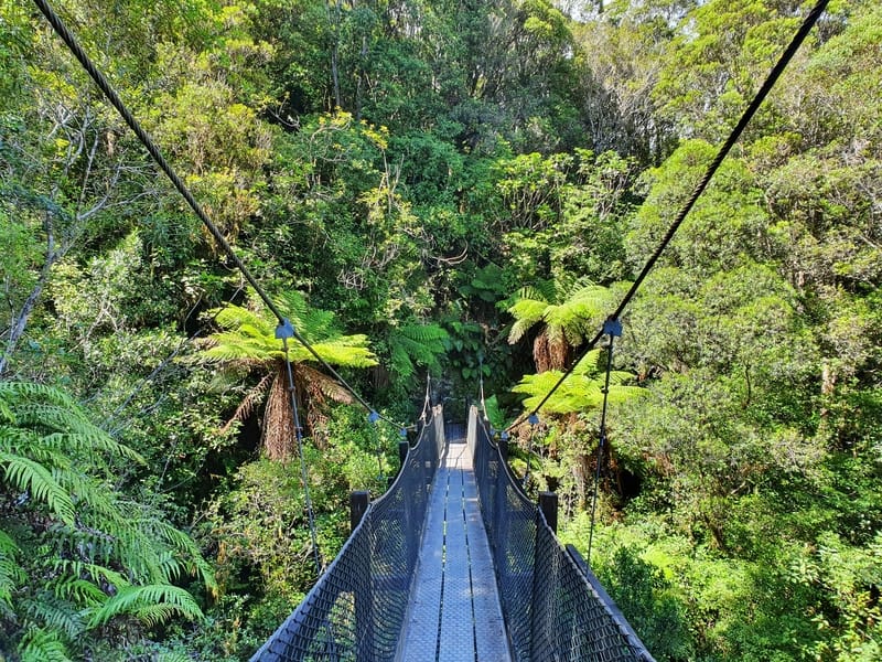
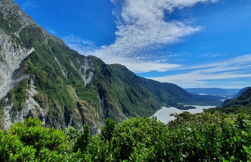
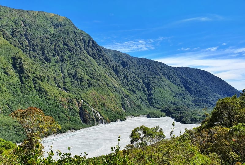
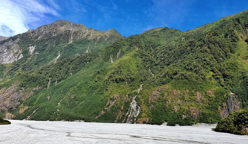
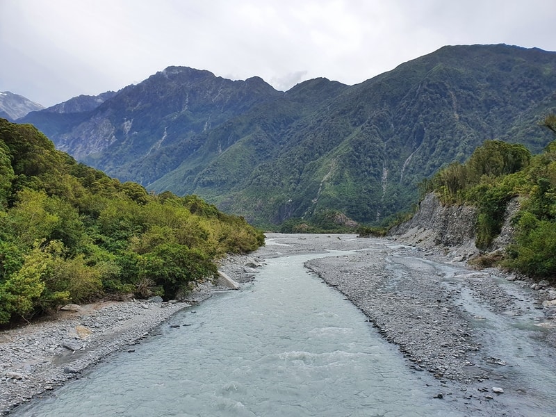
At the junction turn right to take the first of four swing bridges. This one is pretty long over the Waiho River and gives you a glimpse of how big the valley is. If only the glacier hadn’t receded so much over the years you’d see it from here too.
Once you’re across the bridge the hike really begins. There’s no gravel path here.
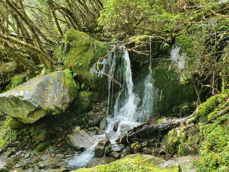
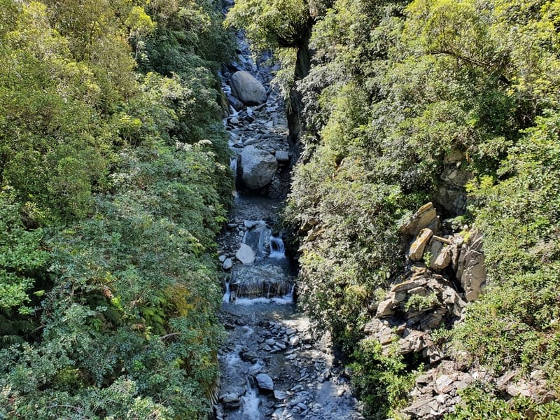
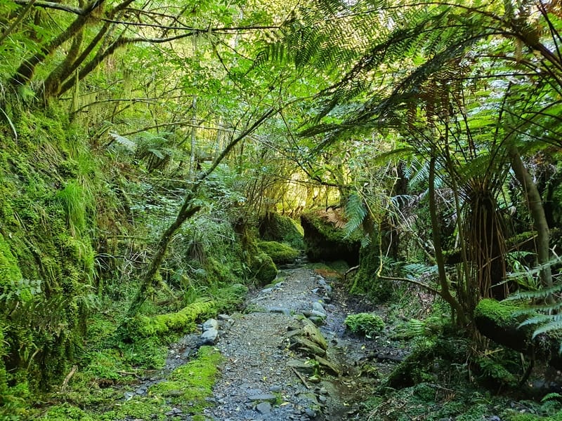
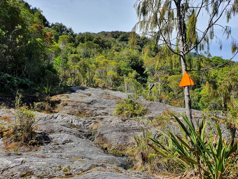
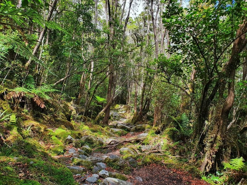
The terrain to start has a lot of rocks and roots on the trail, ready to make you look like a fool. It’s not overly technical to start. You’ll pass over small rivers running down to the valley. The track is easy to follow, but there are orange track markers.
Parts of the track have been upgraded in 2020, but fortunately, it’s more to make sure the track doesn’t deteriorate. The adventure of the track isn’t lost.
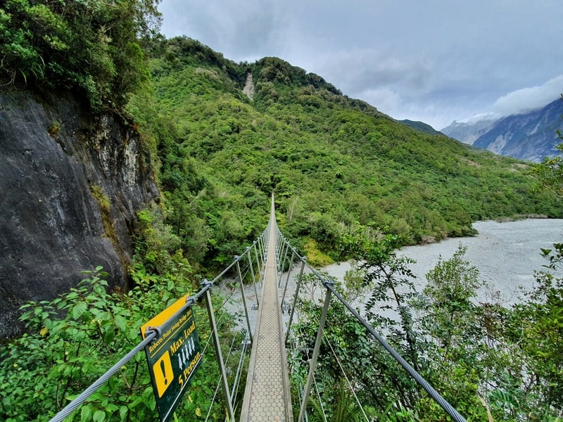
Once you reach the big Roberts Point Swing Bridge the track starts to get more technical. It’s not all roots and rocks though, there’s some smooth rock that doesn’t sketch out a trail, but keep an eye on the orange markers and you’ll make your way up on a route of your own.
This is where it’d get tricky in the wet, the rock would be treacherous.
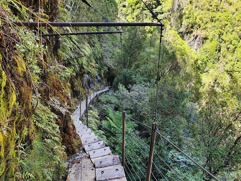
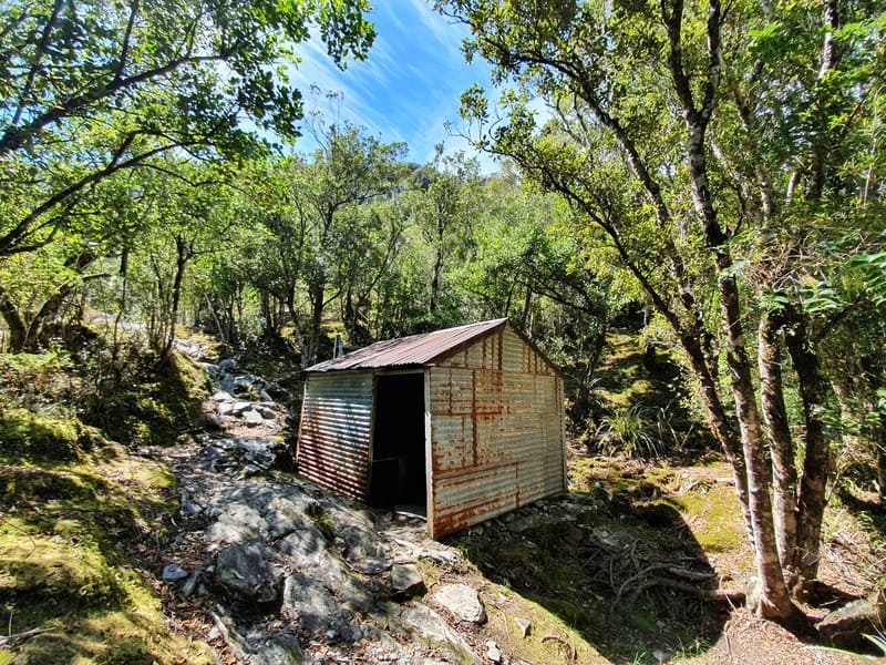
You’ll come across Hende’s Hut, an old hut no longer in use. If you got stuck in a bad weather patch you could shelter here, but it’s not built for overnight stays. Right after the hut are amazing steps hugging the rock face.
From here on out it gets more technical as you continue climbing up. But as long as you’ve got half-decent shoes on, you’ll be fine. This is a hike where you’re better off to leave the jandals at home. You can get away with sneakers, but if you’ve got hiking shoes, you’ll likely want to choose them.
Throughout this whole time you’ll have had glimpses of the valley, but haven’t seen the glacier since you got to Peters Pool.
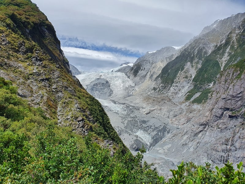
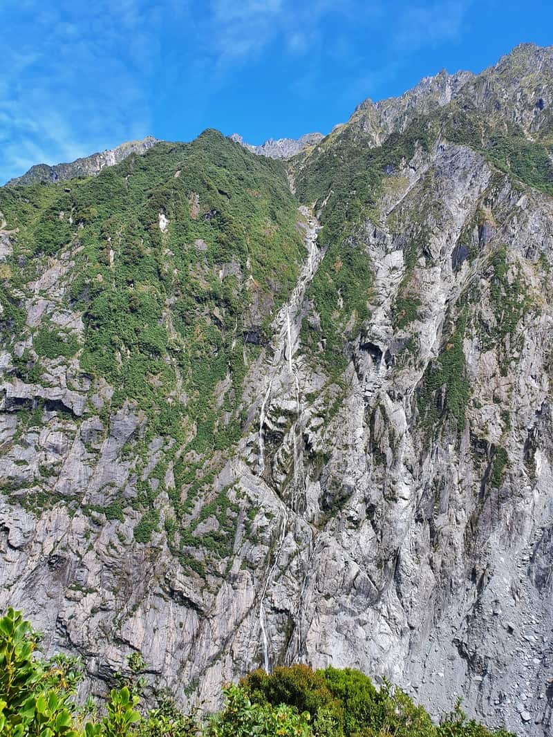
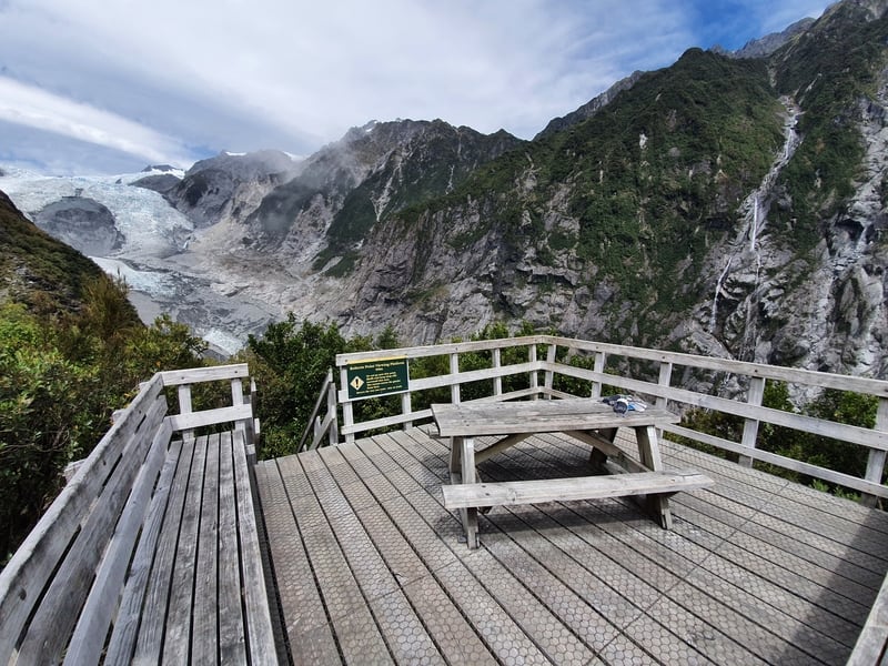
Out of nowhere, you reach the viewing platform. A nice-sized large wooden platform that gives you a view of the glacier, and back down the valley. On either side, you can see the vertical cliffs with waterfalls flowing from them.
There’s a picnic table, enjoy your lunch here…weather permitting.
I came across about 10 people on the hike. Some people had poles and while talking to them, they were all having a blast. The variety of the terrain is what everyone loves.
The return will be slightly quicker, but given the technical parts, it’s not that much quicker as all I could think about was not slipping over in some parts.
Enjoy the hike!
The Roberts Point walk is a great value hike.
It’s an out and back hike, but given the variety of the terrain the return isn’t overly painful. And anytime you get to see a glacier while hiking life can’t be too bad.
I’ve posted some more photos from the Roberts Point Track below. But if you’ve got any questions or comments about the hike, leave a note at the bottom of the page or email jub@churnewzealand.com
RECOMMENDED READING
200+ Things to do in New Zealand
Ideas, ideas, ideas
The Punakaiki Pororari Loop Track
A nifty hike to the outskirts of the Paparoa National Park
Copland Track to Welcome Flat Hut hot pools
A nearby hike that’s one of the best overnight hikes on the West Coast.

Hey, it’s Jub here. I’m the guy behind Chur New Zealand, helping you have the best time hiking, trekking, walking…whatever you want to call it…in NZ. I’m based in Queenstown and am always out and about exploring trails, old & new. If you have any questions, reach out.
Hi Jub, Thank you for the review. You mention the condition of the trail a few times; a picture above shows an orange triangle without a clear trail. Having never been to New Zealand, I’m guessing the orange triangle is pointing the direction and general location of the trail. Are these markers common along the trail? Is the trail easy to lose if one is not paying close attention? Thank you for your help. I look forward to hearing from you.
Best Wishes,
Mark
Hey Mark,
The orange triangles point in the general direction most of the time. You’ll see plenty of them on this track…in theory you shouldn’t veer off the track easily, but us humans can be silly! I can’t 100% recall, but I wouldn’t be surprised if you can’t see an orange triangle at all points on the track. Maybe not on the super obvious parts of the trail.
Have fun.
Chur, Jub
Hey,
first, thanks for your blog! Thanks for sharing!
Second, a little update regarding parking. DOC started to charge parking fee at Franz Joseph carpark ($5/hour or $20/day).
Alex Knob parking is still free, but the lot is significantly smaller. It was already full at 7.30 am on Sunday (end of January 2026). If you don’t want to pay, it is possible to park in town for free at certain placds, and then just walk across the bridge towards the trails. It’s a nice walk, safe for pedestrains with stunning views already.
Marie
Hey Marie,
That’s really good intel, I’ll be updating that information shortly. Thanks for the update.
Crazy it was full by 7.30!
Hope you have an amazing rest of your summer.
Chur,
Jub