The Pororari Punakaiki Loop Track is an extension of the popular Porari River Track.
It’s perfect for those who despise an out-and-back track.
At about 11-12km with less than 300 metres of elevation, the Pororari Punakaiki Loop (best done in the clockwise direction) won’t take up more than half of your day and gives you a taste of hiking in Paparoa National Park. You can also visit the famous Pancake Rocks and a cafe before finishing the loop.
Note:
- DOC refers to the loop as the trail between the Pororari River car park and Waikori Road car park. But I’ll add in Waikori Road and the stretch along the state highway to complete a full loop. Unless you have two cars or get someone to pick you up, walking the full loop makes more sense.
- Some people refer to the track as the Punakaiki Porari Loop Track. This is the same loop, it’s usually referring to the anti-clockwise route)
TABLE OF CONTENTS
1. Pororari Punakaiki Loop Track Details
2. Pororari Punakaiki Track Map
3. How To Get To The Trailhead
4. My Pororari Punakaiki Loop Track Experience
1. PORORARI PUNAKAIKI LOOP TRACK DETAILS
QUICK DETAILS:
- Distance: 11 – 12km loop
- Elevation Gain: ~220 metres total
- Difficulty: Easy to Medium
- Download the GPX File
How hard is this track?
Easy to medium.
How long is the loop?
My watch gave me 11.60km for the loop. This includes the 500 metre detour to go and see the Poporari Swing Bridge (recommended).
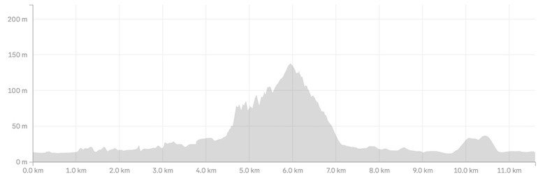
How much elevation gain is there? My watch gave 226 metres of total elevation gain for the walk. The majority of this is in a 1.5km in the middle of the walk, but it’s nothing crazy steep.
Here’s the elevation profile:
How long does it take to complete the loop?
It took me 2 hours and 20 minutes to complete the hike. That’s walking at a good pace. The DOC website suggests it is a 3 hour loop so be prepared for up to that, plus additional time if you choose to swim/have lunch etc.
2. PORORARI PUNAKAIKI TRACK MAP
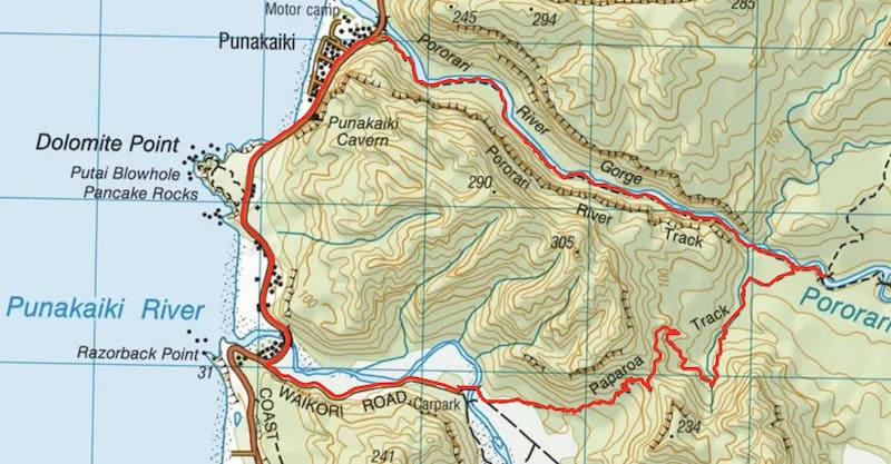
What you see above is the GPX file from my GPX file (linked above) overlaid on a mapo from topomap.co.nz. But as long as you follow the signs you won’t get lost, the track is super easy to follow.
You can also find the trails marked on Maps.me.
3. HOW TO GET TO THE TRAILHEAD
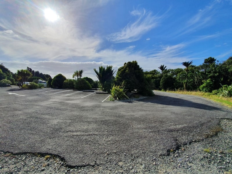
The Waikori Road car park
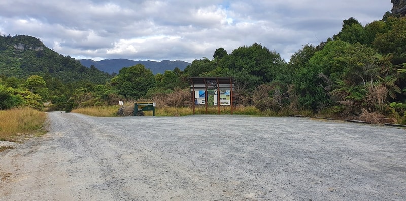
The Pororari River car park
Punakaiki is a small town so it doesn’t matter where you start from, though I prefer the northern end (car park here) which is where most people will start from.
There are 3 accommodation options within a 10 minute of the trailhead:
4. MY PORORARI PUNAKAIKI LOOP TRACK EXPERIENCE
With a storm due to arrive overnight, I wanted to squeeze in at least one hike before the famous West Coast rain rolled in.
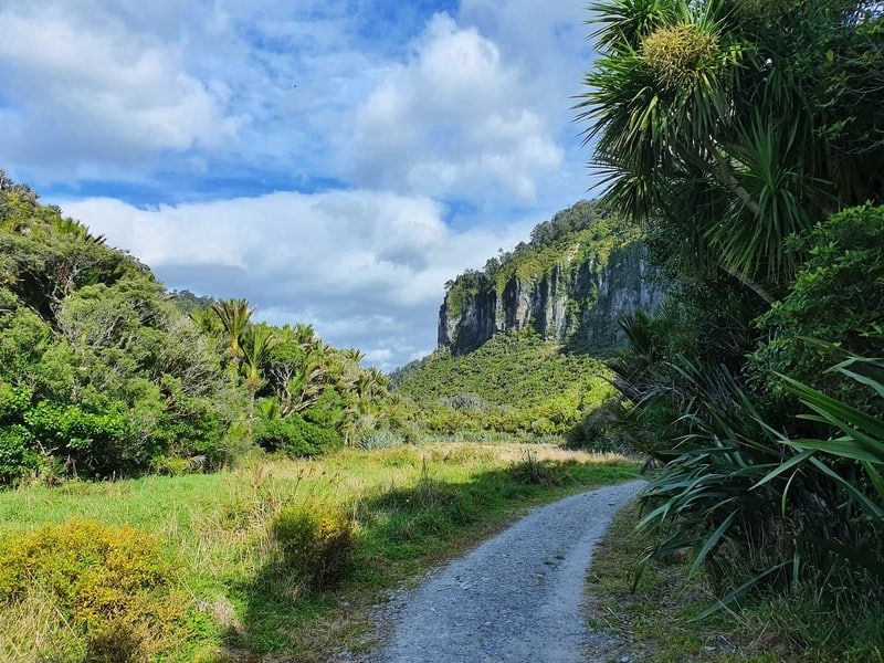
I started the walk at the Pororari River Track a little after 5 pm and was loving the walk track views right away.
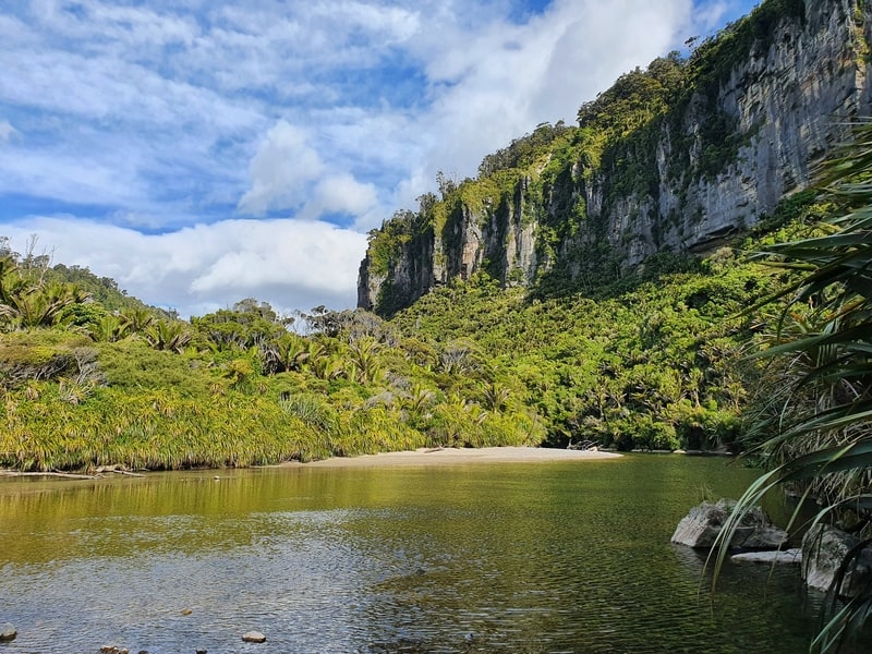
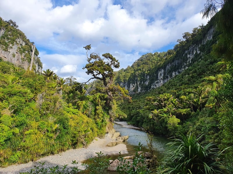
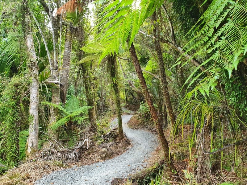
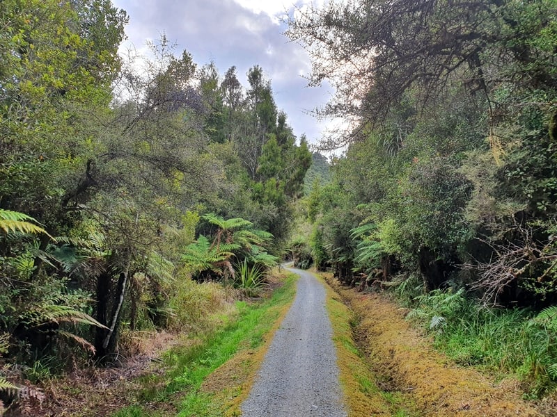
The track is well constructed and you quickly have views of the Pororari River and cliffs, surrounded by deep green vegetation. It’s awesome.
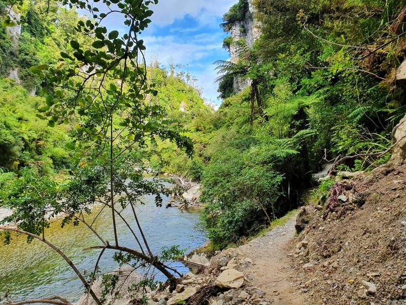
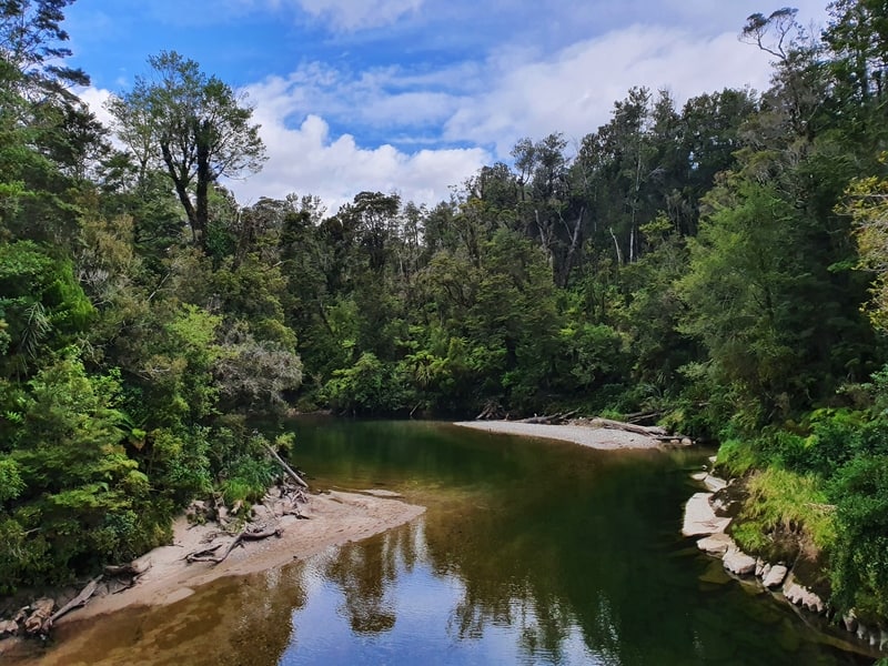
The track follows the river closely for the first 3.2km and you’ll notice little tracks leading to the river from time to time. A quick look around Instagram and I saw that it was possible to swim in the river. It’s not for me, but might be a great idea for you on a warm day.
Speaking of which, you can get away without sunscreen on this walk as you walk through the bush for a lot of the walk (but if you get burnt easily, you should put it on).
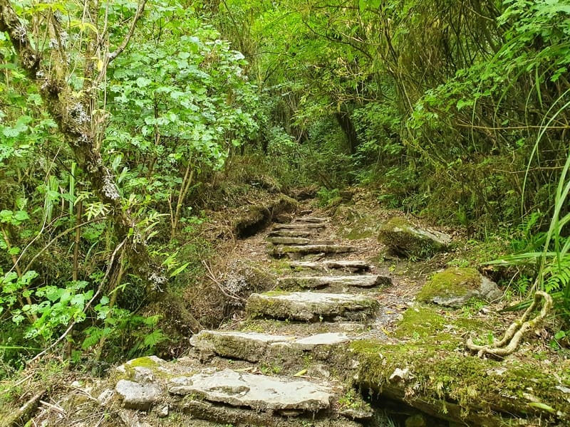
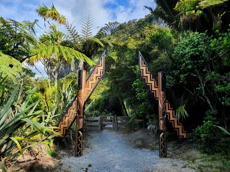
The walk is on a gentle incline for the first 3.2km with slight undulations. There are some cool stairs you’ll go up (there are not many) that lead to a cave-like structure.
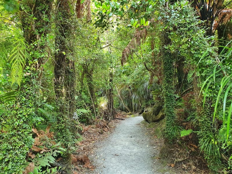
But the river and forest are the main attractions on the first part of this walk up to the junction. I love the Jurassic Park-like feel near the junction.
When you get to the junction all the signs will let you know where to go.
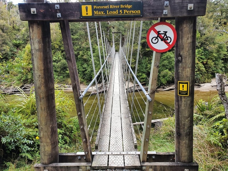
We’ll turn right, but first I recommend continuing straight for another 250 metres or so until you reach the Pororari River swing bridge (this would take you onto the Inland Pack Track). This will give you a final chance for a look at the river before we head back to the junction to complete the next section of the loop.
Back at the junction, follow the signs to the Waikori Road car park. This section does allow people on bikes to use the trail…so if you’ve got headphones in, take at least one out so you can be aware of them from either direction.
Speaking of headphones, leave them at home for this walk. There were a lot of bird calls throughout the walk which was cool. There were plenty of cicadas singing too.
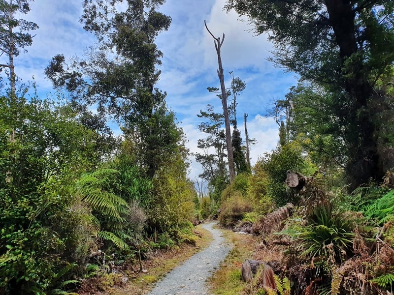
Now that we’re getting further away from the river, we ascend to the highest point which is just a gradual rise. The bush is gorgeous, but this second section isn’t as nice as following the river.
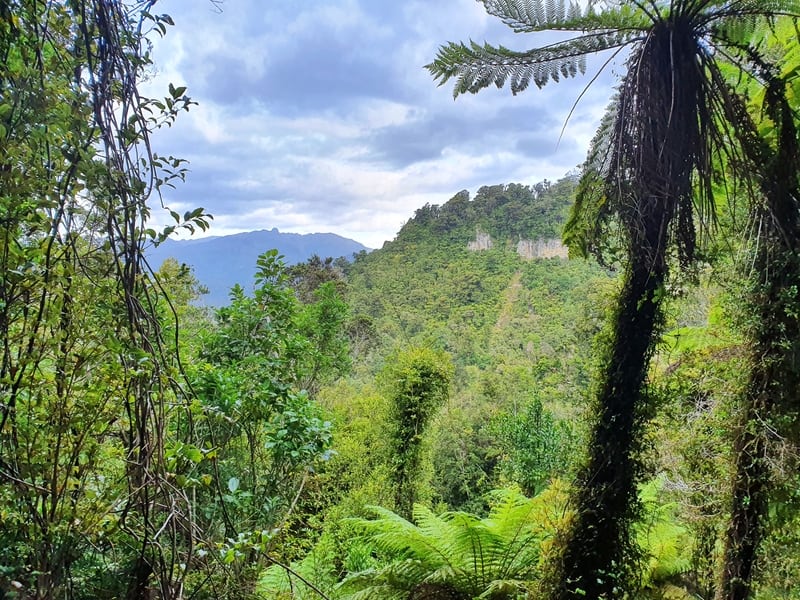
As we begin the descent there are a few sections where you get to peak out in the distance through the bush, but it’s nothing amazing (high standards much).
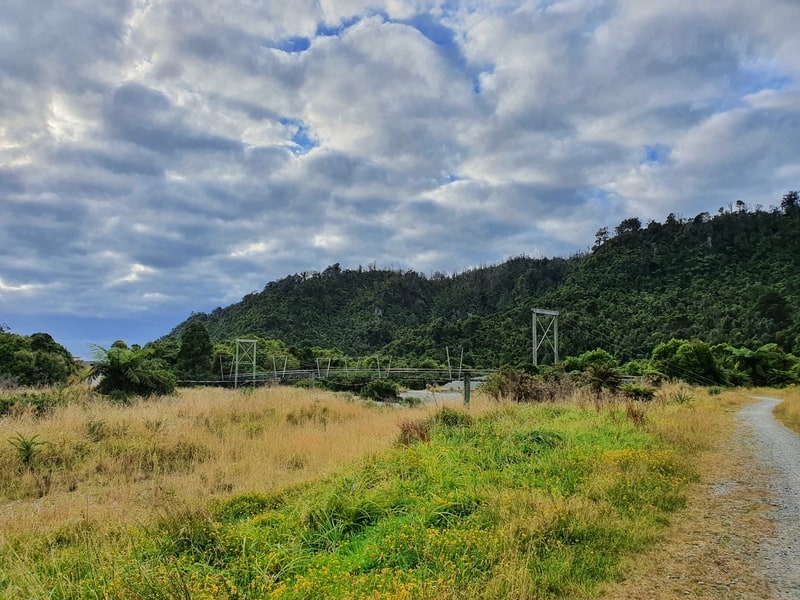
The descent is steady and spits you out at the end of the trail. You’ll see the swingbridge that you need to cross to reach the Waikori Road car park. From here, continue walking along the gravel road alongside the not-so-picturesque Punakaiki River to the highway.
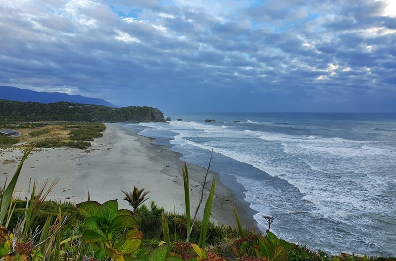
There’s a walking path next to the highway (most of the way) and you’ll get some nice views of the beach. This will lead you to the middle of ‘town’ (where the DOC centre is). Always keep your wits about you with the traffic when on the highway.
Once you’re at DOC centre, you could stop in for food at Pancake Rocks Cafe, or visit the Punakaiki Pancake Rocks if you haven’t yet (best seen at high tide).
Then it was a leisurely stroll following the highway back to the Pororari Car Park (you can visit the Punakaiki Cavern enroute too).
If you’ve got any questions about completing the Pororari Punakaiki Loop Track, let me know in the comments below or email jub@churnewzealand.com.
I’m happy to help 🙂
p.s. Here’s a map of all the walks and hikes documented on Chur New Zealand. You can click the icon to see brief details, as well as a link to read more about the hike (like this post).

Hey, it’s Jub here. I’m the guy behind Chur New Zealand, helping you have the best time hiking, trekking, walking…whatever you want to call it…in NZ. I’m based in Queenstown and am always out and about exploring trails, old & new. If you have any questions, reach out.