The Tiki Trail in Queenstown is a 2km walk (one way) with over 400 metres of elevation gain.
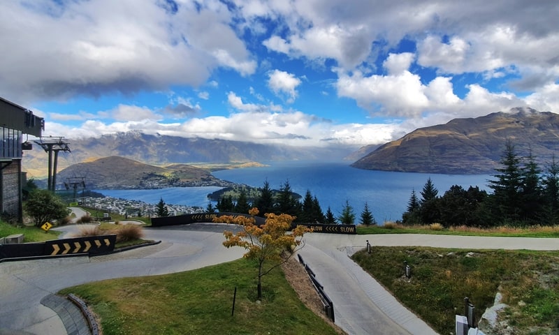
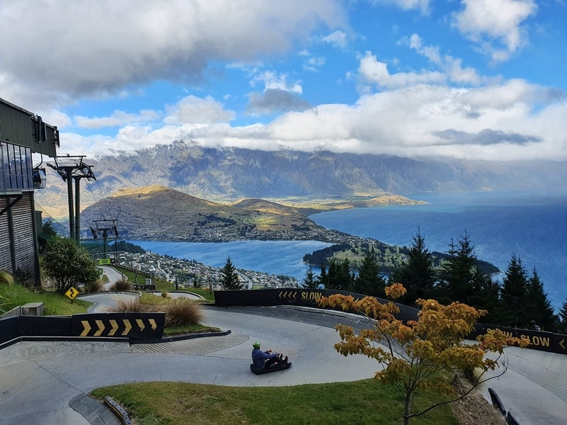
Best of all? It starts in Queenstown, and the top is at the Skyline with amazing views over Queenstown.
While most people will take the gondola (not cheap) up to do various Skyline activities, the Tiki Trail won’t cost you a cent.
And it’s a nice walk in its own right.
It’s also a good little warm up for Ben Lomond and other bigger Queenstown walks. Though Queenstown Hill makes for another alternative ‘warm up’.
This post will give you the details about Queenstown’s Tiki Trail.
Note: Some people call the Tiki Trail the Queenstown Gondola hike.
TABLE OF CONTENTS
1. Details About The Tiki Trail
2. Tiki Trail Queenstown Map
3. How To Get There
4. My Tiki Trail Experience
DETAILS ABOUT THE TIKI TRAIL
When1: 10+ times in 2020 and 2021
Difficulty2: Easy-Medium. Despite being a short walk/hike, the steepness of the track and some of the rocks don’t make this a casual easy walk. That said, times on your side here, and at worst you can get the gondola back down (bring your wallet for snacks/drinks at the top if need be).
Hike Distance3: My Strava recorded right on 2km each way which is what other sources say (give or take 100 metres).
Elevation Gain4: My Strava data recorded 420 metres of incline. 99% of this is on the way up to the Skyline (also known as Bob’s Peak).
Hike Duration5: It took me ~40 minutes to get to the top of the Tiki Trail and 30 minutes to get down.
This will be on the faster side, with some people taking over an hour to reach the top. For 2km that gives you an idea of how steep it is. It shouldn’t take longer than 2 hours total up and down. Don’t forget to add in time for your activities at Bob’s Peak/Skyline.
TIKI TRAIL QUEENSTOWN MAP
The map above is a GPX file overlaid on a topo map.
But you don’t need a map for the Tiki Trail. Once you’re on the Tiki Trail (read below), you can’t really get lost. There’s a couple of points where you cross the 4WD track and then you just continue on walking.
HOW TO GET THERE
The Tiki Trail starts in Queenstown itself so if you’re staying in town, it’s easy to walk to the trailhead at the end of Beacon Street (next to the the cemetery).
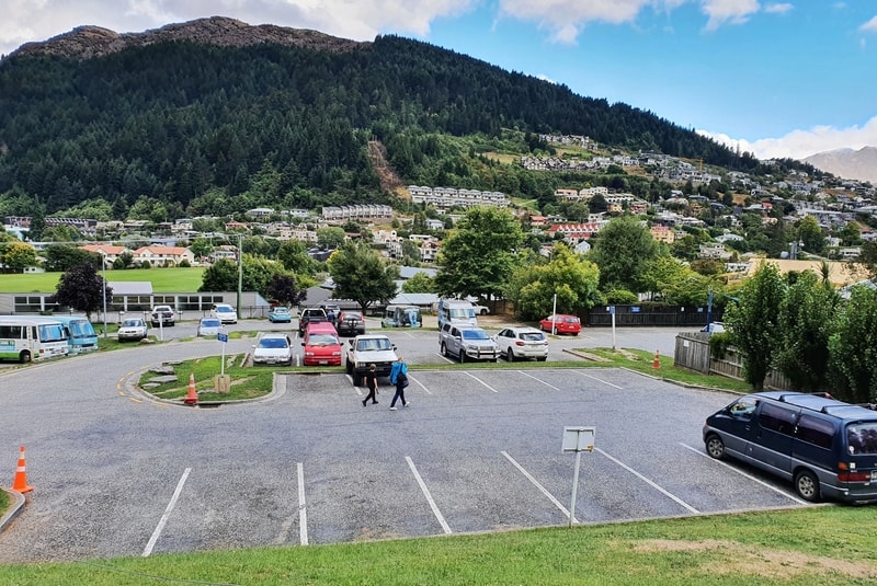
Parking in Queenstown is annoying. There is some parking available near the trailhead (Beacon Street Car Park), but it’s only for 4 hours.
If you’re driving into Queenstown to walk the Tiki Trail, I would assume you want to spend more than 4 hours in the city. So either go to a paid parking space or a free parking space (Malaghan Street and the more residential streets have some).
If you’re staying in Fernhill/Frankton/Arrowtown etc. you can take the public bus into Queenstown.
MY EXPERIENCE WALKING THE TIKI TRAIL
Having spent a few months in Queenstown, I’ve been up and down the Tiki Trail bunch of times.
And it has grown on me. Talking to others, some love it. And some strongly dislike it. At worst, you know you’re going to get a good workout in and have some sweet views at the top (weather permitting).
Note: This track is fine to do in winter most of the time.
At first, I wasn’t a fan as you’re in the forest, and there are only a few spots where you can get a viewpoint. I’d rather appreciate being up above the treeline with constant views (yes, I’m being picky).
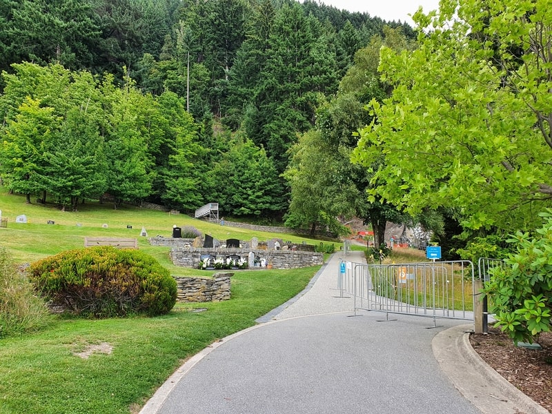
The entrance to the Tiki Trail is over the steel stairs in the photo above. You walk around the edge of the cemetery. Be careful not to walk in the lane where mountain bikers (MTB) come down.
Crossing the steel bridge, walk over the MTB track (again, watch out) and you’re into the climb right away.
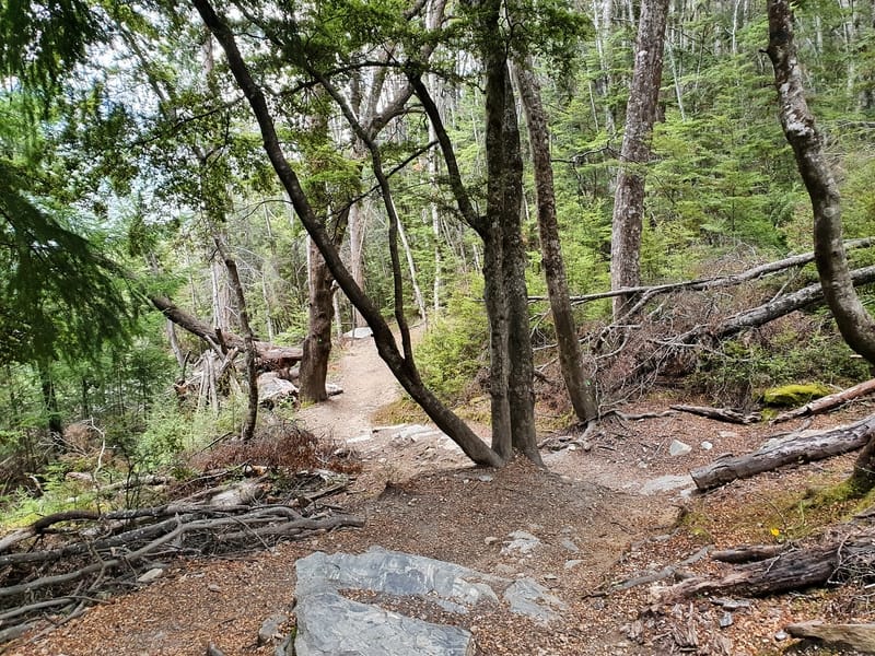
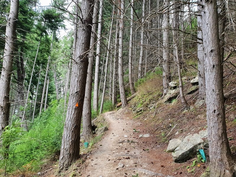
The bottom half of the Tiki Trail is a lot more technical than the second half. You’ll soon see what I mean with lots of rocks on the path weaving through the pine trees.
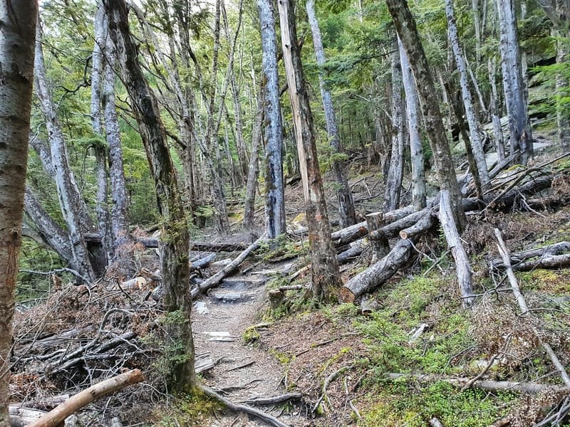
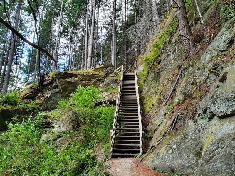
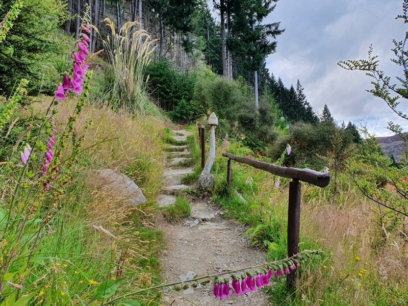
There are no sections where you’re bouldering/rock climbing, but you’ll be often be looking down at your feet to avoid tripping at the start. Do look up though, as there are a few wooden chairs where you can get a photo opp in the first 500 metres. Also of note, there are two sets of stairs on the way. Nothing too crazy.
The trail isn’t marked with orange triangles, but you can’t get lost at all. Anytime there’s a trail leading you elsewhere, there’ll be a chain or sign pointing you in the right direction.
OPEN THIS IN A NEW TAB: AMAZING HIKES IN THE SOUTH ISLAND
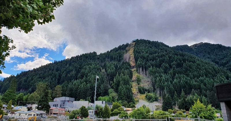
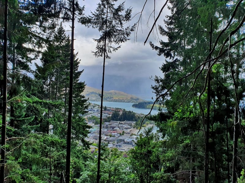
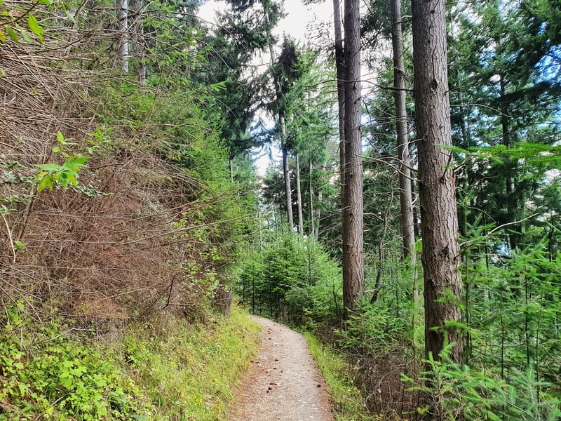
If you’ve looked up towards the Skyline from in the city itself, you’ll see the hillside to the left of the gondola is covered in Pine Trees. So it makes sense that you’re going to be covered by them 90+% of the time on the trail.
Fortunately, you still get occasional views over Lake Wakatipu. If you’re feeling broken, the increasingly awesome views might be the dopamine hit you needed.
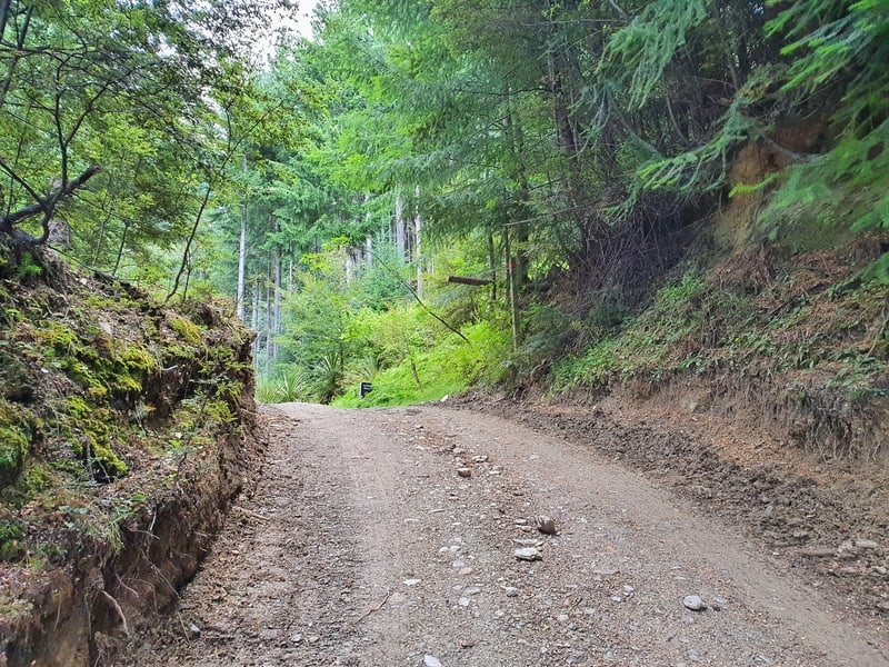
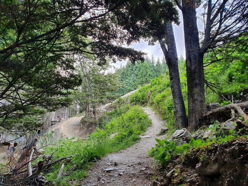
As I mentioned earlier, the trail crosses the 4WD track twice. The first time you cross straight over and continue carrying on up. The second crossing, turn left on the 4WD track and you’ll see the sign in about 20 metres where you continue on the track.
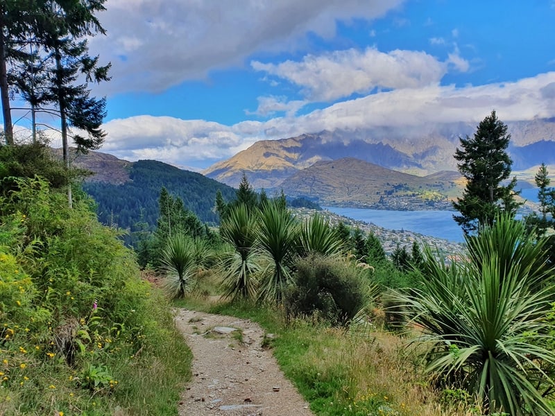
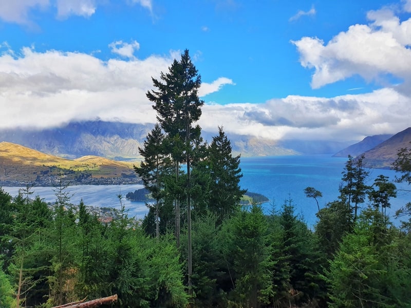
About two-thirds of the way up is the best viewpoint on the route. It’s a good spot for a break before the final, less rocky, push to the top.
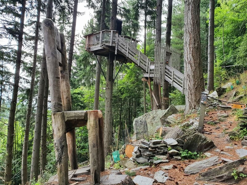
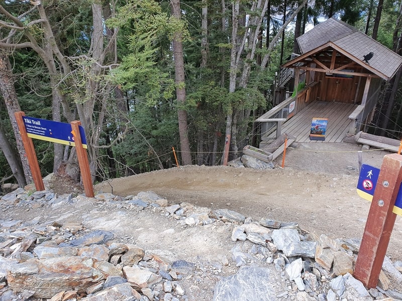
If you’re wondering what the building/structures are on the way up, they’re related to the Ziptrek eco tours.
If you’re not looking up as you walk, the exit of the track will appear out of nowhere. Spitting you out on the 4WD track again,50 metres or so away from the Skyline where you’ve got activities and views galore.
You could continue walking up to Jan’s Peak if you wanted.
The return walk is simple, go back the way you came. Be careful to go on the walking track, it’s easy to end up on the MTB track. I’m speaking from experience 😉
It took me about 40 minutes to get up, and 30 minutes to get down. It’s a steep descent, so the 2km will still take some time. Unless you break out into a jog.
RECOMMENDED READING
200+ Things to do in New Zealand
xyz
Devil Burger in Queenstown
Treat yourself to a burger when you get back down?
Various Walks in Arrowtown
Arrowtown has some more great walks that are less than 10km long

Hey, it’s Jub here. I’m the guy behind Chur New Zealand, helping you have the best time hiking, trekking, walking…whatever you want to call it…in NZ. I’m based in Queenstown and am always out and about exploring trails, old & new. If you have any questions, reach out.
Took the gondola up and walked down. Not for those with weak knees (and I don’t mean easily frightened).
Nice work JT!
Thank you for this info, I took the Tiki trail yesterday and loved it, it’s a beautiful hike – lots of lovely photo opportunities.
Yay, that’s awesome to read Abby. I’ve heard the start has changed a little since the mud/landslide…I’ll need to go take a look at the new route and update this post 🙂