Jan’s Peak in Queenstown is awesome for a couple of reasons:
- it’s super easy to access (7km return from Queenstown, and about 3km return from the Skyline)
- has a unique viewpoint overlooking Queenstown
- you’ll most likely have the spot to yourself
After 5+ years in Queenstown I still love this spot.
Yet, it’s one of the few Queenstown hikes off the beaten path. I only found it when I was scrolling around on Google Maps.
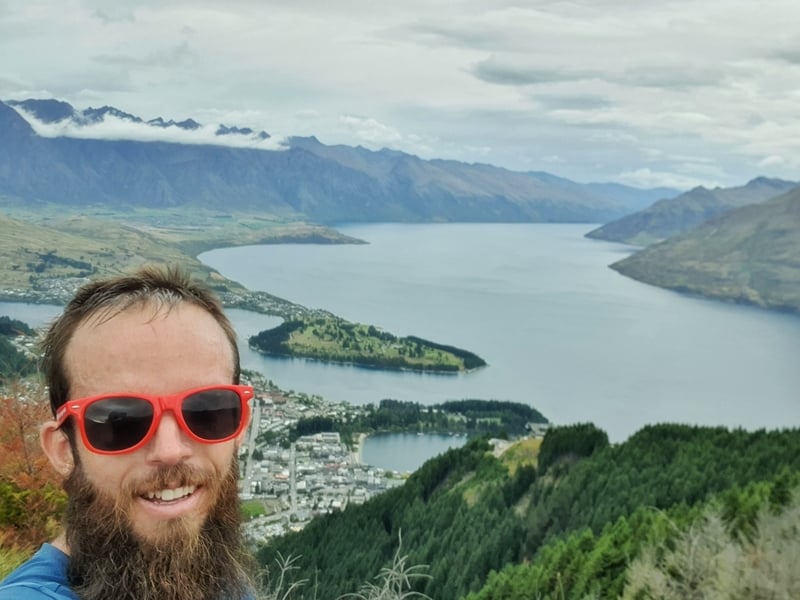
The photos get better, trust me (scroll towards the bottom of the post). This is to prove I’ve been 🙂
Jan’s Peak has less than 20 Google reviews (at time of last update), compared to the Tiki Trail (800+) and Ben Lomond (130+).
This post will give you all the details on getting to Jan’s Peak, one of the best places to visit in Queenstown that’ll be tourist-free.
TABLE OF CONTENTS
1. Details About Hiking to Jan’s Peak
2. Jan’s Peak Track Map
3. How To Get To The Trail Head
4. My Experience At Jan’s Peak in Queenstown
1.
DETAILS ABOUT HIKING TO JAN’S PEAK
QUICK DETAILS:
- Distance: ~7km return
- Elevation Gain: ~700 metres total
- Difficulty: Easy to medium
- Download the GPX File
How hard is the hike?
From Beacon Street: Medium.
From the Skyline: Easy.
How long is the hike to Jans Peak?
From Beacon Street, Queenstown it’s ~7km return and from the Skyline building, it’s ~3km return.
What’s the elevation of the hike to Jan’s Peak?
From Beacon Street, Queenstown there’s about 700 metres of elevation gain. From the Skyline, it’s about 300 metres.
How long does it take to get to Jan’s Peak?
From Beacon Street: 2 hours round trip for me, schedule in 2-3 hours. If you’re walking from the Skyline, it’ll take 45-90 minutes (plus however long you spend at the viewpoint).
2. JAN’S PEAK TRACK MAP
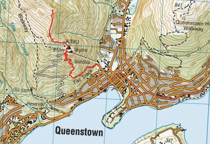
Note: I’m calling this the Jan’s Peak track as that’s the name of the peak on Google Maps. You won’t find this labelled on a topo map, or maps.me. Weirdly, you will see it on Strava labeled Tyne’s Lookout.
The GPS coordinates are: -45.01935,168.64477
The map above is the GPX file uploaded onto a topo map. I’ll make sure the photos in the description below are detailed enough so you can get there without going the wrong way. Get a good topo map and install the GPX file above.
3. HOW TO GET TO THE TRAILHEAD
You’ve got two options. You can walk from Beacon Street via the Tiki Trail, or walk to Jan’s Peak from the Skyline on Bob’s Peak (you can take the gondola).
4. MY EXPERIENCE HIKING TO JAN’S PEAK IN QUEENSTOWN
As I’ve already detailed the Tiki Trail walk here, I’ll only talk about my experience from the Skyline up to Jan’s Peak in this post.
As it’s easy to take the wrong turn, I’m going to write the directions in the captions of the photos below. This is for the section from the top of the Tiki Trail to the paragliding take-off zone.
Here’s the video version of the route to take. I filmed this hyper-lapse which shows you the way.
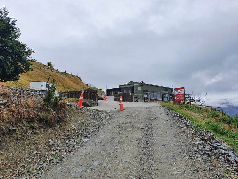
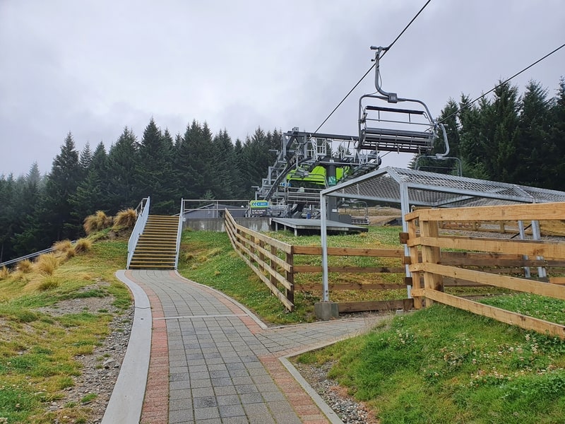
From the top of the Tiki Trail, turn right and walk up here towards the Skyline building.
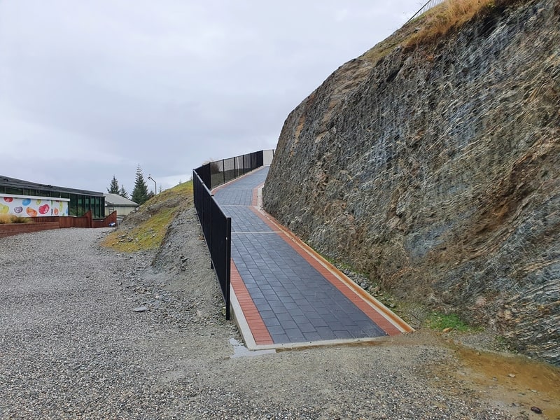
Continue walking up next to the building until you see this pathway. You’ll walk up here, and keep following the path.
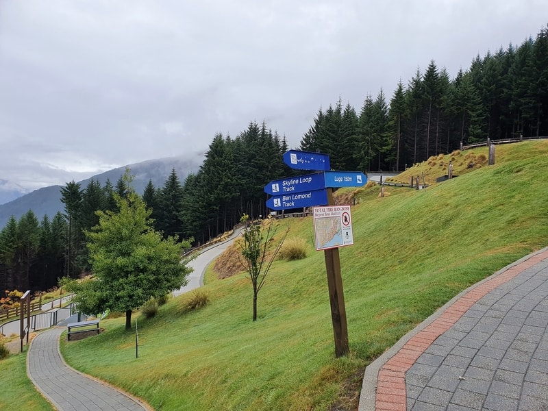
At this junction in the path, turn right towards the luge NOT left, unless you want to go up the Ben Lomond Track.
As you approach the top of the luge, take a right here.
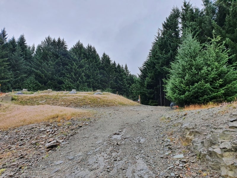
After crossing under the gondola, continue straight up the 4WD track (don’t turn left at this point).
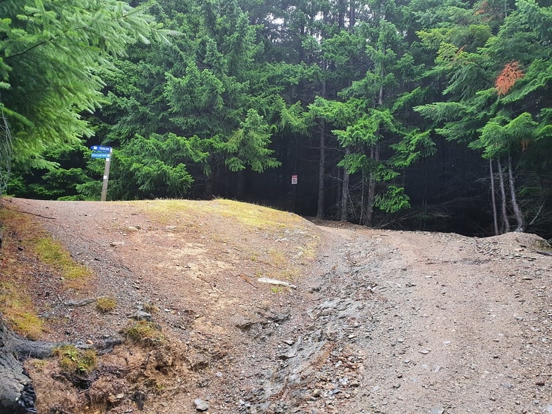
Do turn left here! The blue sign will mention this is the walking track to the paragliding take off point. You’ll know if you’ve missed the turnoff as there’s a sign saying you can’t walk beyond a certain point just after the turn off.
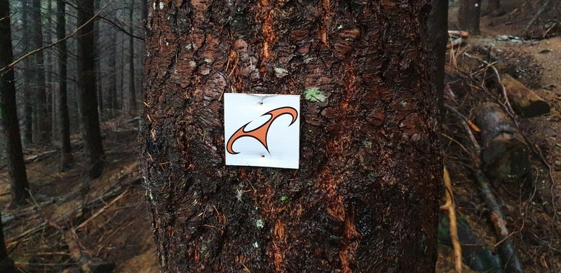
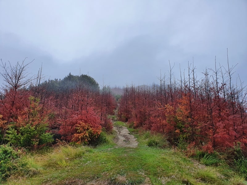
Walk through the pine forest, following these markers.
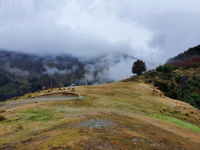
And wallah, you’ll end up at the paragliding take off point.
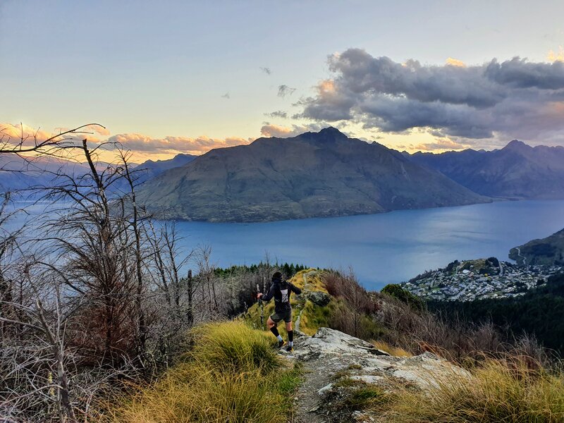
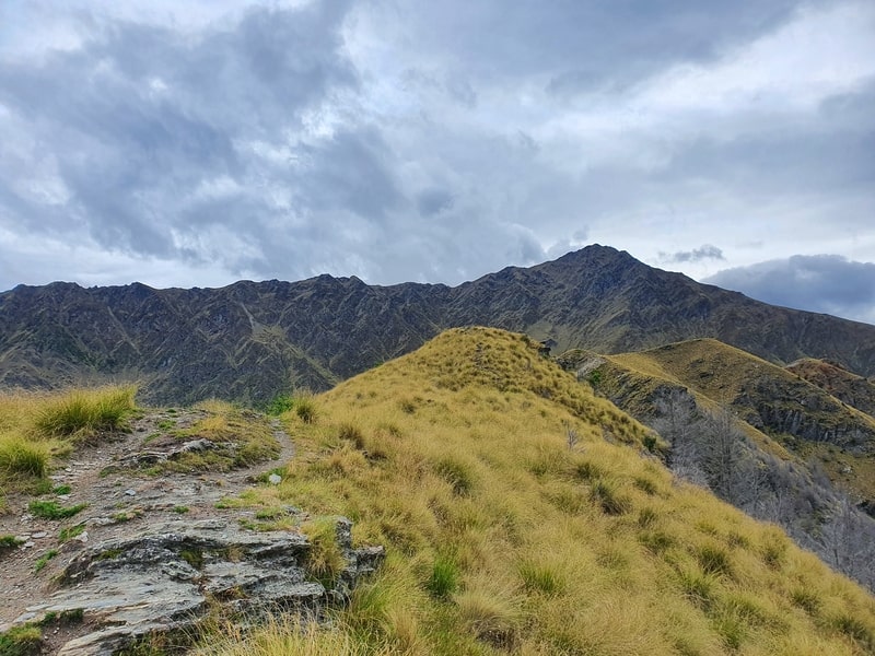
The walking track continues on the other side of the paragliding takeoff zone. Ideally, you’ll get to watch a few paragliders takeoff. This is where the views start getting fun too.
The trail from here is more rugged. It’s easy to follow, but it’s not a maintained trail as such (it’s something in Queenstown off the beaten path and all). From here it’s less than one kilometre to Jan’s Peak so it’s all good.
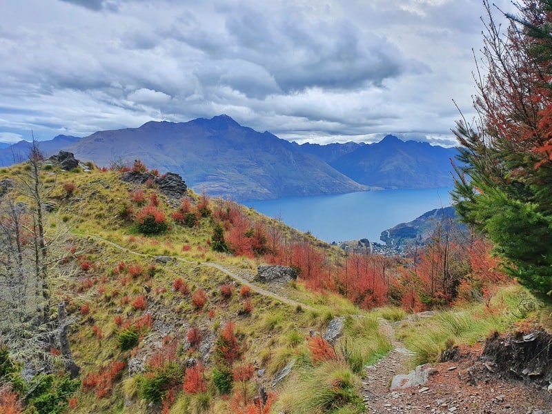
And before you know it, you’ll be there with some unique views of Queenstown. It’s almost like you have a birdseye view of central Queenstown. But to get a proper birdseye view you do have to go paragliding.

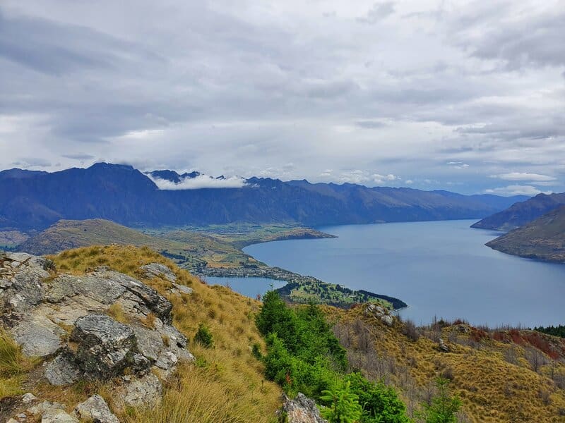
You’ll notice when you get to the peak (the rocks make it obvious, despite there being no official point), but if you look closely, you could continue walking along the ridge. This will lead you back onto the main Ben Lomond Track, one of the best South Island hikes, in a couple of kilometres (below the saddle).
So you could say it’s an alternative route to the peak, or you could complete a loop back around to the Skyline. Personally, I prefer the up and down route for this one.
Coming back is easy enough. There’s one point a couple of minutes below the summit where the path splits. Make sure you stay left 🙂
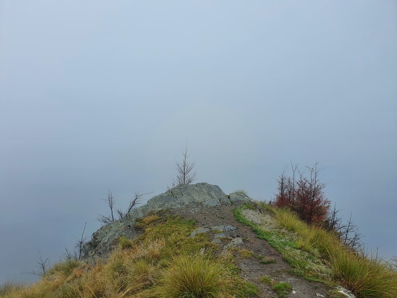
As you can tell in this photo, the walk is best down when there’s no risk of low cloud. Unless you like to imagine what the views might look like!
Jan’s Peak is a great off the beaten path walk in Queenstown. And it’s so close to the hundreds that visit the Skyline every day.
If you have any questions, email jub@churnewzealand.com or leave a comment below.
p.s. Here’s a map of all the walks and hikes documented on Chur New Zealand. You can click the icon to see brief details, as well as a link to read more about the hike (like this post).

Hey, it’s Jub here. I’m the guy behind Chur New Zealand, helping you have the best time hiking, trekking, walking…whatever you want to call it…in NZ. I’m based in Queenstown and am always out and about exploring trails, old & new. If you have any questions, reach out.