Welcome to this post about 26 of the best hikes and walks in Queenstown.
There’ll be the popular Queenstown walks like Queenstown Hill and Ben Lomond, but that doesn’t mean you shouldn’t give the Moonlight Track, or Wye Creek a go.
I’ve been on all of these tracks myself, most of them several times, and places like Ben Lomond 20+. Queenstown has been my backyard for over three years!
And yes, some of these are dog and family-friendly walks in Queenstown which I’ll mention below the table of contents.
Each walk/hike below will contain:
- photos
- distance
- difficulty
- a short description of what you can expect
If you want more information about a track, such as the elevation profile, more photos, and a first hand trip report you can click on the links in each description.
Queenstown is one of the best destinations for hiking in New Zealand, let’s get into it.
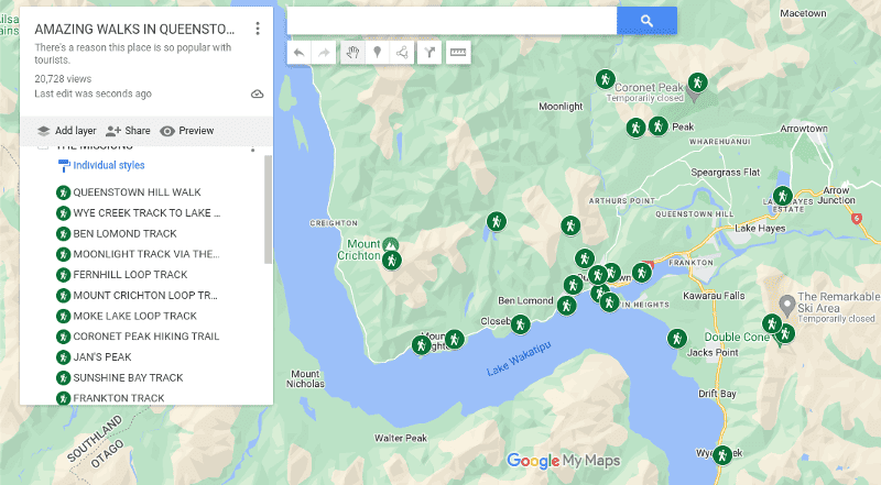
QUEENSTOWN WALKS MAP
If you click on the image below will have Google Maps open in a new window.
26 QUEENSTOWN WALKS AND HIKES
1. Queenstown Hill
2. Ben Lomond Track
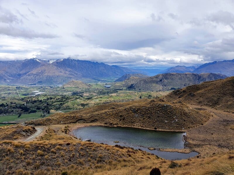
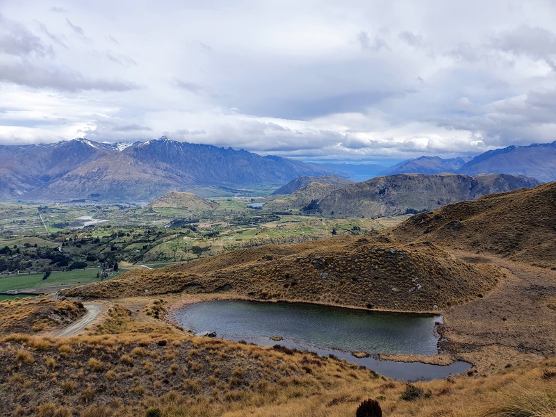
3. Mount Crichton Loop Track
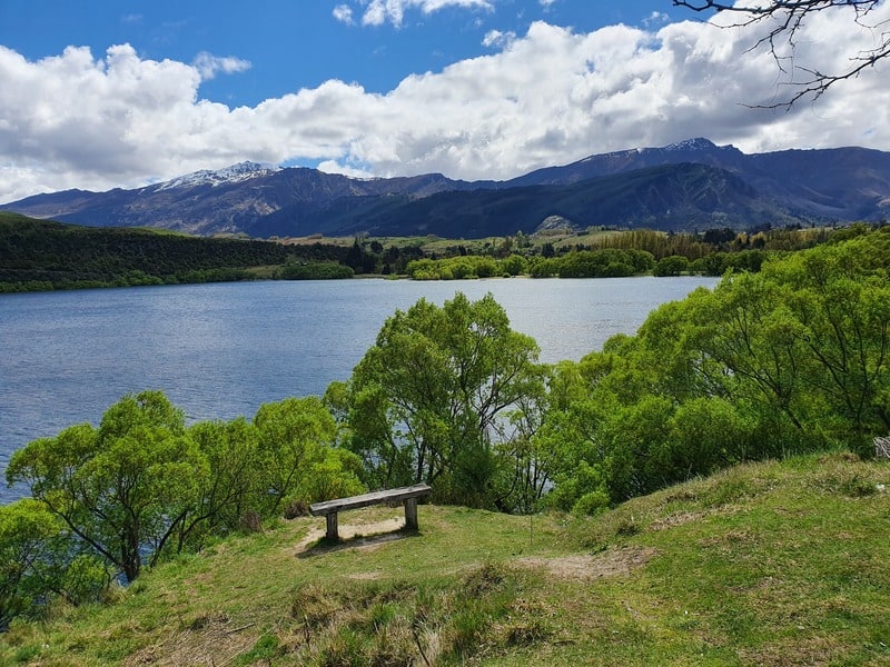
4. Moke Lake Loop Track
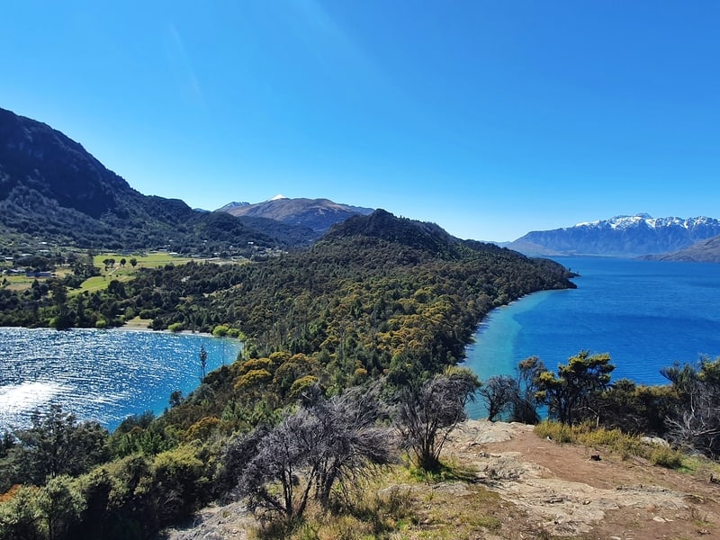
5. Wye Creek Track to Lake Alta
6. Fernhill Loop Track
7. The Moonlight Track
8. Coronet Peak Hiking Trail
9. Tiki Trail
10. Jans Peak
11. Sunshine Bay Track
12. Frankton Track
13. Queenstown Gardens
14. Kelvin Heights Peninsula Track
15. Seven Mile Track
16. Bowens Peak
17. Lake Hayes Loop
18. Atleys Track
19. Devils Creek
20. Mount Dewar Track
21. Jacks Point Trail
22. Bobs Cove Track
23. Lake Alta Track
24. Queens Drive
25. Mt Crichton Summit
26. Lower Wye Creek to Helipad
27. Other Walks Near Queenstown
I’ll address a few common Queenstown hiking questions before we get started.
Best walks in Queenstown for kids?
I’ll go with:
- Lake Hayes
- Queenstown Gardens
The best hikes in Queenstown?
Hands down the Ben Lomond Track is one of the best hikes in the South Island, not just Queenstown. It’s a hike that lives up to the hype.
Best Queenstown walking tracks with dogs?
The Sunshine Bay Track.
Best walk in Queenstown for beginners?
If you want a walk/hike with a little elevation, but nothing crazy, go with Queenstown Hill. It’s steep, but you can turn around at any point…and you get great views.
Best sunset hike in Queenstown?
I’ve not been to many of the hikes for sunset…but I’m going to say Jan’s Peak is a good spot.
Is this every walk near Queenstown?
Nope! There’s a few I haven’t included in this post, yet 😉
What are the best winter walks in Queenstown?
If there’s been snow to a lower level, then getting into the snow on Queenstown Hill is fun. And if you’ve got microspikes, consider going up Ben Lomond (while being prepared to turn around). Before the ski season opens, you can do the snowy walk to Lake Alta too.
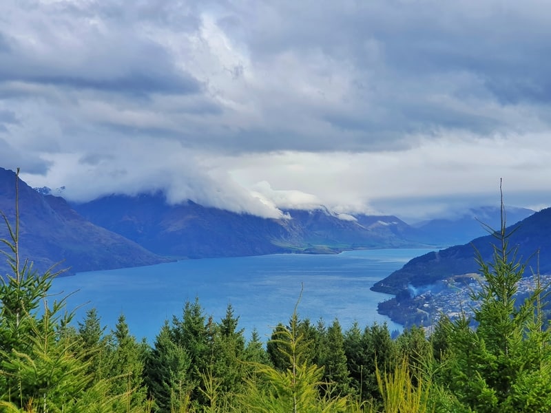
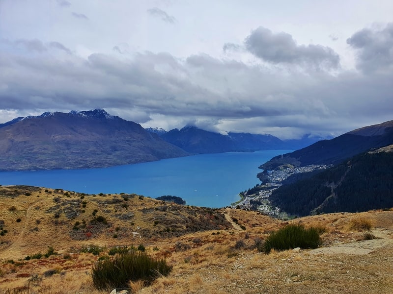
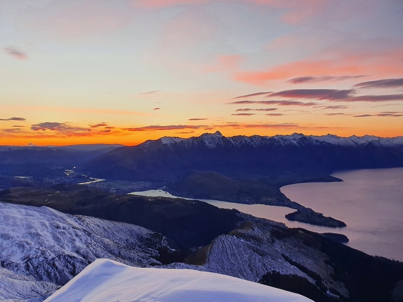
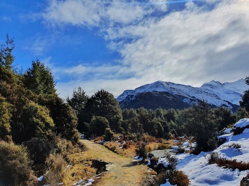
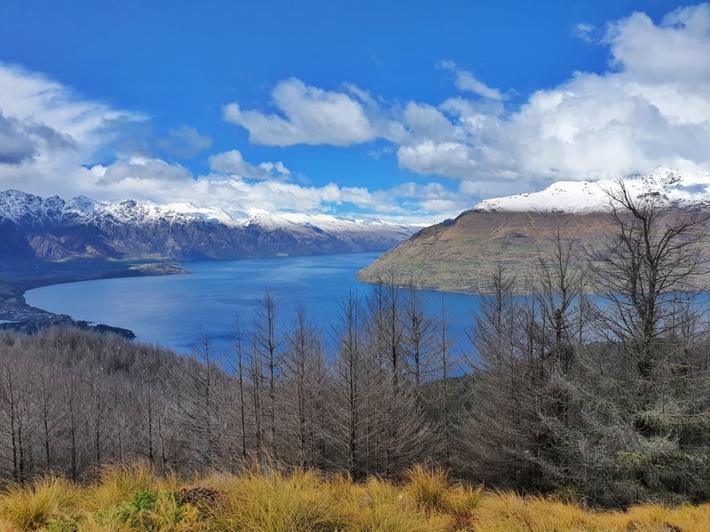
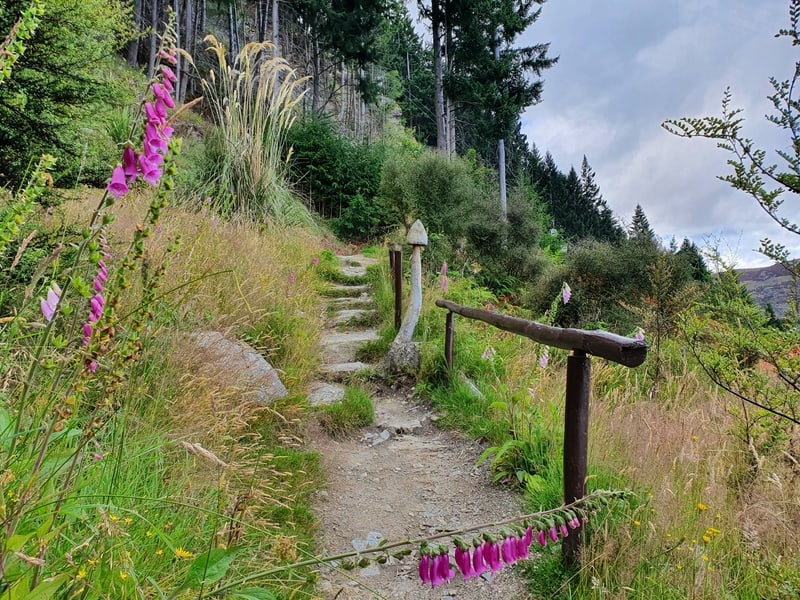
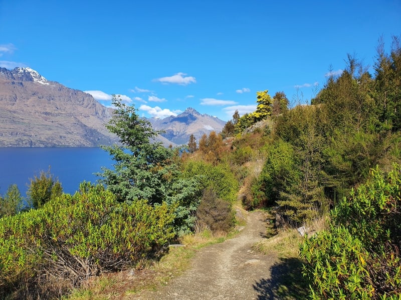
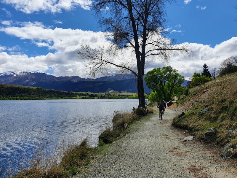
1. QUEENSTOWN HILL WALK
- Difficulty: Easy – Medium
- Distance: ~6km
The walk up Queenstown Hill one of the easiest walks to do in Queenstown.
With the total walk taking 2.5 hours return for the slowest walkers the views are good value for effort. You saw the photos, right?
You can see why it’s one of my favourite views in Queenstown.
The trail is not totally smooth the further you (with minimal flat spots) go up the rougher the terrain is. While you don’t need hiking boots, shoes will be better than jandals 😉
This is the perfect Queenstown hike if you’re looking for free things to do in Queenstown with kids.
You don’t have to go to the summit either, with the Basket of Dreams offering good views of Queenstown from that point.
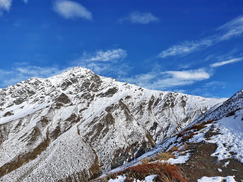
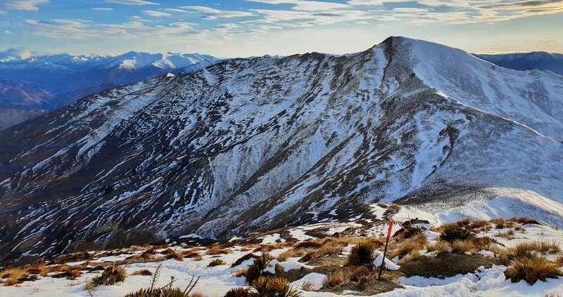
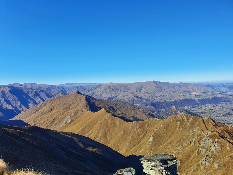
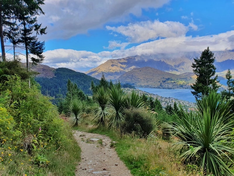
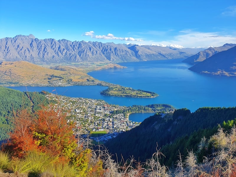
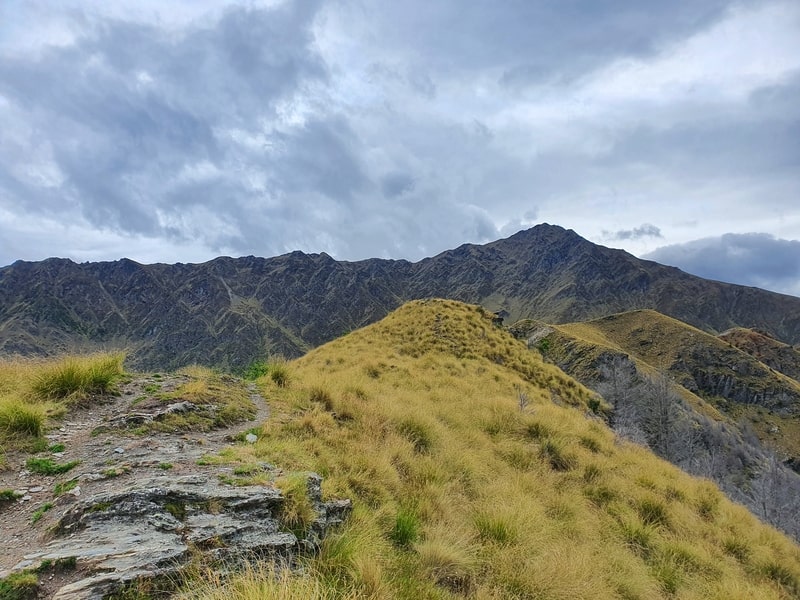
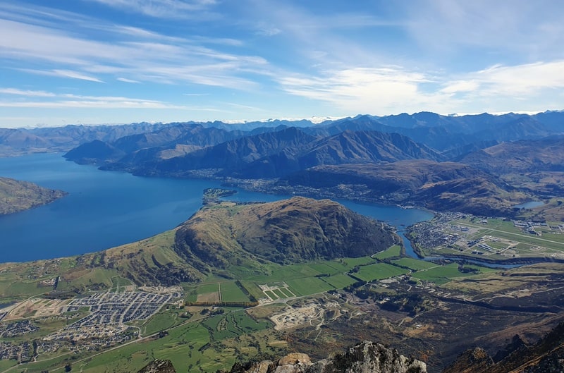
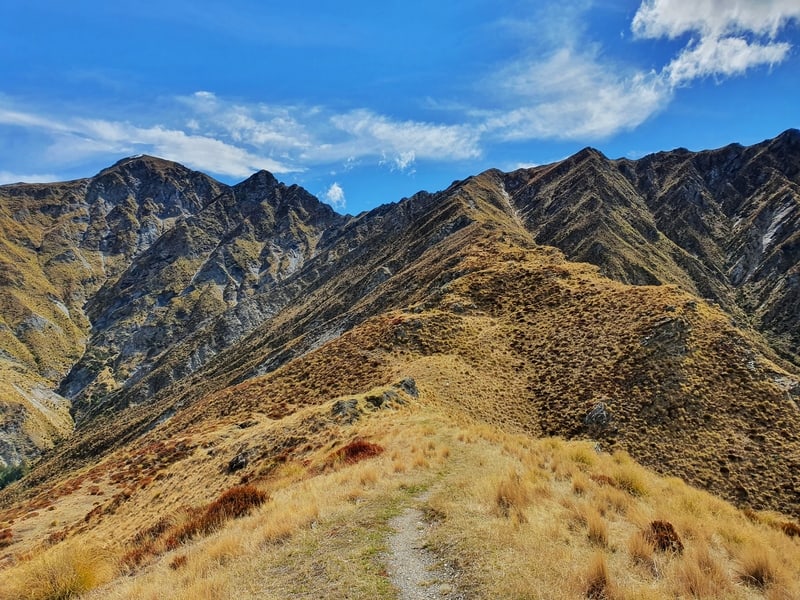
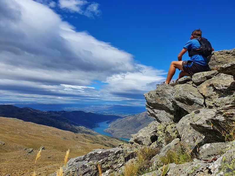
2. BEN LOMOND TRACK
- Difficulty: ~15km return from the bottom of the Tiki Trail
- Distance: Medium – Hard
People will often compare Isthmus Peak and Roys Peak. But the Ben Lomond Track has to be a contender for the walk in Otago with the best views. Perosnally I think it’s a better track than both of them asyou’ll see why when I compared Ben Lomond vs Roys Peak.
If you’ve been dreaming about Queenstown hiking missions, make the effort to get up to the summit for sunrise. If you can handle the early wake-up call!
It’s not one of the easy hikes in Queenstown, but the great thing is even if you just get to the Ben Lomond Saddle, you’re rewarded with great views. But do everything you can to get to the summit!
This walk to the summit isn’t for those with any hiking experience.
The track is easy to follow and for me it’s the best day hike in Queenstown.
Note: During the middle of the Queenstown winter you may need proper alpine equipment between the saddle and summit.
3. MOUNT CRICHTON LOOP TRACK
- Difficulty: Easy
- Distance: ~7.8km
The Mount Crichton Loop is one of the Queenstown tracks that’s often overlooked. It’s not talked about nearly as much as Bob’s Cove or Queenstown Hill but offers views of:
- mountains, Lake Wakatipu, Lake Dispute, waterfalls, rivers, and some other crazy natural formations.
And if you enjoy historic huts, you’ll walk past Sam Summers Hut.
If you want, you can also extend the walk to link Lake Dispute and Moke Lake together.
If you’re travelling by campervan and/or camping, it’s right by the 12 Mile Delta Campsite which is convenient.
4. MOKE LAKE LOOP TRACK
- Difficulty: Easy
- Distance: 6 – 7km
The track is in good condition, and there’s only a little bit of elevation when walking the track around Moke Lake making it one of the best walks in Queenstown for all levels.
Given it’s outside of the immediate Queenstown area, no one will accidentally discover this walk so it’s rarely overcrowded. And there’s also a DOC Campsite at the northern end of the lake should you want to stay there.
You can do this walk year round, but if there’s been snow to low levels, you’ll want a 4WD vehicle. It’s a lovely way to get a safe snowy hike however. And don’t forget to check out the epic ‘secret/not so secret’ viewpoint I mention in the full article linked above.
After your walk, you can swim in the lake or bask in the afternoon sun. I’d stick to only doing that in the summer though 😉
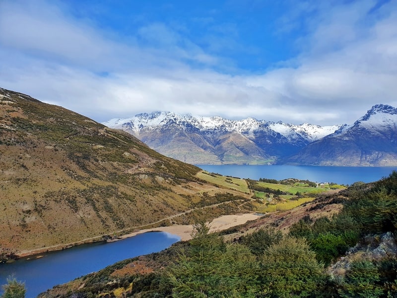
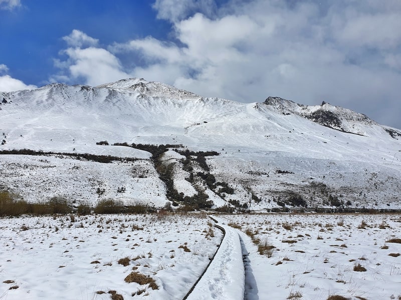
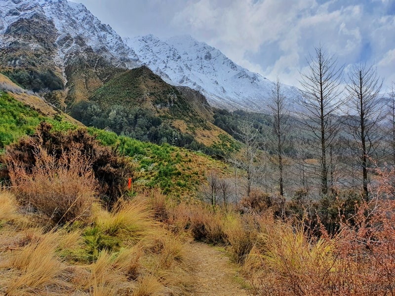
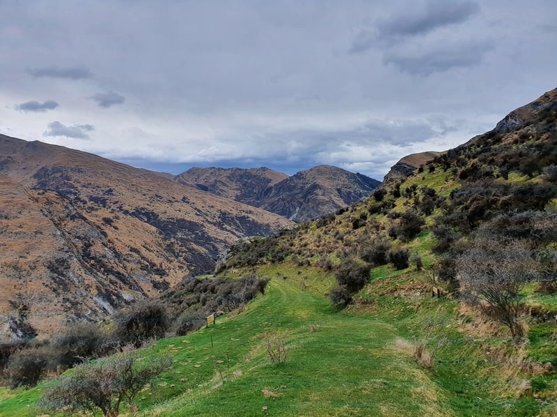
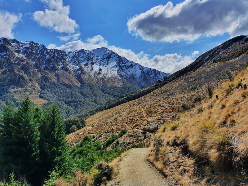
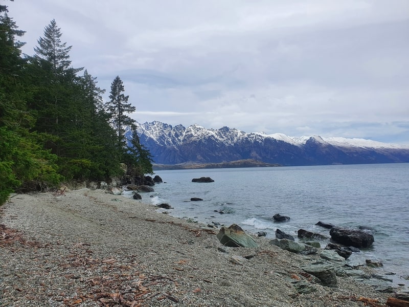
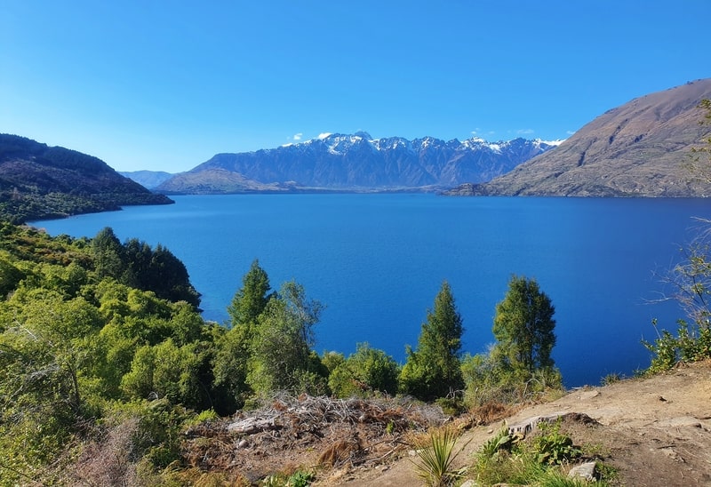
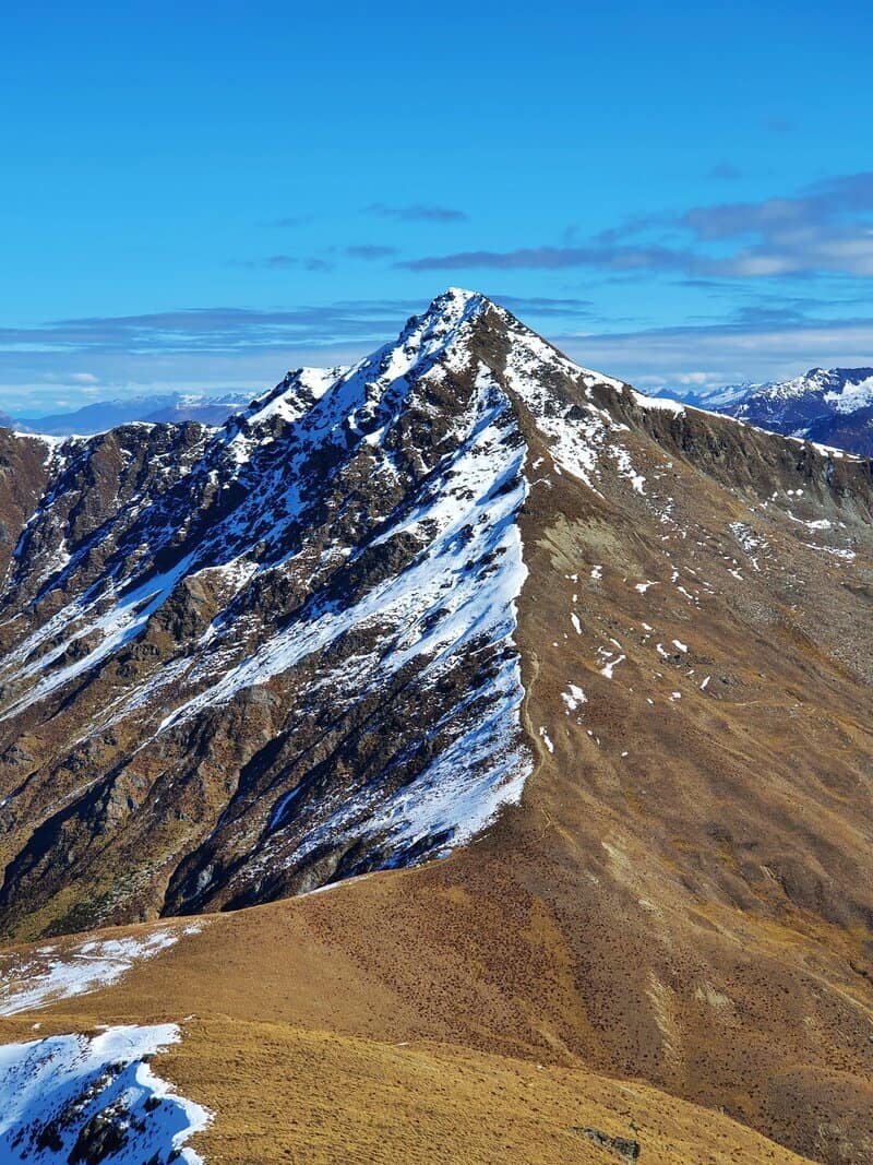
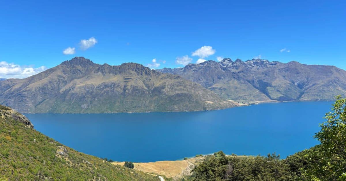
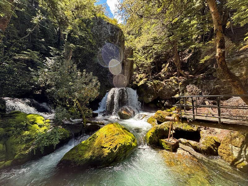
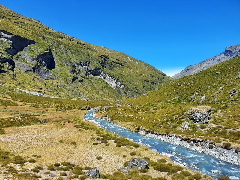
5. WYE CREEK TRACK TO LAKE ALTA
- Difficulty:Medium – Hard
- Distance: 15 – 16km
Wow. Wow. Wow. The <Wye Creek to Lake Alta hike is an epic day out. From Queenstown, it looked like there was minimal snow left on The Remarkables.
Don’t let that fool you though, once you’re over the other side of the Remarks there can be a lot more snow remaining through to early-mid summer. There was a lot more than we expected.
Make sure to speak to the staff at the DOC visitor centre in Queenstown before you embark on this hike.
But it’s insanely awesome if you’ve got time for it. Start as early as possible, as it’ll take you longer than you think.
There are three distinct stages to the hike.
Part one took you up through the bush line. Part two above the tree line through the tussocks, Part three, the alpine territory. The contrast was amazing, as were all the waterfalls!
And have a solid plan transport wise for getting to/from the hike.
6. FERNHILL LOOP TRACK
- Difficulty: Medium
- Distance: 7 – 8km
This is my least favourite of the Queenstown walks as I always get lost. But I’m not alone, it’s a regular occurrence on the Fernhill Loop if you’re doing it for the first time.
There are some locals who like the Fernhill Loop…and I can see why…it helps that they know where they’re going.
The loop is pretty steep both up and down, with mountain bike tracks crossing through some sections.
With that said, there are some nice parts. Once you get up above the tree line, you get some nice views. And along the One Mile Track, there are some cool relics and waterfall action. And you’ll get to hang out at the bench memorial for McGazza, a local legend who passed away doing what he loved in QT.
But yea, unless you’re in Queenstown for a few months, I wouldn’t put this at the top of your must-do walks in Queenstown.
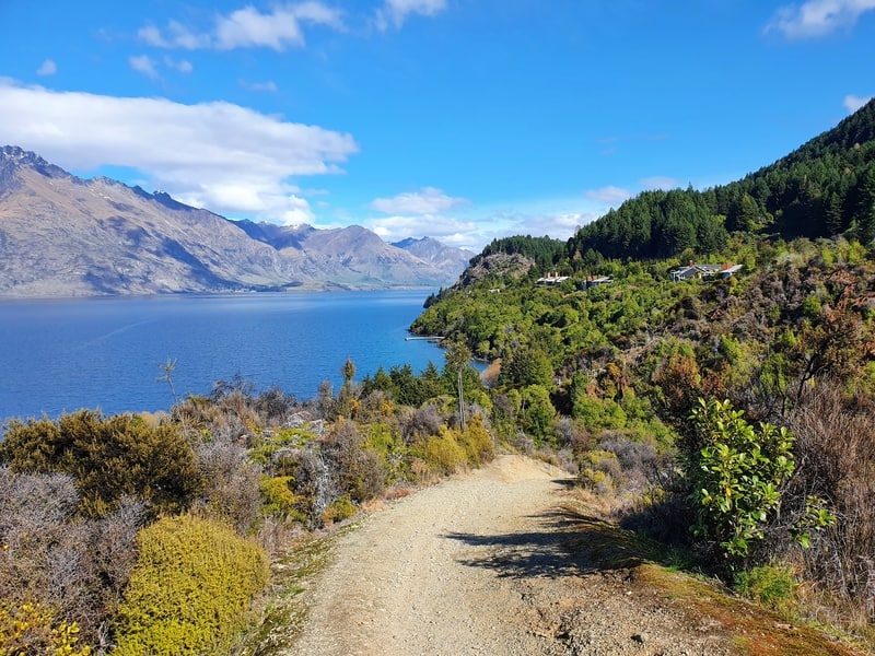
7. THE MOONLIGHT TRACK VIA THE TIKI TRAIL
- Difficulty: Medium.
- Distance: 18 – 20km
The Moonlight Track can be completed from two start points, both finishing in Arthur’s Point:
- Moke Lake
- Tiki Trail
The Tiki Trail is the most convenient as it’s in Queenstown. And given the track finishes in Arthur’s Point, you can easily bus back to town afterward (or walk).
The Moonlight Track goes up to Ben Lomond Saddle, but rather than going up to the peak, it continues over the other side of the saddle across private land.
You get to see the valleys through the mountains, and in the right light, the wrinkles on the mountains are awesome.
The final stretch takes you up above the Shotover River where you might hear the jetboat roaring, or someone screaming from the bungee. In the autumn the views over Arthur’s Point are magical.
From Moke Lake, you continue heading north following the river. It’s an easy route to follow.
This is an awesome walk, but it’s still no Ben Lomond Track. So make this a walk to do if you’re spending a week or more in Queenstown.
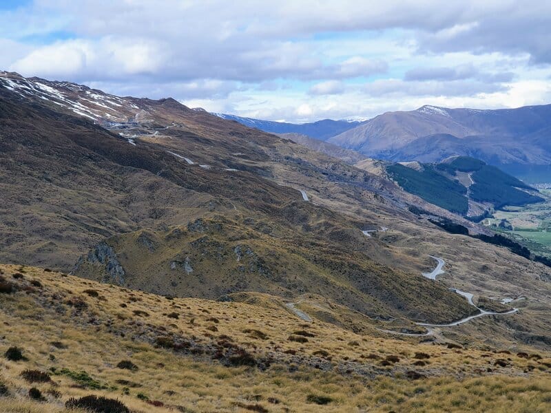
8. THE CORONET PEAK SUMMIT HIKE
- Difficulty: Medium
- Distance: ~4.5km return
In the summer and autumn, Coronet Peak becomes another one of the fun Queenstown walking tracks open to everyone (it’s free).
It’s only about 4.5km or so to the summit, and you follow the 4WD tracks a lot of the time. It’s certainly steep!
Once you get to the summit you get to see all over Queenstown, Arrowtown, and the Southern Alps.
It really is epic at the summit. For those who are keen on a unique adventure, you can continue along the Mahu Whenua Traverse to Treble Cone and stay in Turks.
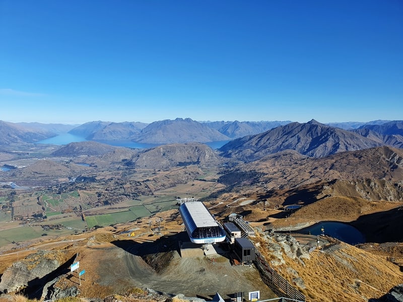
9. THE TIKI TRAIL
- Difficulty: Easy – Medium
- Distance: 4km return
The Tiki Trail is a grunty trail that people will go up for three reasons:
- A cheap way to get to Skyline (vs the gondola).
- As a reintroduction to hiking up steep climbs in preparation for larger hikes and wear in new boots.
- The gateway to the Ben Lomond summit.
The Tiki Trail goes up the hill next to the gondola you can see from most places in town.
It’s about 2km to get to the top of the hill, with over 400 metres of elevation in that time. And the terrain has some technicality to it too.
That said, you’ll see people of all ages and fitness levels on the Tiki Trail. You’re in the forest most of the time, but do get a couple of sweet views out over the lake.
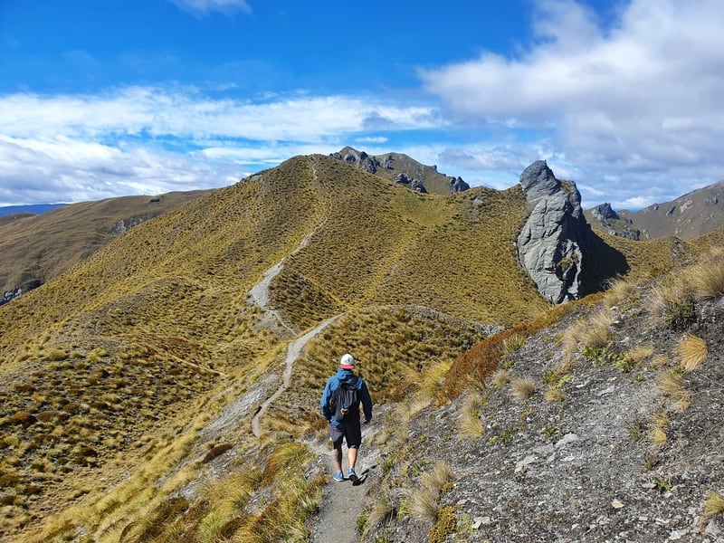
10. JAN’S PEAK
- Difficulty: Medium (from the bottom of the gondola)
- Distance: ~7km
Hiking Queenstown’s Jan’s Peak is awesome!
When you reach the peak, you’ll likely have it to yourself and have the chance to see Queenstown from a unique viewpoint along with views along Gorge Road.
When you’re hiking up to Ben Lomond, as long as you have a little bit of energy left I’d recommend you come back via Jans Peak which has some of my favourite sections of trail in all of Queenstown.
You get to see the takeoff area for the paragliders too.
And when you get back down to town, see if you can spot where you were 😉 You’ll want to read the full post to see how to get there.
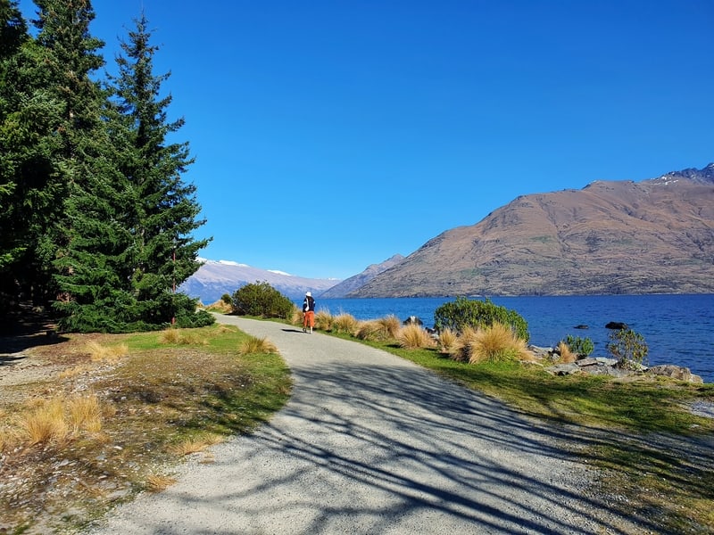
11. SUNSHINE BAY TRACK
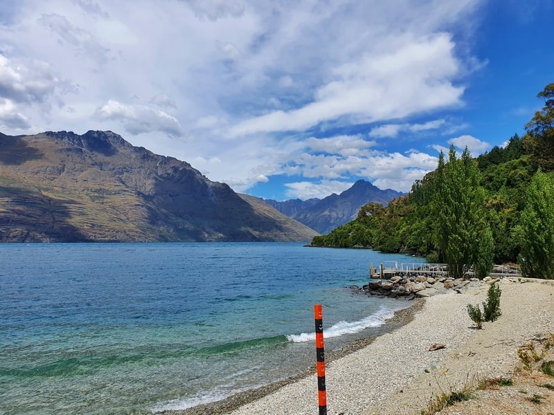
- Difficulty:Easy
- Distance:2km each way (more if you’re walking from town rather than the trailhead)
The Sunshine Bay Track is a great out and back walks from Queenstown. You get various types of views along the way before you reach the one of the quieter beaches in Queenstown.
The nice views include looking out over the lake, towards the mountains, towards Queenstown and in between you’ll walk through some native bush. There’s also a waterfall that’s well hidden if you’re not looking for it.
The Sunshine Bay Track is one of the only hiking trails in Queenstown I’ve seen a New Zealand Pigeon (Kereru)! You may spot tui too.
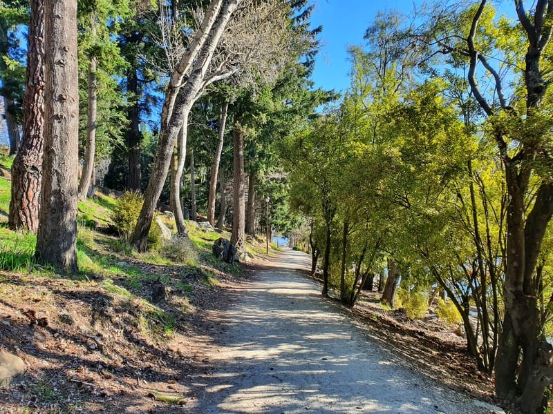
12. FRANKTON TRACK
- Difficulty:Easy
- Distance: ~7.3km each way
The Frankton Track is a popular commuter route for cyclists, and one of the most popular walking tracks in Queenstown for those looking for regular exercise.
With a wide, well-maintained trail following the lake, the Frankton Track is a really nice trail for people who want some fresh air, a coffee, and a catch-up.
There’s a couple of nice places where you take a break (The Boatshed and Altitude Brewing), and you can’t ever argue about the views. The Remarkables are epic.
You can walk this as an out and back, or if you walk all the way to do things in Frankton, you can always catch a bus back to Queenstown.
It’s a track I have done countless times, so probably don’t appreciate it enough for how many visitors say it’s a great Queenstown scenic walk.
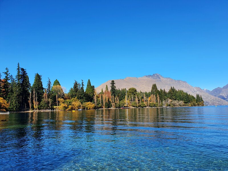
13. QUEENSTOWN GARDENS
- Difficulty: Easy
- Distance: Varies
The Queenstown Gardens are a beautiful little spot with plenty of activities to keep you busy if need be (Saturday morning Parkrun is fun).
My favourite times here are in autumn with the colours of the leaves and on a sunny afternoon where you can sit on the hillside and enjoy the sunshine.
If people are planning to take a walk here, the majority of the time that’s going to be following the track around the outside gardens starting from Queenstown Bay Beach.
But do take some time to walk the tracks on the interior of the gardens too. There are some nice spots for a picnic in the afternoon sun as well (avoid this in the middle of winter).
There’s also the ice rink, frisbee golf, and a skate park in the gardens.
14. KELVIN HEIGHTS PENINSULA TRACK
- Difficulty: Easy
- Distance: ~3km loop
The Kelvin Heights Peninsula Track is a fun walking trail between Lake Wakatipu and Queenstown Golf Course. It’s got very little elevation change, but there’s a good amount of variety in the trail.
You’ve got the section next to the beach, the part through the forest (when I run this section I feel like I’m dancing), and then the stretch next to the picturesque Queenstown Golf Course.
And to fill out a few hours here, you can chill out at John Wilson Cove, and the cafe on the golf course.
15. SEVEN MILE TRACK
- Difficulty: Easy
- Distance: 3km each way
The Seven Mile Track is a great little walks near Queenstown many overlook given the hot competition in Queenstown.
The Seven Mile Track has some good views of the lake and into Wilson Bay while taking you through a forested section too.
If you want some beach privacy, there’s a good chance you’ll get that on one of the little sections of beach on this trail.
As this walk is in the same area as the Seven Mile Mountain Bike Park, I recommend doing this track if you’re with someone who would prefer to be out on the MTB trails while you walk. That’s a win.
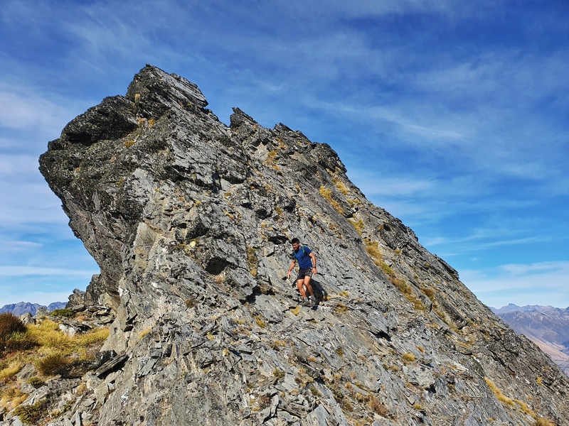
16. BOWENS PEAK
- Difficulty: Medium – Hard
- Distance: ~14-15km
Bowen’s Peak is a rarely scaled peak because most people are heading up to Ben Lomond, for good reason.
But if you’re one who likes to zig, when others zag you might prefer going up to Bowen’s Peak (or you can do both).
Bowen’s Peak isn’t as high or as dramatic as Ben Lomond so I’d still say go with Ben Lomond if you can only do one…but the view towards Ben Lomond from there is epic!
The trail is pretty tricky to find, and follow (you turn off at a junction a little before reaching the saddle), so I often find myself just hiking straight towards the summit, and jumping on the trail if/when I find it from time to time.
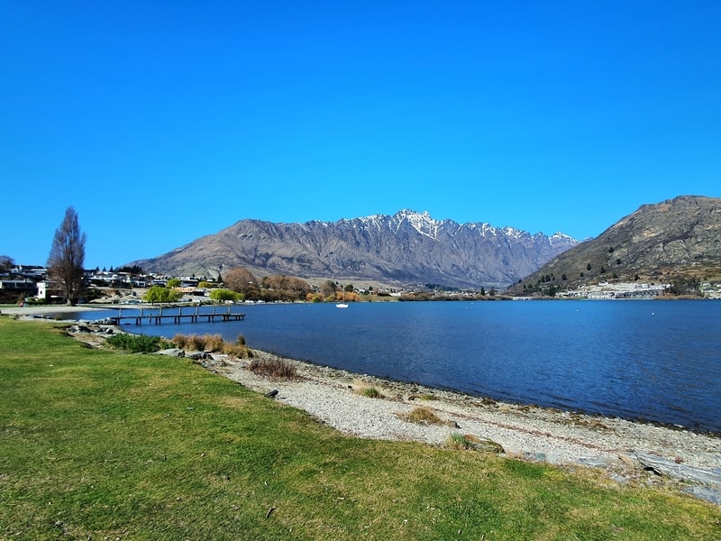
17. LAKE HAYES
- Difficulty: Easy
- Distance: 7 – 8km
The Lake Hayes Loop is stunning track between Queenstown and Arrowtown.
There are various points you can start the walk, but I’d suggest starting at the northern end of the loop where you can relax and play afterward.
Do check the Queenstown Council website to make sure the water is safe to swim in before you go.
The loop is well maintained, though the southern end can be underwater after heavy rain.
Other than that, the track is well maintained and the views are always awesome. This is a good spot for sunset too!
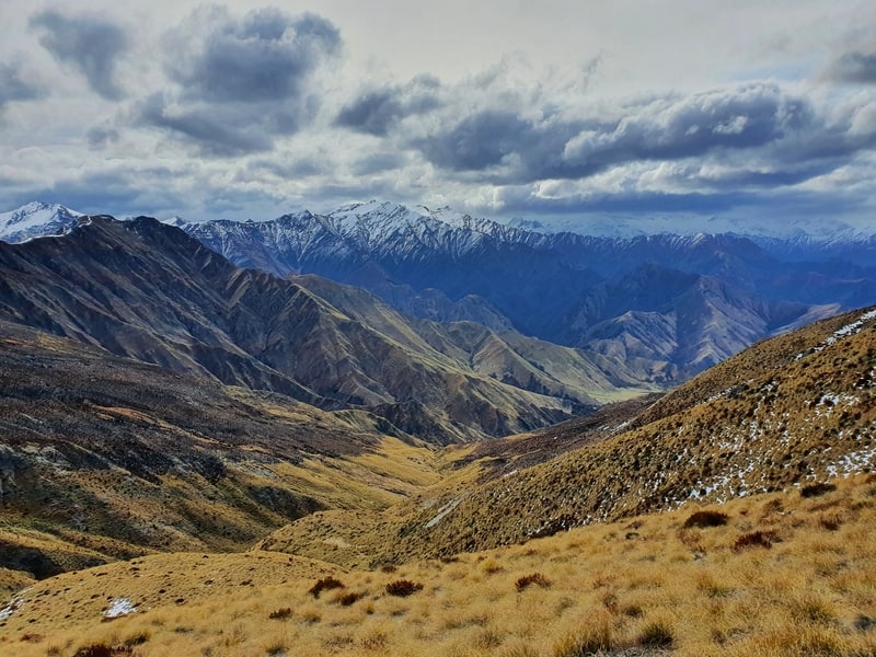
18. ATLEYS TRACK
- Difficulty: Medium
- Distance: 18.2km
Sharing part of the same track as the hike below, Atleys Track is one of the walks around Queenstown that show how easy it can be to escape crowds, even in a tourist focused destination.
The hike takes you along a 4WD track most of the time, with awesome views of mountains and ridgelines throughout the hike. And you’ve got the amazing views from Mt Dewar.
This is a hike that takes you into a part of Queenstown most people won’t see. If that’s your thing, you’re going to love this track. I enjoy this place every time I’m here.
19. DEVILS CREEK TRACK
- Difficulty: Medium
- Distance: 15km
The Devils Creek Track is on a section of land close to Skippers Road and Coronet Peak Road.
This location makes it a bit off the beaten path in Queenstown, but wow, the views from Mount Dewar are awesome.
If you’re after technical terrain, the 4WD tracks and road won’t be of interest to you, but this has some amazing views of the basin and surrounding valleys/mountains.
Definitely put this hike on your list if you don’t have a car and are looking for things to do in and around Arthurs Point.
20. MOUNT DEWAR SUMMIT
- Difficulty: Easy to Medium
- Distance: 5.2km return
The hike to Mount Dewar is a good hike if you want awesome views, don’t mind hills, but you’d rather stay on non-technical trails.
This hike isn’t flat, for the 2.6km up to the summit the incline is steady but the 4WD track makes things uncomplicated. The same goes for the return trip too.
And the best part is you get some great views throughout the hike. But the best part is the 360-degree summit views. If you’re looking to walk in some snow, this track might give you that option as well.
This is a shorter version of the Devil’s Creek and Atley’s Track hikes mentioned above.
21. JACKS POINT TRAIL
Details coming soon.
22. THE BOB’S COVE TRACK
- Difficulty: Easy
- Distance: Less than 4km
Bob’s Cove is a stunning place, and if you get the chance to visit, make sure you follow the Bob’s Cove Track to the viewpoint.
From this viewpoint, you get some epic, and unique views and the colour of the water hits different. Especially on a sunny day.
This is a great walk for families and/or groups of friends as there’s the beach you can hang out at, and/or jump off the jetty into the frigid Lake Wakatipu.
This is a walk every Queenstown local will speak about glowingly.
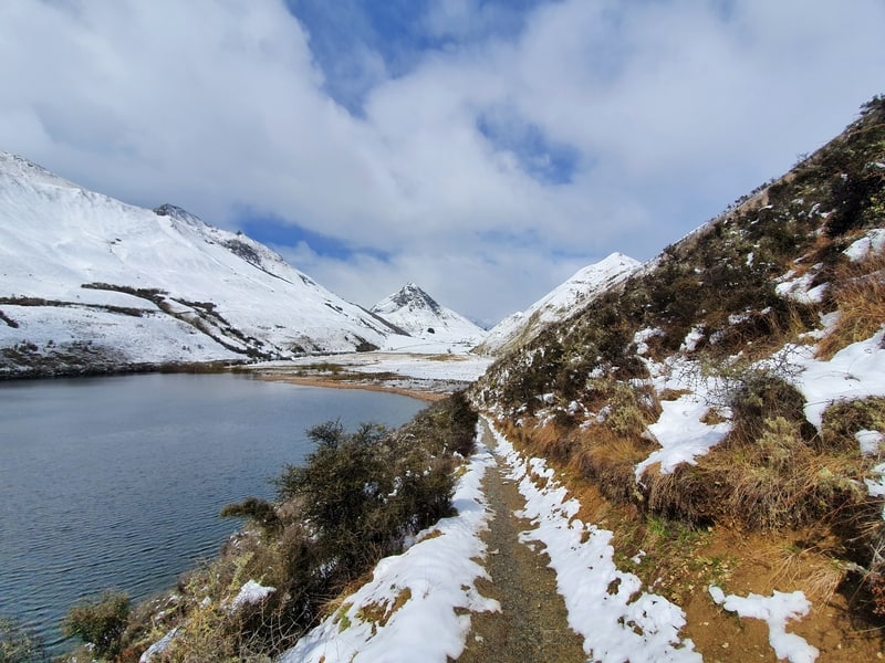
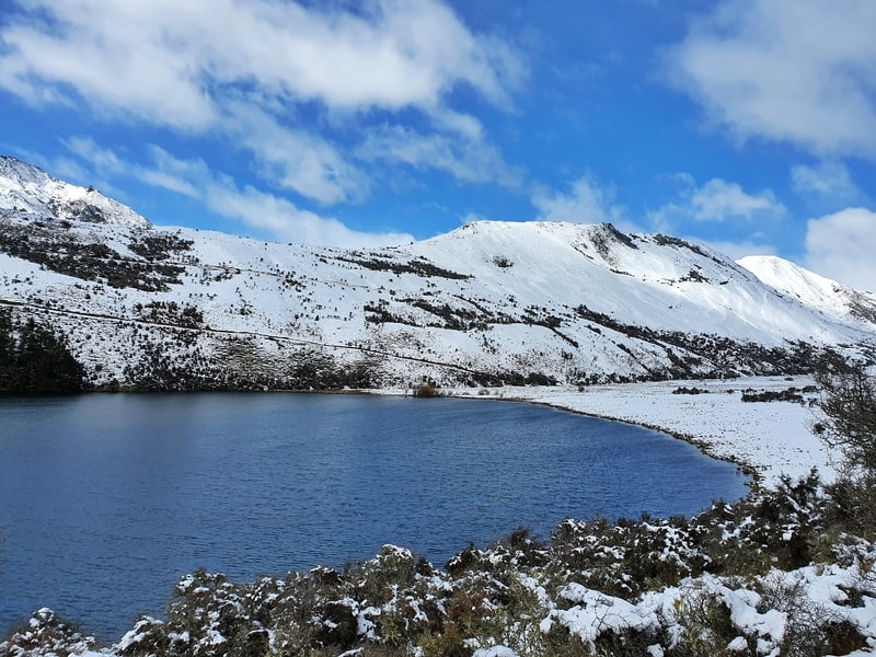
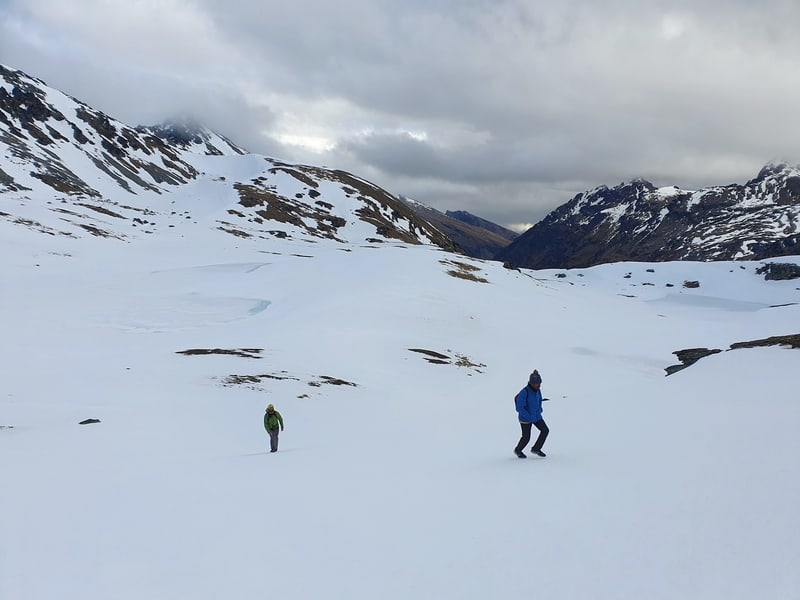
23. LAKE ALTA TRACK
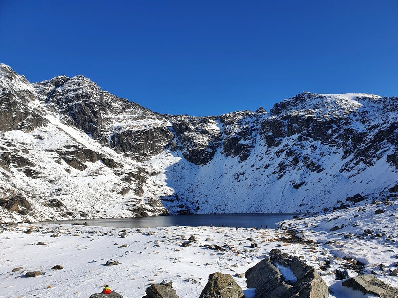
- Difficulty: Easy
- Distance: 3.5 to 4km
The stunning Lake Alta track takes you through the Remarkables ski field. The drive to the trailhead has some nice views too!
This is one of the best short walks in Queenstown that’s best experienced in late spring, summer, and autumn. The end point is the glacial Lake Alta with Double Cone towering 500 metres above. This is a great way to spend a few hours in Queenstown.
24. QUEENS DRIVE HIKE
Looking up at the Remarkables from town, they look steep! And while you can climb to the top of Double and Single Cone (the highest peaks), that’s not for everyone.
One place you can hike to is towards the top of the chairlifts. A little beyond the chairlifts is a viewpoint that looks over the entire Queenstown. It’s a steep drop down below.
Watching the sunset from up here is magical.
And for those who are okay with some exposure, there’s a track around the face of the summit which you can take all the way around to Wye Creek and Lake Alta route. But it’s not for the faint hearted…and a no go for most people if there’s any snow.
You can read about the Queens Drive/Wye Creek loop here.
25. TO THE MOUNT CRIGHTON SUMMIT
- Difficulty: Hard
- Distance: 13 – 15km
This is potentially the hardest hike in this post. There are various ways to get to the Mt Crichton Summit, but I think the best is the way is to start on the main Crichton Loop (#3 on this post) before leaving that track and going up and along some amazing ridgelines.
The terrain gets gnarly at some points, but as long as you do some research in advance and have some commonsense you can get to the summit (plus some good fitness).
You’ll get to see some amazing views of both Lake Wakatipu and the surrounding mountains on this hike. And you can see Lake Isobel too.
26. LOWER WYE CREEK TO HELIPAD
The hike from Lower Wye Creek to the helipad is becoming more popular thanks to the relatively short distance, yet it offers great views of the lake and there’s a couple waterfalls too. It’s steep, but short enough to grit through it.
27. SOME OF THE BEST DAY HIKES NEAR QUEENSTOWN
Heading up towards Brow Peak from Arrowtown
- Sawpit Gully Track: Easy – Medium & ~8km
- New Chum Gully Track: Easy – Medium & 7 – 8km
- Brow Peak: Medium – Hard & 19 – 20km
- Crown Peak: Medium & ~24km
- Tobins Track + Mount Beetham: Medium & ~8.5km
- Big Hill Track: Medium & 15.5km
Close to Mount Alpha on the Wanaka Skyline Track
- Isthmus Peak Track: Medium
– Hard & ~15km - Wanaka’s Skyline Track: Medium & 23km
- Roys Peak Track: Medium & ~16km
- The Rob Roy Glacier Track: Easy – Medium & 11km return
As seen on the Earnslaw Burn Track
- Mount McIntosh Track: Medium – Hard and ~18km…this is one of the best overnight hikes near Queenstown
- Earnslaw Burn Track: Medium – Hard & 27km
- The Shirt Tail Track Easy – Medium, at 1.6km return has an amazing lookout
Other MORE WALKS NEARBY
A good view on the Mount Horn Track in Cromwell
- Mount Horn in Cromwell: Medium – Hard & 18 – 20km
- The Meg Hut Hike near Cardrona: Medium & 14km return.
- Rock Peak Track: Either 7.8km return, or 22km point to point.
I’d love to hear your thoughts on these Queenstown walks. What do you think are the best day walks in Queenstown?
And don’t forget, you can use these tracks as running routes as well.
If you’ve got any questions about hiking in Queenstown, I’m happy to help. Leave a comment below or email jub@churnewzealand.com

Hey, it’s Jub here. I’m the guy behind Chur New Zealand, helping you have the best time hiking, trekking, walking…whatever you want to call it…in NZ. I’m based in Queenstown and am always out and about exploring trails, old & new. If you have any questions, reach out.
WoW What a great blog.
I just came across this really interesting website.
It has all the information what I was seeking and need.
i’m sure, i’ll visit the site many time to get more trails in NZ.
catch up later
Chur.
Hey bro, stoked you found it. I’ll have to fix the GPX file, cheers for the heads up! You can download the GOX file from Strava here 🙂
https://www.strava.com/activities/4188135862
Catcha soon mate, chur.
“Best sunset hike in Queenstown “…I would say do the Lake Alta track and then climb the slope/ridge to the right of the lake. Once gained the high ground, maintain the same altitude across the ski-field to the top of the lift and then make your way to top of the Remarkables skyline ridge. The sun sets down the end of Lake Wakatipu in summer and over Ben Lomond in winter. You can then walk out down the ski access track back to the carpark
Hey Jordan, I just got to this area for the first time last week (Queens Drive). HOW GOOD! 100% agree with ya, will need to update this page soon. Cheers, Jub
Good stuff. Funny enough I just started following you on Strava and noticed that the day after I posted the above, you were up there.
Also was in your area last week, and was on the Routeburn (Valley of the Trolls) the same day you ran it. We finished 2 hrs ahead of you otherwise would have bumped into you 🙂
Haha, yea great timing! A mate decided we should camp up there and thought I better check out the ridge. Crazy how you can get so close to people but be so far away…VAlley of the Trolls = SO GOOD!