The Earnslaw Burn Track is a 26 – 27km out and back hike with the highlight being able to get up close to Earnslaw Glacier.
Given you can get so close to the glacier it’s gaining in popularity. It also helps the trailhead isn’t far from Glenorchy.
While I often think Instagram is misleading about hikes thanks to one viral spot, I do think the Earnslaw Burn Track is one the best hikes in the country, provided your fit, and prepared and make sure you know what you’re getting into.
Important camping info: If you don’t want to read the whole post, read this at least:
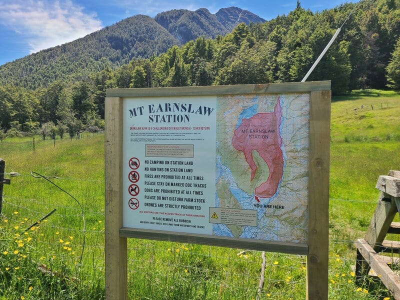
The first 8km of the track is on private/DOC land (until you exit the forest). You then enter private land, where you can hike but not camp as per the sign at the trail head (below)
In the past people have always camped out well beyond the forest, in what was never allowed as such…but never turned away. If you do now, you’re trespassing. You can still camp just after the forest…there’s signage on the track when you enter the private land. There’s no way to miss it.
Don’t ruin things for other people. The landowners could prevent access completely. Follow the rules on the sign.
Moving on, the rest of the post will give you all the details you need to have a great time on the Earnslaw Glacier Track, one of the great hikes in Glenorchy.
TABLE OF CONTENTS
1. Details About The Earnslaw Burn Track
2. Earnslaw Burn Track Map
3. How To Get To The Earnslaw Burn Track Car Park
4. My Earnslaw Burn Experience
1. DETAILS ABOUT THE EARNSLAW BURN TRACK
How hard is the Earnslaw Burn Track?
Hard. It’s harder than people expect having looked at the distance and elevation profile.
The first 8km or so in the forest is a technical trail with constant undulations filled with roots and rocks, it’s slow going. And most people will inevitably take a wrong turn at some point (I even did on my recent trip, which was my fourth time there. After you emerge from the forest, it’s still not super easy terrain with lots of muddy sections and terrain that doesn’t let you move as fast as you may like.
How long is the Earnslaw Burn Track?
I have the track measured at 13.3km to the bottom of the glacier on Strava making for a 26.6km return trip (plus the walking you do around the glacier). Each time I do the track I get close to that number.
What is the elevation profile like?
Strava recorded ~891 metres of total elevation. 754 metres of that on the way to the glacier and 137 metres on the return.
Update: On my most recent trip I totalled 1200 metres of elevation. Which is a lot of difference to 900 metres. Don’t hate me if you’re watch gets a different number, but there’s a ballpark figure in there somewhere.
Here’s the elevation profile one way:
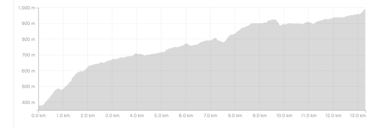
This is where people often get in trouble. The elevation profile looks crusiey, but with the tricky terrain it’s certainly not straightforward.
How long does the Earnslaw Burn Track take?
The DOC website states that it’s a 4-6 hour tramp one way. While that seems like a long time for 13.3km, it’s definitely technical. Having talked to a few people who have done the track, a couple of them took 6 hours to get to their campsite for the night. The sign at the entrance states 8 to 12 hours as a day hike…I think this is a fair judgement to be on the safe side.
2. EARNSLAW BURN TRACK MAP
The map above is the GPX file from the Strava recording overlaid on a topo map.
The Earnslaw Burn Track isn’t on maps.me at the time of writing, and given there’s no reception in the valley (there is for the first ~3km of the track) it’s a good idea to at least study the terrain/map before you go. NZTopo50 is my favourite topo map app, it’s well worth the $8.
It’s a marked track through the forest, but does get confusing at times when the track splits off or there’s a chunk of tricky terrain, but you get the idea of where you’re going early on. People have gotten lost on the trail, so if you think you might be off the trail (mainly for in the forest), check the topo map!
If you fancy an Earnslaw Burn alternative, check out Canyon Creek Track.
3. HOW TO GET TO THE EARNSLAW BURN TRACK CAR PARK
The Earnslaw Burn Car Park is here on Lovers Leap Road.
Pretty much everyone drives to the trailhead. It’s about 15km/15 minutes drive from Glenorchy. And one hour from Queenstown on the stunning Glenorchy Scenic Drive.
Once you pass the Routeburn turnoff and get onto Glenorchy-Paradise Road the road becomes gravel.
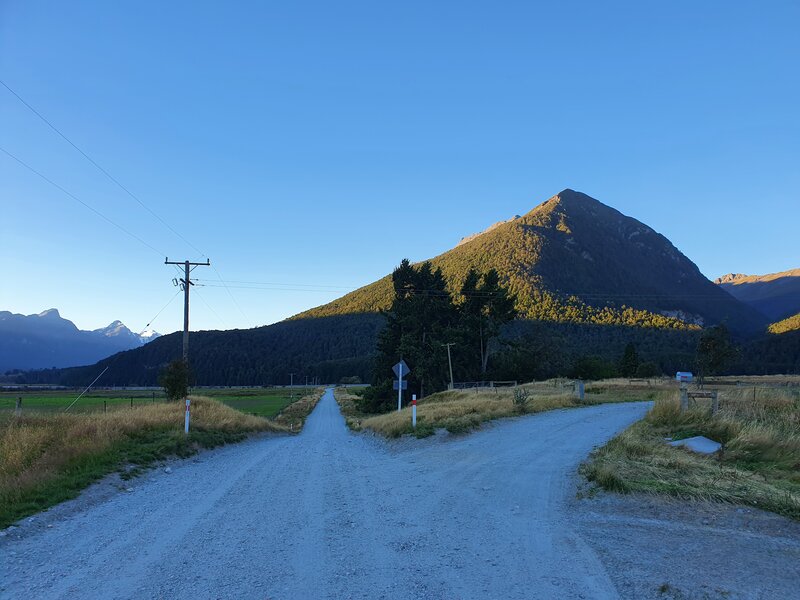
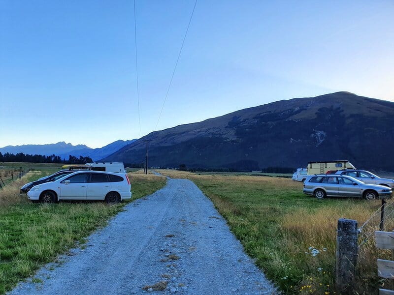
Follow the road for about 4.5km before you need to take a low-key right turn that’s not obvious. The photo above is where you veer right (look for the letterbox). From here you’ve got 1km to get to the parking area. Once again the parking area isn’t obvious, make sure you’ve got the car park location pinned before you start. The second photo above is of the car park.
There’s no public transport to the trailhead, though there is a private company that can get you from Queenstown to Glenorchy and beyond, and while I’ve had success hitching to the trailhead (hitching from Queenstown to Glenorchy is easy) you’ll most likely have to walk a good chunk of the 5.5km from the Routeburn turn-off as there’s little traffic continuing on.
4. MY EARNSLAW BURN EXPERIENCE
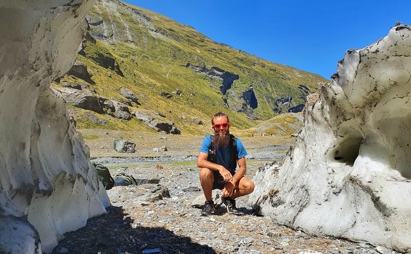
I’d picked a stunning day for the Earnslaw Burn Track (do aim to get a great weather day) and hopped over the fence to get started.
There’s a couple of fences, but you’ll see an orange triangle in the distance…follow the triangle.
Watch out for the small stream after 100 metres or so. You don’t want wet shoes this early in the walk 🙂
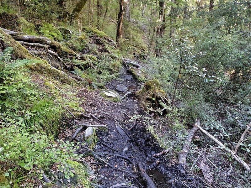
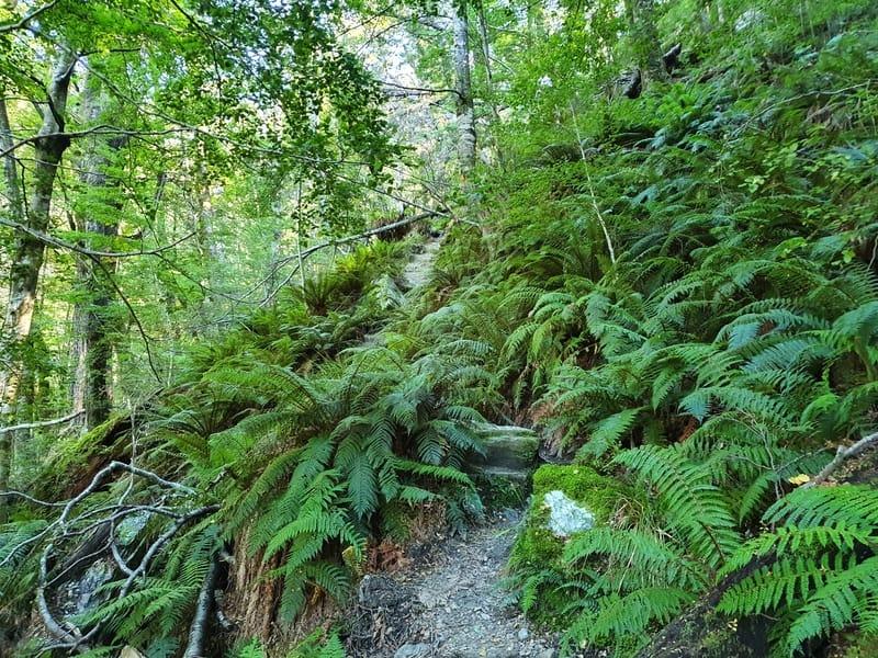
As per the elevation profile, the walk starts off on an ascent for 3km or so. You’re walking through the forest, and the terrain is not easy. There are lots of roots hoping to catch your lazy foot. And there’s usually treefall you’ll need to work out how to go under, over, or around as you weave through the forest.
There are a couple of views out over the forest in the first 2km, but you’ll be that focused on making sure you don’t trip over that you might miss ’em. It’s better later anyway.
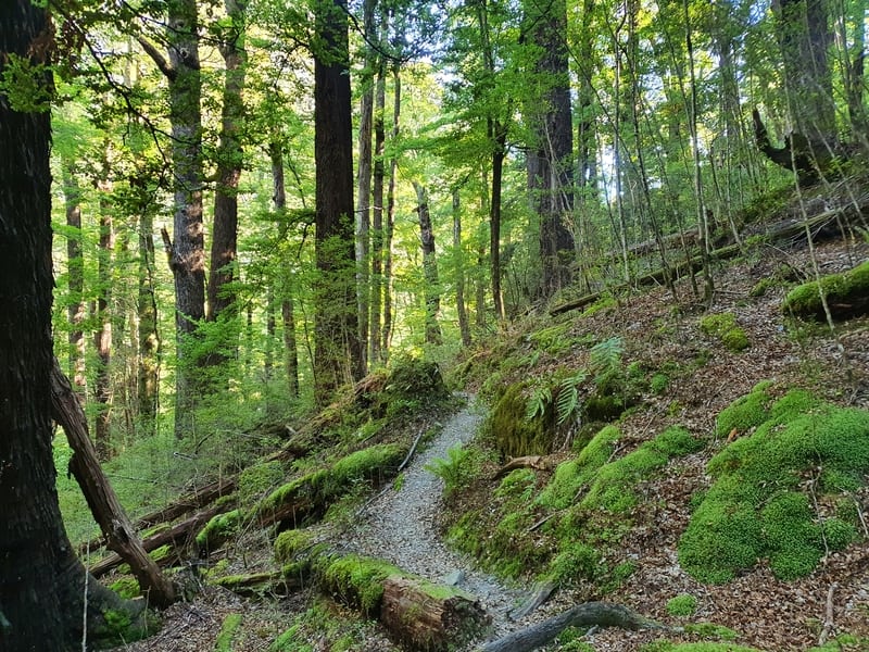
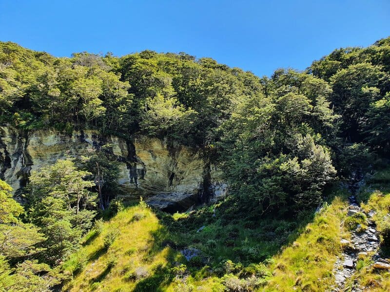
Eventually, the trail begins to flatten out from the 3rd to 8th kilometre but that doesn’t make the going any easier. Some of the terrain’s quite gnarly as you inch your way up steep pinches, go down and up waterways, and forever changing your stride length to avoid the roots.
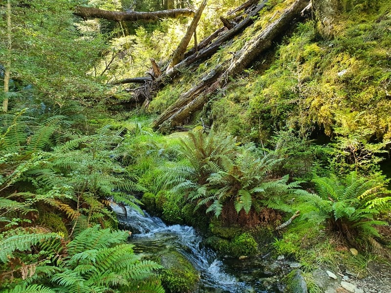
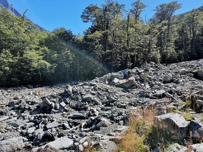
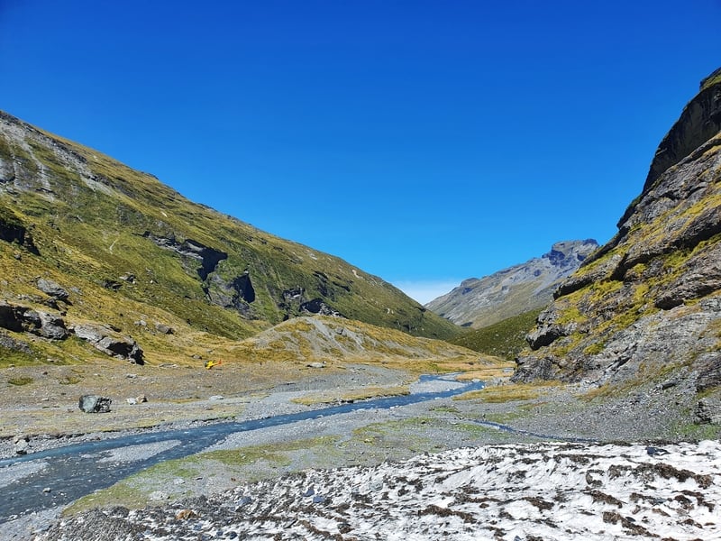
About 8km into the hike you’ll emerge from the forest briefly to cross a riverbed. This is a good spot to take a break and fill up your water bottles. The river level can vary heaps, just make sure you follow the usual safety practices when you’re crossing the river.
It’s back into the forest again. Yay more roots. You’re back to following the river now and if you studied the topo map, you’ll know there’s a rock biv labeled.
It’s on the other side of the river. While it looked like a cool spot (photo above), and people do sleep there (apparently)…it wouldn’t be my cup of tea! Even in the summer, it gets cold overnight. If you check it out, make sure you cross the river in a safe spot.
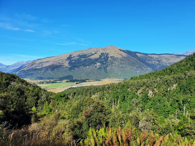
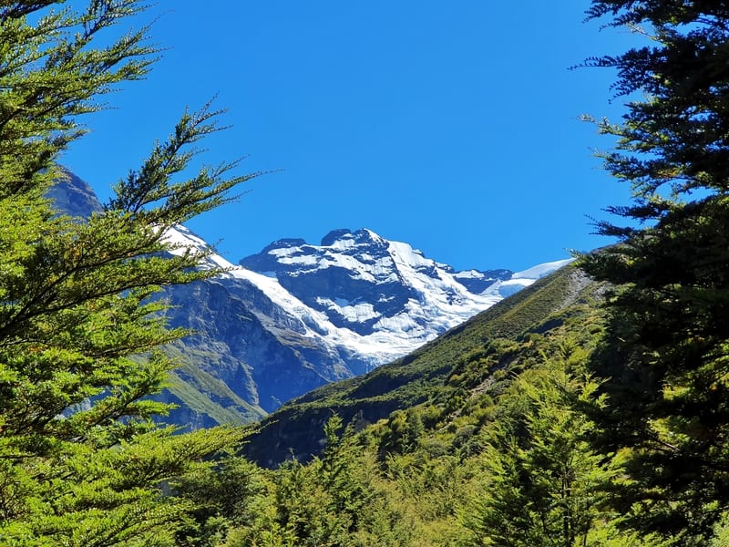
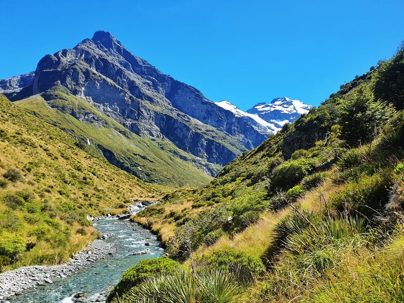
This is when you finally get some views of the mountains too (the photo below). Your hard work will hopefully be worth it now? You’re only minutes from finally escaping the forest. If you’re hiking in the summer, don’t forget to apply some sunblock about now.
Just because you’re out of the forest, don’t make the same mistake I did and think the tussocks will be a walk in the park. They’re not.
Once you emerge from the canopy, you’ve done the majority of the climbing, but the terrain isn’t super kind yet.
Note for the campers: People set their tents up anywhere over the next four kilometres leading to the glacier. I saw one tent maybe 300 metres from the glacier, but there are plenty of flat spots further away. It’s first in first serve.
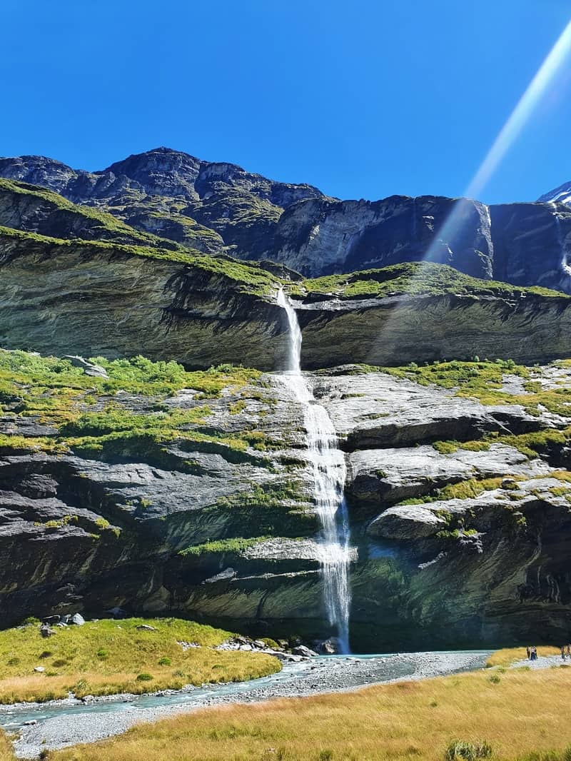
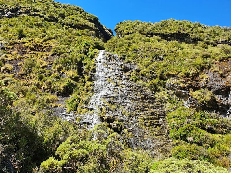
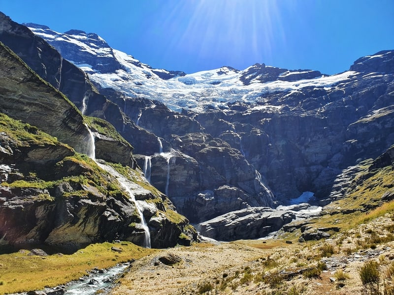
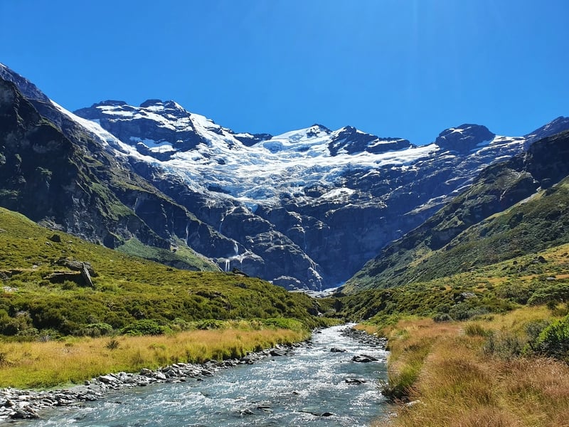
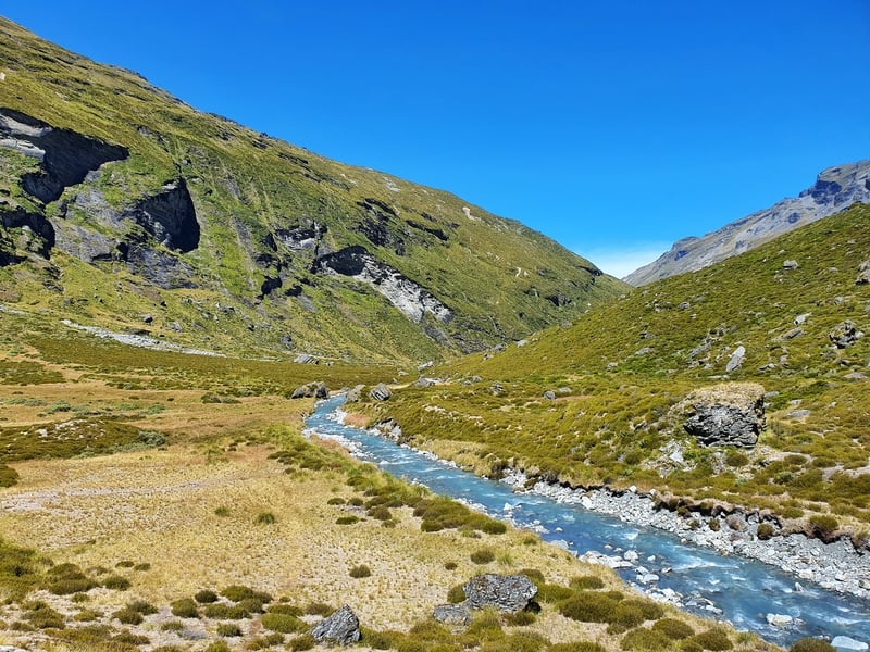
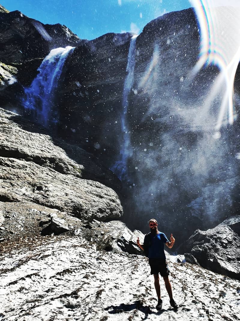
Following the river through the valley is amazing as you close in on the glacier. There’s a big waterfall you’ll see on the left, and a bunch of smaller ones. All stunning!
Note: You can swim in the river, but crikey it’s cold. Even in the summer. For the obvious reasons.
You’re walking through the tussocks trying to vaguely follow the footsteps of people who have been before you. It becomes a bit of a choose your own adventure at times with people choosing the line that looks the most practical to them.
And then it’s just a matter of continuing on until you get right up close to the base of the glacier. The views as you approach are pretty awesome too 😉
While I was there two helicopters landed to take wedding photos :p I’d much rather take the time to walk to the NZ glaciers.
I better say this: remember that nature doesn’t care about you so tread carefully around the glacier. If only I was better at photography!
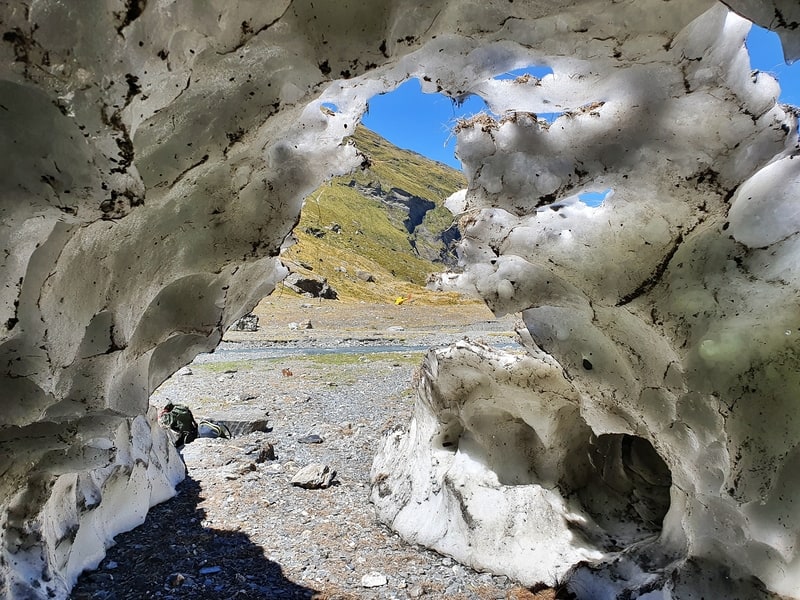
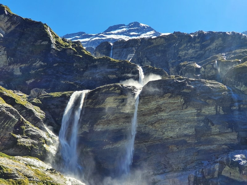
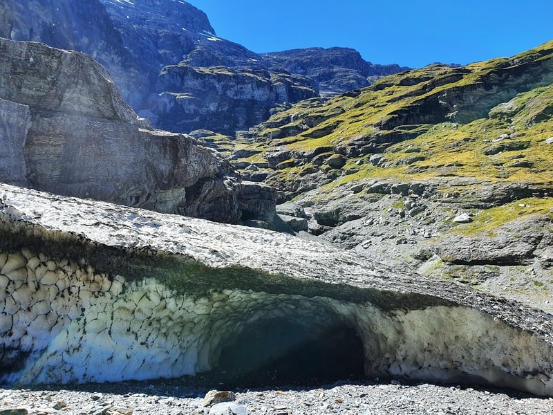
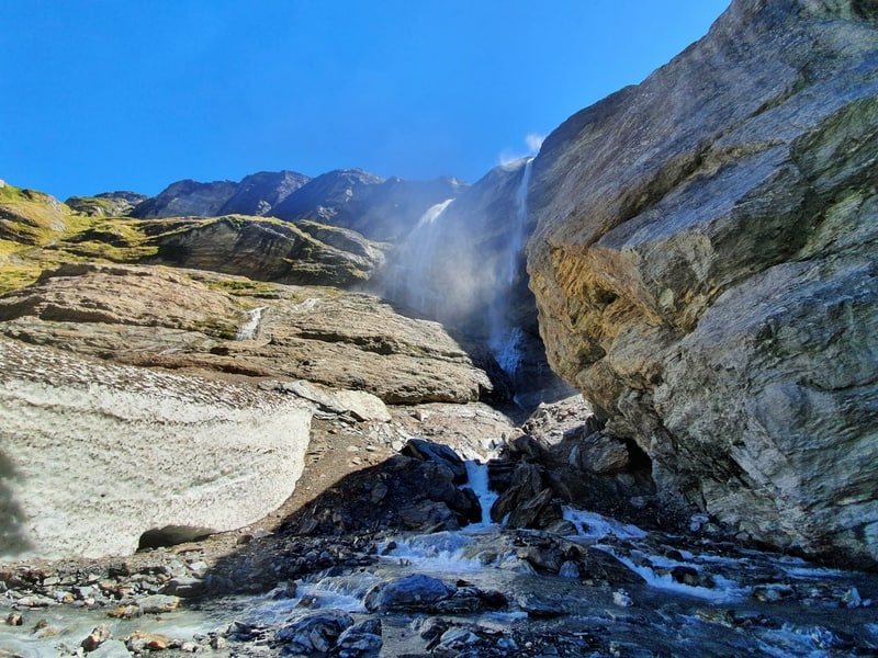
It’s so wicked though! The waterfalls, ice caves, and snow are amazing. No wonder it’s a filming location for The Hobbit.
If you’re staying overnight, park up and enjoy the sunset and your explorations. If you’re on a mission doing a day hike, make sure you leave plenty of time to get back before sunset. It’s not going to be a fun walk back in the forest, even with the best headtorch.
And the walk back, despite being a solid descent back down isn’t going to be that much faster than your hike in. Especially with fatigue starting to set in.
But take your time and you’ll be good as gold!
The Earnslaw Burn Track was once a hidden gem, but I’ve noticed at the end of 2020 it’s starting to become more popular and talked about. It’s certainly not mainstream yet (hopefully they keep the track rugged to limit visitors) but if you’re on the fence, get there sooner rather than later.
I’d love to hear what you think of the Earnslaw Burn Track. Leave a comment below or email jub@churnewzealand.com
Chur,
Jub
p.s. Here’s a map of all the hikes documented on Chur New Zealand. You can click the icon to see brief details, as well as a link to read more about the hike (like this post).

Hey, it’s Jub here. I’m the guy behind Chur New Zealand, helping you have the best time hiking, trekking, walking…whatever you want to call it…in NZ. I’m based in Queenstown and am always out and about exploring trails, old & new. If you have any questions, reach out.
Hey, just wanted to say a quick thank you for this AWESOME trip run-down! I’ll be doing it in a few days, and I feel totally prepared thanks to your site. Unfortunately there’s not much sun in the forecast, but hopefully that means I’ll get some sweet waterfalls from the rain 😉 Thanks again for putting this together!
Hey Melissa,
Thanks for the kind words! The forecast certainly doesn’t look super awesome, that can change though. FINGERS CROSSED! If there’s a little moisture, choose ya campsite carefully!
Chur, Jub
hi Jub, I’ve reading your hike descriptions for a while (probably for a year-ish), borrowed ideas to make plans for my travels in NZ, so first of all: thanks heaps!
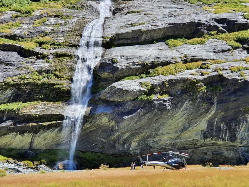
I’ve recently done the Earnslaw burn track and camped at the spot where the chopper is on your photo!
the track was pretty muddy and soggy, avoiding getting water in my shoes was pretty much impossible, despite the fact that it hadn’t rained for a couple of days. constantly having to go off the track, as a desperate measure of avoiding water/mud, made it feel soooo long (on the way out) that even though I was amazed (and frankly, a bit intimidated) by the views, I don’t want to do this track again… 😀
so anyway, a useful info: the choppers did come in the morning and one of the pilots told me that the area beyond the treeline is private property (Earnslaw station) and camping is not allowed. he took photos of a guy pooping and said he was going to show it to the owner and the track will get closed.
I told him that I think it’s not right to just own a place like this and that it’s at least 4 hours one way to the glacier, so even if people don’t camp there, some will poop. I can understand his frustration as they pay the land owner for the concession and hikers going to the loo is not what they want to show their guests (although I’m sure they make a really good profit).
but I looked it up and 10m on each side of the river is a marginal strip, so I don’t think the owner can revoke access. anyway, I still think it’s just not right being able to own that land, especially that there is no farming going on from the forest… but that’s a different issue.
thanks a lot again for your descriptions!
Hey Gyuri,
Thanks for the kind words!
I’m glad you got to experience Earnslaw Burn! As much as people enjoy it, I think you might be in the majority with saying once is enough.
THanks for sharing the chopper experience…it’s a tricky one with this being private land, yet there’s the the 10m from a river rule…gets tricky. I’ve not heard from the station owner at all, but I can understand if he would vlose access…it’s getting popular now, and if he did decide to farm the land…well it gets complicated. Perhaps there should be a toilet installed by DOC at least at the DOC Land border…there’ll be so much human faeces up there :/
I’m sure the next year or two could see some changes up there!
Happy hiking.
Chur,
Jub
Hi! The Earnslaw hike itself sounds too difficult for me – as I’m a beginner hiker. But I would love to see it one day. On my South Island trip, if you had the choice would you do Earnslaw Burn (landing by heli – just to be able to see it at least) or instead hike Rob Roy Glacier on a guided tour?
Hey Biua,
Hmmmm, I’m going to say the guided tour to Rob Roy Glacier. The drive into the start of the trail, and the information you’ll learn from guides will be really interesting! The chopper tour sounds great, but it’ll be over before you know it, and you might not learn so much…and I’m all about hiking in vs. flying into somewhere. Rob Roy is magic!
That’s my two cents.
Cheers,
Jub
And by tour I actually meant to say a guided walk e.g with Eco Wanaka, just to make sure I can definitely access the starting point as won’t have a 4WD
Hello, thank you for the wonderful description of an amazing hike. My friend and I are coming to New Zealand for the first time at the end of February. We will be doing the Routeburn Track in early March. We have a free day a few days before and I was thinking of doing this hike. Is that a good addition or is it redundant since they are so close to each other?
Thank you for any advice!
Hey Gretchen,
Tiotally not redundant, they’re two totally different experiences so do this one! That’s provided it’s good weather, and you’ve got at least one rest day before taking on Routeburn. You’ll love both 😀
Cheers,
Jub
Thank you. Here’s hoping for good weather. We are doing the doubtful sound cruise just before Routeburn.
Hey,
it would be not such a problem if people followed rules for peeing and pooping in the outdoors. Which the majority doesn’t, sadly.
I really recommend to educate oneself with some YT videos. Easy rules.
I encounter so much TP and even wet wipes anywhere around the world on really beautiful places, it makes me angry, eventhough I do my part in cleaning up and picking up tubbish after others as well.
M.
Hey Marie,
I’m totally with you there! It’s a big problem worldwide. Everyone does seem to be doing their part and camping in the designated campsite on the Earnslaw Burn Track however, we’ll take it!
Chur,
Jub
Hello is the this track still good to hike mid April? Would you say it’s to cold or anything extra to know about the terrain
Hey Zoe,
If you’re heading out there this weak, it’s going to be really cold and freezing, with potentially snow later in the week (and it looks wet…just wouldn’t consider Earnslaw Burn with this weeks tbh). That said, next week could be a lot warmer and it’s beautiful again. Classic autumn, always prepare to be cold, but there can be clear calm periods where it’s dry and sunny which are lovely. But yea, I wouldn’t do Earnslaw Burn this week.
Chur,
Jub