If you’re planning a trip to McIntosh Hut near Glenorchy you’ll get some great views of mountains, lakes, rivers, and forest. You can hike this as a solid day hike, or make it an overnight trip staying in McIntosh Hut.
Like me, you’ll likely do the ~18km full Mt Mcintosh Loop Track. BUT the loop might not be the best idea as you’ll read later in the post…in which case you do an out and back.
There’s also a side trip to Black Peak you can consider for sunrise or sunset which is awesome.
Alright, Mount McIntosh Hut Track, let’s go.
p.s. McIntosh Hut is free to stay in, no backcountry hut pass or hut tickets required.
TABLE OF CONTENTS
1. Details About The Mount McIntosh Loop Track
2. Mount McIntosh Loop Track Map
3. How To Get There
4. My Experience On The Mount McIntosh Hut Track
5. How To Get To Black Peak
DETAILS ABOUT THE MOUNT MCINTOSH LOOP TRACK
How hard is the Mt McIntosh Loop Track?
Medium to hard. On the way up to the hut, the uphill is pretty relentless with only a few shorter flat sections (you do drop down across the gully). After the hut, the biggest factor is you’ve got a steep descent that everyone, including me, absolutely hates.
How long is the McIntosh Loop Track?
In total, it’s a 18 to 19km loop. Going the traditional (anti-clockwise loop),from the main car park it’s about 10km to reach the McIntosh Hut. And the return to the carpark is about 8km (which does inlcude ~500 metres along the Glenorchy-Queenstown Scenic Road).
How much elevation gain is there?
Based on various maps, I estimate there to be ~1500 metres of incline on the full loop. For reference, you start ~380 metres above sea level, and the McIntosh Huts are about 1460 metres above sea level. Most of the incline is on the way up, but there are still 100 to 200 metres on your way back from the hut (don’t forget the gnarly descent).
How long does the hike take to reach McIntosh Hut?
It took me 2 hours and 25 minutes to reach Mount McIntosh Hut and a little under two hours to get back to complete the loop. That was walking at a good pace (I was practicing my power hiking at times). I then hiked in to stay overnight with a friend and we took a little under 4 hours which I think would be an average pace.
The return will be a little faster but times will vary widely because of the steep hill you go down.
MOUNT MCINTOSH LOOP TRACK MAP
The above is a GPX file overlaid on a topo map to the McIntosh Huts and back to complete the loop. Unfortunately, the tracks aren’t on Maps.me as I write this post. So you’re best bet will be to buy this topo map app (the free versions are crap).
Note: The track to McIntosh is well signposted like all Glenorchy walks and reasonably easy to follow.
HOW TO GET THERE
The Mount McIntosh Hut Loop starts at the car park labelled as Mount Judah Recreational Trails on Google Maps (on the Glenorchy-Queenstown Road).
It’s about 2km from the centre of Glenorchy and 48km (~45 minutes) from Queenstown. So your best bet is to drive there.
You could also walk as it’s only 2km from Glenorchy, but it’s along the main road with cars going fast. Make sure to stay off the road and walk safely.
Hitchhiking in NZ is a solid option usually, and it’s an easy hitch from Queenstown (this is what I used).
Though if you’re getting off the trail late in the day and wanting a ride back into Queenstown, there can be very little traffic coming from Glenorchy. That said I’ve never had to wait for many cars until someone pulls over to offer a lift.
There’s also a couple of Queenstown track shuttle companies you can use to get to the trailhead.
RELATED POST: HOW TO GET TO GLENORCHY FROM QUEENSTOWN
MY EXPERIENCE ON THE MOUNT MCINTOSH HUT TRACK
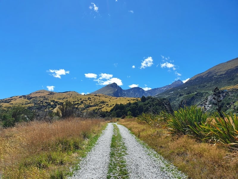
The track from the carpark is a cruisey 4WD track to start with on a solid incline. Let’s just say it’s a fairly standard incline relative to most of the Glenorchry, Queenstown and Wanaka walks.
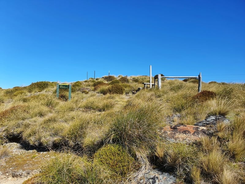
You’ll pass a couple of historic sites early on the track which are a good excuse for a short break.
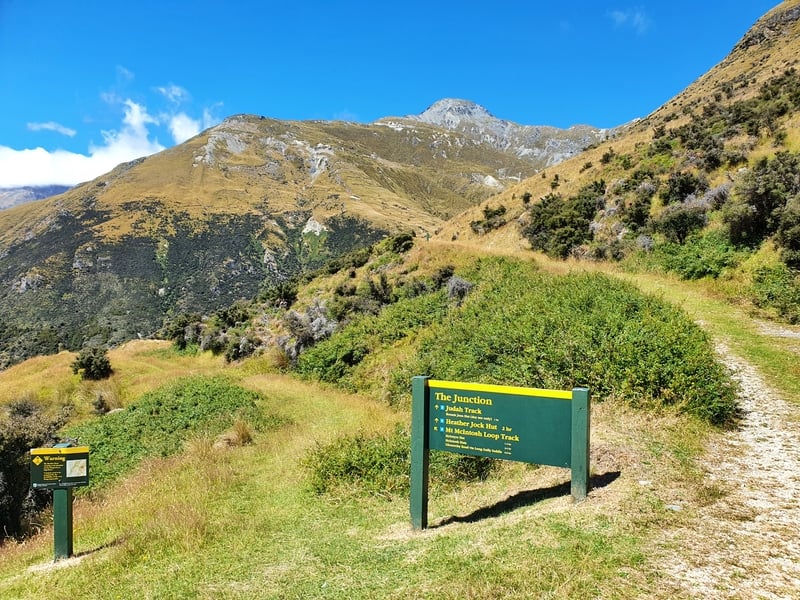
After 4.2km you’ll come to the junction where the Mount Judah Track and McIntosh Hut tracks split. We’ll be going left.
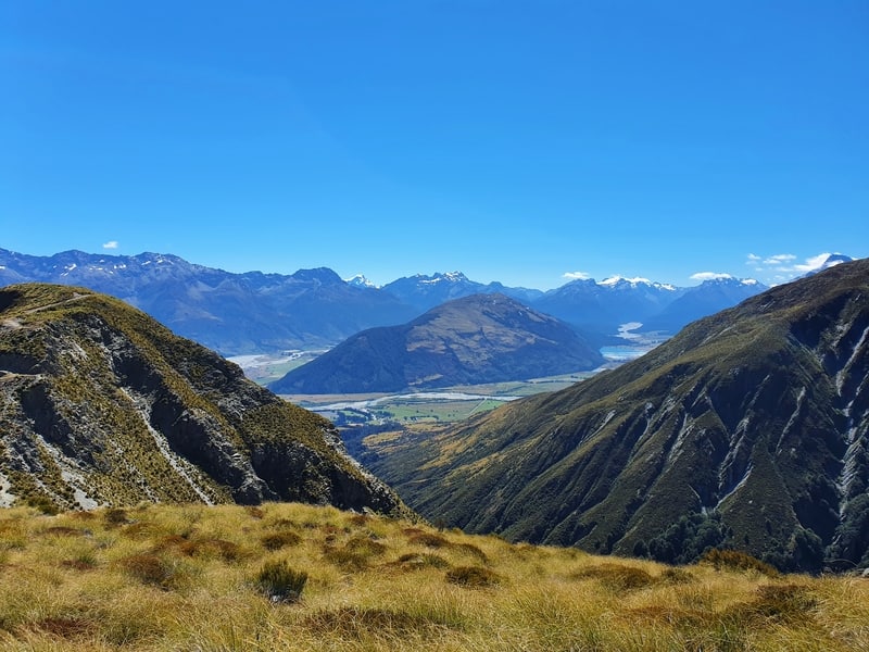
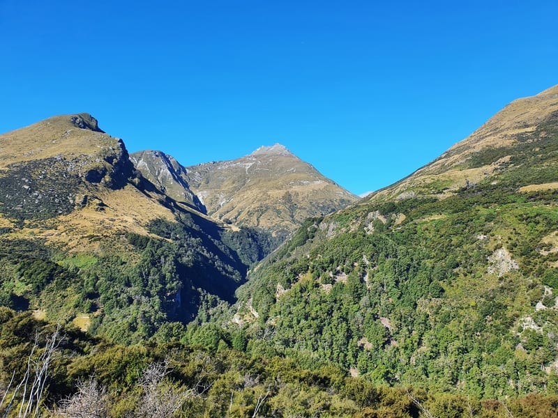
If you look across the valley you can see the tracks you’ll be on soon enough as well as Mt McIntosh which gives you an idea of where your end point is (well below the summit).
But first we dive down and up the gully. The descent to the river is through some overgrown grass before a steep dirt track takes you through the forest.
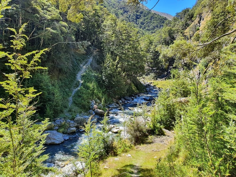
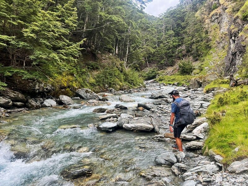
There are two water hops. The first one you can do without getting your feet wet. But the second one will involve walking through the Buckler Burn river, which if there’s been rain, can be dangerous. The signs mention this before you start, so make sure you follow all precautions when crossing the river.
When I crossed it was a perfect day, and there’d been no rain for a few days prior so it barely reached my knees.
Note: it’s not recommended to drink from this river as per the DOC website.
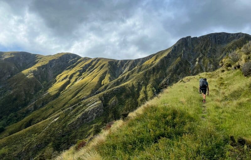
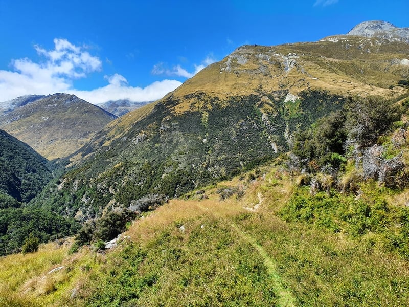
On the ascent out of the valley it’s a steeper track than what we’ve been on so far. But once you’re back out above the trees, the views are amazing. The track isn’t super clear with the track less maintained but I had no troubles following it. There are enough orange pole markers to keep you in check.
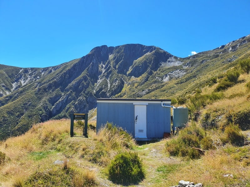
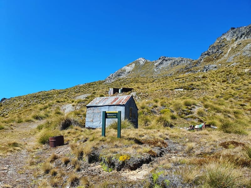
Then out of nowhere you’ll come to McIntyre Hut, which is about 1.6km after the river crossing.
It’s a 2-minute detour to check out McIntyre Hut, so take a quick look (you can stay at this hut which is $10 for adults $5 for youth).
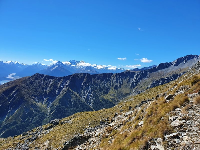
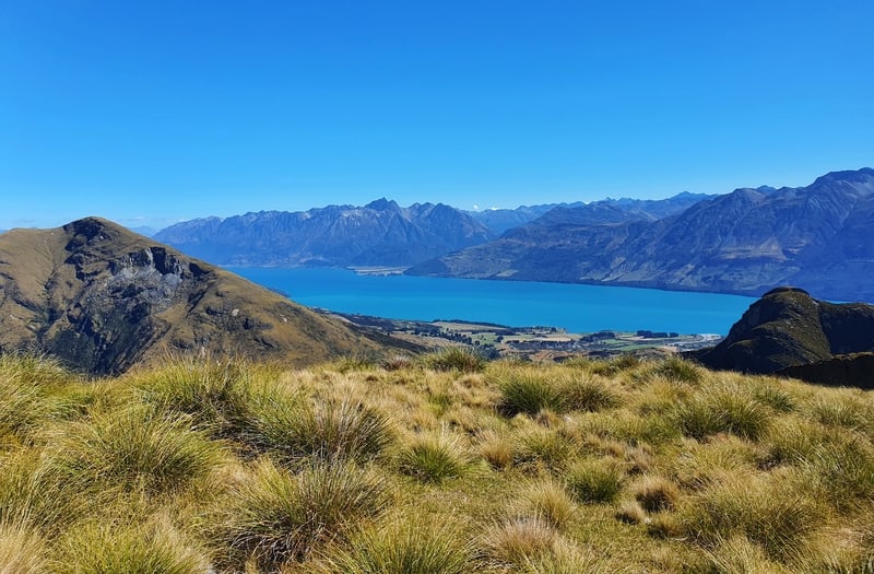
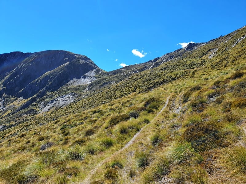
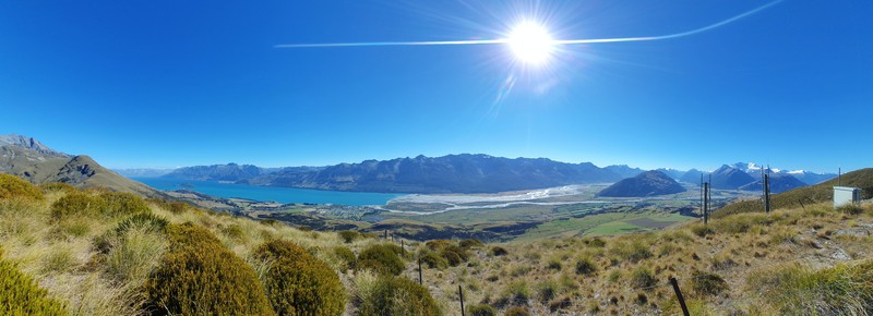
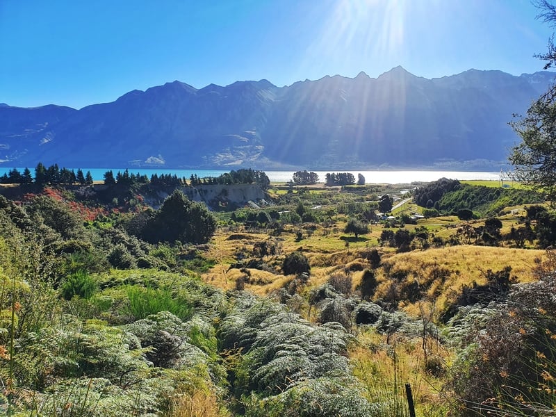
Now it’s back to slogging your way up the hill. Fortunately, the views get better and better as you get to see Lake Wakatipu in the distance and Mount Alaska. The trail along here isn’t super smooth still, but it’s easy enough to follow.
You’ll likely come across some goats…I always try and make some noises to let them know I’m coming. The thought of them not noticing me until the last minute and they panic makes me sad haha.
2km after McIntyre Hut, you’ll reach Long Gully Saddle. Turn right to continue the climb to McIntosh Huts. The climb really is quite relentless! But you’ve got less than 1km to go now 🙂
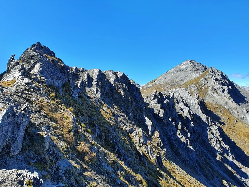
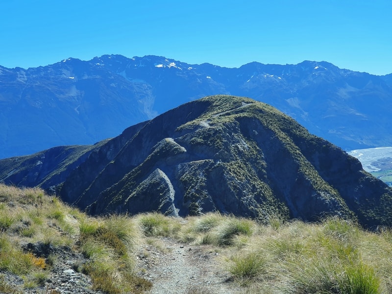
You could just go an explore the peaks up behind the hut regardless. They’re pretty epic!
And when you can see the hut in the distance, that’ll be all the motivation you need. And you’ll have seen Black Peak too (weather permitting). You’ll either be stoked and 100% want to get there, or if you’re buggered, have decided that’s not for you at all.
And then you arrive at the huts. I hope you’ve sneaked a couple of beers in your pack. Enjoy one of the amazing overnight hikes near Queenstown.
I stayed here one night and it’s a nice hut, though a rat ate my avocado :(! I would recommend staying here. Based on the intentions book, you’ll likely have the 4-bunk hut to yourself in November and December.
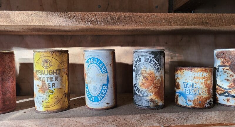
I loved these old beer cans at the hut!
Maybe still bring a tent just in case? Otherwise you can head down to McIntyre Hut if it’s full.
The Descent
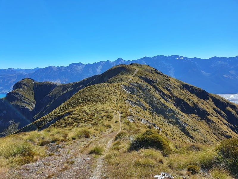
Coming back down from McIntosh Hut, we descend the way we came to Long Gully Saddle. At the junction we continue straight up an old mining trail. You’ll see the climb as you approach, and it looks intimidating. But it’s a short and sharp 70 metre climb.
And the views are epic! You’ll get clean views of Mount Alfred which was formed when the Dart River split in two. It’s pretty cool!
Back to the track, it’s undulating for a little bit following an obvious track. But then it’s time to descend!
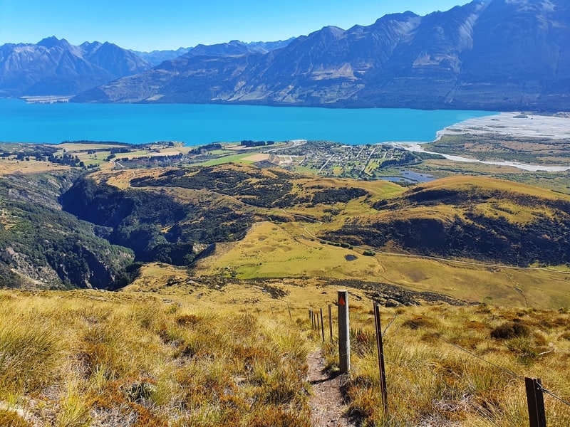
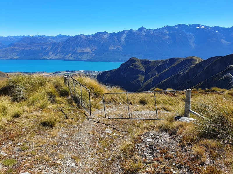
You’ll need to cross the fence on the photo above. You’ll see this on your left hand side.
You’ll be following the fenceline for the next few kilometres. It’s not a great track at all with the first 700 metres or so is reasonbly flat before you’ve got a hectic descent for 2km. It’s really steep, with over 500 metres of descent on a track that isn’t well formed.
Take your time and you’ll be fine, but I did slip a couple of times. You’ll be relieved when the track begins to flatten out. Everyone despises this section and if you have really bad knees, you might prefer to return from the hut the way you came. While it’s slightly longer, the descent is so hectic.
From there it’s not the greatest of walks for the last 2km as you follow a stream on an overgrown track. Watch out for a couple of the muddy sections towards the end!
Then you’ll be spat out on the Glenorchy-Queenstown Road. Turn left if your car is at the Mount Judah car park, and turn right to walk into Glenorchy. You’ll see what I mean by this trailhead being well disguised.
I wouldn’t blame you if you came back the way you came. The descent is really nasty. You could walk to the top of the old miners trail then return to go back the way you came. It would mean backtracking, but you’ll get great views on the way back and your knees will appreciate you.
HOW TO GET TO BLACK PEAK
You don’t have to go to Black Peak when you’re staying at McIntosh Hut, but it’s aweome. From what I can tell in the intentions book, most people don’t go there.
On my first attempt I went the wrong way and ran out of time so had to go back without reaching the Black Peak summit.
Whatever you do, don’t continue walking up the track past McIntosh Huts. That won’t take you to Black Peak.
You’ll need to walk back from McIntosh Hut the way you came for about 400 metres. It’s easy to miss the track as it’s not signposted. So I’ll use the two photos below as a guide.
Do not pass back through this fence. The track turnoff is about 100 metres on the Black Peak side of the fence.
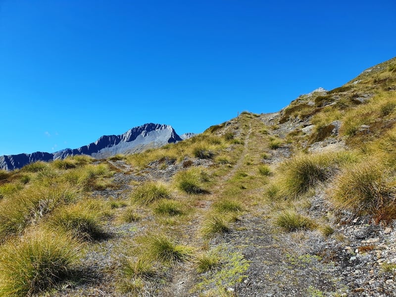
See that faint trail veering left? That’s the trail you’ll take to get to Black Peak.
If you’re on the way to McIntosh Hut, the track to Black Peak is in the photo above.
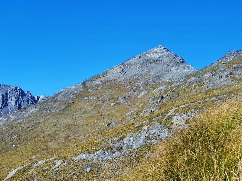
You can also see the track marked on the topo map app I recommended above. This is your best chance of making sure you take the best route to the base of Black Peak. You’ll then see the switchbacks up Black Peak which end close to the summit. Reasonably easy scramble up.
Then take it easy coming back down, it’s steep.
The hike to Mt McIntosh Loop Track is an underrated hike, especially if you’re looking for an overnight mission. You get epic views on the hike throughout, and the huts views are spectactular.
Other than that steep descent, the hikes is brilliant!
If you have any questions, feel free to email jub@churnewzealand.com and I’m happy to help.
RECOMMENDED READING
200+ Things to do in New Zealand
Yes, this link is at the top of pretty much every recommended reading section 🙂
39 South Island Hikes
Oh, where to start…so many options.
Awesome Walks in Queenstown
If you’re spending a few days in Queenstown, put a couple of these on your list.
My best New Zealand travel tips
At least a couple of these should help you have a better experience on your NZ travels 😉

Hey, it’s Jub here. I’m the guy behind Chur New Zealand, helping you have the best time hiking, trekking, walking…whatever you want to call it…in NZ. I’m based in Queenstown and am always out and about exploring trails, old & new. If you have any questions, reach out.