If you’re looking for some amazing Glenorchy hikes you don’t need to look hard.
There are a couple of Glenorchy walks on the easier end of the spectrum and a host of hikes in Glenorchy that are a good challenge, even for experienced and skilled hikers.
This post will get straight into the details of the walks/hikes (whatever you want to call them) I’ve experienced in the Glenorchy area.
GLENORCHY WALKS
1. Glenorchy Lagoon Track
2. Mount McIntosh Track
3. Mount Judah Track
4. Earnslaw Burn Track
5. Routeburn Track
6. Rees-Dart Track
7. Lake Sylvan Track
8. Sugarloaf Pass Track
9. Glacier Burn Track
10. Mount Larkins
11. Black Peak
12. Lake Rere
13. Glenorchy Walks Map
14. Other Walks Near Glenorchy
1. GLENORCHY LAGOON TRACK
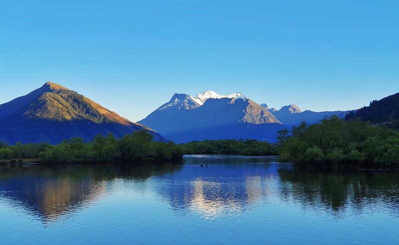

- Difficulty: Easy
- Distance: ~5km (depending on the route you take)
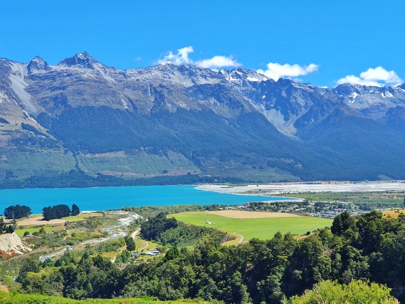
The Glenorchy Lagoon walk has some epic views and is one that people of all levels of fitness can do if they’re looking for easy walks around Glenrochy.
The walkway starts close to the historic steamship depot and Glenorchy wharf (there’s free parking here) which means you can tick off some other things to do in Glenorchy.
The signs by the car park get you started on the Glenorchy Walkway. It’s a nice walk to start with, but the wow part is when you get up and around the lagoons.
Try and go when there’s no wind about as the lagoon boardwalks are amazing spots to see incredible reflections of the surrounding mountains.
There’s a couple of routes you can take, but they will all loop around to the same spot inevitably. Just make sure you spend the majority of your time on the boardwalk 🙂
This is the best Glenorchy walk for those on a day trip from Queenstown and want to go for a walk but don’t have time for one of the longer Glenorchy hikes.
RELATED READ: THE GLENORCHY RACES ARE HELD CLOSE TO THE LAGOONS
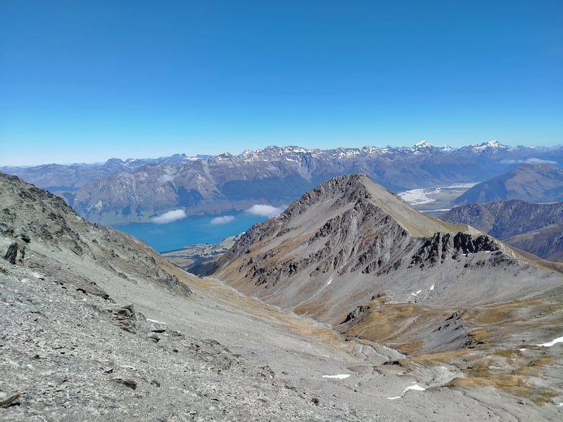
2. MOUNT MCINTOSH TRACK
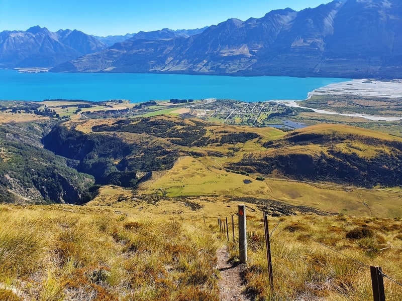
- Difficulty: Medium to hard.
- Distance: ~18km for the full loop.
The Mount McIntosh Hut Track is one that I mention to people who are looking for a low key beautiful walk in Glenorchy.
This hike, starting at the same point as the Mount Judah track below, can be completed as a loop or an out and back.
Most people will do it as a day hike, but you can stay at McIntosh Hut or the McIntyre Hut overnight (got your backcountry hut pass?).
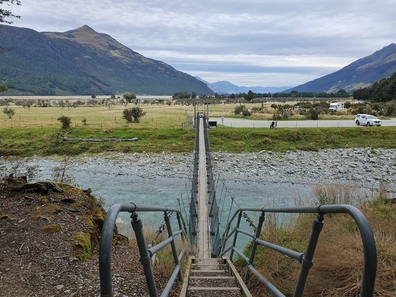
The hike is steep with few if any flat sections. But the trail is well maintained the majority of the way with no overly technical sections on the way up.
When you veer left away from the Mount Judah track, you’ll dip down the valley where there’s a crossing. If there’s been heavy rain or lots of snow melt this could become dangerous to cross…something to keep in mind.
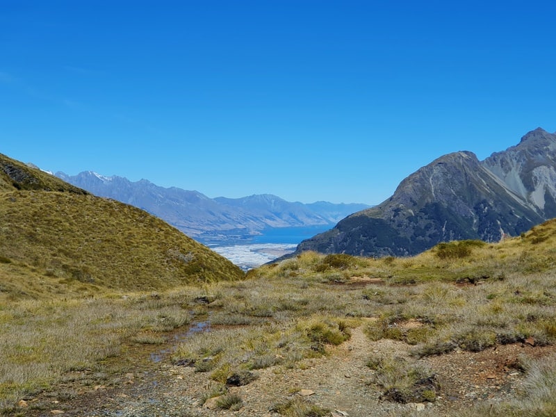
The hut is the ‘end’ of the hike, and you’ll have had epic views of Mount Alfred, Lake Whakatipu, and all the surrounding mountains on the way. If you want you can continue up towards Black Peak beyond McIntosh Hut, or it’s time to turn back the way you came.
You’ll have seen where the loop breaks off on your way up, and while there’s 1-2km of a super steep descent on the way back, you get more epic views. If you struggle on steep descents I’d recommend you do this as an out-and-back hike.
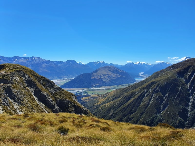
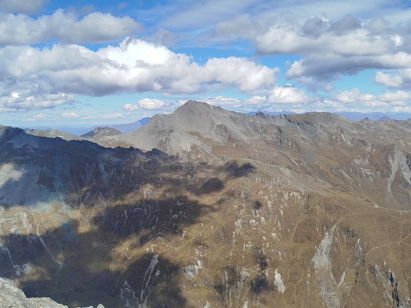
3. MOUNT JUDAH TRACK
- Difficulty: Medium to hard
- Distance: 16-17km
Starting at the same point as the hike above, the Mount Judah Track can also be done as a Glenorchy day walk or overnight trip staying at Heather Jock Hut (4 beds).
The track has some history plotted along the way as you hike up the valley. The track then splits off (this is after the Mount Judah turnoff), where there’s a loop so it doesn’t matter which way you go. I recommend going right to start.
The loop has a few historical huts you can check out (day use only) and you’ll be loving the views throughout the hike.
The looped section of the hike is technical/spots in spots, but definitely make it all the way to Heather Jock Hut, it’s an epic spot! Maybe you’ll wish you’d packed for an overnight trip to get out of QT?
There are a couple of peaks beyond Heather Jock Hut you can hike to if the conditions are perfect.
Some people have claimed this is their favourite hike in NZ! It’s not mine, but again, it’s a wicked-cool hike that doesn’t get a tonne of foot traffic.
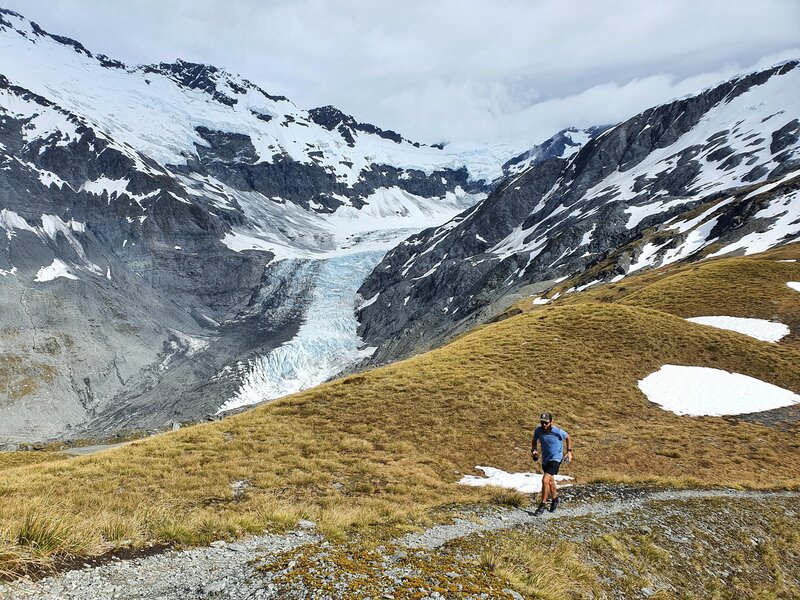
4. EARNSLAW BURN TRACK
- Difficulty: Medium to hard.
- Distance: ~26km return.
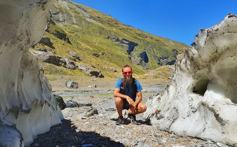
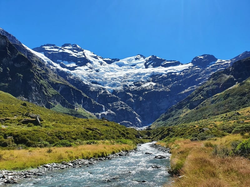
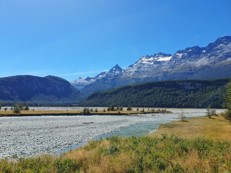
If you’re looking to hike to see a glacier, the Earnslaw Burn Track is one to pencil in.
This hike can be completed as a long day hike, but most people opt to camp overnight (hence this hike should be avoided in winter unless you really know what you’re doing) as it’s becoming known as one of the best hikes on the South Island for camping.
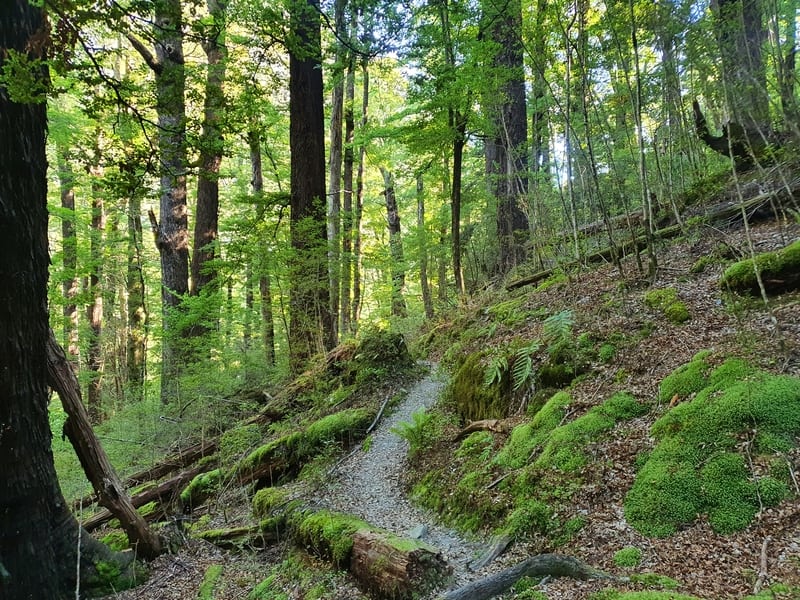
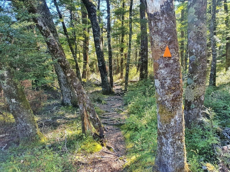
The start of the hike takes you through a forest track that is easy enough to follow but is slow going with lots of little twists/turns/ups/downs, and debris (all the things) making progress slower than you’d like.
Once you get through the forest, you’re above the treeline and closing Mount Earnslaw through the valley next to a river.
There are ample camping spots, look for a flat clearing and set up for the night if that’s your plan…remember the closer you get to the glacier, the colder it’s going to get (generally).
Then it’s time to head to the base of the glacier. It’s an epic experience if you’ve never been up close to one before. Even in the summer, there’ll be lots of ice cave-like things around. Enjoy and explore until your heart’s content.
Remember mother nature is unpredictable…don’t go do anything stupid, and things can go wrong even if you’re smart. This is a hike where hiring a PLB is sensible.
This is one of the top up-and-coming hikes in the region, popularity-wise.
5. ROUTEBURN TRACK
- Difficulty: Medium to hard.
- Distance: 32km
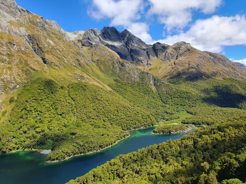
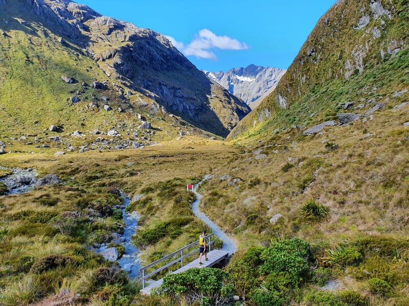
The Routeburn Track is one of New Zealand’s Great Walks, meaning the trails are well maintained and you’ll have incredible scenery.
While the traditional way to do the Routeburn is as a 2-3 day hike staying overnight at huts, there are other options. You can complete the entire hike in a day (make sure you sort out the transport) or you can get to various points of the track as a Glenorchy day hike.
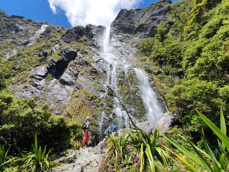
The Routeburn Falls is a popular spot to go from the Routeburn Shelter, as is Lake Harris both of which are epic day walks Glenorchy has to offer.
Regardless of how you experience the Routeburn Track, you’re in for a treat. I’ve written about hiking the Routeburn Track and the various transport options to get to the Routeburn Track.
6. THE REES DART TRACK
- Difficulty:Hard.
- Distance: 63km (not including the Cascade Saddle side trip).
The Rees Dart Track is one of the longer multiday hikes in the region measuring in at 63km, which doesn’t include the 20km side trip to Cascade Saddle.
With the side trip most people will spend 5 days on this hike as you loosely follow the Rees and Dart Rivers. There are some more technical sections on the track which make for an amazing hike.
The huts are lovely, with wardens on the track in the summer. You’ll need to plan your Rees Dart Track transport beforehand, but once that’s sorted you’ll be able to switch off and enjoy the stunning Mount Aspiring National Park.
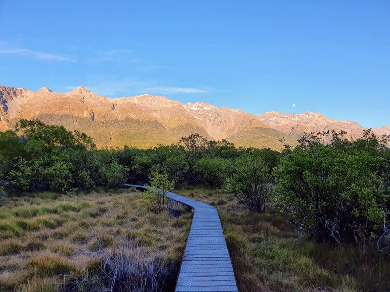
7. LAKE SYLVAN TRACK
- Difficulty: Easy.
- Distance: 6.3km
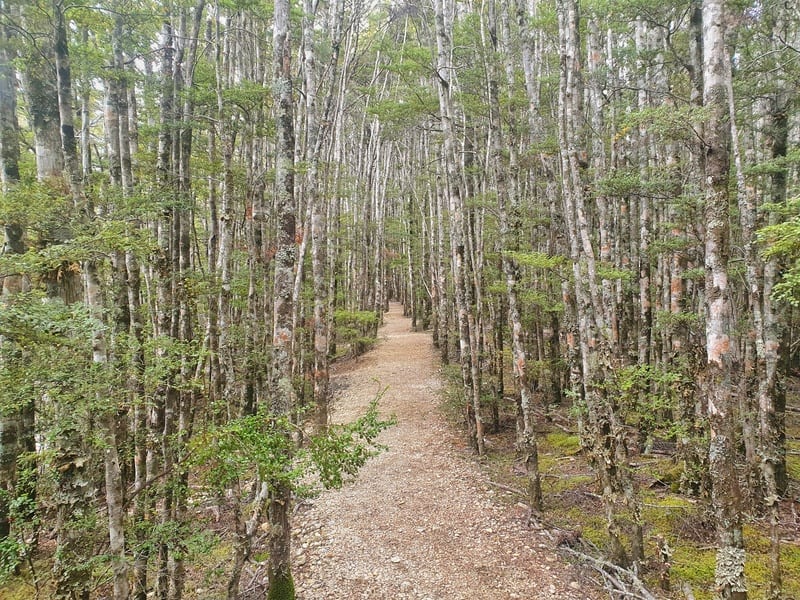
If you’re looking for an one of the easiest Glenorchy walking tracks, then the Lake Sylvan Track is a great option. It’s a well maintained track through a beech forest. You’ll get a nice lookout over Lake Sylvan, with the bonus of mountain views in the background.
If you want, you could add in the Sugarloaf Pass Track mentioned below, but that’s significantly harder. There’s also the Lake Sylvan campground right at the trailhead which is awesome.
8. SUGARLOAF PASS CIRCUIT
- Difficulty: Hard.
- Distance: ~20km
The Sugarloaf Pass Track takes in parts of the Routeburn and the Lake Sylvan Track, but is also a gateway to Theatre Flats and the Five Passes Track.
The track is one of the harder hikes near Glenorchy. The weather and navigation can be particularly tough at times. But you’re walking through some stunning forest for a good 10-12km of the trail. Then the pass has some epic views…it’d be super fun to camp up here at some point.
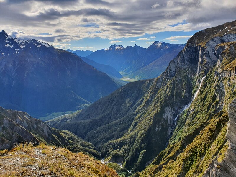
9. GLACIER BURN TRACK
- Difficulty: Easy – Medium
- Distance: 8km return (minimum)
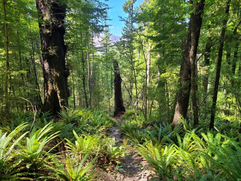
The Glacier Burn Track is a little hidden gem of a hike near Glenorchy. This track is surrounded by so many awesome tracks that it has to fight hard to get noticed…but more and more people are starting to take notice.
The DOC track takes 4km (90% through beautiful beech forest), before it emerges from the treeline. In the winter and spring, call it a day at the treeline…you’ll get to see the Glacier Basin and the Humboldt Mountains Ridgeline from afar.
But in summer and autumn, continue on for epic views of the Glacier Basin, a waterfall and beautiful views of the Dart River and Richardson Mountains. If you’re looking for an easy introduction into off road nav, this is a great option.
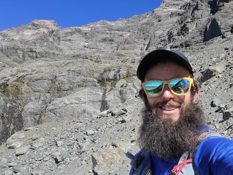
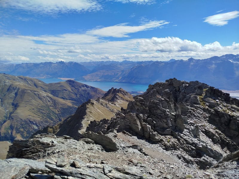
10. MOUNT LARKINS
- Difficulty: Hard
- Distance: 27km return (minimum)
If you’re looking for an awesome overnight adventure (which you might turn back on), the hike to Mount Larkins is awesome. It’s definitely for experienced trampers only, but it’s a rewarding track and there’s multiple ways you can do this…whether it’s an overnight hike or long day trip for the super fit.
There’s a couple of crux points, where if the conditions aren’t right you’ll need to turn around. But all in all, to get a peak
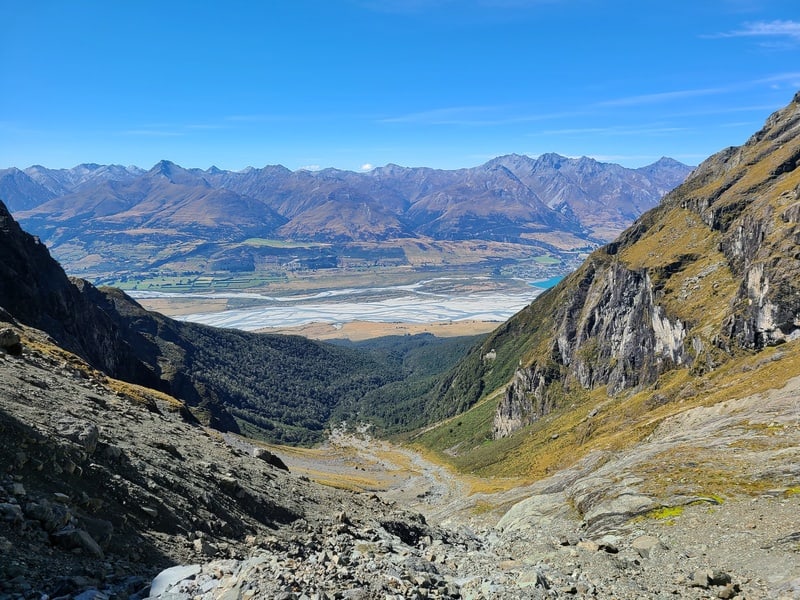
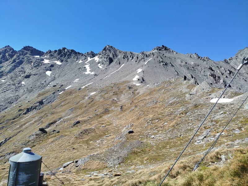
11. BLACK PEAK
- Difficulty: Hard
- Distance: ~26km return (minimum)
If you’re looking for an off the beaten path peak that isn’t too far away from civilisation, Glenorchy’s Black Peak is a good option. It reminds me of Mount Armstrong near Brewster Hut…it’s comfortable doable for most, but most go to the Hut…in this case McIntosh Hut.
For the peak baggers, definitely give this one a whirl for epic Views over GY! There’s even a trail most of the way to the summit.
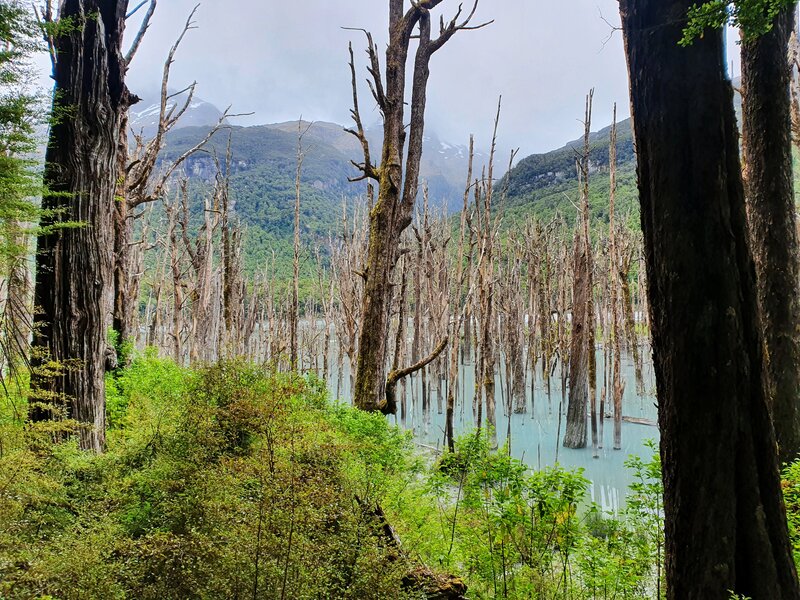
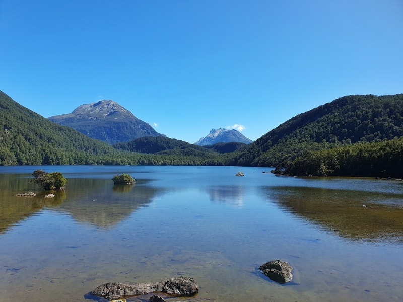
12. LAKE RERE LOOP TRACK
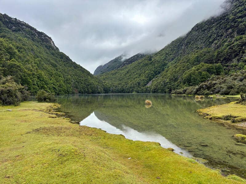
- Difficulty: Medium
- Distance: ~14-15km
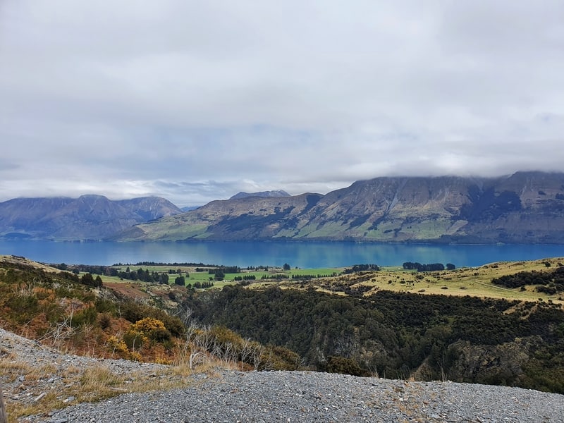
If you’re looking for a hike with good variety along the way, but doesn’t have lots of vert the Lake Rere Loop Track is a good option.
The track doesn’t have too much in the way of technical either, provided there’s no treefall. You’ll see waterfalls, lakes, valleys, farmland (animals) and you get to cross a few bridges. Not bad value for 15km!
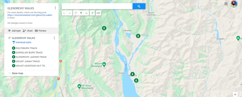
13. GLENORCHY WALKS MAP
(you can click on the individual posts for more detailed maps of the relevant walks.)
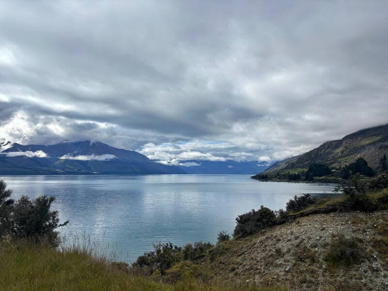
14. WALKS NEAR GLENORCHY
Note: these walks are all featured on Chur New Zealand.
If you’re planning to spend a few days in Glenorchy, then you might want to consider one of these hikes that can be accessed on the Queenstown-Glenorchy Scenic Road.
And of course, there’s no shortage of hikes in Queenstown and Arrowtown. We really are spoiled for choice.
If you have any questions about these Glenorchy walks, leave a comment below or email jub@churnewzealand.com . And tell me about your Glenorchy hikes experience!
p.s. If you’re looking for short walks in Glenorchy, look for the Diamond Lake walk.

Hey, it’s Jub here. I’m the guy behind Chur New Zealand, helping you have the best time hiking, trekking, walking…whatever you want to call it…in NZ. I’m based in Queenstown and am always out and about exploring trails, old & new. If you have any questions, reach out.
Just wondering if the road into Mount Judah track i suitable for a motorhome
Hey Kim,
Yea, plenty of campervans park in the Mount Judah carpark 🙂
Cheers,
Jub
Nice! – just what I need. Our daughter will be working there for a few weeks. So I will fly over and do some hikes. Looks a great area!
Hey Chris,
You’re gonna have a blast out there, so many options!
Cheers,
Jub