Before reading this, I’m sure you know there are plenty of amazing Mount Aspiring National Park walks and hikes you can do.
They can be as short as a few minutes long (Fantail Falls), to epic multi-day adventures staying in huts or camping under the stars (Rees Dart Track).
While Mount Aspiring National Park is popular, there are still walks that aren’t so popular. But the popular ones are popular for a reason.
This post will document the various walks and hikes in Mount Aspiring National Park I experience. Some are popular, others, not so much.
IMPORTANT: Hiking in Mount Aspiring National Park during winter can be hazardous for a variety of reasons. Before doing any of these Mount Aspiring National Park walks in winter/spring (well, anytime) you should get to DOC for the most up to date information.
16 MOUNT ASPIRING NATIONAL PARK WALKS
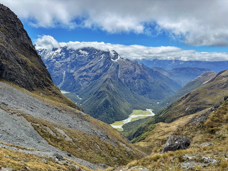
1. Gillespie Pass Circuit
2. Rees Dart Track
3. Blue Pools Track
4. Routeburn Track
5. Valley of the Trolls
6. Rob Roy Glacier Track
7. Brewster Hut Track (and beyond)
8. Sharks Tooth Peak
9. Liverpool Hut
10. French Ridge Hut
11. Sugarloaf Pass Track
12. Lake Sylvan Track
13. Dragonfly Peak
14. Makarora Valley Track
15. Cameron Hut Track
16. Emily Pass
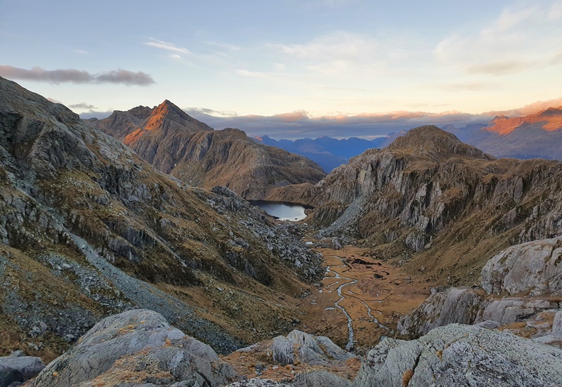
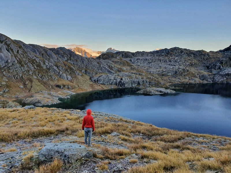
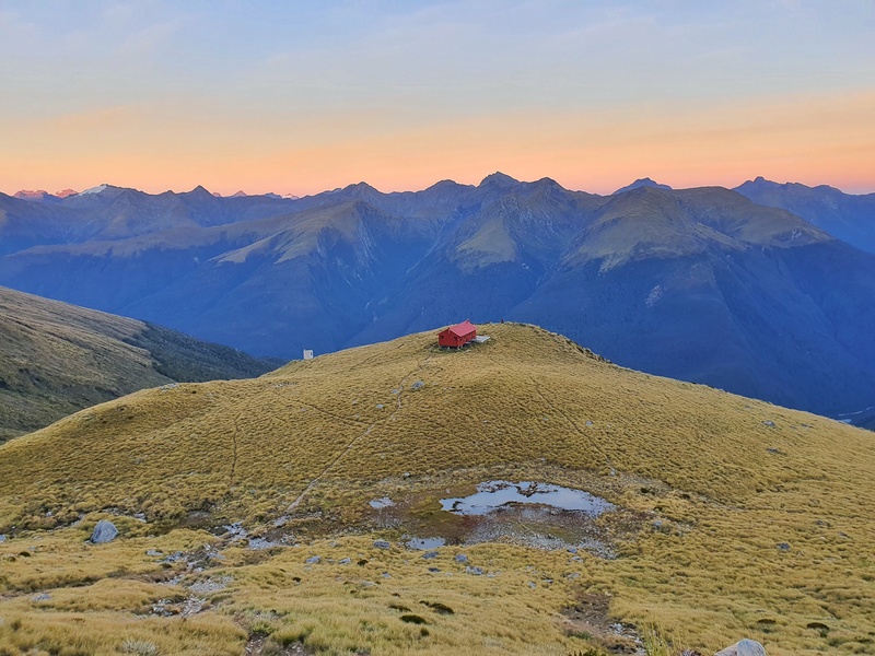
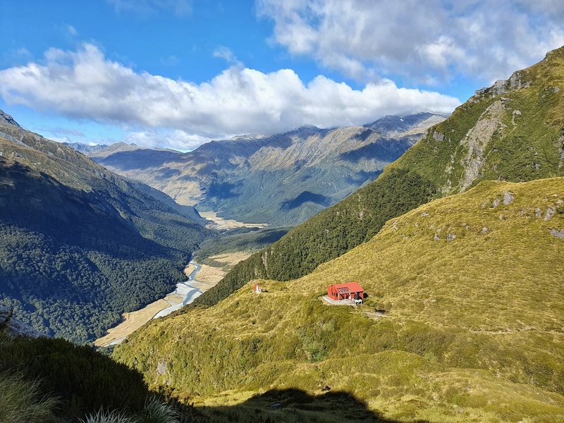
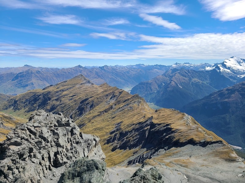
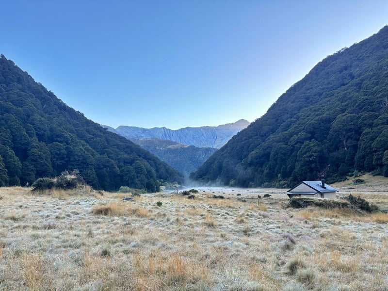
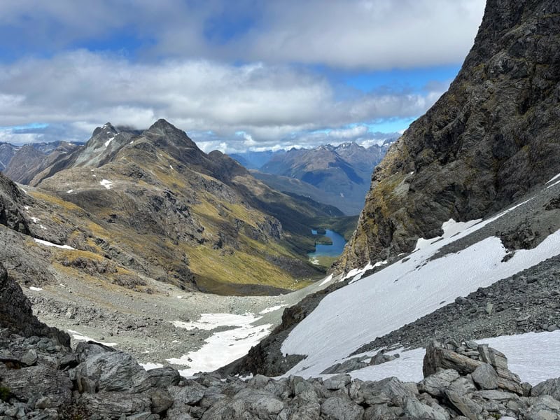
1. GILLESPIE PASS CIRCUIT
- Distance: 58km+
- Elevation Gain: ~2900 metres
Gillespie Pass is amazing! A few friends have said it’s one of there must do hikes in NZ – I agree, and these are people who have done lots of the top-rated ones.
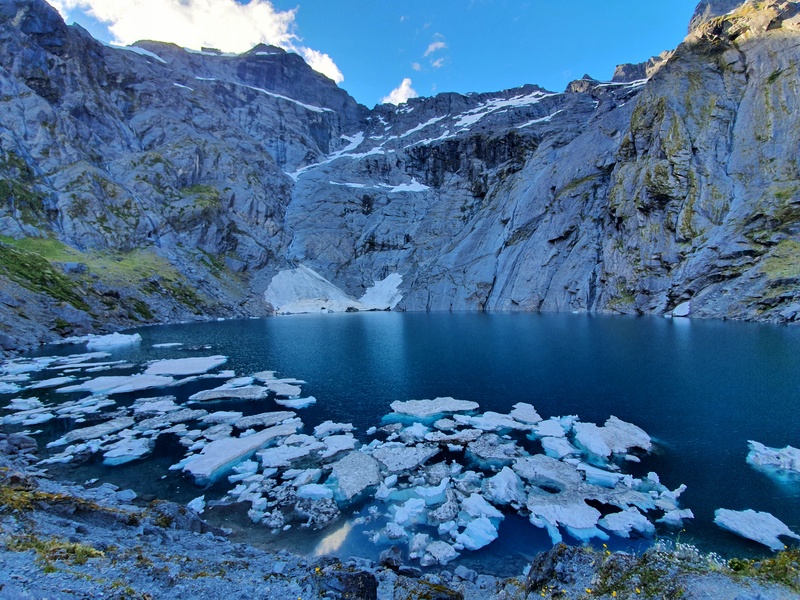
Like many of the 3-5 day hikes in NZ, it’s the middle days that are the best for this hike. The two best parts are going over Gillespie Pass and heading up to Lake Crucible (there are some icebergs in the lake until about mid-January).
If you’re a photographer, you’re going to love this. And Siberia Hut is one of the best in the country.
Not keen on a 3-4 day hike? The Gillespie Pass Circuit transport options give you the option of doing a 1 or 2-day trip to Crucible Lake.
READ THE FULL POST: THE GILLESPIE PASS CIRCUIT
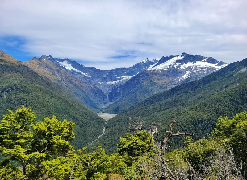
2. REES DART TRACK
- Distance: ~85km
- Elevation Gain: ~3,000 metres
The Rees Dart Track is an amazing circuit track following the Rees and Dart Rivers. To get between the two rivers you cross over the Rees Saddle which isn’t a big mission (relatively speaking) but offers great views.
There are three huts you can stay at on the way (your Backcountry Hut Pass isn’t valid during the high season, unfortunately), with the opportunity to swim in the rivers. That’s never a bad thing in the summer.
There are a few side trips you can do on this hike, but the premier one is to Cascade Saddle. As long as the weather permits, this is a trip you have to do with amazing views to another part of Mount Aspiring National Park and great views of the glaciers.
RELATED POSTS:
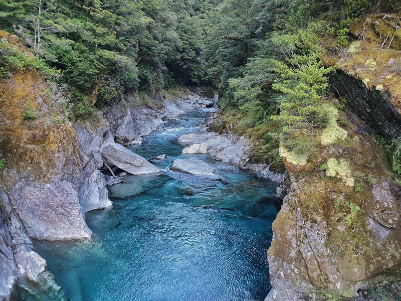
3. BLUE POOLS TRACK
- Distance: 3km return
- Elevation Gain: Less than 100 metres
The Blue Pools are super famous, and I can see why. This is a nice walk that won’t take up all your days, and is a great stopover if you’re driving from Wanaka up to the West Coast.
It’s not something I’d go out of my way to visit though (for example you’re in Wanaka for 2 days). The water is certainly blue, but I think it’s the momentum of social media that’s propelled this place to a little bit above what it probably is.
That said, the short walk makes the Blue Pools worth visiting if you’re going nearby anyhow.
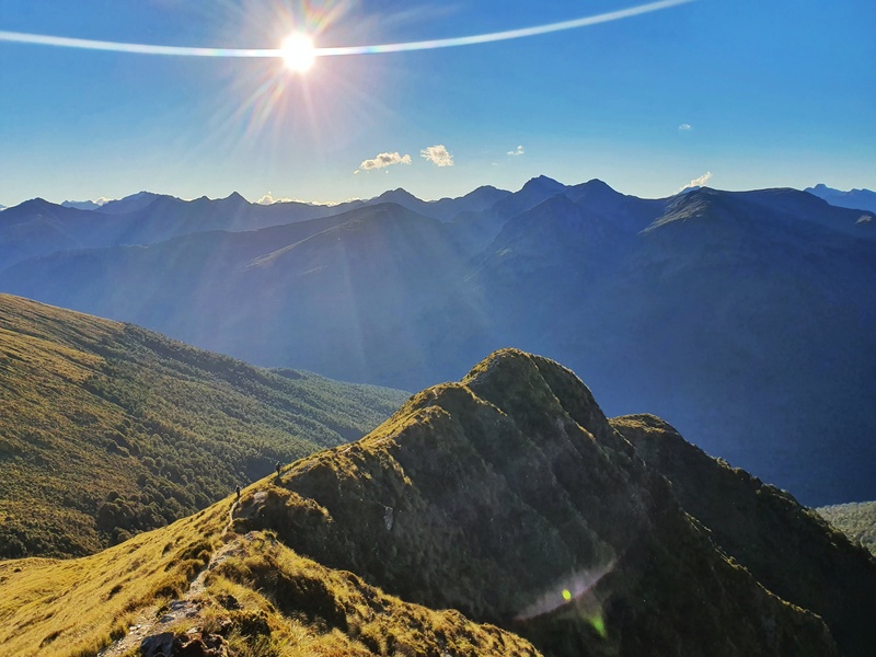
4. THE ROUTEBURN TRACK
- Distance: 32km
- Elevation Gain: ~2200 metres
For some reason, I always think the Routeburn Track is in Fiordland National Park, another one of New Zealand’s epic National Parks. But it’s in Mount Aspiring National Park too (you cross the border between them).
That said, it’s my favourite Great Walk with so much variety in the 32km and few ‘boring’ sections.
The Routeburn Flats and Falls are stunning, and then you’ve got Lake Harris and the Pass before plunging down to Lake MacKenzie.
There are lots of day walks you can do on the Routeburn, but if possible, do the whole walk…even if that means you need to put in one big day.
And there are some side trips off the Routeburn you can do, but make sure you do the whole track before you start getting fancy visiting places like Valley of the Trolls which we’ll talk about below.
RELATED POSTS: TRANSPORT OPTIONS FOR THE ROUTEBURN TRACK
HIKING THE ROUTEBURN: A TOTAL GUIDE
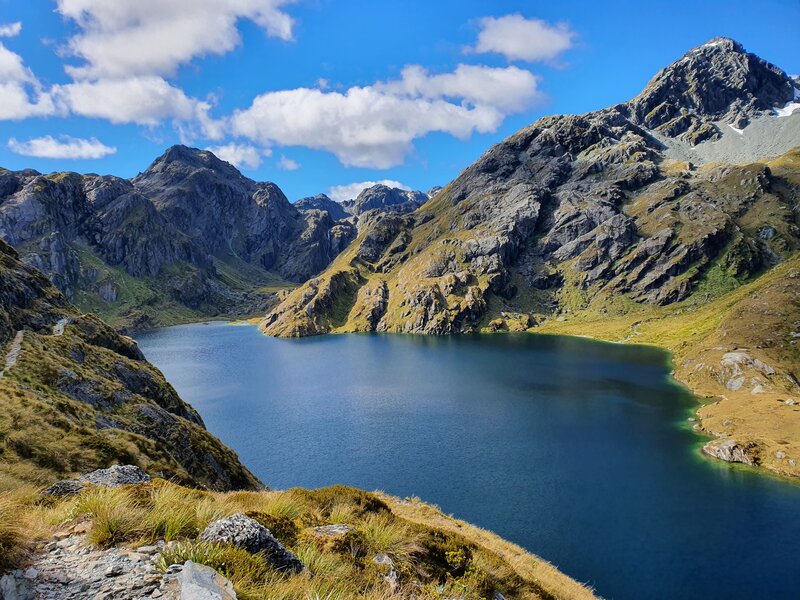
5. VALLEY OF THE TROLLS
The Valley of the Trolls is a detour off the Routeburn, but it feels like a whole new world there and deserves its own place in this list.
The valley is accessed from Lake Harris and while not a marked trail, there’s a trail you can follow easy enough. The Valley itself is about 1km long but that 1km has peaks towering above you, and ideally it’s sunny and it’ll feel like your in a story book. I did at least.
And if you’re heading to the valley, as long as you’ve got time, make sure to check out Lake Wilson. You can even camp next the lake which is an awesome time.
Make sure to read my full post on visiting Valley of the Trolls & Lake Wilson for more details on what to expect.
6. ROB ROY GLACIER TRACK
- Distance: 10 – 12km
- Elevation Gain: 450 – 500 metres
This is one of the most popular day hikes in Mount Aspiring National Park. At 10km or so in length, it leads to a glacier without being an overly difficult hike.
The main viewpoint doesn’t get you super close to the glacier, but you can go off track and get closer if you feel the need to.
I do think one of my favourite viewpoints on this hike is early on the hike where you get views down the Matukituki Valley and river.
READ THE FULL POST: THE ROB ROY GLACIER TRACK
7. BREWSTER HUT TRACK (& BEYOND)
- Distance: 5.6km
- Elevation Gain: 950 – 1000 metres
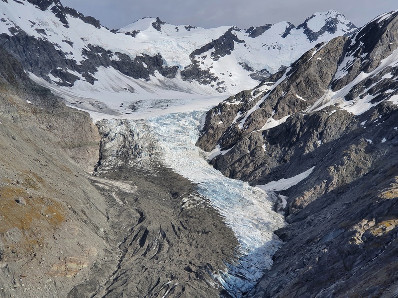
The track leading to Brewster Hut is steep, pretty gnarly, and relentless. But wow wow wow. It’s not a long track to the hut (2.8km) and once you emerge from the treeline, the scenery quickly opens up and you’ll be wow’ed too.
I highly recommend staying overnight at the hut if you can so you can walk around to the glacial lakes and enjoy a few hours hanging out around them.
This is one of the bucket list hikes to do in Otago I reckon (it’s technically the West Coast). It’s just so peaceful up here. If you can, ideally wait for a blue sky day so you get the best of all the views…including Mount Aspiring in the distance. It’s crazy to think that these two are both hikes in Mount Aspiring National Park.
READ THE FULL POST: THE BREWSTER HUT TRACK
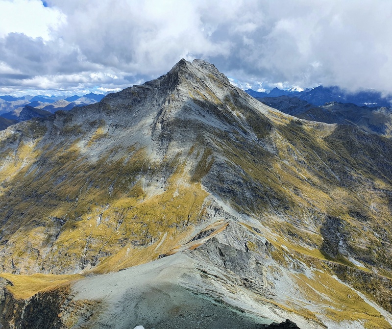
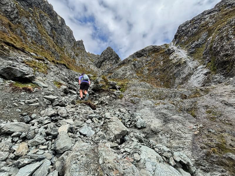
8. SHARKS TOOTH PEAK
- Distance: 9 – 11km
- Elevation Gain: ~1800 metres
This is an advanced track that’s not an official DOC track (you’ll follow sheep tracks some of the way), therefore should only be tackled in later summer by experienced hikers.
With that out of the way, this is an amazing hike with incredible views. It’s super steep, with lots of exposure but a rewarding challenge with an obvious peak you’re trying to get to.
If you’re looking for an off-the-beaten path route, this is a great option. Check out the photos in the full post below!
READ THE FULL POST: HIKING SHARKS TOOTH PEAK
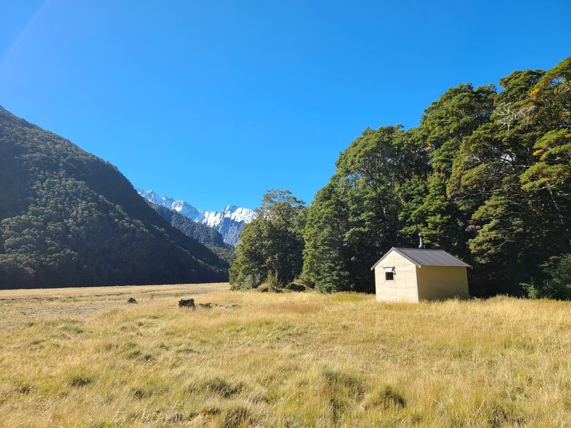
9. LIVERPOOL HUT
- Distance: 32km return
- Elevation Gain: ~1250 metres
The Liverpool Hut track is one of the overnight hikes in Mount Aspiring National Park that always has people saying amazing things. The views through the valley are nice, but it’s the views from the hut that is breathtaking.
You’ll need to book the hut well in advance if you’re going during any holiday period as it’s a popular spot.
The hike to the base of the climb is really chill, and you’ll pass Aspiring Hut on the way as you follow the Matukituki River. And then boom, the last 1.5km of the hike is a steep incline to the hut sitting on a nice plateau.
You’ll work hard for the views, but wow. SO WORTH IT!
READ THE FULL POST: HIKING TO LIVERPOOL HUT
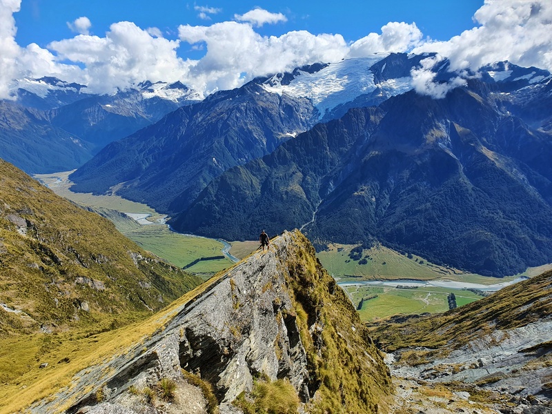
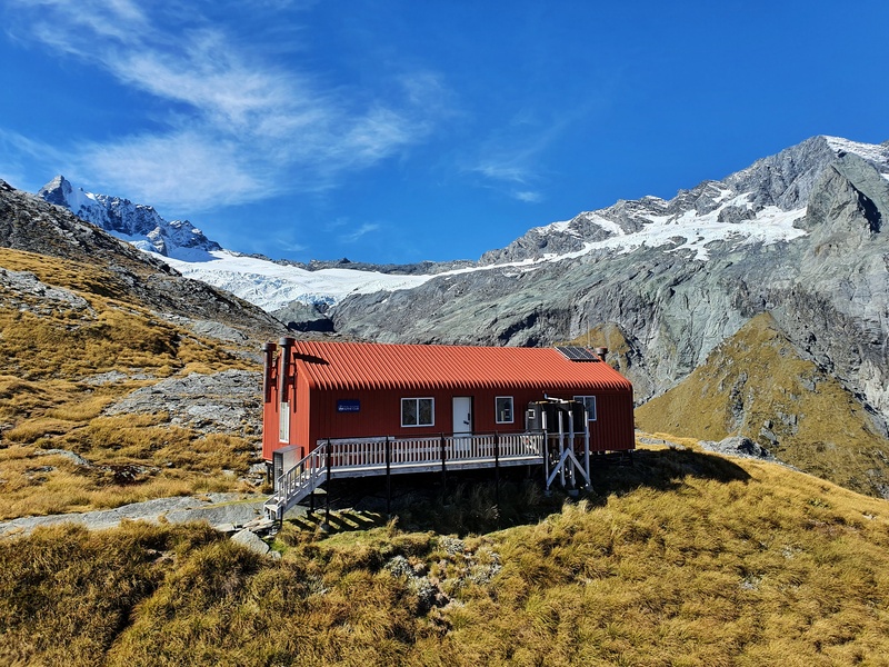
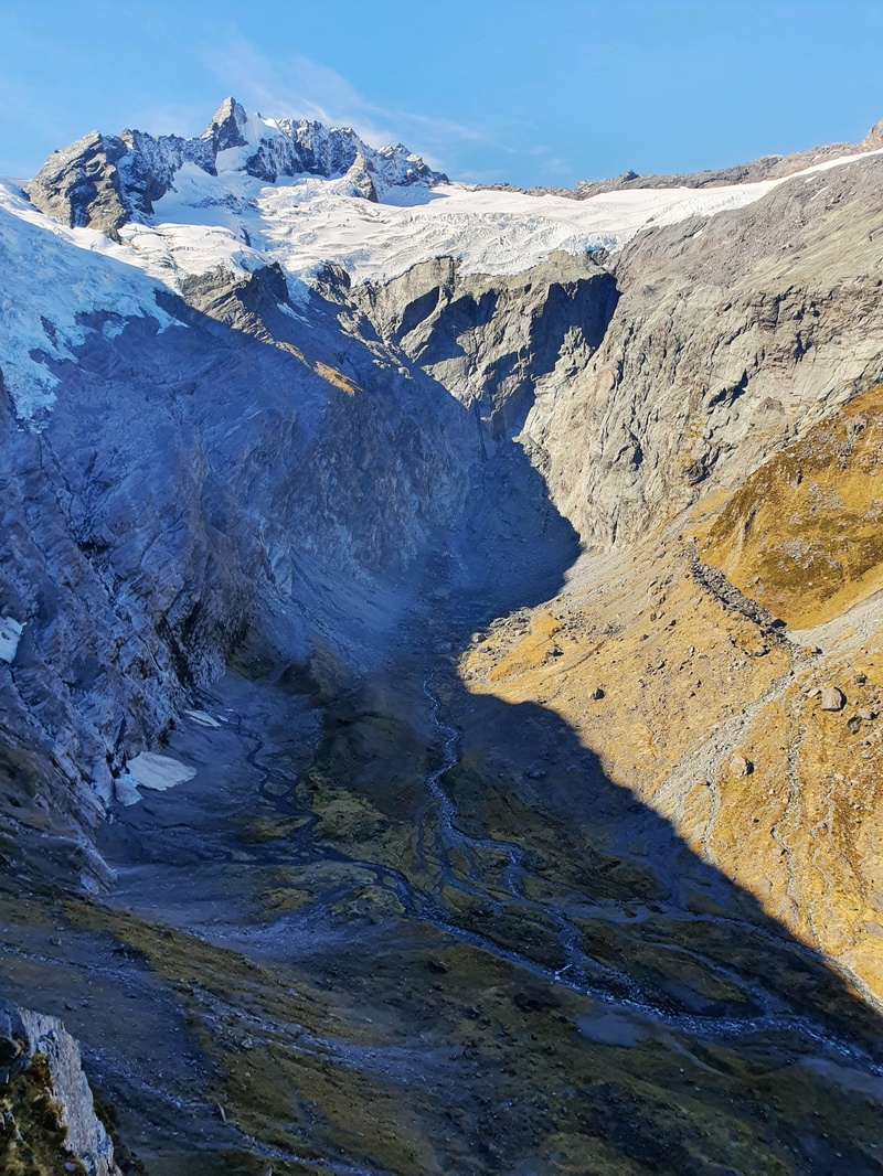
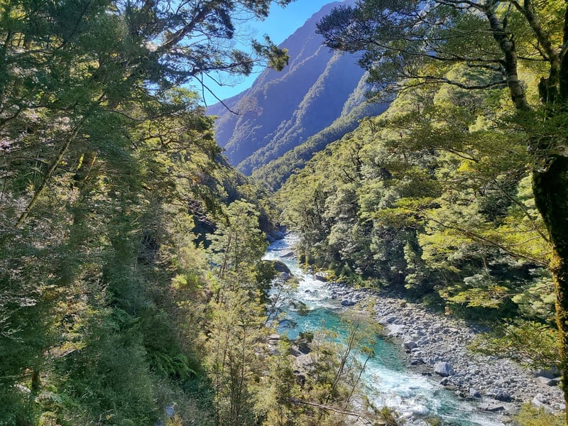
10. FRENCH RIDGE HUT
- Distance: 34-36km return
- Elevation Gain: ~1550 metres
The French Ridge Hut track is a popular overnight hike for those who are looking for a challenge and amazing views.
The first 14-15km of the hike takes you along the West Matukituki Valley Track with peaks towering above you. The last part of the hike is a fun steep hike up a rooty and rocky track up the French Ridge Track leading to the hut.
Once you’re in for a hut you’ve got epic views over the valley, glaciers, and Quarterdeck Pass which is one of the routes you can in theory take to summit Mount Aspiring.
READ THE FULL POST: HIKING TO FRENCH RIDGE HUT
11. SUGARLOAF PASS TRACK
- Distance: 20 to 23km
- Elevation Gain: ~1200 metres
The Sugarloaf Pass Track is an awesome circuit that starts and finishes close to the Routeburn Shelter. The terrain is a mix of smooth, gravel road, and super technical.
And like a few other hikes in Mt Aspiring NP, you’re below treeline for the majority of this trail. The views are unreal though!
The terrain is a mix of smooth and super technical.
READ THE FULL POST: THE SUGARLOAF PASS TRACK
12. LAKE SYLVAN TRACK
- Distance: 6.3km
- Elevation Gain: ~50 metres
If you’re looking for a short walk to do that gives you a taste of Mount Aspiring National Park nature, then the Lake Sylvan track is a great option.
The walk is on a well-manicured track and the beech forest is beautiful. You get a nice view of the lake (not great for swimming) and see some mountains. It’s all pretty cool for a short walk that anyone can do (there’s a shorter out and back to the lookout you can do).
And the trailhead is right next to a campsite which might be the accommodation option of choice for you near Glenorchy.
13. DRAGONFLY PEAK
- Distance: 32 to 34km
- Elevation Gain: ~2,200 metres
If you’re looking for an off the beaten path hike that can be done as a big day hike, or as part of an overnight mission, put the hike to Dragonfly Peak on your list. It’s a demanding hike that veers off the East Matukituki Track to climb up past Whare Kea Lodge to a peak offering 360-degree views.
There’s not a whole lot of scrambling over rocks involved, but this hike will push those who aren’t at the top of their fitness. But the views, are awesome and totally worth it! In terms of difficulty, this hike is a lot longer than Sharks Tooth Peak, but not nearly as scary exposure wise.
14. MAKARORA VALLEY TRACK
- Distance: 22 to 24km
- Elevation Gain: ~1,200 metres
If you like small cute huts, the Makarora Hut is worth visiting. Located at the end of the Makarora Valley Track, you’ll likely have the 4-bed bunk to yourself with the valley surrounding by mountains.
You might be less than 10km from one of the most popular huts in the South Island, Brewster Hut (#7 in this list), but most want even know there’s a hut in the valley below.
This isn’t a beginner hike, but as long as you leave yourself a good amount of time to get to the hut…you’ll have a blast. It’s another showcase of the variety Mount Aspiring National Park has to offer.
15. CAMERON HUT TRACK
- Distance: 14-16km return
- Elevation Gain: ~1,100 – 1,200 metres
Let me get this straight…if I was to choose one of the previous two tracks, I’d probably goto Makarora Hut…but Cameron Hut is a great one if you’re looking to get off the beaten path without driving for hours down weird roads.
This track is hard work, and a classic tramping experience where you don’t get great views on the hike very often. But the flats where the hut are, well I loved that part! It would be fun to explore the area around the hut more next time (never say never).
But let’s just say this is a hike where it’s one that you need to pick your audience carefully.
16. EMILY PASS (OFF THE ROUTEBURN)
- Distance: 7km return
- Elevation Gain: ~800 metres
*this is from the point it leaves the Routeburn at the Shelter end, to connecting back at Mackenzie Hut.
Emily Pass is a great variation off the Routeburn and can be combined with other hikes in the area. It cuts the corner of the Routeburn off with a steep hike up a stream bed, a tussock traverse and then an awekward climb next to a waterdall before reaching the pass. This is an advanced route, with good decision making abilities required.
Emily Pass itself straddles Mount Aspiring National Park and Fiordland National Park, so once you’re heading down to Lake Mackenzie, you’re in Fiordland. How good!
Definitely read a few blog posts on the trip before considering this hike.
The walks in Mount Aspiring National Park (hikes) are amazing. It’s a large park with some hikes that are super popular (Routeburn/Rob Roy) and some that aren’t like Makaroa and Cameron Hut.
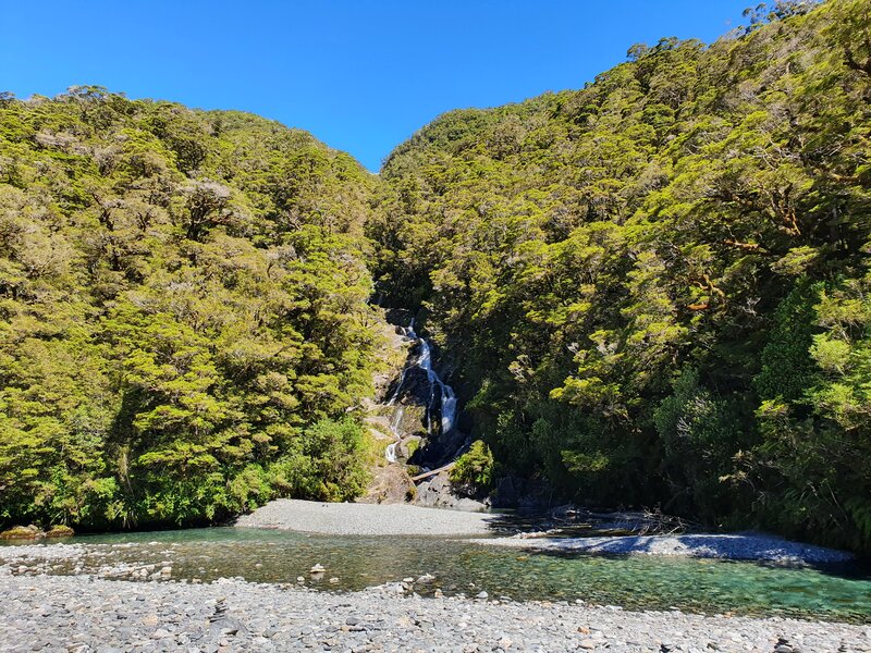
But there’s so much variety too…I haven’t included the quick walks to places like Fantail Falls (photo below) which only takes a couple of minutes to walk to.
If you have any questions about any of the Mount Aspiring walks/hikes, let me know in the comments below or email jub@churnewzealand.com.
WHAT TO READ NEXT: 11 OF THE BEST MULTIDAY HIKES IN THE SOUTH ISLAND

Hey, it’s Jub here. I’m the guy behind Chur New Zealand, helping you have the best time hiking, trekking, walking…whatever you want to call it…in NZ. I’m based in Queenstown and am always out and about exploring trails, old & new. If you have any questions, reach out.
Hi Jub
We are a couple of experienced but aging (71&75) hikers who would love to spend a few nights (4-5) at Mt Aspiring hut and do day walks from the hut. Happy to walk 10-15 km/day, uphill but not to technical or steep. Would be grateful if you have any recommendations
Hey Sigrid,
I love that you’ll spend a good time at one hut, something I need to do more.
The Matukituki Valley is pretty steep on all sides, so other than continuing on up towards Pearl Flat you’ve not got much in the way of options that aren’t super steep. But you could explore different nooks and crannies up there. You’ll be off track, but you could poke around Shovel Flat and see what you find. The track up towards Cascade Saddle is steep, but it’s right by the hut so I’m sure you’ll take a nosey up there at some point.
Have a great time!
Cheers,
Jub
Hi,
Do you have a slot for this month, like from 12th of May to 24th of May? And how much it is and things that included on the trip.
Hey Edita,
Sorry, I don;t run tours…hopefully you have a good week of weather…it’s looking good so far. Happy to help any specific questions you have.
Chur,
Jub