October 2024 Update: The Rob Roy Glacier Track bridge is open, you’re good to go again 🙂
The Rob Roy Glacier Track is a popular ~11km out-and-back hike/walk to a viewpoint where you can see the stunning Rob Roy Glacier.
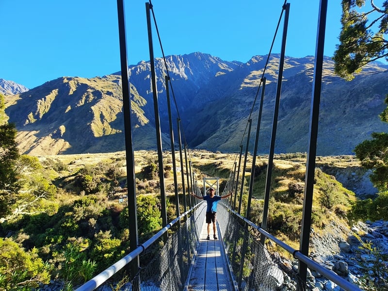
Proof I’ve been on the Rob Roy Glacier Track (well at least onto the swingbridge 😉 ). I want to share my experience, not make things up.
This post will give you details about one of the best walks in Wanaka, and what you can expect along with a few tips and tricks I learned along the way.
TABLE OF CONTENTS
1. Details About The Rob Roy Glacier Track
2. Rob Roy Glacier Track Map
3. How To Get To The Trailhead
4. My Experience On The Rob Roy Track
1. DETAILS ABOUT THE ROB ROY GLACIER TRACK
How hard is the Rob Roy Glacier Track?
Easy – medium. The track is one of the most famous walks in the South Island is easy to follow and there’s less than 500 metres of elevation. That said, if you’re not used to hiking you might feel your leg muscles the next day.
How far is the Rob Roy Glacier Track?
My Strava recording says the track is 11.2km return. That’s without going off the trail or exploring beyond the viewpoint at all. The DOC website says it’s 10km return, so plan to walk in the 10-12km range.
What is the Rob Roy Glacier Track elevation?
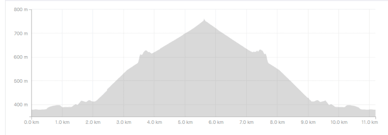
The Strava recording gave me 457 metres of elevation gain. Almost all of that is enroute to the upper viewpoint. On the way back you’re pretty much going all downhill. I’ve popped the elevation profile below:
What’s the Rob Roy Glacier track time?
It took us 1 hour and 30 minutes to get to the upper viewpoint. We were a group of eight with a range of walking experiences, but no one really struggled. There was lots of stopping and starting while we waited for others to catch up and whatnot. We then spent about two hours at the top! The walk back took about 1 hour and 20 minutes so 2 hours 50 minutes of walking time.
DOC recommends 3-4 hours of walking time. This is probably about right for most people if you include 20-30 minutes at the upper viewpoint (you won’t spend long at the lower viewpoint).
Is the Rob Roy Track closed?
Yes. After reopening in Feb 2021 after a major slip. The track has been closed again as the bridge needs to be replaced and repaired. This is not going to happen before March 2024 at the earliest.
2. ROB ROY GLACIER TRACK MAP
Clicking on the map below will open it up in a new tab where you can scroll around etc.
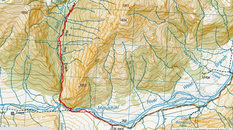
The map above is the GPX file from Strava overlaid on a topo map. Note, you’ll see the black and red lines diverge. That’s where the major damage was and they’ve rerouted the track.
That said, you don’t need a map or anything for the Rob Roy Glacier walk. It’s clearly signposted and easy to follow. That’s always going to be the case when upwards of 20,000 people are doing the track each year.
3. HOW TO GET TO THE TRAILHEAD
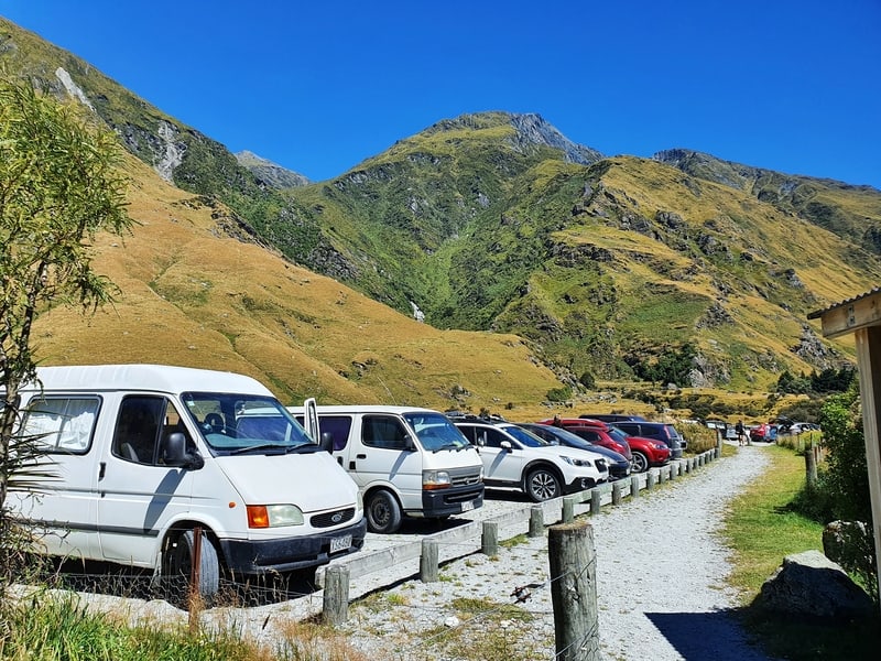
The trailhead for the Rob Roy Glacier Track is at the Raspberry Flat Car Park at the end of Wanaka-Mount Aspiring Road. The car park is massive as it’s also the starting point to other hikes in Mount Aspiring National Park.
The last 30km or so of the Wanaka-Mount Aspiring Road is a gravel road. The gravel road starts close to the Treble Cone turnoff which is a little over 20km from Wanaka.
Google Maps says the drive time from Wanaka to the Raspberry Flat car park is nearly two hours. While it’s slow going on the gravel road, we didn’t take that long. It was about 1 hour 20 minutes for us. That said, the creeks were very low. If there’s been rain recently, it wouldn’t be so fun driving through them.
Two hours would be the maximum drive time though. Despite being a gravel road, it didn’t appear people were too concerned about their vehicle choice based on the cars we saw in the car park.
4. MY ROB ROY TRACK REVIEW
As a group, we were excited to be on the Rob Roy Glacier Track less than two weeks after reopening.
I was super surprised at how busy the car park was and thought that the majority of the cars would be from people experiencing the Rob Roy Glacier, like us. That didn’t seem to be the case as we saw maybe 30 people on the track. Meaning dozens were out exploring the other tracks over the weekend like the French Ridge and/or Liverpool Hut tracks.
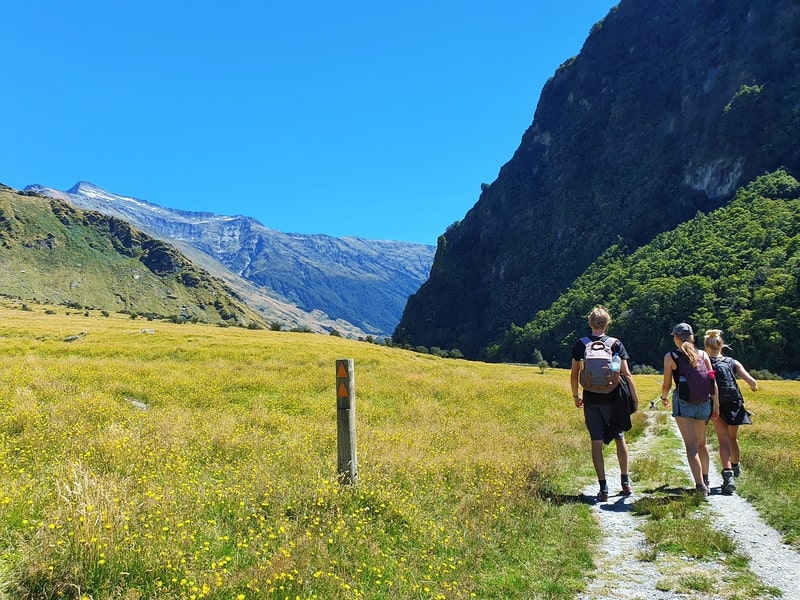
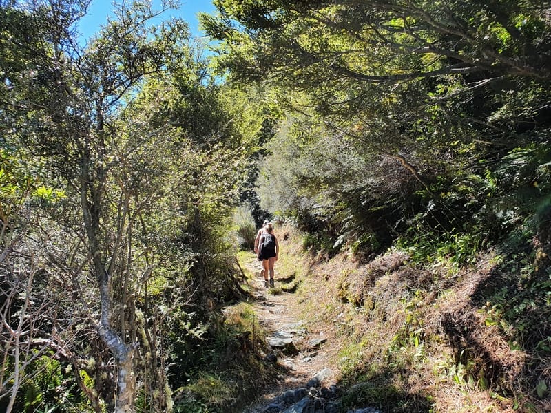
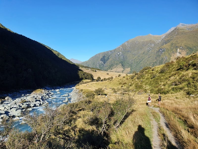
After reading the signs about Mount Aspiring National Park we set off on the trail following the West Matukituki River. I was a little nervous we might somehow end up on the wrong track but that was irrational of me.
You simply follow the track next to the river for about 1.5km until you get to the swingbridge.
After crossing the swing bridge, there’s only one track.
We were under the forest canopy on a gentle incline. For some reason, I was expecting us to emerge from the forest canopy after a few hundred metres and we’d be left with epic views for the rest of the hike.
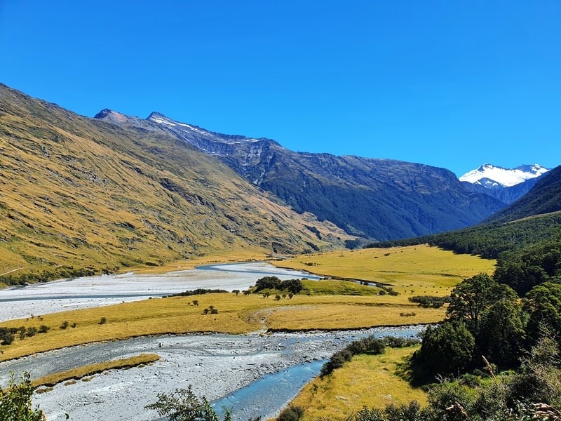
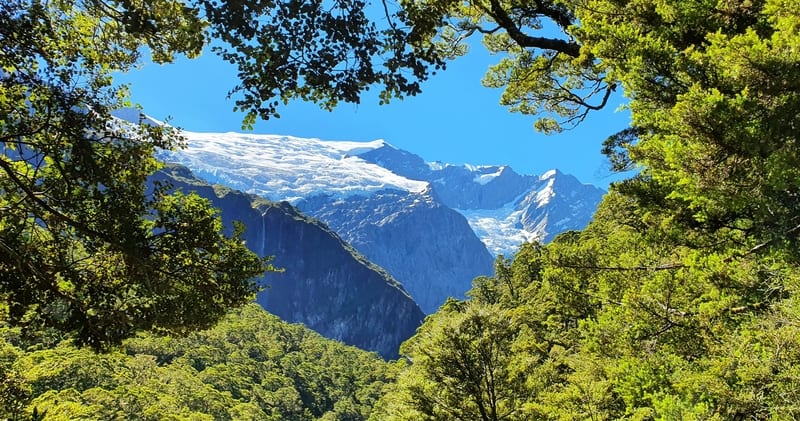
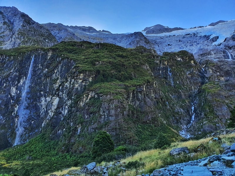
Instead, we got to a cool viewpoint (the photo above) before reentering the forest canopy where we’d be climbing through for the next couple of kilometres.
The forest is beautiful there’s no doubt about that, but I guess I just was expecting more views of the surroundings.
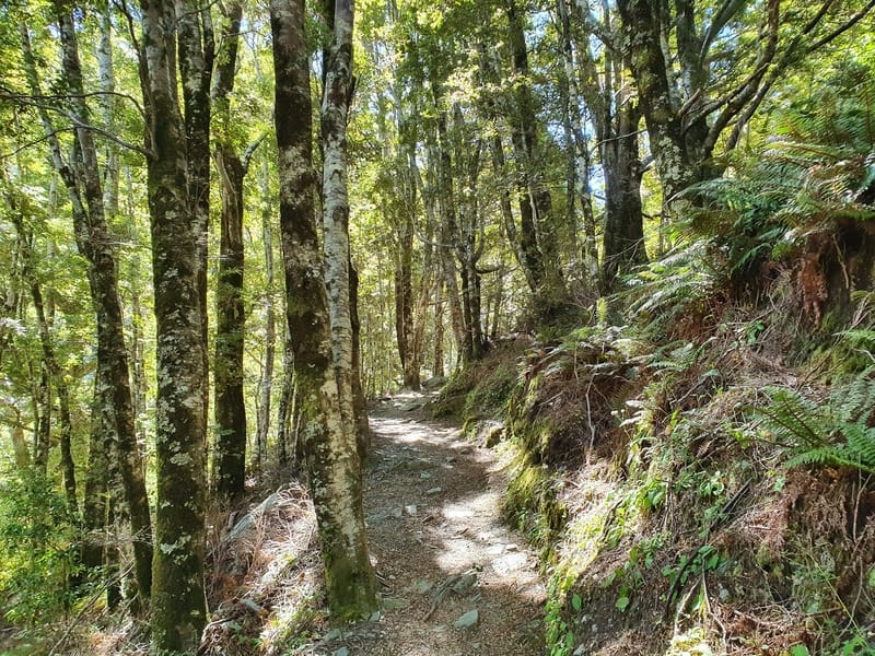
We were making good time, but it was definitely steeper than I expected. It’s an easy hiking track in terms of terrain. It doesn’t have the status of being a great walk but is well-maintained.
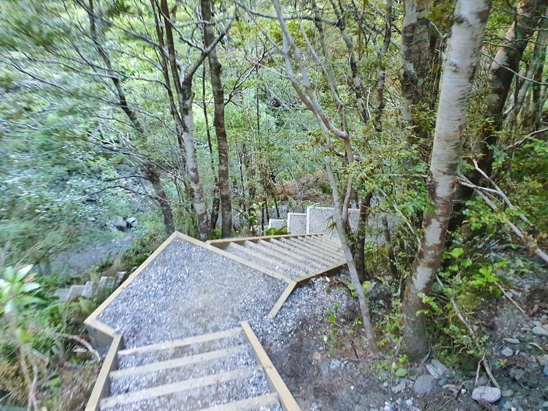
After nearly 3.4km you’ll hit the stairs. These stairs are a new addition to the track. They’re steep, but there aren’t hundreds of them. Grit your teeth and get it done.
From here you’ve got another 500 metres or so until you reach the lower lookout. Once again, it’s just a steady climb.
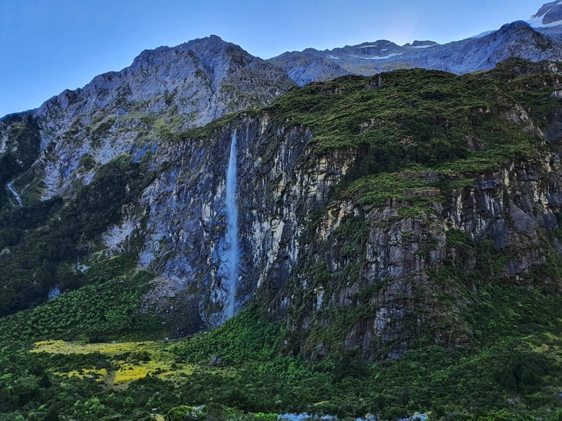
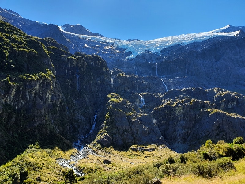
The lower lookout has a few benches for you to take a break with your first view of the glacier through the trees (see above).
If you’re considering turning around here, don’t! You’re not far from the top, and you get way better views from the upper lookout. You’ve got less than 1.5km to go from here!
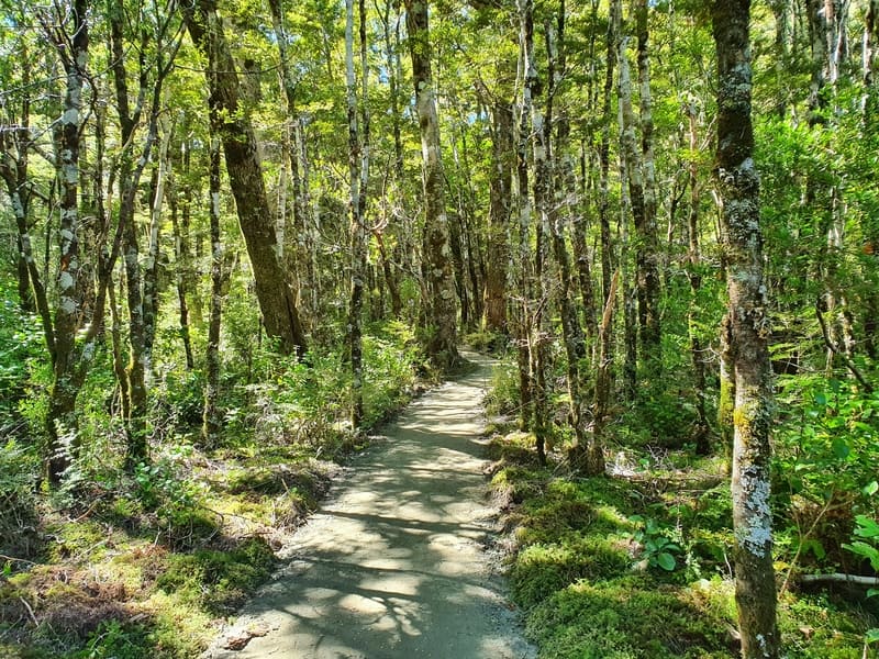
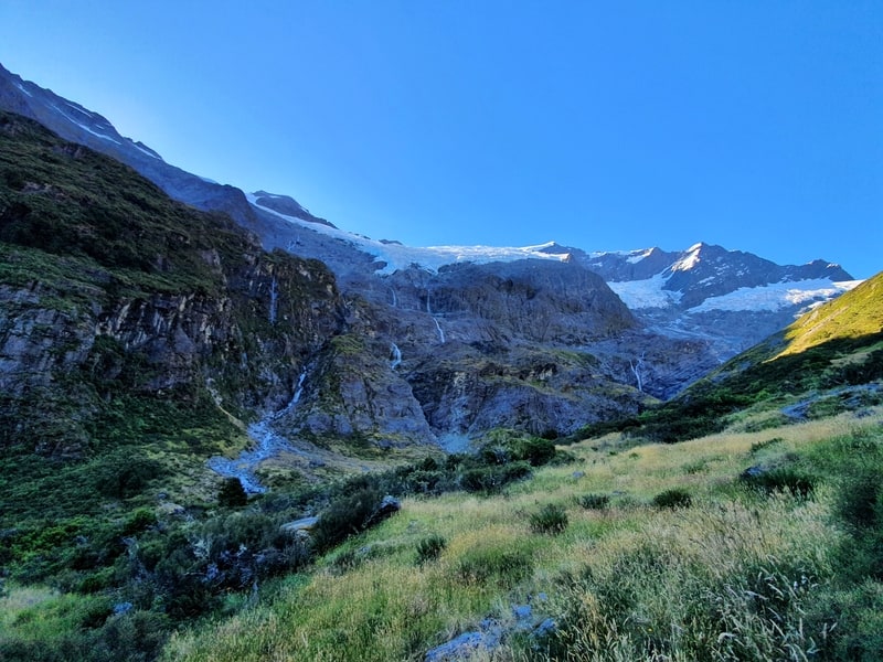
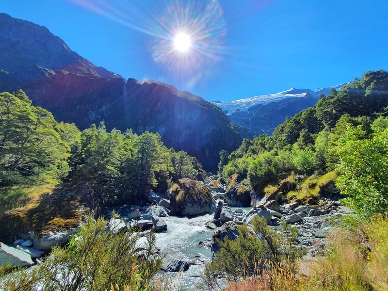
You’ll notice the forest canopy getting lighter which is a good sign. Then it’s time for the most technical part of the hike, a dry river bed you need to cross. It’s a mix of boulder and rock hopping for about 50 metres.
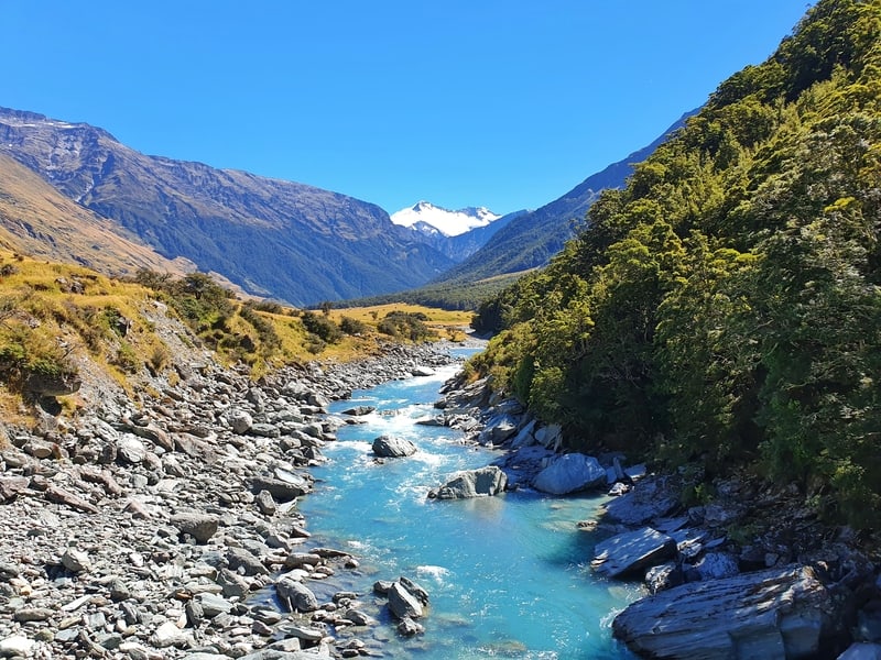
You’ll then meet the Rob Roy Stream shortly after the dry riverbed which is a good spot to either fill up your bottles or jump in for a swim if you’re brave enough…she’s cold.
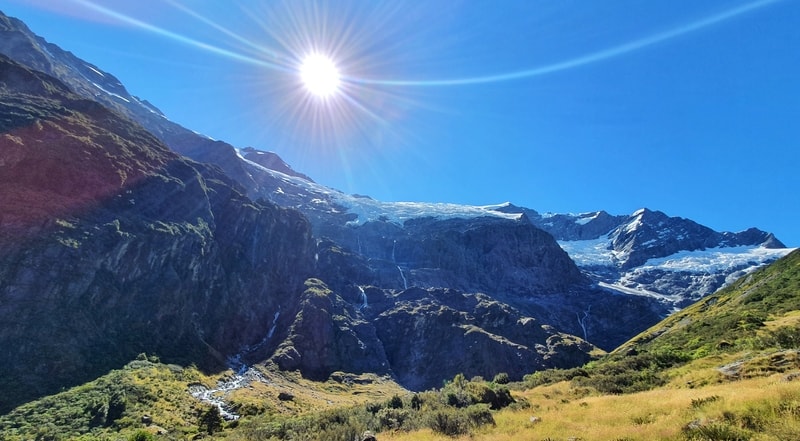
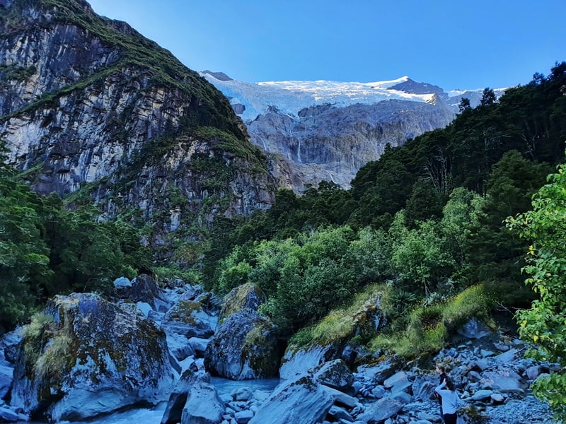
From here you’ll be at the top before you know it as you fully emerge from the forest canopy.
You’ll know when you’re at the upper viewpoint when you see a couple of information boards explaining what you’re looking at.
There’s no large manicured area where you can chill out which surprised me. But there are plenty of rocks in the surrounding area you can easily scramble onto as you take in the epicness of the glacier.
If you’re planning to get awesome Rob Roy Track photos, I’d recommend going earlier in the day. The lighting isn’t great when the sun is up in the middle of the afternoon.
This is the end of the trail technically, but there are some remnants of tracks that continue closer to the river. They are easy tracks to follow, and if you’re pretty tired at this viewpoint, there’s no need to go further. Though I’d love to get closer to the glacier, as you do on the Earnslaw Burn Track.
RELATED: GLACIER HIKES IN NEW ZEALAND
We ended up spending a couple of hours up here as a group. Some of us went exploring, others napped, ate food, etc. It was a cool spot to hand out. There are a couple of spots where you can find shade, but if it’s summer…bring your sunblock.
On the descent, it’s pretty easy going and those worried about their knees should be okay. Perhaps you’ll want to take a swim in the river? We were planning to…but we ended up spending too long at the viewpoint so had to keep moving to get back to Wanaka.
Just remember you’ve got an hour-plus drive back to Wanaka. But the car park is also a freedom camping spot, so if you have a campervan equipped for that you might find you’ll be spending the night out here.
I can understand why the Rob Roy Glacier Track is popular. It’s:
- not overly long
- in a National Park
- not too bad elevation wise
- looks good on the gram
- is a track that has good
- views of a glacier!
But if I’m honest, did it live up to the hype? Yes and no. The glacier is cool (you can see it from afar on the Sharks Tooth Peak hike too), but when you consider a track like Earnslaw gets you close up to the glacier (granted the hike is a lot more difficult) then it’s hard to be WOWED by Rob Roy.
Maybe do Rob Roy first if you plan on doing both 😉
Anyway, I’d love to hear about your Roy Roy Track experience. Drop a comment below.
RECOMMENDED READING
200+ Things to do in New Zealand
If you need any more inspiration.
Walks in Wanaka
If you’ve got a shortage of time, there’s plenty of trails to explore in Wanaka
The Speights Ale House in Wanaka
When you get back to Wanaka, you might fancy stopping off in here for a burger and beer
See Franz Josef Glaier From The Roberts Point Track
This is a hike that’s got lots of variety!

Hey, it’s Jub here. I’m the guy behind Chur New Zealand, helping you have the best time hiking, trekking, walking…whatever you want to call it…in NZ. I’m based in Queenstown and am always out and about exploring trails, old & new. If you have any questions, reach out.
Hi, it’s me again! Sorry I think I wrote the last comment half asleep. So, what I really want to ask is, if I have time for only two hikes, one with my family (young children and all), and one alone, which should I go for, in the Wanaka area?
Do you think Rob Roy Glacier for family hike, and the solo one at Earnslaw Burn is good? But I’ll be missing Roy’s Peak… Which is more spectacular: Earnslaw Burn or Roy’s Peak? 🙂
Thanks once again for the very informative guide. Really amazing work, and very very helpful. I can’t wait for December when we fly over to NZ. I know I wouldn’t want to leave!!
Regards,
Dening
Hey Dening,
I’m always guilty of being on the laptop half asleep too haha.
Rob Roy is great for the family, it’ll be fun for the kids on the drive out there too. Stick with that plan.
Just to be clear, the Earnslaw Burn track is out near Glenorchy. It’s awesome, but if you’ve got the choice of the two to do solo while being based in Wanaka, I’d go with Roys Peak…otherwise it’s a VERY LONG DAY if you’re driving to and from Earnslaw Burn in a day. That said, I really like the Breast Hill Track next to Hawea 😉 So if it’s between Roys Peak and Earnslaw Burn, go with Roys Peak. But consie the Breast Hill Track for sure…absolutely amazing.
Did you just drop yet another trail hike suggestion?! 😅 I have enough, and it is precisely the problem — it seems the more I research and plan my trip, the more trails there are that screams “HIKE ME!” or “Top NZ hike in South Island” 😆 and I cannot make the choice! THEY ARE ALL BEAUTIFUL!
Thank you, once again, for the suggestions. I will 100% take my family on the hike to Rob Roy, fingers crossed not too much rain so we can make the drive over a few shallow rivers and make it to the start of the trail.
I am somehow, quite taken by Earnslaw Burn… your photographs (even the thick difficult part through the forest is stunning!), and also The Rings of Power — when the scene came on with Elrond the elf walking towards Khazad Dum where the dwarves live — I thought, nah, that scene isn’t real, not with that stunning glacier and multiple waterfalls. It’s fake. Then it turned out to be real. And it’s in NZ, in the South Island, just two hours from where I’ll be staying two nights. OF COURSE I’M GOING! 😀 😀
Do you think it’ll be a stretch — if I make the drive (solo) from Wanaka at 6am, to Glenorchy / start of trail head for Earnslaw Burn, start the hike-run? Could I complete it, spend 30 minutes admiring Earnslaw Burn glacier itself, and make it back to car, and drive back to Wanaka by … 8pm?
I am a runner, I have done one trail marathon with elevation in decent time. I could possibly jog through the trail in the forest? The distance (25km return) isn’t a problem. I’m more worried about getting lost, but I suppose if I keep to a northern direction I should be able to make it to Earnslaw Burn.
Would it also be safe for a solo female hiker?
Thanks once again, so very much!
Regards,
Dening
Hey Dening, alright, based on what you’ve said, you can definitely do it 🙂 I’ve done it as a trail run as well and think it was 5 hours, that’s with a friend who isn’t super experienced on trails but has fitness. So you’ll have plenty of time. Crazy how much more ground you can cover when you can just keep a steady trot on yea! You won’t need to take much water with ya, soon after you exit the forest, you’ve got all the epic glacier water you can drink 😀
And yeap, safe for a solo hiker! One of my besties camped there overnight solo, she loved it.
I’m not sure if I’ll be available but if I am and wanted someone to join, I could be keen (am based in QT still). Feel free to shoot me a message 020 4170 2764 on Watsapp at anytime.
Hi Jub,
I intended to message you after my hike to Earnslaw Burn Glacier to thank you for your very detailed guide on not just this hike but others (e.g. I read up about Porari River hike which we did visit). I enjoyed my time in NZ South Island tremendously, and my husband feels the same (though I did many more hikes/runs than him). Children unfortunately were very put off after we dragged them along Hooker Valley at Mt Cook for a 10km + walk on a very cold, wet day, especially our youngest, so we didn’t do the Rob Roy Glacier hike, to my regret.
I did hike Earnslaw Burn, getting up very early and doing the drive in mist and low clouds through Glenorchy, doing the 9km hike through the forest and finally to the valley. It was an intense experience: very tiring to say the least, as it was very wet and muddy, and I was pressed for time as had to make the return hike out, drive back to Wanaka, and meet the family, so I was essentially doing a 25km hike non stop arghhhh! Such a waste; I wish I could have sat down admiring the glacier and stayed a night or two, but I was hiking very lightly. In any case, I do agree it is out of this world beautiful, remote, magical. (You’re right that it made for a very long day, what with the drive and then the hike in and out!)
This trip cemented our decision to try to move to NZ to live and work, so if we do succeed, I’ll drop you a note and perhaps you could take my husband and I for a off the beaten track hike!!
Thanks once again! And enjoy the summer — it was getting quite warm!
Regards,
D
Hi Jub,
Do you happen to know if there is a bus going from wanaka to raspberry flat car park? im planning on hiking up to mt aspiring hut and doing rob roy but i cant seem to find any kind of transport that isnt a rental car. Im not from New Zealand and ill be solo hiking so I would much rather catch a bus than rent a car. i heard from a fried who hike there years ago that there is a shuttle bus but i cant find any info on it.
Thanks!
Hey Ella,
There’s a couple of options you can try, but there’s no regular shuttles…try Yello Taxis and KT Taxis. Alternatively, the hostels you stay in might have some options for you. If you’re going in the next couple of months, Hitchhiking is pretty easy too…at your own risk.
Have fun!
Chur,
Jub