There are some awesome walks around Wanaka and the surrounding area. But which one should you do?
This post will help you out with 13 of the best Wanaka walks/hikes.
As you’d expect none of the Wanaka walking tracks are the same, so I’ve included:
- a few photos from each walk
- a short description
- who it’s best for
I’ve written about most of these walks in Wanaka in further detail if you want more photos/details etc.
Here are the locations of the walks in and near Wanaka (if you click on the map it’ll open in a new window).
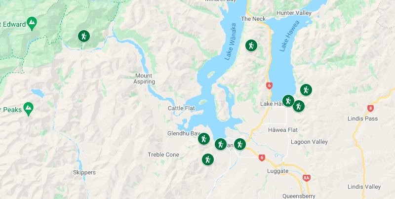
WANAKA WALKS
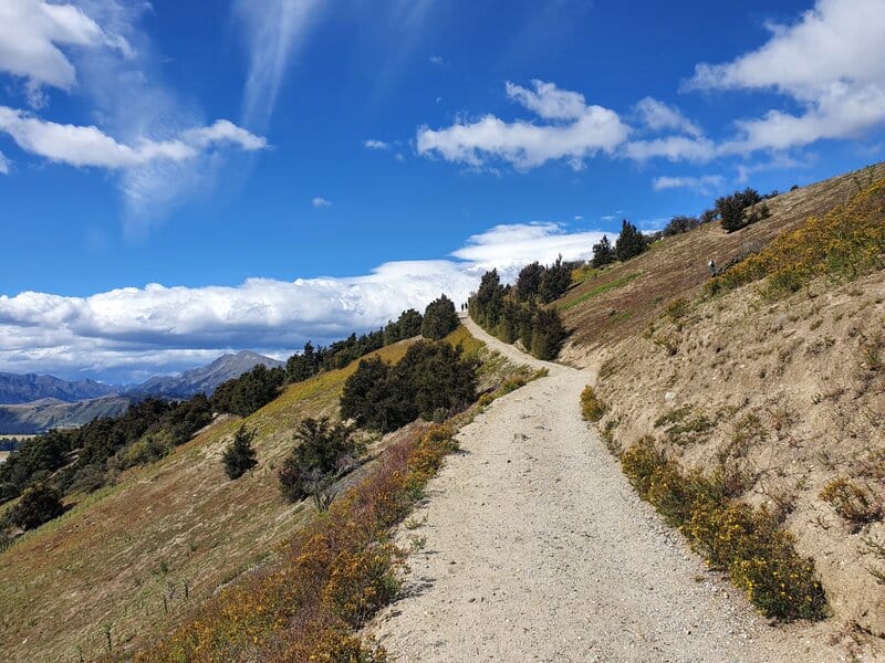
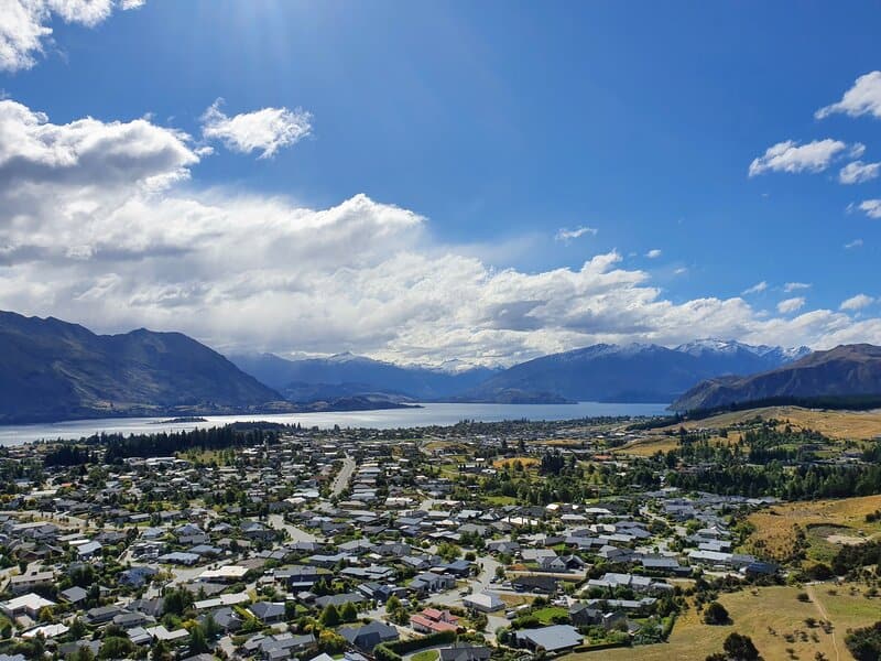
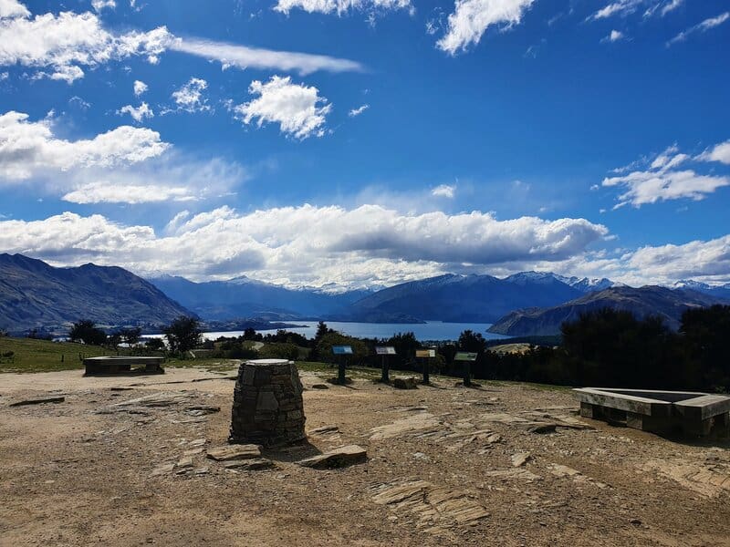
1. Mount Iron Track
2. Roys Peak
3. Wanaka Skyline Track
4. Waterfall Creek Track
5. Diamond Lake & Rocky Mountain Walks
6. Motatapu Track to Fern Burn
7. Rob Roy Glacier Track
WALKS NEAR WANAKA
8. Isthmus Peak Track
9. Grandview Mountain Track
10. Breast Hill Track
11. Gladstone Track
12. The Meg Hut Track
13. Black Peak Wanaka
1. MOUNT IRON TRACK
- Difficulty: Easy – Medium
- Distance: ~4.5km
The Mount Iron Track is the equivalent of the Queenstown Hill walk. It starts close to downtown (you can walk or drive to the trailhead) and quickly rises up to the summit of the track before looping back around.
If you’re looking for one of the walks in Wanaka to escape people without too much effort, this is a great option.
You can walk the track in either direction. Going clockwise means you’ll start the walk on a manicured path with minimal rocks and bumps. You get views on the way up, but it’s the panoramic views around the summit which are what you’re really wanting.
If you decide to go for the full loop rather than an out and back, be prepared for a steeper more technical descent.
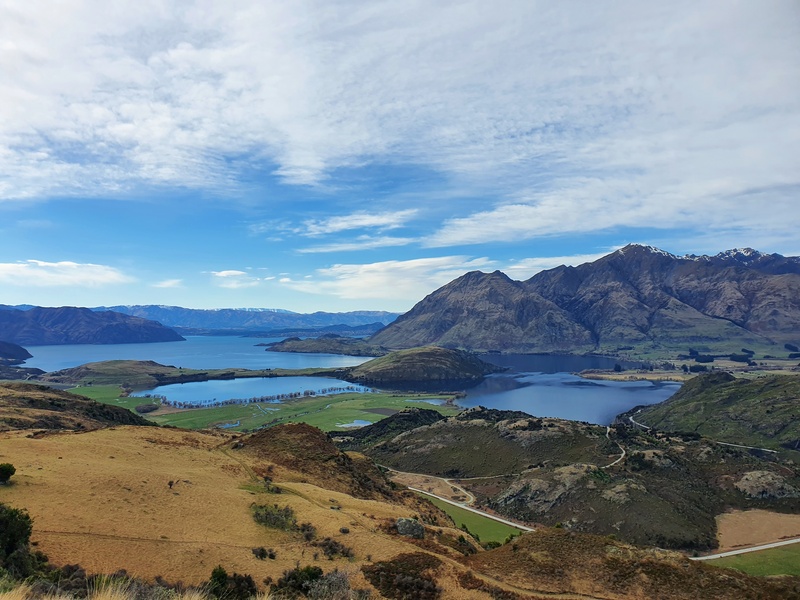
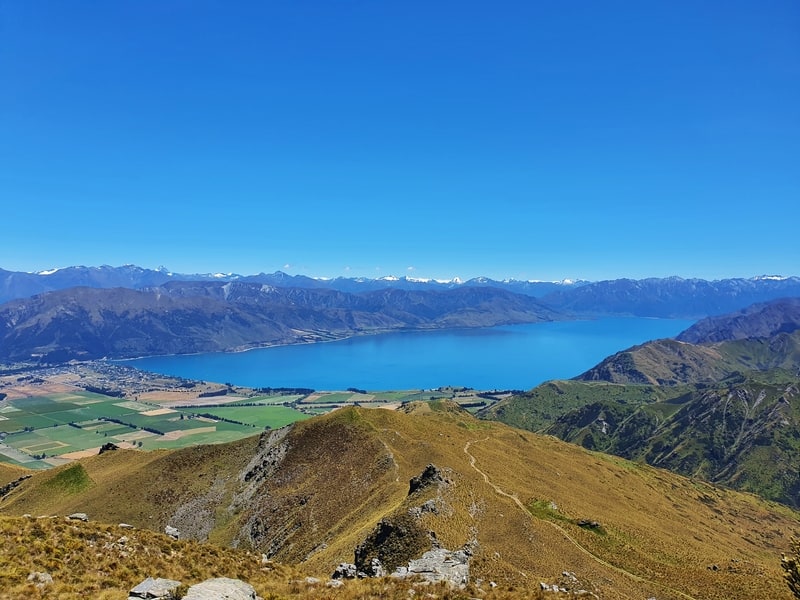
2. ROYS PEAK TRACK
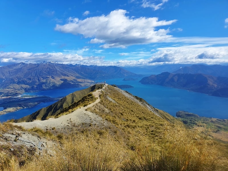
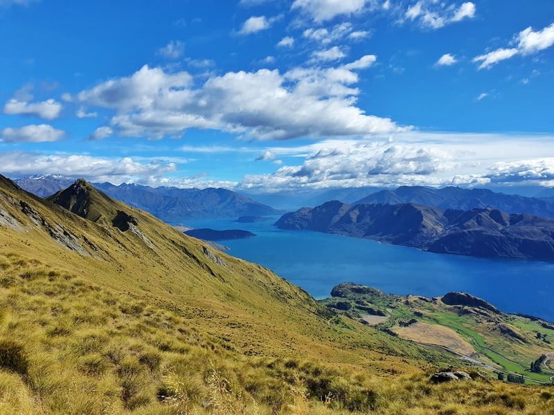
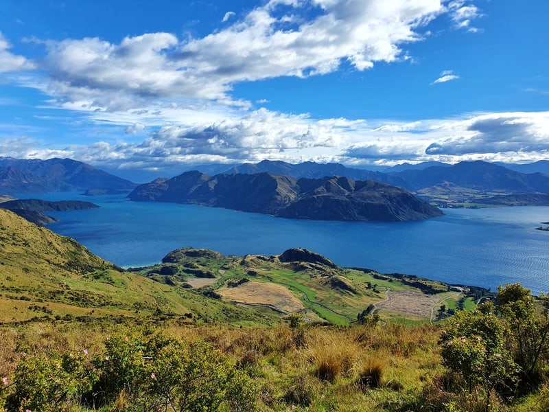
- Difficulty: Medium
- Distance: 15-16km return
Ah, Roys Peak. It’s one of, if not the most popular Instagram hikes in New Zealand.
But for those who have done lots of hikes and walks around Wanaka etc, it’s usually overrated.
But if you’re a sucker for FOMO, you’ll want to put this list of best walks in Wanaka to do…
The walk is primarily made up of switchbacks on a maintained track, there are some rockier sections and leads to the well-known Roys Peak viewpoint.
The viewpoint is legit good, and the views on the way up are awesome as you see all the sites around Lake Wanaka and Mount Aspiring National Park. But it’s very much same/same all the way up.
Not keen on standing in queue for the viewpoint? Make sure you keep walking to the summit of Roys Peak where you can get a similar photo 🙂
And then the return sees you walk back the way you came unless you’re going to follow the Skyline track (one of the underrated Wanaka walks) below.
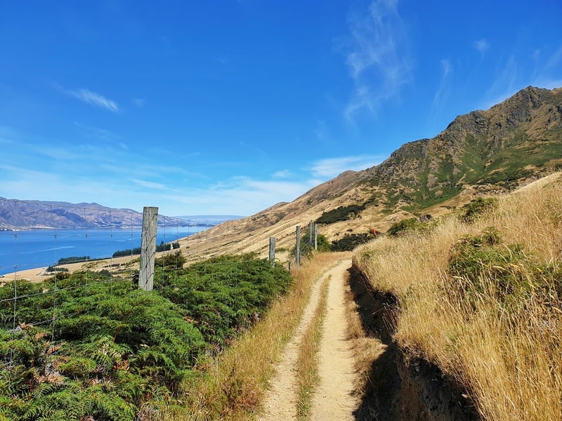
3. THE WANAKA SKYLINE TRACK
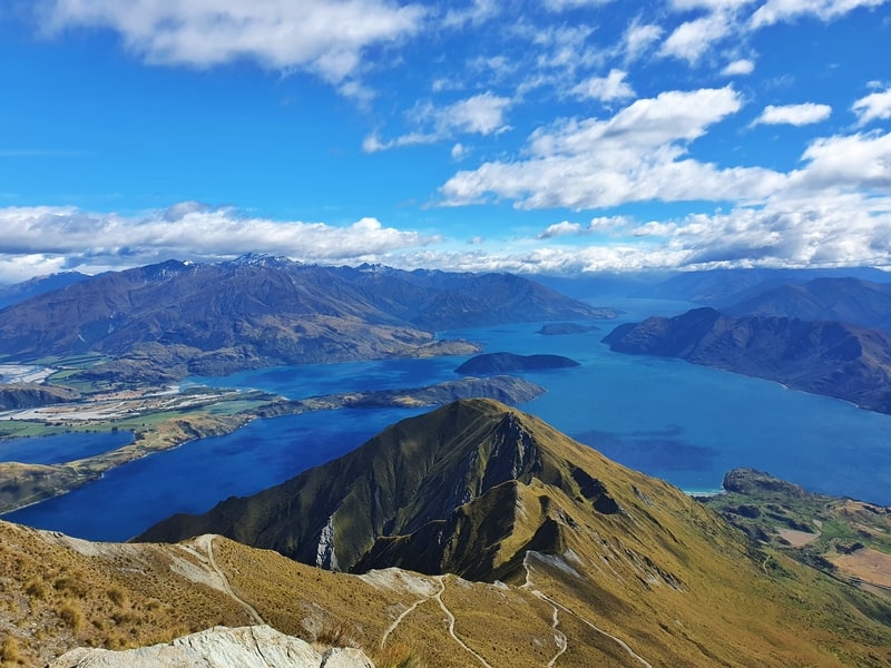
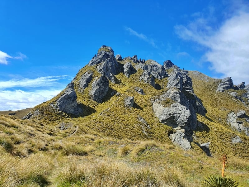
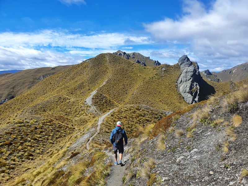
- Difficulty: Medium
- Distance: 23km
The Skyline Track is a longer end-to-end that makes for a great day out (ideally you’ll think about the transport in advance).
This was more popular than the Roys Peak Track out-and-back, back in the day!
It takes you up the same route as the Roys Peak Track which leads to the ridgeline you’ll follow for a few kilometres before standing the descent back down the other side.
The walk along the ridgeline is one of my favourite sections of walking tracks in Wanaka, with a couple of narrow spots. It is so worth carrying on beyond the famous viewpoint.
4. WATERFALL CREEK TRACK
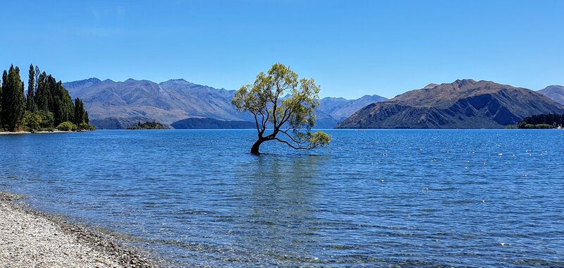
- Difficulty: Easy
- Distance: 2 – 20km
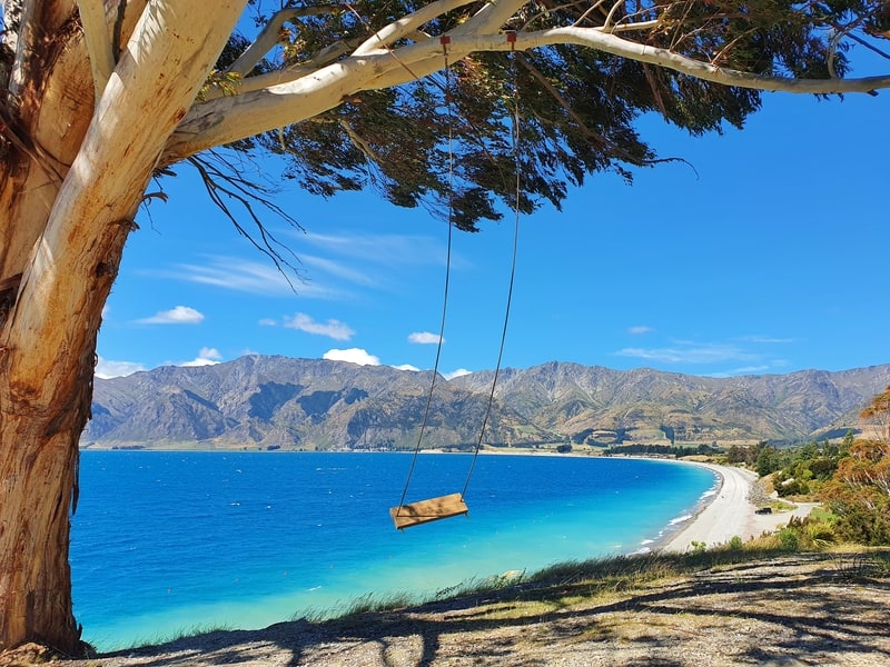
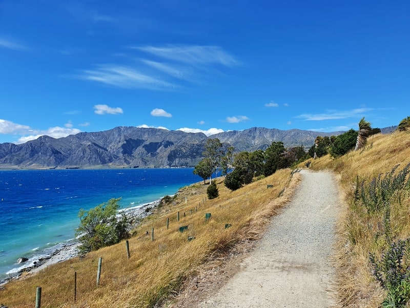
The Waterfall Creek Track basically starts from anywhere along the lake in front of the town and heads west (turn left facing the lake) for ages. It’s the best easy walk in Wanaka on the lakefront.
There are various sites you’ll see, most notably that Wanaka Tree.
The track isn’t entirely flat with some little rises along the way, and parts where it gets slightly more technical. But people on bikes have no trouble so you’ll be right.
You can even keep following the tracks to Glendhu Bay if you wanted! That’s going to be a very long return route so ideally someone would pick you up there (or you could hitchhike back).
If you’re after shorts walk in Wanaka, this is the one for you.
5. DIAMOND LAKE & ROCKY MOUNTAIN WALKS
- Difficulty: Easy – Medium
- Distance: 2 – 7.5km
Located in the Diamond Lake Conservation Area, there are a bunch of tracks you can combine here to go as little or as far as you want. If you can, make the effort to go all the way to the Rocky Mountain Summit as you get epic views over both Lake Wanaka and all of the surrounding mountains.
The Diamond Lake & Rocky Mountain walks pretty impressive! While it can feel busy, it’s not going to be as crowded as some of the other tracks in Wanaka.
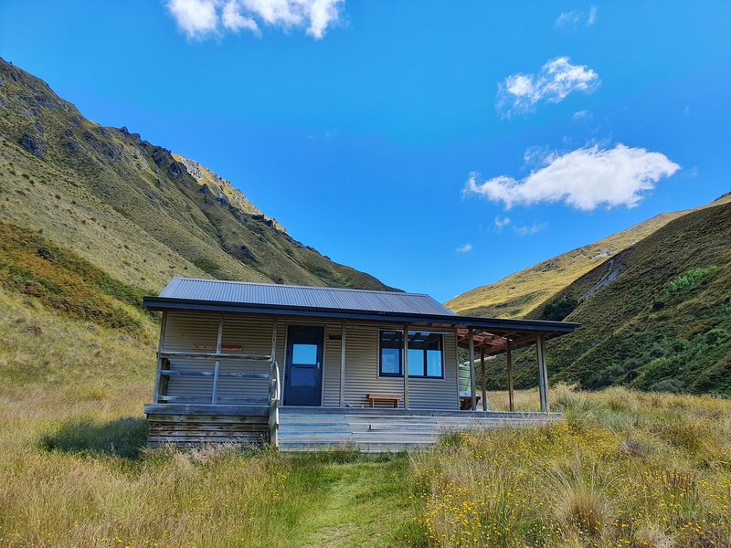
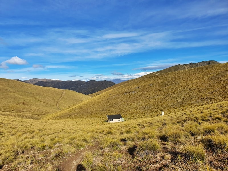
6. MOTATAPU TRACK TO FERN BURN HUT
- Difficulty: Easy – Medium
- Distance: 14km return
The Motatapu Track is a tough 3 to 4 day hike between Wanaka and Arrowtown. But if you’re looking for a day walk near Wanaka, the 14km return trip to Fern Burn Hut is a great option.
Starting near Glendhu Bay, you’ll cover a variety of terrain and while you’re going up to the hut, you don’t go over any of the steep technical terrain the Motatapu Track is known for.
Take a picnic to enjoy at the hut, and you can explore the hut if you’d like. This is also a great introduction to overnight hiking near Wanaka if that’s something that interests you.
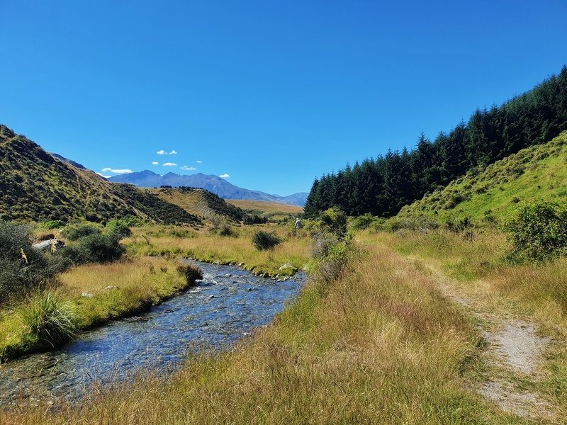
7. ROB ROY GLACIER TRACK
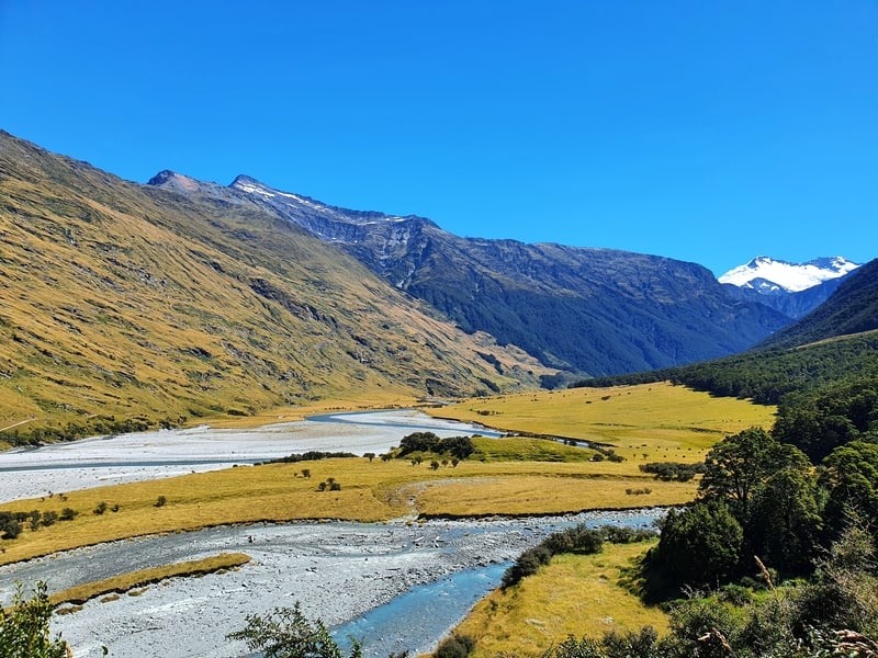
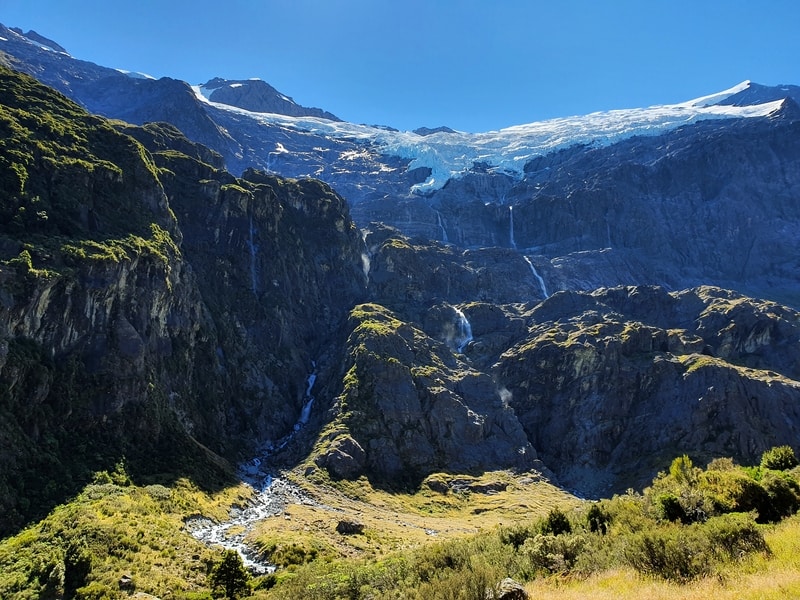
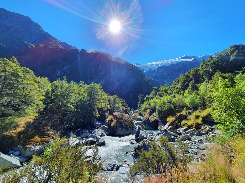
- Difficulty: Easy – medium
- Distance: 10 – 12km
If you’re looking for glacier walks in Wanaka, the Rob Roy Glacier Track is what you’re looking for.
It’s one of the most popular glacier hikes in NZ given it’s super easy to access yearround (weather permitting).
There’s some elevation to the track after you cross the bridge, but the track is well maintained (except for one river bed crossing section) so everyone can chip away at the track easily enough to the top.
The main viewpoint is quite far from the glacier, but you can continue off-trail to get a closer look if you want.
Personally I prefer the Earnslaw Burn Track for a close up view of a glacier, but the Rob Roy is popular for a reason. It’s short enough without being too technical.
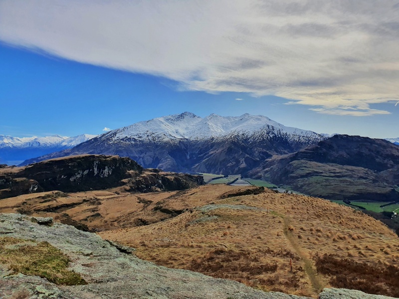
8. ISTHMUS PEAK TRACK
- Difficulty: Hard
- Distance: 15 – 16km return
Like most of these walks near Wanaka, Isthmus Peak is one of the awesome hikes around Lake Hawea. Isthmus Peak Track is a popular alternative to Roys Peak and for many (including me), the better hike.
The stats are similar in terms of length and height above the lake, but Isthmus is the tougher hike.
The best part is you get to see Lake Hawea on the way up which is beautiful. It’s not until you get to the summit when Lake Wanaka comes into view.
The biggest downside to this hike is it’s a little bit of a drive from the heart of Wanaka.
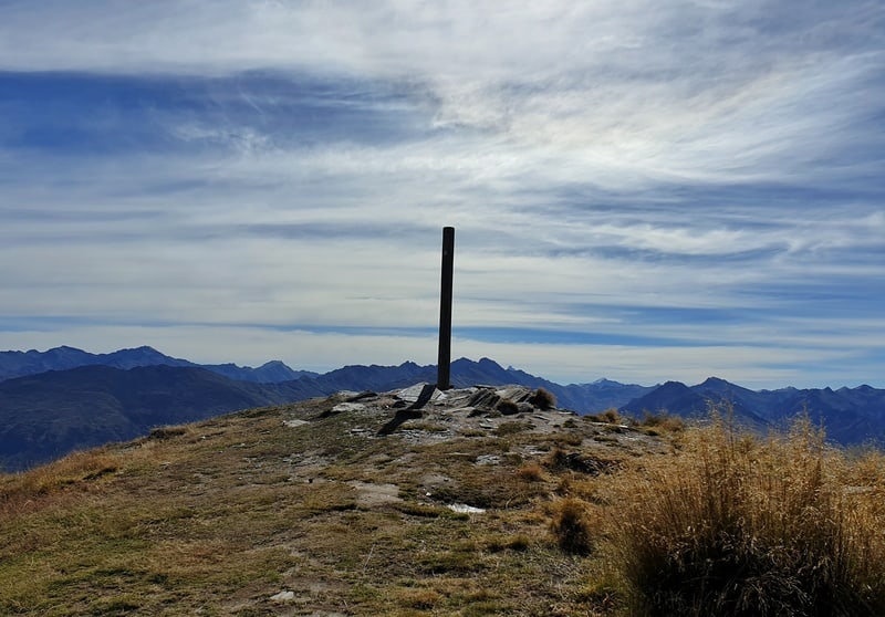
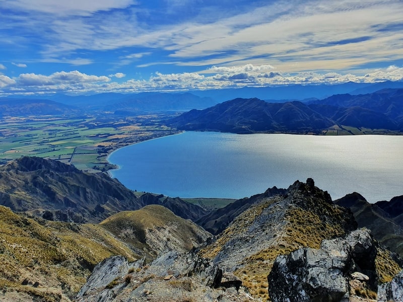
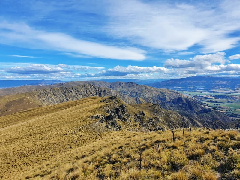
9. GRANDVIEW MOUNTAIN TRACK
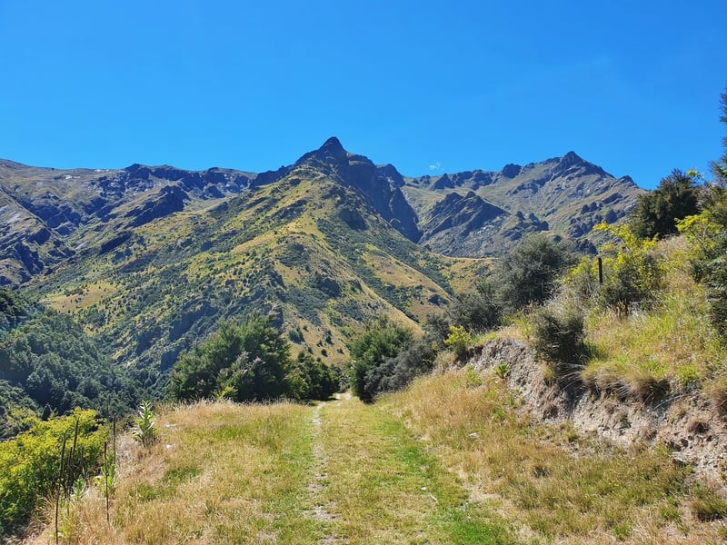
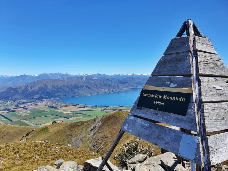
- Difficulty: Easy – medium
- Distance: 18km return
The Grandview Mountain Track is an absolute great walk that needs more love.
The start of the walk takes you through a valley, which is deceptive as it doesn’t feel super steep. But then you start the climb and you’ll be surrounded by a ridgeline and it looks like you could be going in any manner of direction.
The tracks easy to follow though and after taking in some viewpoints, you’ll see the trig at the summit. Your destination.
With great views of Lake Hawea and the land between there and Wanaka (you see Lake Wanaka too), this is another one of the hikes around Wanaka that should get more love. If only the competition wasn’t so strong.
10. BREAST HILL TRACK
- Difficulty: Medium
- Distance: 4 – 5.5 hours
If you’re not familiar with the concept of a vertical kilometre (VK), they’re considered to be 1000 metres of elevation in less than 5km of distance. A.k.a. steep.
And the hike up Breast Hill Track from Dingle Burn Road can be made into a VK.
So yea, you’re climbing pretty much straight away on this hike but it’s spectacular. It feels like you can almost swan dive into Lake Hawea. That might be a slight exaggeration :p
The terrain gets rugged at points, but the orange poles will keep you on track until you reach the ridgeline. There are various routes you can go from here, but follow the ridgeline left to get some epic viewpoints.
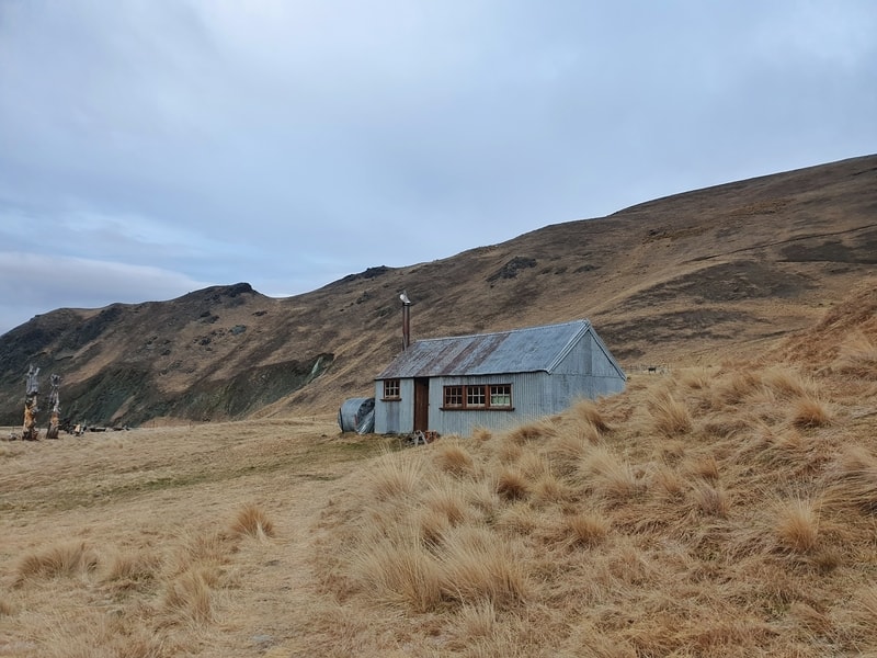
Or if it’s windy, you might be better off having lunch at the Pakituhi Hut. And yes, you can stay here overnight. The sun is beaming on the hut all day, even in the winter, so if there’s minimal snow, this is a great spot to stay in winter.
The hike back down is steep, so make sure you leave plenty of time to get back down.
11. GLADSTONE TRACK
- Difficulty: Easy
- Distance: 12 – 13km
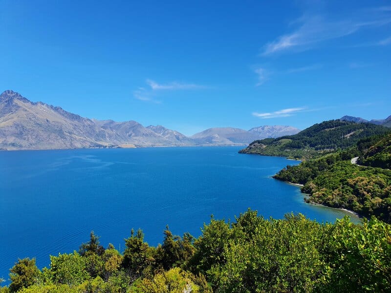
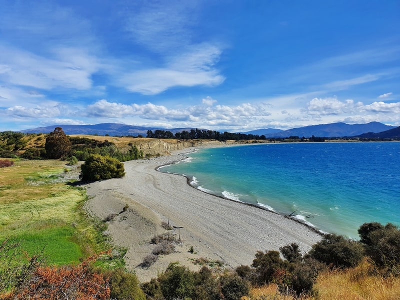
The Gladstone Track is one of the best short walks near Wanaka. The walk starts at the Hawea Dam, and follows the shoreline along Lake Hawea for 5km or so, making it another of the easier Wanaka day walks.
It’s a beautiful walk on a good day and you could easily drag this walk over a whole day if you stopped at the various beach fronts, playgrounds, maybe at the fish and chip shop.
The scenes are surprisingly varied for a shoreline walk. And as the pictures show, it’s totally beautiful!
12. MEG HUT TRACK
- Difficulty: Medium
- Distance: ~14km return
I wasn’t going to include the Meg Hut Track as it starts near Cardrona, but it’s closer to Wanaka than the Isthmus Peak Track so decided to include it.
This is a great walk up a 4WD through a valley taking you into the Pisa Conservation Area.
In the winter you might find yourself going above the snow level early on, but the track is easy to follow still. Once you get close to the hut there are a few different turns you can take to create a big day hike if you like.
On the way back down you get great views back down into Cardrona and across to the ski fields. Alternatviely, you could connect to the Rock Peak Track.
This is another hut where it’s possible to stay overnight, but if it’s a cold snap over the winter, avoid this hut!
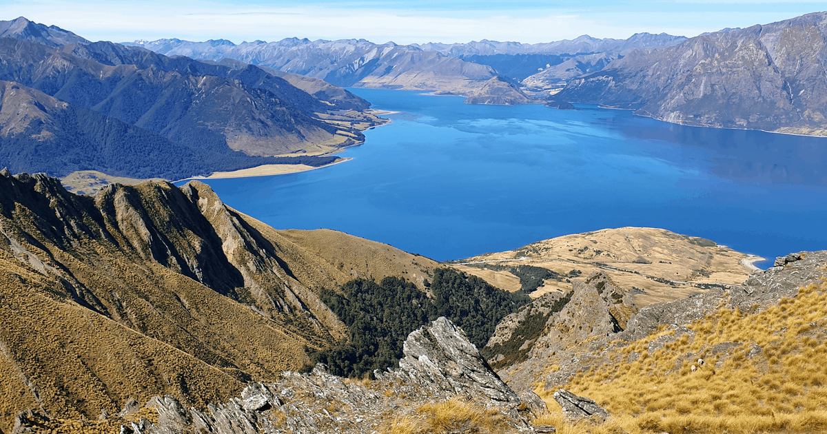
13. BLACK PEAK WANAKA


- Difficulty: Hard
- Distance: ~24km return
If you’re after an epic hike that’ll leave you craving a beer at the end of the day, the hike to Wanaka’s Black Peak is what you’re looking for. It’s ‘only’ 24km….less than the Routeburn which people do in a day, but it’s a lot more brutal. There’s no forest cover, and there’s 2000 metres of vert in there. BUT IT’S INCREDIBLE. The views are out of this world, and it’s so much great single trail goodness.
FAQ’S ABOUT WALKING & HIKING IN WANAKA
What is the High Country Walk Wanaka?
The High Country Walk is a guided walk that takes you off the beaten path. Operated by Ridgeline Wanaka, you’ll get to learn about life in Wanaka, and steps taken to protect vulnerable species/pest control in the region. This is expensive and certainly isn’t for everyone, but you can learn more about the offering
here.
Given the cost, I’d personally much rather do the other walks on this list. But if might suit you!
What are the best places to eat in Wanaka?
Wanaka has lots of great places for a feed post hike. If you’re after Mexican, head to the Burrito Craft (massive burritos).
Or Amigos is a great place for a group. That said, a pub meal and a beer at Speights Ale House never goes astray.
Looking for ice cream? Good luck deciding between Black Peak and Patagonia…you can’t go wrong with either.
And there’s a fair few craft breweries about town too.
If I don’t have access to a car, are there shuttles and things to the trails?
Yeap, there are hiking shuttles in Wanaka available, but hitchhiking is reasonably easy if you’re comfortable with that. I’ve written about a list of the hiking shuttles in NZ but here are the Wanaka-based options:
- Yello
- KT Taxis
- Wanaka Bike Tours & Hike
Are there some suitable winter hikes in Wanaka?
Yes! Mount Iron and Diamond Lake are usually good to go year round, there may be some ice at times to be aware of. Waterfall Creek at lake level is good to go too.
Roys Peak is often fine to hike in winter, but it’ll depend on the snow conditions so be sure to check in with the local DOC office to get the latest update.
Note: There’s often an annoying layer of inversion over in Wanaka throughout winter.
What are the dog-friendly walks in Wanaka?
Of the hikes mentioned in Wanaka, the best dog friendly walk in Wanaka is Mt Iron. It’s great for the location, terrain, and you’re not super close to the traffic.
BONUS: OTHER WALKS NEAR WANAKA
- 20+ walks in Queenstown
- Amazing walks in Arrowtown
- Have you thought about hiking in Glenorchy?
- Hiking Cromwell’s Mount Horn
- Overnighting at Liverpool Hut
- Hiking to Corner Peak
If you’ve got any questions about these Wanaka walks and hikes, drop a comment below or email jub@churnewzealand.com.
And if you’ve got any tips and tricks for others, they could appreciate a comment too 🙂
RELATED POSTS:

Hey, it’s Jub here. I’m the guy behind Chur New Zealand, helping you have the best time hiking, trekking, walking…whatever you want to call it…in NZ. I’m based in Queenstown and am always out and about exploring trails, old & new. If you have any questions, reach out.
Is the Rob Roy’s glacier hard to drive to? Because I’ve seen other sources say that you may need a 4wd
Hey India,
In the winter a 4WD is probably wise, but you can do it in a 2WD drive if you’re comfortable driving through fords. This would be only be realistic if there’s been no recent rain otherwise the fords won’t be practical to drive over in a 2WD