The Rock Peak Track is one of several sneaky good hikes in the Pisa Conservation Area.
There are several ways you can enjoy the Rock Peak Track starting from the Crown Range Summit carpark:
- And out and back to Rock Peak from the Crown Range Lookout (~7.8km return)
- A point-to-point day hike between the Crown Range Lookout (~22km)
- An overnight hike, staying at Meg Hut (~26km)
- Stay at Meg Hut then continue on via the Cardrona to Cromwell Pack Track or Roaring Meg Track.
DOC only talks about the first option on their website, but the other two make for fun hikes too. I’ll detail all three in this post.
TABLE OF CONTENTS
1. Details About Rock Peak Track Hikes
2. Rock Peak Track Map
3. How To Get To The Trailhead
4. My Rock Peak Track Experience
1. DETAILS ABOUT ROCK PEAK TRACK HIKES
How hard is the Rock Peak Track?
All three options aren’t easy, but you’re on a 4WD track pretty much the whole way so navigation isn’t hard.
In the winter the snow can make things difficult (I’ll talk about this further along). In the summer the lack of water sources and shade means you’ll definitely need to take plenty with you.
That said, they’re manageable, and while there are some short steeper sections, it’s all very walkable. I’ll give the Rock Peak walks an easy to medium difficulty.
How long is the Rock Peak Track?
While you can walk do a shorter out and back if you like (you’ll still get some great views), to get to Rock Peak is 7.8km return from the summit carpark. To get from the carpark to the Meg Hut track carpark (by the Snow Farm turnoff) is about 22km, and if you do go via Meg Hut you can add ~4km onto this.
How much elevation gain is on the Rock Peak Track?
The Crown Range Summit is 1,076 metres above sea level and Rock Peak is 1,490 metres above sea level.
There’s essentially no downhill sections on the way up to Rock Peak, making for 414 metres of elevation gain in just under 4km. That’s a steady climb.
For the full length from carpark to carpark there’s about 1,120 metres, and if you head down to Meg Hut, you can add on another 200 metres or so.
While you can walk the point-to-point hikes in either direction, starting from the carpark means you’ll have less uphill to walk overall so most people will start there (Cardrona, a great little spot, is about 500 metres above sea level).
How long does the Rock Peak Track take?
The hike to Rock Peak return will take 2-3 hours for most people (DOC suggests 90 minutes one way), but that’ll depend on how long you spend taking photos.
The hike over to Cardrona is going to take at least 4 hours, but don’t be surprised if you end up taking upwards of 7 hours. It’s hard to gauge though, I don’t know many people who have done this hike to ask.
Can you hike the Rock Peak Track in winter?
Yes, you can although there’s some avalanche risk in the area so it’s not going to be for everyone. I completed the track in mid-September and if you’re planning to do the full route would really recommend microspikes to make life easier.
In the middle of winter, you may want crampons. And as the track isn’t fully marked route finding can be tricky.
Are dogs allowed on the Rock Peak Track?
Yes, if you’re starting from the Crown Range Summit carpark, you can bring your dog on the track.
2. ROCK PEAK TRACK MAP
The map below is the GPX file from my Strava recording overlaid on a map from TopoMap.co.nz.
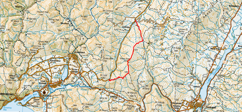
You can see the full track on this map, so I recommend downloading this topo map app. These are also a few other great hiking apps for NZ.
You can also see the full track on the Maps.me app.
3. HOW TO GET TO THE TRAILHEAD
The easiest way to get to the trailhead which is at the Crown Range Summit carpark is by car. It’s about a 35-minute drive from Queenstown and Wanaka or a 20-minute drive from Cardrona.
If you’re doing an out-and-back hike, this is the easy option.
If you’re doing the point-to-point walk, you’ll need to use the two-car system, or hitchhike between the two places. When we hitchhiked between the two, we left the car at the Cardrona end (this car park) and easily hitched back to the Crown Range summit end. NZ is a great country to hitchhike in.
Or you could use a service like Haula in Queenstown, or Yello in Wanaka if you’d like a private shuttle which is great for larger groups.
4. MY ROCK PEAK TRACK EXPERIENCE
The Rock Peak Track is amazing, and if you’re not in a rush to complete the journey between Queenstown an Wanaka.
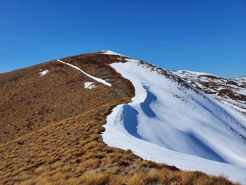
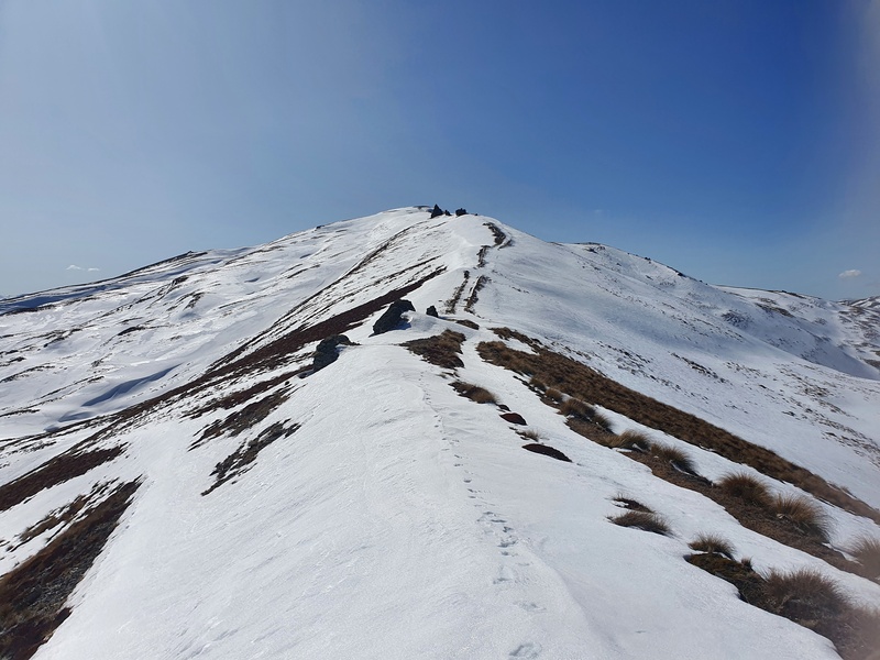
At the carpark you can see the track winding up the hill, but it’s not as bad as it looks in my opinion. The 4WD track can be rutted out in some sections but is in good condition overall.
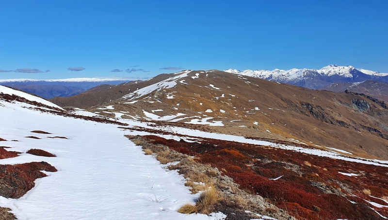
After a short while you’ll see the transmission towers on a peak in the distance, that’s where Rock Peak is!
The trail to get there is epic enjoy the views and good luck not trying to take all the photos.
Make sure you make the righthand turn to veer up to Rock Peak. Once you get up there, you’ll have panoramic views and it’s a great spot to picnic while you down towards Gibbston.
Now you can either head back the way you came, or it’s time to continue on to complete the traverse.
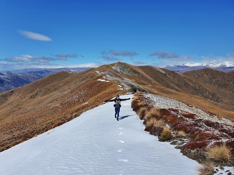
The next ~10km will see you going up and down as you follow one of the epic ridges of the Pisa Conservation Area. There’s a fair bit of time you spend on the ridgeline itself and but given you can’t see the Crown Range Road most of the time, you’ll feel like you’re in the middle of nowhere.
There’s not much in the way of DOC track poles on the route, but sticking to the 4WD track is easy enough for all, including those who a navigationally challenged like me.
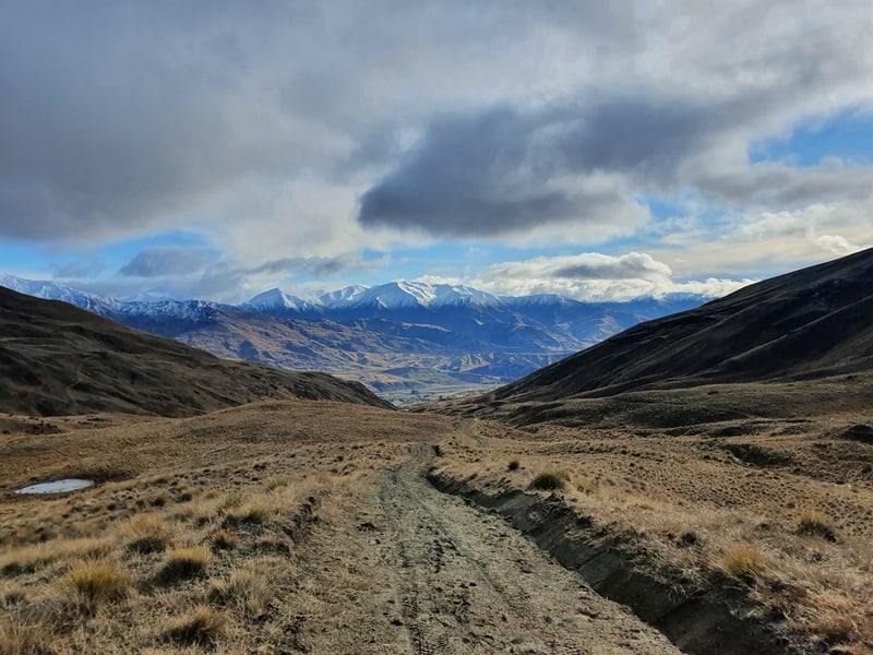
After you hit the 15km mark, the descent begins. It’s a steady descent for 7km back to the carpark. Again, you’re on a 4WD track so it’s not super annoying though your knees might not like you at the end of the day.
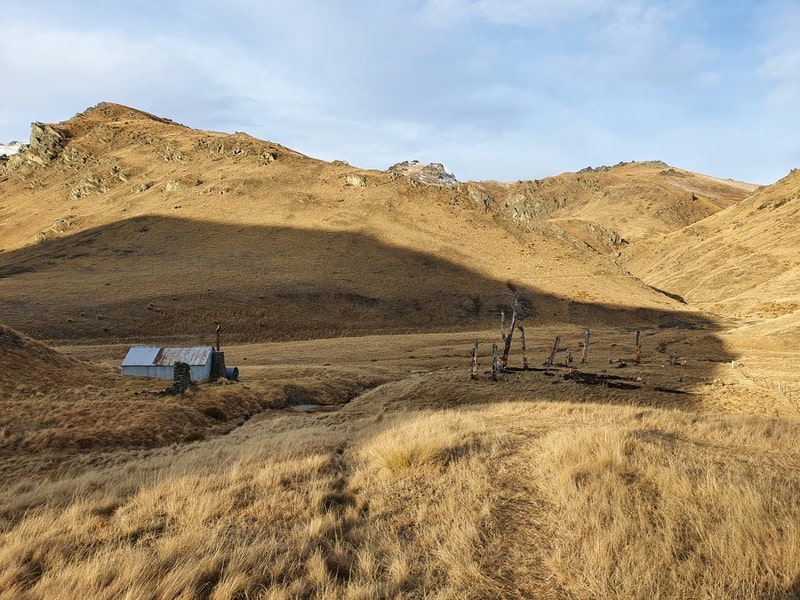
If you’re planning to stay/visit Meg Hut, you’ll take the right-hand path once you cross the fence 2km into the descent. It’s a cool little trip to Meg Hut which makes it either a great overnighter from Wanaka or overnighter from Queenstown.
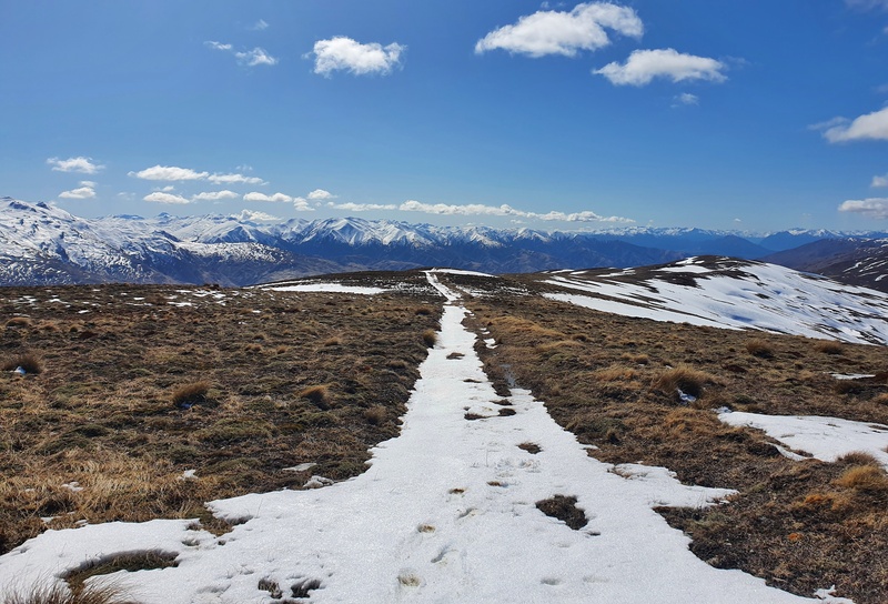
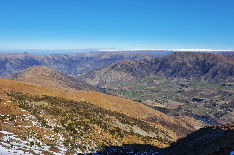
The rest of the descent will give you beautiful views down into the Cardrona Valley and across to the Cardrona Alpine Resort. It always amazes how much traffic you see going up and down the ski road in winter!
And then once you go through the field, where you’ll probably see cows, you’re essentially home and hosed. Time for a beer at the Cardrona Hotel?
The Rock Peak Track is an off the beaten path hike. But it’s beautiful and a place more people should see when they’re in the Otago region.
If you’ve got any questions and/or comments about the Rock Peak Track, leave a comment below or email jub@churnewzealand.com.

Hey, it’s Jub here. I’m the guy behind Chur New Zealand, helping you have the best time hiking, trekking, walking…whatever you want to call it…in NZ. I’m based in Queenstown and am always out and about exploring trails, old & new. If you have any questions, reach out.
Just walked to Rock Peak from Crown Saddle.Pretty tough walk when you are 70 but my wife wanted to get some photos in the snow.Incredible views.You won’t get views like these from a paved road
Hey Mark,
That’s awesome! I’m loving the tops with the bit of snow on the tops…definitely way better than paved road views. Stoked you’re still ging at 70.
Chur,
Jub