The Pisa Conservation Area is a beautiful area between the Crown Range Road and the Upper Clutha Basin. To the north, you’ve got Wanaka, and south there’s Gibbston.
It’s made up of 23,000 hectares, but as you can see in the map below, the Area is segmented in an interesting way. That’s because of the private land surrounding the area.
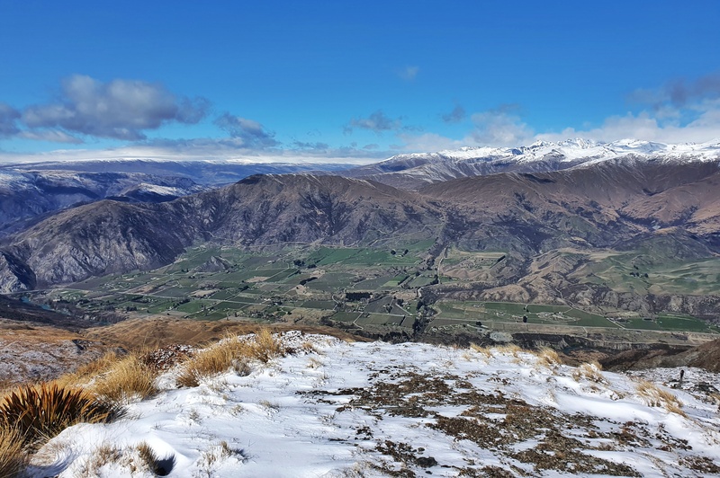
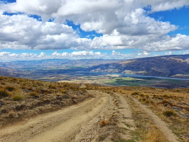
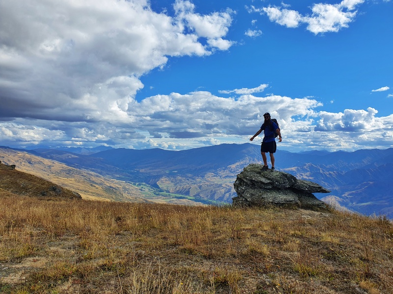
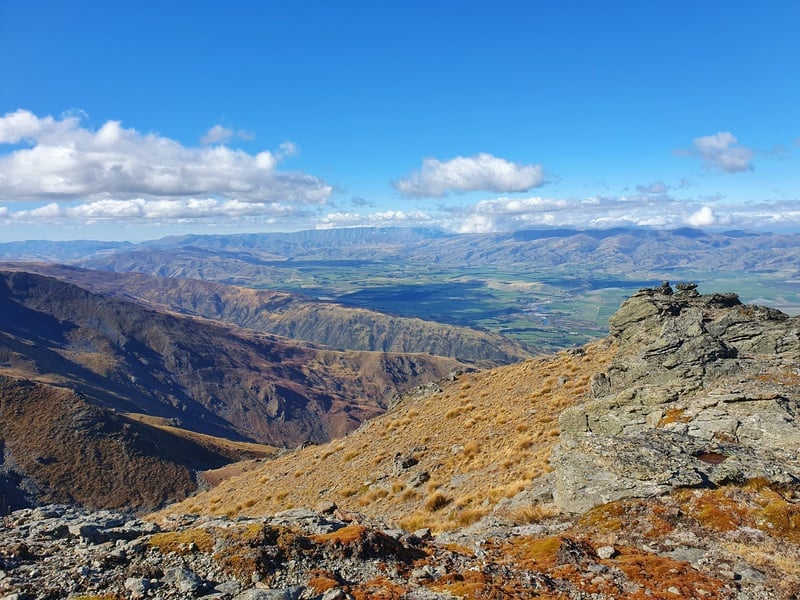
The Pisa Conservation Area is mostly high country and offers epic views in all directions from various points. You can see the Wakatipu Basin, Upper Clutha Basin, Wanaka, Cromwell, and several mountain ranges. Speaking of which, the main range in the Pisa Conservation Area in the Pisa Ranges with the highest point being Mount Pisa, 1963 metres above sea level.
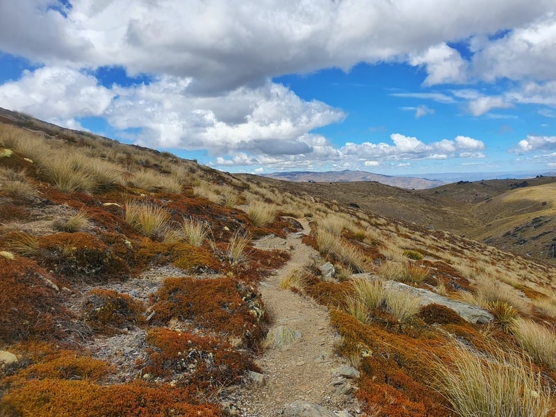
The most popular activity in the area is hiking, with plenty of day hikes and overnight hikes available. This post will cover different hikes you can do that take you into the Pisa Conservation Area, along with the huts you’ll find.
Note: For most hikes, you’ll need to cross some private land before entering the Pisa Conservation Area.
TABLES OF CONTENTS
TRACKS IN THE PISA CONSERVATION AREA
1. Meg Hut Track
2. Rock Peak Track
3. Cardrona-Cromwell Pack Track
4. Little Criffel Track
5. Mount Scott Hike
6. Roaring Meg Track
7. Tinwald Burn Ridge Track
HUTS IN THE PISA AREA
8. Meg Hut
9. Deep Creek Hut
10. Kirtle Burn Hut
FAQ’S
TRAILS IN THE PISA CONSERVATION AREA
1. MEG HUT TRACK
- Distance: 14km return
- Elevation Gain: ~920 metres total
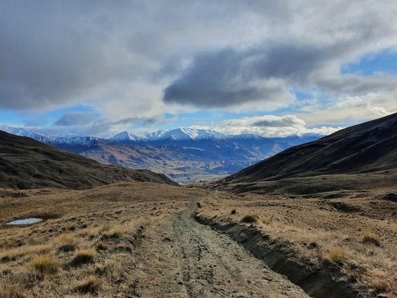
The Meg Hut Track. is probably the most popular hike in the Pisa Conservation Range. Probably due to a few factors…the distance, access, difficulty, and Meg Hut itself. It also enables you to carry onto the Roaring Meg Pack Track, Cardrona-Cromwell Pack Track and Rock Peak Track.
The hike follows a 4WD track most of the way which makes the steady climb manageable.
You can do this hike as an overnight hike from Queenstown or a good day hike. Make sure to stop off at the Cardrona Hotel for a beer afterward.
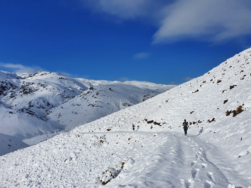
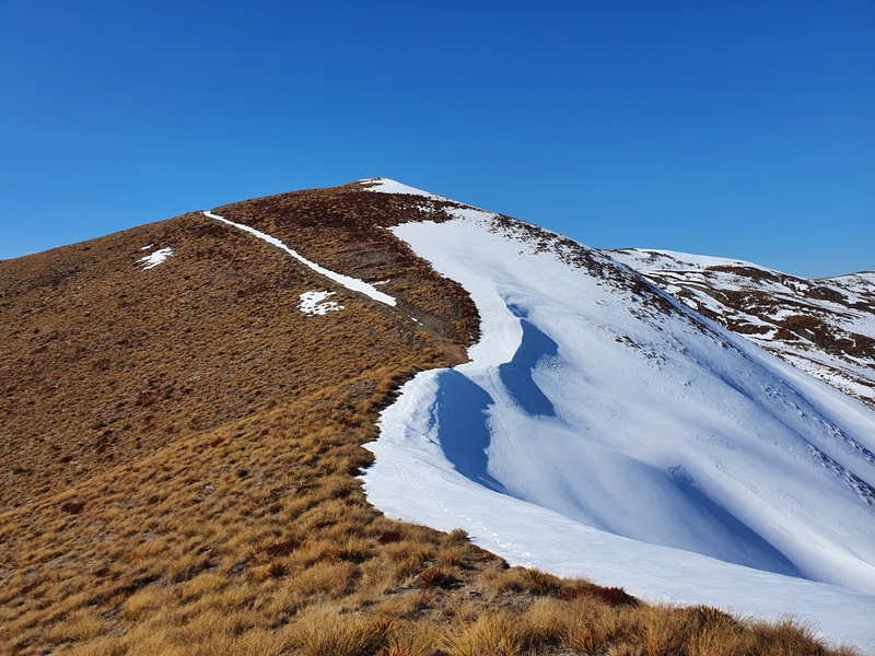
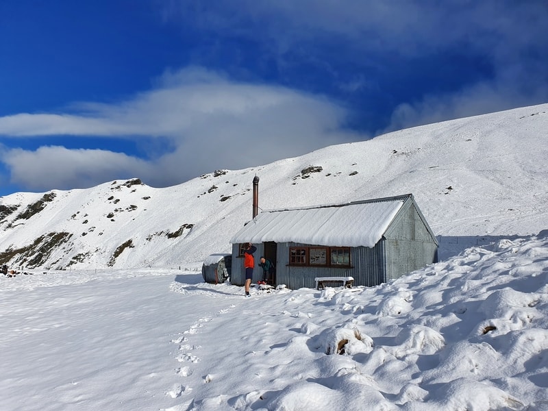
And if the idea of staying in a hut surrounded by snow is appealing, Meg Hut is a great option as you can see above.
2. ROCK PEAK TRACK
- Distance: ~22km
- Elevation Gain: ~1100 metres
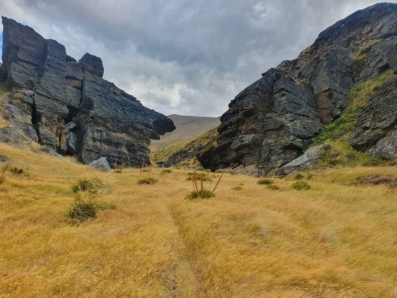
This Rock Peak Track is a point to point hike between the Tuohy’s Gully carpark and the carpark at the Crown Range summit.
From Tuohys Gully, you follow the same track that heads towards Meg Hut. Once you get to the junction, about 6km in, you head right…more climbing for you! But then you get to traverse a long a ridgeline which is super fun!
The track is pretty well signposted, but the Topo Map is always useful to keep you on track.
There’s no water along the ridge, so bring plenty with you. You get some epic views throughout though, so this is a fun adventure. And of course, you’ll pass Rock Peak which is a little detour towards the Crown Range summit end of the track. You can also do this as an out and back from the summit to Rock Peak return.
3. CARDRONA-CROMWELL PACK TRACK
- Distance: 24 to 25km
- Elevation Gain: 1300 to 1500 metres
Another point to point hike that starts on the route that to Meg Hut, you even go all the way to the hut.
But instead of turning back, you’ll continuing hike up towards Cromwell. Once you’ve don’t the steep hiking up you’ll being to go along ups and downs as you approach Deep Creek Hut. What a hut this is! And fi you stay here overnight, you’ll likely have it for yourself.
You can do the Cardrona Cromwell Pack Track hike as a day hike but if possible, stretching it out to one or two nights is a good idea.
4. LITTLE CRIFFEL TRACK
- Distance: 17.5 to 19km
- Elevation Gain: 1100 metres
The Little Criffel Track takes you along a section of the Criffel Range and can’t be joined up with other hikes in the Pisa Conservatin Area. You’ll need to cross the Cardrona River which can get flooded fast. Save this hike for a sunny day.
It’s a simple way to describe this hike. You go up, then across, then down. There’s about 4km between the start and finish of the track which you walk also, following the road, or just use the 2 car system to swap, or hitchhike which should be easy enough.
5. MOUNT SCOTT HIKE
- Distance: 3km
- Elevation Gain: 400 metres
If you enjoy a little of trail hiking, then stop off at the Crown Range summit carpark and cross the road and grind up to Mount Scott. Some people say there’s a faint trail to the summit, but I’ve yet to come across is so can’t verify.
This isn’t a hike for beginners despite the short distance, as most of it is off trail.
6. ROARING MEG PACK TRACK
- Distance: 18km
- Elevation Gain: ~1150 metres
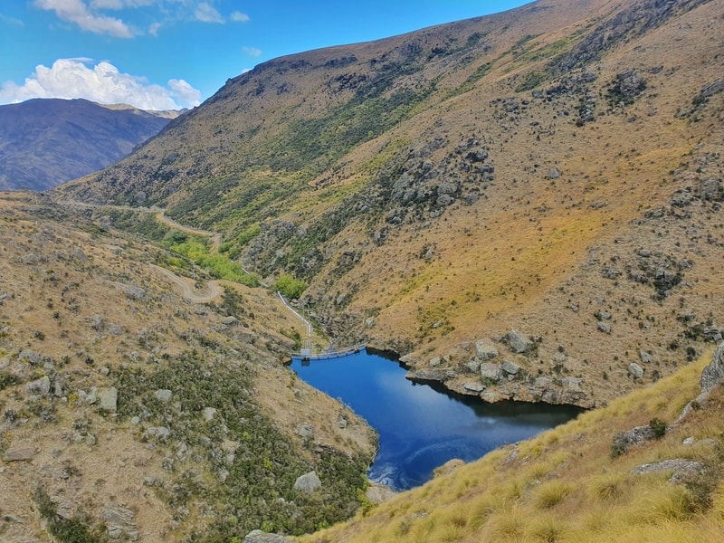
The Roaring Meg Pack Track is a fun 18km point to point hike passing by the impressive Roaring Meg Dam (and starts at the lookout).
The track has a mix of 4WD roads and single tracks as you hike through the Pisa Conservation Area. Following the Roaring Meg for a lot of the hike, it’s easy to see where the trail got its name from. This is a sneaky beautiful hike…I’d love to camp out here during a full moon!
7. TINWALD BURN RIDGE TRACK
- Distance: ~25km
- Elevation Gain: ~1850 metres
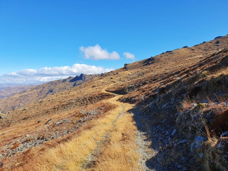
The Tinwald Burn Ridge Track is a grunt! Starting on the Cromwell side of the ranges, the journey takes you 12.5km all the way to the summit of Mt Pisa (1963 metres high). You’re following a 4WD track the whole way which means it’s not a technical terrain, and for some people getting that high might be the highest you’ve been in NZ which is fun.
The views are pretty awesome the whole way, and honestly, this reminds me of a tougher challenge of Roys Peak hike. It’s up a pretty straightforward track…and while you won’t get quite the awesome views, you’ll probably see no one else out on the trails which is fun.
HUTS IN THE PISA CONSERVATION AREA
8. MEG HUT
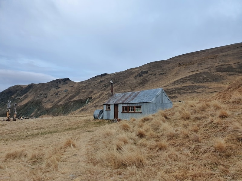
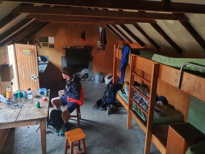
This is one of my favourite huts to stay in close to Queenstown as it’s easy to reach. There are times where you’ll end up with all 8 beds at the hut being full, which makes for a cozy night if the fires cranking.
Fees
- Adult (18+): $5 per night
- Youth (11–17): $2.50 per night
- Child/Infant): free
9. DEEP CREEK HUT
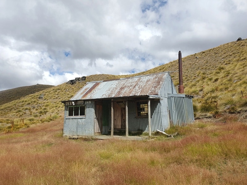
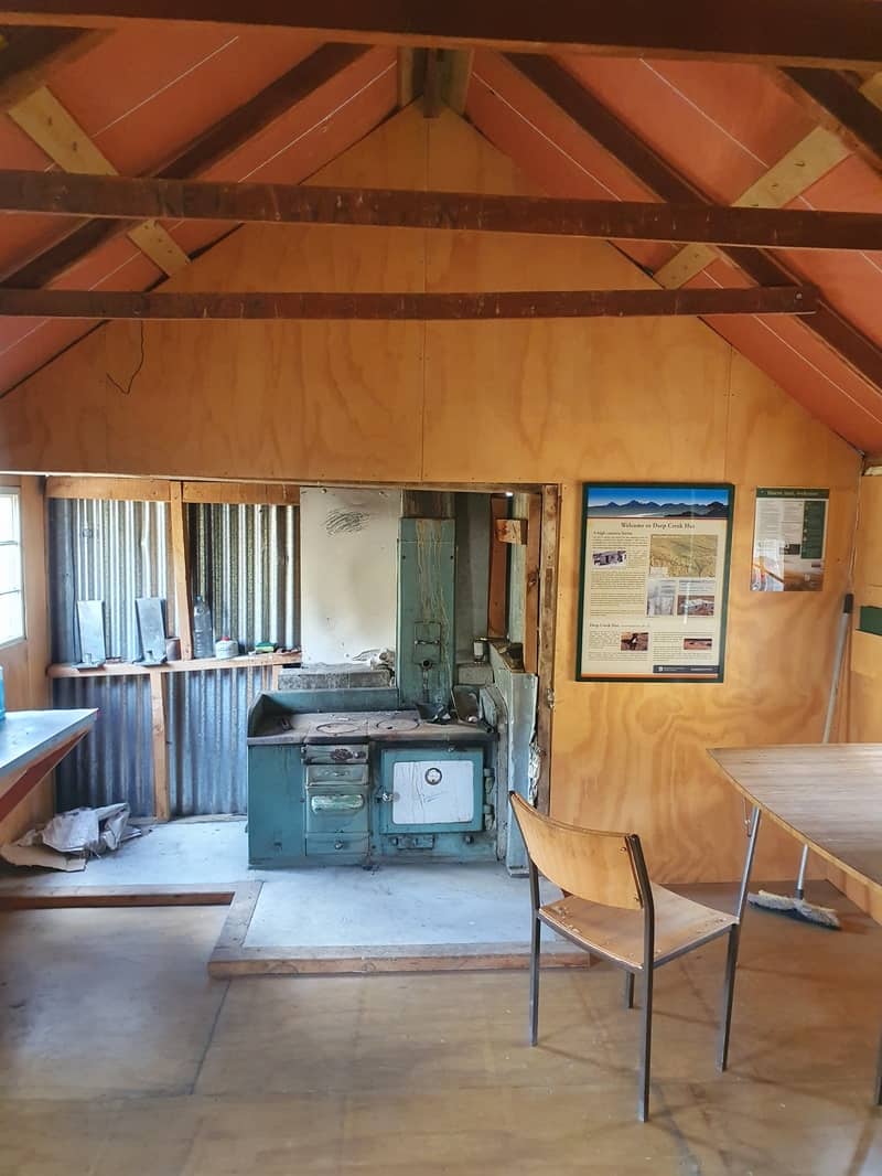
You’ll find the 6 bunk Deep Creek Hut on the Cardrona-Cromwell Pack Track. Alternatively you can do an in and out hike from the Swann Road carpark at one end of the Pack Track. This hut is often talked about by locals, but not many people end up staying there based on the hut book entries. I’m not exactly sure why?
There’s some cool history to this hut which is told on an information board in the hut.
Cost to stay here? It’s free!
10. KIRTLE BURN HUT
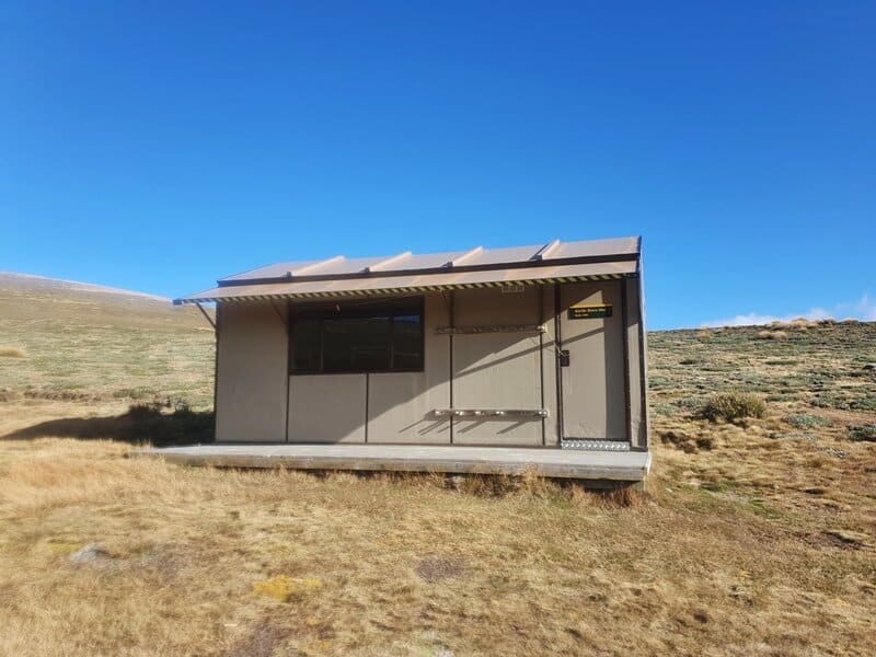
Kirtle Burn Hut is located a few kilometers beyond the borders of Snow Farm making it a popular hut for people to snow shoe and/or ski tour to during the winter.
In the summer, you can either hike or mountain bike to the hut. The most popular route people take to reach Kirtle Burn Hut starts from Snow Farm, but you could go via any number of tracks in the Pisa ranges (such as starting from the Tinwald Burn Ridge Track).
The hut is pretty simple, and honestly, my least favourite of the huts in the Pisa Ranges.
Fees
- Adult (18+): $5 per night
- Youth (11–17): $2.50 per night
- Child/Infant): free
FREQUENTLY ASKED QUESTIONS
Are dogs allowed in the Pisa Conservation Area?
You can take dogs into the Southern Block, but you can only enter/exit via the Crown Range summit carpark as the other options cross private land.
Can you hike here in winter?
You can, but it’s not always suitable and there is avalanche risk. Talk to DOC before heading into the Pisa ranges for the latest information. Other useful sources could include the Snow Farm website.
Are you allowed to go snow touring?
You sure can and it’s one of the best ski touring places in NZ apparently. This site has some information that look great.
What animals may I see?
I’ve only seen sheep, alpacas, cows and red deer. But apparently you might also see Chamoix, goats, and pigs.
And there we go!
If you’re driving between Queenstown and Wanaka, you’ll likely be crossing over the Crown Range. rather than beeline straight through the road, why not spend some time hiking in the Pisa Conservation Area. You won’t regret it!
If you have any questions about the Pisa Conservation Area, email me jub@churnewzealand.com.

Hey, it’s Jub here. I’m the guy behind Chur New Zealand, helping you have the best time hiking, trekking, walking…whatever you want to call it…in NZ. I’m based in Queenstown and am always out and about exploring trails, old & new. If you have any questions, reach out.