The Tinwald Burn Ridge Track is a steady hike up a 4WD track on the eastern side of the Pisa Conservation Area.
The track is ~12.3km each way to the summit of Mount Pisa, the highest peak in the Pisa Ranges.
This post will give you all the details you need to know about hiking the Tinwald Burn Ridge Track.
TABLE OF CONTENTS
1. Tinwald Burn Ridge Track Details
2. Tinwald Burn Track Map
3. How To Get To The Trailhead
4. My Tinwald Burn Ridge Track Experience
1. DETAILS ABOUT TINWALD BURN RIDGE TRACK
How hard is the Tinwald Burn Ridge Track?
It’s a steady track more or less than the whole way and on a 4WD trail. That means there’s no navigation required on the way. But 1700 metres of consistent elevation is going to take its toll. I’ll go with medium difficulty.
How long is the Tinwald Burn Ridge Track?
The DOC website says it’s 25km return. My watch came in at 12.3km one way, which gets to 24.6km so expect 25km or so of hiking.
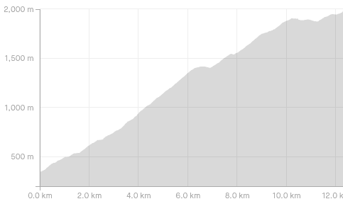
What is the Tinwald Burn Ridge Track elevation gain?
The total elevation gain from the trailhead to the summit is about 1700 metres. On the way down there’s a little under 100 metres of gain, for a total of ~1800 metres of elevation gain.
Here’s the elevation profile:
How long does the hike take?
DOC says about 10 hours. I’d be surprised if it took people longer than 10 hours. That said, if you’re not used to elevation, it could easily end up being 7 to 9 hours. If you’re doing the return hike in under 5 hours, you’re a machine.
How high is Mount Pisa?
The summit of Mt Pisa is 1,963 metres (6,440 feet) above sea level.
Is this hike dangerous?
While I’d say no, things could go wrong if you’re not responsible.
- There are essentially no water sources on the way. Bring plenty with you!
- In the winter, you’ll probably need microspikes at a minimum but may well need crampons and ice aze and the necessary skills.
- This track is exposed and at 1963 metres, the conditions at the summit can be a lot different to what it’s like at the trailhead, so pack well.
2. TINWALD BURN TRACK MAP
* Clicking the image below will open the map in a new window where you can scroll in/out/around to get better bearings.
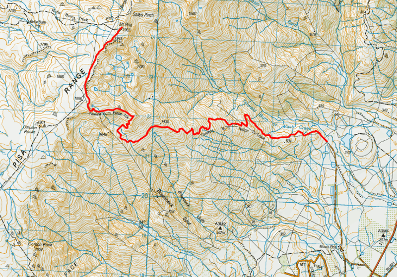
You can find the track on Maps.me and the best topo map app which you should download. It’s not on Google Maps.
3. HOW TO GET TO THE TRAILHEAD
The most realistic way to get to the Tinwald Burn Ridge Track carpark (above) trailhead is via car (4WD is the best option).
The turnoff to take on the road between Cromwell and Wanaka is Mount Pisa Road. After a few hundred metres on Mount Pisa Road, take the right-hand turn into Mount Pisa Station (this is a gravel road). You got a few kilometres to travel now…it’s easy, just follow the orange triangles and the green/yellow DOC signs.
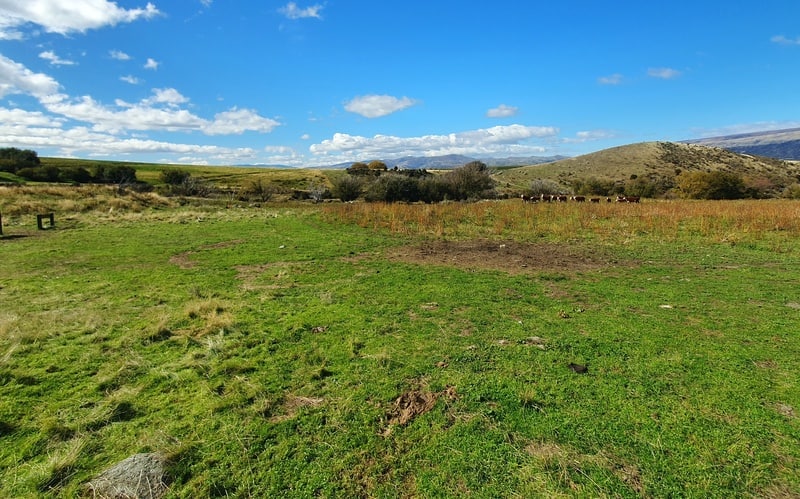
The carpark is a green field, there won’t be any shortage of space to park!
Notes:
- You may need to open a couple of gates on the way.
- You’ll not follow the road that goes through Mt Pisa Station that you can see on topo maps (here’s the route on a map).
While I hitched to the Mount Pisa Road turnoff and walked to the trailhead from there, that’s not for everyone!
4. MY TINWALD BURN RIDGE TRACK EXPERIENCE
After a long walk to the trailhead which passes cherry orchards…and is beautiful all the same. As I approached the carpark a herd of cows was there to greet me. They ran away as did the next herd a couple of hundred metres into the hike.
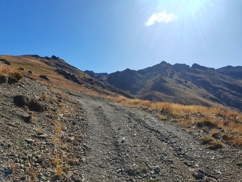
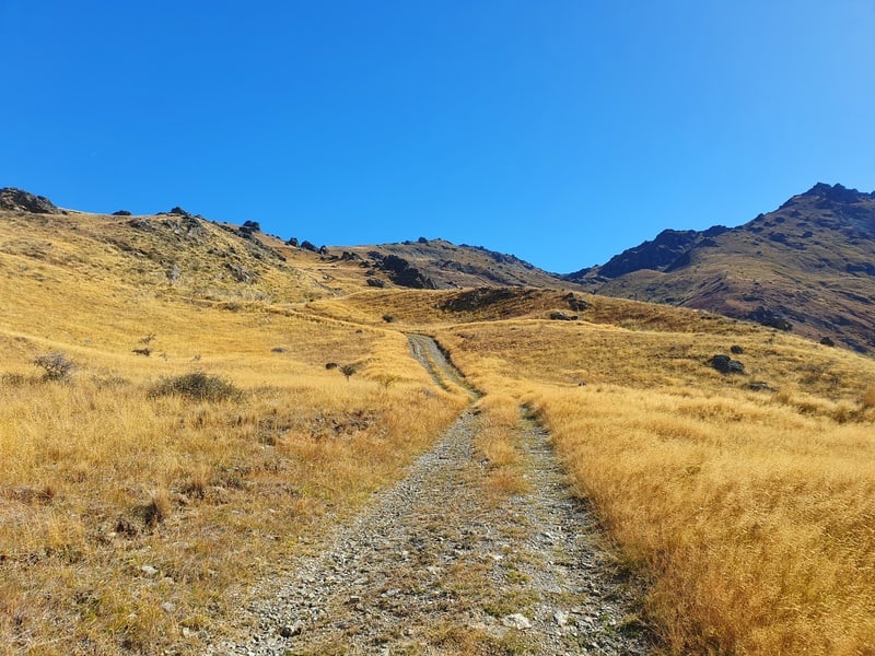
You get straight onto the 4WD track after going over the stile by the carpark. You can see the ridgeline you’re aiming for from the get-go, but it looks way different once you get there.
There’s not much to say about the hike as you hike up the spur, though in hindsight I never noticed Tinwald Burn which is a bit silly.
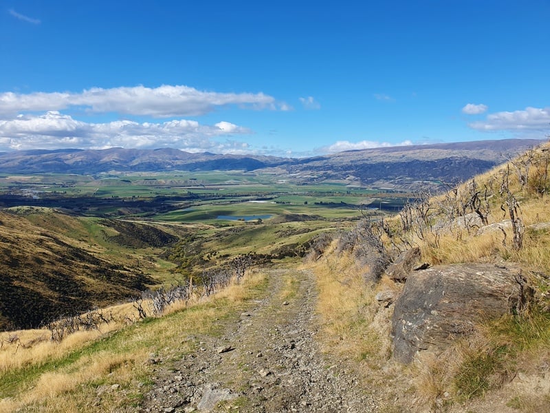
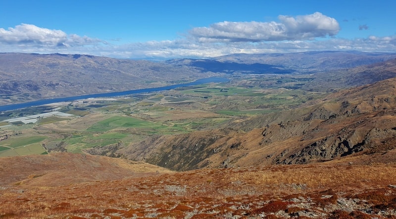
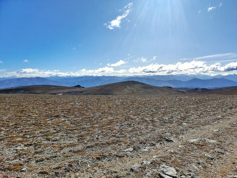
You’ll get some awesome views behind you over the Upper Clutha Basin, they get better and better the higher you get.
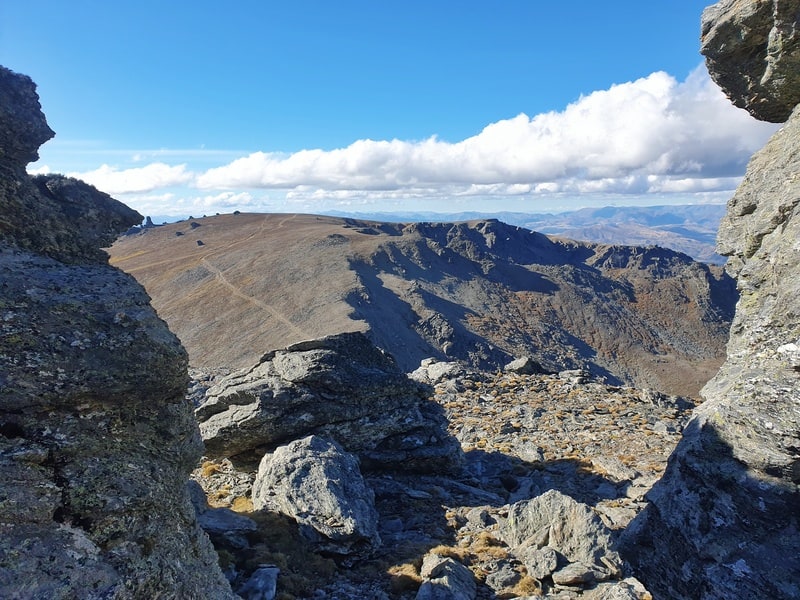
The track winds up the spur, and I do like the rocks jutting out along the way, something you’ll see on other nearby hikes like the Cardrona to Cromwell Pack Track and Mount Horn.
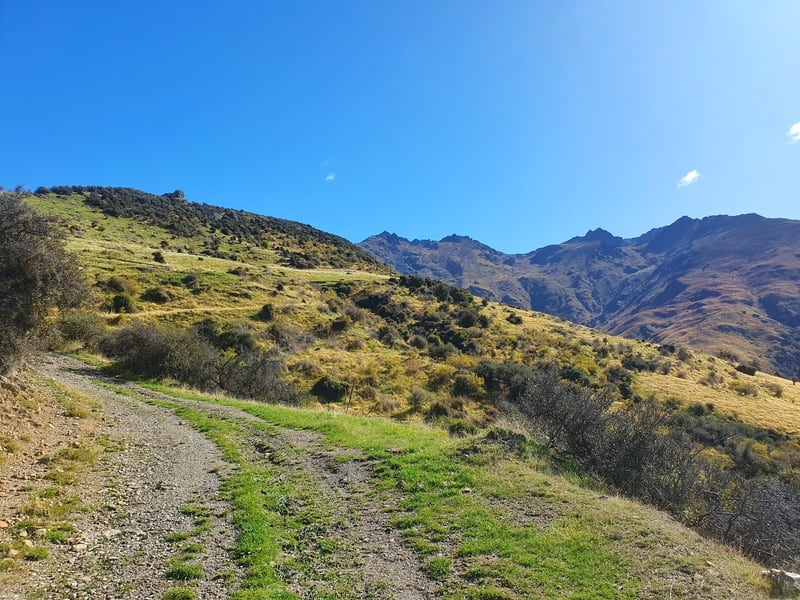
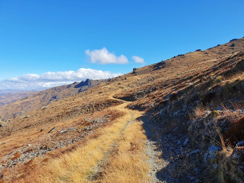
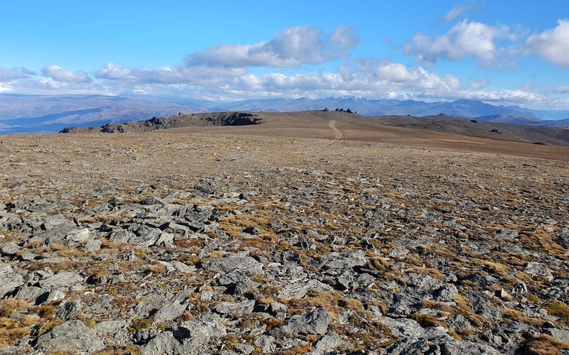
As you get higher up there are some flatter sections. The 7th kilometre sees you traverse across the hill a bit before you start going up again.
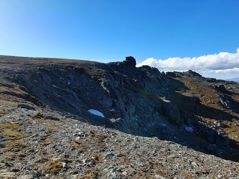
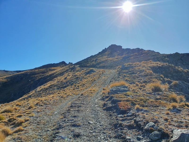
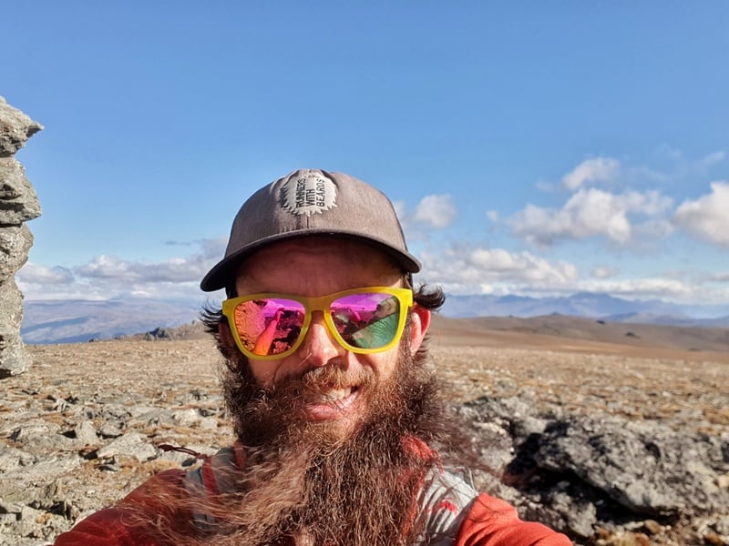
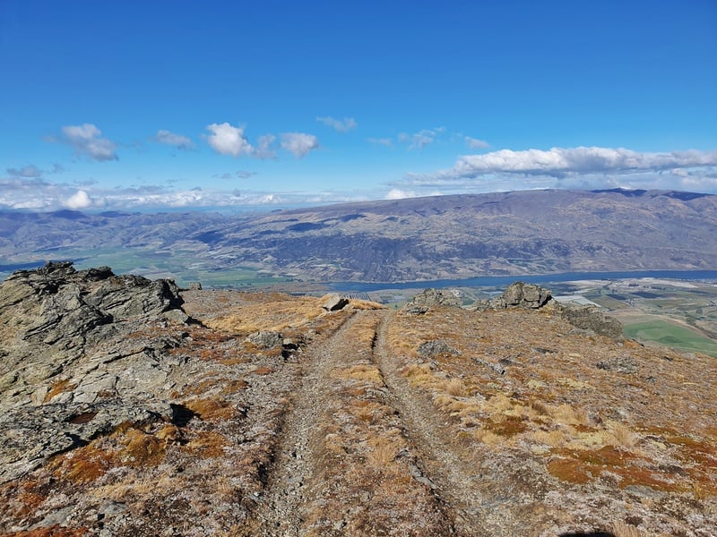
You’ll see a cool bluff as you approach the top of the Pisa Range, and after 10km you’ll reach the top of it. You’ve still got a couple of kilometres to go, but it’s crazy how different it is on the tops with its gently rolling hills.
You’re still on a 4WD track right until the summit which you’ll know is there when you reach this group of rocks:
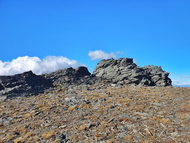
It’s a pretty cool spot, and surprisingly cold and windy while I was up there. That was after minimal wind on the way up the spur.
You could continue on in any direction if you were doing a point-to-point hike. But most people will return the way you came.
The descent is straightforward, but your quads won’t be loving you as you descend a steady 1700 metres back down to the trailhead. You get some great views on the way down though.
The Tinwald Burn Ridge Track is something different, and you’ll likely be the only person on the trail while you’re there. Yet it takes you to the summit of Mount Pisa which is fun, and the tops are pretty cool in how flat they are.
If you have any questions/comments about the Tinwald Burn Ridge Track, leave a comment below or email jub@churnewzealand.com.

Hey, it’s Jub here. I’m the guy behind Chur New Zealand, helping you have the best time hiking, trekking, walking…whatever you want to call it…in NZ. I’m based in Queenstown and am always out and about exploring trails, old & new. If you have any questions, reach out.