The Cardrona-Cromwell Pack Track is a 25km track that takes you up and over the Pisa Range, starting close to Cardrona and finishing in Lowburn, close to Cromwell (or vice-versa).
This post will give you everything you need to know about this hike that can be done as a day hike or an overnight hike with two huts passed on the way.
Note: The section between Deep Creek Hut and Lowburn can be confusing. Make sure to double check the directions so you avoid Lowburn Station.
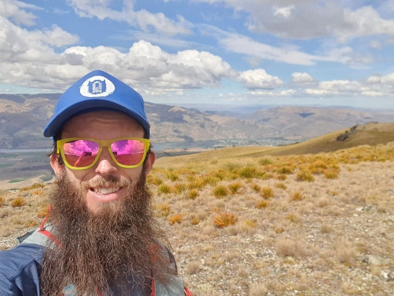
Note: I went from the Cardrona to Cromwell direction, so I’ll be talking about the track in that direction.
TABLE OF CONTENTS
1. Cardrona-Cromwell Pack Track Details
2. Cardrona-Cromwell Pack Track Map
3. How To Get There
4. The Cardrona-Cromwell Pack Track Experience
1. CARDRONA-CROMWELL PACK TRACK DETAILS
What distance is the Cardrona-Cromwell Pack Track?
The official distance is 25km according to DOC, but my GPX file came in at 24km which isn’t too far off.
Approximate distances:
- From Tuohy’s Gully to Meg Hut: 7km
- Meg Hut to Deep Creek Hut: 8km
- Deep Creek Hut to Swann Road Carpark: 10km
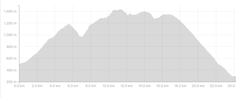
How much elevation gain is there on the track?
It’s a relatively small difference, but do note that the Cardrona end is slightly higher than the Cardrona end so if you want a net downhill you’ll want to go from Cardrona to Cromwell.
The elevation gain is ~1300 metres with 1500 metres of descent. Here’s the elevation profile:
How long does the Cardrona-Cromwell Pack Track take?
In theory you can walk the full 24-25km between 9 and 12 hours. If you’ve got a heavy pack, it’s going to take most of the day to get the hike done.
That said, if you break it up over two or three days, you can be hiking just a few hours each day which would be nice.
How hard is the Cardrona-Cromwell Pack Track?
If you’re planning to do the hike in a day, it’s a medium to hard hike given the distance, elevation, and trickier section in the middle where the trail can be overgrown (I’ll detail that further below).
As an overnight hike or even a 3-day hike, it’s about medium as the distances between the huts aren’t crazy.
What’s the better hut of the two?
I love Meg Hut and will always tell anyone who wants to go, go. But if you like having a hut to yourself if possible, Deep Creek Hut is a lot more likely to be vacant.
Is this a good hike to do in winter?
Not really due to avalanche risk. Mountaineering knowledge may be necessary. That said, you can usually get to Meg Hut okay even in the snow which can be a fun winter adventure.
2. CARDRONA-CROMWELL PACK TRACK MAP
The map below is the GPX file (which you can download here) and will open in a new window if you click the image.
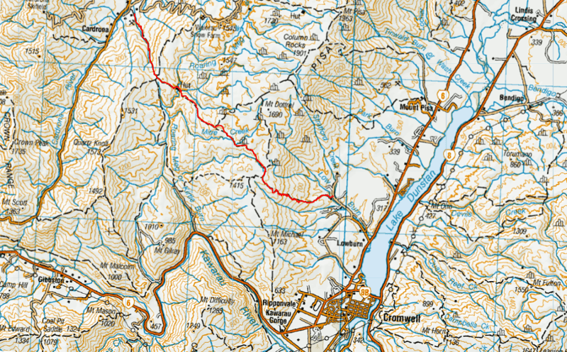
You won’t find this track on Google Maps or Maps.me so having a good topo map app is best.
3. HOW TO GET THERE
The easiest way to get to the start of the trail is by car, that’s to either end.
Lowburn Carpark
The Lowburn end carpark wasn’t super clear, but I believe I got it right by finishing here. It’s not a carpark per se, but there’s space to park on the side of the road. It’s about a 10 minute drive from Cromwell. Having the GPX file downloaded will help you make sure you’re in the right place.
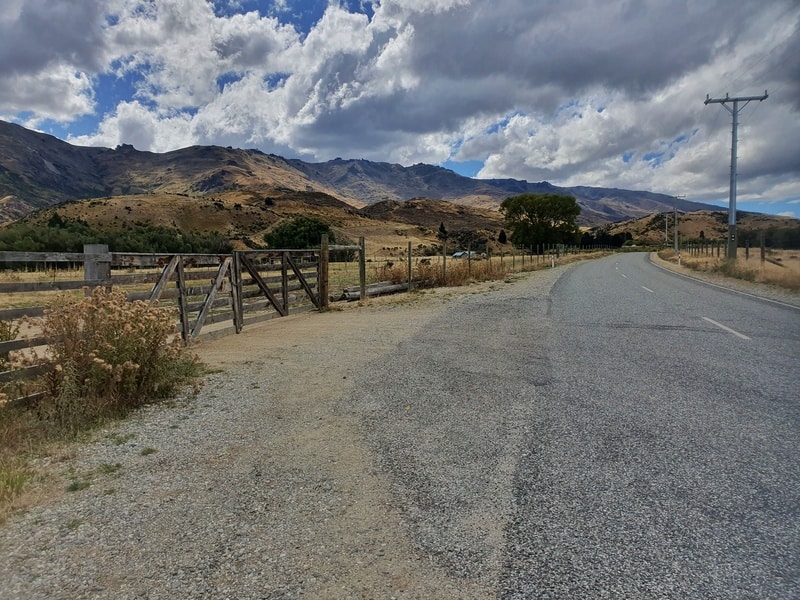
The Tuohys Gully carpark is just outside of Cardrona village. You turn into the road leading up to Snow Farm, but go right at the first junction following the farm road. You’ll pass through a couple of gates before you get to the carpark.
The Tuohys Gully carpark is easy enough to hitchhike to, but the Lowburn Road gets minimal traffic so if you hitchhike to that turn off you’ll still need to walk 3km or so to the start of the track.
As this is a point-to-point hike, you’ll need to work out logistics, ideally with another car parked at the other end where you can then do a key swap, etc.
4. THE CARDRONA-CROMWELL PACK TRACK EXPERIENCE
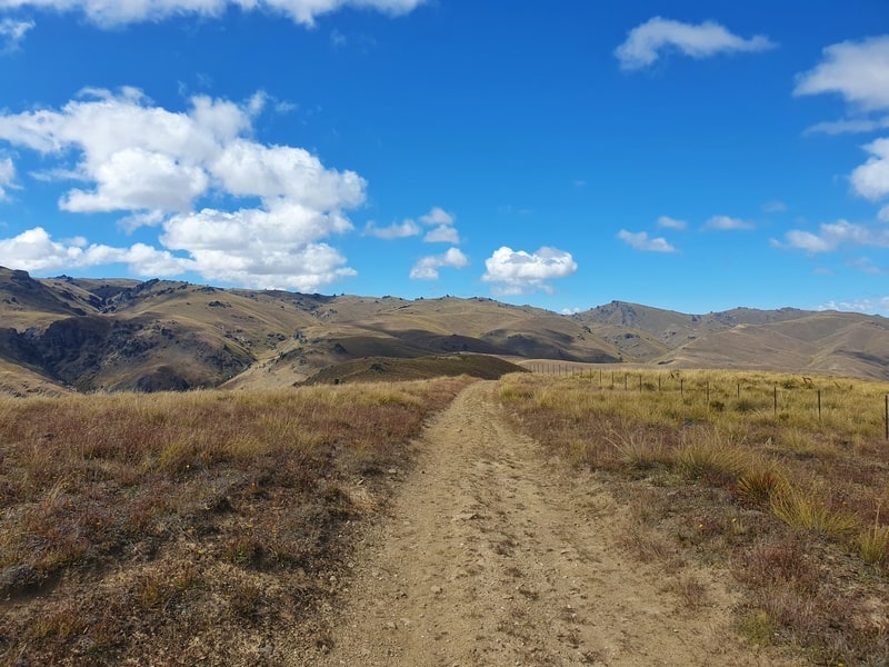
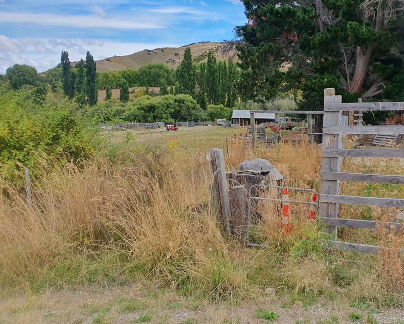
The Meg Hut Track starts off with a section of farmland which likely has some sheep and/or cows hanging about, but follow the orange poles. Easy. You’ll then end up on a 4WD, and the real uphill begins.
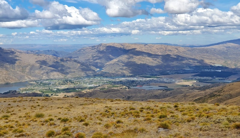
You won’t have any shelter until you reach Meg Hut, so if it’s hot, slip slop and slap. The journey up to Meg Hut is easily navigated, but peak over your shoulder for cool views across Cardrona Valley. You’ll veer left to reach Meg Hut (going right takes you to the Roaring Meg and Rock Peak Tracks).
Drop down into Meg Hut and enjoy a break, this is the first part of the Cardrona to Cromwell Pack Track complete. If you’re staying overnight, collect some wood if need be…there might be minimal or carry on over the creek if you’re continuing on. Fill up your water in the stream!
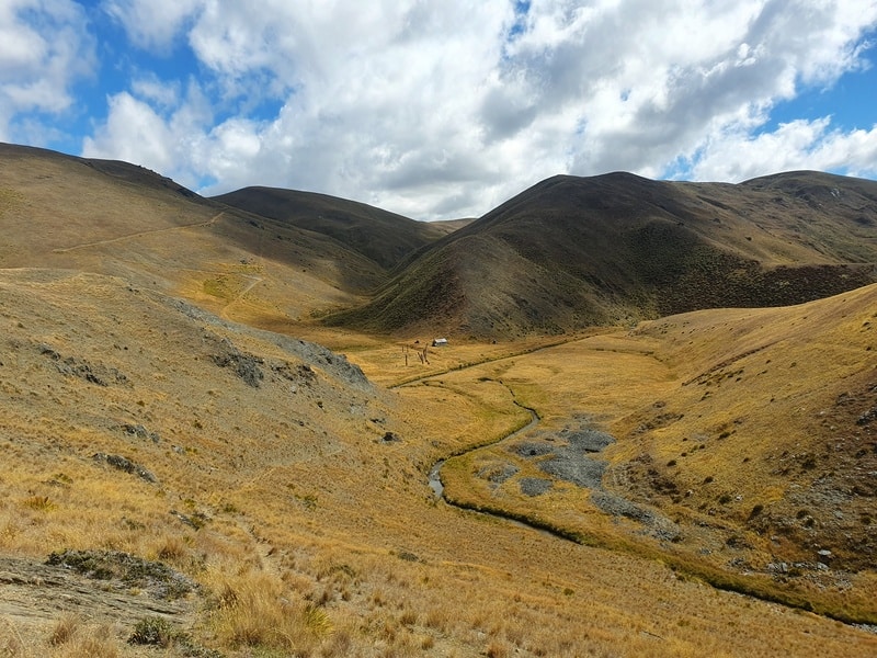
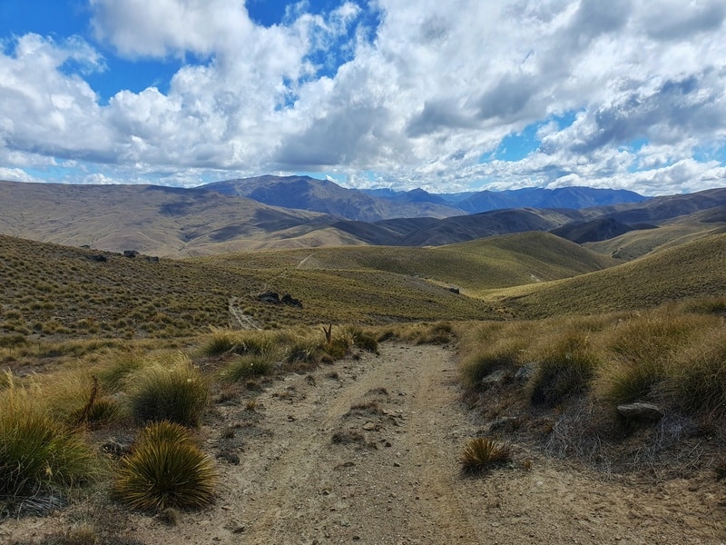
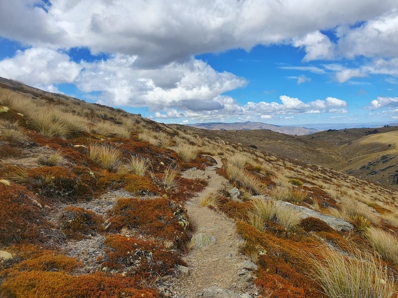
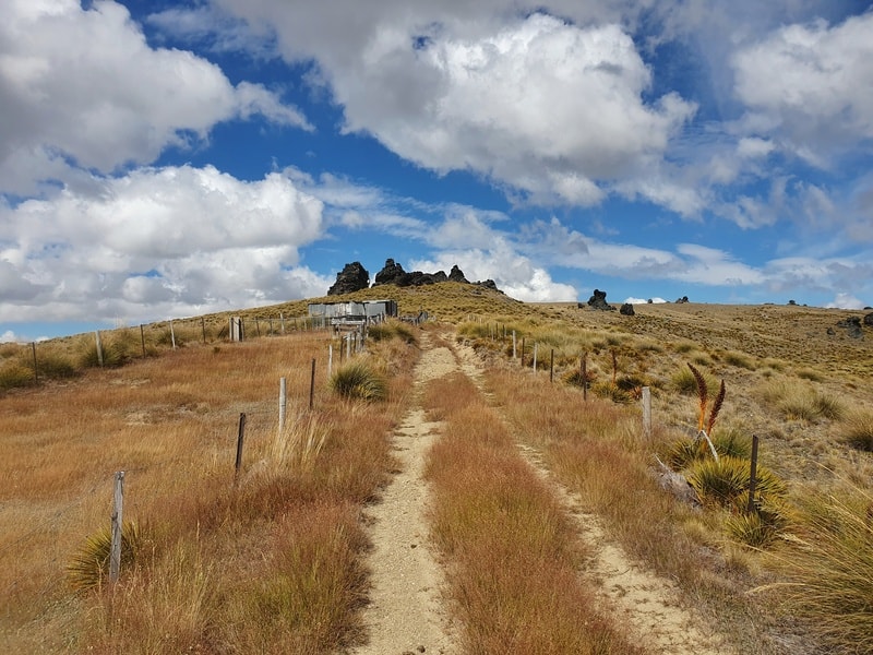
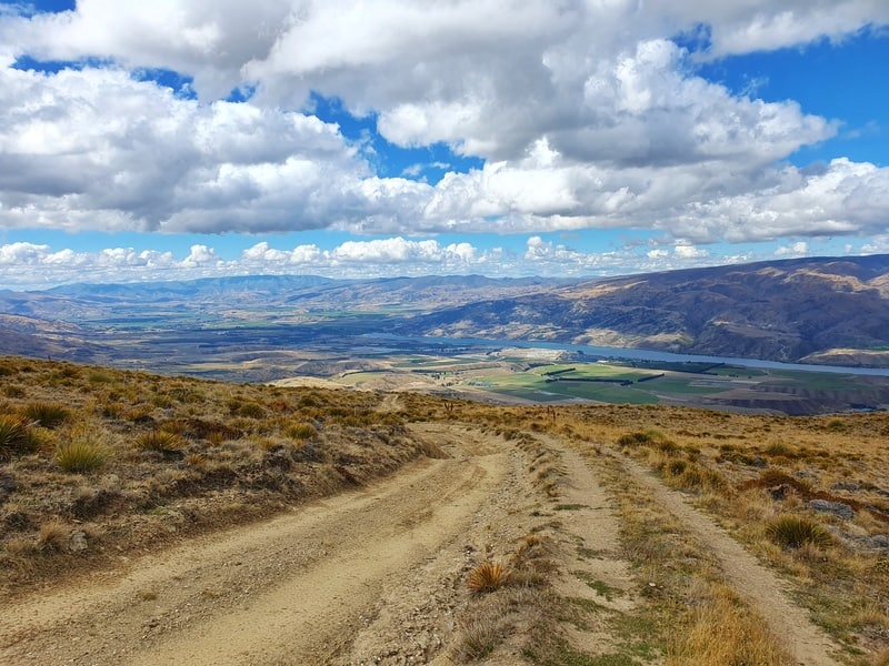
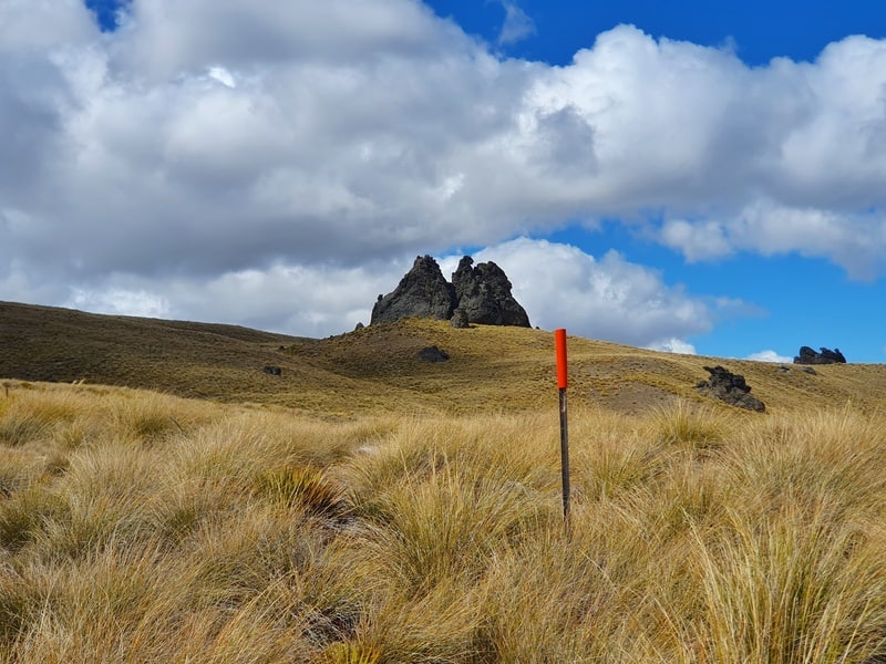
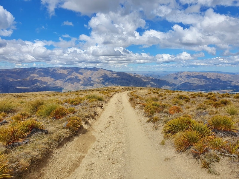
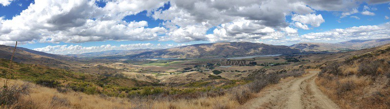
The track then continues up the hill on the other side of the creek with plenty of orange poles leading the way. The ascent continues steadily up for 3.5km or so until you reach the tops.
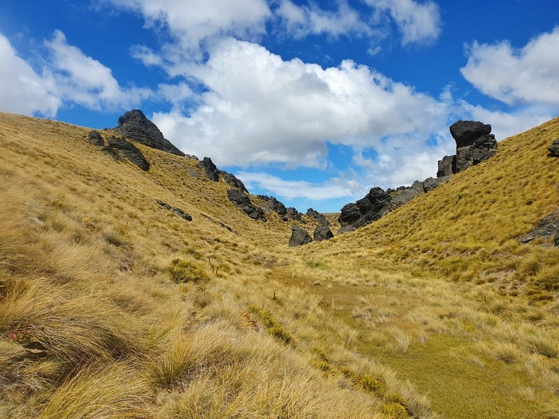
From here you’ll be traversing up and down smaller undulations with some cool views stretching way out. The track is easy to follow until you get about 11km into the trail (total).
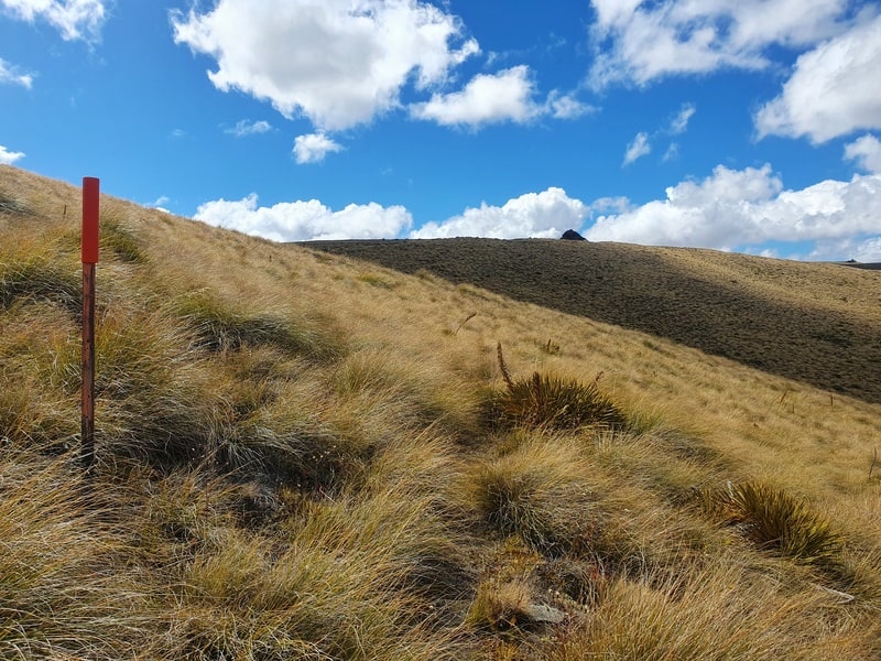
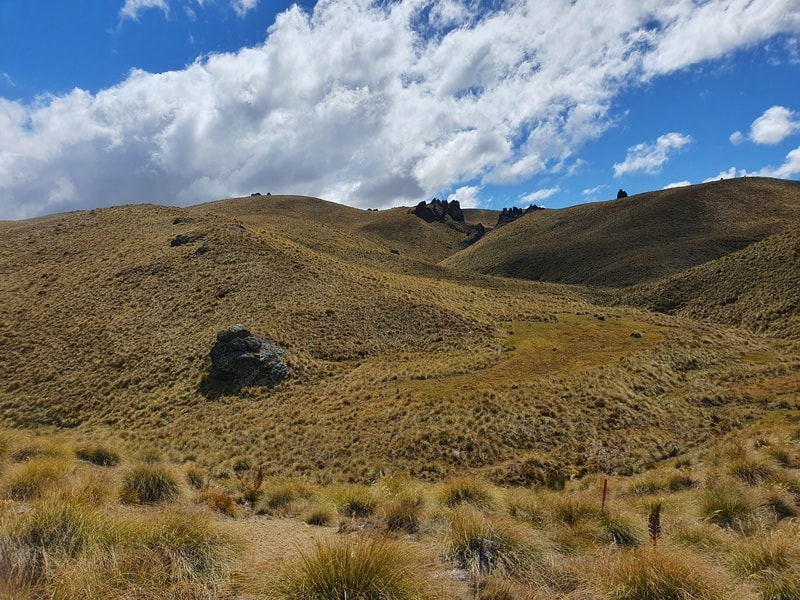
You’ll see the poles take you off the 4WD road and into the tussock. It’s not easy going at times for the next 4km as until you reach Deep Creek Hut. The trail is fine in some spots, but then it gets swallowed up in tussock and Spaniards. There’s plenty of poles that’ll keep you going in the right direction if you lose the trail. There’s a few water sources along this section too.
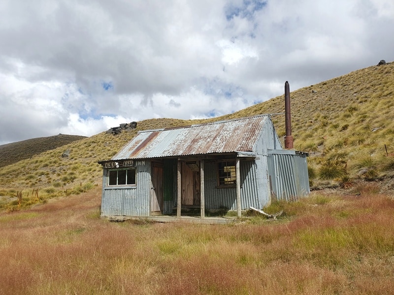
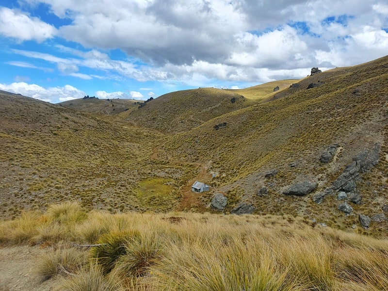
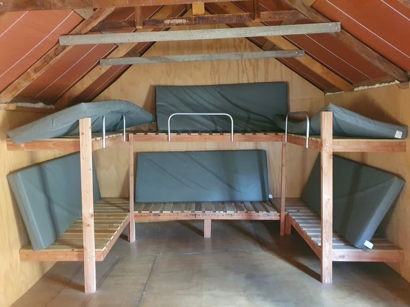
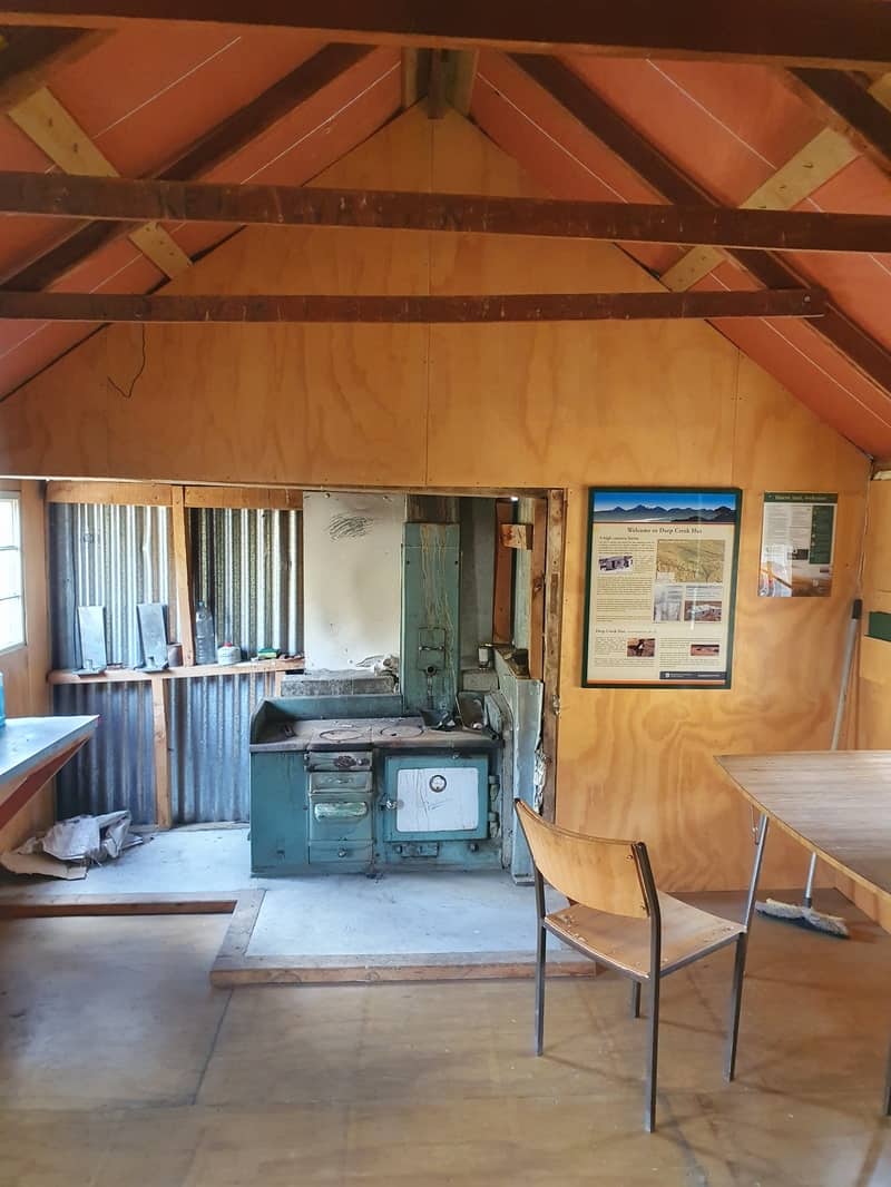
Arriving at Deep Creek Hut is magic! For such a cool hut it doesn’t get many visitors based on the log book. It’s a cool hut though, either overnighting or for a picnic and some shade.
Note: Don’t do what I did and follow the farm/4WD track all the way out (which is also marked on the topo map app). This is for horses only. It’s confusing so make sure to read the DOC description (and screenshot it beforehand) at this link.
Once you’ve finished, head into Cromwell for a feed and beverage!
The Cardrona-Cromwell Pack Track is a low-key track through the Pisa Range. While Meg Hut gets a fair few visitors, the Deep Creek Hut gets very few making it a great way to switch off from the world…yet civilisation isn’t far away.
If you’ve got any questions about the Cardrona-Cromwell Pack Track hike, email jub@churnewzealand.com. Happy to help.
p.s. here’s a few more photos to finish off from the track. I didn’t want to flood the post with photos 🙂

Hey, it’s Jub here. I’m the guy behind Chur New Zealand, helping you have the best time hiking, trekking, walking…whatever you want to call it…in NZ. I’m based in Queenstown and am always out and about exploring trails, old & new. If you have any questions, reach out.
We are the run holders on Lowburn Station. The track you walked down is open only to horse riders. There is an alternative track for walkers/trampers. It is a poled route and leaves the farm track above Deep Creek hut. There is a description of the track on the DoC site. It also exits on Swann Road and the start/end is marked there. We would appreciate it if you could explain this in your directions.
Kind regards Dave and Anne.
Hey Dave and Anne,
Thanks for reaching out. I did not realise this, I’ll add this to the post and put it in bold.
Have a great summer!
Cheers,
Jub
Great description, Jub, and great photos of Deep Creek Hut. I know Meg hut but didn’t know what to expect of Deep Creek Hut. Very much looking forward tonit at the beginning of April.
Hey mate,
Thanks for comment. Meg is awesome too right. You’ll enjoy Deep Creek…I feel like the Pisa ranges are underestimated big time.
Cheers,
Jub