Mount Horn is a summit (with a trig) close to Cromwell on Northburn Station.
At 1136 metres above sea level there are various tracks leading to the Mt Horn peak.
This post will give you the details about an 18-20km loop track starting at The Bruce Jackson Lookout.
Important! As the track is on private property (Northburn Station):
- You need to ring to get access permission to the track. You can email me (jub@churnewzealand.com) if you want the phone number. It’s on a sign early on the track (I attempted to ring but got no answer and decided I would continue the walk).
- All tracks on Northburn Station are closed from September 20th to November 30th for lambing.
TABLE OF CONTENTS
1. Details About The Mount Horn Track
2. Map Of The Loop Track To Mount Horn
3. How To Get To The Starting Point
4. My Mount Horn Loop Track Experience
DETAILS ABOUT THE MOUNT HORN HIKE
When1: February 2021
Difficulty2: Medium. It’s a solid amount of elevation, but it’s never viciously steep and the majority of the tracks are 4WD tracks.
Hike Distance3: My Strava detail came in with 18.62km. I did take a little detour that was less than 1km. Plan to be walking 18-20km and you’ll have the right mindest.
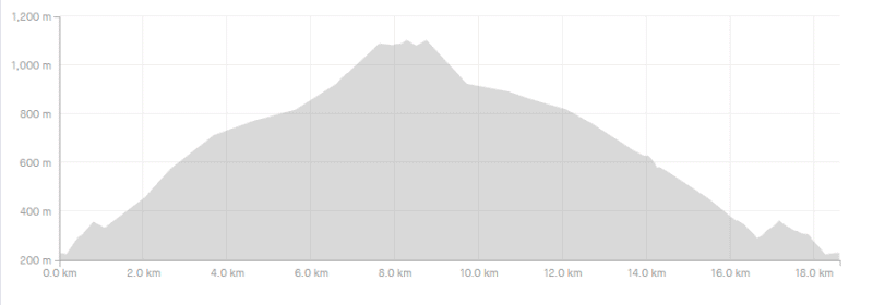
Incline4: Strava recorded 1,004 metres of elevation for the walk. The majority of that is on the way to the Mount Horn summit. Here’s the elevation profile:
Hike Duration5: It took me 4 hours and 15 minutes to complete, which includes a 10-15 minute break at the summit. Other than that, it was only quick stops to take photos. I’m a quick hiker, so it’ll take most people between 4 and 6 hours to complete the loop (without any massive breaks).
MOUNT HORN LOOP TRACK MAP
The map above is the GPX file from my hike to Mount Horn overlaid on a topo map.
You can’t find the trail on Google Maps, but they are on Maps.me (my favourite offline map app). That’s where the screenshot below is taken from.
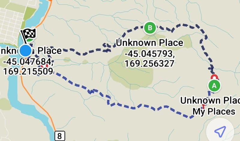
You can’t see Mount Horn marked on Maps.me, so I matched up where the summit was by cross-referencing the topo map. There are lots of trails that veer off the path you want to take, and they’re not signposted at all so downloading maps.me before you begin is a good way to ensure you don’t go in the wrong direction.
HOW TO GET THERE
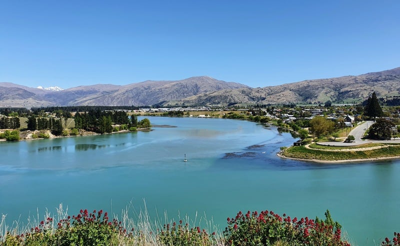
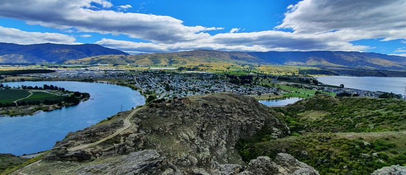
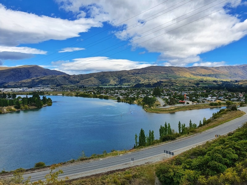
The best place to park is at The Bruce Jackson Lookout. A car park with a view is always nice (see above) 🙂
For reference, the car park is less than 4km away from the Cromwell Fruit Sculpture. If you’re staying in Cromwell, you might consider walking to the trailhead as well…but it’s not exactly a nice walk along State Highway 8 after you cross the bridge.
From Queenstown, it’s a 50-55 minute drive, and Wanaka 40-45 minutes.
Sadly, there are no great public transport options.
RELATED POST: 6 WAYS TO GET TO CROMWELL FROM QUEENSTOWN
MY EXPERIENCE ON THE MOUNT HORN TRACK
Having looked at tracks leading up to Mount Horn I opted to walk in an anti-clockwise direction. This is the direction I recommend you take,
So from the car park, I headed south. The road you’ll follow for ~100 metres is a highway so do be careful. The track begins just after this 75km road sign on the other side of the road. You won’t miss the trailhead.
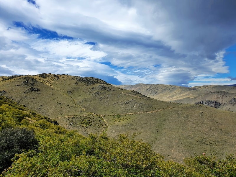
There’s no slouching around as the incline starts right away. I loved the little bushes that you’ll see early on the trail. Don’t forget to look over your shoulder for some views of Lake Dunstan and the Clutha River.
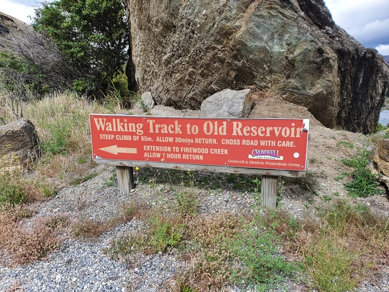
It’s a cruisey climb up until you reach the fence where the private property begins (the number is written on a sign here). Assuming you have permission, carry on over the fence. If worst comes to worst and you’re not allowed on the track, you’ve had a short walk, and the scenery has been awesome as you drop back down to the car.
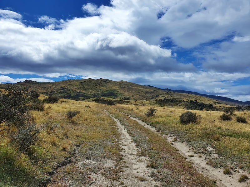
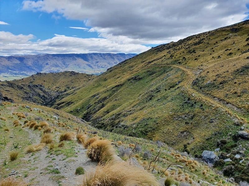
The trail from here now switches primarily to 4WD tracks all the way to the summit. Do keep your phone handy as there are lots of times where the track splits off and there are no signs marking the way to Mt Horn.
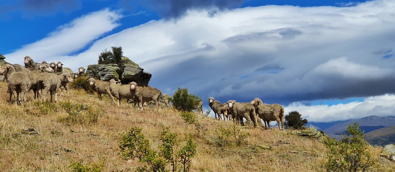
The views you’ll get a pretty awesome right throughout as you’re never under the forest canopy. You’ll be walking past some low shrubs early in your walk, and you might come across some sheep (they were super scared of me approaching), but otherwise it’s views for days.
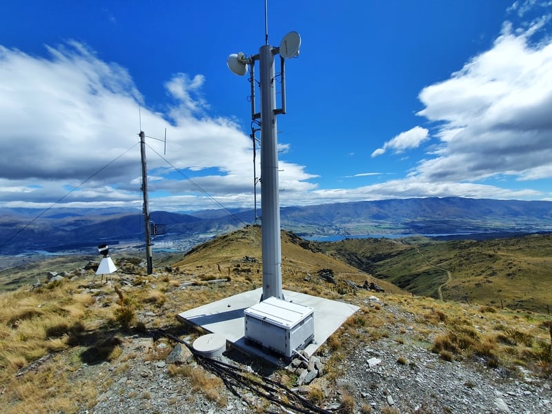
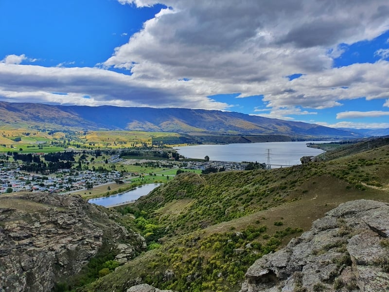
You’ll be able to spot Mount Horn after a few kilometres. The technology at the top helps you know where you’re looking. But do keep your phone handy, there are turnoffs all the way up.
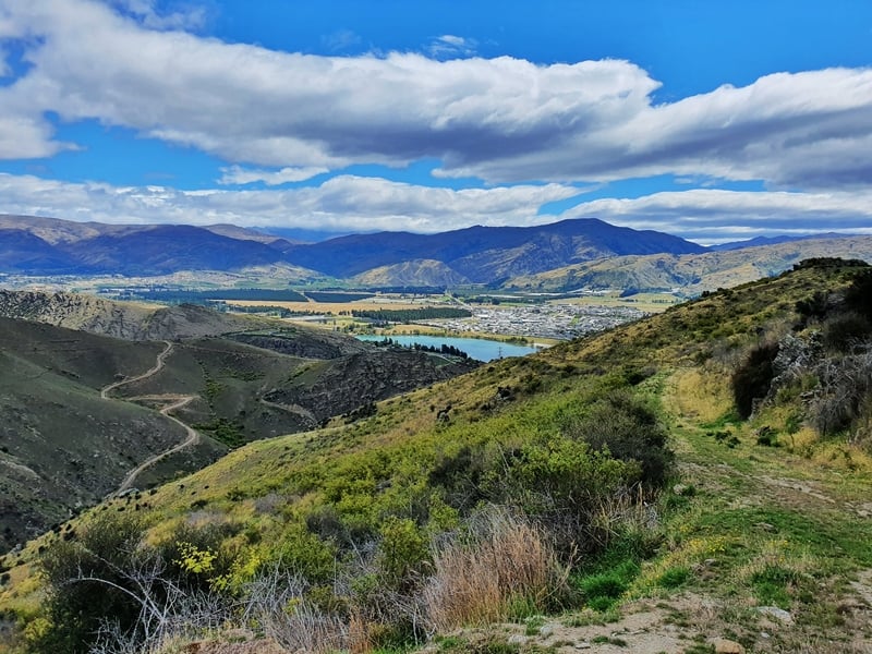
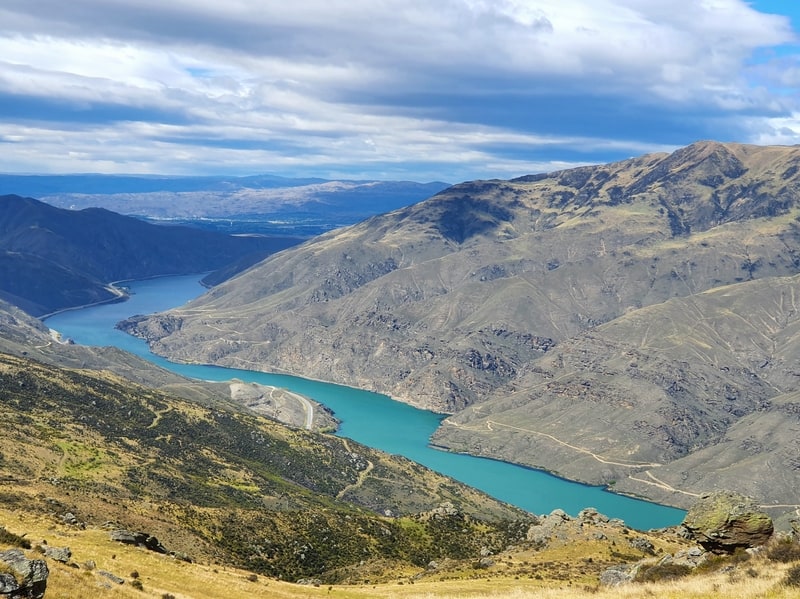
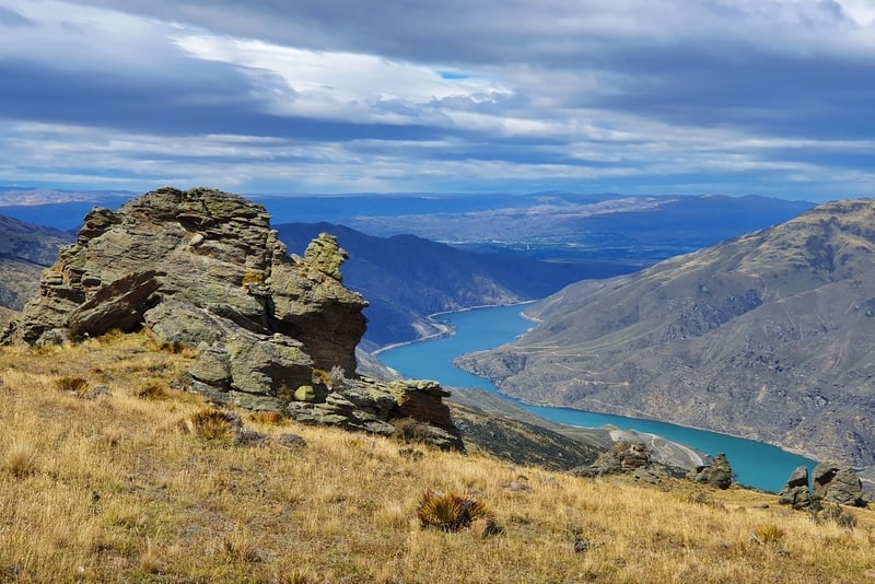
When the Clutha River comes into view again, wow. The colours are amazing. Combined with the rocks jutting out of the terrain in patches it’s all very cool. And maybe you’ll get some epic photos for Instagram 😉
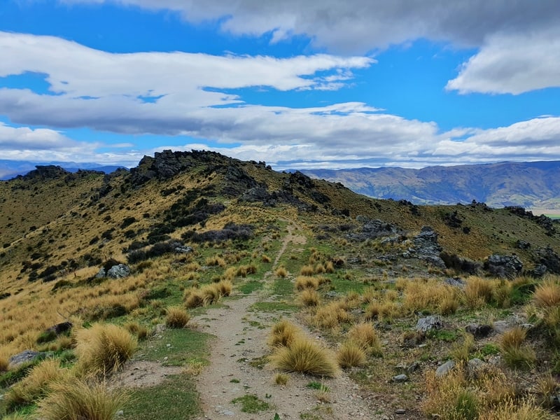
Eventually, after 7.5km or so of hiking up a constant incline (I like how the gradient changes gradually, not in an undulating way) you’ll be close to the top. You’ll come across a couple of fences near the summit.
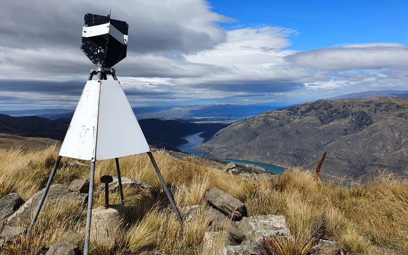
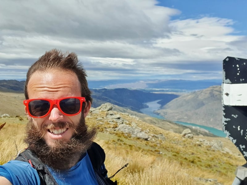
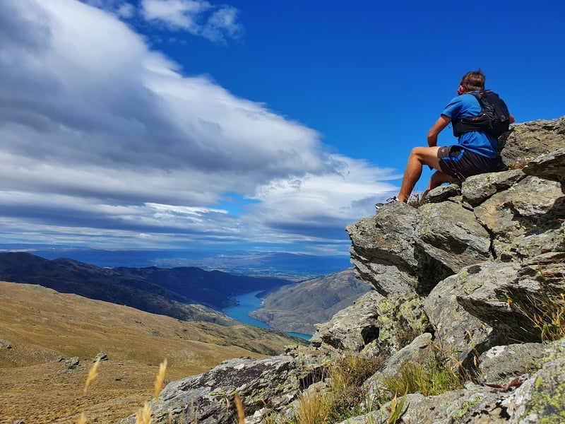
Veer off to the right to reach the trig and enjoy the views! You get views in all directions which is awesome.
RELATED: WHAT IS A TRIG?
I was surprised at how windy it was on the summit having barely noticed it on the way up. So if it’s a colder day, bring a jacket if you plan to spend time at the summit. It could be really cold up there 😮
After you’ve summit, it’s time to head back down to where we veered off. I found I needed to verify which direction I was going to continue the loop with maps.me.
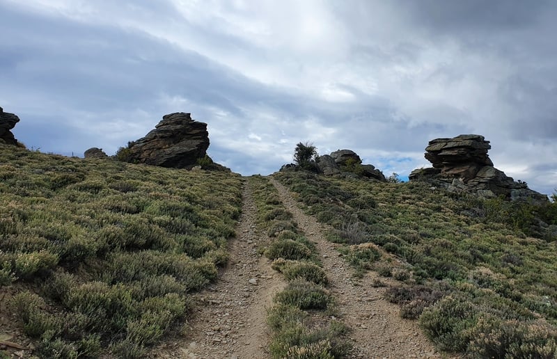
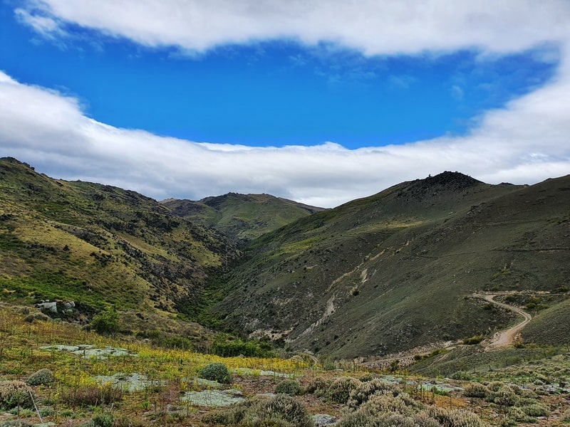
The track goes from a 4WD track into something easy enough to follow but more technical on the descent.
The descent for the first km is on a decent gradient as you cross over to the other side of a valley.
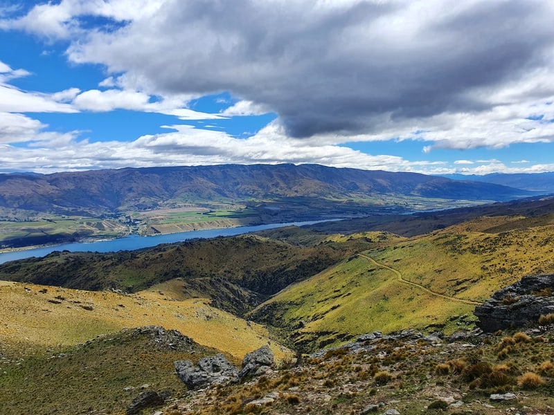
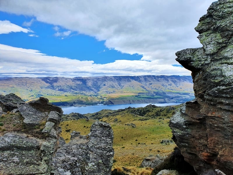
From there you’ll have a couple of spots where you’ll want to make sure you follow the right turnoff and are following the track (it kind of just disappears a little bit sometimes). You’ll be getting views of Lake Dunstan a good amount of the way back on the loop which is nice.
The terrain is a bit gnarlier on the second half but nothing outrageous. I just love all the crazy sporadic rocks found here. If only I knew a great way to get epic photos with them.
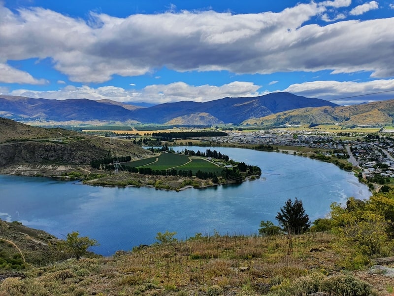
Once you start to see the Clutha River you’ll know you’re nearly at the finish. It definitely took me longer to get back to the trailhead than I expected.
The track spits you out about 300 metres north of the car park. On the highway. There’s plenty of room to walk next to the road, so cruise back to your car and get onto the next adventure!
Cromwell’s Mount Horn is definitely not a popular hike even though it’s not far the all the tracks in Queenstown.
If you love some of the photos in this post and want some photos that are unique, I can highly recommend you do this track. That said, it’s never going to be on a top 20 list of best walks in the South Island. Should it be?
If you love it that much, maybe you’ll want to sign up to the Northburn 100 😉
I don’t know anyone who had done this walk before I went, and I couldn’t find anything on Instagram so can you tell me what you think of the Mount Horn summit track?
Drop a comment below or email jub@churnewzealand.com
Happy hiking!
RECOMMENDED READING
The Ultimate List of Things to do in NZ
An epic list of things to do in NZ
Walks and Hikes in Arrowtown
There’s more to Arrowtown than gold and history!
Some of Queenstowns top hikes
Where to go hiking in Queenstown

Hey, it’s Jub here. I’m the guy behind Chur New Zealand, helping you have the best time hiking, trekking, walking…whatever you want to call it…in NZ. I’m based in Queenstown and am always out and about exploring trails, old & new. If you have any questions, reach out.