Hiking Roys Peak Track to the Instagram famous viewpoint1 is on the top of the list of things to do in New Zealand for lots of people.
Important: The Roys Peak Track is closed from October 1st to November each year for lambing.
The majority of people only walk to the Roys Track viewpoint before heading back down to the car park. This is a return hike of ~13km with about 1000 metres of elevation.
But there’s the option, which I recommend, to walk to the summit of Roys Peak2. This is a 15.5 – 16km return trip with ~1200 metres of elevation gain.
I’ll mention the differences between the viewpoint and summit in the details below.
TABLE OF CONTENTS
1. Details About Roys Peak Track
2. Roys Peak Track Map
3. How To Get To The Trailhead
4. My Experience Hiking Roys Peak
5. Alternative Hikes To Roys Peak
DETAILS ABOUT ROYS PEAK TRACK
When3: January 2021
How hard is Roys Peak Track?4 Medium. If you’re never hiking, it’s going to be a tough hike with the elevation gain.
But as it’s the most popular Wanaka walk it’s not super long and is on a well-trodden trail so isn’t super tricky in any way.
Quick tip: If you’re not sure how you’ll go with the hills, you could try doing the Mount Iron Track a day or two before. It’s a lot less incline, but it’ll give you some idea at least.
How long is Roys Peak Track?5 To the viewpoint: it’s about 6.5km each way. To the summit: ~15.5-16km return.
Incline6: To the viewpoint: ~1000 metres. To the summit: ~1200 metres. 99% of the incline is on the way up the track.
How long does the Roys Peak Track take? I walked with a friend, both of us are reasonably fit and it took us about 1 hour and 40 minutes to reach the viewpoint. After a 10 minute break at the viewpoint, it took another 20 minutes or so to reach the summit of Roys Peak. DOC suggests the walk take 5-6 hours which is on the conservative side.
Are there toilets at Roys Peak? Yes, there is one next to the car park and one at the famous Roys Peak viewpoint.
RELATED: ROYS PEAK VS ISTHMUS PEAK
ROYS PEAK TRACK MAP
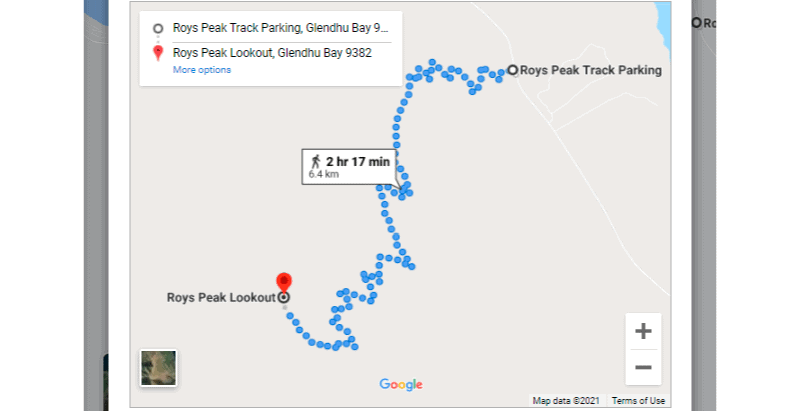
You can view Roys Peak Track on both Google Maps, and with the offline maps app maps.me.
The map above is from Google Maps but as you know, it’s one of the most popular tracks on the South Island, so you don’t really need a map to get you to the viewpoint/summit. The 6.4km on the map is close to what my Strava recording was.
HOW TO GET TO THE TRAILHEAD
There are several ways to get to the Roys Peak Track trailhead which starts at the carpark.
DRIVE
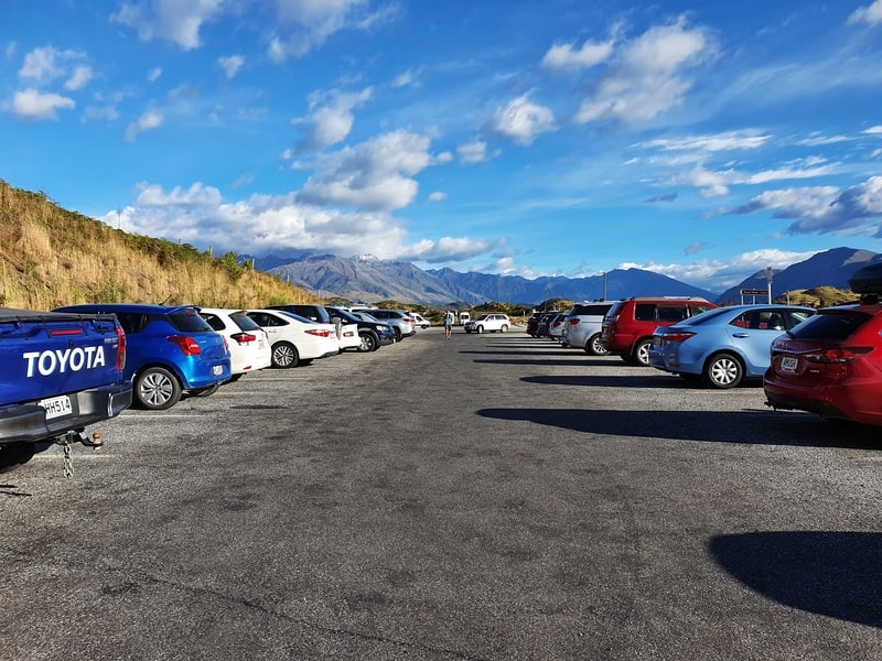
The car park is a short drive from Wanaka (~7km and less than 10 minutes), and the car park is free.
It’s a decently sized car park, but in the summer the car park will fill up quickly so your best bet will be to get their early so there’s no fluffing about before you start hiking.
SHUTTLE
There are a few different companies that can arrange your transport between Wanaka and the start of Roys Peak. Give Trail Connect a call and see what their current schedule is.
WALK
You can walk from Wanaka to the trailhead in about 1.5-2 hours (depending on your walking speed). The best route to take is via waterfront I think. But even with this route, the last couple of kilometres along the main road isn’t fun with minimal space roadside.
Personally, rather than adding 3-4 hours to your day out, I’d prefer hitchhiking to the trailhead which should be easy enough from just past Pembroke park.
FROM QUEENSTOWN
You can do the Roys Peak Track as a day trip from Queenstown easily. The drive is about 70 minutes via the Crown Range and 90 minutes via Cromwell.
MY EXPERIENCE HIKING ROYS PEAK
Having not been aware of the lambing season that closes down the Roys Peak Track a few months earlier, I finally joined a mate to walk up to Roys Peak.
We didn’t start super early, arriving at the car park at about 8.30am but given there were no tourists in the country, the car park wasn’t overly packed just yet.
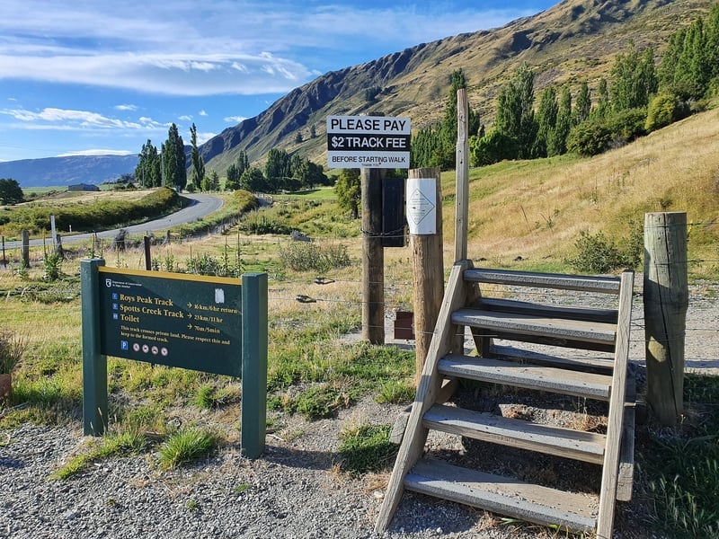
The track starts at the west side of the car park, and we were surprised to find there’s a box where they ask for a $2 donation. Who carries coins these days?
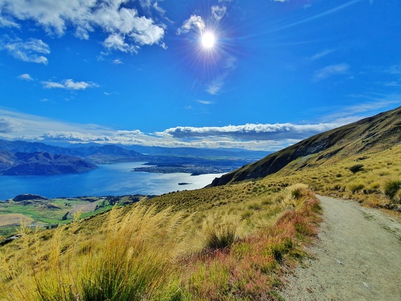
The hike doesn’t mess about, with the incline starting from close to the first step. You’re now in for a 6.5km hike up a steady incline up plenty of switchbacks.
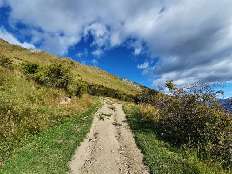
The ground you’re walking on varies a little from grass to gravel, to hard-packed dirt (you’ll notice this in photos) but it’s never technical at any point so you can keep up a steady pace.
You’ll start to get some awesome views from early on in the hike, but I recommend trying to avoid taking too many photos on the way up. The constant stop starting on an incline is only going to make your hike drawn out.
Partway through the hike, you’ll see some tracks that go directly up rather than taking the more gradual route along the switchbacks. If you’re fit you can save time by taking these, but if you’re not using to hiking up steady inclines, take the longer route.
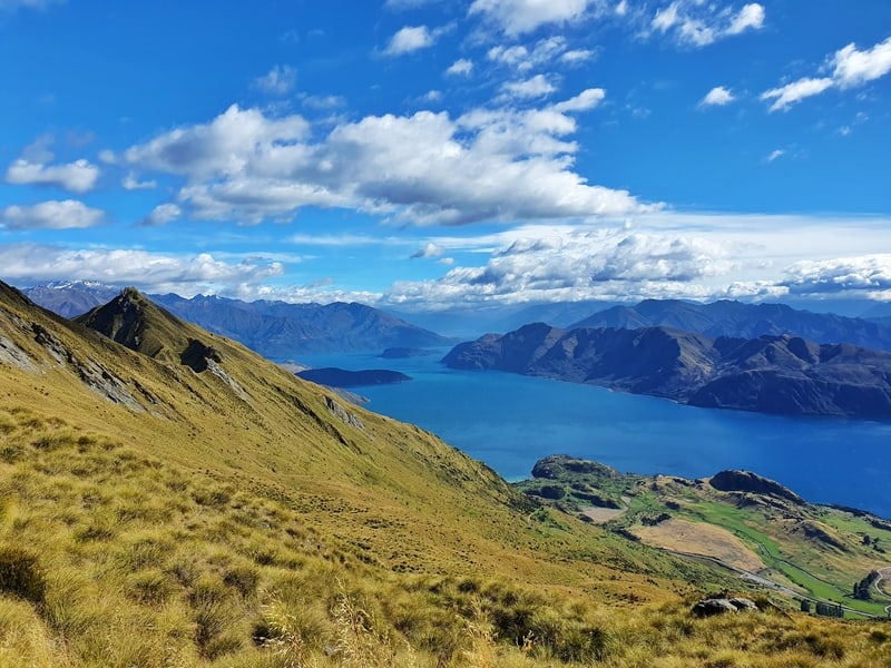
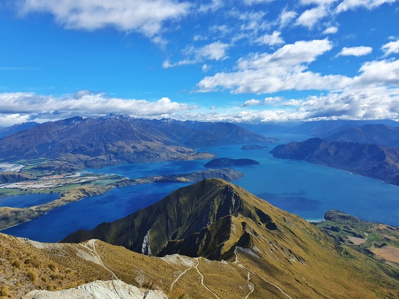
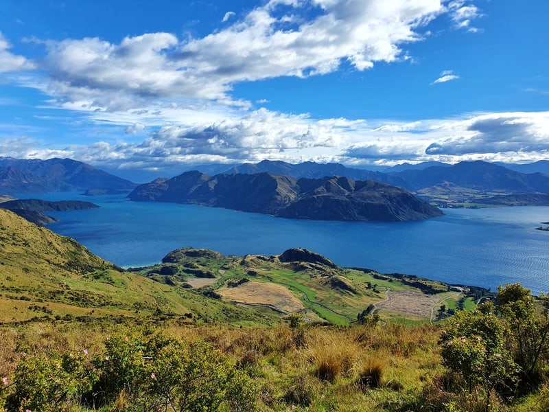
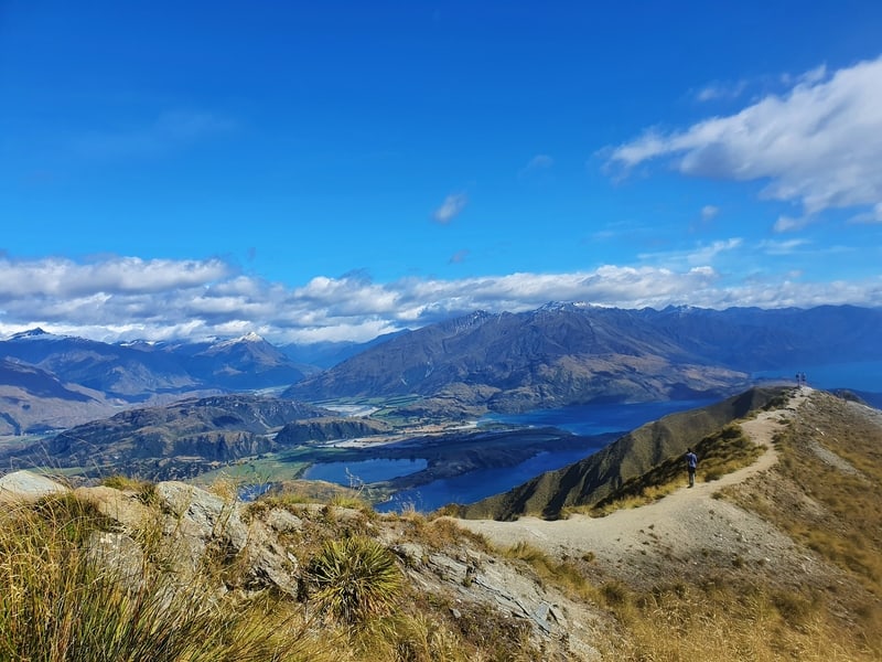
You can see the viewpoint from a few kilometres into the hike, but this might not be a good thing as you know you’ve got a few hundred metres of elevation gain to go.
We did get a little confused when we saw a helicopter on a peak further down the ridgeline. It turns out this was Coromandel Peak, and if you’ve got a spare $1500+, you can take a helicopter to this viewpoint with Aspiring Helicopters
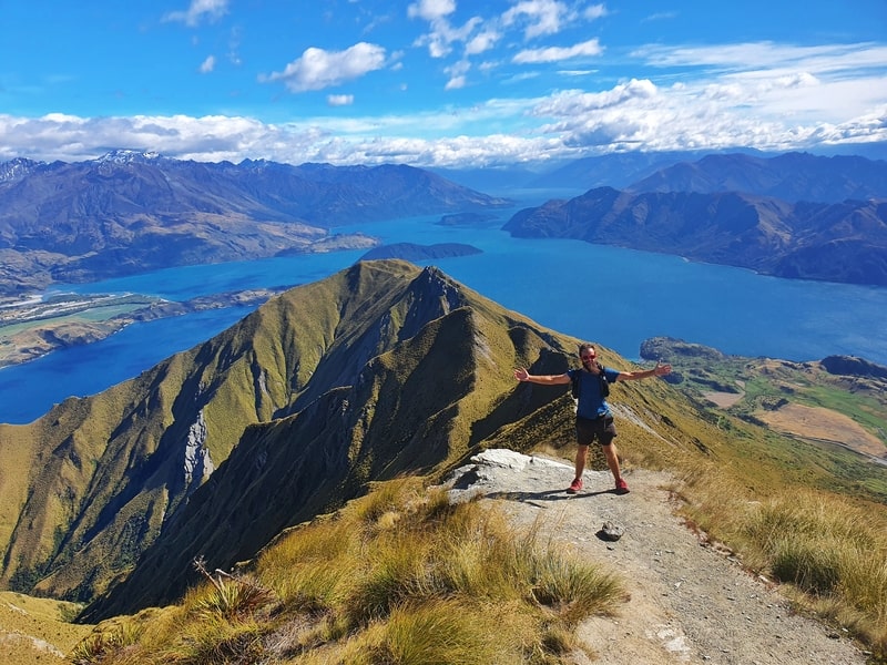
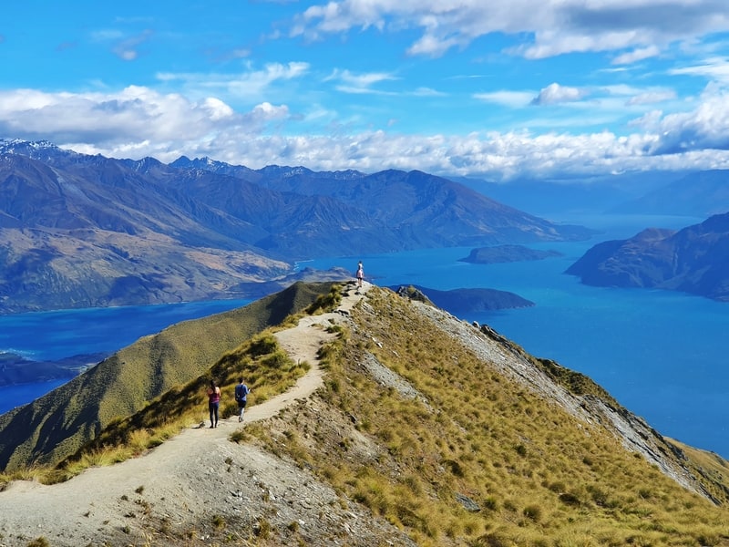
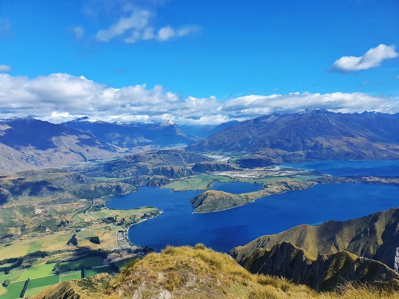
Once you get to the viewpoint (above) it’s hard to know what to expect. Hopefully, you’ve got amazing views with only a couple of people around.
We stopped here for a break but didn’t get to THE photo spot as a couple were taking way too many photos and we didn’t want to wait.
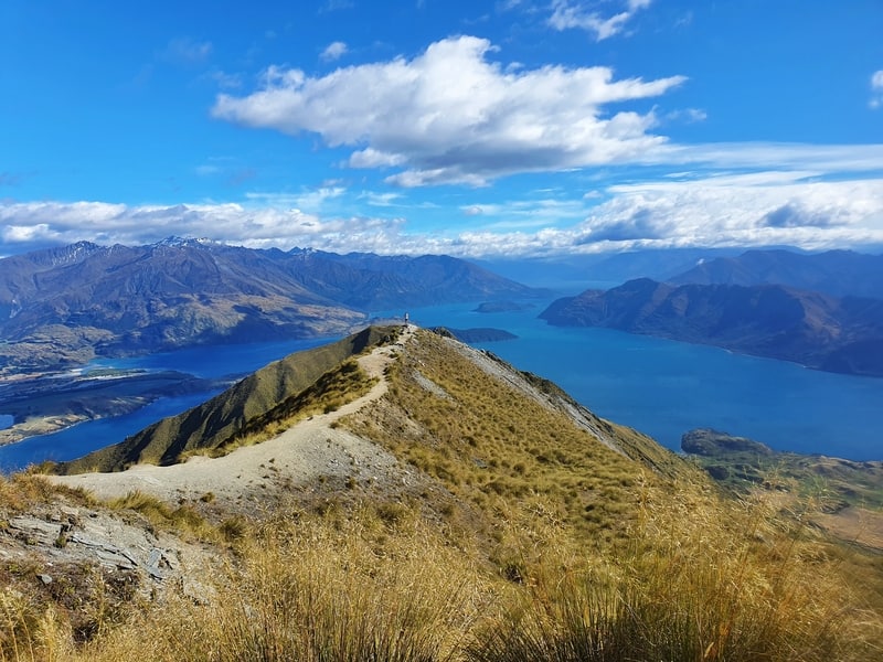
Most people treat the famous viewpoint as the turnaround point on their Roys Peak Track experience but if you’re someone who needs to finish things, continue on up to the summit where you’ll have another couple of photo opportunities on the way and fewer people around.
And it’s time to head back down.
The hike down is tougher for many with the steady decline putting pressure on the knees. But there’s no other choice so just enjoy the views and make your way down as you can. As I mentioned earlier the terrain isn’t technical so there’s that in your favour.
This is where the benefit of switchbacks really pays off.
Is Roys Peak worth it?
Yes. While it’s a super touristy trail, there’s a reason. The views are epic throughout the walk (weather permitting) and if you’re staying in Wanaka, the track is easy to reach.
If you want to avoid others as much as possible, get to the viewpoint for sunrise, and make sure to go all the way to the summit of Roys Peak. You won’t need to queue to get a photo up there.
You could then even complete the full Wanaka Skyline Track, just make sure you have a plan to get to/from the trailhead.
That doesn’t mean I think it’s the best option in the classic Roys Peak vs Ben Lomond debate.
If you’ve got any questions/thoughts about the Roys Peak Track, drop a comment below or email jub@churnewzealand.com
ALTERNATIVE HIKES TO ROYS PEAK
Isthmus Peak Track
This is the most popular alternative to Roys Peak for those who are jaded against doing things that are too popular 😉
The Grandview Mountain Track
This is a nice off the beaten path hike not too far from Wanaka.
The Ben Lomond Track
This is an epic, yet harder hike, that’s Queenstown’s response to Roys Peak. There’s some epic photos from sunrise in this post.

Hey, it’s Jub here. I’m the guy behind Chur New Zealand, helping you have the best time hiking, trekking, walking…whatever you want to call it…in NZ. I’m based in Queenstown and am always out and about exploring trails, old & new. If you have any questions, reach out.