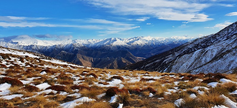
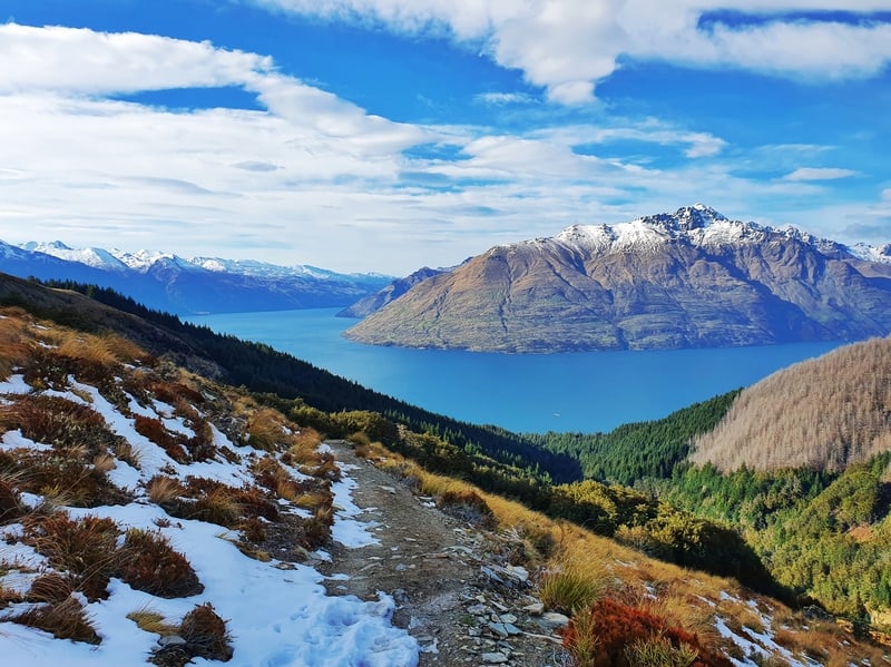
The Ben Lomond Track is a hike everyone should do if possible. It’s amazing. There are great views throughout the hike, but the 360 views at the summit have to be the best.
There are a few different ways you can complete the hike to Ben Lomond Track, with the Tiki Trail route the most popular. But I’ll make sure to list the other options, including my favourite route featuring one of the best ridgelines I’ve seen.
Want to make your Ben Lomond hike extra special, wake up early and get to the summit for sunrise! In the summer, there’s no shortage of people on Queenstown’s hiking trails so this can be a good way to get to the summit without lots of others. And it has got to be the best place to see sunrise in Queenstown.
This post will give you the details about one of the best hikes on the South Island. I’ll answer common questions, and yes, there are plenty of photos.
p.s. There are a few different places where you can begin the Ben Lomond hike. I mention each of them under the ‘how to get to the trailhead’ section. But I’ll be talking about the route starting from the bottom of the Tiki Trail in the FAQ below.
p.p.s. Do read the DOC warnings (or visit the DOC visitor centre) to get absolute up-to-date info on the track.
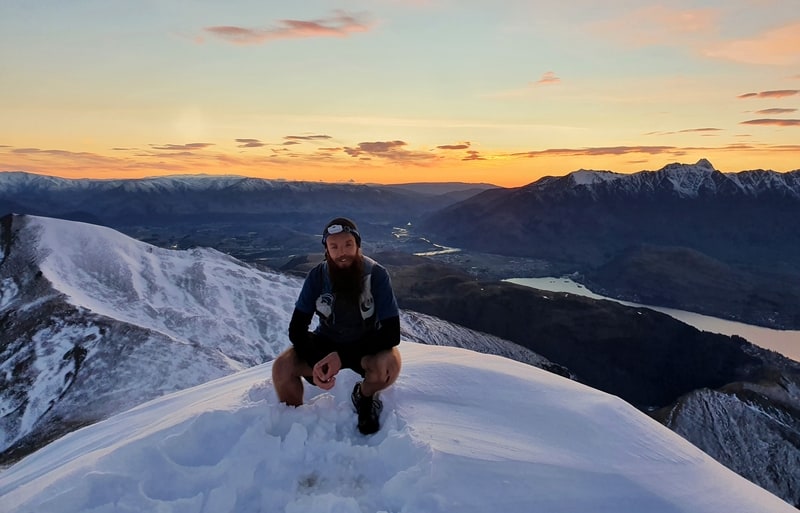
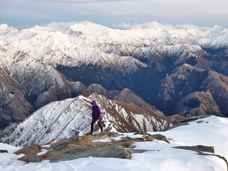
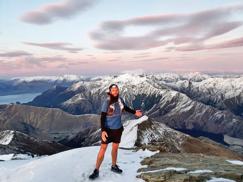
Trust me, the photos get a lot better. This is me at the summit to prove I’m not making stuff up in this post 🙂
TABLE OF CONTENTS
1. Ben Lomond Track Details & FAQ
2. Ben Lomond Trail Map
3. How To Get To The Trailhead
4. My Experience Hiking The Ben Lomond Track
5. My Favourite Route Up & Down Ben Lomond
1. BEN LOMOND TRACK DETAILS & FAQ
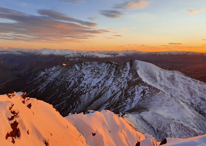
Without a doubt, this is a 5-star epic sunrise hike…but it’s a 5-star hike at all times of the day. I’m grateful to have been to the summit over a dozen times.
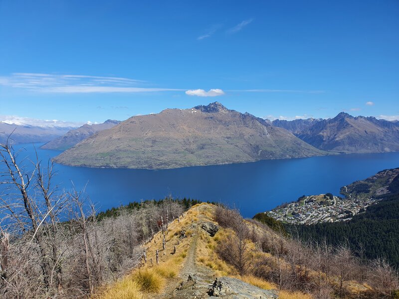
You get views throughout, and because of the incline, there’s no need for man-made structures up near the summit which preserves the raw feeling (the sole monument at the summit was destroyed by lightning in 2021). And yay, for the trailhead starting in town.
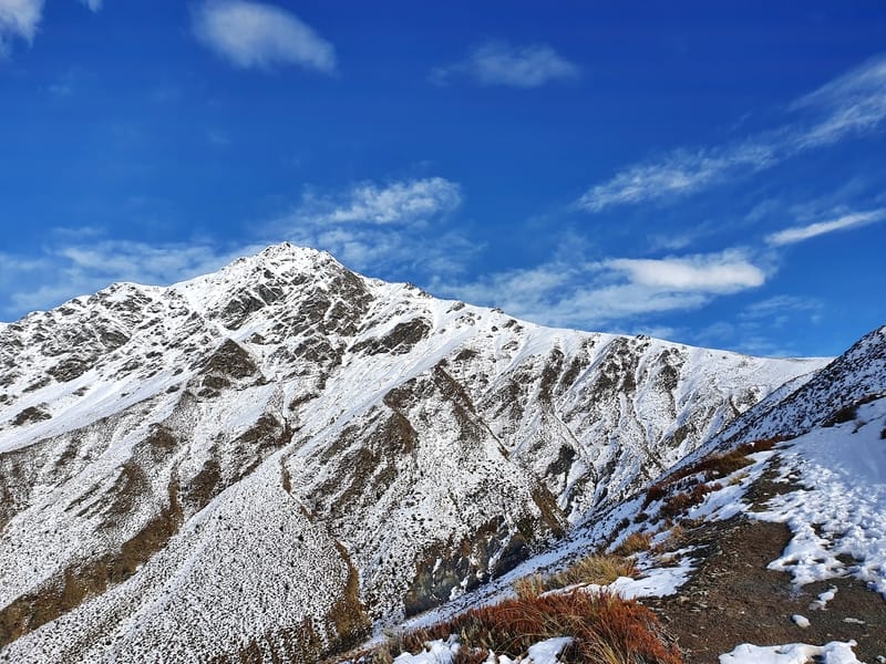
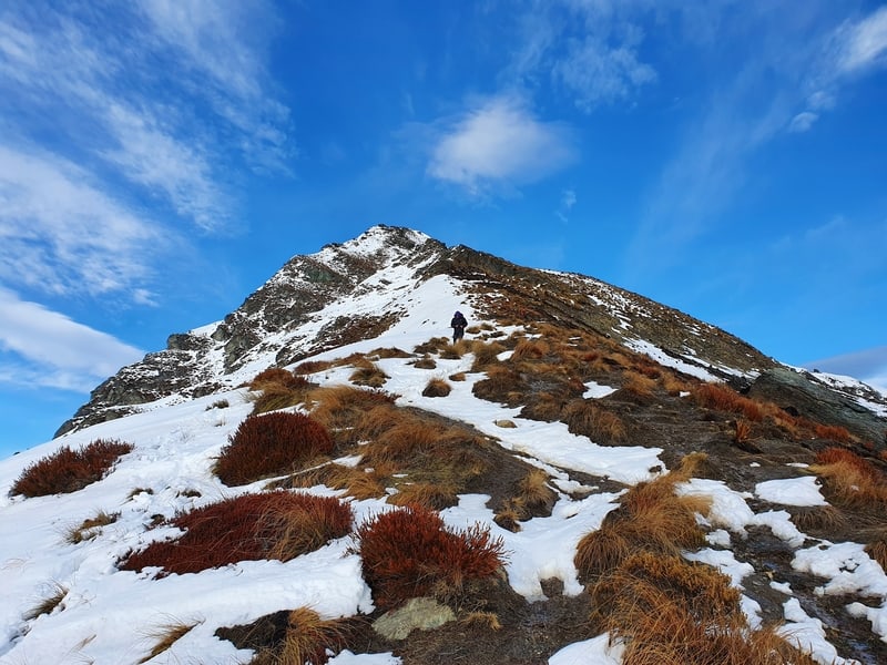
As you can expect the trail is well maintained. Even beyond the saddle when the signs make it clear you’re now walking on an unmaintained trail. The trail is more technical past the saddle, but it’s easy to follow with poles marking the track.
FAQ time…
How hard is the Ben Lomond hike?
Medium to hard. In summer the lack of snow will make this hike easier, but then the heat then becomes a factor. If you’re not a big hiker, this will be a big mission! But if you’re hiking regularly you’ll be good as gold with this one.
What is the Ben Lomond Track distance?
That depends on the route you take. The most popular route via the Tiki Trail and returning the same way. According to my Strava recording the Ben Lomond track distance for that route is 15.1km return.
Why does the DOC website say the track is 11km return?
That’s the distance excluding the Tiki Trail.
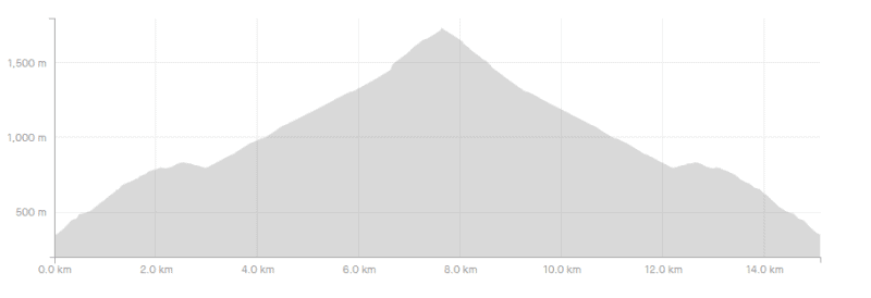
What is the Ben Lomond elevation gain/profile?
According to the Strava data, the total elevation gain is 1480 metres (see the elevation profile below) which is more or less all on the way up. The summit of Ben Lomond peak elevation is 1,748 metres above sea level (you start at ~350 metres above sea level).
How long to climb Ben Lomond?
My first time up Ben Lomond took us 5 hours and 57 minutes there and back. This included perhaps 30 minutes at the summit, and there was a lot of snow. We didn’t really stop to eat on the way up, or down. Just a few short stops to take photos/admire the views.
DOC suggests 6-8 hours for the 11km return trip which gives you an idea of how long it can take. For reference, we made it up the Tiki Trail in 35-minutes. It’s hard to predict how early you should leave to make it to the summit for sunrise. We had less than 3 hours to make it and did so, but are both reasonably fit.
Are there guided tours up Ben Lomond?
Yes, there’s a new offering from Skyline. It’s expensive, but they do seem to get bookings.
If you’d like to shout me a beer or two, and I’m free, give me a message on Watsapp/SMS on +642041702764 and we can go hike the trail (though we’ll start at the bottom of the Tiki Trail – and go via the cool ridgeline) 🙂
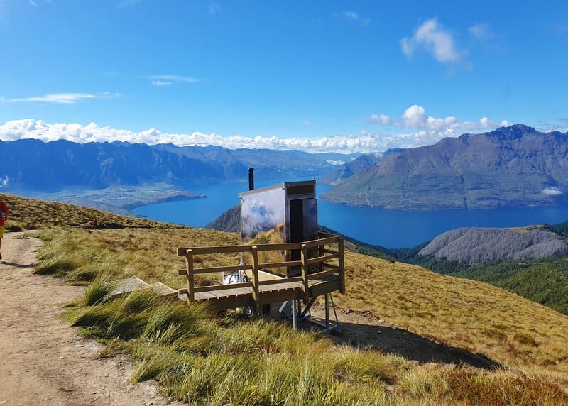
Are there toilets on the track?
Yes! There was a toilet installed close to the Ben Lomond Saddle in late-2022. This was a few years in the making and will hopefully keep the areas surrounding tracks poop and toilet paper free.
Here’s a photo of the Ben Lomond toilet:
Are dogs allowed up to the summit of Ben Lomond?
No. No exceptions.
Can kids climb Ben Lomond?
There’s no reason they can’t…if they’ve had some hiking experience before and have a concept of what it’s like being in the mountains. You’re the parent, not me, so you’ll need to make the best decision for your kids. At worst you’ll be able to get to the saddle comfortably.
I’ve seen parents take their you kids up in carriers like the Macpac Vamoose before, and kids who might be like 5 years old ambling there way up…though I suspect they were carried at points 😉
Can you hike Ben Lomond in winter?
Yes. In theory. I have been up in every month of the year, but never when there’s been heavy snow that would involve ice axes/crampons. That will rule out most of June/July/August, but there are times throughout that period where lots of snow will have melted. In these times you can make it to the summit if you’ve got experience/good fitness as you will have to walk through some snow. But at worst you can give it a go and if need be turn around, you’ll still get some great views.
Make sure to give DOC a call to see what they recommend.
If I decide my knees are sore, can I buy a one-way ticket down the gondola?
You can! They don’t advertise it on their site, but there’s a sign at the bottom of the Tiki Trail. Adults are $29 and children are $17 (a return pass is $46 for adults an $32 for children).
What is the best time to climb Ben Lomond?
In a perfect world, a nice warm day at the end of September/early October is great. You’ll still get some patches on snow on Ben Lomond and on the surrounding peaks which make the views that little better. Otherwise, I like autumn (March and April) when the days are still warm, but it’s unlikely to be scorching hot likt in summer.
Summer is when most people will be walking up Ben Lomond, but even then it’s not like there’s heaps of people crowding the track. So personally October or April are my favourite times to climb Ben Lomond, but anywhere in between that works to.
What gear should I bring/pack for the Ben Lomond hike?
- Water…bring plenty of water, as there’s no water source once you pass Skyline. In the summer you’ll want to bring at least 1 litre…maybe 2 or more per person.
- Snacks. Because snacks are life. And they’ll fuel you 🙂 My go-to hiking snacks include energy balls (a.k.a. bliss balls)…I make these ones, bhuja, apples, and anything with peanut butter.
- Sunscreen. For a good portion of the hike, you’re above the treeline with no shade. Skinnies isn’t cheap, but a little goes a long way, and they’re kiwi made.
- Hat. As I mentioned, there’s no shade so the more protection the better.
- An outer layer. Even if it’s a super warm day in the middle of summer, it doesn’t take much for a small breeze to make the summit a chilly location…especially after you stop sweating. I use my Pisa Jacket in times like these. In the winter months, you’ll need to bring plenty more clothing (especially for sunrise at Ben Lomond).
This can all fit in a 20L day pack.
In terms of footwear, most people are going to be okay in trainers (not so much in winter), so don’t feel as though you 100% need hiking boots to do this track…though they’re never a bad idea (I’m team trail running shoes all the way).
Hiking poles could be handy if you’re knees don’t like long descents. They’ll be particularly handy in the section between the saddle and summit for some people. Personally, I don’t use them.
Hiring a PLB is never a bad idea, but it’s not necessary for this hike. There’s plenty of cell coverage on most of the track and it’s a well trodden route.
2. BEN LOMOND TRAIL MAP
Note: If you click on the map below, it’ll open up in a new tab on topomap.co.nz.
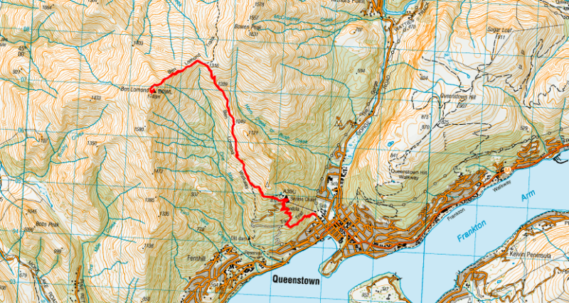
If you download Maps.me (offline maps), you’ll be able to make sure you’re on track. This is going to be helpful when it’s dark (especially if you haven’t walked any of the Tiki Trail).
When we reached the Skyline Gondola area it was nice to use maps.me to make sure we weren’t making a wrong turn off going through there. But the trail is well marked so you’ll have no issues.
You can get most of the track on Google Maps, and all of it on my favourite topo map app for NZ.
3. HOW TO GET TO THE TRAILHEAD
There are four starting points for walking the Ben Lomond Trail. I usually go via the the Tiki Trail as that’s the most popular starting point.
1. Bottom of the Tiki Trail: The Tiki Trail trailhead is literally in Queenstown and is the most popular starting point for the Ben Lomond climb. You don’t need me to tell you how to walk to the start from where you’re staying. If you’re driving into Queenstown to do the hike, you may need to pay for parking. I did see this spot a few minutes walk from the trailhead that’s $7 for 12 hours.
2. At One Mile Creek: You can park at the One Mile carpark, then across the road, walk up the beautiful One Mile Track which continues on up through some mountain bike tracks and gets you onto the main Ben Lomond track here. This route is technical in sections and can be easy to get lost on (guilty) due to the crisscrossing bike paths. It’s stunning though!
3. From Lomond Crescent via the Skyline Access Road: The Lomond Crescent entrance takes you up the access road (so vehicles can get things up to the Skyline building). This is a dusty 4WD drive so isn’t as technical as the Tiki Trail or One Mile Creek routes, but is longer as there’s a lot of switchbacks…skip this option.
4. Top of the Gondola: If you’re doing the sunrise hike, you’ll be out of luck as the gondola doesn’t run 24/7. During the day though, it could be a good way to ensure you make it to the top if you’re not sure how well your legs will cope with the elevation gain. It’ll save you ~2km of walking and ~400 metres of elevation on the way up.
4. MY EXPERIENCE HIKING THE BEN LOMOND TRACK THE FIRST TIME
Note: I walked with a mate from the hostel.
Daylight savings had started a few days earlier, which meant the sunrise was scheduled for 7.12 am. Much better than the 6.12 am it could have been if the clocks hadn’t moved forward.
We’d asked a few people how long it took them to get to the summit, and the general consensus was you need at least three hours if you’re going quick. I know I’m a fast hiker, and my friend was confident he is no slouch and would hustle to make it up. As we weren’t keen on waking up earlier than needed, we planned to leave the hostel at 4 am.
The alarms were set at 3.45 am with the forecast looking good.
Despite our good intentions weren’t out the door until 4.10. By the time we got to the trailhead it was 4.20 am. I was a little nervous we’d struggle to make it in time for the sunset.
We set off up the Tiki Trail, a trail I haven’t walked in years. With the head torch on I set a solid speed up the hill.
p.s. I have the awesome Knog Bilby Run 400 head torch.
Having now walked the Tiki Trail in the daylight for the Moonlight Track I’m impressed with how fast we went up this section (35-minutes). It’s a pretty technical walk with daylight, yet in the night with just the headtorch we didn’t encounter any big problems. Phew.
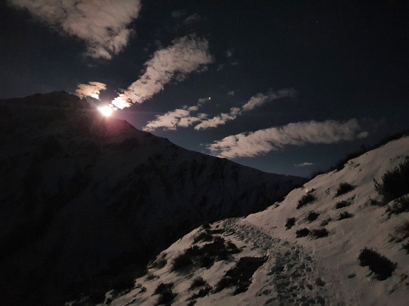
Once we got to the top of the gondola, we started to appreciate the (unplanned) full moons added light beyond the beams of my headtorch.
We navigated through the Skyline amenities and found the dirt track again. We noted the DOC estimated walk times to the saddle and the summit, using them as a marker to gauge how fast we were walking.
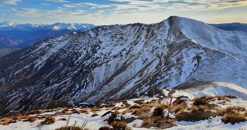
After a short section of forest we got our first glimpse of the Ben Lomond peak.
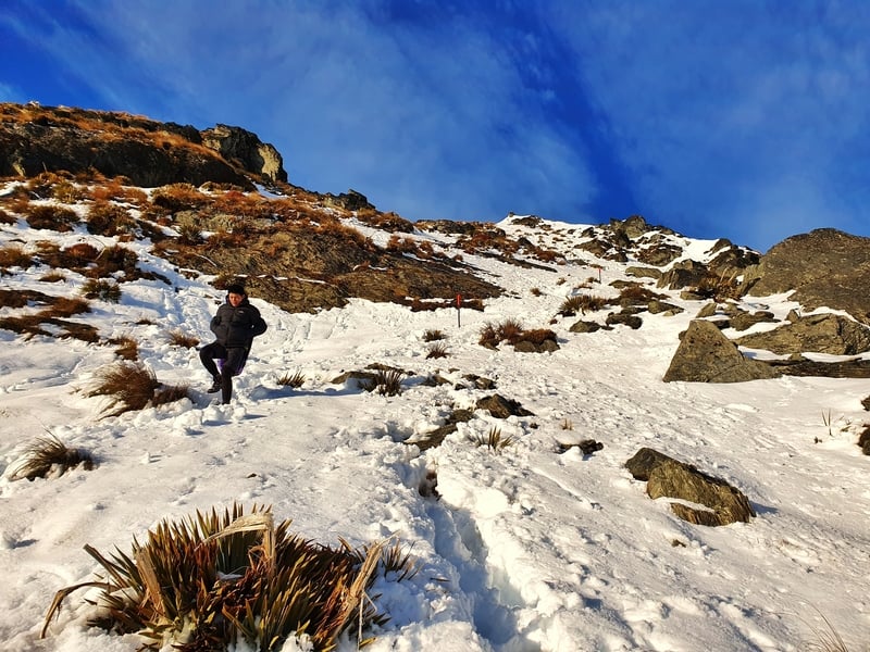
We knew the walk to the Ben Lomond Saddle would need to be efficient with the snow or ice to deal.
I can’t recall exactly where we started walking in the snow, but it was before we reached the saddle. It wasn’t deep to start with, and it’s much better than walking on ice.
As we closed in on the saddle, we knew that despite making what felt like a good time, we couldn’t ease off the pace. The climb from the saddle to the summit would be a slower grind.
We hadn’t been chatting much on the way up. I’d been in that annoying distance ahead, ensuring my friend kept moving quickly. Though the 5 metres had started to stretch out once we hit the snow. There was no way I was missing the first light. Ideally, we’d be there for first light.
And once the sun is up.
Once we hit the saddle, we could feel the cooler temperature, assisted by our pace slowing in the snow. It wasn’t freezing by any means, but it was good motivation to keep moving to stay warm.
We still needed our headlights beyond the saddle as we followed the marked poles up the ridgeline to the peak. We did stray off the track at times, choosing to follow the footsteps in the snow left from the previous day. There are some sharp dropoffs on the way to the peak, so if you’re straying off the poled route, make sure you don’t make any silly mistakes.
My friend was a lot slower going from this point on. I did my best to nurse the pace. I didn’t want to walk with him side by side as that would make the pace slower overall.
The snow wasn’t too thick across the board, but there was the odd step where we got knee-deep.
What was also on my mind was knowing that we weren’t going straight up the peak to the summit. The trail takes you around the side and you come up from the other direction which would add on another 10-15 minutes of walking (you can see this on the map).
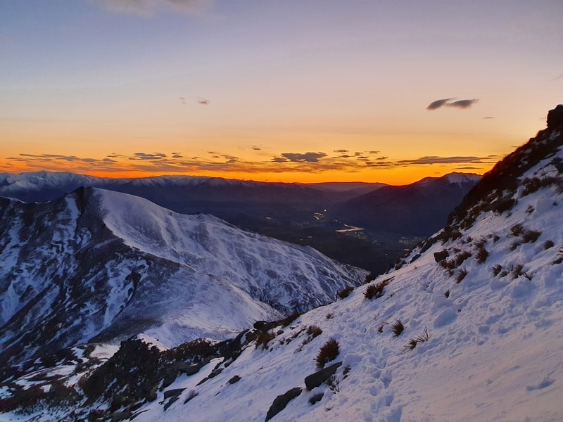
We were less than 500 metres from the summit when the oranges started to glow on the horizon as dawn came through. My mate had slipped back further but I continued to wait to ensure he was within eyesight…while we had a beautiful day for it, it’s a basic safety measure.
It was at about this time when I started to understand why DOC recommends crampons and a pickaxe in the height of winter. While waiting for him at one point, I didn’t notice I was standing on ice. A slight shift in weight and I was on my bum in a second.
The last couple of hundred metres of the climb wasn’t so bad, perhaps that was because of the excitement of being so close. But I hared up there with the friend a few minutes behind.
I’m not sure if it’s what we expected, but we were the only two who had woken up at silly o’clock to make it.
I wish I could say I stopped to take it all in peacefully, but wow it was cold!
So cold that the phone battery started draining fast. Thankfully I’d decided to bring my power bank so I could get some more photos.
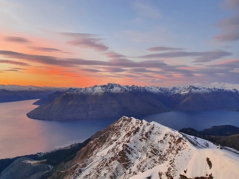
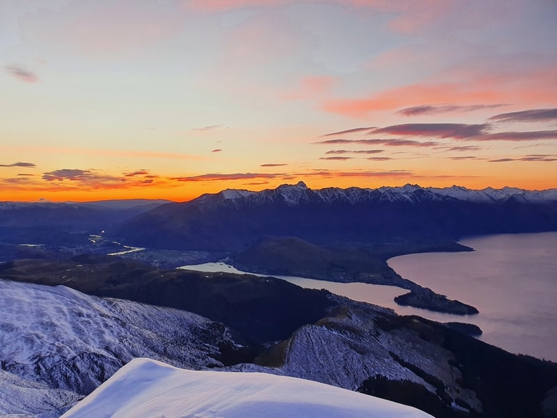
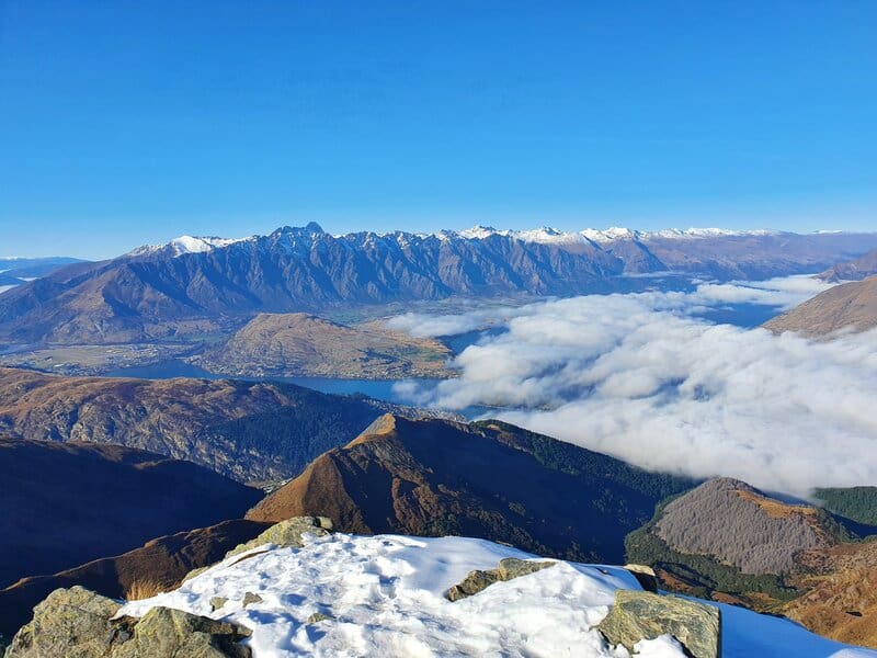
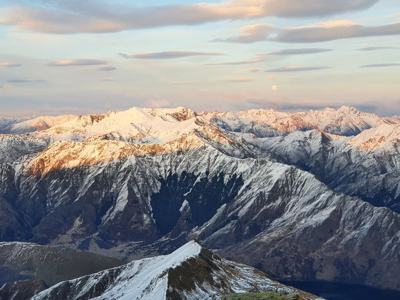
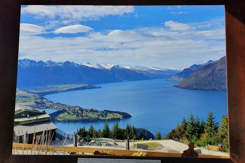
The sunrise was amazing with the sun rising up behind Lake Wakatipu.
I’ll let the photos and video do the talking though, as the 360-degree views were insane as the sunlight started to hit the various parts of the landscape.
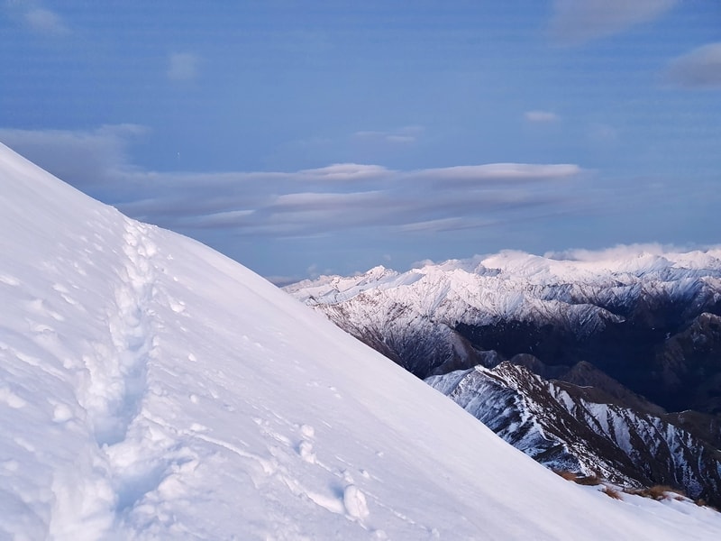
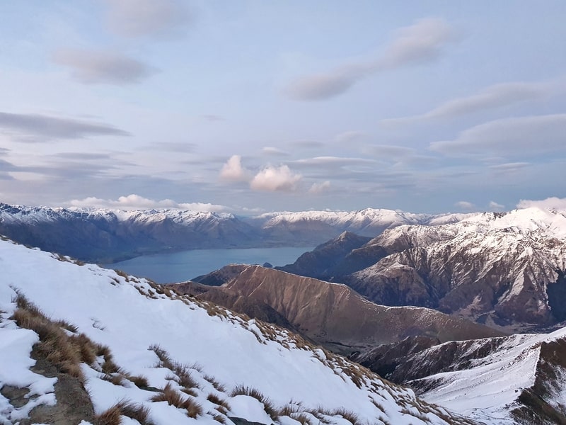
This is a view from the summit in early June. There was some snow in the last few hundred metres leading to the summit.
Asking some people back at the hostel which they preferred better, Roys Peak or Ben Lomond They all said Ben Lomond.
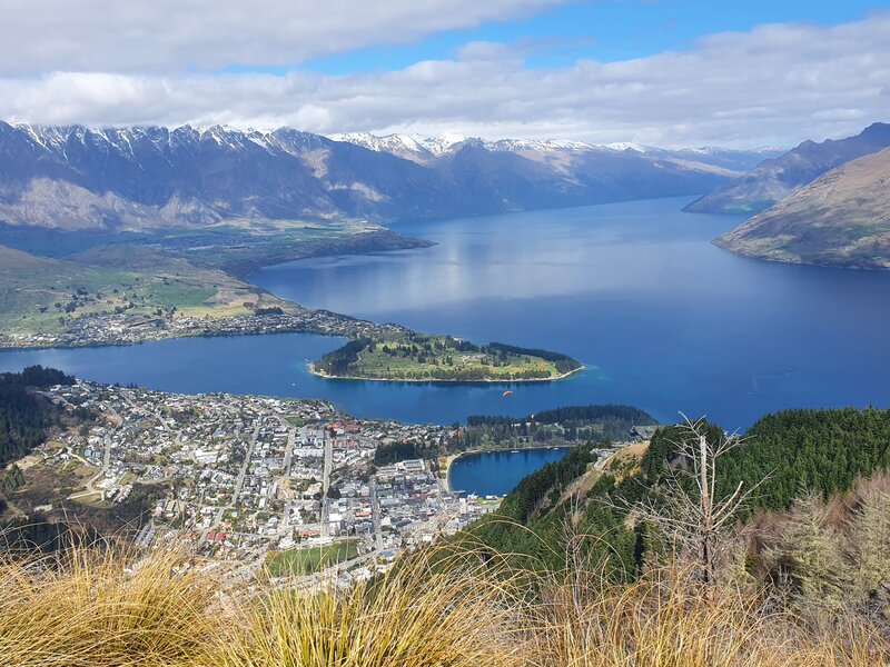
After admiring the views, we were both feeling cold. While we had million-dollar views (you can even see Moke Lake), it was tough to enjoy them while being pretty uncomfortable. With that said, we were at the summit for about 30 minutes before we started beginning the journey back.
The descent from the summit to the saddle was slow going. We were acutely aware of the ice now and avoided it wherever possible. Now that it was light, we could see it easier which if anything slowed us down even more. I did manage to take another slip despite the precautions.
Once back at the saddle, progress was pretty steady as the ice that had settled in our footprints began to turn into slush.
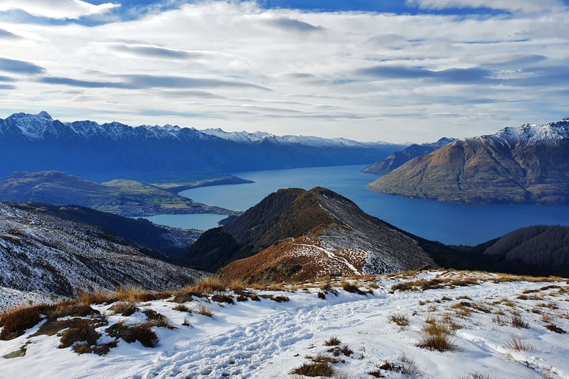
We were loving the views all the way back down. We also took looks back towards the peak we’d just come from. We were stoked to not have to share the sunrise with many others.
We saw two groups of people making their way up when we got close to the gondola, both stunned we had already been to the top.
The morning was still young, so the top of the gondola was quiet before we jogged down the Tiki Trail. I guess we had enough energy figured jogging would get us back to Fergburger (a great post-hike treat) earlier before any kind of queue could form.
I felt a little awkward walking into Fergburger with the dry blood from my cuts on my knee and wrist but the burgers went down a treat. I can confirm Fergburger is worth it. Just go early to beat the queues.
Lord of the Fries Queenstown is another good burger option where you won’t look so out of place. Or just go and drink craft beer 😉
And then we walked back to the hostel where I spent the next three hours sleeping. Best day ever type of stuff.
5. MY FAVOURITE ROUTE UP AND DOWN BEN LOMOND
The experience above is my first time going up the Ben Lomond Track. But I’ve since been to the summit a host of times, and have decided this is my favourite route.
You start at the One Mile Track, and go to the summit via that route an return via Jan’s Peak and the Tiki Trail.
Why?
- The One Mile Track is interesting with some old mining equipment you get to see.
- It’s not a pure out and back, which makes it more interesting on the way back down.
- The ridgeline to Jan’s Peak is one of my favourites in the Queenstown area (Brow Peak is another favourite)
- You get a fun view looking down on Queenstown
Next time I do it, I’ll make sure to record it exactly to give precise GPX files, distance, and elevation profiles.
Wow, the Ben Lomond summit hike delivers. I’ve taken a few friends up for their first visit to the summit and they’re all stoked the whole way.
I’d love to see your photos from your Ben Lomond hike. Link them in the comments below and I’ll check them out. Leave any useful tips you have too 😉 Or any questions.
RECOMMENDED READING
200+ Things to do in New Zealand
All of the best things!
Walking The Mount Crichton Loop
This would be a good option as a warm-up before doing the Ben Lomond track
Queenstowns Moonlight Track
Instead of turning left at the saddle, the Moonlight Track continues straight
Running Trails in Queenstown
5 of the best options if you’re visiting Queenstown

Hey, it’s Jub here. I’m the guy behind Chur New Zealand, helping you have the best time hiking, trekking, walking…whatever you want to call it…in NZ. I’m based in Queenstown and am always out and about exploring trails, old & new. If you have any questions, reach out.
Hey mate, I just wanted to say thank you for all the info on the blog. I have been in Queenstown on a 4 week holiday and have set myself a hike-a-day challenge. Your blog has been invaluable. I’m far from a hard-core hiker like you but managed to tick off some longer and more challenging hikes after reading your very thorough descriptions. I’m due to leave in a few days but I see there might be a window this Friday for the Ben Lomond summit. Fingers crossed I’ll make it!
Hey Anastasia,
THanks for the sweet message! Glad you were able to knock off some of the hikes you found rewarding. A hike a day challenge is something I want to do for a month as well..so good.
Today was definitely not the day for Ben Lomond haha. Friday should be alright though, have fun!
Cheers,
Jub
Best blog and info on the area that I’ve come across. Thank you.
Hey Tilly,
Thanks for the kind words! Hope you enjoy(ed) Ben Lomond 😀
Cheers
Jub
Thank you very much for this. I have relatively good fitness but I’m not a hiker and would otherwise not have attempted it. It was a great experience. It takes quite an effort to get up there, especially if you do the Tiki Trail, but the views are magnificent. I did this on April 22nd and couldn’t quite make the summit as it was quite icy near the top. Walking poles would have come in handy for long stretches on the way down. It was a sunny day and what appeared to be dry and firm ground earlier in the morning became damp, mucky and quite slippery on the steeper downhill grades as the morning wore on. Also, unless you’re dead set on making the summit, I would say there is little point going past the saddle in terms of the views. I highly recommend doing this. ✅
Hey Steve,
Cheers for sharing your experience. Stoked you had a good time. It’s funny, as now that icy section has gone again (May 12th). I agree, most people don’t NEED to get to the summit, but good shout on getting a wee bit past the saddle.
Best part, if you find you’re not fit enough to get as far as you planned on this trail is you can turn around.
Enjoy the rest of your trip in NZ!
Chur,
Jub