The Moke Lake Loop Track is a scenic 6 – 6.5km walk 20-minutes outside of Queenstown.
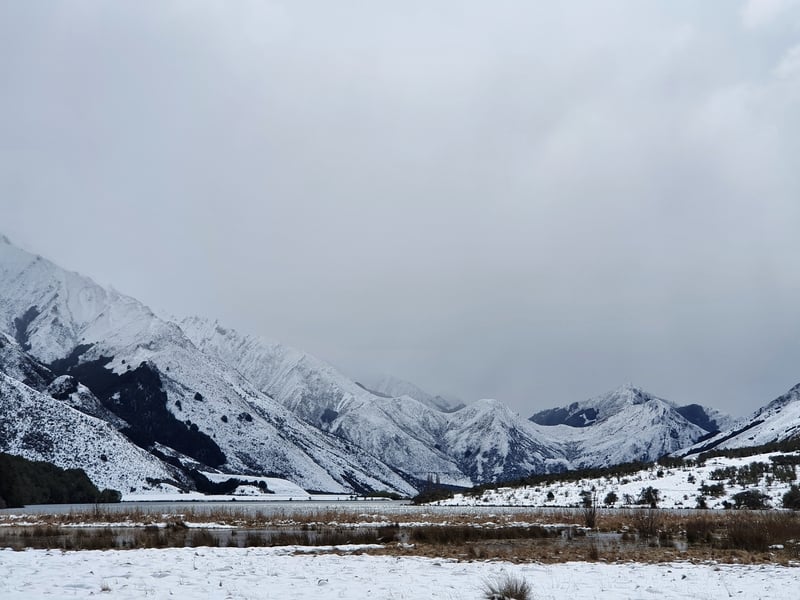
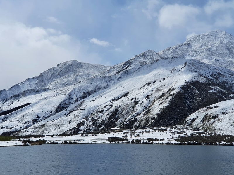
This walk is accessible year-round and will be a different experience in each season. The first time I did the Moke Lake walk was in late September and the surrounding snow was stunning (it’s rare to have snow so low at that time of the year).
This post will give you all the details you need to know about walking the Lake Moke Loop.
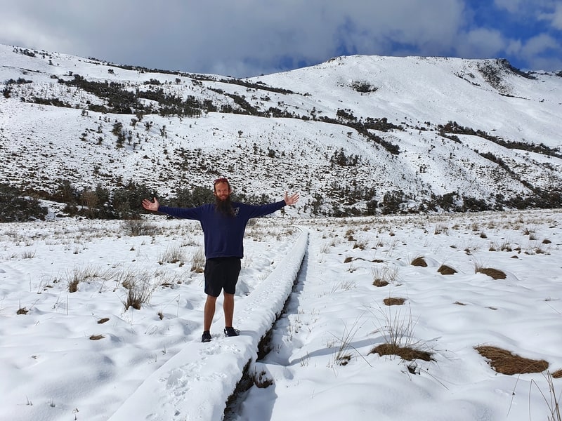
Me on the snow covered boardwalk. Proof I’ve walked around the Moke Lake Track.
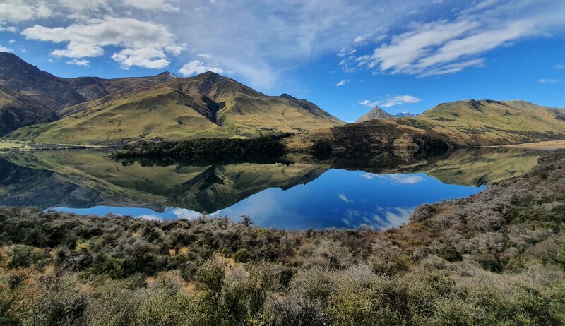
These were some amazing reflections on Moke Lake in early October…beautiful.
TABLE OF CONTENTS
1. Details About The Moke Lake Track
2. Moke Lake Track Map
3. How To Get To Moke Lake
4. My Moke Lake Experience
5. The TWO Secret Moke Lake Viewpoints
1. DETAILS ABOUT THE MOKE LAKE LOOP TRACK
This is one of the Queenstown walks that everyone has good things to say about.
Given it’s a 20-minute drive out of the city on the gorgeous Queenstown to Glenorchy Scenic Drive, there aren’t be millions of people on the track and you do feel pretty isolated being away from all the highways and cell reception.
The views are awesome, and the track is easy to follow with the boardwalks a nice touch.
And then like Rotorua’s Blue Lake walk, you can cool off (if it’s summer) and swim in the lake. Note: most lakes around Queenstown are cold but I found Moke Lake bearable.
Also, you can walk from the Mount Crichton loop to Moke Lake.
How hard is the Moke Lake walk?
Easy. While there’s a little elevation on the loop, there’s nothing complicated about the track with it being easy to follow.
How far is the Moke Lake walk?
Based on most Strava records, this is a loop that comes in at about 6-6.5km most of the time.
You might find yourself popping on a little detour at some points, but you won’t walk more than 7km for sure.
What is the Moke Lake walk elevation gain?
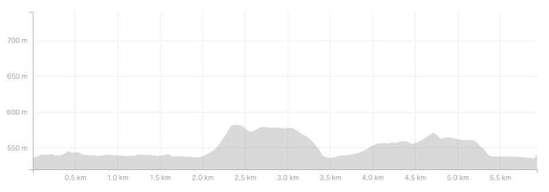
My Strava record about 156 metres of elevation gain. You can see the elevation profile above… there are no massive climbs, it’s more gentle undulations.
How long does the Moke Lake track take?
It took us just over 2 hours to complete the loop. We were stopping for photos a reasonable amount and weren’t racing through the walk so 2 hours is pretty reasonable for most people. The DOC signs say it’ll take 2.5 hours. I feel as though most people will take 2-2.5 hours to complete the walk (plus picnic time), though 75 – 90 minutes is possible if you’ve got limited time.
If you don’t fancy the walk, you can book this trip which includes transport to/from Queenstown. Rather than walking the track around the lake, you can choose to go on a kayak or SUP on the lake, one of the great spots in Queenstown to do so.
Or buy an affordable inflatable Kayak from Macpac which I’ve reviewed here.
2. MOKE LAKE LOOP MAP
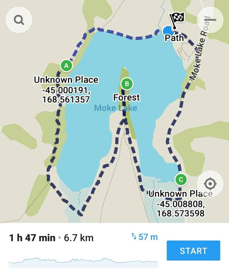
The map above is from maps.me and has the full loop on the map, as well as the other tracks in the vicinity.
Google Maps shows most of the track, but not the whole thing so I prefer sticking with the Maps.me app (there’s minimal phone signal near Moke Lake as well). That said, the signs are pretty solid and you won’t ever be far from the lake so you shouldn’t get lost at all.
3. HOW TO GET TO MOKE LAKE
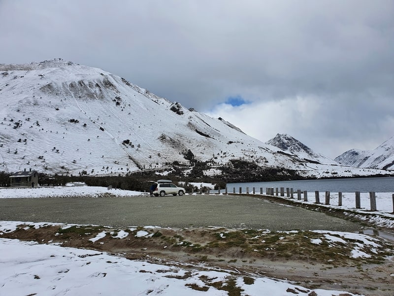
The parking at the DOC campsite area.
There’s no public transport to Moke Lake, so you’ll likely need to drive.
Hitchhiking from Queenstown is another option, though there is limited traffic after the turn-off onto Moke Lake Road so you might end up taking a while to get there. Some people like to bike here too…that’s not my idea of fun though 😀
There are numerous points where you can start the walk around the lake, but parking at the Moke Lake campsite is the norm. The track runs right from there.
You can also do some of the other tracks in the area that lead to Moke Lake.
DRIVE
It’s about 15km from the centre of Queenstown to Moke Lake. All you need to do is drive west along Lake Wakatipu towards Glenorchy and make the right-hand turn onto Moke Lake Road. Keep driving and you can’t miss the lake at all 🙂
Google estimates the drive to take 20-25 minutes.
4. MY EXPERIENCE WALKING THE MOKE LAKE LOOP
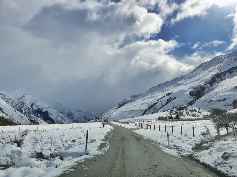
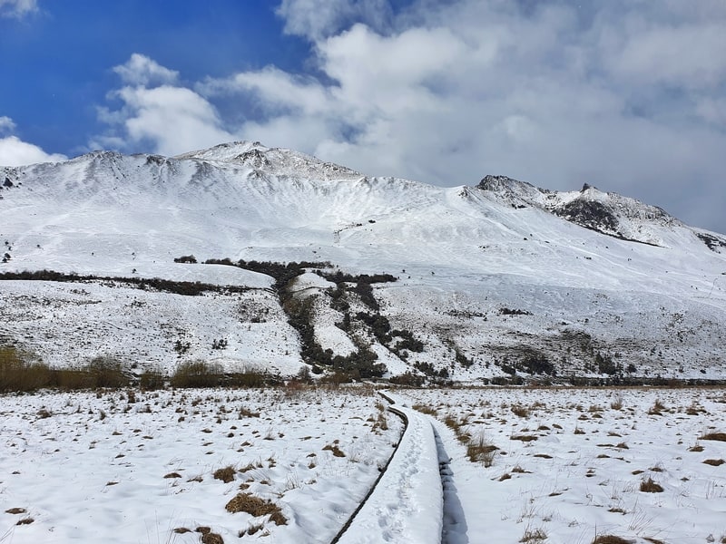
The drive along Moke Lake Road transitions from a sealed road to a well maintained dirt road after a couple of kilometres,
The day before I did the walk snow had been falling in Queenstown itself so we knew we’d be walking in at least some snow. That was ok, the main concern was the road to the lake might not have been suitable for driving.
We shouldn’t have worried though, as there was no snow on the road itself, but we drove cautiously, grateful for no slips on the ice (in a station wagon).
Once we arrived at the DOC campsite area we parked in front of the entrance. In hindsight we should have driven into the campsite area to the large car park space you see above (there’s a toilet block nearby too).
It doesn’t really matter what way you walk, but the most instinctive way is to go anti-clockwise across the boardwalk/bridge next to the car park first.
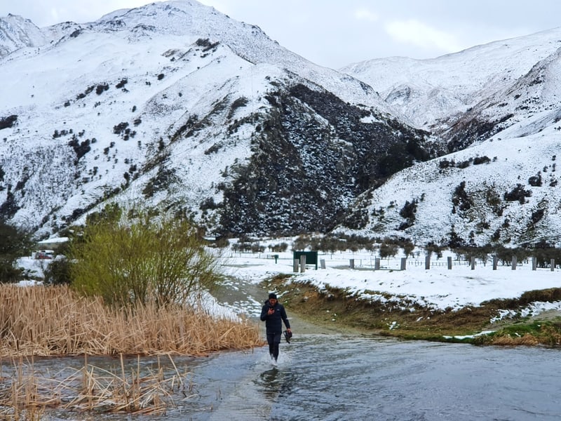
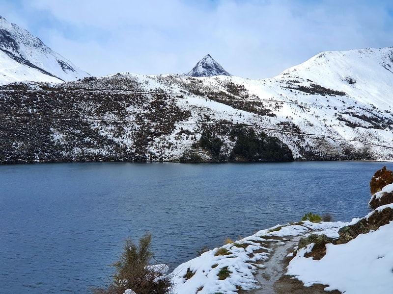
But that boardwalk soon gave became our first obstacle. The water level was higher than the boardwalk thanks to the melting snow. We attempted to find another crossing upstream but soon turned back after we committed to taking our shoes off and walking across. A chilly start!
I believe if you walk upstream about 200 metres you’ll come across a spot to cross, but that does mean sneaking across private land. That should be okay, as long as you move quickly. That said, the boardwalk will usually be fine.
With our shoes back on we follow the shoreline. Despite the snow it’s easy enough to follow the track. Once you hit the fenceline at the northwest corner of the lake, you can veer right to find the secret Moke Lake spot which I’ll detail later on.
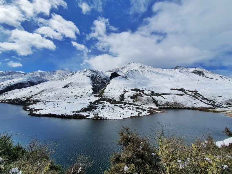
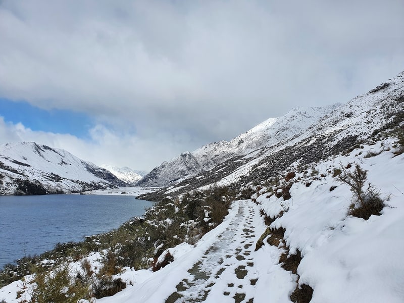
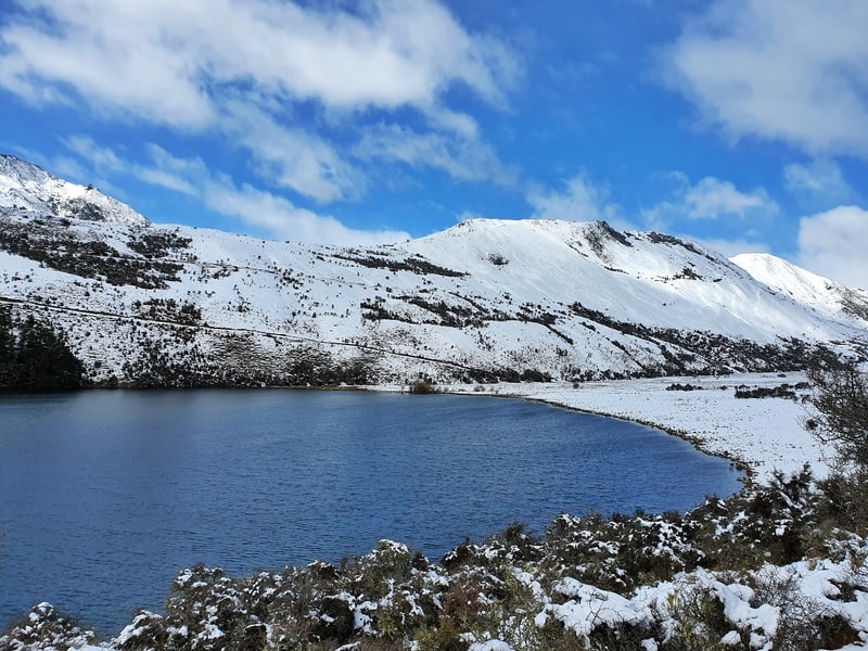
We turn left following the lake which involves a small incline to start. It’s nothing crazy and again the trail is easy to follow. The photo opportunities really begin here with the mountains, including the Ben Lomond summit overlooking the lake.
There’s nothing really to report as the walk is self-explanatory. It’s just a matter of following the track around the lake and trying not to stop for every single photo opportunity. You’d be there all day.
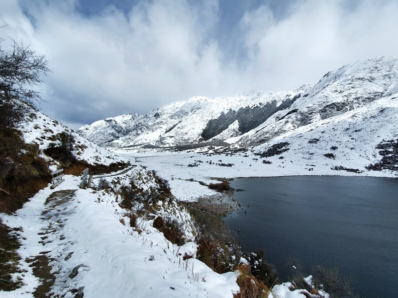
There are two boardwalks on the southern ends of the lake too. There’s something satisfying about walking on boardwalks.
The part where we nearly made a wrong turn was at the lake peninsula bit (this will make sense looking at the map) where there are a bunch of options. In reality, it’s simple.
We decided to walk out on the peninsula to see the view, which does add another few hundred metres to the walk but it’s a nice view (photo above). If you wanted to have lunch on the way, this would be the spot.
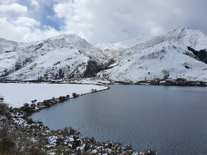
As you walk back to the main track, take the track on the left closest to the lake. This next section had some of the nicest views I felt.
After crossing the boardwalk and following the final stretch along the east side of the lake, you’ll be on the road for a few hundred metres. It’s not a heavily trafficked road so you’ll be fine (keep the kids close). You’ll see a sign pointing you back to the track as you make your way back to the campsite area.
In the summer, a swim in the lake after the walk would be ideal…or you could continue on the Moonlight Track to Arthur’s Point, departing Moke Lake.
No chance that was happening for us 🙂
5. THE SECRET LAKE MOKE VIEWPOINT
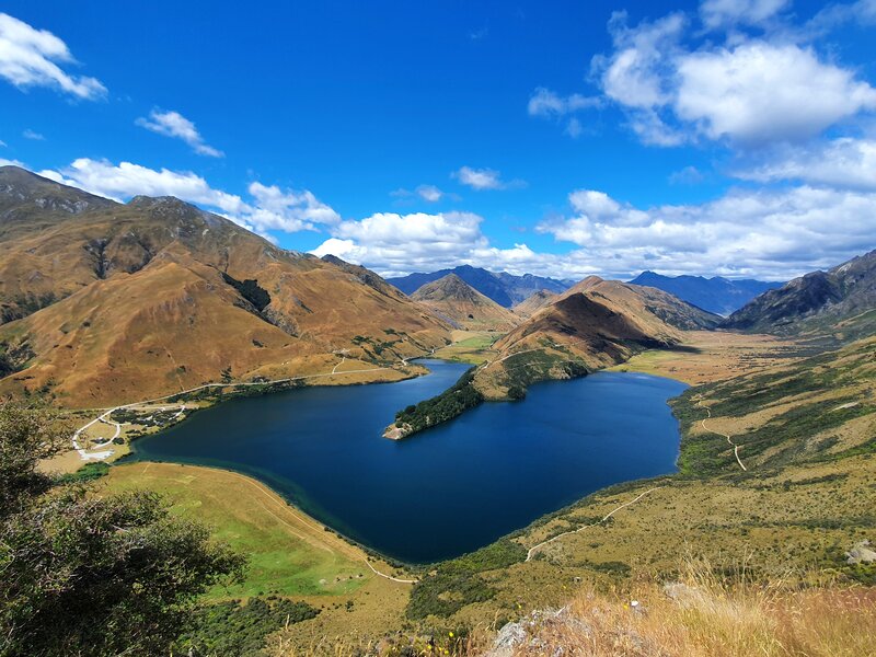
Let’s be honest, this isn’t such a secret now (there is another one with Moke Lake views towards Ben More Peak)…but I first discovered this from DestinationlessTravel.com. What does make it ‘secret’ is there are no DOC track/markings (or topo map routes) to take you there. It’s easy enough to find though…and provided you’re okay with heights and a steep incline, you’ll be good as gold.
But only do this if it’s dry. It’d get sketchy in the snow or if it’s wet.
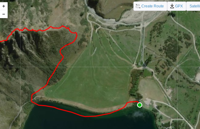
This is the route based on my Strava file. I can confirm I can’t walk on water so it’s not a perfect map, but you’ll get the idea of where to go from it.
I’ve posted the map above but from the campsite, walk across the boardwalk, and continue following the track until you get to the base of the hill where you turn left. Instead, you’ll go right where you’ll see a faint track following the fence line.
You follow this for a wee bit (there’s a couple of awkward sections) and then you’ll see the track veer up the hill.
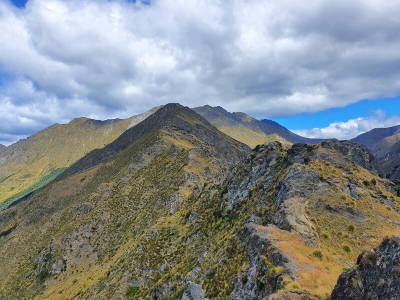
This is steep (over 300 metres of elevation in 1km), but it’s doable…and you can go as high or as low as you like. And if you really wanted, you could camp on the little plateau a few hundred metres up. If you love a ridgeline you can walk a reasonably long way along the ridge.
The Moke Lake Loop walk isn’t what you’d call a hidden gem. There’s a DOC campsite there after all. But it’s an amazing way to spend a few hours in Queenstown and get away from the chaos of town.
If you’ve got any questions about Moke Lake, leave a comment below or email jub@churnewzealand.com and I’ll do my best to help.
RECOMMENDED READING
What do in New Zealand?
Read this post and you’ll never need to ask the question again.
Amazing Hikes in the South Island
There are hundreds, I hope to do them all someday, but I rank my top five in this post.
The Queenstown Hill Walk
A must-do activity when you’re here.
New Zealand Slang
Some of the more common slang phrases you’ll hear in the country.
Bob’s Cove Track
Another awesome walk that’s close to Moke Lake.
18 Things to do in Queenstown
One of the top spots in the nation
Top Running Trais Near Queenstown
Moke Lake, plus four other great routes.

Hey, it’s Jub here. I’m the guy behind Chur New Zealand, helping you have the best time hiking, trekking, walking…whatever you want to call it…in NZ. I’m based in Queenstown and am always out and about exploring trails, old & new. If you have any questions, reach out.