Rotorua’s Blue Lake walk is one of if not the most popular walking tracks in the area. At less than 6km on a pretty flat track, it’s accessible to all fitness levels.
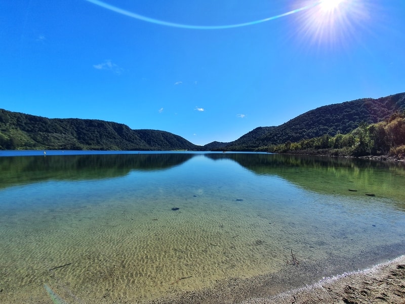
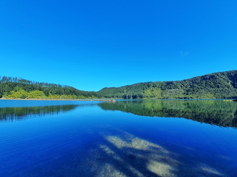
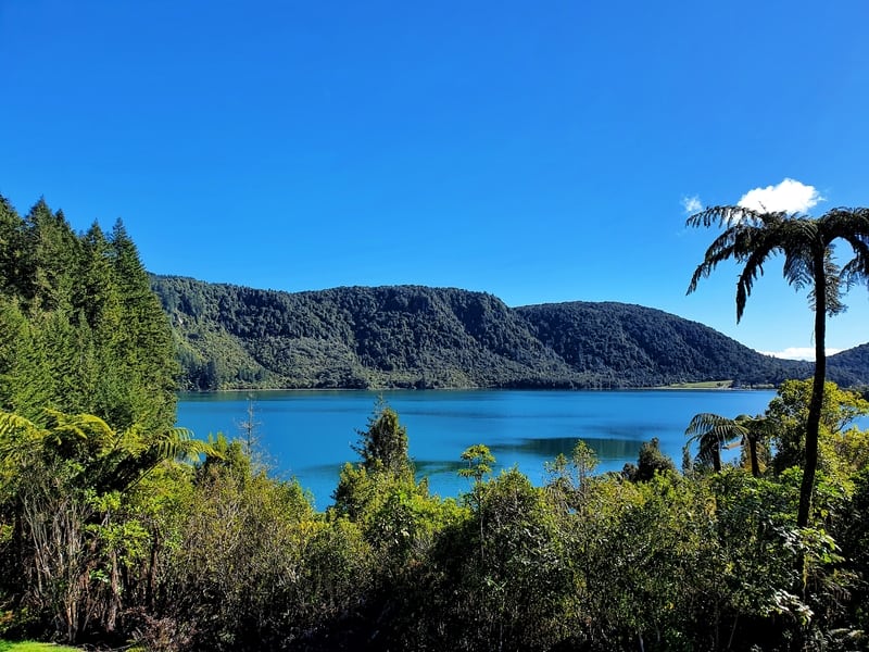
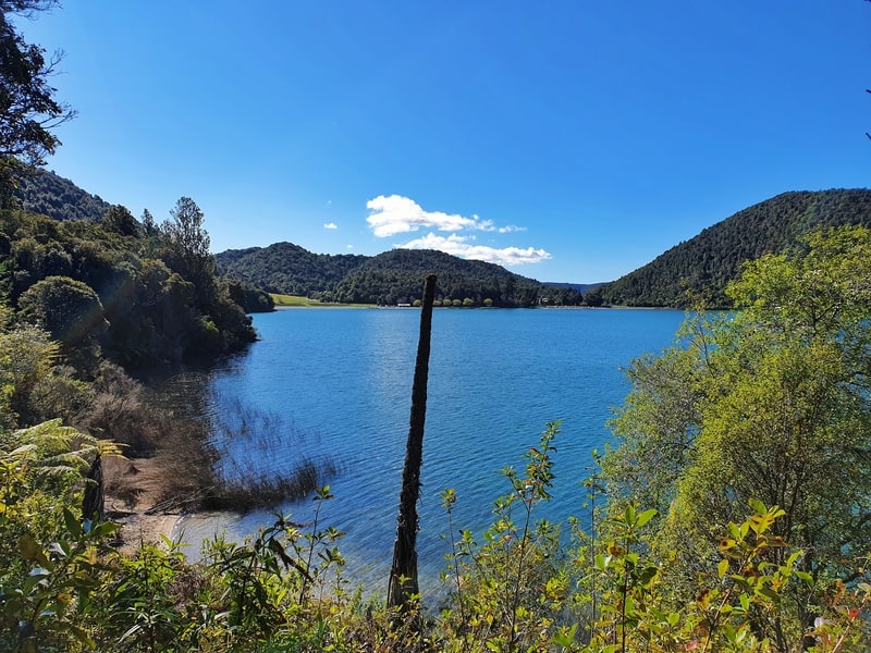
And the blue lake is genuinely blue. When you get to the Blue and Green lake viewpoint you’ll be surprised at how distinct the colours are (on a sunny day at least).
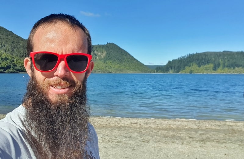
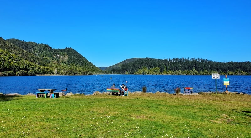
Proof I’ve walked Blue Lake
This post will give you everything you need to know about the Blue Lake walk. There’s plenty of photos too.
Honestly though? You don’t need to prep much for this walk, just go do it 🙂
TABLE OF CONTENTS
1. Blue Lake Walk Rotorua Details
2. Blue Lake Map
3. How To Get There
4. My Blue Lake Trip Report
1. DETAILS ABOUT THE BLUE LAKE WALK IN ROTORUA
QUICK DETAILS:
- Length: 6km max
- Elevation Gain: Less than 100 metres
- Difficulty: Easy
- Time: 1 to 2 hours
It’s hard to fault this walk!
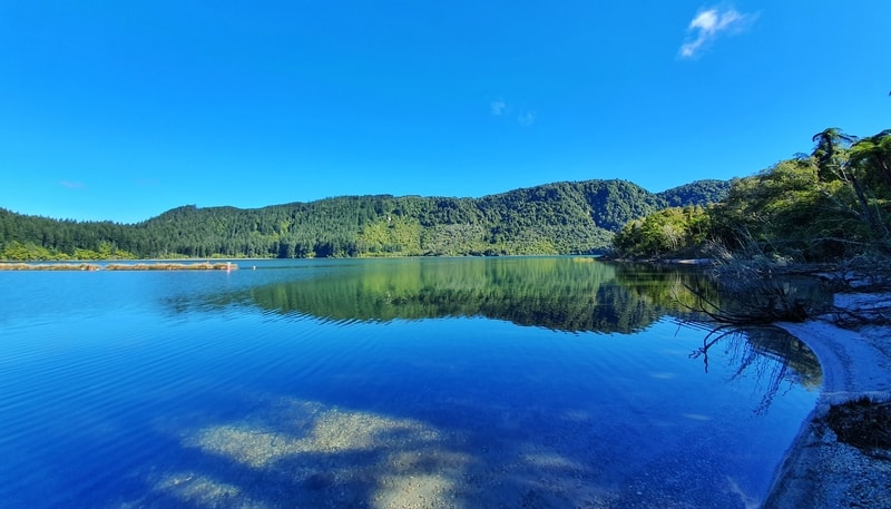
The Blue Lake is genuinely blue, and you get to see the Green Lake from afar while you’re at it. There’s a cafe and campsite right by the trail, and it’s a loop track. Win, win, win.
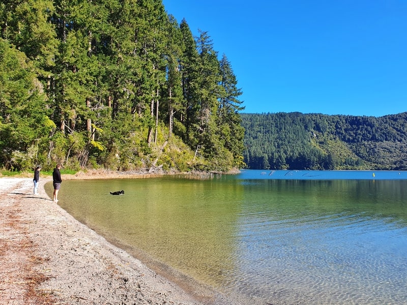
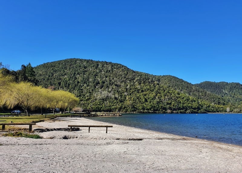
There are beaches you can stop at on the way (you’re allowed to swim in Blue Lake), and the track is well maintained. More wins. It’s a pretty choice walk.
But given it’s so popular, I would like to see some kind of public transport offered out this way. Even if it was just once on the weekends?
How hard is the Blue Lake walk?
Easy. There’s minimal elevation and the track is easy to follow.
How long is the Blue Lake loop?
As you’ll see from my Strava data we took a detour down a trail towards the Green Lake. If you take this away, that leaves a 6km loop. Maps.me has the circuit at about 6km and the sign on the track has it at 5.5km. So plan for a 5.5 – 6km walk 🙂
Are there any hills on the track?
There’s less than 100 metres of incline on the circuit. A good chunk of this is at the southeast corner of the lake where the Green and Blue Lake viewpoint is.
How long does it take?
It took us 2 hours and 18 minutes to complete the walk ( with the detour). If you’re speedy, you could walk the circuit in just over an hour, but most people will comfortably finish within 2 hours which includes some short breaks on the beach and taking photos.
2. MAP OF THE BLUE LAKE WALK
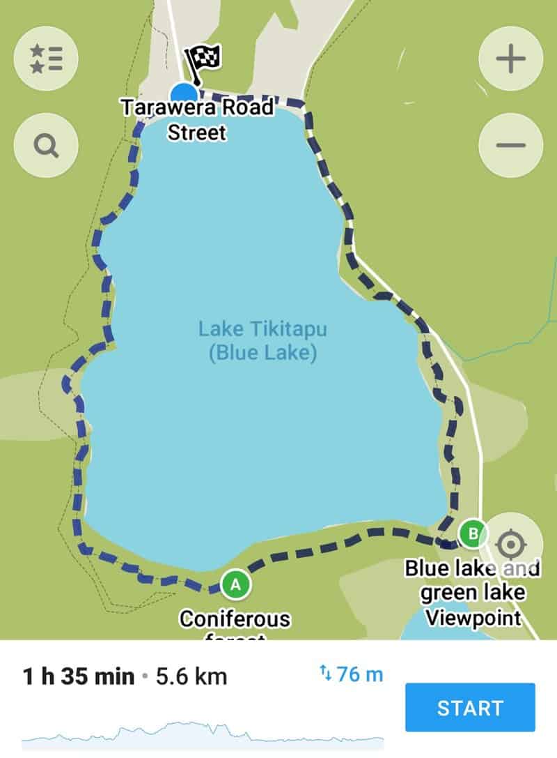
I’m surprised, the majority of the Blue Lake circuit is shown on Google Maps (here). It doesn’t show the trail on the eastern side of the lake though.
The map above is from maps.me. You won’t need a map for this track though, it’s easy to follow. Just stick close to the lake!
3. HOW TO GET THERE
There are no public transport options to Blue Lake so your best bet is to drive. You can go via bike, but the road route isn’t nice so you could meander through the dozens of Whakarewarewa Trails on the way which would be fun.
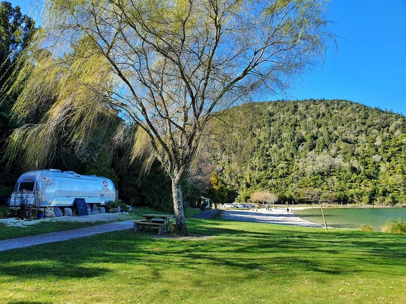
The drive there takes about 10 minutes from the city centre. There’s a couple of spots you can park, but I suggest parking just past the AirStream Cafe opposite the Top 10 Holiday Park. That was you’ve got easy access to your car if you want to take a swim after the walk. And access to coffee.
4. MY BLUE LAKE WALK EXPERIENCE
We had a beautiful morning for our Blue Lake track adventure. Although my mate was gutted Air Stream cafe was closed (for all of August). No coffee for him.
I’d read somewhere that walking in the anti-clockwise direction is best as that way you walk against the traffic for the short section along the eastern end of the track.
So we started walking that way having parked in from on the Blue Lake Top 10 Holiday Park (there are a few different car parks around the lake).
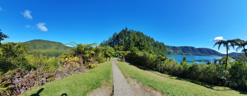
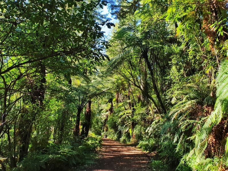
You continue following Tarawera Road, but there is a defined gravel path so you’re not walking on the actual road (keep younger kids close to you). On your left is a tree-filled hill, and an epic blue lake on the right. The walk is awesome straight from the get-go.
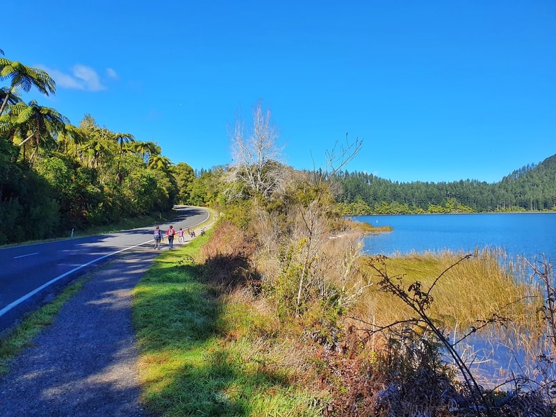
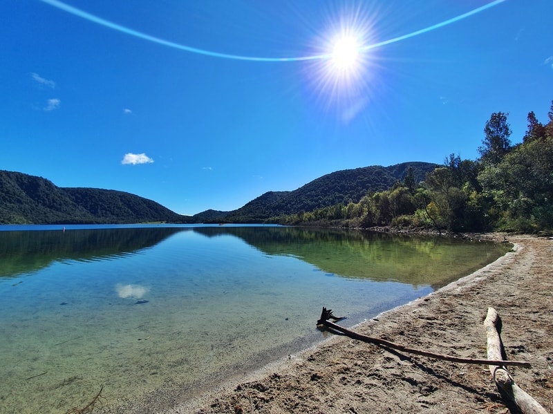
Pro Tip: If you’ve multiple days you can go to the lake, go on the sunniest day. The blueness of the lake is shown off even more. After following the road for about 500 metres you’ll come across a sign where it tells you to follow the track into the bush rather than continuing on the road. No cars to annoy you anymore.
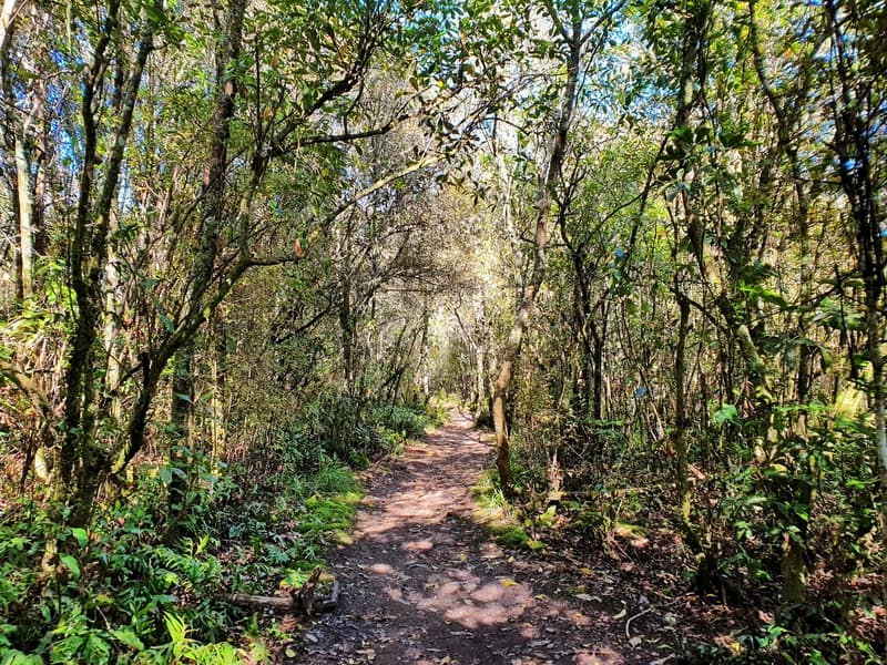
You’re under a thin tree canopy which is nice. I can imagine in summer it’s key when the sun just wants to burn you. There’s a couple of spots where the bush breaks up and you’re lakeside. Depending on where the sun is when you’re walking, they might produce the best photos for you.
Along this section, there are a couple of junctions, but it doesn’t matter which route you take. We always kept right (closer to the lake) but I can imagine if the tides are big you might need to go the left way to avoid wet shoes. Either way, there’s minimal difference.
And then you pop out at the beach on the southeast corner of the lake. This is a nice spot to hang out and is less busy than the north end of the beach.
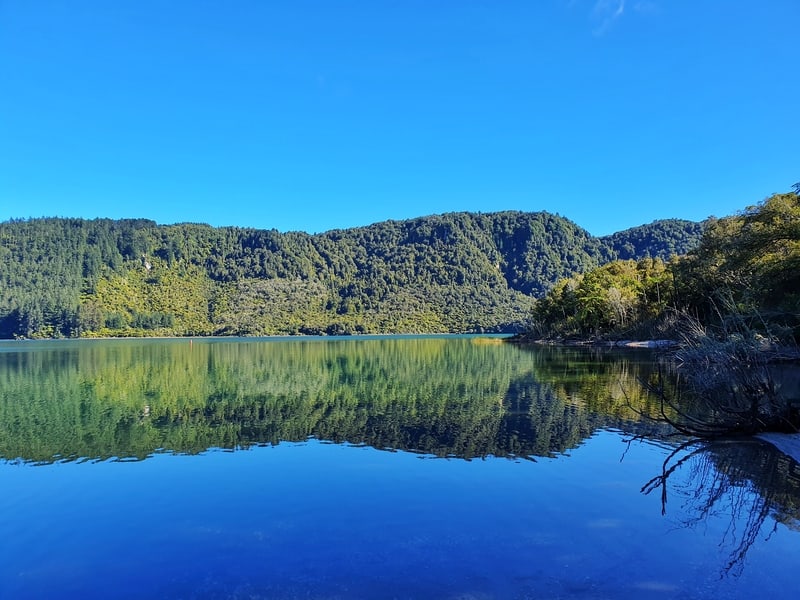
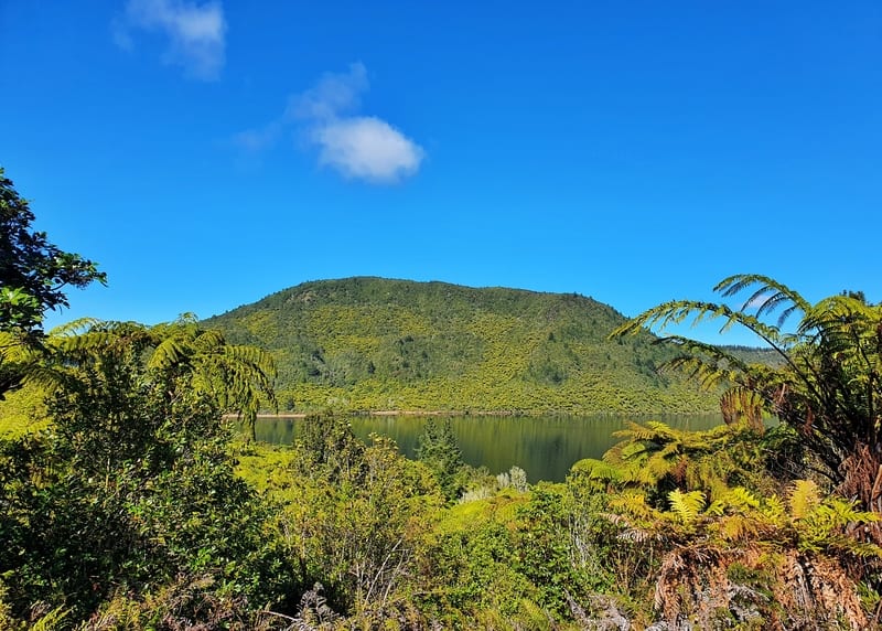
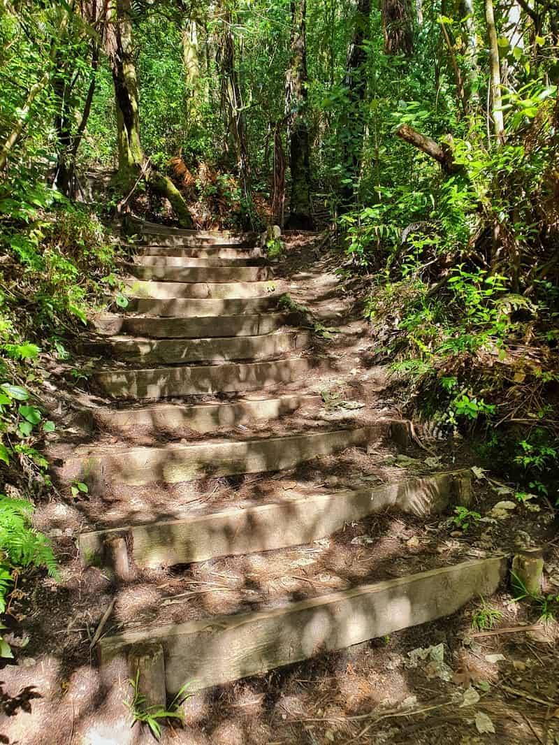
You exit on the other side of the lake, and you’ll need to go up the stairs which is the only ‘tough’ part of the walk. They won’t last more than a minute. When you get to the top, you’ll see a car park on your left. Walkthrough this car park as you’ll want to see the Green and Blue Lake Viewpoint. You get a good glimpse of the waters of the lake from the same spot which is cool. I still can’t believe how different the colours are.
From the Green and Blue Lake viewpoint
A few quick facts for you (from the information boards on the track):
Blue Lake (Tikitapu)
- Named as the place where the daughter of a high born chief lost her sacred greenstone
- Deepest points is 27.5 metres (150 hectares in size)
- No surface outlet, though it’s thought to drain underground to Green Lake
- Formed ~13,500 years ago
- Blue colour is due to the reflection from white rhyolite and pumice bottom
Green Lake (Rotokakahi)
- Named lake of the shellfish (kakahi)
- deepest point is 32 metres (440 hectares in size)
- Flows into Lake Tarawera via the Te Wairoa Stream
- Formed ~13,300 years ago
- Emerald green from above due to the shallow sandy bottom
- The lake is privately owned and sacred (tapu)
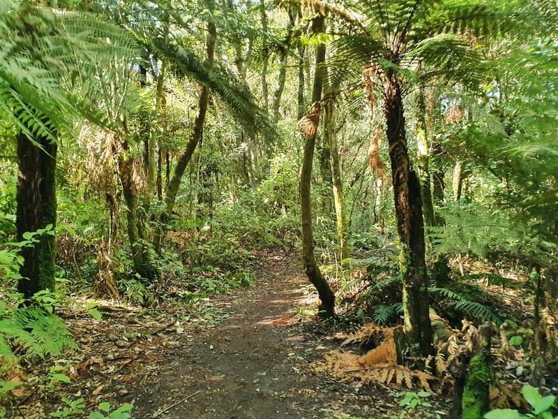
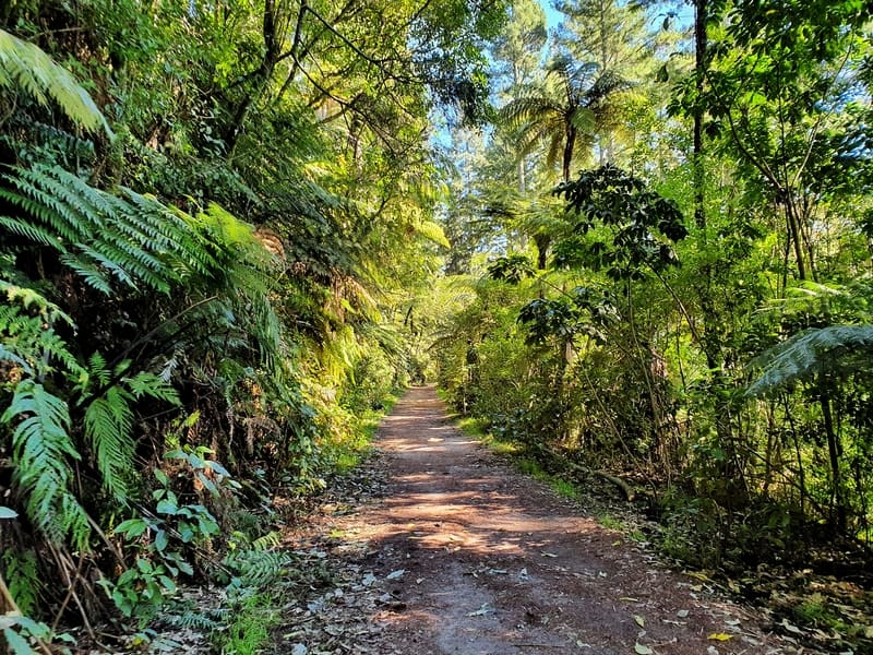
Once you’ve taken in the views, go back through the car park and continue on the circuit track. You’re now following the ridgeline that separates the lakes for a couple of kilometres. The trees are much larger here, and it’s more of a foresty track rather than a single trail. Beautiful all the same.
The next junction gives you a few options. You might be tempted to go left to see if you can get another view of Green Lake. We were thinking this, but after a couple of kilometres of walking hadn’t come across any epic views so turned back.
You can’t swim in Green Lake anyway (you can in the Blue Lake).
Once we got back on track, we meandered back to the start as we got a few more views peeking through the trees as we transition back onto a single track.
Back close to the starting point we chilled out on the beach for a little bit. This is where the boat entry to the lake is as well, so it’s certainly the busier end of the lake.
Blue Lake is one of, if not the most famous lakes in Rotorua and for good reason. It’s beautiful, reasonably easy to access and the walk around the lake is suitable for all ages. And you can go swimming afterward!
If you’ve got any questions about it, drop them below or email jub@churnewzealand.com.
p.s. Here’s a map of all the hikes documented on Chur New Zealand. You can click the icon to see brief details, as well as a link to read more about the hike (like this post).

Hey, it’s Jub here. I’m the guy behind Chur New Zealand, helping you have the best time hiking, trekking, walking…whatever you want to call it…in NZ. I’m based in Queenstown and am always out and about exploring trails, old & new. If you have any questions, reach out.
Did the blue lake walk , really nice walk,not very fit and completed it in just under 1 & 1/2 hours hardest part is the walk up to the carpark lookout area but just had a few stops to catch my breath and all good
Hey Phil,
Thanks for sharing your experience. Definitely a really nice walk 🙂
Enjoy Rotorua!
Cheers,
Jub