The Bob’s Cove Track is a short walk (usually about 3.7km return) packed with stunning views.
At times in summer, this sometimes feels super popular and at others, it feels like one of Queenstown’s hidden gems. But you can walk the Bob’s Cove Track throughout the year which makes it a great option for those looking for a nice walk during winter that’s not going to be muddy.
If possible, visit on a blue sky day when the water will look the best.
And while I say it can be popular, it’s just far enough away from the heart of Queenstown to not be overcrowded even on a busy day.
This post will give you the details about visiting Bobs Cove, and includes a bunch of photos from one of Queenstown’s easy walks.
TABLE OF CONTENTS
1. Details & FAQ’s About The Bob’s Cove Track
2. Bob’s Cove Track Map
3. How To Get To Bob’s Cove
4. My Bob’s Cove Walk Experience
1. DETAILS & FAQ’S ABOUT THE BOB’S COVE TRACK
How hard is Bob’s Cove Track?
Easy. It’s an easy walk with only one hill on the way to the lookout that may get your heart rate up a little.
How long is the walk at Bob’s Cove?
There are various routes you can take from the car park to the viewpoint, with the most direct route about a 3km return walk. The route I took on the map further below is ~3.7km.
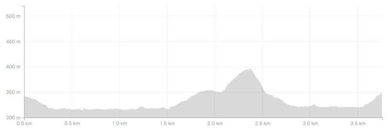
How much incline is there on the track?
The most notable elevation is the section up to the viewpoint, but it’s less than 100 metres total.
Here’s the elevation profile:
Hike long does the Bob’s Cove walk take?1 if you’re walking without stopping for photos, enjoying the views etc. you can do this walk in 45 minutes. But don’t be surprised if you end up taking 90+ minutes while taking it easy and enjoying every Bobs Cove track has to offer.
Can you swim at Bob’s Cove?
Yes, you can swim at Bob’s Cove. There’s a beach (with stones) you’ll pass on the walk which is a good place to base yourself for a couple of hours if you like. You might want to go and jump off Bobs Cove jetty which you can see from the beach.
Is the Bob Coves Track dog-friendly?
Yes, as long as they remain on a leash at all times.
2. BOB’S COVE TRACK MAP
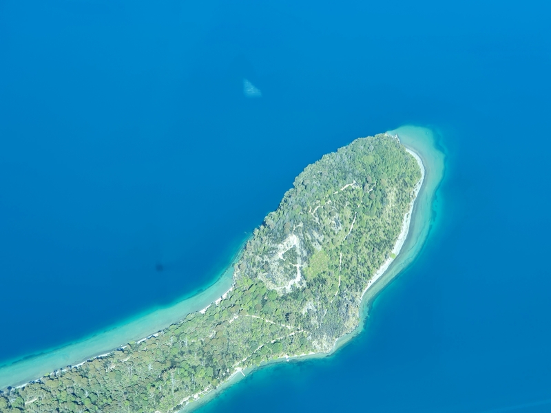
This is the peninsula you’ll see on the map below…as seen from a flight to Milford Sound with Air Milford.
Note: If you click on the map below, it’ll open the topo map in a new window.
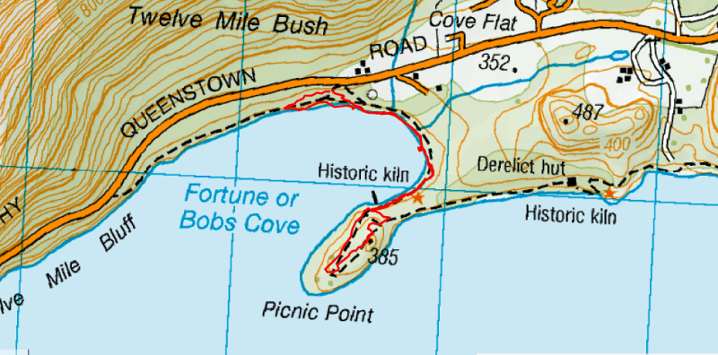
The map above is the Strava GPX file created when I recorded one of my Bob’s Cove walks.
The majority of the most popular Bob’s Cove walking route is on Google Maps, but it doesn’t include the full picnic loop on the peninsular which you can see on the image above.
That said, it’s easy to figure out where to go on this route so you don’t need a map.
3. HOW TO GET TO BOBS COVE
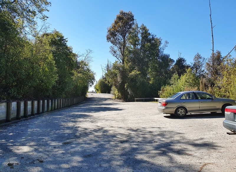
The best way to get there is to drive.
The distance from Bobs Cove to Queenstown is about 14km which takes about 15 minutes to get to. You can find Bob’s Cove car park on Google Maps here.
If you’re driving to Glenorchy, Bob’s Cove is a great stop on the Queenstown to Glenorchy Scenic Drive.
Hitchhiking in Queenstown is a norm, and you can easily hitch to Bob’s Cove. For the hitch back, walk 200 metres or so from the car park towards Queenstown where it’s easier for cars to pull over.
If you’re planning to use Uber/Ola etc. to get to/from Bob’s Cove you may struggle to get a ride back as the cars don’t like pickups that far out of town. And there’s not a lot of phone reception either.
4. MY BOB’S COVE WALK EXPERIENCE
I’ve visited Bob’s Cove a few times now, including once on a night run where the galaxy was on full display which was beautiful. That’s when this became one of my favourite places to run near Queenstown.
But in this post, I’ll describe the 3.7km Bob’s Cove walk as seen on the map above. It’s the best route I reckon.
From the car park, you’ll come to a junction right away with a sign pointing out various options. If you take a left you’ll take the direct route to the beach, but I recommend going right following the loop track.
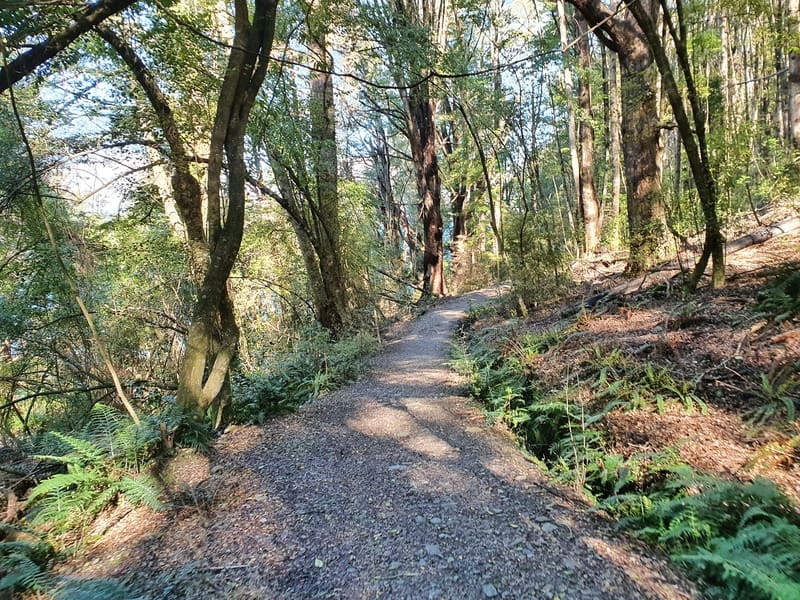
You’ll descend down the well-maintained track which takes you through some rather thick forest which is beautiful. On a warm sunny day, I like how the trail has a little cooling effect (on me at least).
S
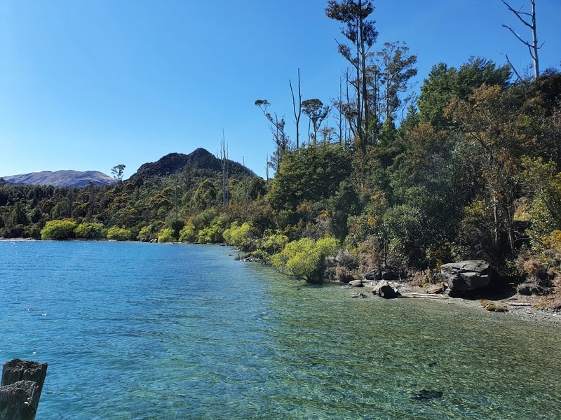
Make sure you don’t take the Bridle Track turnoff at the next junction, and you’ll soon find the track following the shoreline…though there’ll be trees between you and the water for a few hundred metres yet.
There’s a variety of trees and shrubs on the track and you’ll see some little signs with some facts about the trees along the way. My favourites are the lancewoods. So funky!
The loop track section doesn’t take long to complete before you stay right (you won’t complete the loop just yet) to head towards the beach following the track with a water race alongside.
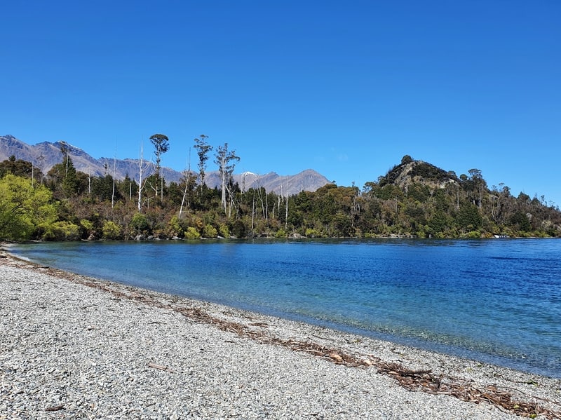
And then Bob’s Cove Beach appears, which has to rank as one of the best beaches in Queenstown give the views and location.
On a sunny day,I can easily spend a few hours out here. So with that said, you should probably head to the viewpoint right away before you get into full-on relax mode 😀
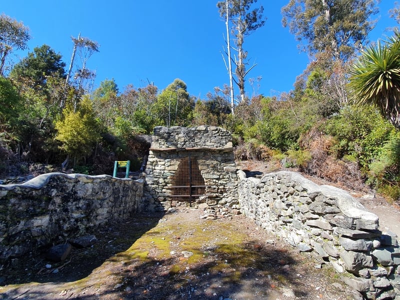
Keep following the cove around. You’ll come across a historic fire kiln (there’s a couple of info boards). There are a few gum trees along here, these were planted to help keep the limestone kilns burning.
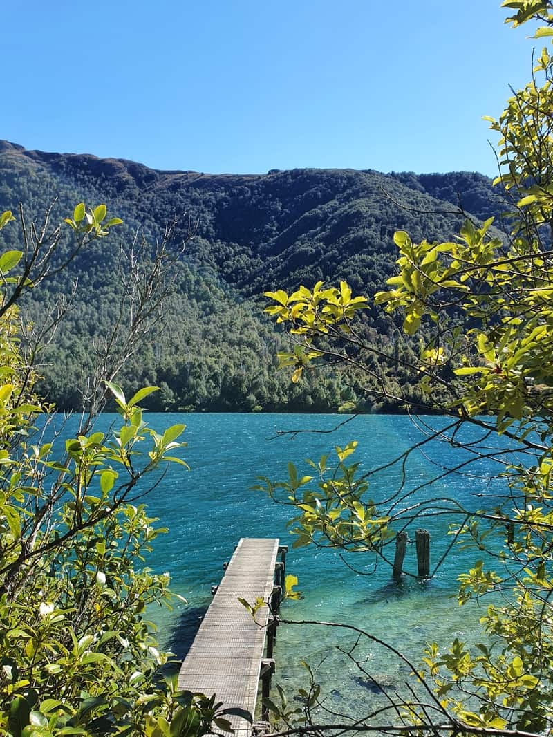
Moving on, you’ll then see the jetty which you can jump off…or take good looking Instagram photos if that’s your thing 😉
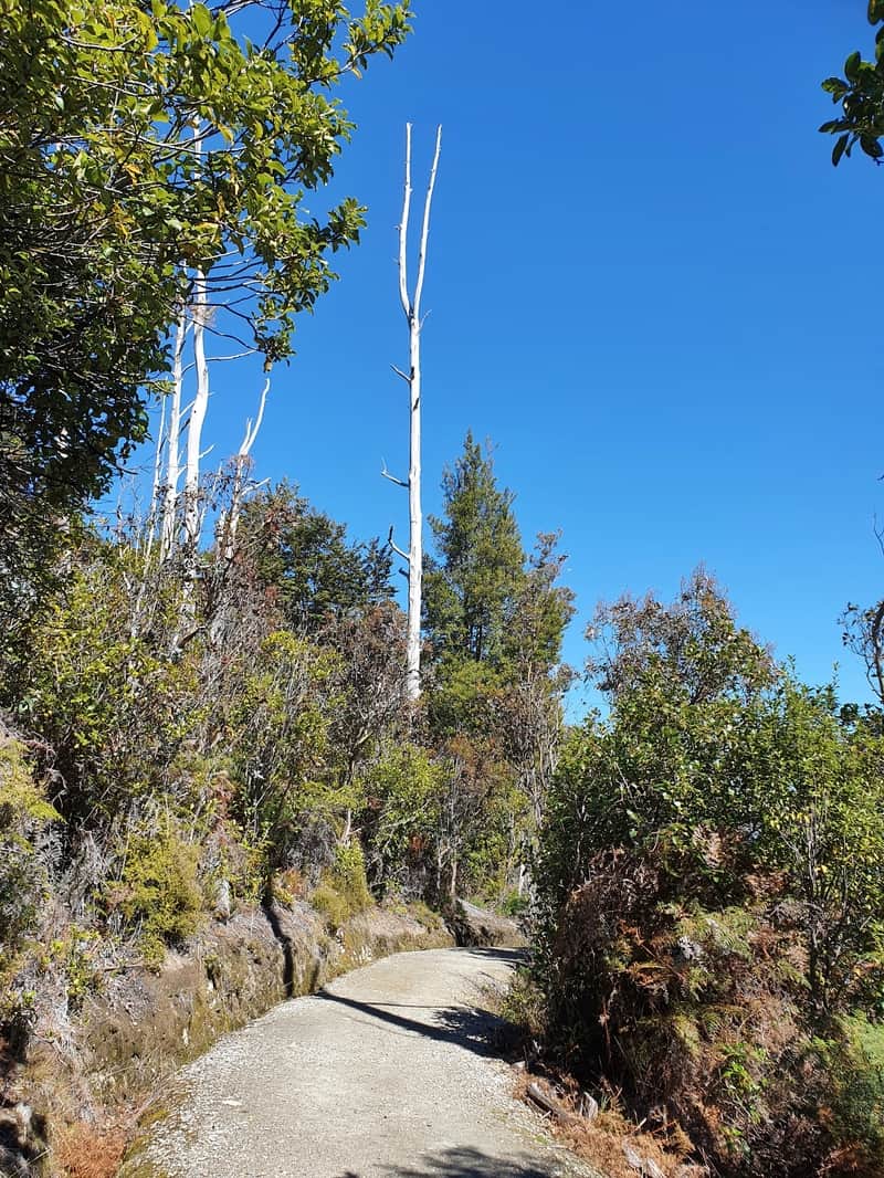
And a couple of hundred metres later you’ll get to another junction. Take a right as you’ll be following the picnic loop via the epic Bob’s Cove viewpoint.
There’s a steady incline up to the viewpoint, but the total elevation is less than 100 metres. You get some views on the way to keep you motivated.
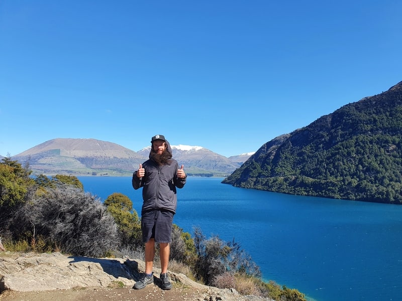
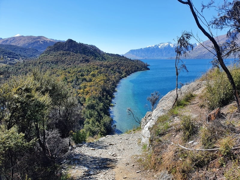
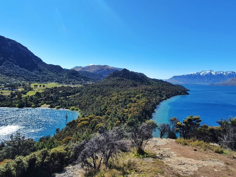
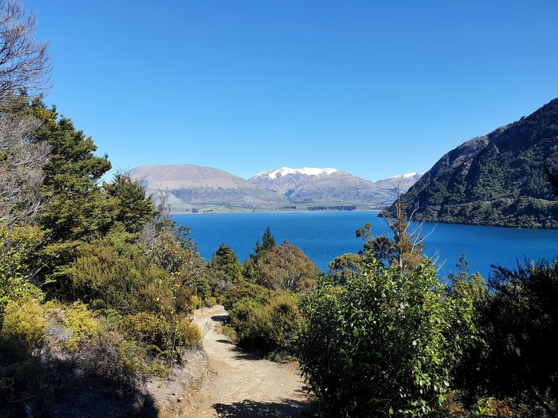
And once you reach the viewpoint, enjoy! You’ve got views back towards the beach, east along the shoreline and of The Remarkables, Cecil Peak, and Walter Peak. It’s got to be one of, if not the best walk next to Lake Wakatipu.
I’ve been up here at nighttime too…with minimal light pollution, the stars are amazing out this way.
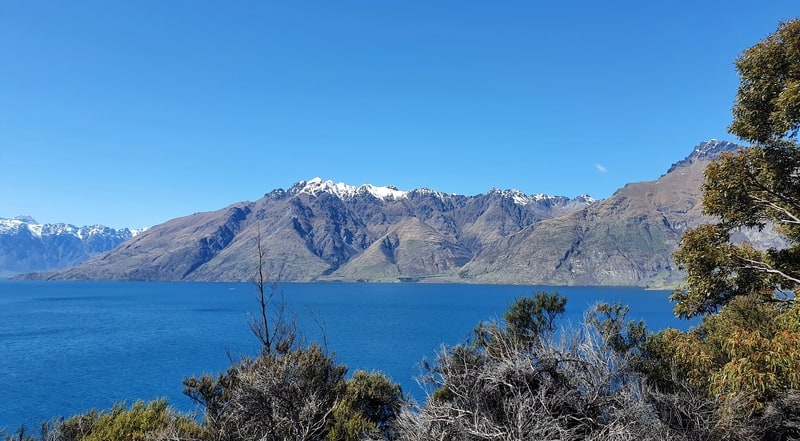
Add in the colours of the water, and it’s definitely one of the best views in Queenstown. You could easily spend an hour or two enjoying a picnic up here rather than at the beach if you wanted.
And then it’s time to head back down the other side of the hill where you’ll get a couple more awesome views of the shoreline on the way down. When you get to the green DOC signs, follow the directions back to the car park.
Of course, stop at the beach/jetty on the way back if that’s your plan.
When it’s close to the end of the track, turn right to complete the original loop track you started on and you’ll end up back at the car park.
The Bob’s Cove Track is pretty stunning yea? If you’re not planning on doing lots of South Island walks/hikes, make this one you must do.
If you’ve got any questions about the walk, let me know in the comments below or email jub@churnewzealand.com
Cheers!
WHAT TO READ NEXT: THINGS TO DO IN QUEENSTOWN

Hey, it’s Jub here. I’m the guy behind Chur New Zealand, helping you have the best time hiking, trekking, walking…whatever you want to call it…in NZ. I’m based in Queenstown and am always out and about exploring trails, old & new. If you have any questions, reach out.