The Queenstown Hill walk is a 5-6km out and back hike with a small loop in the middle (the map below will show the loop). This is a favourite with locals and for good reason.
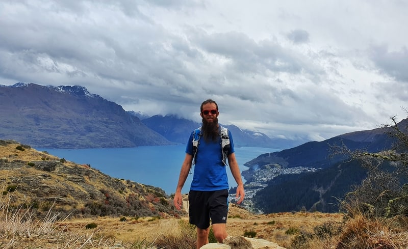
Proof I’ve experienced the Queenstown Hill summit.
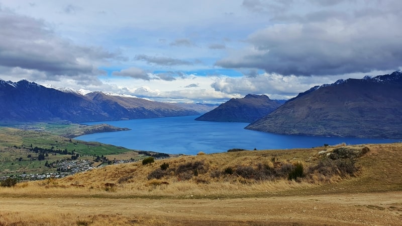
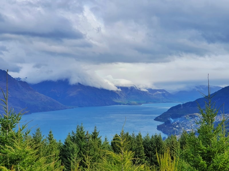
With a steady incline, the lookout from the top of Queenstown Hill offers amazing 360-degree views. You’ll see Lake Wakatipu, Ben Lomond, The Remarkables (you can walk up them), and more.
And you don’t need to walk all the way to the summit, you get lovely views from the Basket of Dreams at the halfway point of the loop.
This makes it one of the popular Queenstown walks and a close to must-do activity in Queenstown.
This post will give you all the details you need to know before you begin the walk, along with plenty of photos and a video. I’ve been up Queenstown Hill at least a dozen times. It’s always a goodie.
TABLE OF CONTENTS
1. Details About The Queenstown Hill Walking Track
2. Queenstown Hill Walk Map
3 How To Get To The Trailhead
4. My Queenstown Hill Hike Experience
5. Other Queenstown Hill FAQ’s
1. DETAILS ABOUT THE QUEENSTOWN HILL WALKING TRACK
How good! You literally walk from a residential street onto the trail, and less than 2.5km later you’re at the summit where you can chill out and take in all the views.
You can’t ask for much better given you get views on the way too. The only criticism I can find is there’s no sign at the Queenstown Hill summit which tells you what you’re surroundings are.
But yea, this is a magical walk if you’ve just arrived from the airport and have a few hours of daylight left.
How hard is the Queenstown Hill hike?
I’ll give it an easy to medium rating. It’s not difficult in terms of technicality, but I do see people taking regular breaks on the way up. If you’re not feeling super fit, don’t get flustered. It’s a solid incline! Thankfully it’s a relatively short hike so give yourself plenty of time and you’ll get there.
How far is the Queenstown Hill track?
Based on regular Strava records, I get about 5.5km return. That includes a little bit of walking around at the summit and around the Basket of Dreams.
What is the Queenstown Hill elevation gain?
From bottom to top there’s about 408 metres of elevation gain total (according to Strava). The trailhead is at 430 metres and the summit of Queenstown Hill is 841 metres above sea level, a difference of 411 metres. There are minimal undulations so this feels right.
How long does it take to walk Queenstown Hill?
On a good day, it’ll take me about 1.5 hours to get up and down, which includes a little break at the top. That’s going at a good speed and I am a decent uphill hiker.
The sign at the trailhead says 1.5 to 2.5 hours return. This is going to be accurate for 80%+ people. But you could always take a picnic or book or whatnot and spend a few hours at the summit stretching it out to a half-day trip.
2. QUEENSTOWN HILL WALK MAP
You can see the walking tracks on both Google Maps (above) and Maps.me. Maps.me includes the mountain biking tracks which can be confusing when you’re looking at the app.
With that said, the Queenstown Hill track is easy to follow (you’ll never accidentally end up on the bike tracks) and you don’t need a map.
3. HOW TO GET TO THE TRAILHEAD
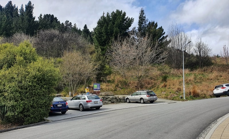
The trailhead is here on Belfast Terrace on the outskirts of town making it easy to access on foot, or by car. The nearest bus stop is 700 metres away from the trailhead.
DRIVE
No you cannot drive up Queenstown Hill! But you can drive to the small car park in front of the trailhead. There’s a good chance it’ll be full, in which case you’ll need to find free parking elsewhere on Belfast Terrace. It’s less than 5-minutes drive from the Queenstown waterfront.
WALK
If you’re going to walk from town, be prepared to add some elevation to your walk (~120 metres). That said, it’s so convenient to get to and from this trailhead, embrace it.
OTHER
You can get an Ola/Uber/YourRide to the trailhead which could be handy if you’re not used to walking up hill. It’s not an easy walk up to the trailhead :p
4. MY QUEENSTOWN HILL HIKE EXPERIENCE
This is the trip report from my first time up Queenstown Hill.
With the weather set to turn for the worse over the next few days, I made a beeline to the Queenstown Hill trailhead to get the walk completed while the sun was around.
The walk to the trailhead was steeper than I expected and I can imagine a few people wondering what they’ve gotten themselves in for before they’ve started the actual walk.
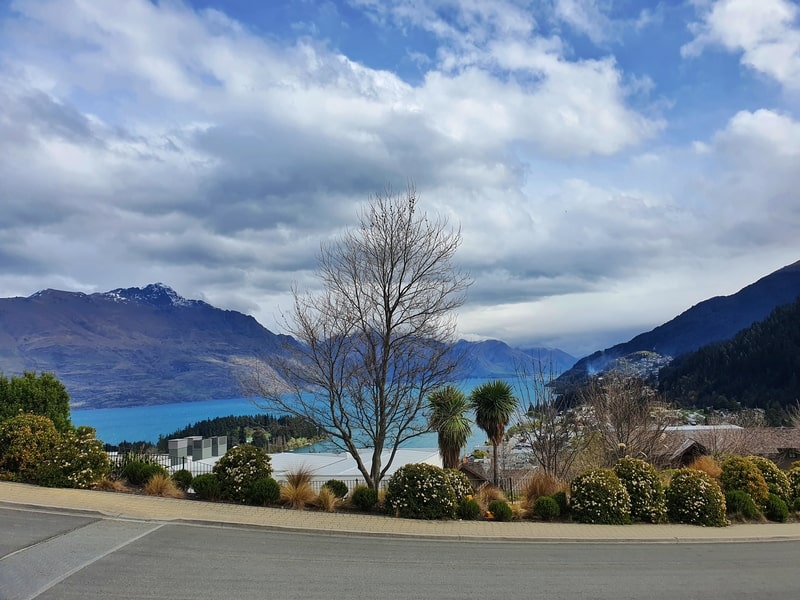
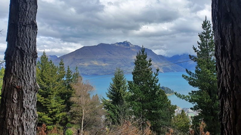
You even get a view from the trailhead
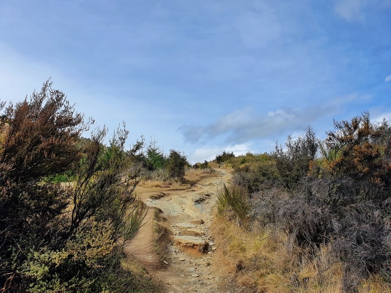
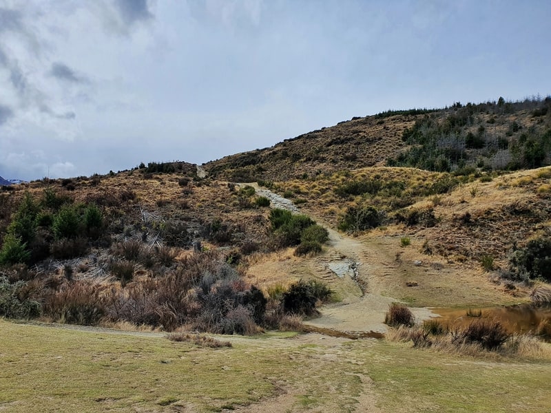
The track starts off with an incline from the get go, with the first 100 metres possibly the steepest section of the entire track. Your footing isn’t an issue with a tightly packed dirt trail.
What I did like was that you’re rewarded with views early on to keep the motivation going. They also give you the opportunity to take a low key break 😉 As do the information signs on the way which give you introduction about the history of the area.
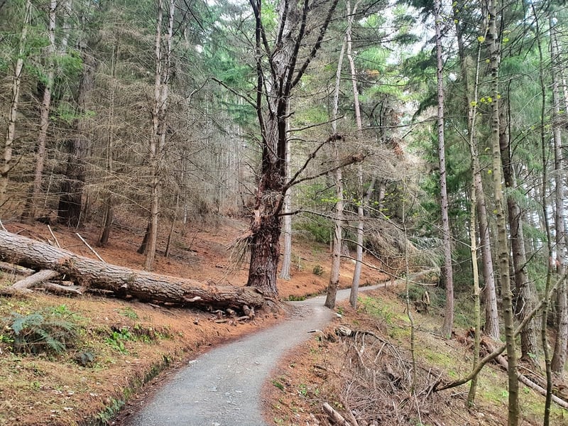
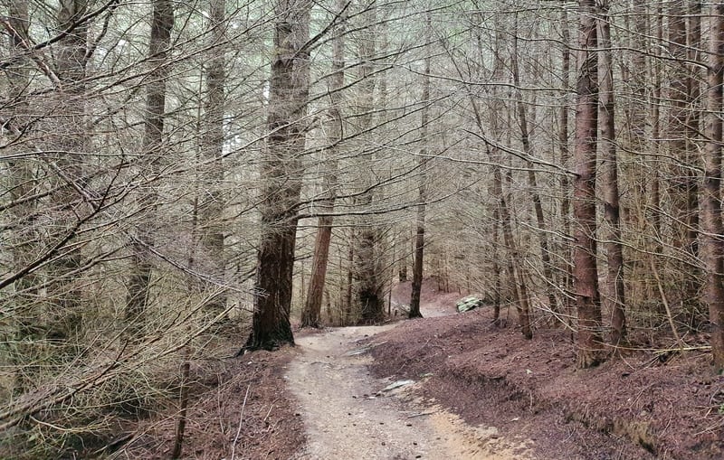
You’ll soon be in the forest which will look totally different depending on the season you’re there for.
After about 1.2km you’ll come to the junction which creates the Queenstown Hill loop. There’s a sign, but it doesn’t matter really which way you go as you end up at the same point.
Most people were going left from what I could tell, so I did too. This is the shorter steeper route to the summit, but it’s not crazy steep. The path does get more rocky this way though, but overall it’s the best way to do for the loop as it’s gentler on your knees to come down the other way.
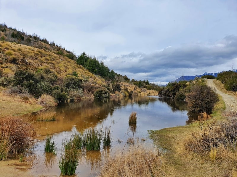
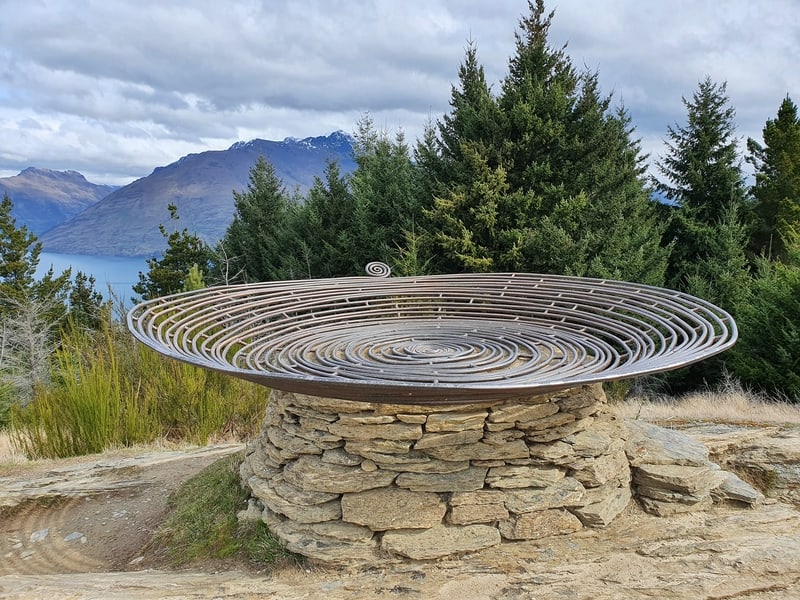
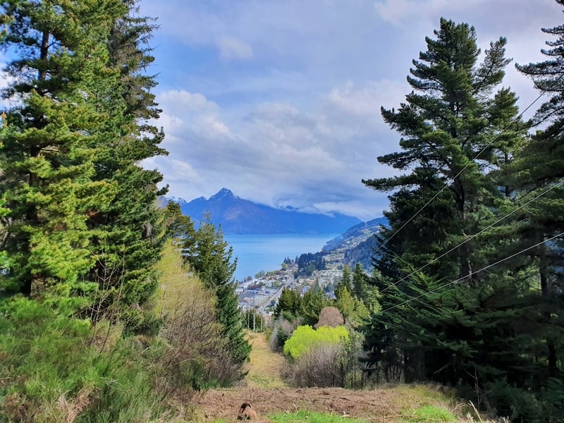
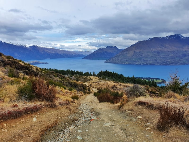
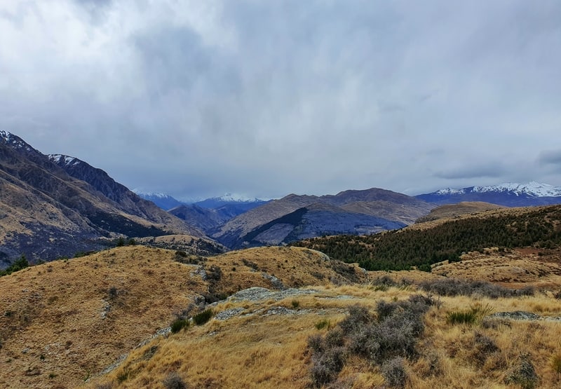
It’s then not long until you’re above the treeline and see the mountains ahead of you. It’s a couple of hundred metres to the Basket of Dreams sculpture and the first spot where you get some awesome panoramic views. There’s also a little pond (tarn?) there.
Many locals who want a short exercise stint will carry on with the loop from here, but this is not the summit.
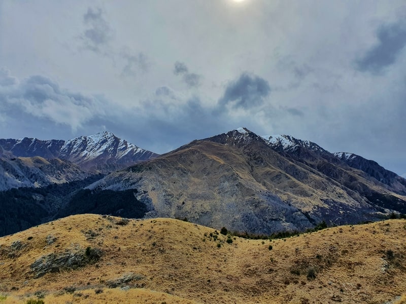
You’ll see the track continues on up. But it’s less than 1km to the summit from here. It’s not a perfectly smooth trail to the summit, but it’s nothing crazy technical. You’ll be tempted to stop and take photos every time you look over your shoulder from now on.
Lake Wakatipu is stunning thanks to the mountains climbing above. And for a different perspective of this view, make sure to do a couple of the walks next to Lake Wakatipu.
There was one noticeable spot that was good for photos before the summit where some people were hanging out. That was enough for them as they turned back around before reaching the actual summit. But you really should go to the summit.
It’s not marked but you’ll know you’re at the summit when the track suddenly flattens out (even though the track continues on, this becomes private land so you can’t go any further).
It’s also marked on Maps.me as a location.
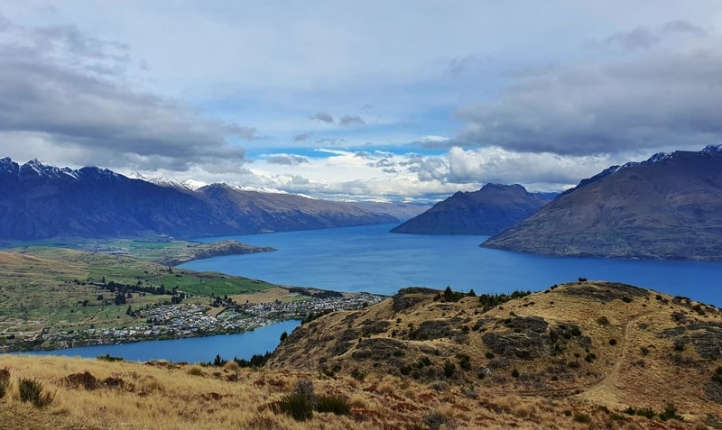
The view from the summit in September.
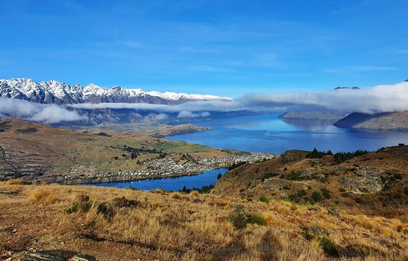
And what the view from the summit on June 1st.
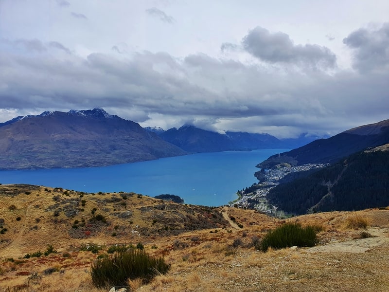
The views are awesome and you get genuine 360-degree views. I spent 5-10 minutes chilling at the top trying to soak it all in (isn’t that what we all do?). Note: I’ve happily spent 30+ minutes here on later visits.
And then it was time to head back down past some goats that came from nowhere. Back at the Basket of Dreams I turn left to complete the whole loop. It’s a much smoother path going this way, with no rocky sections.
And from there it’s just a matter of making your way back to the start to finish this action-packed walk.
5. OTHER QUEENSTOWN HILL FAQ’S
What should you bring on the Queenstown Hill walk?
Comfortable clothing, and maybe an extra upper layer if it’s not a super warm day as it can be breezy at the top. It’s not a super long hike so you don’t need lots of food, maybe a cheeky snack? There’s no water source, so bring at least 500ml…ideally 1 litre. If it’s a warm day, don’t forget your sunscreen, sunnies, and hat!
In terms of footwear, there’s no need for hiking boots. You’ll be okay in regular shoes.
Can you hike Queenstown Hill in winter?
Yes, the Queenstown Hill summit is 841 metres above sea level. It’s not often the snow level will be below this. If it is you can still go up and get some awesome views of the town covered in snow. If it’s a super cold morning and you leave early, be cautious as some patches may be icy.
Are dogs allowed on the Queenstown Hill track?
No. And please respect that. There’s a massive sign near the start of the hike so you’ve got zero excuses.
Best time of year to hike Queenstown Hill?
Anytime! There’s no real best time of the year to hike Queenstown Hill in my eyes. Whenever you’re in Queenstown, go do it!
Is sunrise or sunset from Queenstown Hill any good?
I’ve seen some great sunsets from the summit, but I’ve yet to make it for a sunrise 🙂 Hiking back down the hill at night isn’t too bad…don’t forget your headtorch (I use the Knog Bilby Run 400)! I would recommend going down the longer way in the dark as it’s less technical.
Is Queenstown Hill worth it?
I’m pretty sure you know my answer to this…YES! It’s a great hike that’s so easy to access from the city and you get awesome views. And it won’t take up all your time.
Queenstown is known worldwide for its scenic views, and despite being the least original track name you can think of (Queenstown Hill walk), this is a great example of what people are referring to.
If you have any questions or comments about the Queenstown Hill walking track, leave a comment below or email jub@churnewzealand.com .
RECOMMENDED READING
A big list of what to do in New Zealand
You’ll never run out of ideas with these ideas
Is Fergburger worth it?
Yes, no, maybe? These people offer their two cents
Lake Tekapo’s Mount John Track
An amazing walk with lots of lake views
39 South Island Hikes
A guide to the walks feature on Chur New Zealand

Hey, it’s Jub here. I’m the guy behind Chur New Zealand, helping you have the best time hiking, trekking, walking…whatever you want to call it…in NZ. I’m based in Queenstown and am always out and about exploring trails, old & new. If you have any questions, reach out.