The Mount John walk is one of the must-do activities in Lake Tekapo.
It’s less than 10km to complete the full loop, but you can make it shorter if need be.
The reward?
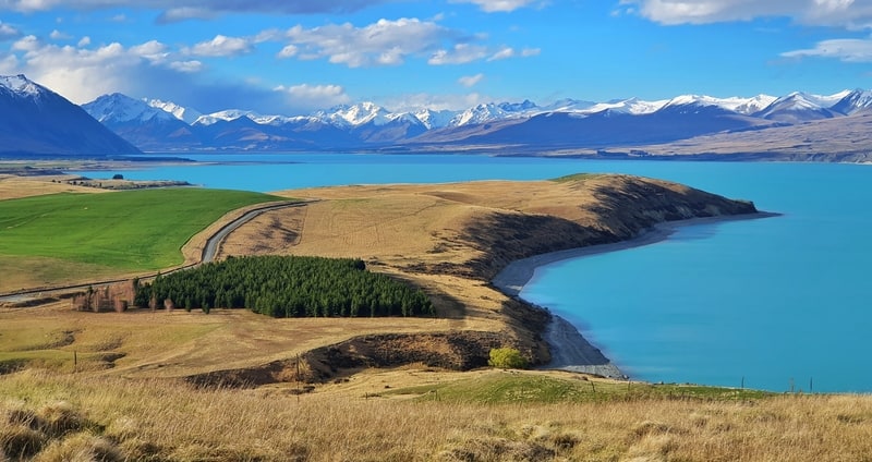
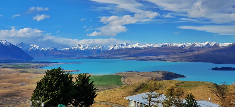
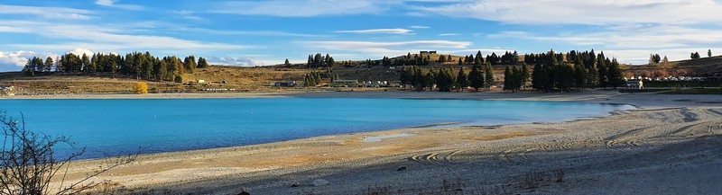
Amazing views of Lake Tekapo, Lake Alexandrina, and the surrounding mountains (and flatlands).
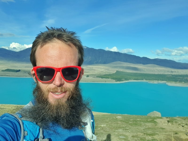
Proof of having walked the Mount John track. The photos get better, I promise.
TABLE OF CONTENTS
1. Mt John Walkway Details
2. Mt John Summit Circuit Track Map
3. How To Get There
4. My Mount John Experience
1. MOUNT JOHN WALKWAY DETAILS
How hard is the Mount John Walk?
Easy to medium. The summit climb will get your heart rate up, but it’s less than 2km long. The rest is cruisey.
How far is the Mount John Summit Circuit?
My Strava recording came in at 9.76km, but that’s because I spent time at both Mount John summits.
If you only visit the southern summit, you’ll walk about 8km. At the trailhead, there’s a sign saying the track is 8.5km. Be prepared to somewhere between walk 8-10km depending on your exact route.
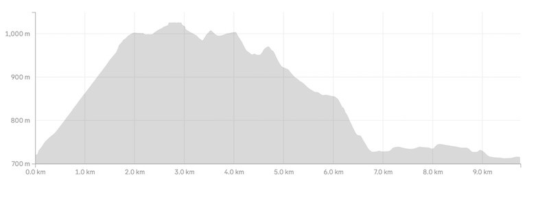
What’s the elevation gain of the Mt John walk?
Strava recorded 393 metres of elevation. If you’re not going to the observatory it’ll be a little bit less.
Here’s the elevation profile:
How long does it take to walk Mount John?
It took me about 2 hours and 10 minutes to complete the walk. I spent a bit of time around the trig (maybe 10 mins). If you don’t go to the observatory you can complete this like 1 hour 45 minutes. That said, I think most people will take 2 hours to 2 hours 45 minutes to complete the walk.
2. MY JOHN SUMMIT CIRCUIT TRACK MAP
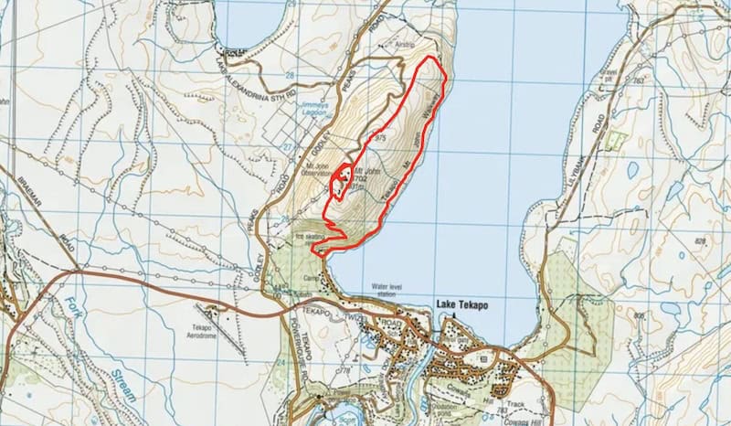
The map above is the GPX file from the Strava recording overlaid on a Topo Map. I use this paid topo map app for all my NZ adventures.
You’ll find the map of Mount John on both Google Maps (direct link here) and Maps.me.
3. HOW TO GET THERE
The trailhead is 2km from Lake Tekapo’s town centre so your two options are to walk or drive. If you’re looking for accommodation right beside the trailhead, Lake Tekapo Holiday Park is for you.
WALKING TO THE MOUNT JOHN TRACK TRAILHEAD
If you’re in Lake Tekapo township, walk towards the lake and turn left when you find the gravel trail. From here you walk along the trail until you arrive at the trailhead. You’ll get some nice lake views on the way. A warm-up for what’s to come.
DRIVE
There’s plenty of parking space in and around the trailhead thanks to the Tekapo Springs parking lot right next to the trailhead. The parking is free which is convenient for those passing through town for the day or staying further outside town.
RELATED READING: 30+ AMAZING HIKES IN THE SOUTH ISLAND
4. MY MOUNT JOHN WALK EXPERIENCE
I had a cool wintery, yet spectacular day for walking the Mount John Track. I’d just arrived in town and instantly began to understand how beautiful this spot was as I walked along the lakefront to the trailhead.
The trailhead is right by Tekapo Springs, and I found myself walking up to the springs reception having completely missed the trailhead. This is what it looks like.
As it’s a loop track, you have a decision to make which way you’ll walk the track.
I went with the anti-clockwise route and would recommend that way. The first two kilometres will be tough, but once you’re through that, you’re coasting with only minor inclines the rest of the way.
Starting the trail, I was grateful for the trees on the incline to keep any heat off me. In the summer, they’ll be your only break from the direct sun. It was pretty steady and steep going to start. There’s a couple of viewpoints along the way, but they’ll only keep getting better 🙂
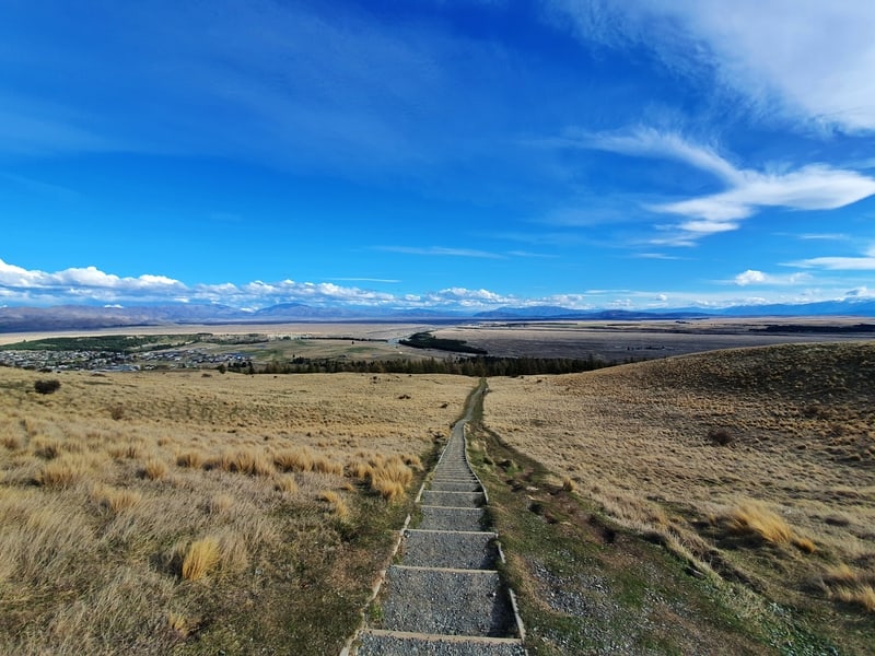
Once you emerge from the trees you’re most of the way to the top. After you scaled the set of stairs that is.
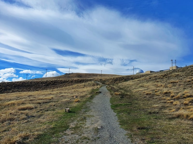
At the top of the stairs, you’ll soon come across your first junction. You can continue straight which will take you around the back and up to the observatory, or you can go right and that’ll take you straight to the southern summit and skips the observatory.
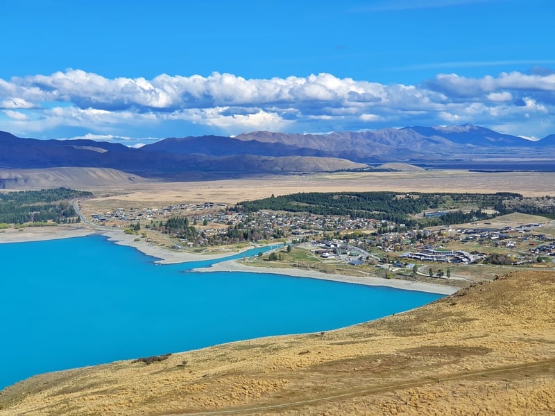
Continuing straight I soon got more epic views of the surroundings including Lake Alexandrina. It was so spectacular!
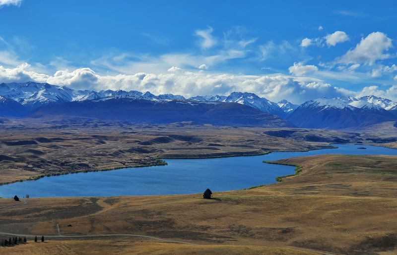
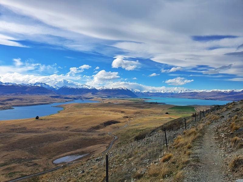
The wind was really starting to get strong now, I feel like that’s pretty normal up here though. As you continue on around the side of the hill, you’ll see another lake come into view. Turns out that’s Lake Tekapo (and Lake McGregor). It’s bigger than I realised. With the snow-capped mountains in the background, the views are amazing.
I was getting a little bit confused about how to navigate the loop at this point. Here’s what I did in picture format with the words below 🙂
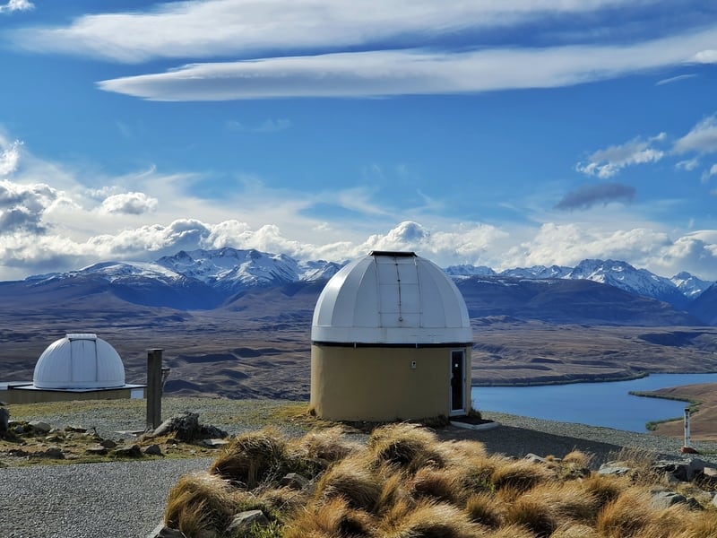
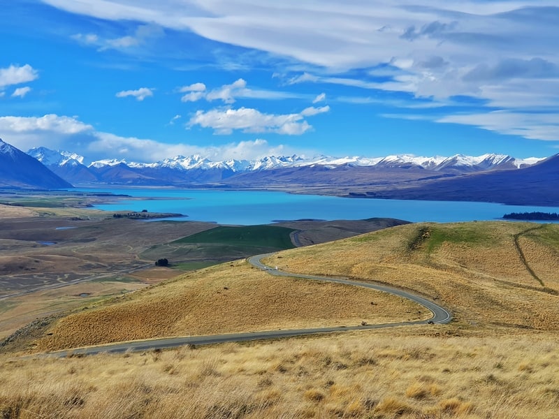
I continued walking on the path until I got to the road (yes, you can drive up here between certain hours. Cheaters 😉 ). I then followed the road up to the summit where you’ll find the observatory, a cafe (closed when I was there), and the trig along with all of the views.
You could spend a long time up here…if the wind isn’t annoying.
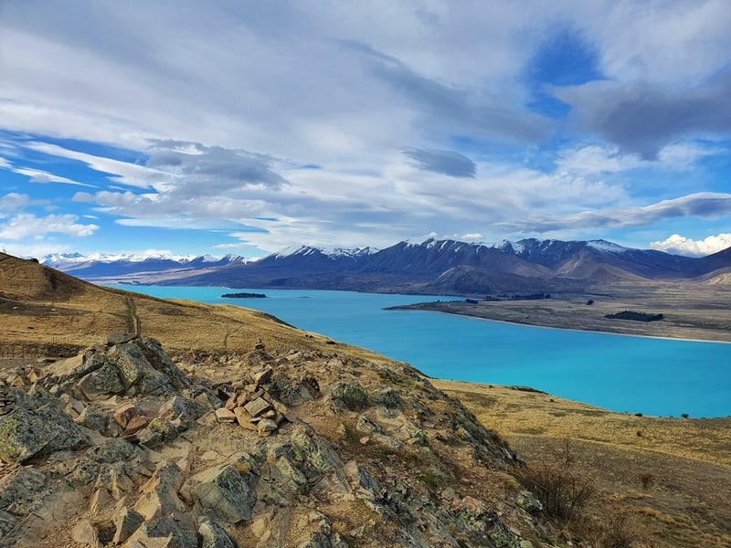
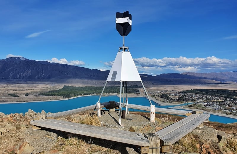
I then scooted down to the main loop. This offers another viewpoint (it’s where all the rocks are, and some cairns). Again, spectacular.
From here you’ve got some rolling terrain as you walk north towards Lake Tekapo. The views though, wow, wow, wow.
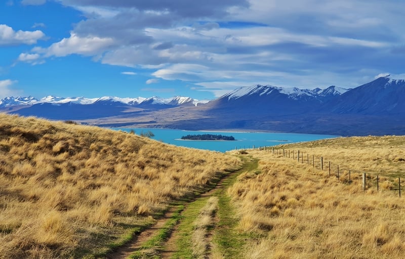
The track is super easy to follow. I went through this section pretty quickly. As good as the views are, it’s a little same but different for so long there’s no need to take it slowly.
As you get closer to the lake level, you’ll make a right-hand turn leading you back towards the start. You’ll be following Lake Tekapo for about 3km which has some little undulations on the way. There are some sections where you can walk down to the lakesideif you decide to take a dip in the lake.
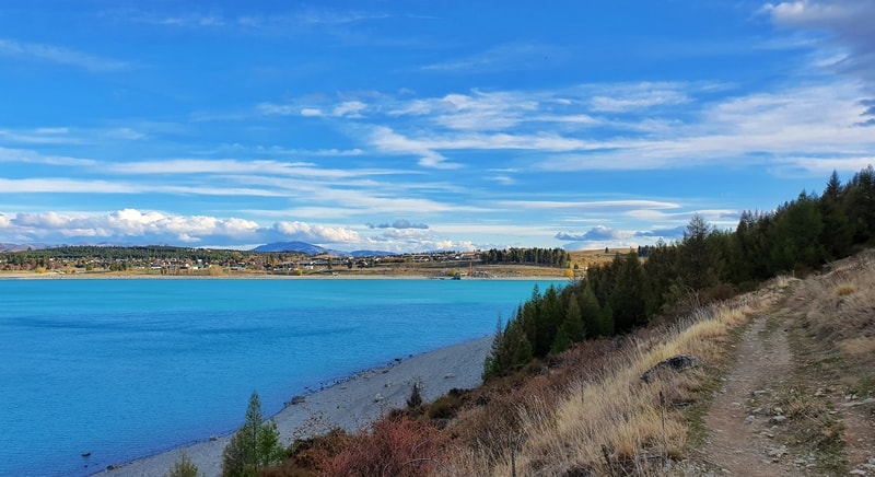
And before long you’ll be back at the Tekapo Springs car park.
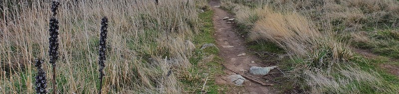
p.s. You’ve probably seen Instagram photos of the lupins flowering next to Lake Tekapo. There’s only a narrow time to the year that they are truly photogenic though. According to Dangerous Business that’s mid-November until just after Christmas. As you can see in the photo above, they’re not so good looking in the winter.
The Mount John walk is honestly a must-do activity when you’re here. Not a fan of walking/hiking? Make this an exception.
If you’ve got any questions about the Mt John Summit Track, send me an email jub@churnewzealand.com, or in the comments below.
p.s. Here’s a map of all the hikes and walks documented on Chur New Zealand. You can click the icon to see brief details, as well as a link to read more about the hike (like this post).

Hey, it’s Jub here. I’m the guy behind Chur New Zealand, helping you have the best time hiking, trekking, walking…whatever you want to call it…in NZ. I’m based in Queenstown and am always out and about exploring trails, old & new. If you have any questions, reach out.