The Little Criffel Track is a tough 18km circuit that takes you into the Pisa Conservation Area between Cardrona and Wanaka.
The track isn’t super well known, but if you want something off the beaten path that gives you some unique views, this is an awesome Otago hike.
This post will give you all the details about hiking the Little Criffel Track (Note: I’ll be mentioning everything as if you’re starting the hike from the car park closest to Cardrona/Avalon Carpark).
TABLE OF CONTENTS
1. Little Criffel Track Details
2. Little Criffel Track Map
3. How To Get To The Trailhead
4. My Little Criffel Track Experience
1. LITTLE CRIFFEL TRACK DETAILS
How hard is the Little Criffel hike?
I’m going to say hard. The first 4.5km is at least. It’s a tricky ascent..there are steeper hikes in the area, but as this isn’t a maintained trail it can mean some sections are slow going. And the track isn’t always visible which is bad weather wouldn’t be fun.
How long is the track?
The DOC website states 19km, but my Strava recording was well short, coming in at 17.5km. So feel ready for 19km, and be stoked if it’s a little less?
What is the Little Criffel Track elevation gain?
Here’s the elevation profile based on my Strava recording:
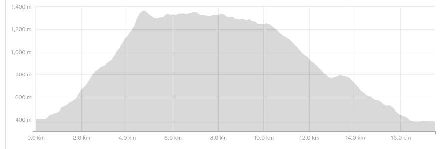
There’s about 1100 metres of total elevation gain on the Little Criffel Track. The majority of this is in the first 4.5km (about 90% of it). Across the top, you’ve got relatively gentle undulations before the descent which has more or less no uphill sections at all.
How long does the hike take?
DOC suggests the hike will take 6 – 8 hours. It took me 4 hours as a quick hiker taking minimal breaks.
I suspect for the majority of people you can plan for a 5 – 7 hour journey. The first 4.5km are slow going, but from there on you can get some good momentum going and if need be makeup time.
WARNINGS
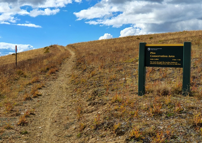
You can’t access the trail from Larches Carpark between October 10th and November 10th due to lambing.
In the winter the Cardrona River can run high as the snow melts. The first time I attempted this track we aborted as the river wasn’t safe to cross, and we did the Meg Hut track instead which was awesome. So if it’s been raining lately, this track may not be wise.
The snow on the incline to start with make things quite tricky/slow going if you don’t have great boots/crampons.
2. LITTLE CRIFFEL TRACK MAP
The map above is the GPX file from my Strava file on a topo map. This track is a route on the way up the incline, and the track can be tricky to follow at times but you should be able to find it without any complications.
The track isn’t on Google Maps, but you can follow the track on Maps.me. I doubt you’ll get lost, but having maps.me downloaded for offline use is a nice backup.
3. HOW TO GET TO THE TRAILHEAD
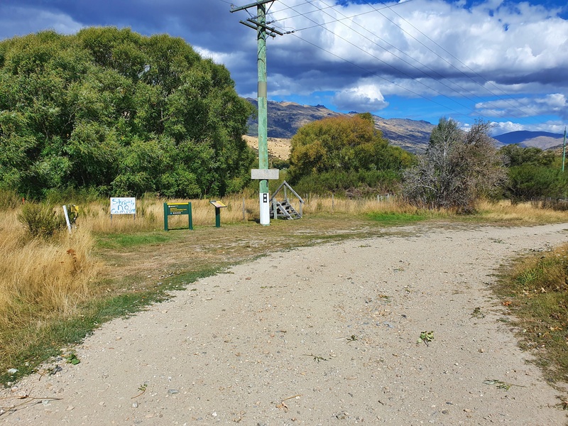
The easiest, most practical way to get there is by car to one of the two trailheads/car parks which are:
The Little Criffel Track starts right alongside the Crown Range Road between Cardrona and Wanaka. The Avalon car park is a little hard to see, but as long as you’ve got the car parks pinned on Google Maps, you’ll be good as gold.
The car parks are plenty big enough considering the tracks aren’t popular so parking space isn’t an issue. The only niggle is the 4.2km between the two car parks. If you can take two cars and leave one at each end that would be ideal.
If you only have one car, you can walk the extra distance…but it’s not a nice walk alongside the road…if you’re lucky you might be able to hitch a ride (which I did).
You could also leave a bike locked up at one end of the trail and drive to the other end. Provided you put the bike out of sight from the main road it’ll be safe (don’t blame me if it isn’t).
4. MY LITTLE CRIFFEL TRACK EXPERIENCE
*starting from the Avalon car park/the one closest to Cardrona.
Having not succeeding in crossing the river on my first effort during winter on this trail, I was stoked to see what the Little Criffel Track had to offer towards the end of summer.
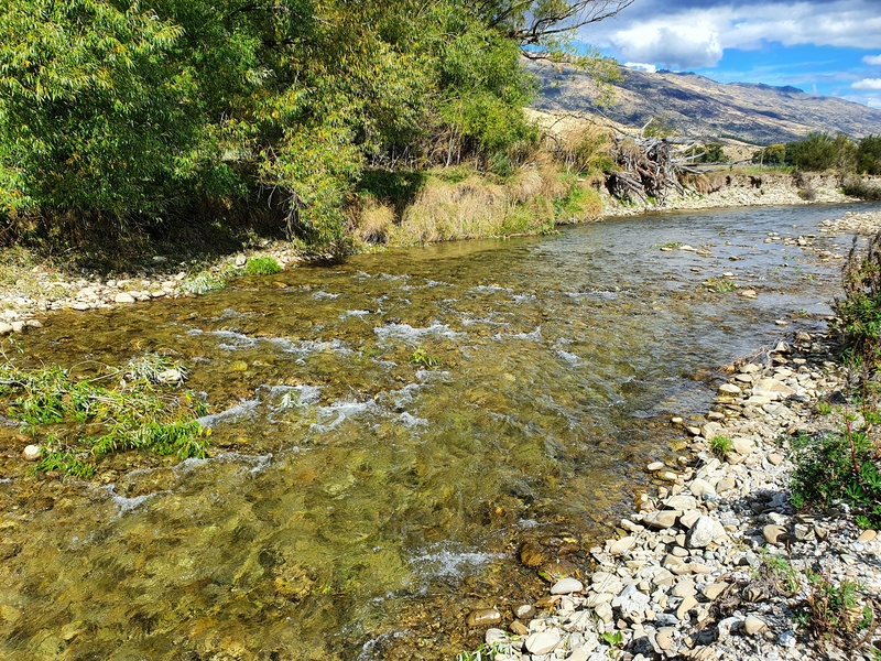
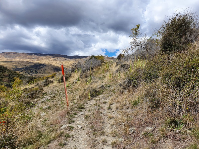
The Cardrona River crossing was a breeze (there had been a long stretch of good weather) and then for the first 1km or so, it was just a matter of spotting the next orange marker At times it wasn’t easy to see the next marker. When I couldn’t see one I’d just walk straight until spotting the next one soon enough.
Once you start going up the hill, there is a sheep track most of the way but I found it was easy to stray from it on the route to the next orange marker in the distance.
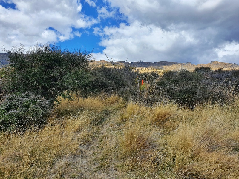
There was some matagouri to bash through which is never fun, but it wasn’t too crazy. Eventually, that transitioned into Spaniards as we were on the 4.5km up to the ridgeline.
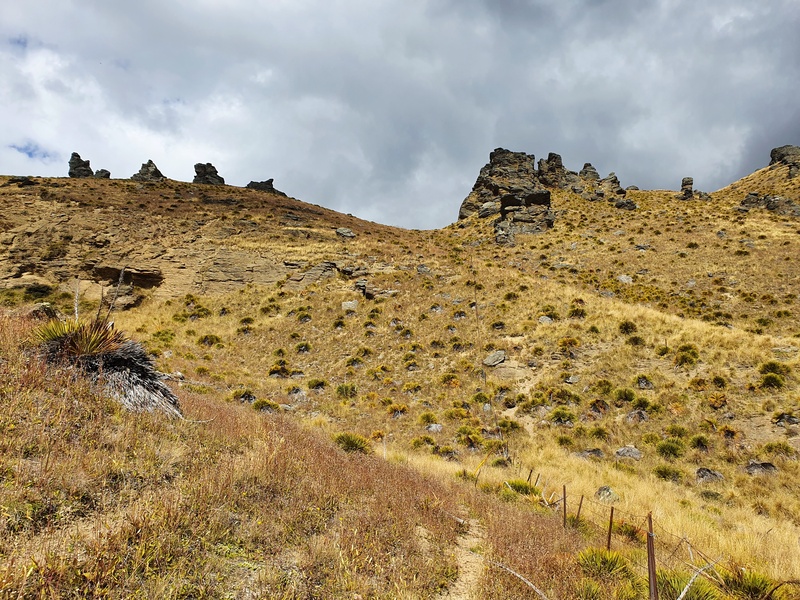
There’s a couple of steep sections towards the top of the climbing where things were slow going. Don’t forget to look back behind you to see how far you’ve come 🙂
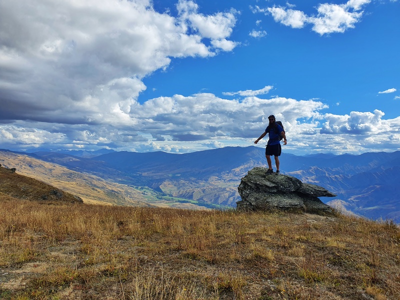
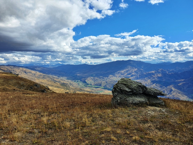
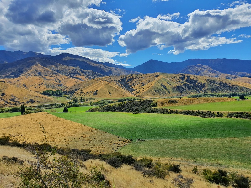
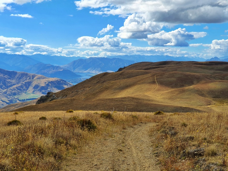
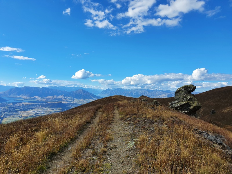
Once I got to the top though, things were breezy and it felt good to be able to walk consistently without any mitigating factors. Even if it was a 4WD track. The photos above give you a good idea what you can expect.
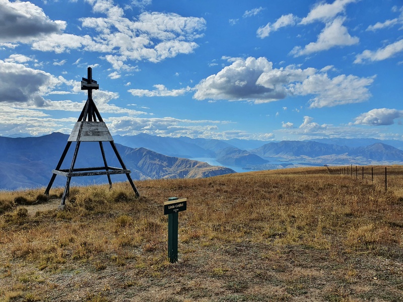
This section lasts about 6.8km with the Little Criffel summit 3.5km of the way in. There’s no obvious peak at Little Criffel summit, but you’ll see the trig and there’s a rock to get your Insta photo from.
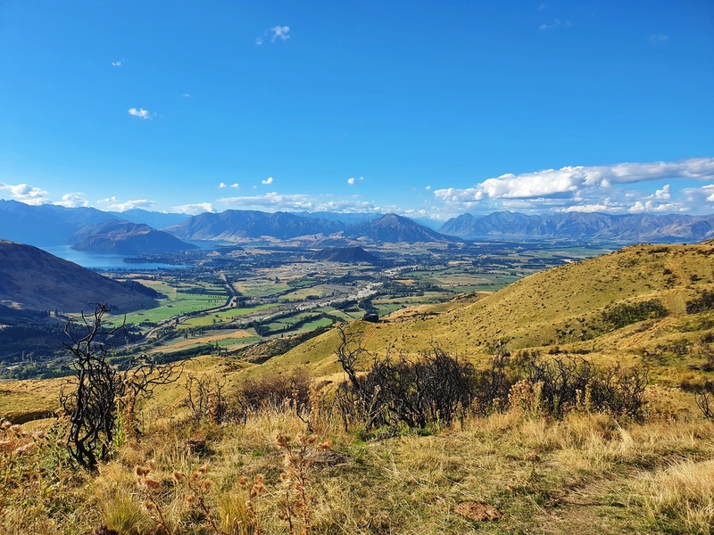
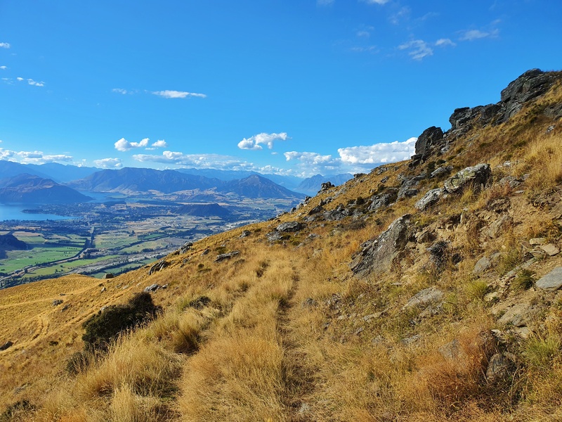
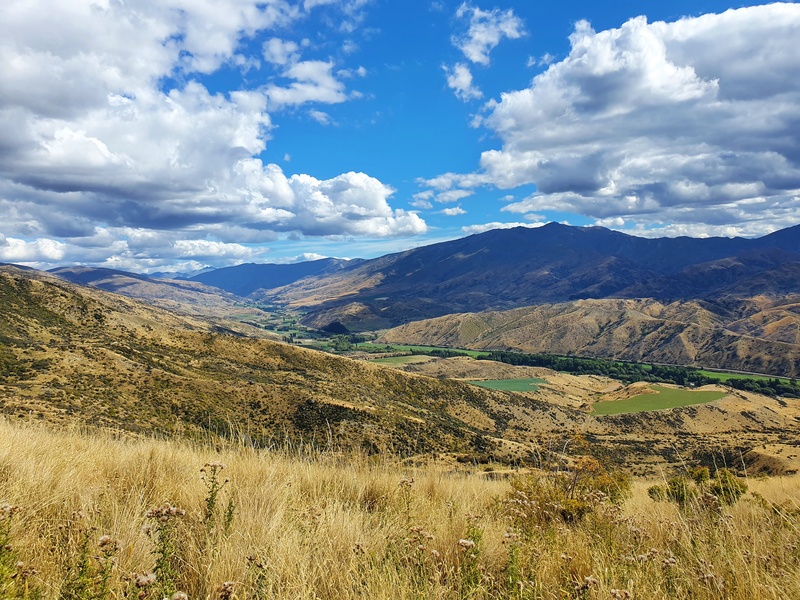
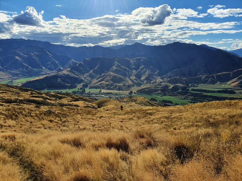
The track continues on as it was on the 4WD track as you get some more views of Lake Hawea, Lake Wakatipu and the basin coming into view. They’re pretty cool, and turning around you still get some sweet views back up the Crown Range.
To the right you’ll see higher ridgelines, but I don’t think you can spot Mount Pisa, the highest point in the Pisa Conservation Area, from here at all.
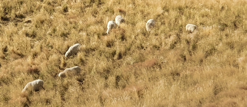
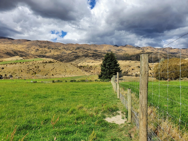
And then the descent starts. Its a technical track at times that has switchbacks galore. You get back onto private property eventually, and I did come across some sheep and cows. Cows always make me nervous haha…I walked around them.
The descent was pretty steady as the Crown Range Road gets closer and closer. Before you know it you’ll be back on the flat.
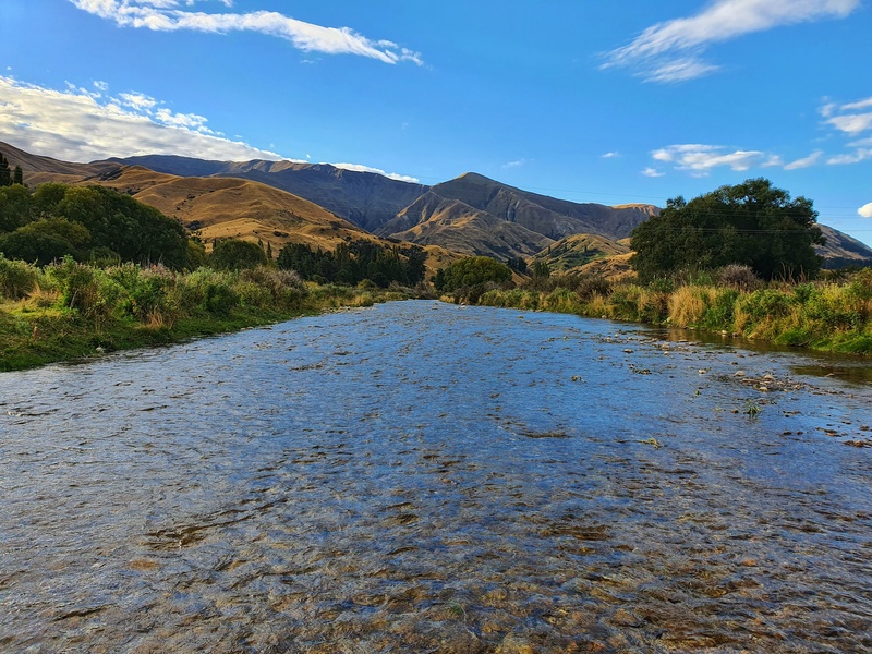
It’s a flat section to finish the last kilometre of the hike, including another crossing of the Cardrona River. This one is wider but shallower. Again, if there’s been rain recently…or the snow melts high, this could be a dangerous crossing.
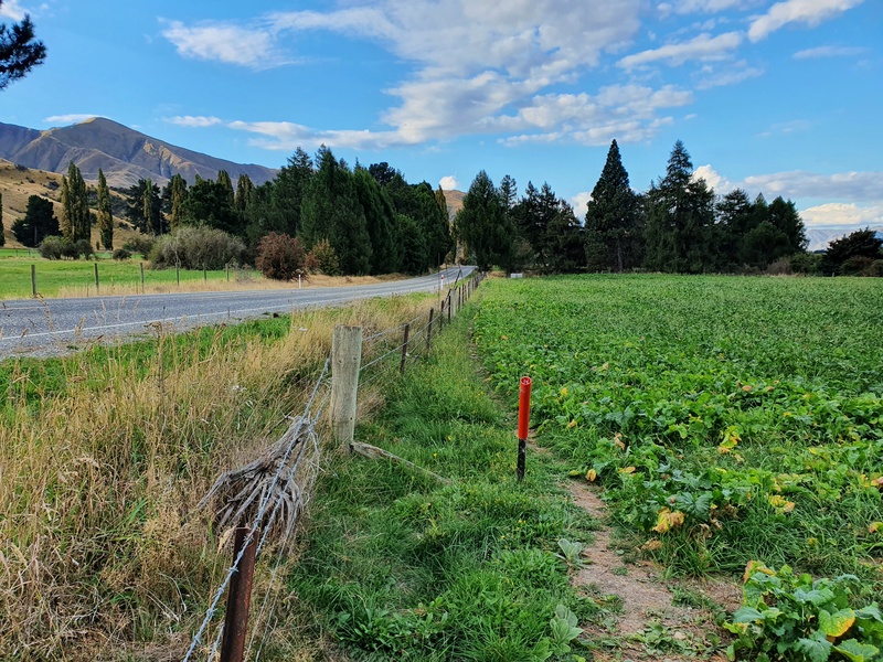
The track has a weird last section as you follow the fenceline next to the road. And that’s that, you’ve completed the hike!
I really enjoyed the Little Criffel Track. To see no one else on a trail is always a fun feeling, the same goes with the nearby Rock Peak Track. The challenge of the first 4.5km was along with the unique views capped off a great afternoon.
If you’ve got any questions/thoughts about hiking the Little Criffel Track, leave a comment below or email jub@churnewzealand.com.
RECOMMENDED READING
The Skyline Track
One of the trailheads to this starts close to the Larches Carpark…you could combine them for a massive day?
Amazing walks in Wanaka
This track is not far off lots of other awesome walks.

Hey, it’s Jub here. I’m the guy behind Chur New Zealand, helping you have the best time hiking, trekking, walking…whatever you want to call it…in NZ. I’m based in Queenstown and am always out and about exploring trails, old & new. If you have any questions, reach out.
Hi we have 3 4wd’s, we are from Nelson. We would like to do an overnight drive upto a point and drive out the next. We are staying in wanaka at the moment and we have roof top tents
or if there’s a hut is an option to. Thanks
Deane
Hwy Deane, up the Macetown Road would probably be your best bet!