Otago is a gorgeous place with dozens, if not hundreds of hiking trails in the region.
This post will cover the Otago walks and hikes detailed here on Chur New Zealand. I’ll give a brief description of them, including a level of difficulty and how long the walk/hike is.
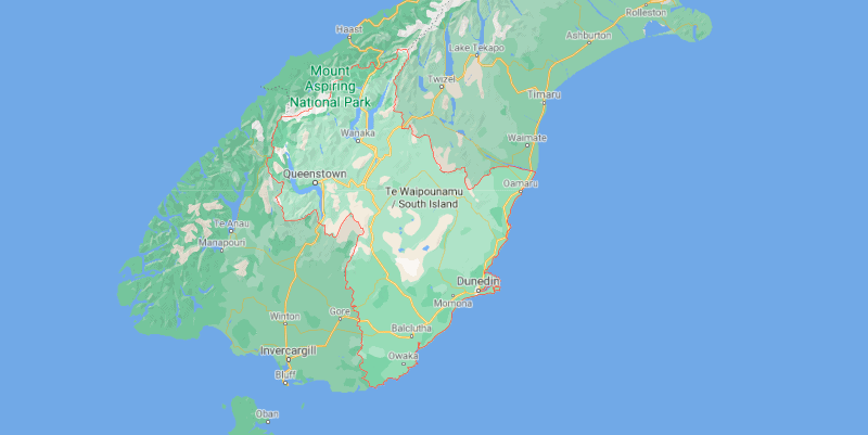
For those who aren’t too familiar with what’s where in NZ, the Otago region is inside the red outline:
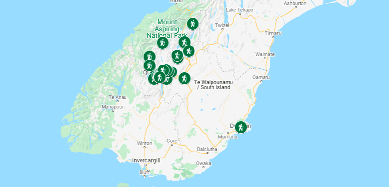
A MAP OF THE OTAGO WALKS AND HIKES
This will hopefully make it easier for you to plan which walks you’ll do based on where you’re going (clicking the image will open the map in a new window).
27 OTAGO WALKS & HIKES
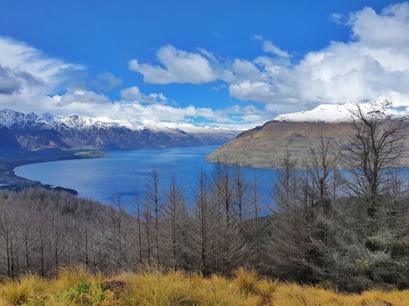
1. Ben Lomond Track
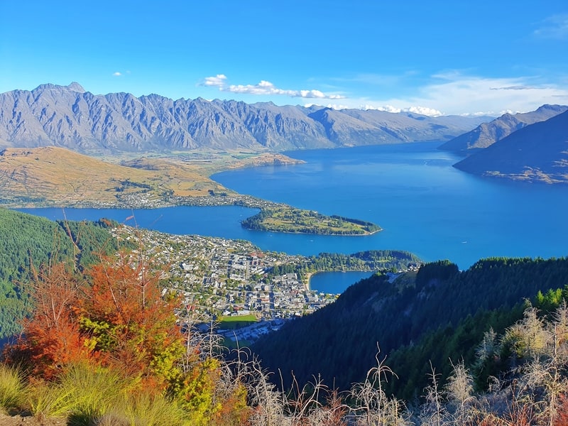
2. Queenstown Hill Walk
3. Roys Peak Track
4. Earnslaw Burn Track
5. Mount McIntosh Track
6. Moke Lake Track
7. Fernhill Loop Track
8. Jan’s Peak
9. Tiki Trail
10. Queenstown Gardens
11. Moonlight Track
12. Wye Creek to Lake Alta
13. Mount Horn Track
14. Meg Hut Track
15. Nichols Falls
16. Rob Roy Glacier Track
17. Skyline Track Wanaka
18. Isthmus Peak Track
19. Grandview Mountain Track
20. Coronet Peak Hiking Trail
21. Brow Peak Track
22. Sawpit Gully Track
23. New Chum Gully Track
24. Tobins Track
25. Crown Peak Track
26. Lake Hayes Track
27. Mount Judah Track
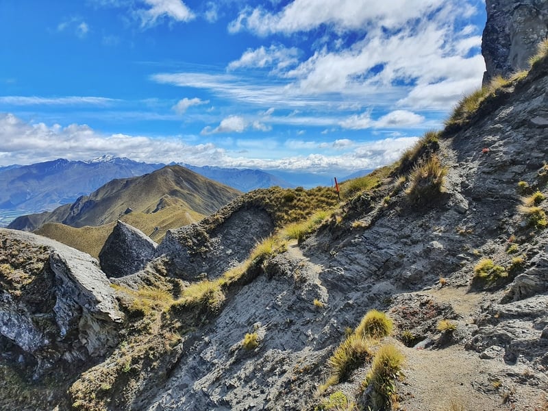
1. BEN LOMOND TRACK
- Difficulty: Hard
- Distance: 15-16km return
This is one of the marquee walks in Queenstown, and one of my favourites hikes on the South Island. It’s a challenge, but the trail is well maintained up to the saddle.
As long as you start early, everyone can make it this far at least. You can catch the gondola to Skyline for a headstart too.
During the winter the snow will make the walk tough and an ice axe and crampons are often recommended between the saddle and summit.
Despite being up to the summit a bunch of times I’ve never seen a kea up there, but many do. Keep an eye on your snacks.
Bring plenty of good hiking snacks and water, there’s nothing to buy beyond the Skyline. Or any toilets for that matter.
But with this hike starting and finishing at the bottom of the gondola, you’ve got all the great food and craft beer options in Queenstown waiting for you.
For some of you, this will be the hardest hike you’ve done. But the views are worth it, with panoramic views. And yes, it’s better than Roys Peak 😉
READ THE FULL POST: THE BEN LOMOND TRACK
2. QUEENSTOWN HILL WALK
- Difficulty: Easy – Medium
- Distance: 5.5 – 6km return
The Queenstown Hill walk is one you’ll see locals and tourists doing. If you’re walking to the start of the track from the waterfront, you’ll feel like you’ve done a hike already as you make your way up to the trailhead.
But the track doesn’t let up with minimal if any flat sections. The well-maintained track has a loop in the middle.
If you want to get the full experience, turn left at the junction so you’re walking up the steeper, more technical section and can walk down the gradual smooth route.
At the top of the loop, you reach the Basket of Dreams which offers some views of Queenstown and will be the turnaround point for some. But you should continue walking the last 1km to the viewpoint for the best views.
And yes, it’s one you can do in winter.
READ THE FULL POST: THE QUEENSTOWN HILL WALK
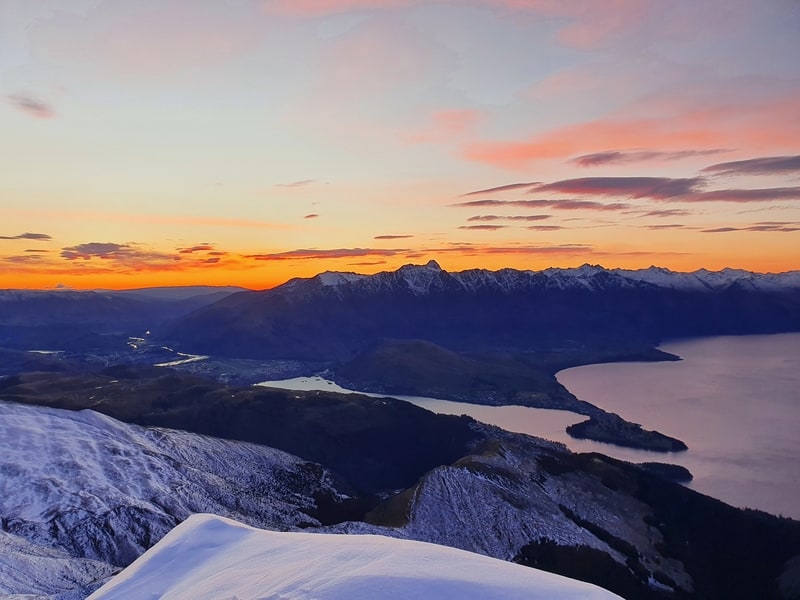
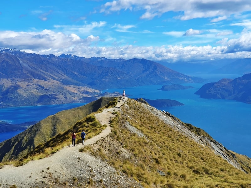
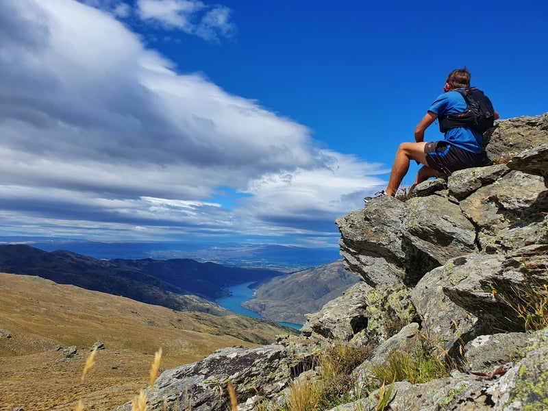
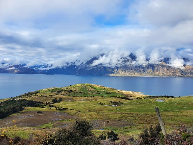
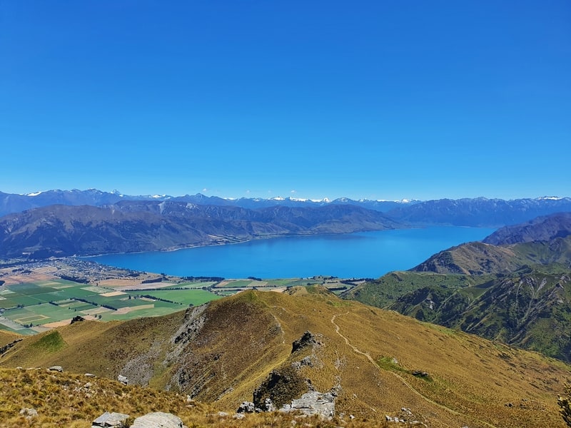
3. ROYS PEAK TRACK
- Difficulty: Medium
- Distance: 13km return
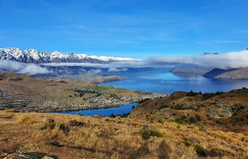
Ah Roys Peak, you probably know about this as it’s probably the most popular of the hikes in Wanaka and one people will make as a Queenstown day trip.
But if you don’t, this is THAT Instagram hike with the famous viewpoint (see above) where people will queue up to get a photo.
The hike itself isn’t that exciting to be honest, as it goes up the side of the mountain with a fair few switchbacks to make the gradient less hectic.
But there’s no denying the views of Lake Wanaka are epic. I guess it’s just a lot of the same all the way up.
Like Ben Lomond, this will be the toughest hike some people will do…
And again, bring lots of water and snacks. Though you do have a toilet at the viewpoint.
I would recommend going to the top of Mount Roy, it’s another kilometre or so past the viewpoint…the photo opportunities are similar, but a lot less crowded.
READ THE FULL POST: ROYS PEAK TRACK
4. EARNSLAW BURN TRACK
- Difficulty: Medium – Hard
- Distance: 26-27km return
The Earnslaw Burn Track is one of the hikes that shows the diveristy of the walks near Glenorchy.
It’s one of the hikes I recommend to those who want to set up camp overnight in the summer (this is not a suitable winter hike for most). Though you can do this as a big day hike.
At 13km each way it’s a slow trudge through the first of two distinct parts of the track.
The first part is in the forest, but the track has lots of little undulations, with rocks, sticks, creeks and whatnot making it hard to get a consistent cadence going.
Once you emerge from the bush, the scenery is incredible and while there might be the occasional helicopter buzzing about you do feel quite remote.
Once you’ve set up camp, you can get right up close to the bottom of the glacier and explore…including walking through some ice caves. It’s a spectacular sight as you approach the valley.
Given there’s no phone reception out here, it’s a good idea to bring a PLB for this Otago hike. Ah, and a hike that’s best done if you’ve got some overnight hiking experience.
READ THE FULL POST: THE EARNSLAW BURN TRACK
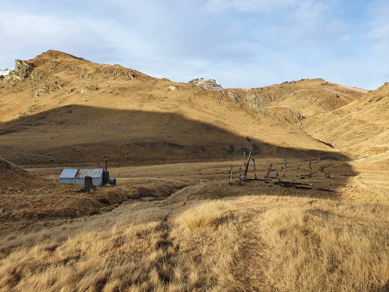
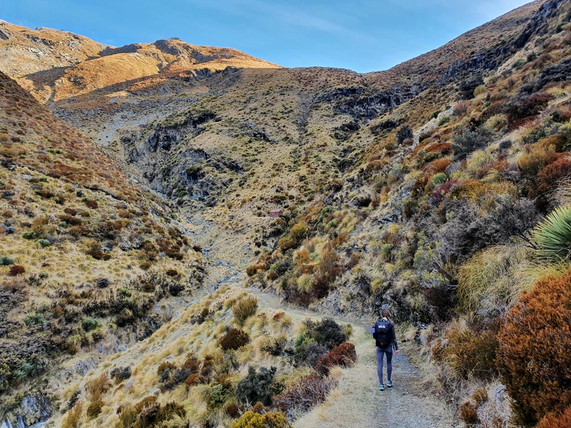
5. MOUNT MCINTOSH TRACK
- Difficulty: Medium – Hard
- Distance: ~18km return
About 2km before you get to Glenorchy is a car park that looks reasonably harmless. But it’s the trailhead for two great tracks, Mount Judah and Mount McIntosh.
The Mount McIntosh Track takes you up the steady ascent before you cross over the valley (there’s a creek crossing) and continue climbing up, up, up. Like a lot of these walks, there are no a lot of flat sections but the views of Lake Wakatipu and the surrounding mountains are incredible.
McIntosh Hut is a great day hike, but it also makes for one of the best overnight hikes near Queenstown.
The hut is basic, but with the views you get, the facilities are the least of your worries.
If you want, you can continue hiking beyond the hut and reach Black Peak (check the full blog post for how to get there).
This hike is doable in winter, provided the level of the creek isn’t too high…in which case you can start from the other entrance.
Coming back down, there’s an alternative route that has some amazing views but is super steep for 1-2km. For those with dodgy knees? It’s not advisable, go back the same way you came.
READ THE FULL POST: THE MOUNT MCINTOSH TRACK
6. MOKE LAKE TRACK
- Difficulty: Easy
- Distance: 7 – 8km
Oh, Moke Lake!
What a beautiful little place this is. You can visit year-round…although if there have been some snow dumps recently, the drive might be a bit tough for some vehicles.
This is a beautiful spot and the walk is relatively easy with only little undulations as you follow the lake.
In the winter the trail can get icy and there are some sections where avoiding wet feet is pretty much impossible.
This is also a good spot to just hang out for a few hours on a sunny afternoon with no reception. You can swim in the lake, or bring your kayaks and SUPs.
One of the things I want to do is see a sunset from Moke Lake, I bet it’d be incredible…as they are from all the Queenstown lakes.
READ THE FULL POST: THE MOKE LAKE LOOP TRACK
7. FERNHILL LOOP TRACK
- Difficulty: Medium
- Distance: 7 – 8km
The Fernhill Loop is not my favourite track. Having done it a few times, I still somehow wander off track…in fairness I think it’s poorly marked.
This is a steep walk with a high elevation to distance ratio.
I do like the section at the start that follows the One Mile Track, it’s rugged, and raw, and there are a couple of nice waterfalls.
The track is easy to follow to start with until you get the midway clearing, then it’s tricky to figure out where the track continues on. I’ve even taken the wrong route and ended up connecting with the Ben Lomond Track once.
If you’re following the right track, a couple of kilometres around the top of the track are stunning with the peak of Ben Lomond looming large above you.
And the descent back down is confusing as it mingles in with various mountain bike tracks. I feel bad walking on bike tracks, but I’m never sure what’s what going back down the hill.
If you’re spending lots of time in Queenstown, you’ll get to this walk eventually, but it’s not the top of my list…maybe if they make better signage?
READ THE FULL POST: THE FERNHILL LOOP TRACK
8. JAN’S PEAK
- Difficulty: Medium
- Distance: ~7km return
Jan’s Peak (as it’s called according to Google Maps), is the peak I point out to people from Haka Lodge (where I live in Queenstown) with excitement.
I’ll point it out when someone is asking where they should walk/hike too, but they want somewhere new.
Sure, they have to do the Tiki Trail to get to the start, but from there it’s all-new terrain and you get to see paragliders taking off as well (some of the time).
Beyond the paragliding takeoff area the trail is not marked. But it’s a spot where you’ll likely have the peak to yourself with a unique view of Queenstown…it’s like you’re a drone.
The trail back down from the peak has some photogenic moments. But you can also carry on beyond the viewpoint and connect up with the Ben Lomond Track.
If you’re planning to spend some time at Skyline but don’t have time to do Ben Lomond, this is a nifty alternative. Head to the full posts on directions.
READ THE FULL POST: JANS PEAK
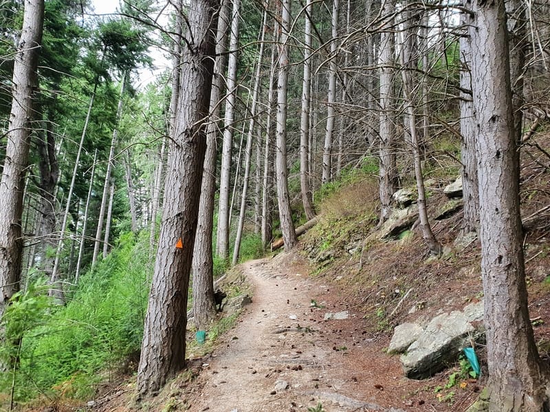
9. TIKI TRAIL
- Difficulty: Easy – Medium
- Distance: 4km return
The Tiki Trail is the route people take to avoid paying for the gondola up to the Skyline. It’s a little under 2km, but with over 400 metres of elevation gain, it’s steep.
It’s a technical trail that winds its way up through the forest on dirt trails that don’t get too muddy in the winter meaning you can go up here year-round.
This is a great walk to get you back into the rhythm of hiking before you head out on some of the great multi-day hikes in Otago.
On the way, there’s a couple of viewpoints and seats for resting and you might get distracted by the zipliners. But in short, it’s a good way to fill in 1-2 hours in Queenstown. And it’s in the shade which is great on those hot Otago days.
READ THE FULL POST: THE TIKI TRAIL
10. QUEENSTOWN GARDENS
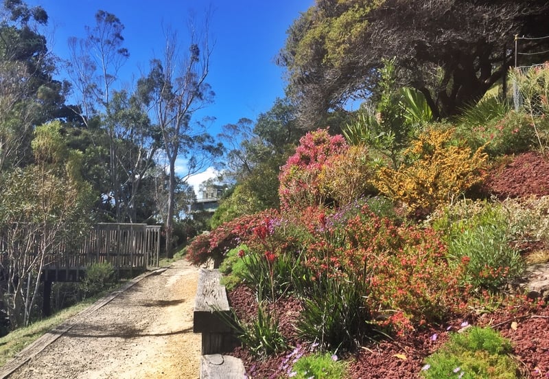
- Difficulty: Easy
- Distance: 2km+
The Queenstown Gardens is the default place for people who want fresh air living in Queenstown. It’s an easy flat walk on a maintained trail and even if you’re day dreaming you can’t get lost.
The views of the lake and all the mountains (Remarkables, Ben Lomond, Cecil Peak) are stunning and the trees in the gardens are lovely too.
And there’s a host of things to do in the gardens themselves if you decide to wander around the internal tracks.
READ THE FULL POST: THE QUEENSTOWN GARDENS
11. MOONLIGHT TRACK
- Difficulty: Medium
- Distance: 18km
The Moonlight Track can be tackled in two ways:
- You can get to Moke Lake and start from there, heading away from Lake Wakatipu, through the valley around the back of Ben Lomond to Arthurs Point.
- Or you can get to Ben Lomond saddle, and continue on over the saddle down the other side connecting with Arthur’s Point.
A lot of people love, love, love the Moonlight Track. And while it’s amazing, I don’t think I love it as much as many do…and ultimately most people won’t get around to doing this track.
If you’re looking for a large loop walk from Queenstown however, at about 35kms door to door this is a good option. At worst, you pull the pin early and catch a bus back down from Arthur’s Point.
Once you’re on the Moonlight Track there are no facilities, so you’ll want to carry plenty of snacks and the like.
Given you don’t get super high on the track, you are okay to do this track year-round, though you probably want to take proper hiking shoes as the trail does get narrow in some sections.
READ THE FULL POST: MOONLIGHT TRACK (VIA THE BEN LOMOND SADDLE)
12. WYE CREEK TO LAKE ALTA
- Difficulty: Medium – Hard.
- Distance: ~16km
The Wye Creek Track is a nice walk on it’s own, but in the summer it’s a great option to walk all the way up and over to Lake Alta.
The hike through the forest is a steady ascent, and you’ll pass a couple of popular rock climbing spots. But it’s once you get above the forest line that this hike really gets going.
The hike through the valley (after a river crossing) of tussocks is unmarked and can be frustrating, but the scenery on either side makes up for it.
There’s a couple of short rocky climbs before you get to the large waterfall. You’ll need to find a pick a line that you’re comfortable with up this steep section that will involve some rock climbing. I’ve never felt unsafe, however.
Then you’re at the point where there’s a couple of alpine lakes with Double Cone above you. Apparently, you can get up Double Cone but conditions haven’t been kind to allow me to do this.
Then after one more climb you’ve got the descent down to Lake Alta and the Remarks skifield to finish…it can be sketchy going down here if it’s icy.
This is a great day out but is a big effort. Make sure to have your plans sorted and give yourself lots of daylight hours to get this down. The tussocks, while mostly flat can be slow going.
READ THE FULL POST: THE WYE CREEK TRACK UP TO LAKE ALTA
13. MOUNT HORN TRACK
- Difficulty: Medium
- Distance: 18 – 19km
Cromwell has it tough. With so many incredible trails nearby, the ones around Cromwell hardly get a mention. But if you’re looking for an off the beaten path track with some interesting terrain, the Mount Horn Track might be what you’re looking for.
The track is on 4WD tracks most of the time, but it’s the shrubs that make me happy on this track. It’s mostly shrubs and crazy rocks which I’m assuming have got their bizarre formations from the persistent wind.
There’s plenty of epic views here, I’d love to come back on a blue sky day to get the epic colours of the Clutha River.
The track can be done as an out and back or as a loop, go with the loop option as there are some fun, trickier, sections when you get back down towards the end of the loop mentioned in the full post below.
This is a hike that crosses private land so get permission before you start out. And this is a desert remember, it’ll be hot and dry…bring lots of water in the summer.
READ THE FULL POST: MOUNT HORN TRACK
14. MEG HUT TRACK
- Difficulty: Medium
- Distance: 14km return
The Meg Hut Track near Cardrona can be completed year-round, and if you’re interested in backcountry hiking but aren’t sure if it’s vfor you this is a great introduction.
The hike from the car park is only 7km to the hut, so while steep, it isn’t an all-out effort. And the hut is in a beautiful valley with a few tracks going out from there waiting for you to explore. And if it’s super hot, there’s a stream right by the hut to jump in.
The 14km return hike in a day is pretty comfortable as you’re on a 4WD track most of the time.
This is a good winter hike for an overnight trip from Wanaka as well because even when there’s snowfall the tracks are reasonably easy to follow.
READ THE FULL POST: THE MEG HUT TRACK
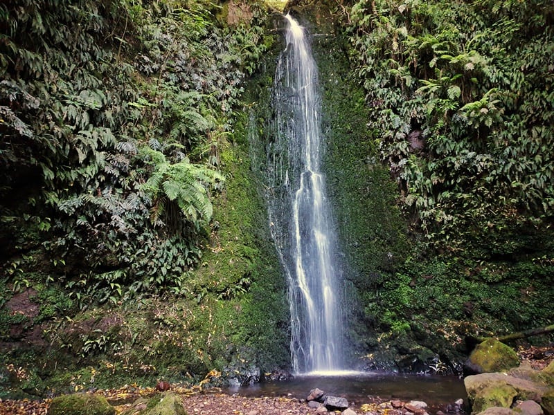
15. NICHOLS FALLS TRACK
- Difficulty: Easy
- Distance: <5km
If you’re looking for a little adventure near Dunedin, the walk to Nichols Falls might be what you’re after. And if you go at night, there’s the opportunity to see glowworms too.
The walk isn’t long, if you don’t get lost, making it a great way to fill in a couple of hours in Dunedin.
The walk takes you through what almost feels like a rainforest which is cool given you’re so close to a city. And while the falls aren’t massive, they’re very good-looking!
READ THE FULL POST: THE WALK TO NICHOLS FALLS
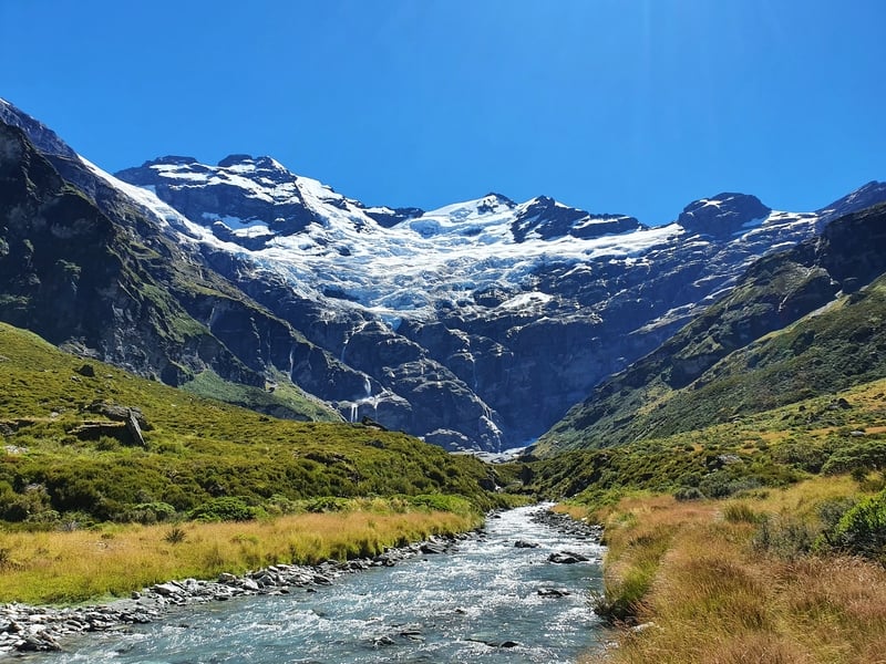
16. ROB ROY GLACIER TRACK
- Difficulty: Easy – Medium
- Distance: 11 – 12km
The Rob Roy Glacier Track is a great opotion for those who have never close to a glacier on a hike before.
It’s about an hour from Wanaka to get here along a beautiful road into Mount Aspiring National Park.
The walk does have some elevation but the track is well maintained and isn’t too steep for any extended stretches.
One thing I wasn’t expecting was the amount of forest you’re walking under. There are some viewpoints along the way, but it’s not until you emerge close to the viewpoint you get to see the glacier.
The viewpoint is a fair way away from the glacier, but there are some extra tracks you can follow to take you closer.
READ THE FULL POST: THE ROB ROY GLACIER TRACK
17. SKYLINE TRACK WANAKA
- Difficulty: Medium
- Distance: ~23 – 24km
Apparently, the Wanaka Skyline Track used to be the option most people would do when they were on the way to Roys Peak. The Skyline Track continues past Mount Roy, goes across to Mount Alpha and then descends down the other side to the Crown Range.
I really enjoyed going to the top of Mount Roy, and Mount Alpha. The views from both are awesome. But I can see why people just go up to Roys Peak, get the photo, then return. For the gram, yo.
READ THE FULL POST: WANAKA’S SKYLINE TRACK
18. ISTHMUS PEAK TRACK
- Difficulty: Hard
- Distance: 15 – 16km
The Isthmus Peak Hike is the most popular alternative to Roys Peak. It starts in a total different location so it’s not a like for like, but I prefer the Isthmus Peak Hike.
It’s a more interesting hike in that there are fewer switchbacks, you get views of both Lake Hawea and Lake Wanaka, and it’s not as popular. That said, you don’t get the Insta photo.
It’s like comparing a day trip from Queenstown to either Milford Sound or Doubtful Sound. Most people will go to Milford because it’s the one most people go to and we follow our peers (that’s my take anyway).
READ THE FULL POST: THE ISTHMUS PEAK TRACK
19. GRANDVIEW MOUNTAIN TRACK
- Difficulty: 18km
- Distance: Easy – Medium
The Grandview Mountain Track is epic! I really enjoyed how it criss-crosses (I feel like this is the wrong word) around the hills a bit. It’s a steep hike over but you get a variety of views as you get closer and closer to the trig at the summit.
This is a good day out, and given the walk is out near Lake Hawea, isn’t super popular.
READ THE FULL POST: THE GRANDVIEW MOUNTAIN TRACK
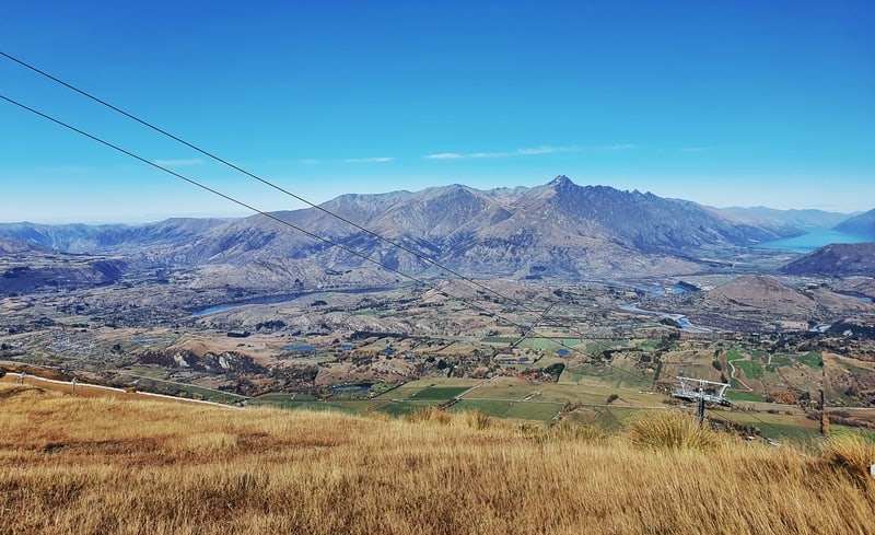
20. CORONET PEAK HIKING TRAIL
- Difficulty: Medium
- Distance: 4 – 5km
Coronet Peak is known for its skifields, but in the summer months you can take the Coronet Peak hiking trail to the summit.
It’s kind of weird seeing the skifield with no snow, the lifts and snowmaking machines look out of place.
This walk is super steep and while there’s an official trail, you can go up in multiple directions.
From the top, you get wicked 360 degree views. And it’s always satisfying to say you’ve been to the top of a mountain 🙂
READ THE FULL POST: THE CORONET PEAK HIKING TRAIL
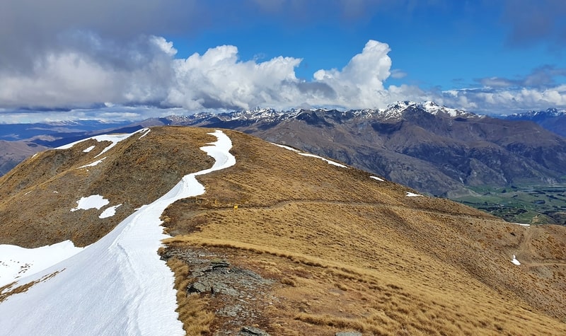
21. BROW PEAK TRACK
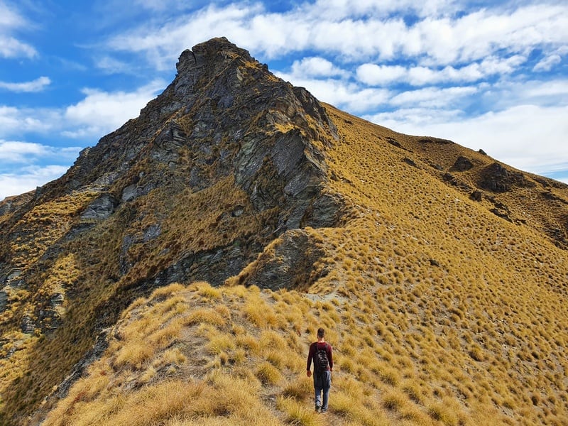
- Difficulty: Medium – Hard
- Distance: 19 – 20km
This is one of the Central Otago walks more people need to know about! Anytime someone asks me about Brow Peak, I get excited and overly enthusiastic telling them they must do it.
As I’m walking along the spine of the ridge it feels awesome with the tussocks blanket one side, and steep cliff like drop offs on the other. It’s a stunner…as the photo shows.
You start the hike from Arrowtown, and there’s a variety of ways you can reach Brow Peak…but in the full post below I talk about the loop I recommend the most.
This is a good weather day hike as you’ll be exposed to the elements out on the ridgeline for a while.
READ THE FULL POST: THE BROW PEAK TRACK
22. SAWPIT GULLY TRACK
- Difficulty: Easy – Medium
- Distance: 7 – 8km
This is one of the regular loops the locals will do in Arrowtown.
It’s a walk where you get a variety of views and terrain that’s not going to have you out all day walking.
You’ll walk up a creek that has lots of little river crossing, so if there has been rain in the previous 24 hours you might want to avoid the track unless you like wet shoes.
And definitely to the side track to German Hill!
READ THE FULL POST: THE SAWPIT GULLY TRACK
23. NEW CHUM GULLY TRACK
- Difficulty: Easy – Medium
- Distance: 7 – 8km
This isn’t as popular as the Sawpit Gully Track and Tobins Track walk and I can see why. It’s a bit more technical in parts and requires a little bit of bushbashing if things are overgrown.
That said, if you’re spending a long time in the Arrowtown region, add this one to your list of hikes to do. Like the Sawpit Track, it’s not going to take up your whole day.
READ THE FULL POST: THE NEW CHUM GULLY TRACK
24. TOBINS TRACK
- Difficulty: Easy – Medium
- Distance: 8km return (including Mount Beetham)
If you’re wanting to get your heartrate up on a non-technical track that offers smeviews while drinking coffee. The Tobins Track is for you!
There’s some vert on the way, but the 4WD track makes things relatively easy to follow.
If you want to make this a hike more so than a walk however, add on the push up to Mount Beetham. This is a crazy hill that comes out of nowhere, and there’s no switchbacks! You’re going straight up the guts all the way to the top.
And take it easy coming down Beetham, it’s slippery…regardless if it’s wet or dry.
READ THE FULL POST: TOBINS TRACK
25. CROWN PEAK TRACK
- Difficulty: Medium – Hard
- Distance: 24 – 25km
The Crown Peak Track is another track like Brow Peak that I recommend people go out and do if they’ve got the opportunity. This is a hike that will fill up most of your day as you wind your way up the hill.
It also incorproates parts of other trails in Arrowtown which is fun.
This is a hike you can do throughout winter as well which is fun (unless there has been crazy amounts of snow).
READ THE FULL POST: CROWN PEAK HIKE
26. LAKE HAYES LOOP
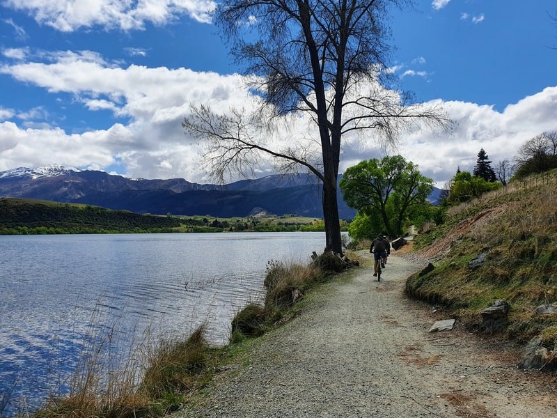
- Difficulty: Easy
- Distance: 8km
The Lake Hayes Loop is a nice walk if you’re travelling between Arrowtown and Queenstown.
On a calm day, the lake looks stunning as you meander the well-maintained trail that has just a few small hills.
If you can, get to this loop at sunset. It’s beautiful!
READ THE FULL POST: WALKING AROUND LAKE HAYES
27. MOUNT JUDAH TRACK
- Difficulty: Medium
- Distance: 16 – 17km
The Mount Judah Track is a hike that people aren’t sure if it’s going to be worth going to or not. Why? Because it’s not super popular therefore it can be hard to find someone who’s done it before you.
But if you’re considering the track, and even staying overnight at Heather Jock Hut, go for it! Ideally on a blue sky day so you get the best views.
The trail goes through an old mining area and has plenty of fun things to look at…in addition to the views that is.
READ THE FULL POST: WALKING THE MOUNT JUDAH TRACK
Wowee. That’s a lot of Otago walks and hikes to put into consideration.
If you have a couple of hikes and/or walks in Otago you’re trying to decide between, drop a comment below and I’ll be happy to help.
Or if there’s one you think I need to do, let me know 😀
READ THIS NEXT: 11 AWESOME MULTIDAY HIKES ON THE SOUTH ISLAND

Hey, it’s Jub here. I’m the guy behind Chur New Zealand, helping you have the best time hiking, trekking, walking…whatever you want to call it…in NZ. I’m based in Queenstown and am always out and about exploring trails, old & new. If you have any questions, reach out.