The Fernhill Loop Track is a 7-8km loop track with a trailhead about 2km from the centre of Queenstown.
There are a few stream crossings along the way, as you switch between mountain biking tracks to the good part where the views are. And then you’ve got a gentle descent back through some more forest along with getting to check out the One Mile Track too.
This post will give you everything you need to know about the Fernhill Loop Track (it’s not an easy hike), one of the less popular touristy things to do in Queenstown.
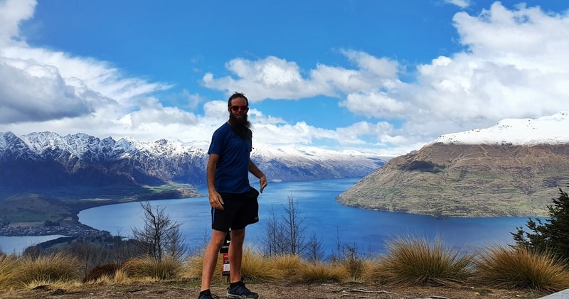
TABLE OF CONTENTS
1. Details
2. Map of the Fernhill Loop
3. How To Get There
My Fernhill Loop Track Experience
1. DETAILS ABOUT THE FERNHILL LOOP TRACK
After the first 20 minutes, I was thinking that this walk was going to get 1-star. But the walk did redeem itself. It’s not like most walks in NZ where you can wing it though (that’s why you’re reading this right).
The middle third of the walk is awesome though, with epic views, and a real rugged feel. The biggest downsides are the confusing signs and the crisscrossing of mountain bike tracks.
When1: September 2020
Difficulty2: Medium. The track isn’t super easy to follow, and with a solid incline it’ll keep most people very honest.
Hike Distance3: My Strava record shows 7.37km. That includes some a couple of hundred metres of walking around working out where the track was. Most other sites say it’s in the 7-8km range so expect to walk something in that range (Maps.me below has it at 6.8km).
Incline4: My Strava logged in 498 metres of elevation. The track starts about 470 metres abve sea level (from Wynard Crescent) and the top point is about 920 metres above sea level so i feel this is quite accurate.
Hike Duration5: It took me a tad under two hours to complete the loop. I didn’t stop for any extended breaks, it was more than few minutes spent finding the track that added time. It’ll take most people 2-3.5 hours to complete.
2. FERNHILL LOOP TRACK MAP
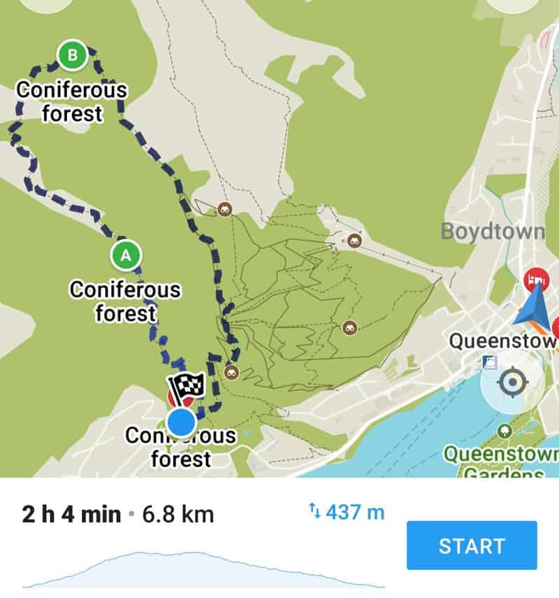
The track isn’t on Google Maps, and I found the track pretty hard to follow so was glad to have the Maps.me app which let me know when I strayed off track a couple of times.
That’s the maps.me map above with the elevation profile walking in a clockwise direction (I recommend walking this way).
3. HOW TO GET THERE
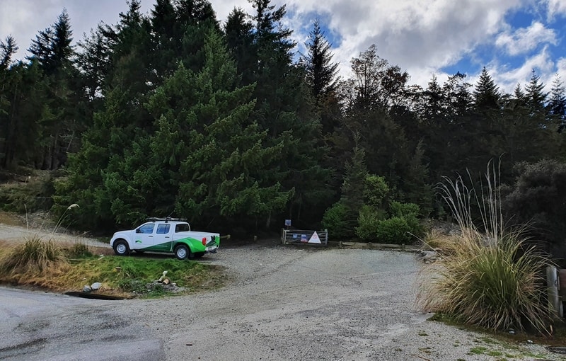
The Fernhill Loop Track car park area
For the purposes of this post, I’m using the Wynard Crescent entrance as the trailhead (this seems to be what is considered the proper entry point for the hike). You can get there by walking, driving, or taking public transport.
WALK
If you’re new to Queenstown, you’ll quite enjoy the walk to the trailhead. Google Maps has it at 3.2km, but if you use Maps.me, you’ll see a couple of paths where you can cut that distance down to 2.5km or so.
PUBLIC TRANSPORT
The #1 bus goes to Fernhill from the main bus stop in the centre of town, though you’ll still need to walk 500 metres or so to the trailhead. But for $2 in one direction, it’s a good option. You can see the places to get on and off here.
CAR
There’s not a massive car park at the trailhead, but it’s not a super touristy track so you should find a space. If not, park on the street. Depending on the traffic, it’ll take you 5-10 minutes to get there (closer to 5 usually).
4. MY EXPERIENCE ON THE FERNHILL LOOP TRACK
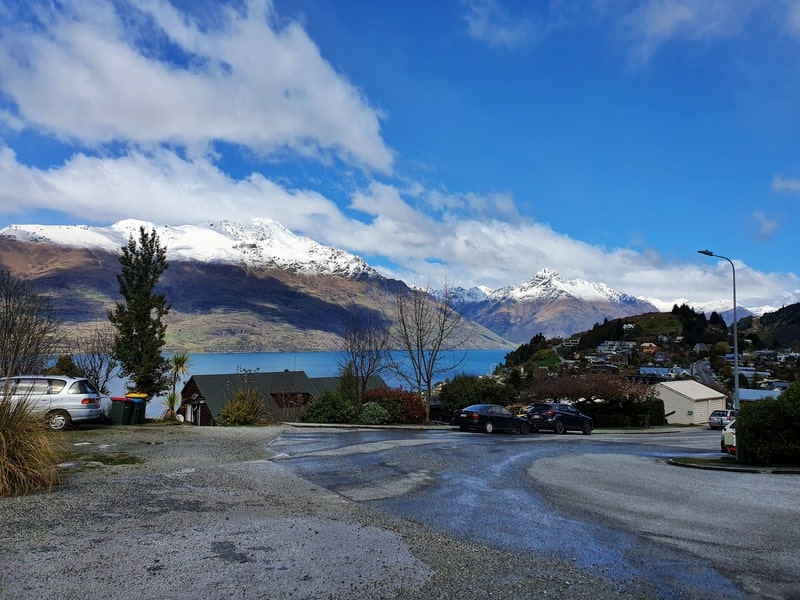
The Fernhill Loop track is a bit confusing to start with (the photo above is the view from trailhead).
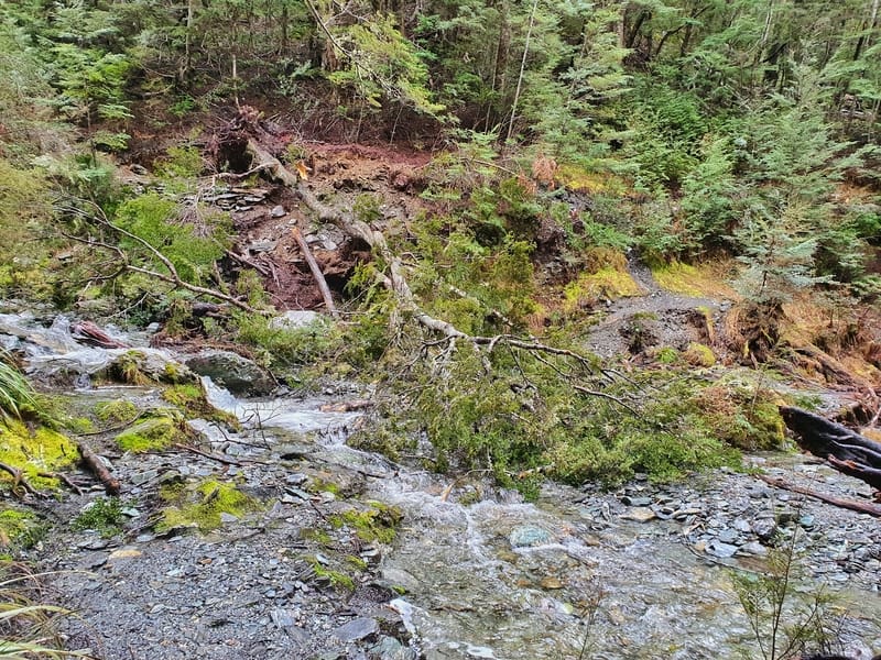
As soon as you hit the track there’s a small stream crossing, go straight through across (in the summer you probably won’t get wet feet). At the junction after the creek, veer left (here). Then at the next junction go left again if you’re like me and prefer to go up the steeper way and come back via the longer descent.
From here I found the signs pretty confusing still and found myself following the mountain bike trails. But you should just follow the 4WD track and go straight up. It’s quite steep. With that said, keep your eyes and ears peeled for any mountain bikers…they’ll be crossing the track fast.
And you can ignore these road closed signs…that also confused me! That’s for vehicles.
With all these obstacles, it’s not a great start to the walk. Make sure you’ve got Maps.me downloaded so you stay on track.
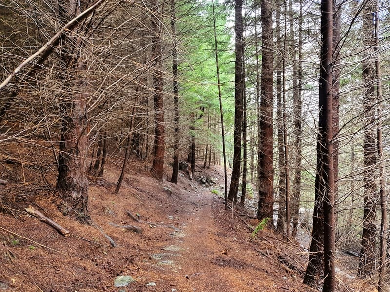
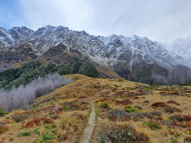
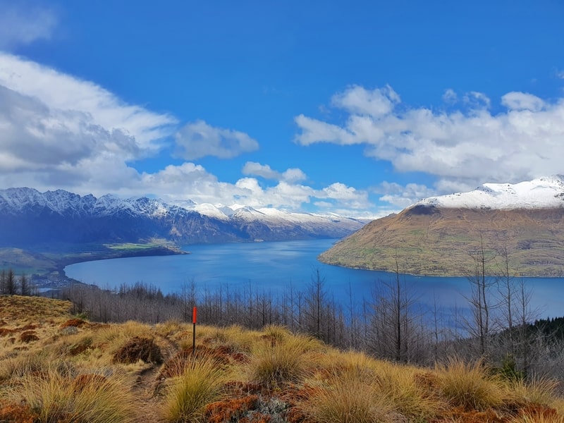
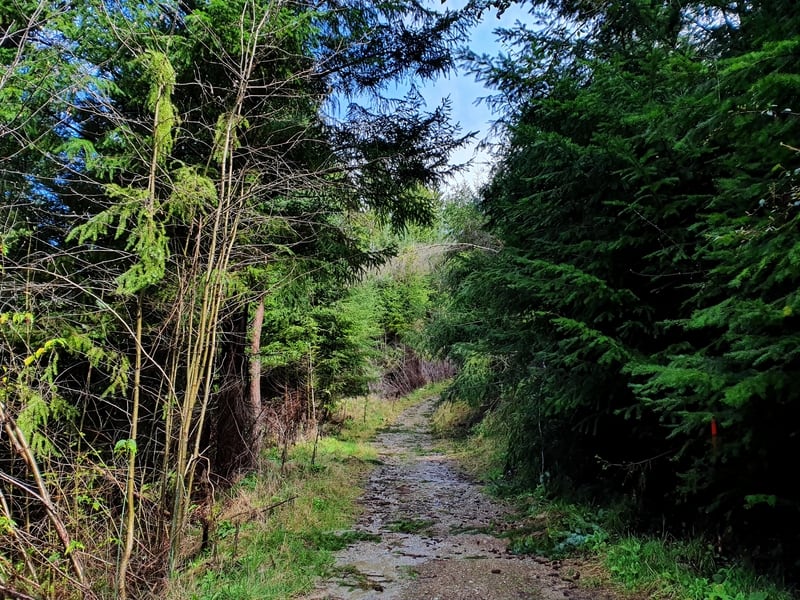
Eventually, you’ll hit a single trail through the forest and this is the start of the nice section of the walk. The track is pretty easy to follow for now and then you’ll come out into the open and the walk gets even better. You’ll suddenly see the mountain range in front of you with tussocks lining the trail.
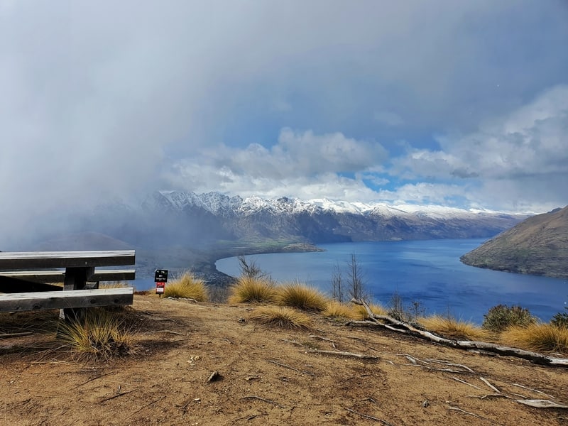
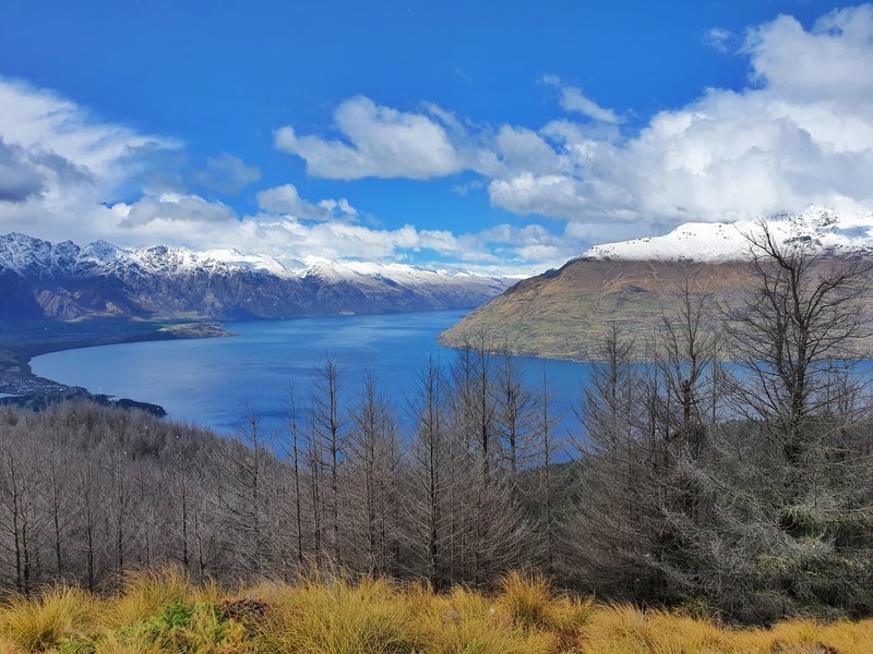
And Lake Wakatipu behind you as always.
Continue on up, and you’ll come to another fork in the road. I went left, thinking this was the more obvious trail and found a wicked viewpoint and a picnic bench which would be the place to have lunch for sure. This trail isn’t popular so you should have the area to yourself, with the more popular Ben Lomond Track visible on the side of the hills to the east.
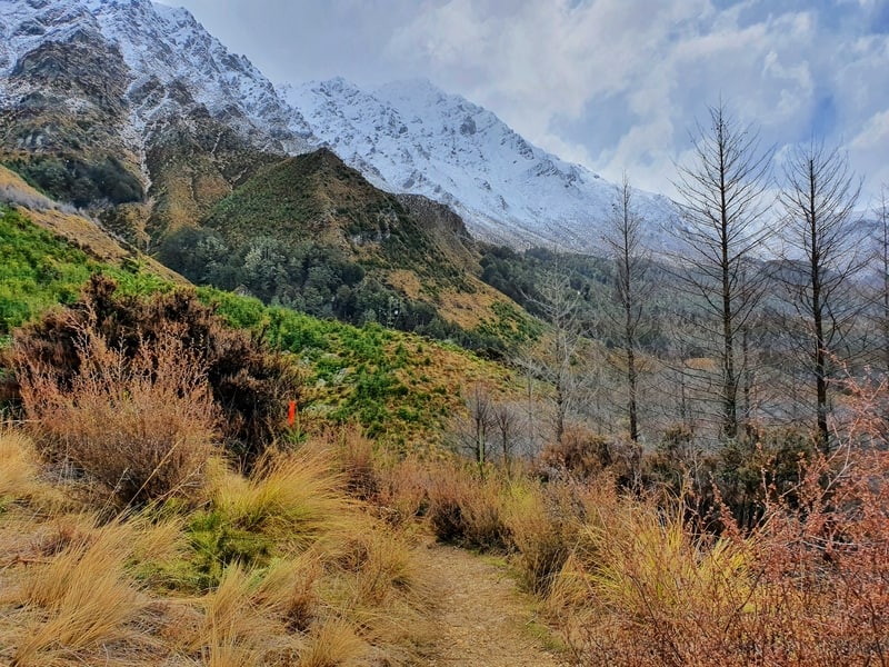
To continue on the trail though, you’ll need to go back to the junction and veer right. This takes you down and through a valley (I saw some goats). You should see enough orange trail markers/poles to keep you on track, but I did find I was regularly verifying I was going the right way with Maps.me.
Let’s just say this, of all the amazing walks in the South Island, this is the one with the poorest signage.

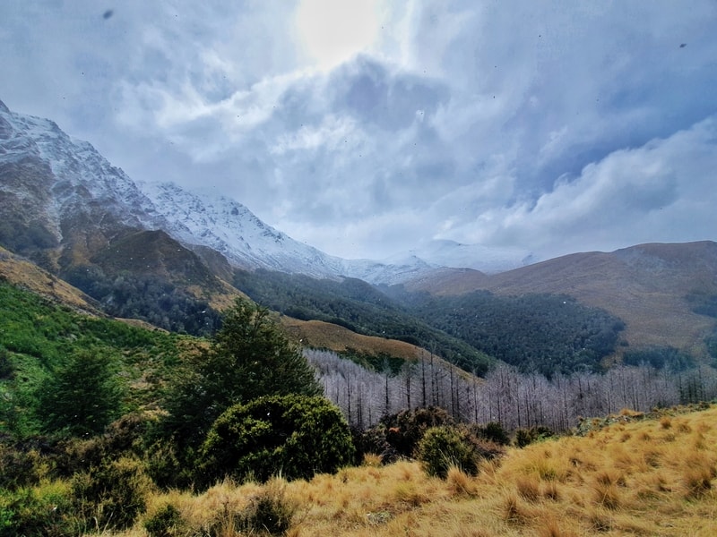
You’ll then enter a beautiful section of forest and if there’s been recent rain/snow you’ll feel like you’re walking down a little stream as the water finds its way to the lake. This section of the forest is gorgeous!
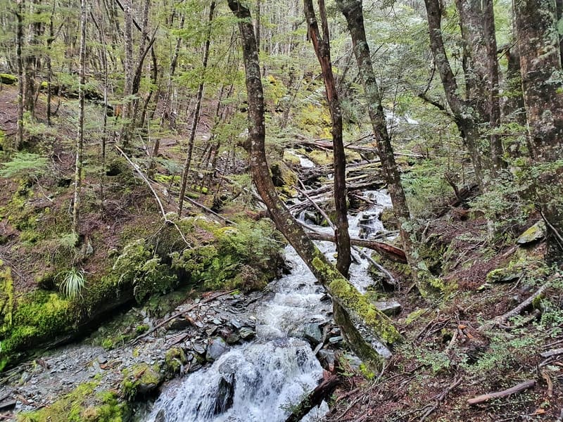
There are a couple more stream crossings, nothing crazy but they made sure my feet reminded me what cold water feels like.
Before long, you’ll see another mountain bike track at which point you’ve just got to stay patient and aware until you come to a crossroads where lots of tracks combine. You’ll see a big orange marker pointing you in the right direction which is actually the One Mile Track which you follow for a little bit before you depart that to finish the loop (you could stay on the One Mile Track if you want a shorter walk back to Queenstown).
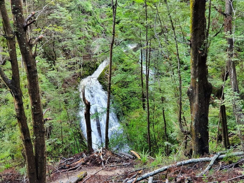
There’s another stream crossing, which also has a bit of a waterfall nearby. It doesn’t seem to have a name though.
And then you’re on the final stretch back to the trailhead. Once again with the mountain bike tracks sharing/crossing the walking trail it’s not an amazing section, the waterfall saves it.
The Fernhill Loop walk isn’t a must-do Queenstown walk, but if you’re spending a decent chunk of time in the city (living here?) you’ll want to get this walk done for sure.
RECOMMENDED READING
200+ Things to do in New Zealand
Because brainstorming ideas is never not fun
Walking up Queenstown Hill
This walk is amazing, and even closer to the city centre than Fernhill
Is Queenstowns world-famous burger worth it?
Yes, no, maybe? It’s probably best you just go and try it out for yourself

Hey, it’s Jub here. I’m the guy behind Chur New Zealand, helping you have the best time hiking, trekking, walking…whatever you want to call it…in NZ. I’m based in Queenstown and am always out and about exploring trails, old & new. If you have any questions, reach out.
Cheers for the post it was spot on and helped me with my walk this morning. Took me 2 hours 45 minutes. Probably took me an hour just on the grunty uphill in the trees at the start (should have picked a cooler morning) but was cruisy from there. Thanks again for all the tips 🙂
Hey Yvette, you did pick one of the more hot and humid days so far this summer…that’s not a bad thing though 🙂
Thanks for letting us know how the hike went for you! Enjoy your next Queenstown adventure. Jub