The hike to Crown Peak from Arrowtown takes you to various different tracks before the long trek up the Crown Range to Crown Peak.
From there you get sweeping views of the Wakatipu Basin and the surrounding mountains. Fortunately, it’s not all out and back as you can include a loop on the way back to Arrowtown for a 25km-ish day.
This post will give you all the details you need to know about the Crown Peak hike. Including lots of photos.
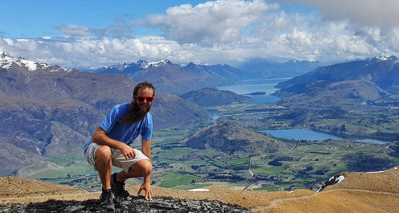
Proof I’ve been to the Crown Peak summit.
TABLE OF CONTENTS
DETAILS ABOUT HIKING TO CROWN PEAK NEAR ARROWTOWN
When1: October 2020
Difficulty2: Medium
Hike Distance3: My Strava data recorded 24.86km return. I didn’t get lost so this feels accurate, if you take the same route noted below.
Incline4: Strava recorded 1497 metres of elevation gain which is pretty much all on the way to the summit of Crown Peak, 1735 metres above sea level.
Hike Duration5: It took me 4 hours and 53 minutes to complete the 25km. This is a quick pace, and did include some jogging on the last couple of kilometres (had to catch the bus). I was making a conscious effort to walk fast, and other than a five-minute break at the top, didn’t take any breaks. I would expect most people to take 5.5 hours to 7.5 hours to complete the walk.
CROWN PEAK TRACK MAP
View Larger Topographic Map
You can click on the map above to zoom in and out of the map in a new tab. The red line is the GPX file from Strava overlaid on a topo map.
You can’t find all of the tracks on Google Maps, nor Maps.me. The signs along the track are super easy to follow though.
HOW TO GET THERE
As the trailhead is in Arrowtown, make your way there and you can begin the walk.
Driving to Arrowtown is easy from Queenstown, Wanaka, and Cromwell (less than an hour). And Arrowtown has free parking at this location in Google Maps, which is also the makeshift trailhead.
There’s a regular public bus service between Queenstown and Arrowtown that costs $2 each way with a Bee Card (timetable here).
It’s also easy to hitchhike to Arrowtown from most nearby spots.
MY EXPERIENCE HIKING TO CROWN PEAK (ARROWTOWN)
The Crown Peak Track isn’t an overly difficult walk, as you spend a large portion of the incline on a 4WD track. But at 25km return, it’s not exactly a short hike making it for a tough day.
There are numerous ways you can navigate to the track that leads to Crown Peak. For refernece when you’re looking at the map (you’ll see a few of these around) of walking tracks in Arrowtown I walked:
Up to the Crown Peak Summit via:
- 14a
- 8b
- 9
- 12
- 11b
- 16a
And back down:
- 16a
- 13
- Glencoe Road
- 14b
- 14a
To make it easy, I’ll use each segment as a sub-header:
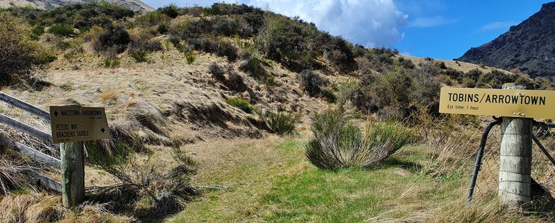
14a
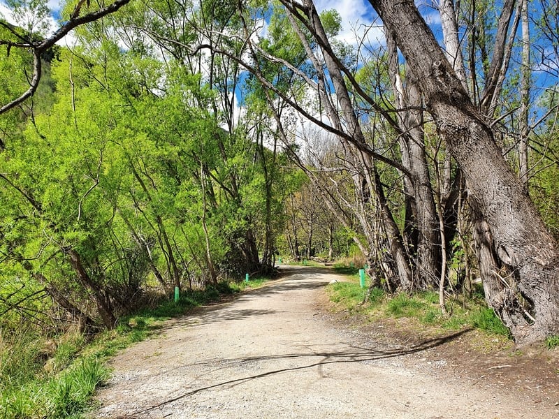
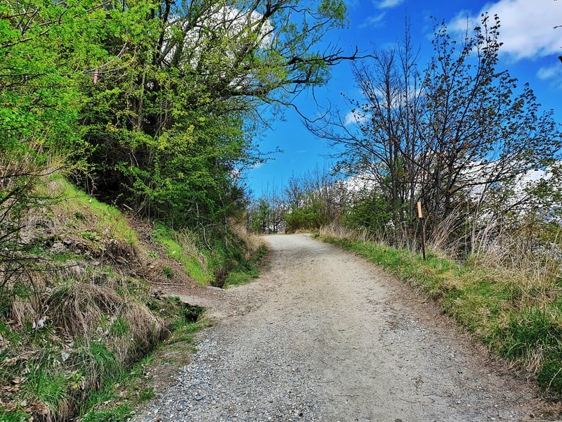
As I mentioned earlier, the Google Maps location X Marks the Spot is the trailhead of choice I use. When you’re here and facing the river, turn right and follow the track next to the river. It’s a nice flat start to walk through a light canopy of trees.
You’ll then see the footbridge come into view, cross that and turn right after the bridge onto Tobins Track up the hill. It’s not a crazy gradient, but you definitely know you’re going uphill. It won’t take long until you get views over Arrowtown though. Just don’t get carried away and walk past the turnoff for 8b.
8b
When you get to this turn off above, we need to turn left to 8b which we’ll stay on for less than a kilometre.
This is a part of the New Chum Gully Track and is a single trail track that’s steeper than what we’ve been on to start. It’ll start to flatten out soon enough, and offers glimpses of the surrounding mountains.
When you get to the first junction on this track, we need to right onto 9.
9
There’s not much to say about this, it’s a short and sharp drop for a couple of hundred metres leading to 12. The track is pretty gnarly, look after your ankles.
12
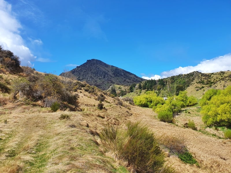
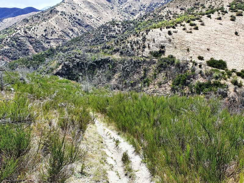
As you descend down #9 you’ll see 12 across the valley trailing along the side of the hill.
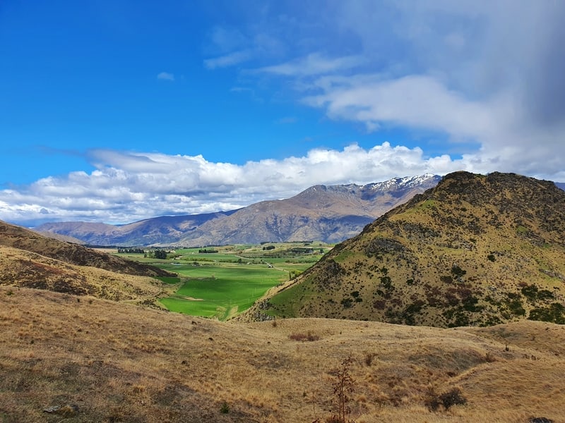
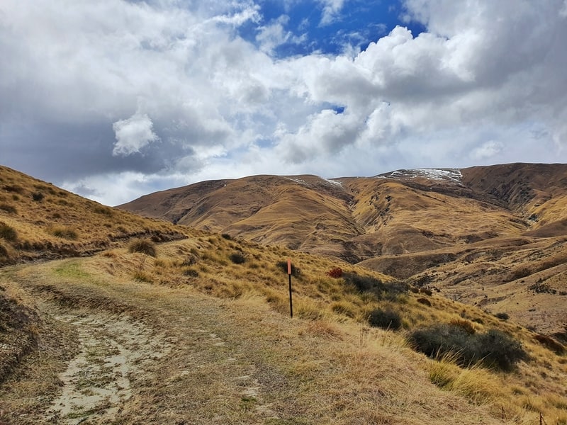
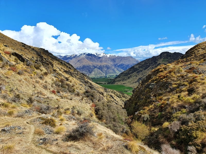
This is the start of the poled route and gains about 300 metres of elevation over 3km or so. It’s a beautiful walk and you can see how contrasting the two different sides of Mount Beetham are. You’ll also see a few houses in the valley. I’d love to have these as a summer home, they’re close enough to Arrowtown yet totally isolated. They just looked so chill.
You’ll now get views of the Crown Range which looks pretty itimidating. That’s not a good thing is it?
Anyhow, you can’t get lost on this section, like any good kiwi hiking track.
11b
When you reached the junction at the end of 12 there’s a sign, so we turn right to the base of the Crown Range.
Like number 9, this is a short section of a couple of hundred metres in Brackens Saddle.
16a
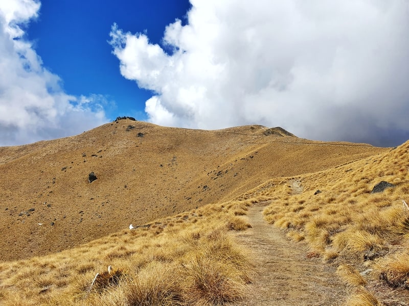
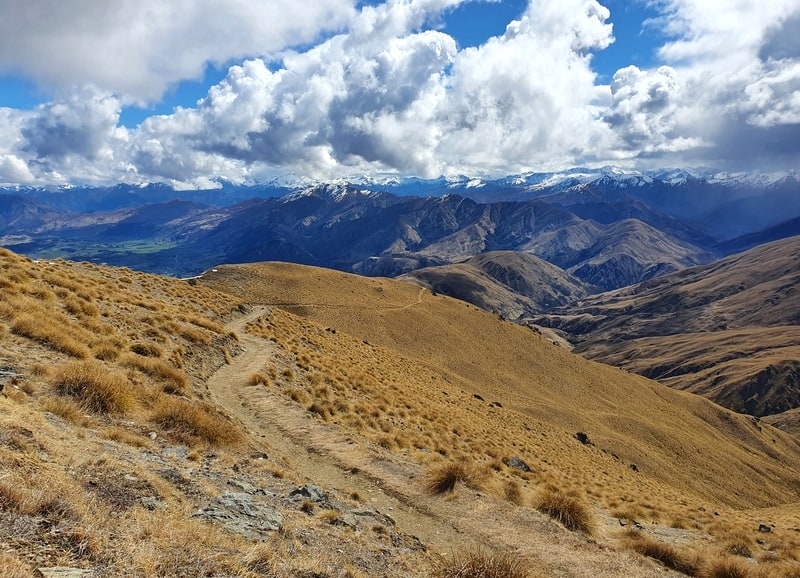
And this is where the fun begins! A 5.7km section with about 850 metres of steady incline to the summit.
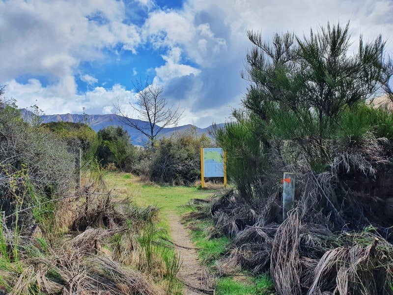
There’s some information about the region here, and another map. When you’re coming from 11b, make sure you turn left to go up to Crown Peak, rather than right. We’ll be following that track on the descent (#13).
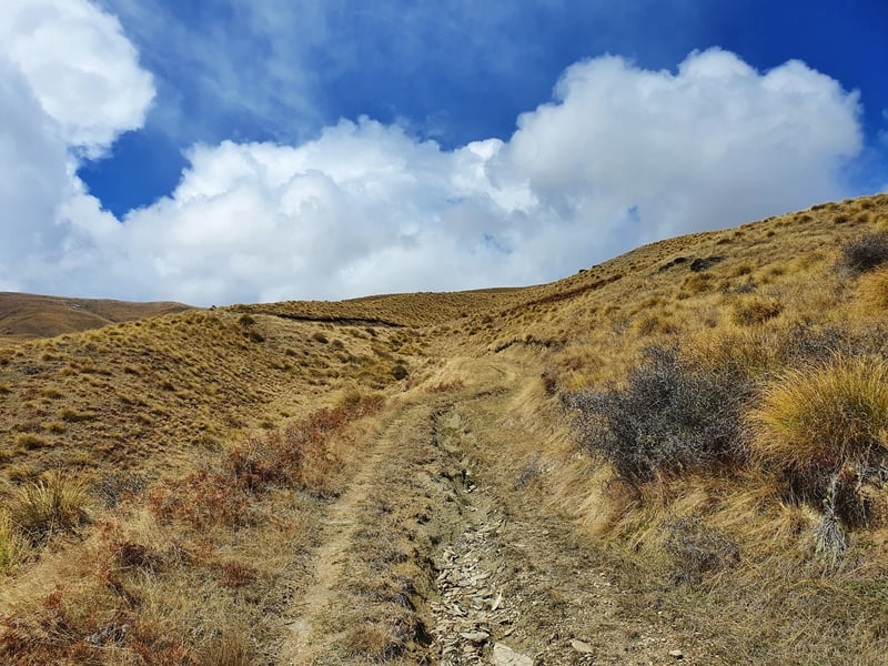
16a is a 4WD track more or less than the whole way to the top. Thankfully it’s not full of switchbacks. They kill my buzz fast.
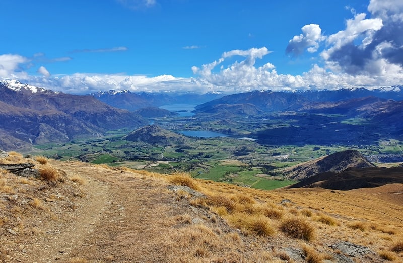
The views on the way are numerous which is nice but it’s not exactly the most interesting of walks. You’re simply grinding up the hill with tussocks on either side of you. You can see the peak in the distance from time to time (there are some large rocks at the peak).
With that said, despite the steady ascent, you can make relatively quick ground and I didn’t hate the walk.
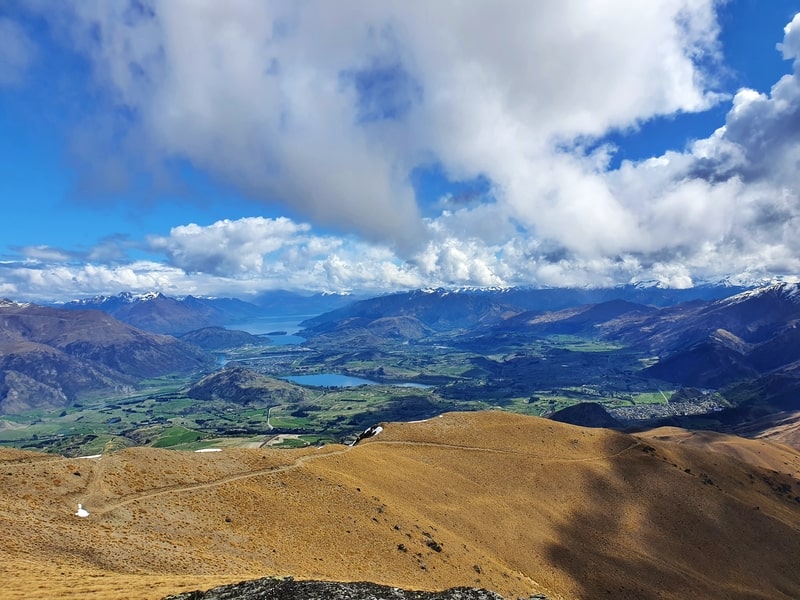
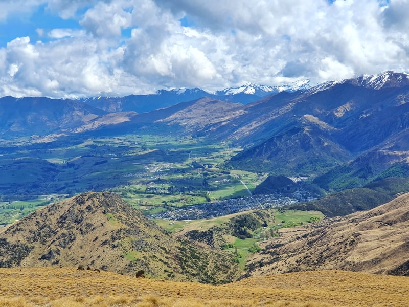
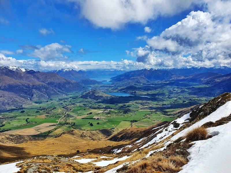
Finally, I made it to the top and was pretty stoked with the views. It’s was now all worth it.
You can see Lake Wakatipu, The Remarkables, up towards Cardrona, Wakatipu Basin, Brow Peak etc.
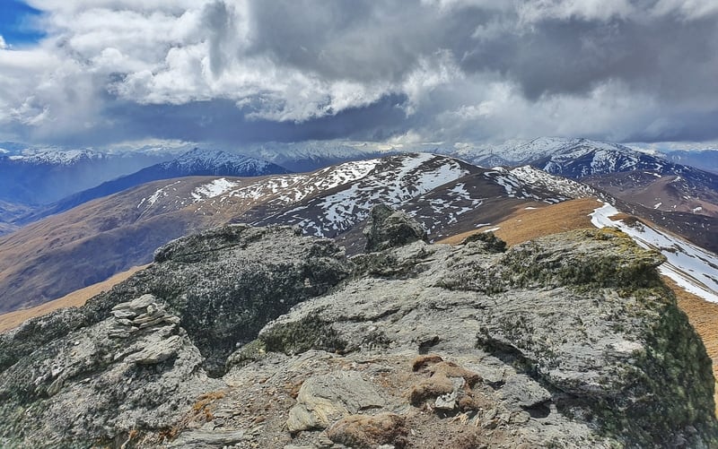
And you have Mt. Sole a few kilometres along the ridge too. If you really wanted, you could add that to your day, but that’s dragging the day out quite a bit so I decided against that.
After spending five minutes at the top, the descent begins.
16a (return)
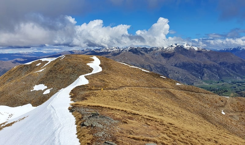
We start back the way we came. If you’re really keen you’ll see a trig 100 metres along 16b which you might want to head to first.
Heading back down 16a you get a better chance of seeing the views regularly coming back down compared to going up, that’s always nice.
The descent is at a gradient where your knees won’t hate life so if you need to make up ground timewise, you can get a move on here. Just be careful of the sections that are rutted out…nobody wants to sprain an ankle.
13
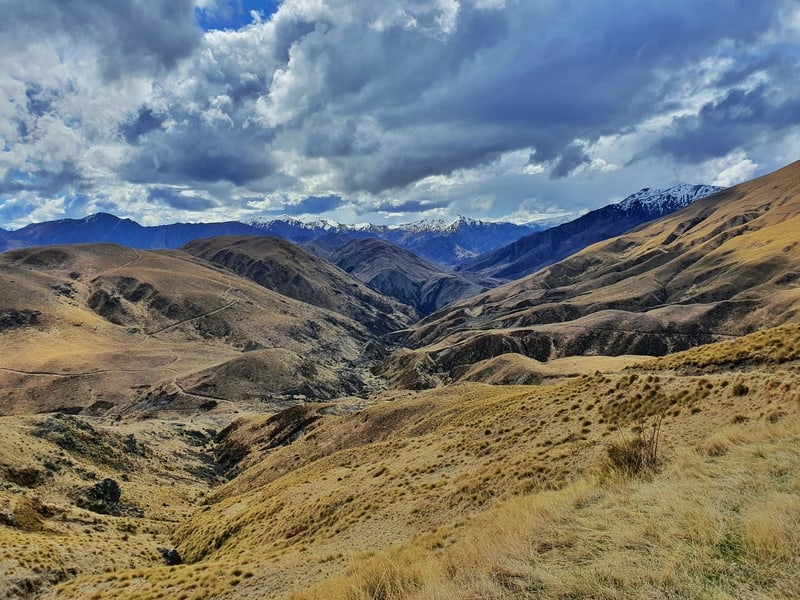
Once we get to the junction, turn left. This is a new track for the day and leads into a wicked little valley which feels really dramatic in spots. On the way to the valley I slipped over on the wet grass a couple of times, make sure of your footing!
This is all on a single trail and can be technical in parts.
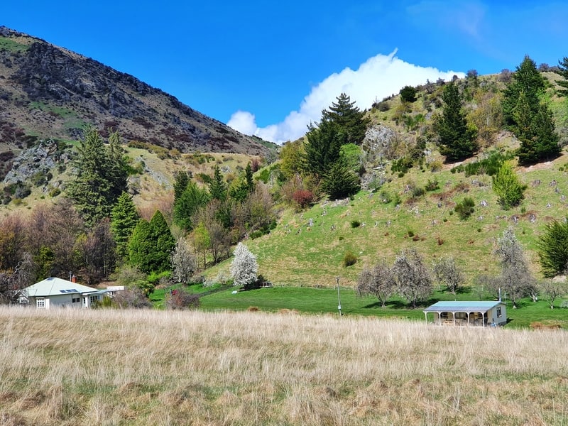
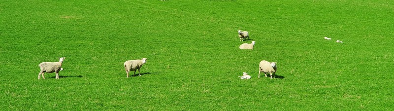
As you emerge from the valley, you’ll see paddocks in front of Mount Beetham. You’ll be dropping down to the paddocks and crossing them. This is private land, so stick to the poled route and don’t shag hassle the sheep. There were plenty of lambs when I passed through…no doubt they got a laugh when I slipped over. Again.
Glencoe Road
The #13 trail leads to Glencoe Road (turn right onto the road), and an unsealed road that goes around the bottom of Mount Beetham. This is basically the final stretch now, despite there being a few kilometres to go yet. Fortunately, you’ll have good views most of the way back.
You’ll stick to this road for about 1km before the yellow street sign lets you know to turn left on Tobins Track.
If you really want to punish yourself late into the walk, you can walk up and down the Mount Beetham Summit Trail before you reach Tobins Track…
14b/14a
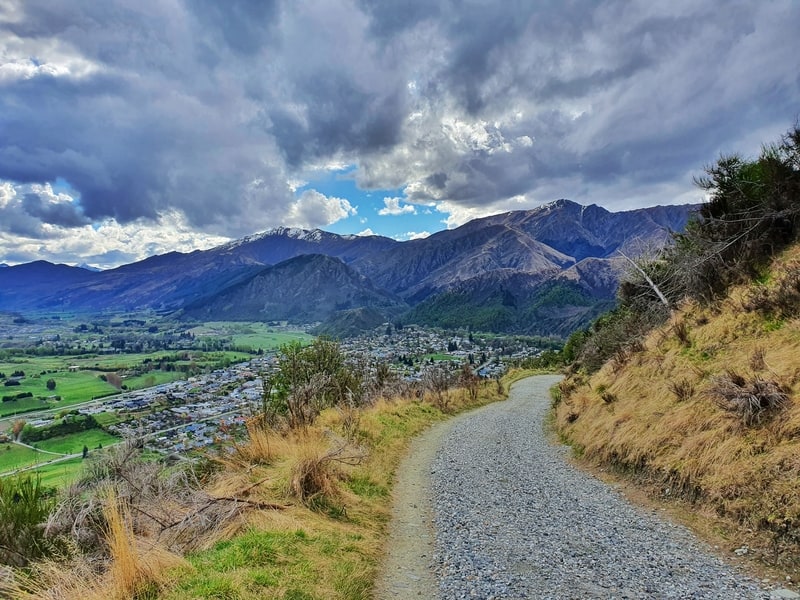
I’ll combine these two final sections that makeup Tobins Track. This is a steady descent down a 4WD track with plenty of views over Arrowtown and the surrounding area (you won’t see Crown Peak though).
Sometimes there’ll be bikers hooning down from behind you, so stick to one side of the track for safety reasons. You just follow this all the way back to Arrowtown 🙂
If I had to compare Crown Peak to Brow Peak, I’d give Brow Peak the edge. But like most walks in the South Island you’ll go on, you can’t argue 🙂
RECOMMENDED READING
200+ Things to do in New Zealand
Not that you need more ideas…
New Zealand slang words
Some of the most know words to learn when you arrive in NZ 😉
FERGBURGER!!! worth it?
If you’re heading back to Queenstown after the hike, you probably should get to Fergs. #treatyourself

Hey, it’s Jub here. I’m the guy behind Chur New Zealand, helping you have the best time hiking, trekking, walking…whatever you want to call it…in NZ. I’m based in Queenstown and am always out and about exploring trails, old & new. If you have any questions, reach out.
Really enjoying your track notes! Thanks for putting this together – please keep posting! Using them as trail inspirations and have referred to them mid-hike as well.
Hey mate,
Thanks for letting me know you’ve found them useful. Will be adding plenty more as of next month 🙂
Happy hiking!
Cheers,
Jub
Hi Jub
I hiked up to Crown Peak this morning as per your track notes and route.
Perfect weather and had one of those magic walks.
I am relatively new to New Zealand and loving the mountains here- so many awesome peaks to climb.
Please keep posting your tips!
Hey Frances,
Yaaas, you must have been in the snow at the top? I’ve just flown back into Queenstown and stoked the snow is still around…but also excited for it to leave so all the summer missions can begin haha.
Welcome to NZ 🙂
Chur,
Jub