This post will give you the details about walk the popular track for Arrowtown locals, Tobins Track.
Tobins Track is a popular walk with the local’s thanks to the track being:
- easy to access
- a good way to get the heart pumping without being extreme
- you get some great views
And if you want to increase the difficulty, you can continue on to Mount Beetham. This will give you a really good workout, with your calves almost surely burning on the way up. But you’re rewarded with views which are always better when you work for them.
This post will detail Tobins Track with a mention of Mount Beetham if you’re up for a longer walk.
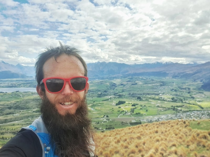
A Mount Beetham selfie.
TABLE OF CONTENTS
1. Tobins Track Details
2. Tobins Track Map
3. How To Get There
4. My Tobins Track (& Mt Beetham) Experience
1. TOBINS TRACK DETAILS
How hard is the Tobins Track walk?
Easy to Medium. Tobin’s track isn’t too tough, it’s just a steady climb on a good track. The 1km grind up Mount Beetham is tough though, with a steep track on a less well formed trail.
How far is Tobin’s Track?
From the point where I started, mentioned below I got 3.2km to the regular Tobins Track turnaround, and then 4.2km if I include Mount Beetham summit. So you’ve got either a 6.4km or 8.4km return trip. You can always turn around on Tobin’s Track early if need be.
What’s the elevation gain of walking Tobins Track?
My watch gave me about 260 metres of elevation gain to the turn around point for Tobins Track, and a total of 526 metres of elevation gain with Mount Beetham included.
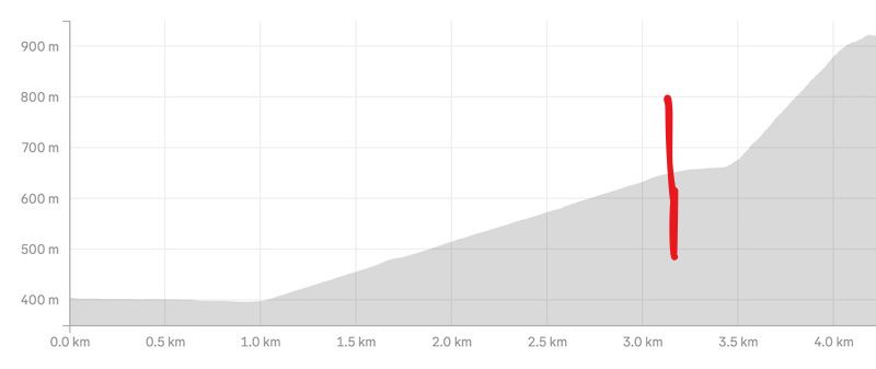
Here’s the elevation profile on the way up…the red line is the end of Tobin’s Track. As you can see it gets a lot steeper going to the top of Mt Beetham.
How long does it take to hike Tobins Track?
It took me 1 hour to reach the Mount Beetham Summit. After spending about 5 minutes up there, I began to walk down and made it back in about 50 minutes for a round trip of just under two hours total.
This is on the fast side, with most people taking longer to get up the Mount Beetham section. I’d schedule 2 – 3 hours for this walk (which gives you some time to enjoy a snack at the summit).
2. TOBINS TRACK MAP
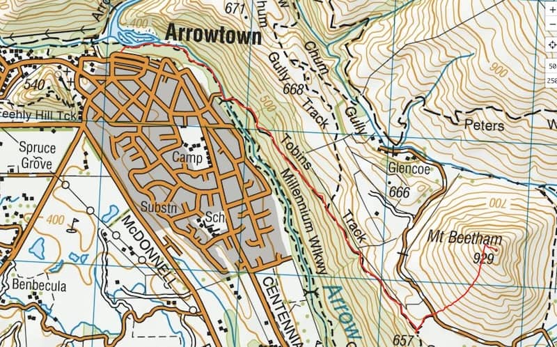
The above is my Strava data overlaid on a topo map (including the section up to Mount Beetham). You can click the image to open it in a new window.
Tobins Track is labeled on both Google Maps and Maps.me, but neither of them shows the track up to Mount Beetham (at the time of publishing).
You don’t really need a map for this walk, but there’s no harm in having this topo map app on your phone anway (paid, but worth it).
3. HOW TO GET THERE
Tobins Track is considered to start at the car park at the bottom of Ford Street here. But I feel like most people are going to be better off starting from closer to Arrowtown’s town centre. Opposite the Arrowtown Wine Store works for me.
Arrowtown is easily reached from Queenstown by bus and car, or is less than an hours drive from Wanaka. There’s lots of free parking available, with only the busiest of summer/fall times that’ll make it hard to find a park (you might need to do a couple of loops).
4. MY TOBINS TRACK (& MOUNT BEETHAM) EXPERIENCE
I wasn’t too excited about Tobins Track going into the walk (for no real reason), but when I heard about the Mount Beetham add on, it soon became one of the must-do walks in Arrowtown for me.
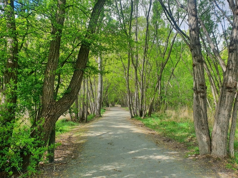
After walking from the bus stop to the wine store (mentioned above) to get my bearings, I walked through the car park towards Arrow River. Turning right at the river, it’s a nice flat start to the walk, through a light canopy of trees with a few tourists looking to get lucky panning for gold.
At about the 1km in you’ll come across a pedestrian bridge that takes you over the river. There’ll be a sign mentioning Tobins Track too.
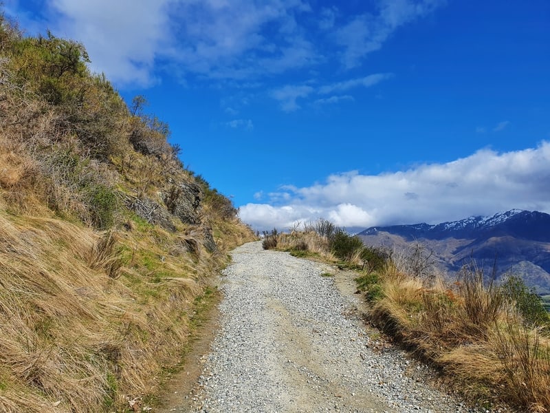
Crossing the bridge, you’re then turning right onto the 4WD track that starts going up the hill right away (again, there’s a sign). You’ll be following this 4WD track all the way for the next 2.5km or so. It’s rarely flat, but the incline isn’t crazy.
It’s important to note, you need to ignore the orange triangle signaling to turn left unless you want to complete the New Chums Track 🙂 Stay on the 4WD track.
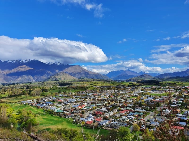
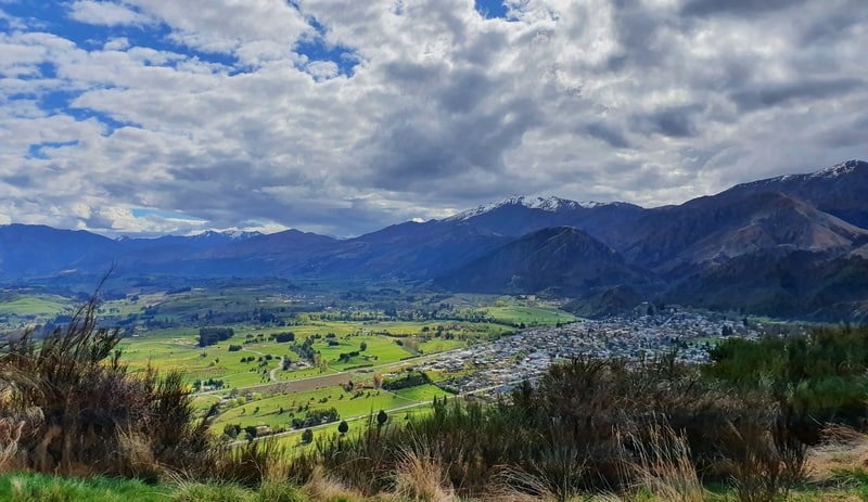
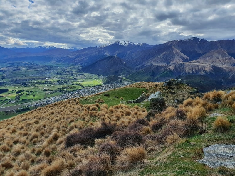
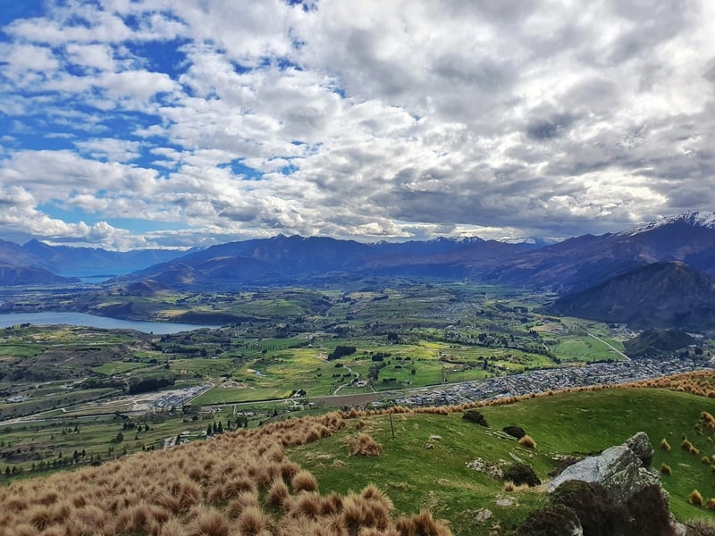
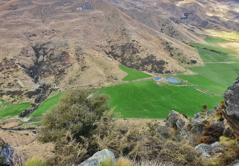
The 4WD track is lined with trees to start, but they soon give way and you’ll start to see views of Arrowtown and the surrounding area on your right (the left is a bank). I started taking photos of the views early on, but they only get better the further you go on. You can even tell The Hills Golf Club is world-class from here, it’s immaculate.
You might also notice the plaque which will give you insight as to why the track is named what it is.
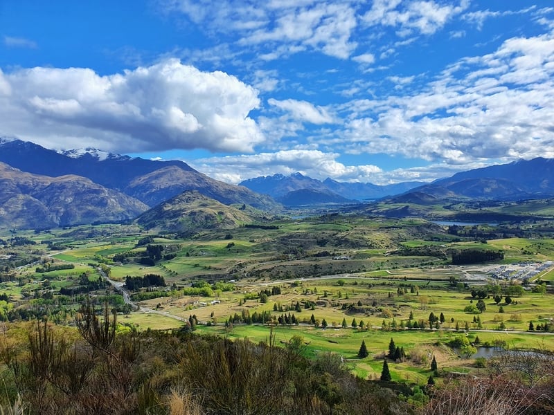
Once you get to the top of Tobin’s Track there’s a couple of benches, and from here you get awesome views.
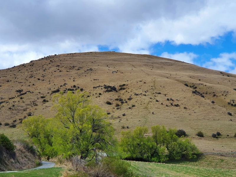
And you’ll get your first view of Mount Beetham. It’s an intimidating sight. The trail is steep! I was expected lots of shrubs and bushes, but it’s straight-up grass.
So it’s time to decide if you’re fully committed now. If you’re pretty exhausted already you’ll want to turn back and head down the way you came (there’s also a track called Tobins Drop which takes you straight down to the river, but I haven’t gone down here). Mount Beetham isn’t for the faint-hearted.
Continuing on the gravel track for a couple of hundred metres to the base of Mount Beetham it’s flat, so catch your breath as you’ll be working hard shortly. You’ll see the route is marked with poles and orange tips as you cross over the stiles on the fence.
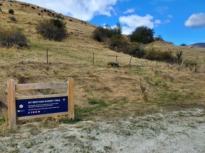
The sign at the entrance is ominous, with 272 metres of elevation gain in 900 metres.
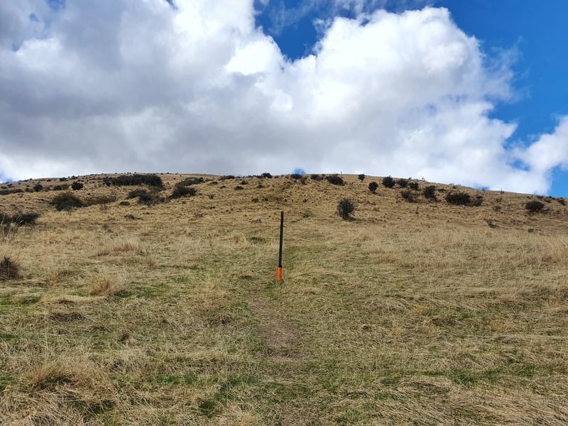
In theory, you could take any route to the summit you like, but it’s best to stick to the route people have taken before you as there are some convenient footholds. If the grass is wet, this would be super tricky. Bring half-decent shoes!
I was working hard all the way up the hill. Glancing behind me to make sure the views are worth the struggle, and trying not to look up too often. The summit didn’t feel like it got any closer. You won’t be racing up this hill in quick time, give it the respect it deserves.
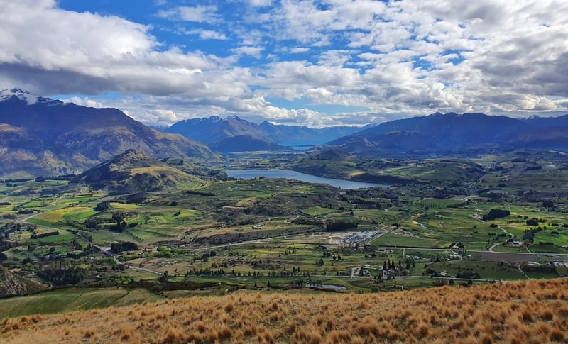
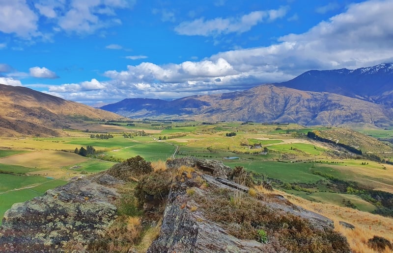
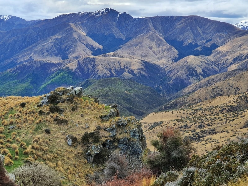
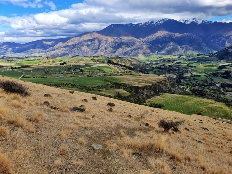
Once you get to the top you’ve views that are way better than the ones at the top of Tobins Track including Crown Peak and Brow Peak, two of the more ambitious Arrowtown walks. And there are a few nicely placed rocks (thanks nature) that’ll allow you to take some good photos so everyone knows you’ve actually made it.
If you decided to bring food with you, this is the spot to eat it. Though it’s very exposed so if there’s a southerly you might suddenly find yourself quite cold.
And when you’re ready, it’s time to go back to Arrowtown the way you came. The Mount Beetham descent is not going to be friendly on the knees, fortunately, it’s soft terrain so it shouldn’t be too bad. Everyones going to be going down at different speeds, go at whatever is comfortable for you.
And once you’re back on the 4WD track you’ll be away laughing as you cruise back down to Arrowtown.
Tobins Track was more exciting than I expected with nice views on the way up. The addition of Mount Beetham is epic. As long as you’re somewhat fit, make it happen 🙂
If you have any questions or comment, let us know in the comments below or email jub@churnewzealand.com.
p.s. Here’s a map of all the hikes and walks I’ve written about on Chur New Zealand. You can click the icon to see brief details, as well as a link to read more about the hike (like this post).

Hey, it’s Jub here. I’m the guy behind Chur New Zealand, helping you have the best time hiking, trekking, walking…whatever you want to call it…in NZ. I’m based in Queenstown and am always out and about exploring trails, old & new. If you have any questions, reach out.