The Coronet Peak hiking trail is a steep 4.5km (approximately) out and back walk starting from the Coronet Peak Cafe & Restaurant.
The track isn’t marked, but the goal is simple. Reach the Coronet Peak summit where you’ll get amazing 360-degree views.
This post will give you all the details about hiking Coronet Peak, yet another great Queenstown walk.
Note: This is only a hike to do when the ski fields aren’t open.
TABLE OF CONTENTS
1. Details About The Coronet Peak Hiking Trail
2. Coronet Peak Hiking Trail Map
3. How To Get To Coronet Peak
4. My Experience Hiking Coronet Peak
5. More Photos
DETAILS ABOUT THE CORONET PEAK HIKING TRAIL
When1: May 2021
Difficulty2: Medium. It’s steep, but not long so you can chip away at it.
Hike Distance3: My Strava tracked 4.4km for the return trip. That wasn’t taking the optimal lines as I wasn’t 100% sure on the route. So if you’re tracking the walk, plan for a 4.5 – 5km return trip and you’ll be fine 🙂
Incline4: Strava recorded 459 metres of elevation. That’s averaging over 100 metres of incline for each kilometre, including the downhill. A.k.a. STEEP!
Here’s the elevation profile:
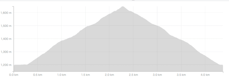
Up, up, up. Down, down, down.
Hike Duration5: My total time was 1 hour and 25 minutes which included ~10 minutes at the summit. The hike up took about 47 minutes, and just under 30 minutes to get down. If you’re not great on inclines, you might take over an hour to get to the top.
I can’t see it taking more than 2 hours to return, including a break to soak in the views at the top. But I can imagine some people spent hours at the summit picnicking 🙂
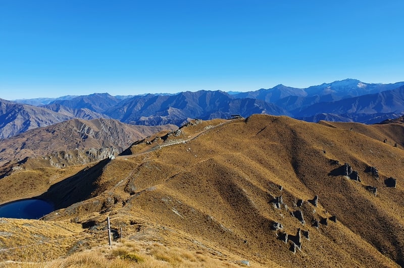
CORONET PEAK HIKING TRAIL MAP
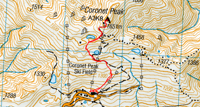
The map above is my GPX file from Strava overlaid on a topo map.
I was using basing the route from the signboard posted at Coronet Peak detailing the summer trails. You can see it online on their website.
The trail isn’t marked on either Google Maps or maps.me.
The track wasn’t marked with signs while I was there so it wasn’t easy to figure out the exact route. But based on the gondolas, I’m pretty sure I took the right path.
HOW TO GET TO CORONET PEAK
Coronet Peak is located at the top of Coronet Peak Road. Coronet Peak Road is sealed all the way.
From Queenstown, the 16km drive takes 20-25 minutes via Arthur’s Point.
From Arrowtown, the 20km drive takes 20-25 minutes.
In summer it’s very rare the road is closed and you won’t need chains. But there’s a sign when you turn onto Coronet Peak Road to let you know what the conditions are.
In the summer you can catch the bus from Queenstown to Arthurs Point, walk the 500 metres to the Coronet Peak Road turnoff, and hitchhike from there. There’s not always a lot of traffic, but you should get picked up by one of the first cars coming past.
MY EXPERIENCE HIKING CORONET PEAK
Fortunately, I picked an awesome day for it in early May. Clear blue skies and no wind. Win.
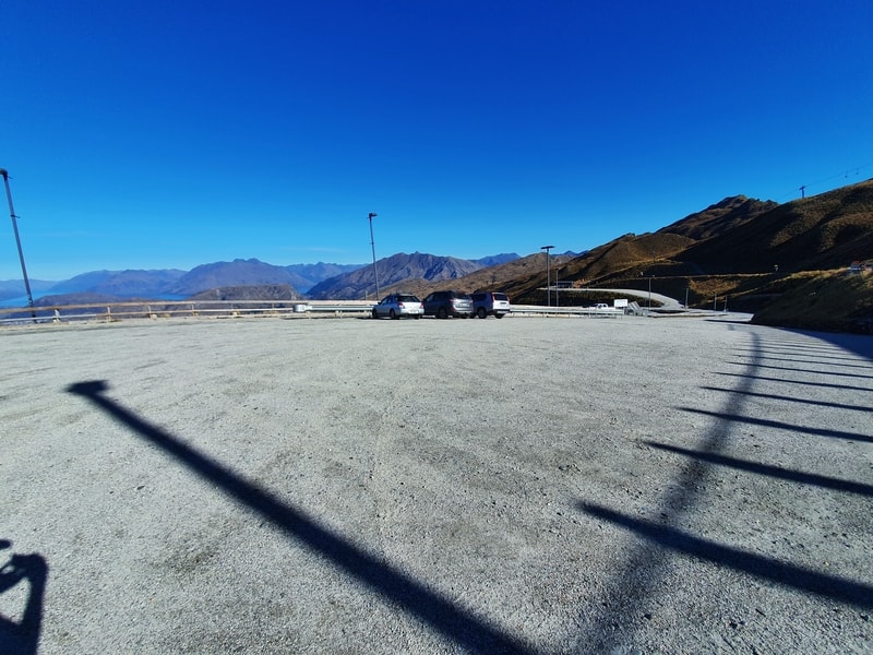
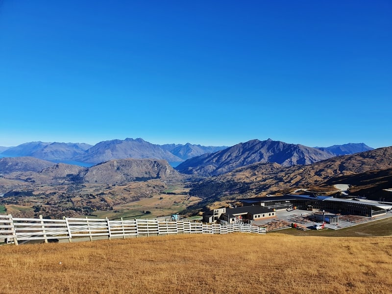
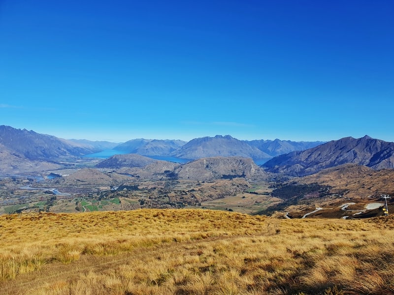
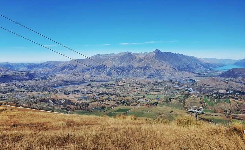
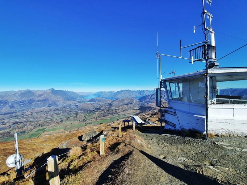
When you arrive at the Coronet Peak car park, it’s tempting to look at the views from the car park. I did, and you probably should too.
But as long as you’ve got a clear day, they’re only going to keep getting better and better as the day rolls on.
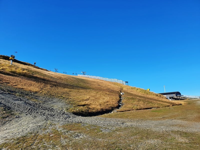
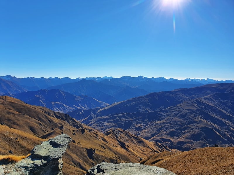
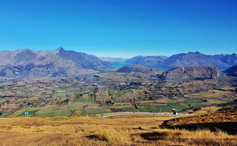
Facing the building from the car park, walk up the stairs around the left-hand side and follow that around the building. You’ll then see the hill in the photo above.
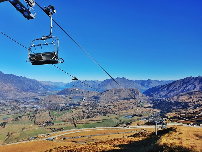
That’s the direction you need to head up, staying on this side of the gondola.
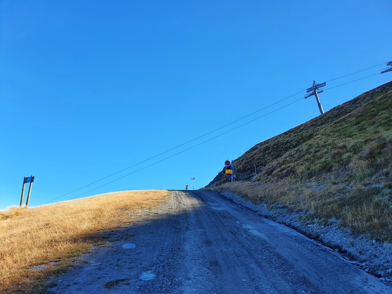
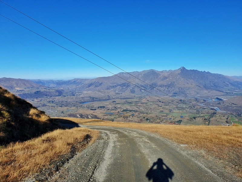
It’s steep from the get-go, and if you turn around after a few minutes you’ll get the idea.
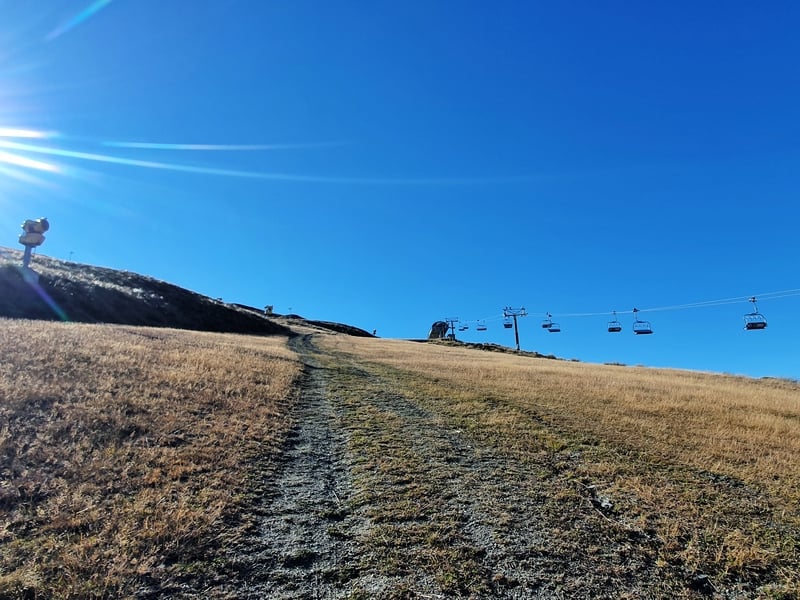
It’s hard to know exactly where to veer off here as the track to me felt like it wants to take you all the way up to the top of the gondola. But there’s a clearing that veers off to the left and a vague trail where vehicles had been.
Pro tip: At worst, there’s a 4WD track that leads to the summit you can follow.
This is a steep pinch, which joins up with the 4WD road. You’ll follow this for a bit under the next gondola. When the 4WD track does a hairpin turn around the hill, you want to continue walking straight up the hill at the apex of the corner.
This is turning out to be pretty hard to explain :p
As I mentioned just before, you can follow the 4WD track if need be. But take a photo of the signboard with the hiking trail to keep track of where you’re going.
When you get to the next junction, take the right-hand turn and you’ll soon see the Coronet Peak summit in the distance.
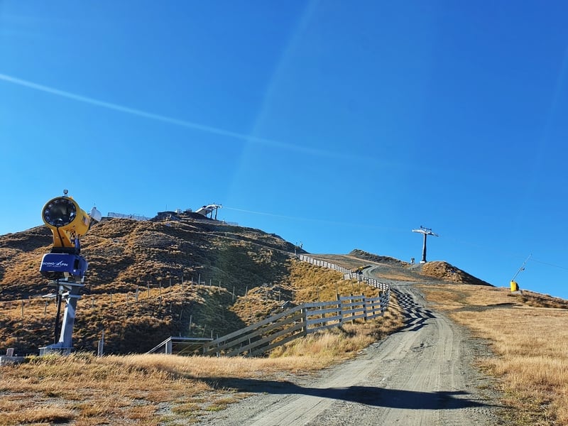
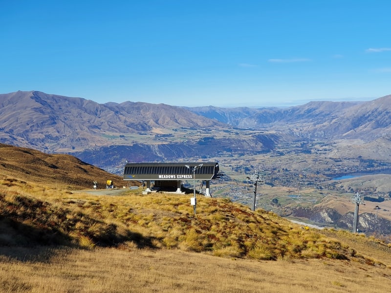
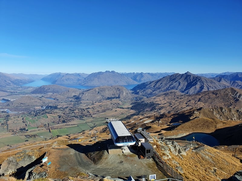
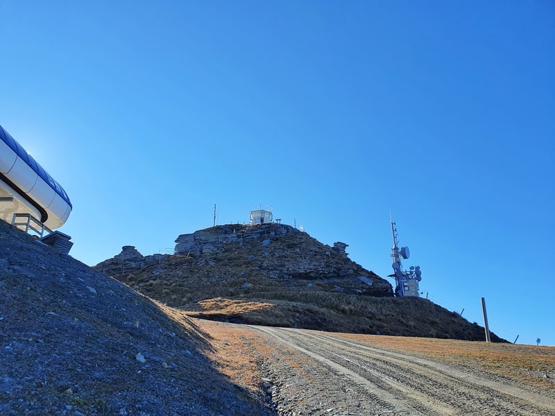
You’ll soon hit some 4WD tracks again. Dig in and make your way to the summit. When you get to the top of the gondola, you’ll realise you’re not at the actual summit.
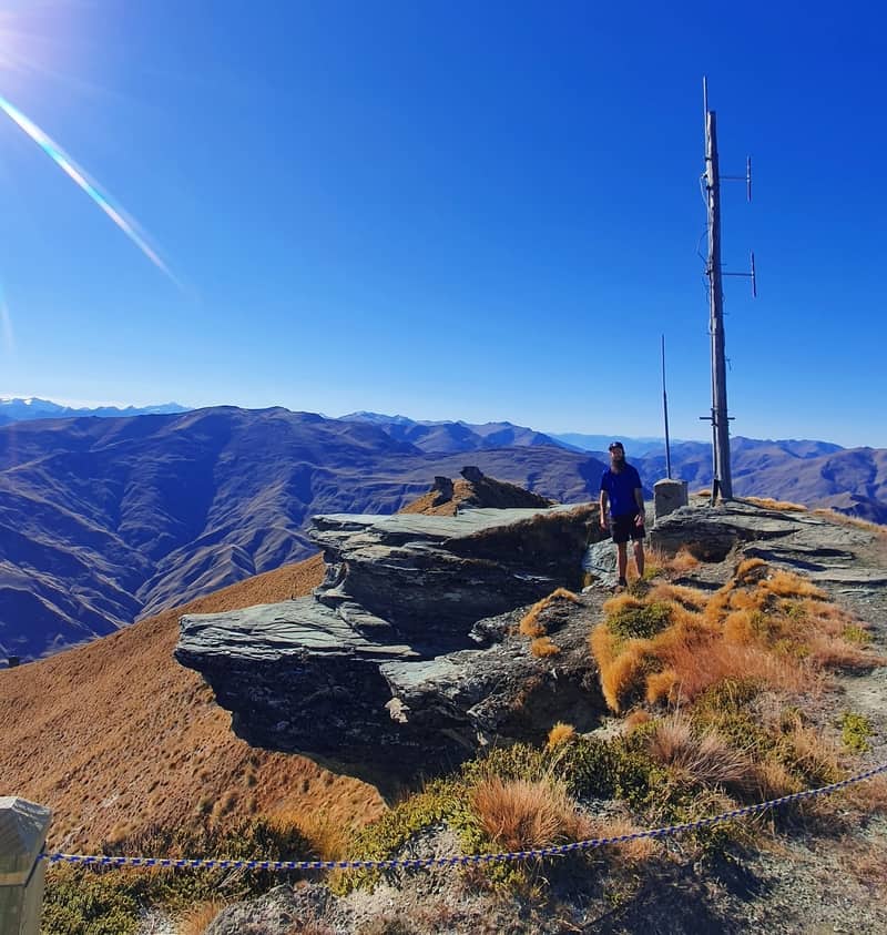
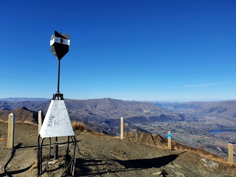
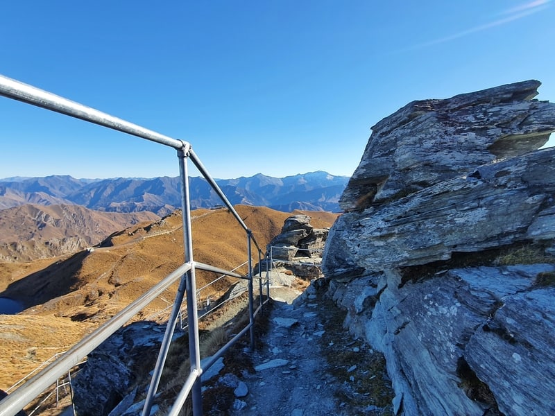
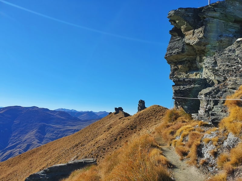
You need to go up the pathway to the little tower at the summit, which is marked with a trig. If you’re afraid of heights, this might not be the best place to go up as there are some steep drop-offs on the way and when you’re at the summit.
At the summit, there’s a rope to prevent you from getting too close to the edges, but I’d be lying if there’s not a few awesome photo opportunities beyond these.
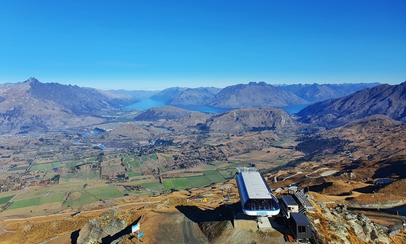
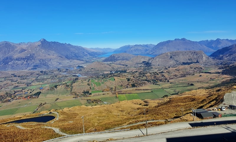
Here are a few photos from the summit.
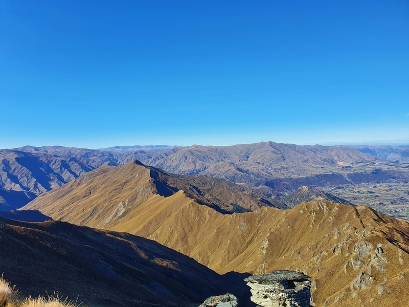
My favourite view is the ridgeline above that includes Brow Peak (the photo above). if you wanted a really big day out, you could follow the ridge and drop back down to Arrowtown. You’d need to figure out logistics with the car though (you can bus between Arrowtown and Queenstown).
There are also two signboards that let you know the names of the various sites you can (hopefully) see. As I mentioned you could spend hours up at the summit, but I was ready to head back down.
Coming back down the same way was easy enough to figure out. If not, you’ll want to improve your ability navigation skills 😉
But again, you can follow the 4WD track the whole way if you wanted. That might be a great option for those with dodgy knees.
MORE CORONET PEAK PHOTOS
And here’s a bunch more photos from the Coronet Peak walk.
Coronet Peak is a well-known ski destination in Otago, but the Coronet Peak hiking trail and mountain biking over the summer? Not so much.
But as you can see from the views, that doesn’t mean you shouldn’t go yourself and add this to your list of South Island hikes to do.
If you hike Coronet Peak, let us know how you found it in the comments below or email jub@churnewzealand.com.
RECOMMENDED READING
The Queenstown Gardens
A place to escape the hustle and bustle in Queenstown.
Vegan burgers in Queenstown
Where to find vegan burgers in Queenstown.
6 Walking trails in Arrowtown
When you reach the summit of Coronet Peak, you’ll see how good these walks can be.

Hey, it’s Jub here. I’m the guy behind Chur New Zealand, helping you have the best time hiking, trekking, walking…whatever you want to call it…in NZ. I’m based in Queenstown and am always out and about exploring trails, old & new. If you have any questions, reach out.