Hiking to Corner Peak is a great option if you’re looking for a challenging day hike that rewards you with nice views all the way, capped off with 360-degree views at the summit.
I’ve had a few people mention the Corner Peak Track is better than Ben Lomond hike. My thoughts? While both are great I agree Corner Peak is better. Provided you’ve got some technical hiking experience. And yes, Ben Lomond is better than Roy’s Peak.
This post will give you all the details you need to know about Corner Peak Track, along with a 15 minute video of the descent from the Corner Peak summit (under my experience). The vieeews.
This is one of those hikes that sums up why hiking in NZ is so good.
TABLE OF CONTENTS
1. Corner Peak Track Details & FAQ
2. Corner Peak Route Map
3. How To Get There
4. My Corner Peak Experience
1. CORNER PEAK TRACK DETAILS & FAQ
- QUICK DETAILS:
- 16 to 17km
- 1700 metres
- Difficult
- 5 to 9 hours
- GPX File can be downloaded here
What distance is the Corner Peak Route?
My Strava recording was 16.25km which looks pretty accurate. A friend who did the hike on another day got about 17km, so be prepared for a 16 to 17km hike.
How high is Corner Peak?
Corner Peak is 1683 metres above sea level.
What is the elevation gain to Corner Peak and back?
The elevation gain on my Strava was 1,702 metres. A friends gave 1,717 metres. So you can expect in and around this much. About 1500 metres of this is on the way to the summit.
Here’s the elevation profile:
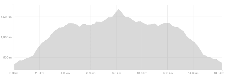
How long does it take to hike Corner Peak?
This is tough! The super quick people can get up and down in 5 hours with minimal breaks. We took just under 6 hours with a 20 minute break at the summit, and a few short breaks along the way. Most people are going to be in the 6 to 8 hour mark though. If you’re not use to single track and/or steep inclines, maybe 9 hours.
How hard is the Corner Peak hike?
It’s hard! Given it’s more of a route, there are poles marking the way most of the time. I would suggest hiking Roys Peak, Isthmus, or Ben Lomond first.
If you’re comfortable hiking these, then I’d feel okay about you going to Corner Peak. Make sure you go on a nice day…that’s not going to be a fun route in wind/rain (I mention winter below)…and if the cloud rolls in, you might find yourself quickly struggling to find the route.
Can you hike to Corner Peak in winter?
In theory you can, but there’s a good portion of the time you’d need at least microspikes, if not crampons. I went in mid-May after some snowfall a few days earlier. It was ok, but I wouldn’t have wanted much more snow before I’d be turning back.
Is water available on the track?
No. You’ll need to bring all the water you need from the start. In summer it’ll get hot, hot!
Are dogs allowed on the Corner Peak Route?
No. There’s a sign at the start of the trail ensuring that you can’t misunderstand this.
2. CORNER PEAK ROUTE MAP
*Clicking on the image below will open the map on topomap.co.nz. Definitely invest the few dollars to buy this topo map app if you’re planning to do lots of hikes like Corner Peak while you’re here.
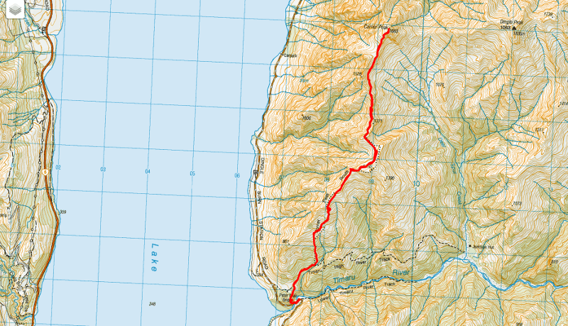
You won’t find this hike on Google Maps or Maps.me. Download a topo map! While you’ll get mobile reception on a lot of the track, having a topo map decreases your risk of getting in trouble a lot, especially when you’ve got a GPX file to follow.
3. HOW TO GET THERE
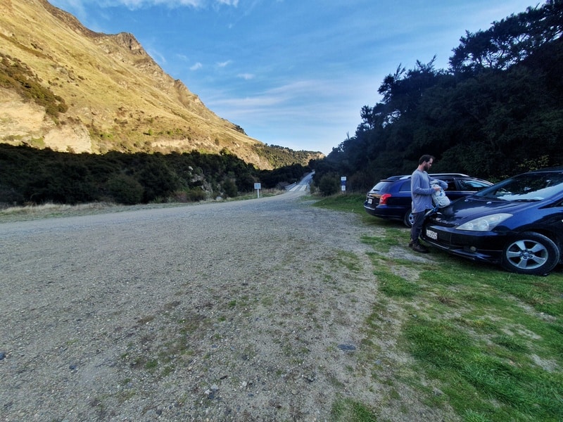
The Corner Peak carpark is the same place as the Timaru Creek carpark on Google Maps (photo above).
The easiest way to get to the Corner Peak trailhead is by car. From Lake Hawea township, it’s about 15km away and given there’s a good chunk of gravel road to travel on, plan for this too take about 20 minutes.
Add another 15 minutes to get there from Wanaka.
You could bike there if you’re really keen! But again, be prepared for a good amount of gravel road alongside Lake Hawea. And there are some shuttle companies you can call in Wanaka if you’re happy with private transport.
4. MY CORNER PEAK EXPERIENCE
Here’s the 15-minute video:
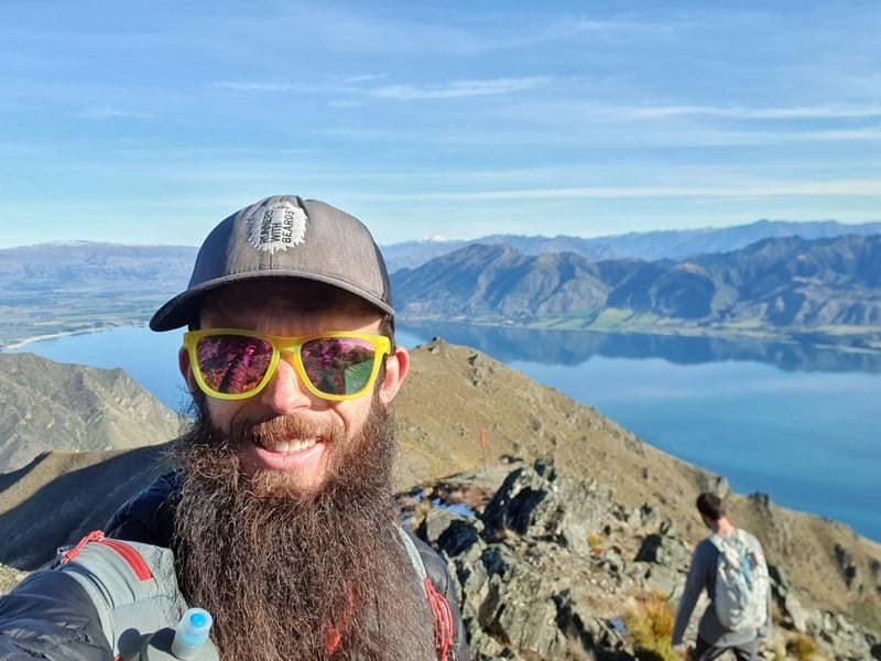
After hearing numerous first hand reports about how good the Corner Peak Track is, I was stoked to finally get this hike underway on a beautiful day in mid-May. There’d been some snowfall a few days earlier, so we had some micro spikes just in case things got a little icy.
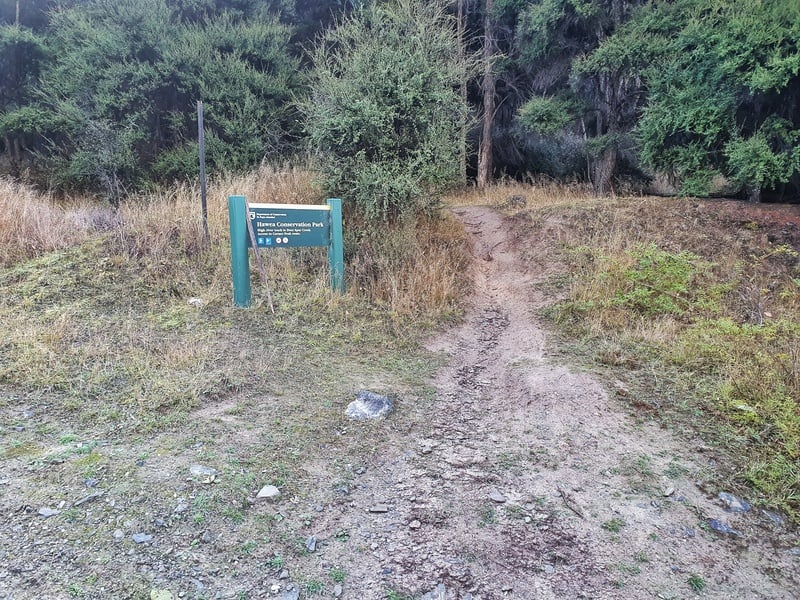
After arriving at the carpark, we crossed the Timaru River over the Peter Muir Bridge and within about 100 metres we took the right at the sign above to start the Corner Peak Route. This starting point isn’t on the topo map but is legit (follow the GPX file), you’ll join the trail soon.
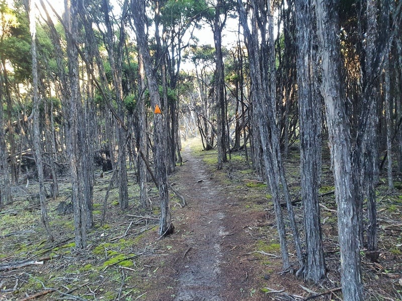
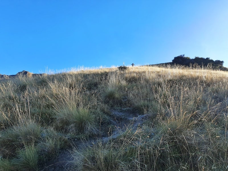
This first part of the track is through some beautiful manuka. Enjoy the gentle incline and shade, as you’ll be in the sun the rest of the way with no shelter.
Leaving the manuka forest, veer right onto the 4WD track which we’ll follow for 700 metres. Then make sure you take a left at the sign. It’s time to get your hill shoes on as we’ve now left the Timaru High River Track and are on the Corner Peak Route.
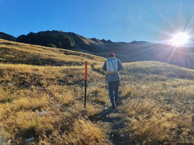
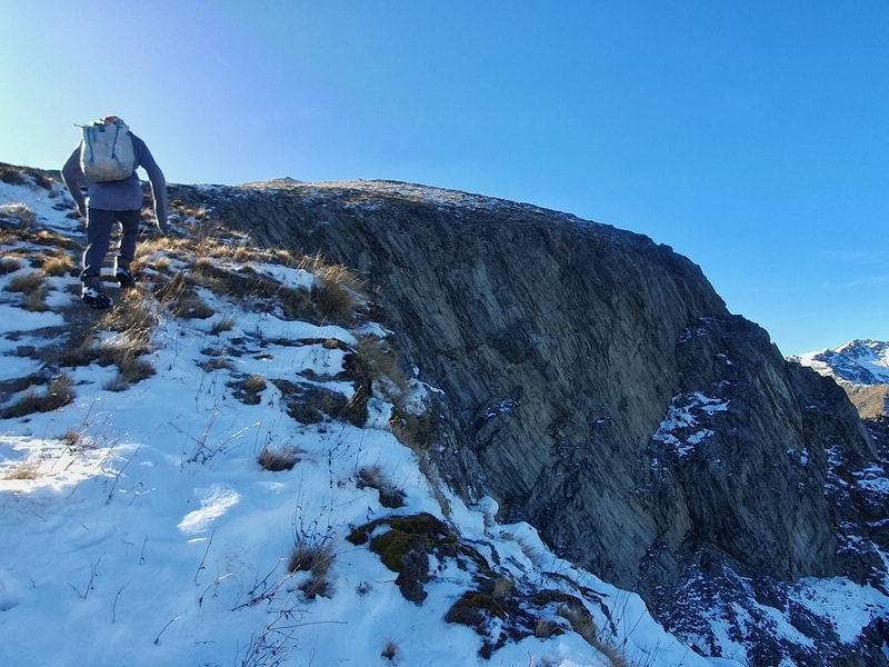
This next section is steep as you follow the single track up. You’ll start getting views of Lake Hawea right away which is awesome. This is a steep couple of kilometres, so dig in.
Once the route starts to flatten out, you’ll have knocked off a good chunk of the elevation gain. At the 4km mark you’ll come across some rocks that you can go either way around. We went the long way around following the tracks as that seemed the safest option.
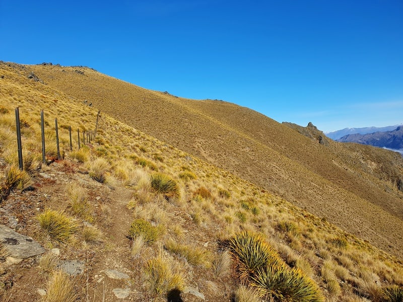
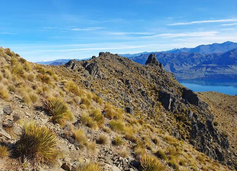
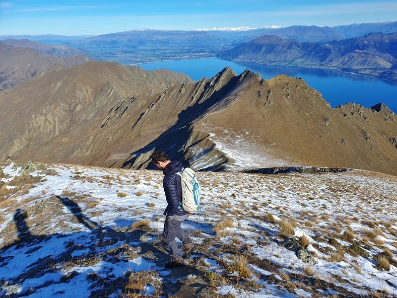
You’ll now sidle along a tussock bank just below a fenceline. We struggled to find the correct track along this section, but tried to just keep the same altitude as we looped around. Now the fun part starts!
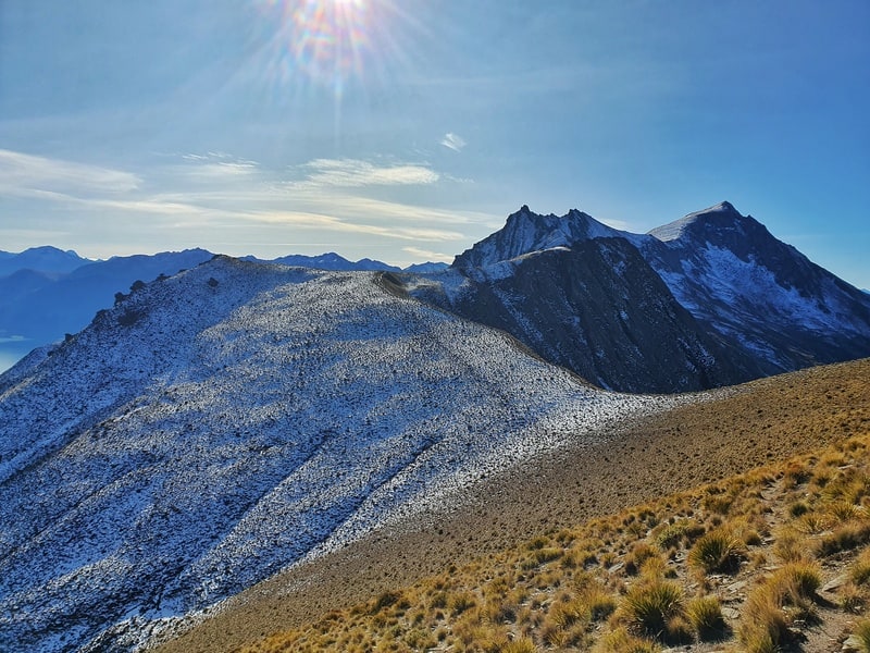
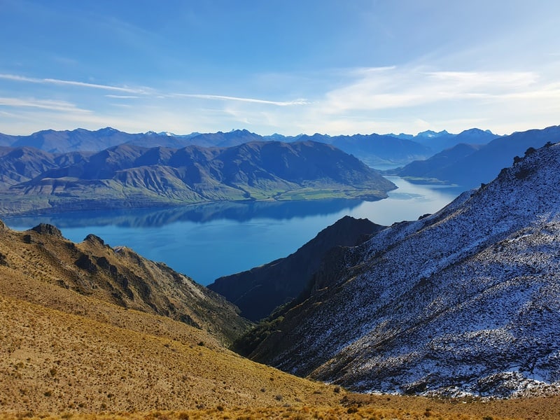
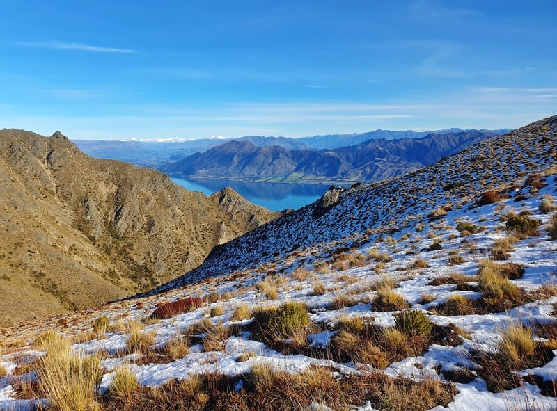
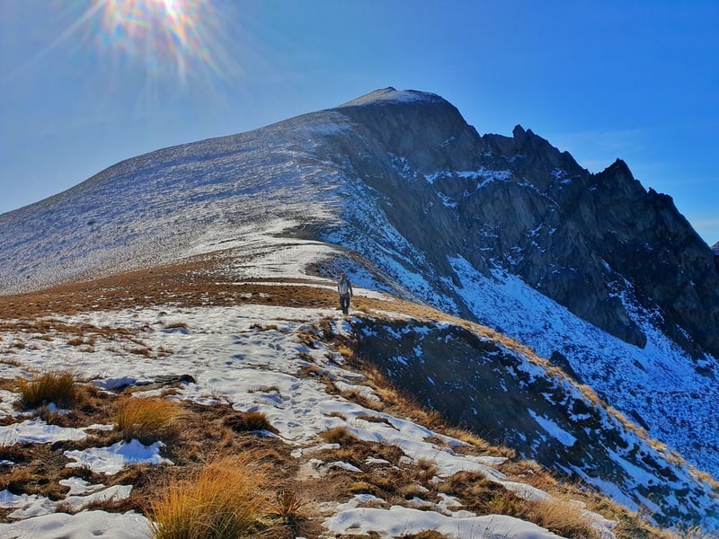
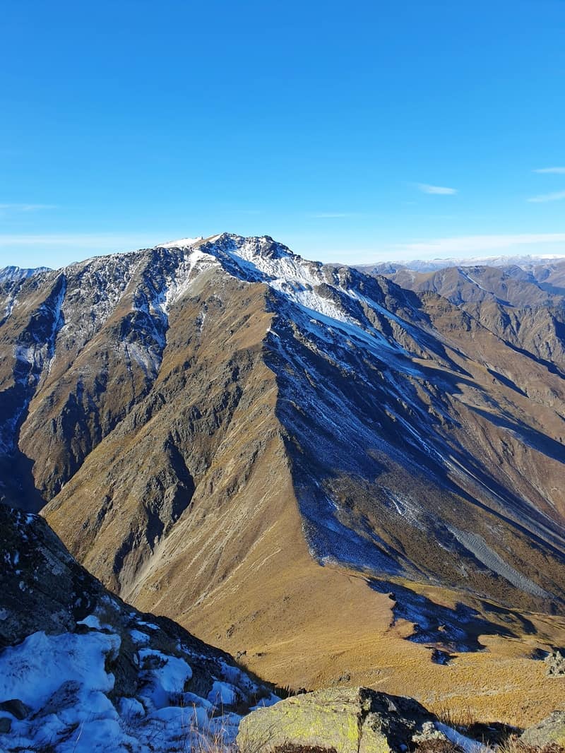
You’ll see the ridge line laid out in front of you. It’s super good looking, and you still get constant views of Lake Hawea. With a dusting of snow, they looked so good.
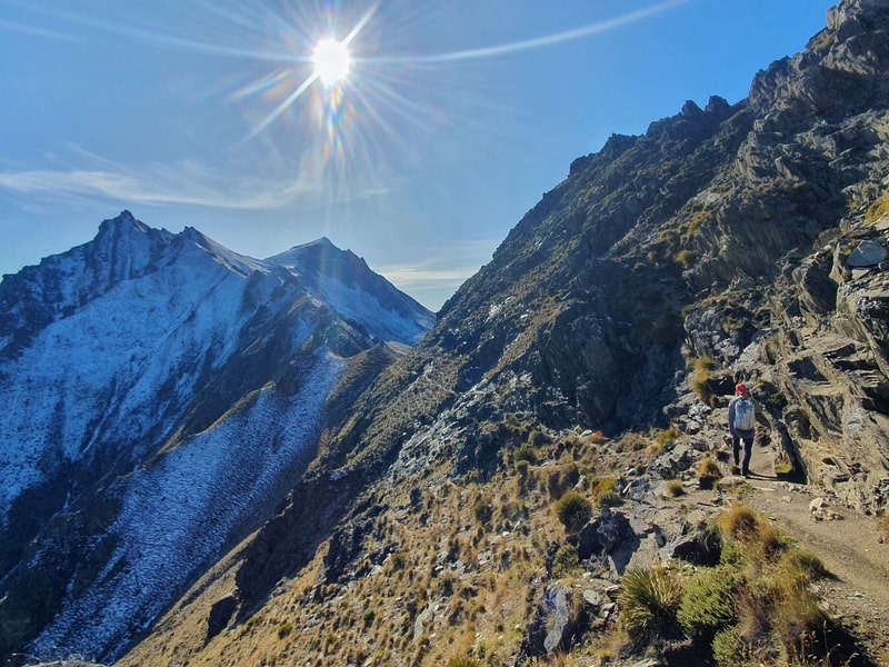
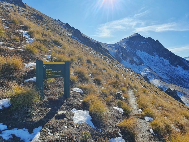
There’s a couple of interesting sections along the way where you sidle below the ridge. You’ll also enter the Hawea Conservation Park along this section too (before that you’re on a high country station).
The final climb to the peak is steep, and with the snow it was a little slippery, but it was easy to push knowing the summit was so close. We’d had perfect conditions the whole way, but soon as we got to the summit it was super windy and chilly.
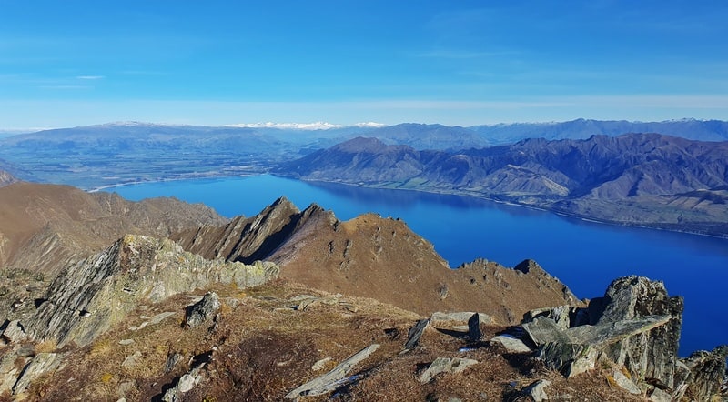
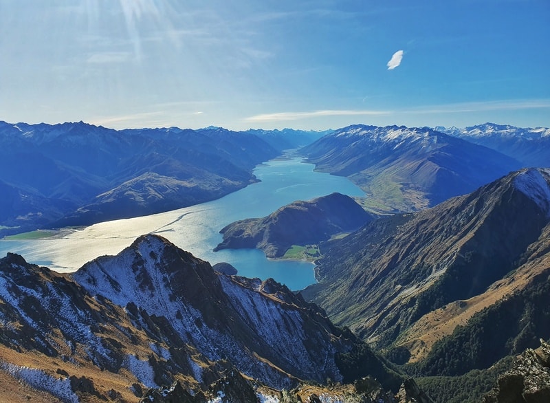
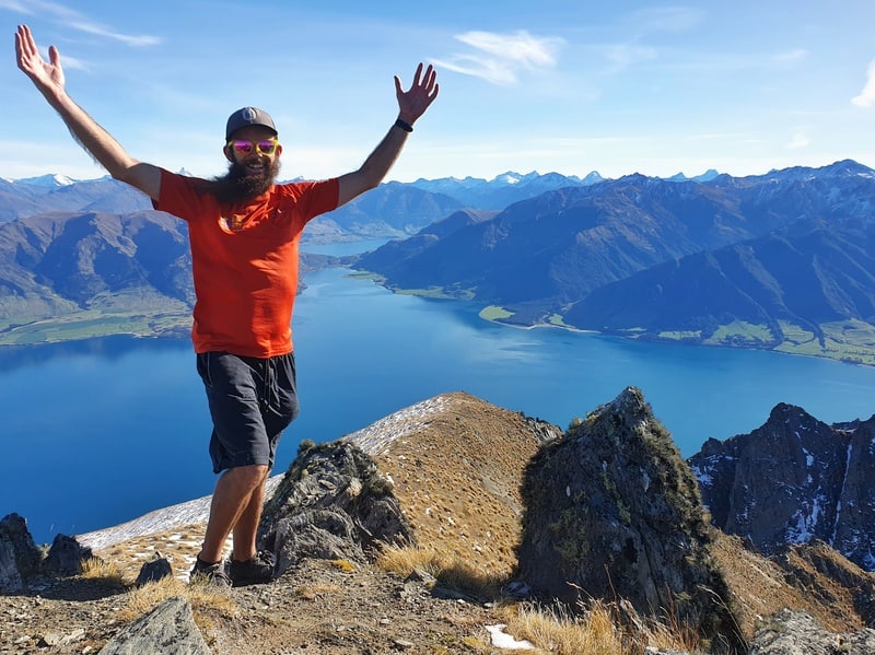
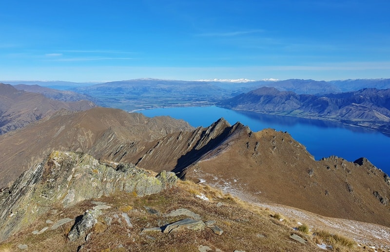
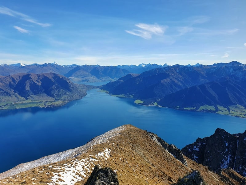
The views at the summit are amazing. You can see all parts of Lake Hawea, including the northern arm which you often don’t get to see. You can see amazing peaks in and around Lake Hawea such as Sentinel Peak, Isthmus Peak, Breast Hill, and Dingle Peak.
And you’ll see some of the mountains over in Mount Aspiring National Park in the distance.
As far as out and back hikes go, this return is pretty awesome. We didn’t have any issues keeping on track etc. which was great. You do get different views of the lake which keeps things fun.
The return was definitely quicker, but it wasn’t too much faster.
And then on the way home to Queenstown we stopped off at Wanaka’s best burrito spot, Burrito Craft.
The hike to Corner Peak is awesome! If you’re looking for a hike that’s only going to get more popular in the coming years, move this one up your list.
Got any questions or comments about hiking to Corner Peak? Leave a message below or email jub@churnewzealand.com.
Chur.
p.s. Here’s a map of all the hikes documented on Chur New Zealand. You can click the icon to see brief details, as well as a link to read more about the hike (like this post).

Hey, it’s Jub here. I’m the guy behind Chur New Zealand, helping you have the best time hiking, trekking, walking…whatever you want to call it…in NZ. I’m based in Queenstown and am always out and about exploring trails, old & new. If you have any questions, reach out.
Hi there, awesome blog and photos!
I think you might be missing a picture just before this comment: “Leaving the manuka forest, veer right onto the 4WD track which we’ll follow for 700 metres. Then make sure you take a left at the sign above. It’s time to get your hill shoes on as we’ve now left the Timaru High River Track and are on the Corner Peak Route.”
The only picture of a sign above that is the one just before the bit of native forest rather than the turn off for the Corner Peak track on the 4WD path.
Cheers!
Hey Harriet,
Thanks so much for the kind words. You’re right, I’m missing a photo there…I thought I had taken one…have removed ‘above’.
It’s super easy to see once you’re there though.
If you go up Corner Peak, would love to hear ya thoughts 😀
Cheers,
Jub
Just wanted to ask
Best footwear you think for corner peak
Hey Corey,
I would stick to what you’d normally use on a hike. Boots? Boots. Trail runners? Trail runners. Although at this time of year, maybe I’d start leaning towards boots if there’s a decision to make. Microspikes if there’s been recent snowfall.
Chur,
Jub