In the Diamond Lake Conservation Area are the Diamond Lake and Rocky Mountain Walks.
There are a few different ways you can explore parts or all of the walking tracks, but I like the 7.5km loop I did on my most recent visit.
This post will give you everything you need to know about the Diamond Lake/Rocky Moutain walks, with a focus on the 7.5km route I took. If you’re looking for a way to spend a few hours walking in Wanaka, this is a great option.
TABLE OF CONTENTS
1. Details About The Diamond Lake & Rocky Mountain Walks
2. Map of the Walks
3. How To Get To The Trailhead
4. My Experience Going To The Rocky Mountain Summit
1. DETAILS ABOUT THE LAKE DIAMOND AND ROCKY MOUNTAIN WALKS
As mentioned, there are a few different routes you can take to explore the Diamond Lake Conservation Area. The Diamond Lake walk, and Rocky Mountain walk are essentially the same thing. The Rocky Mountain walk does take in Diamond Lake though.
How long are the Diamond Lake and Rocky Mountain Tracks?
There are about four options. The following distances are based on my Strava recording.
- Diamond Lake loop: 2.1km return
- Diamond Lake viewpoint return: 2.6km return
- Lake Wanaka viewpoints return: 4.5km return
- Rocky Mountain Summit Loop(s): 7.5km
How hard is the Rocky Mountain walk?
They get progressively harder, partially due to the distance, but the incline gets steeper overall the further up the track you get. In summer the track will usually be super dry, in the winter it can get a bit wet. But even at the trickier parts of the track, you’ll be fine.
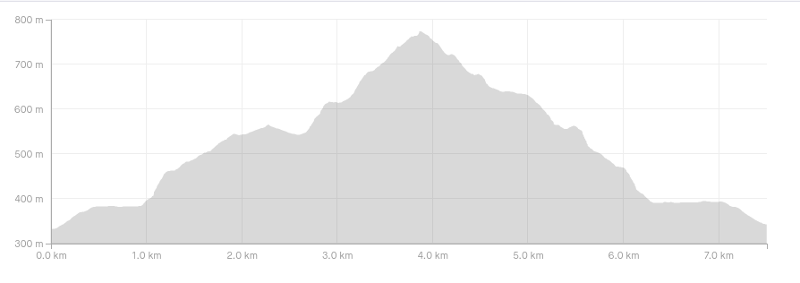
What is the elevation profile looking like?
Based on my Strava, here’s the elevation profile with 499 metres of elevation gain.
How long does it take to do the walk?
To complete the full circuit took us 2 hours and 10 minutes. That included a few breaks at the various viewpoints (maybe 20 minutes of viewing time). We were definitely faster than everyone else we saw (not that many people), so I suspect you could easy spend 3 to 4 hours one the walk.
Does Diamond Lake ever freeze?
In the winter there can be a thin sheet of ice on parts of Diamond Lake, but it’s not going to be solid enough for you to walk/skate on. In the past, we’re talking 1950’s Diamond Lake did freeze regularly and they held the Otago ice skating championships here.
2. MAP OF THE TRAILS
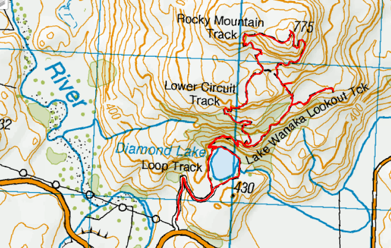
The map below is the GPX file from Strava overlaid on a topomap. You can also see the trails on Google Mas, and Maps.me. Looking at the map can be overwhelming, but the signs are easy to follow.
3. HOW TO GET THERE
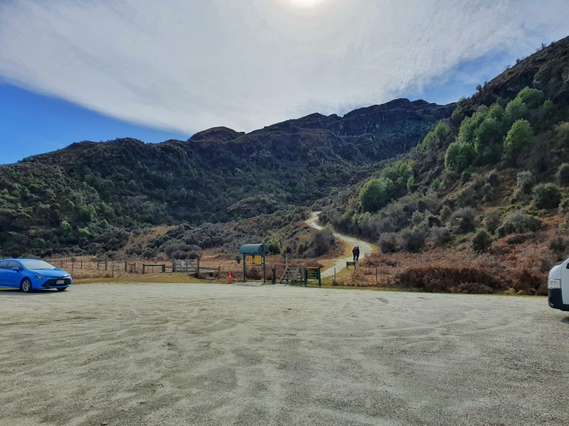
The trail head and car park is here.
Driving: It’s about a 19km drive from the heart of Wanaka to the trailhead (past the Roys Peak turnoff) and will take no more than 20 minutes to reach.
*The road is sealed the entire way to the trailhead.
Cycling: You can cycle out here easily enough. You can follow the road all the way, or take the trails from Wanaka to Glendhu Bay before switching to the road for the last section.
Hitchhiking: You can easily hitchhike to Diamond Lake by sticking a thumb out on Wanaka Mount Aspiring Road, just past the McDougall Street turnoff. I’ve hitched from here a few times and been picked up with minutes. Hitchhiking around NZ is great!
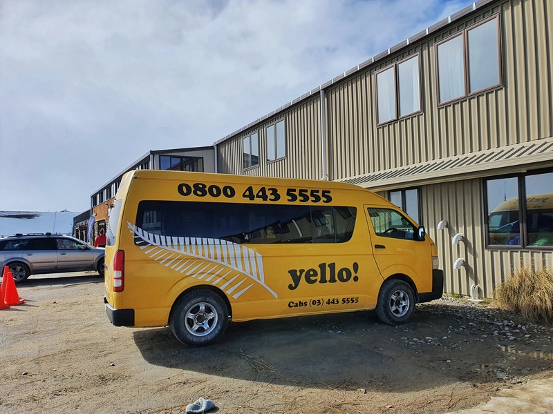
Shuttles: There are a few shuttle companies in Wanaka that can help you get to the trailhead. KT Taxis Wanaka and Yello.co.nz are people to get in touch with. You’ll need to get in touch for a quote at least 24 hours in advance.
4. MY DIAMOND LAKE & ROCKY MOUNTAIN SUMMIT EXPERIENCE
I’ve walked the Diamond Lake and Rocky Mountain tracks a few times now and it always sneaks up on me, in
a good way.
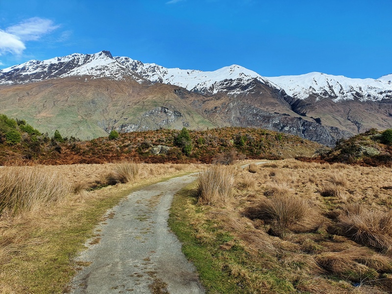
The trailhead starts off small on an old road with a noticeable incline, but nothing too crazy. Once you hit the flat section after a few hundred metres, you’ll soon see a green sign pointing you left. Follow this and Diamond Lake will soon come into view.
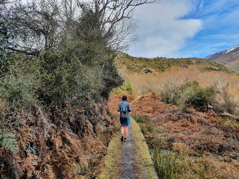
There’s no amazing lake views here, but you’ll come to another junction.
You can turn right to do the Diamond Lake circuit. This loops the lake before heading back to the car park. Turn left to head to the Lake Wanaka viewpoint, and Rocky Mountain summit.
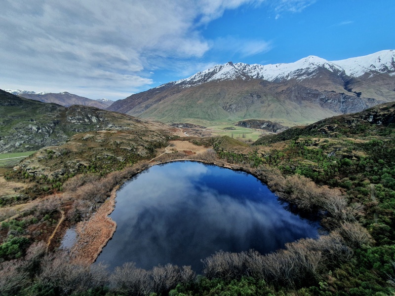
Going left you’ve got a steep section (steepest of the trip) for a couple of hundred metres. There are no views at this point, but that’s alright as you’ll soon see the viewing platform overlooking Diamond Lake.
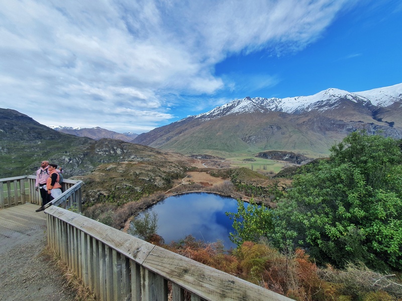
Considering how short the walk is, it’s a nice viewpoint…but the best is yet to come.
About 1.3km into the walk, you’ll come to a sign for the ‘eastern circuit’ or ‘western circuit. It doesn’t really matter which way you go, but I think eastern is better as you get the best views while walking up.
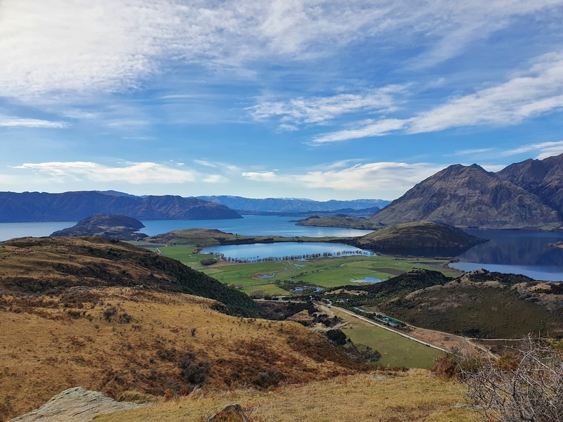
Turning right (east), a steady incline continues for 500 metres before the next junction. Turn right for the out and back for the 350-metre walk to the Lake Wanaka viewpoint, or turn left to continue up to the summit. Unless you’re short of time, go check out the Lake Wanaka viewpoint.
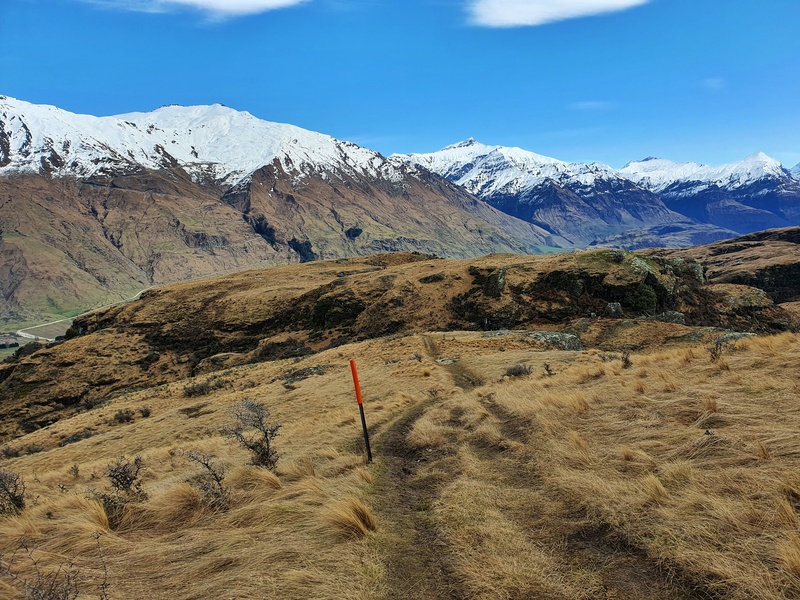
After the viewpoint, backtrack to the last junction and continue on up the hill. You’ll come across another eastern circuit and western circuit sign. We went east again and were happy with the decision.
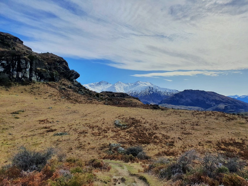
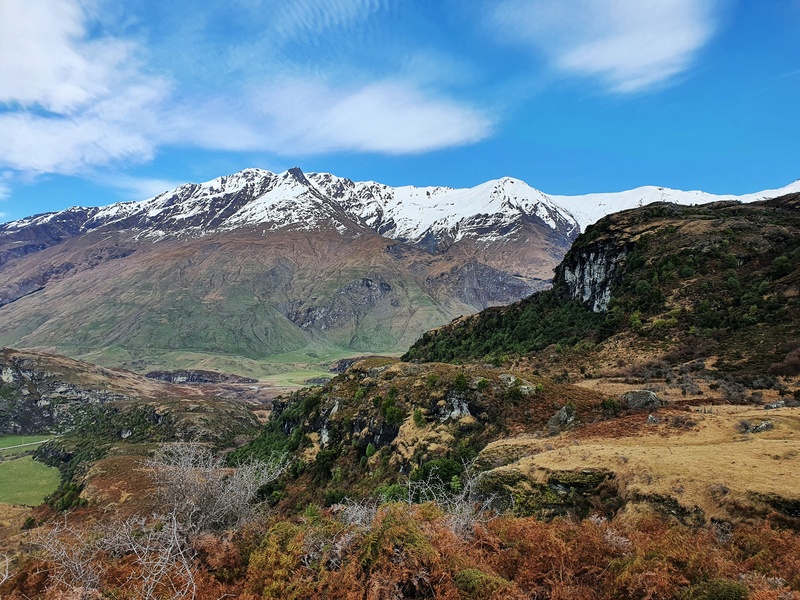
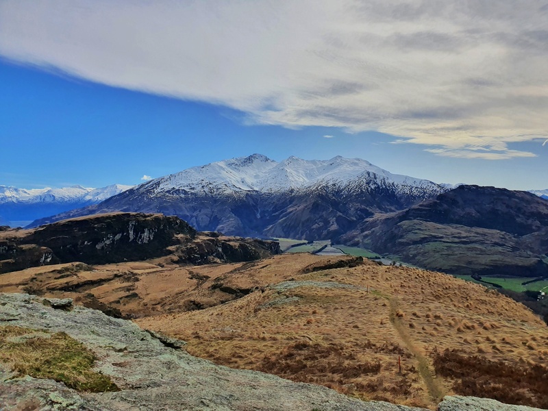
The track doesn’t get a bit narrow in spots further up the top, but even in winter the track condition was decent.
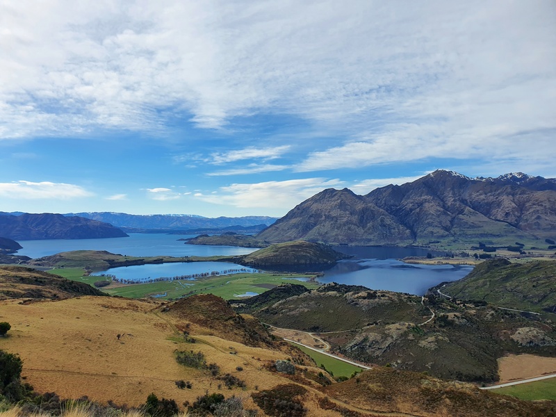
We’d been rewarded with plenty of good views so far, but getting the real panorama views at a summit are always the best. You can spot quite a few landmarks from the summit (it’s a little rocky!) which is fun.
It’s a great spot for a picnic!
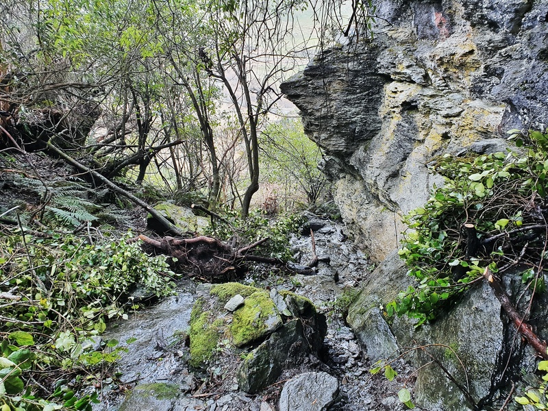
Coming back down, we went the western route. There was one section that had suffered a bit of storm damage that meant we walked in a stream for 50 metres or so. Other than that it was uneventful.
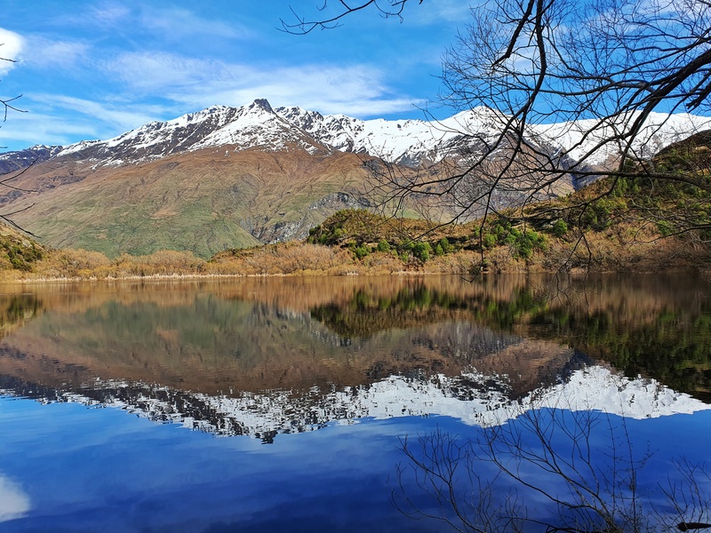
When we got back to Diamond Lake we took the circuit around the lake. There’s an awesome spot where we got some beautiful reflections on the lake.
The Diamond Lake and Rocky Mountain walks are stunning. It’s not too far out of town (not quite as convenient as Mount Iron or Roys Peak), won’t take you all day, but gives you some awesome views, and is a good way to get the legs warmed up.
If you’re planning to do some bigger hikes in Mount Aspiring National Park, this is a great warm-up.
Drop any questions or comments in the box below or email jub@churnewzealand.com.

Hey, it’s Jub here. I’m the guy behind Chur New Zealand, helping you have the best time hiking, trekking, walking…whatever you want to call it…in NZ. I’m based in Queenstown and am always out and about exploring trails, old & new. If you have any questions, reach out.