[slider]If you’re looking for a challenging day hike, the Sugarloaf Pass Track might be what you’re looking for.
At 20km an 1200 metres of elevation gain, this might not seem like a tough day out, but the terrain makes it a long day hike (or a fun overnight hike).
Note: I’ll be talking about the full Sugarloaf Pass Track in the circuit form, starting and finishing at the Lake Sylvan carpark (via Sugarloaf Pass and Routeburn Shelter).
TABLE OF CONTENTS
1. Details About The Sugarloaf Track
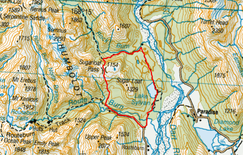
2. Sugarloaf Pass Track 0Map
3. How To Get To The Trailhead
4. My Sugarloaf Track Experience
DETAILS ABOUT THE SUGARLOAF TRACK
How hard is the Sugarloaf Pass Track?
This is a difficult track if you’re doing it as a day hike. For the majority of the track you’re walking on a single trail littered with roots and stones, along with some treefall and other obstacles.
The gravel road between Routeburn Shelter and Lake Sylvan campsite and the smooth trail of the Lake Sylvan Track is a nice reprieve.
If you’re doing this as an overnight hike, it’s not too difficult given the distance. But with a heavier pack, you’ll still know you’ve done 20km.
How long is the Sugarloaf Track?
If you’re doing the Sugarloaf Circuit without any of the detours, you can expect to hike about 20km. That said, you can skip the last part of the gravel road if you’ve got two cars at each carpark which takes off about 4km (I’ll mention more in the ‘How to get to there’ section).
Addons:
- If you plan to visit the Rockburn Chasm and Shelter, you can add ~1.5km distance.
- If you’re looking to go from Sugarloaf Pass to 1290 point, it’s ~2km return (roughly)
How much elevation gain is on the Sugarloaf Pass Track?
If you’re doing just the 20km loop without the detours to Rockburn Chasm, Rockburn Shelter, or point 1290 to the west of Sugarloaf Pass, it’s about 1200 metres of elevation gain.
You can see that elevation chart below:
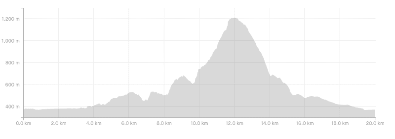
If you’re going to add in the side trips to the chasm, shelter, and 1290, you can add about 200 metres more of elevation to this.
How long does the Sugarloaf Pass hike take?
This is really hard to judge given the distance and technicality of the trails. DOC suggests 8 to 11 hours to do the 16km section between Lake Sylvan and the Routeburn Carpark. That’s no more than 2km an hour.
If you’re taking lots of breaks you could get towards 8 hours, but 6 should be doable if you track along steadily and have some experience on techy terrain.
What’s the best way to hike the Sugarloaf circuit?
There’s no obvious way to hike it, but anti-clockwise as described in this post seems to be the most popular. That’s starting from Lake Sylvan carpark and heading towards the lake to start.
Can the Sugarloaf Pass Track be done as an overnight hike?
Yup! You could camp up on Sugarloaf Pass or next to the Routeburn Shelter.
Are dogs allowed on the Sugarloaf Pass Track?
No, and that’s a strict no. Not anywhere on the track are dogs allowed.
SUGARLOAF TRACK MAP
The map below is the GPX file for the track without any of the detours. You can download the GPX file here, and then you can upload it to this epic Topo Map app (seen in the screenshot below).
HOW TO GET TO THE START
There are two trailheads where you can start the Sugarloaf Circuit (they’re 4km apart):
1. The Lake Sylvan Campsite/carpark
2. Routeburn Shelter
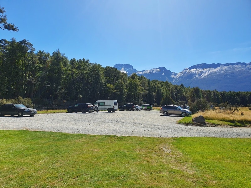
The easiest way to get to the trailhead is by car. From Queenstown its ~70km, and will take 70 to 90 minutes (pending how comfortable you are on the road etc).
There are some other ideas in this post about Routeburn Track transport that you can use as well.
MY SUGARLOAF PASS TRACK EXPERIENCE
I’ve seen the sign for the Sugarloaf Pass so many times while doing the Routeburn Track, I was excited to finally go and see what the story was with the Pass and the circuit.
Note: I started at the Lake Sylvan carpark and went anti-clockwise.
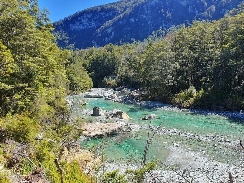
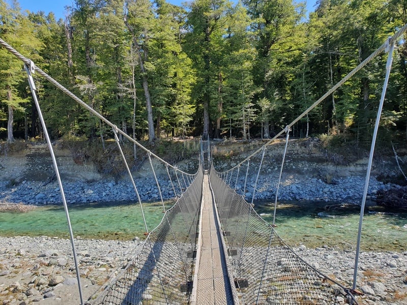
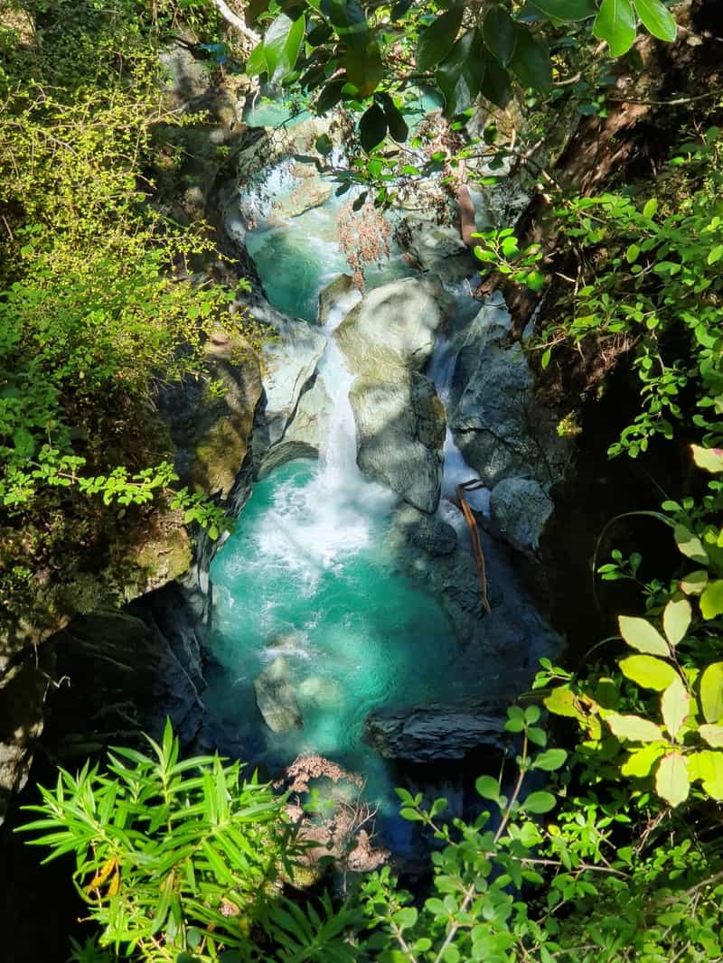
The start of the hike is awesome as you cross the swingbrige over the Route Burn and it’s beautiful colour you can see above.
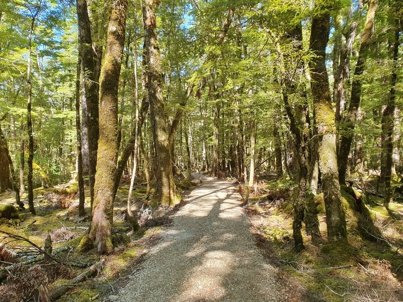
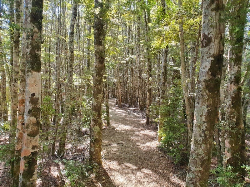
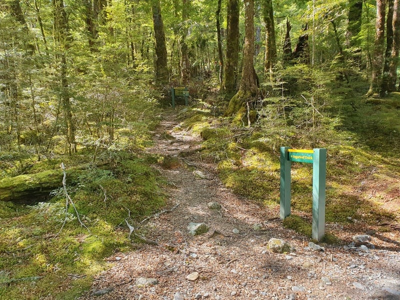
Then you’re onto the trail which is smooth with minimal obstructions as you weave through the Red Beech forest. It’s stunning through here.
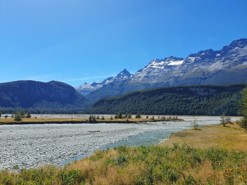
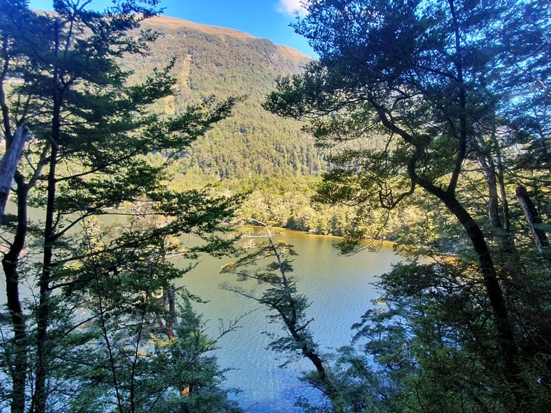
This smooth trail continues on for the first 2km at which point you’ll come across a viewing platform for epic views of Lake Sylvan and mountains in the distance.
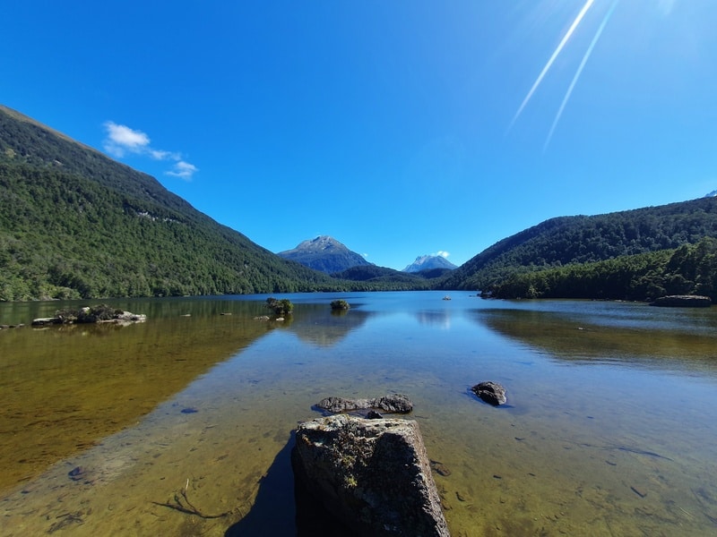
Back on the trail, you continue along the smooth trail close to the lake…you can get to the shore at various points on this section, for another 500 meters or so before the trail splits.
Turn right to continue on the Lake Sylvan loop, or left onto the Sugarloaf Circuit. There are signs, so you can’t miss them. We’ll go left.
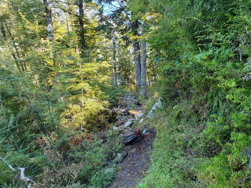
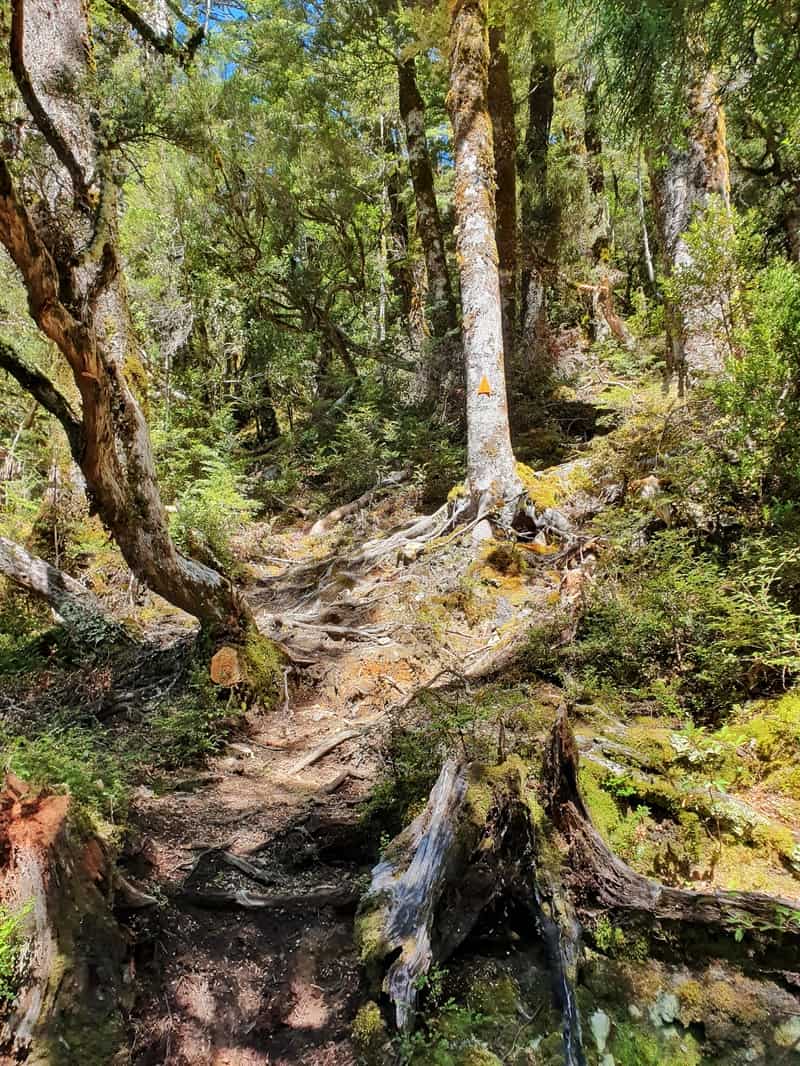
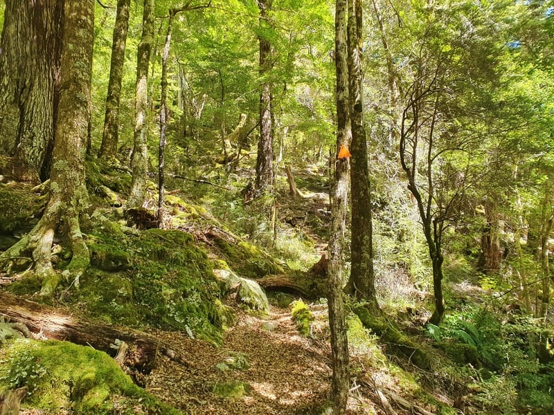
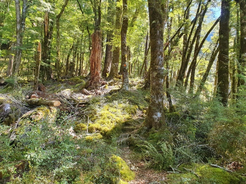
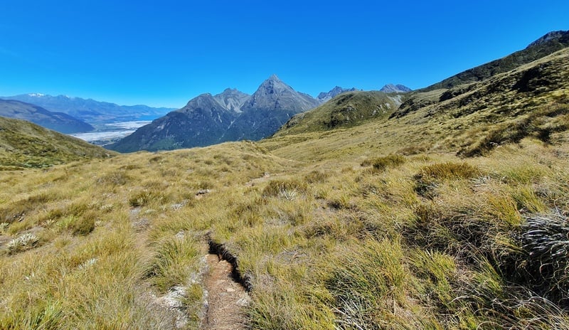
As soon as you turn left the trail becomes a lot more technical, and this is how it’s going to be for the majority of the day. There are lots of roots and occasional rocks and treefall. It never stops. The terrain is gently undulating, nothing crazy but you’ll be a lot slower than you for the first 2.5km.
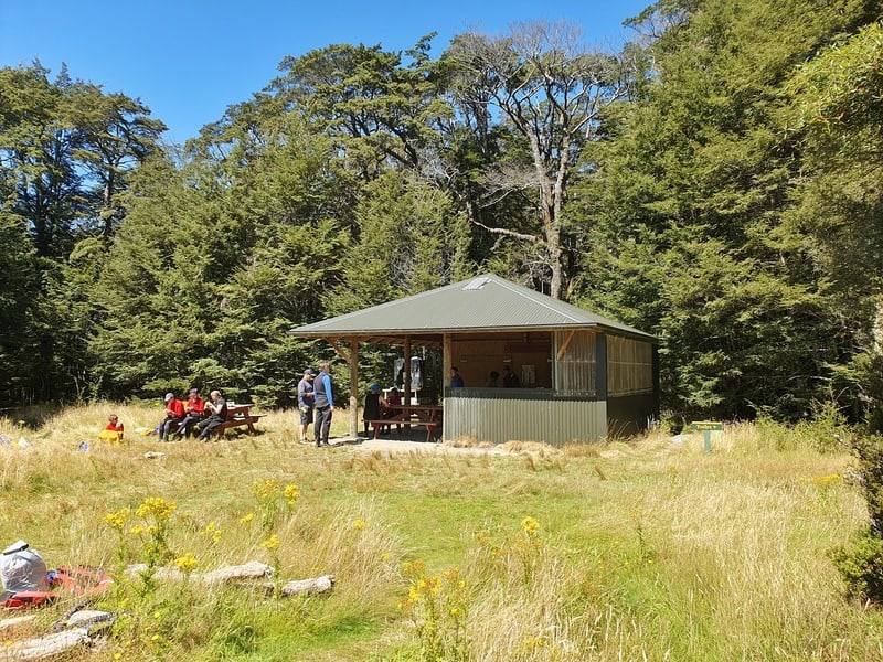
This continues on for a little over 4km when you hit the next junction. You can turn right to visit the Rockburn Shelter and/or Rockburn Chasm. You can also take a dip in the river by the shelter which would be great on a hot day. If you’re planning an overnight trip, this is where you’ll likely camp, by the shelter.
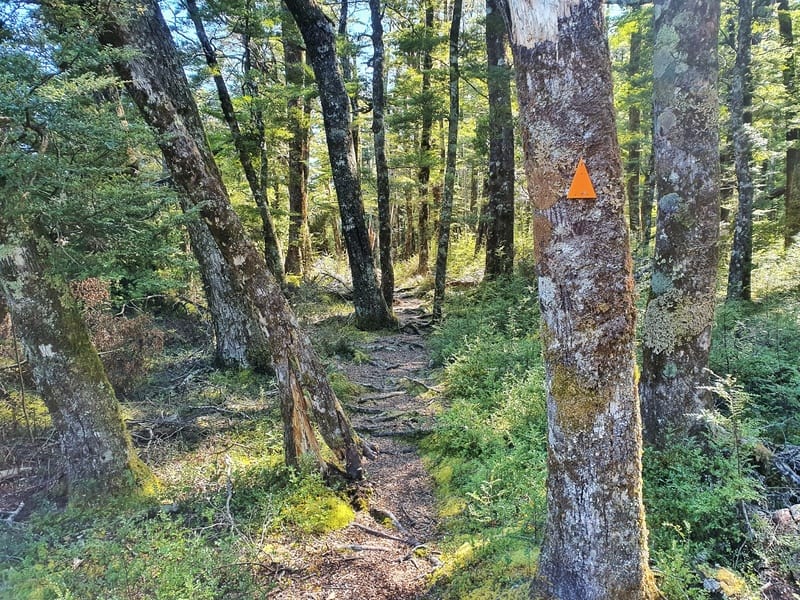
Back to the junction, and carrying on, you continue through technical terrain including some spots where the track is hard to find at points thanks to treefall. There are enough orange markers so you should be fine.
There’s a couple of climbs followed by small descents. Overall you’re definitely gaining elevation.
Then once you’re at about 10.6km into the hike you’ll come to the next junction (keep checking your map as I missed the green sign, must have been too busy looking at where I’m stepping).
If you were heading to Theatre Flats you’d go right, but turn left to head up the final 1.3km to Sugarloaf Pass.
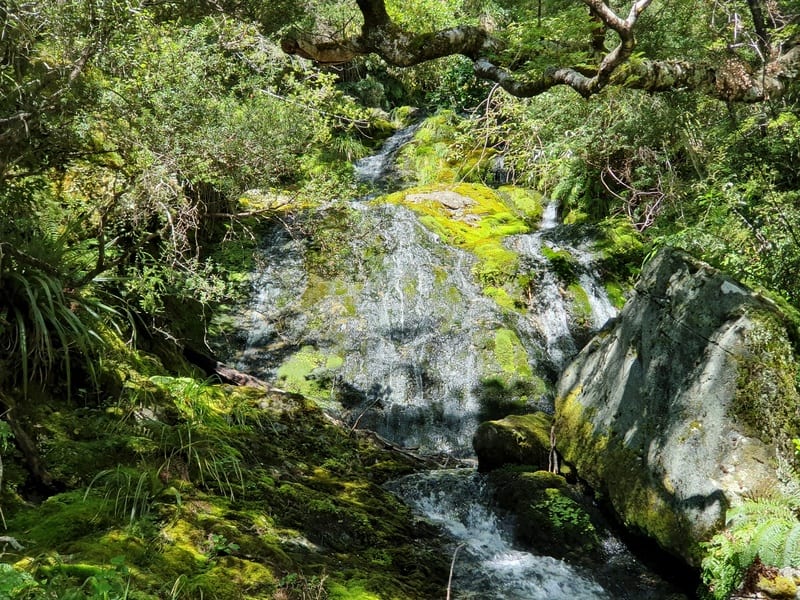
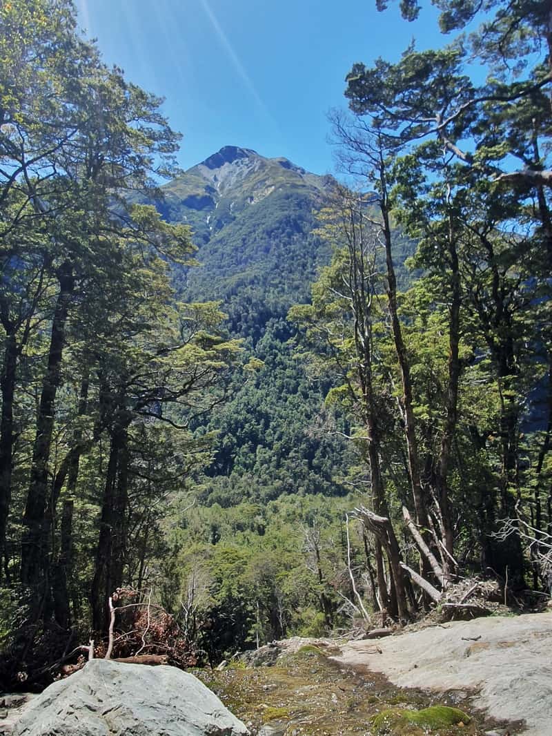
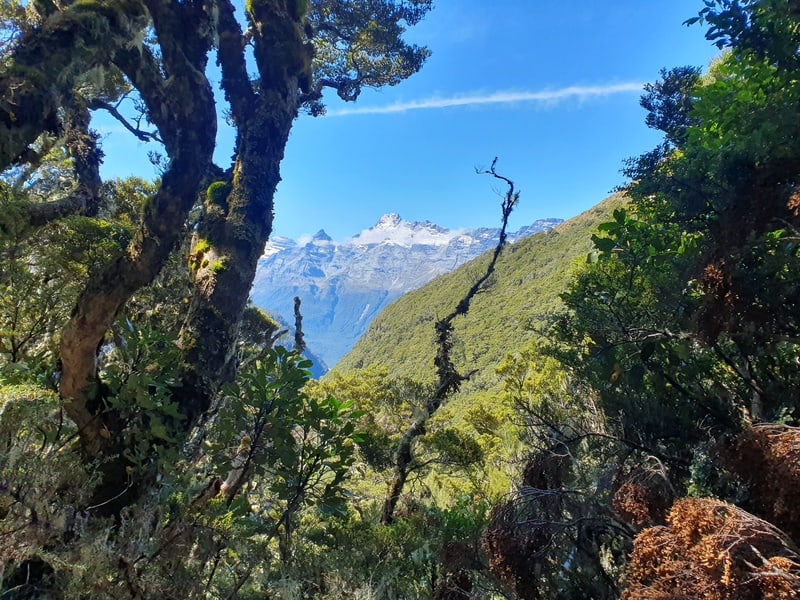
This part gets super technical as it’s the steepest part of the climb, but you’ll catch some lovely views on the way through the forest and of some waterfalls.
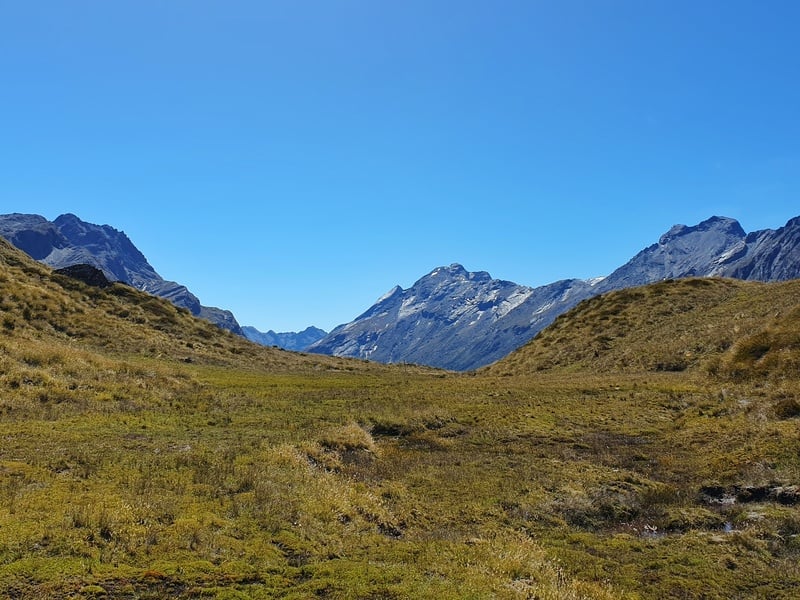
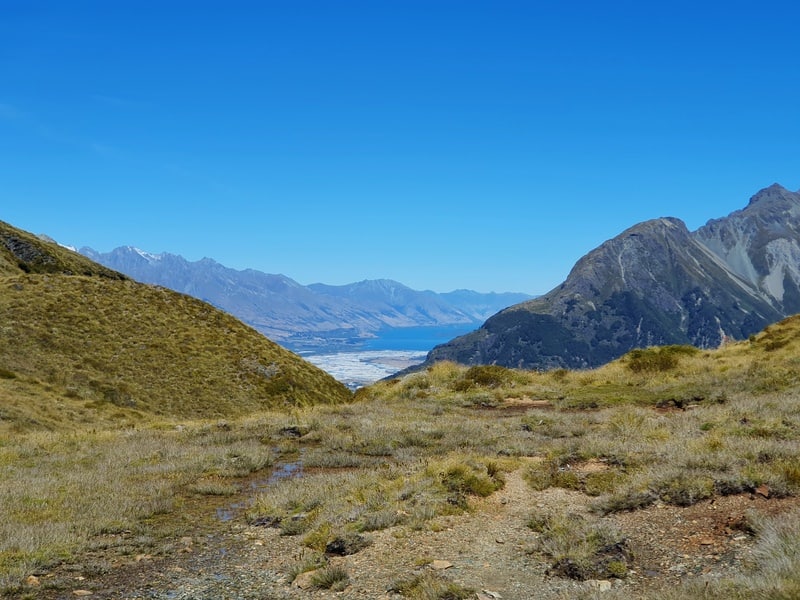
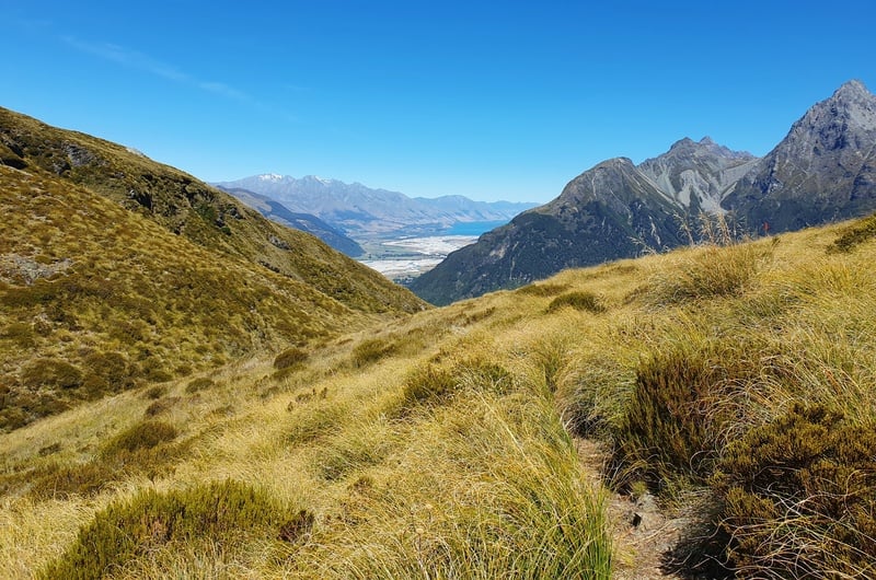
It’s not until you’re essentially at the pass when you emerge above the treeline. Then it’s epic. Behind you there’s the magic Rockburn Valley and a host of peaks. This area is super marshy, but it’s easy enough to find your way through without getting too wet and/or muddy.
Note: The environment on the pass is fragile as you’ll notice. Take care to leave as minimal footprints as you can…stick to the route as much as possible.
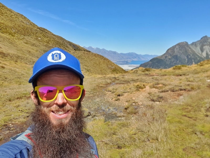
Enjoy this section, it’s awesome. You’ll eventually get some awesome towards Lake Wakatipu with the Humboldt Mountains being a major feature. A great spot to have a picnic. Though I was surprised there was no sign mentioning when you’re actually at the highest point on Sugarloaf Pass.
If you want, you can then turn left and climb the hill to get even better views…I’ll do this next time.
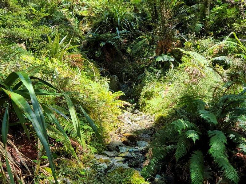
And when you’re ready, it’s time to start the descent back into the forest. It’s a steep descent, and though less technical than most of the terrain you’ve seen, there’s plenty of roots ready to trip you up.
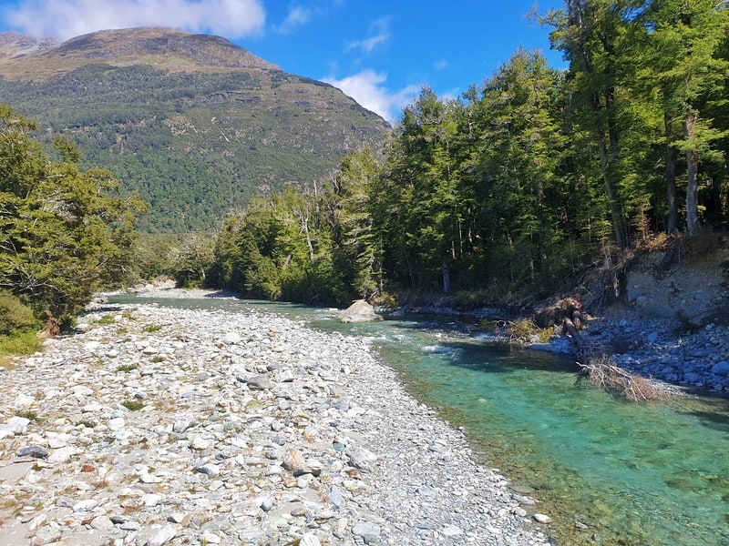
Once you get to Sugar Loaf Stream, the terrain flattens out and it’s another 1.5km until you get to the Routeburn Track. It’s a bit of a relief to get here as that’s the technical terrain finished.
You’ve got just under 1km to go to the Routeburn carpark. And then the final stretch, 4km on the gravel road.
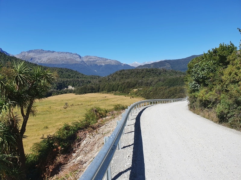
It’s a small descent from here which is nice. If the gravel road feels really painful, you can consider parking a car at each end or perhaps you’ll time things right to hitch a ride.
Arriving back at Lake Sylvan campsite means you’ve finished this pretty hectic trail. Congrats!
The Sugarloaf Track is an awesome hike in Mount Aspiring National Park. Whether you do it as an overnight hike or day hike you can’t go wrong. And it’s the gateway to another couple of awesome trails, the Rockburn Track and the challenging Five Passes.
If you have any questions about the Sugarloaf Pass Track, leave a comment below or email jub@churnewzealand.com and I’ll get back to you ASAP.
p.s. If you’ve read this far, here are a few more photos that I felt like didn’t really fit into the article without things getting crazy.

Hey, it’s Jub here. I’m the guy behind Chur New Zealand, helping you have the best time hiking, trekking, walking…whatever you want to call it…in NZ. I’m based in Queenstown and am always out and about exploring trails, old & new. If you have any questions, reach out.
Hey.
Thank you for all the info. It’s very handy to have more detailed info than the doc site.
A couple of questions;
Have you done it again recently?
Have you done it early winter?
And did you see any deer sign?
Thanks again.
Hey Daniel,
I did it in April this year, no deer sign. I would think it’s okay in winter…
Cheers,
Jub