At 2165 metres, Dragonfly Peak is a grueling 30km+ return hike from Cameron Flat. While it is possible as a day hike (during summer), this makes for a great overnight adventure with camping possible in various spots along the way.
This post will give you all the details (and yes, a GPX file), photos, and a trip report from my experience going to Dragonfly Peak.
Interestingly, although I consider this to be a hike in Mt Aspiring National Park, the summit isn’t actually in the National Park. Only the East Matukituki Track section of the hike is inside the park boundaries.
Let’s get into it.
TABLE OF CONTENTS
1. Dragonfly Peak Details & FAQ’s
2. Dragonfly Peak Map
3. How To Get To The Carpark
4. My Dragonfly Peak Experience
1. DRAGONFLY PEAK DETAILS & FAQ’S
- QUICK DETAILS:
- Distance: 30 – 34km return
- Elevation Gain: 2100 – 2200 metres
- Difficulty: Hard
- Time: Great overnight camping trip or a big day trip.
- GPX File: Download here
How hard is the hike to Dragonfly Peak hike?
This is not a hike for beginners. The East Matukituki Track isn’t too bad, but there are a few river crossings/3-wire swing bridges. Once you’re off the Matukituki Track, you’re off-piste which doesn’t make it any easier. Then the final stretch above Whare Kea Chalet is a choose your own adventure with those who aren’t great with exposure might find a couple of hairy moments.
The most nerve wracking moment for me was the final one metre step to the summit.
How long is the hike to Dragonfly Peak?
My watch recorded a 33.37km which seems to be in the ballpark of what other people get. The distance will vary a little depending on what lines you take, and whether you ford the rivers or cross the swingbridges.
Plan on a 32 to 34km day.
What is the elevation gain of the Dragonfly Peak hike?
Here’s the Dragonfly Peak elevation profile:
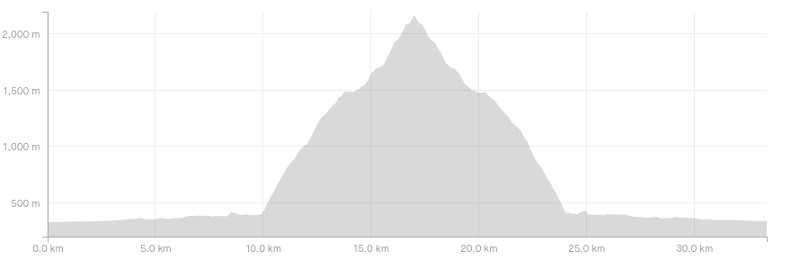
My watch gave a total of 2160 metres. So there’ll be at least 2000 metres, of which over 90% is on the way to the summit.
How long does it take to hike Dragonfly Peak?
How long is a piece of string? This is tough to judge.
I think this makes for a great overnight camp mission. We met people who camped at Junction Flat before heading to Dragonfly Peak the next day. They were out there for the whole second day but got to spend heaps of time enjoying the summit views. You could stay at the Rock of Ages bivoauc too.
We took just under 10 hours and 40 minutes to get up and back which is a reasonable time. We made sure to run a bit at the start and finish, but otherwise it was pretty steady hiking with a few breaks (we did jog a bit around Albert Burn Saddle too). It took us 5 hours 51 minutes to get up, 4 hours 28 minutes to get down). We spent about 20 minutes at the summit.
If you had a heavier overnight pack, the first section will take a lot longer.
It’s a hike that’s very hard to gauge time as the track conditions will vary a lot, and it depends on how comfortable you are hiking off track and the like.
Can you stay at Whare Kea Chalet?
Well you can, but you’ll need a lot of spare cash to stay here…check the website if you’re brave enough.
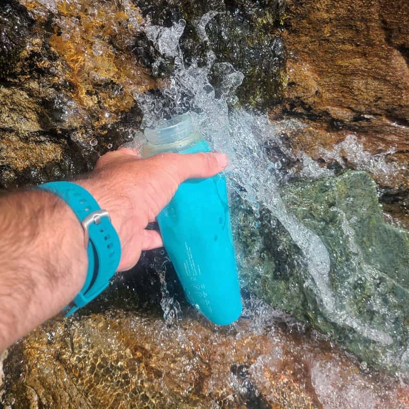
Are there streams you can drink from on the way?
We drank water (not boiled/not filtered) from one of the waterfalls you find at about the 6km mark. Then from below the Matukituki River East Branch swing bridge. Getting closer to Albert Burn Saddle we also found a few streams we happily drank from. Depending on your risk tolerance, you might be taking a water filter.
Can you hike Dragonfly Peak in winter?
I’m sure there’s some people reading this who have the skills too. But I’d recommend this as a summer hike only.
Check out the Whare Kea Chalet website where they have three live webcams which will help you figure out if the conditions are suitable or not.
Why is it called Dragonfly Peak?
Over 60 years ago (1962), there was a Dragonfly plane that disappeared. There’s no trace of it that’s ever been found, but it is believed by many to have crashed in this area. 60 years on and the crash still has people thinking what might have happened.
This is a great write up about a recent search of an area it’s thought to have crashed.
2. DRAGONFLY PEAK MAP
The map below is the GPX from my adventure overlaid on topomap.co.nz. Clicking through will open the map in a new window where you can scroll around etc.
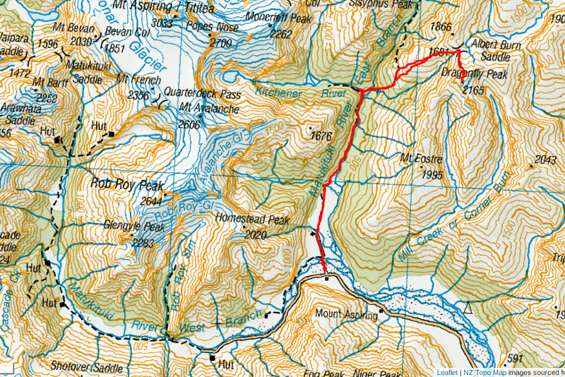
You can download the Dragonfly Peak GPX file here.
3. HOW TO GET THERE
The starting point for most people hiking to Dragonfly Peak is from Cameron Flat carpark and crossing the river there.
Or you can start a little further up the road and cross the suspension bridge.
The easiest way to get here is driving yourself. It’s less than an hour for Wanaka, but you will be on gravel road for about 23km of the journey. Alternatively, hitchhiking into the valley from Wanaka is pretty easy if you go in the morning. Just make sure you don’t leave it too late to hitch out!
Alternatively, you could arrange for a shuttle pick up and/or drop off. I’d be conservative on planning on drop off times etc. You can see a few Wanaka shuttle options here.
4. MY DRAGONFLY PEAK EXPERIENCE
I was expecting great things from this adventure and with a mint weather forecast my friend and I were going to have a great day. With a few final gear checks, including both of us having the GPX file installed on the best topo app map, and the PLB we were off.
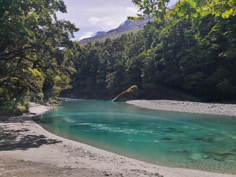
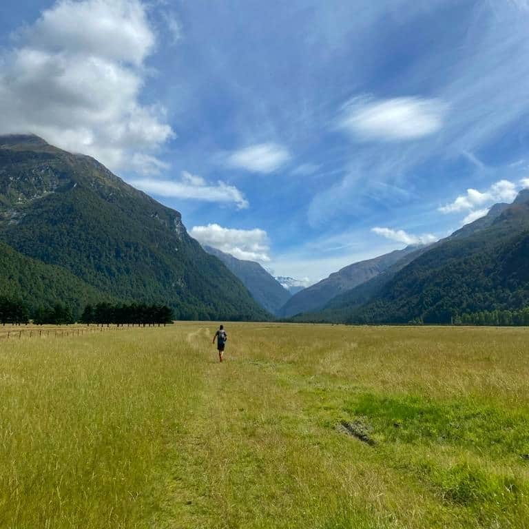
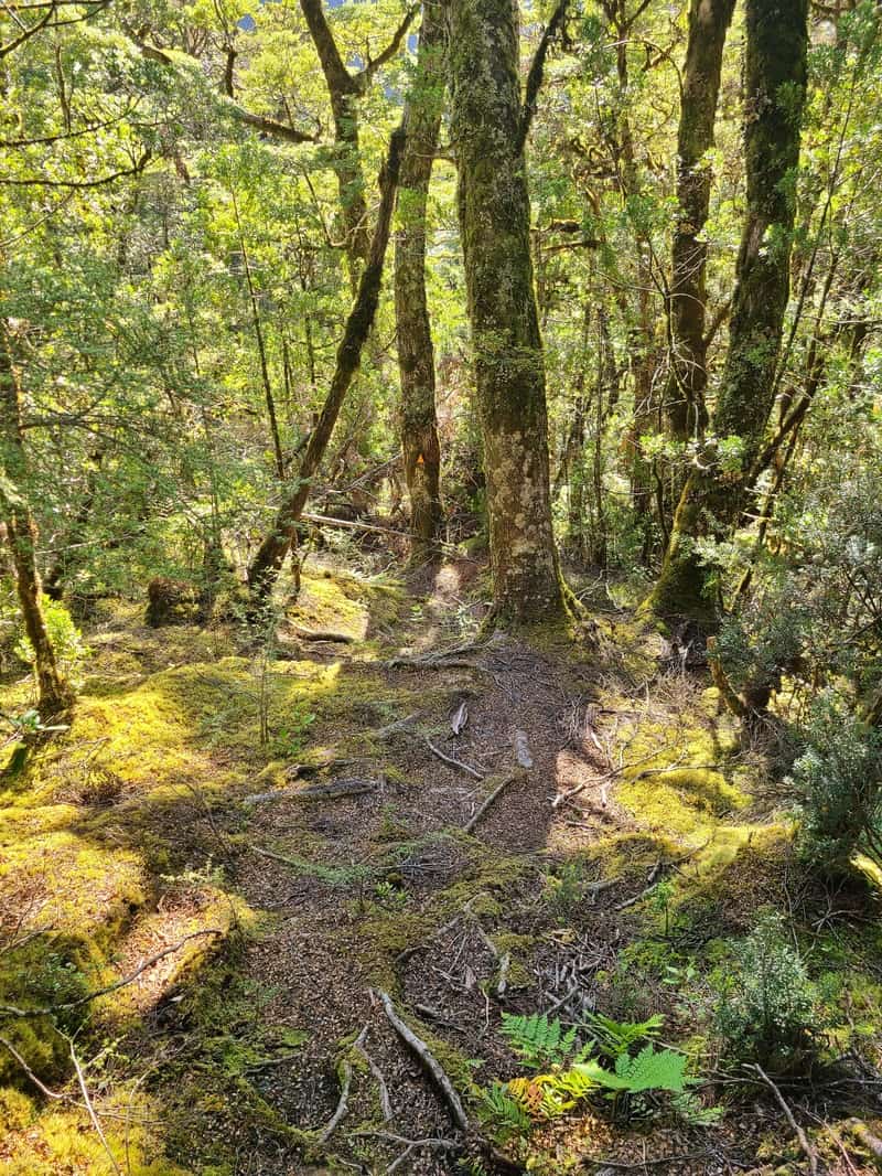
With a slightly later than planned start just after 10am, we crossed the river and jogged through Cameron Flat to make up time. Once we hit the forest we still tried to move quickly but didn’t take any risks. This section of the track is lovely, and there’s even a little beach next to the river which would be a fun spot to read and take a quick dip if you were planning to camp at Junction Flat and had time up your sleeve.
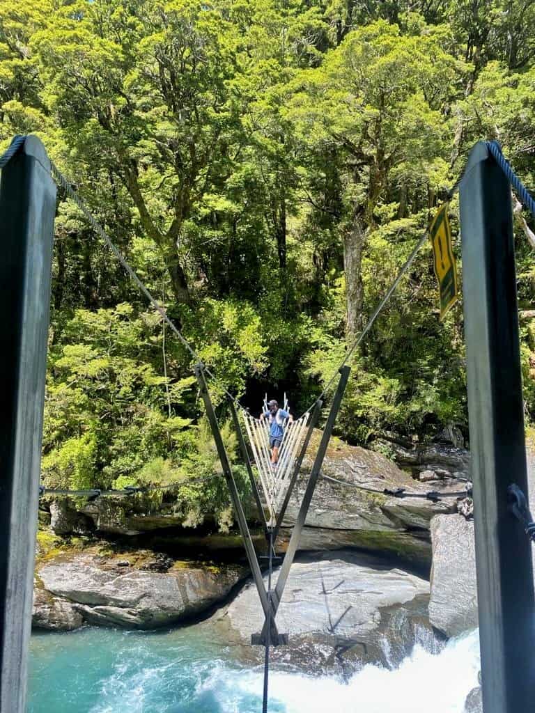
We carried on, and when we got to the Kitchener River decided to make the short journey to the swingbridge rather than fording the river. It’s a short journey to the swingbridge, but we forded the river on the return and it was a few minutes faster faster…even after getting sand out of the shoes.
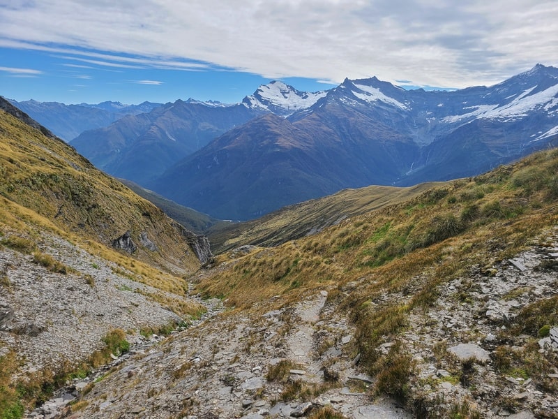
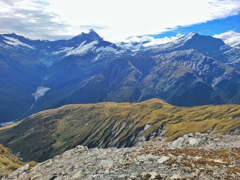
At Junction Flat, take a look to see the peak you’re headed for (photo below). It looks a long way up!
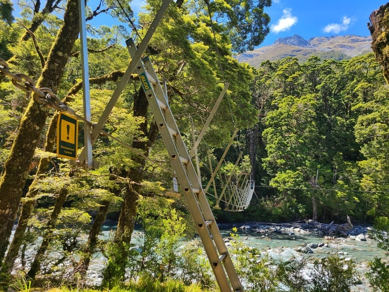
The next 3-wire swing bridge came again in less than 1km. Again, you can ford the river provided the river is suitable to cross.
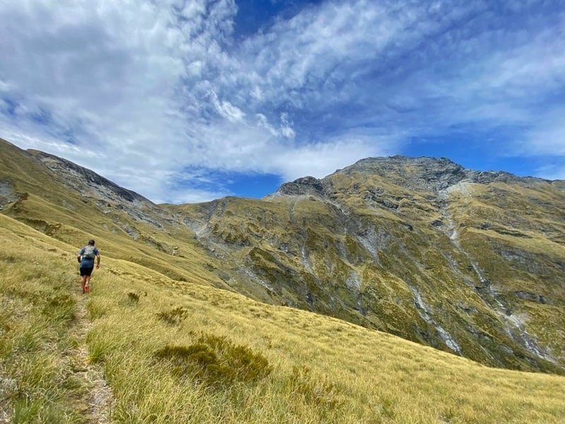
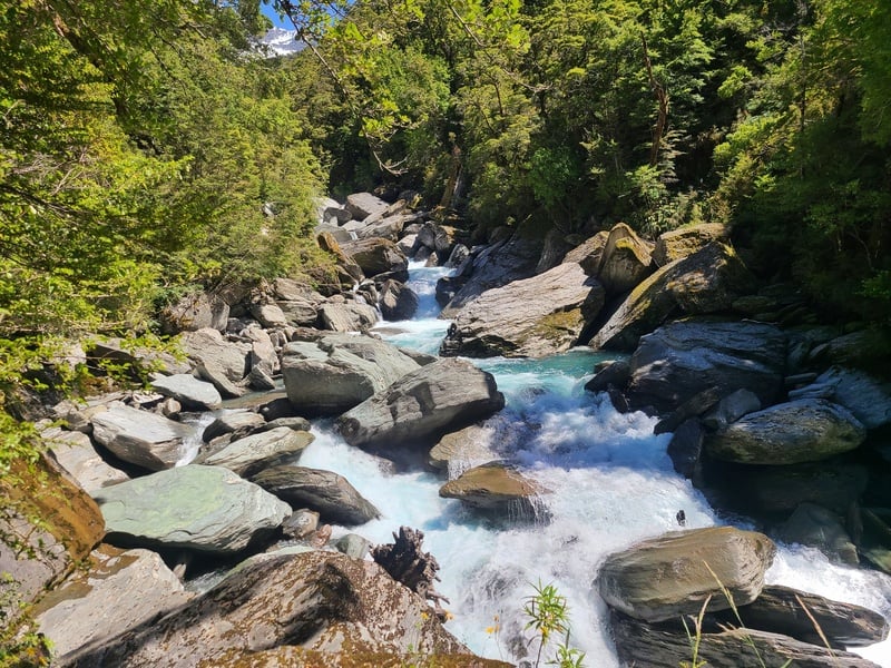
So far the hike had been undulating, but we were about to start the climbing where it would be all but relentlessly up until we reached the summit of Dragonfly Peak.
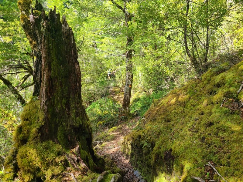
There was some treefall shortly after the Matukituki East Branch swingbridge but the orange triangles were easy to spot. The ascent isn’t easy, but make the most of the shade while you can.
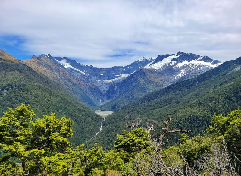
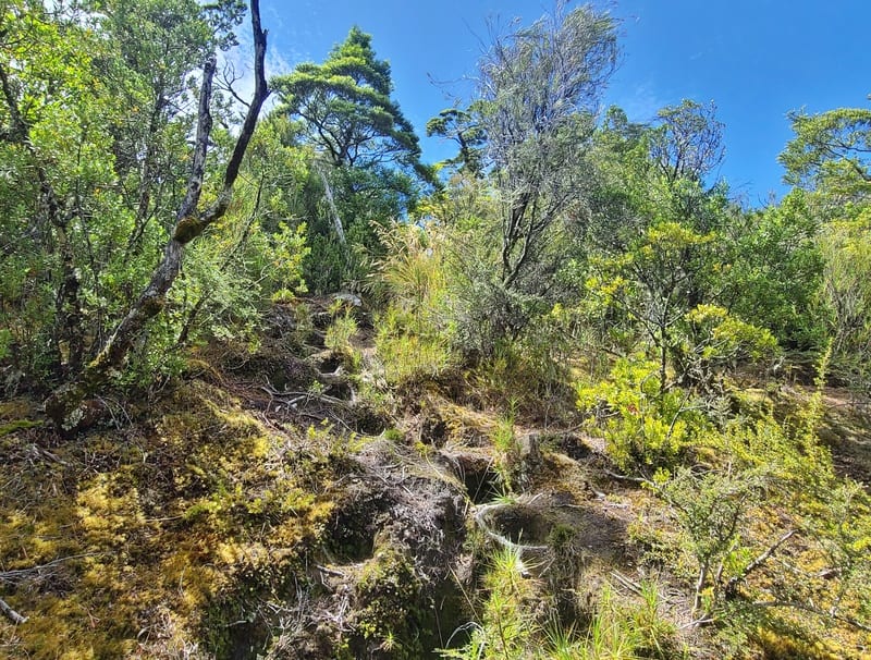
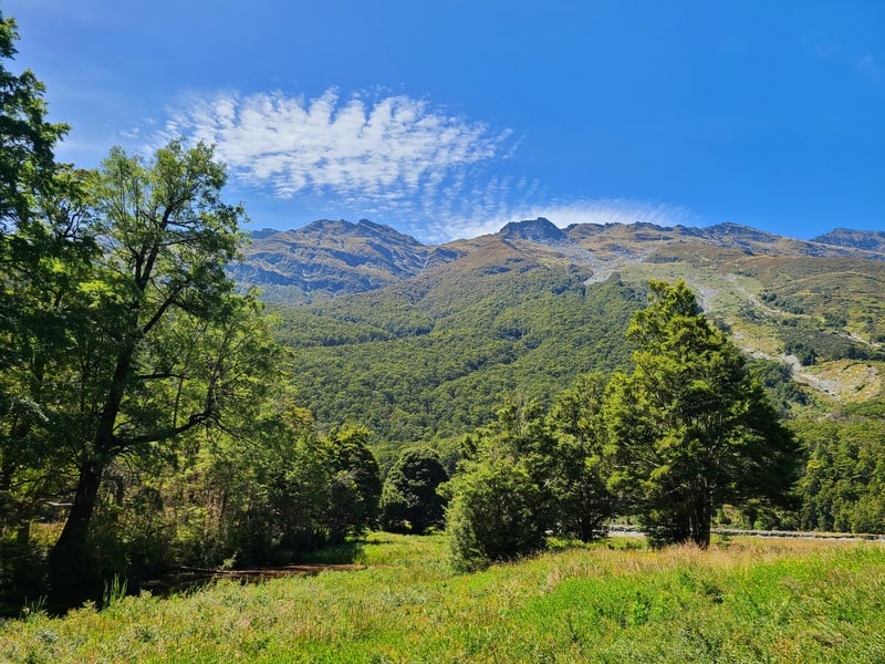
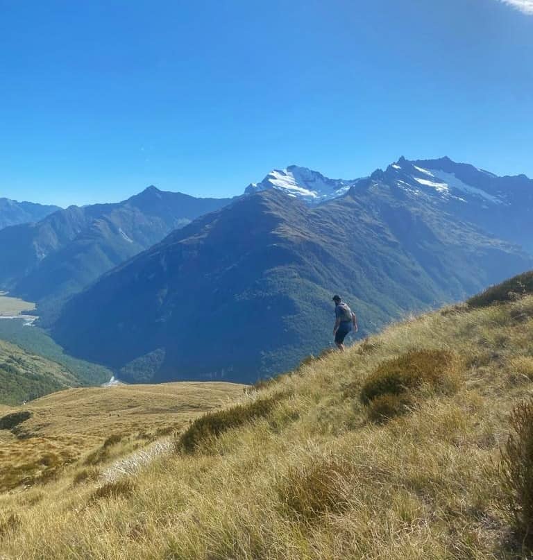
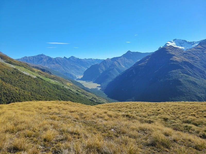
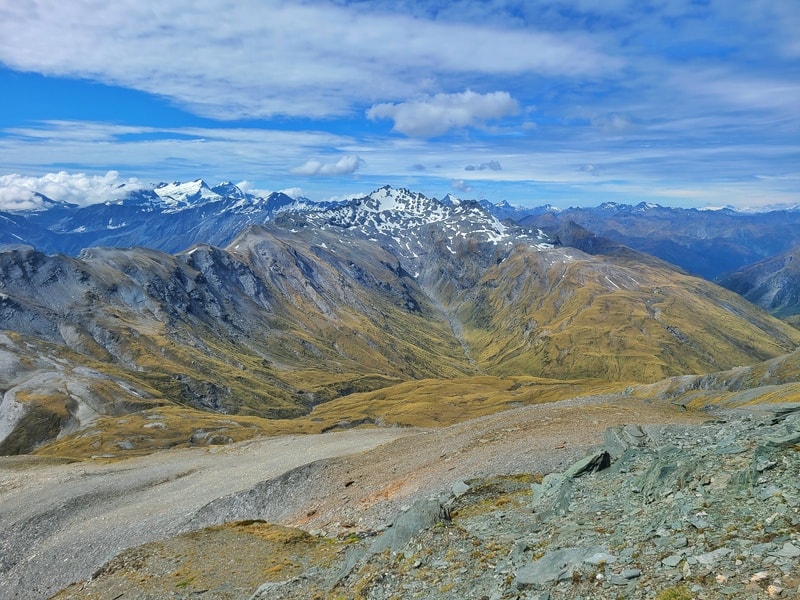
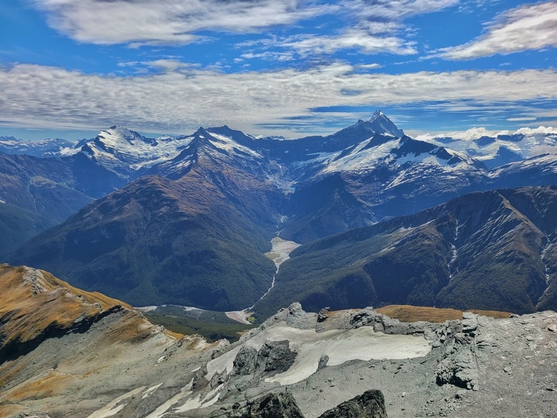
Soon enough you’ll start to emerge from the treeline where you get the first glimpse in towards Aspiring Flats, Mount Aspiring, glaciers and more.
You’ll also need to start thinking where you’ll veer off the East Matukituki Track to start heading towards Dragonfly Peak.
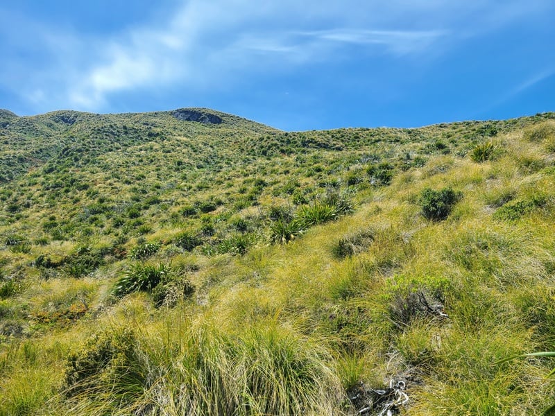
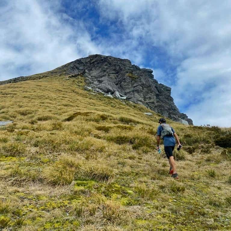
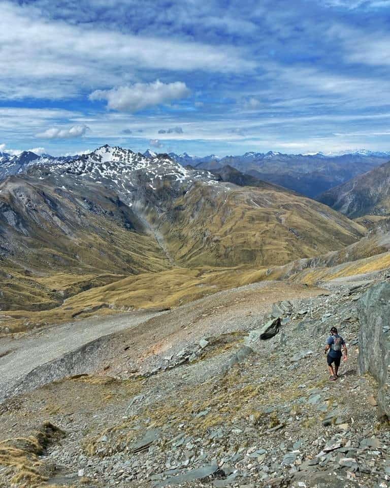
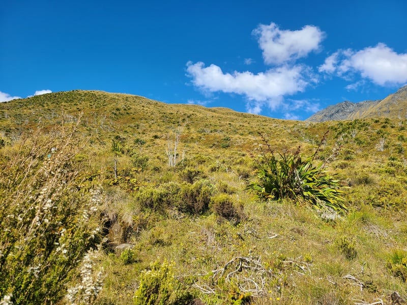
We decided to turn off on the northern line on the map above (it could be easier to read this with your topo map open with the GPX file installed). When we turned right, it was a tough incline through tussocks for a while there as we aimed for some rocks you can see above.
But then it ‘flattened’ out a bit and we did find some form a of trail which was handy. We should have made more of an effort to follow it. Getting closer to Albert Burn Saddle, it looks a lot harder than it is really…especially if you stick to the track. Are you noticing a theme?
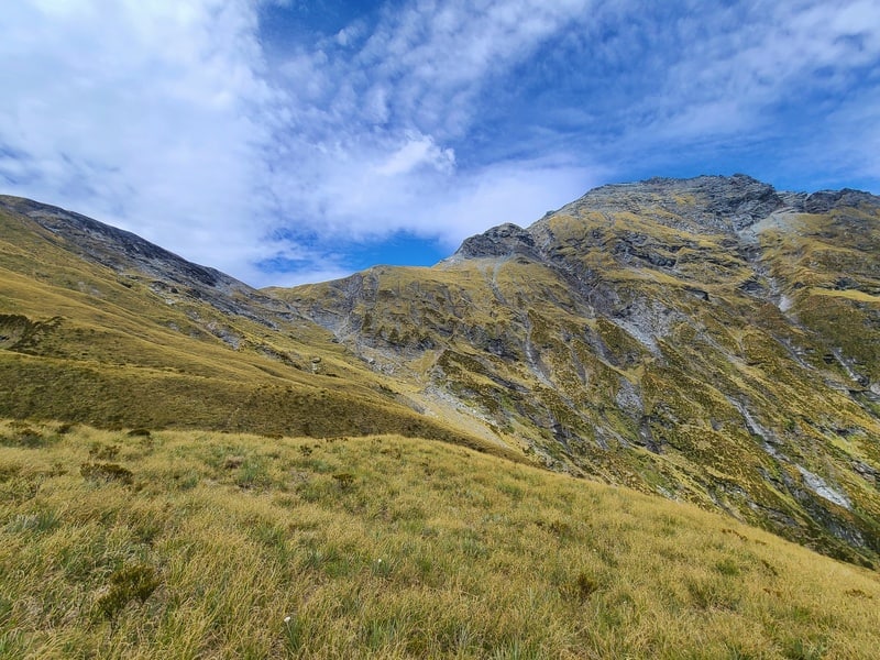
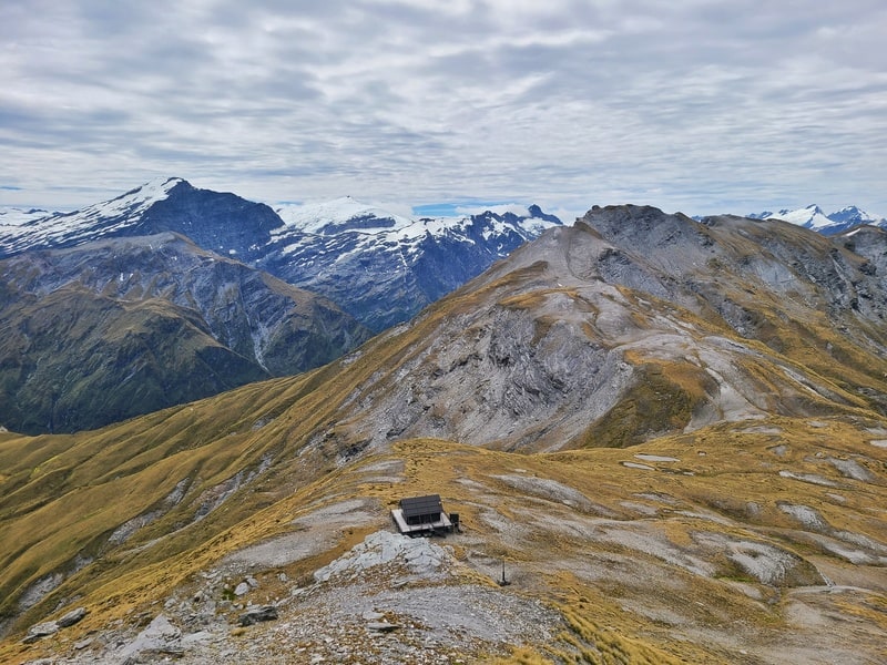
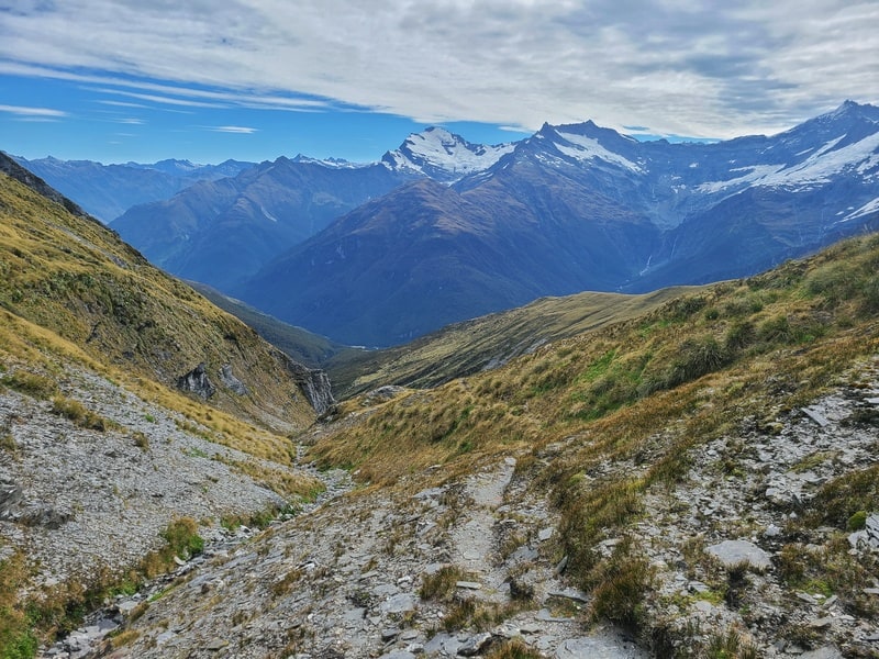
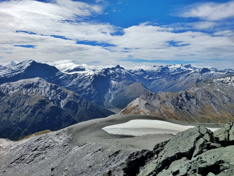
The views from Albert Burn Saddle are sweet! But there’s the final stretch to go. Heading right, you’ll soon see the fancy Whare Kea Chalet. We went just left of that and it’s quite intimidating looking up where you’ve got to go…but epic at the same time. I chose the line I felt was best, with the focus on always going up.
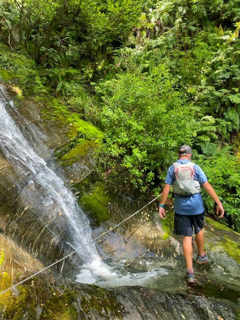
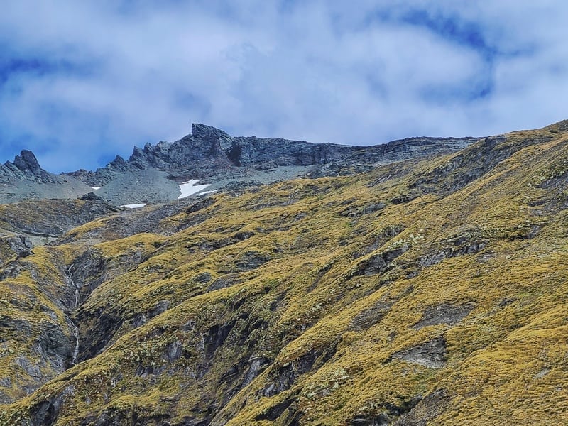
It’s good to know what you’re aiming for, which is the small waterfall you can see in the photo below. Don’t beeline it here necessarily though. You can try follow the GPX file, but I think it’s best if you take the line that’s most comfortable looking for you. I’m happy with the route we took.
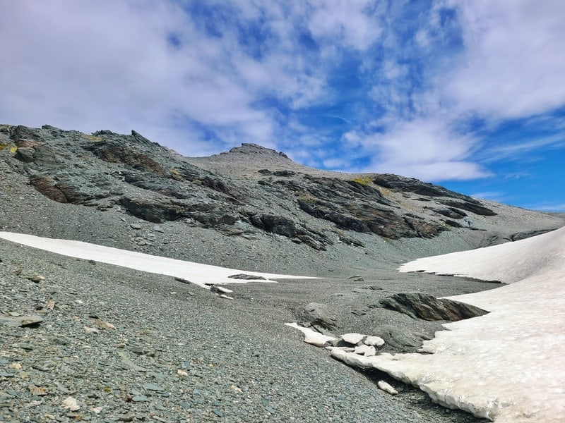
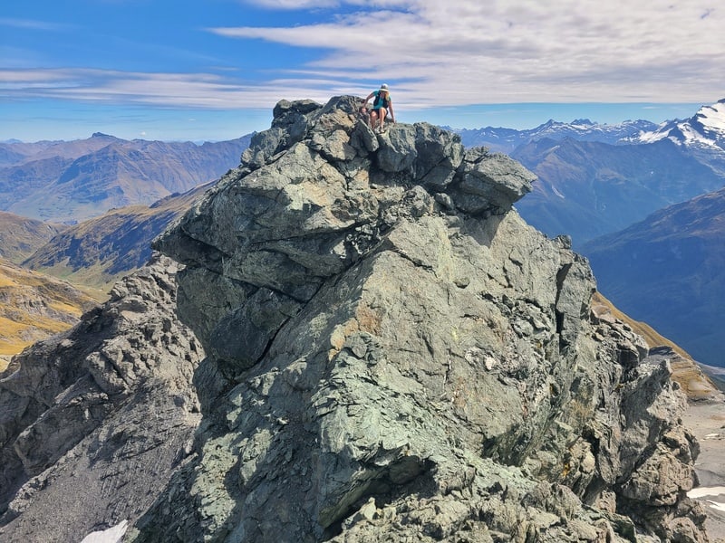
Once you’re up next to the waterfall, the final section flattens out and then you’ve got the last step to get to the summit which is a bit precarious. But there’s a way to get up (and down). If you’ve made it this far it won’t stop you.
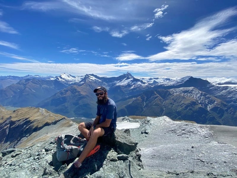
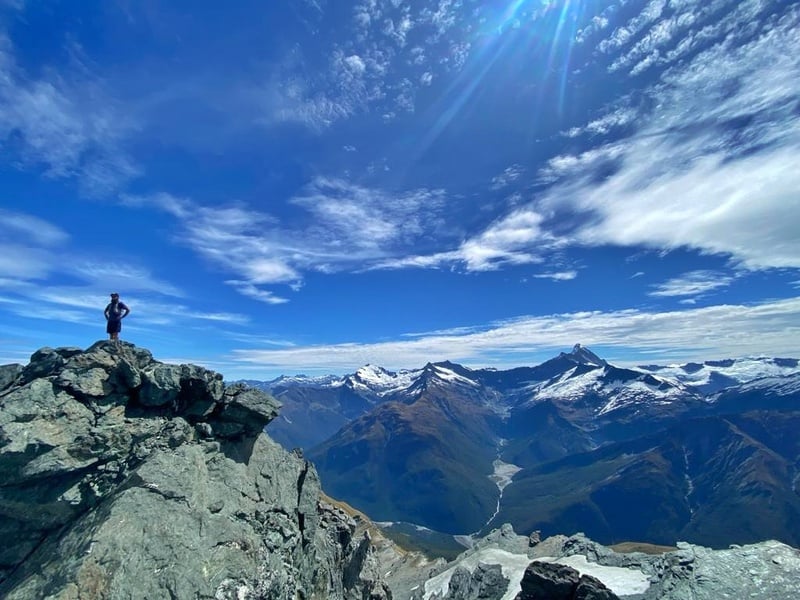
ENJOY THE SUMMIT 😀
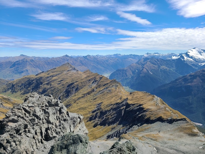
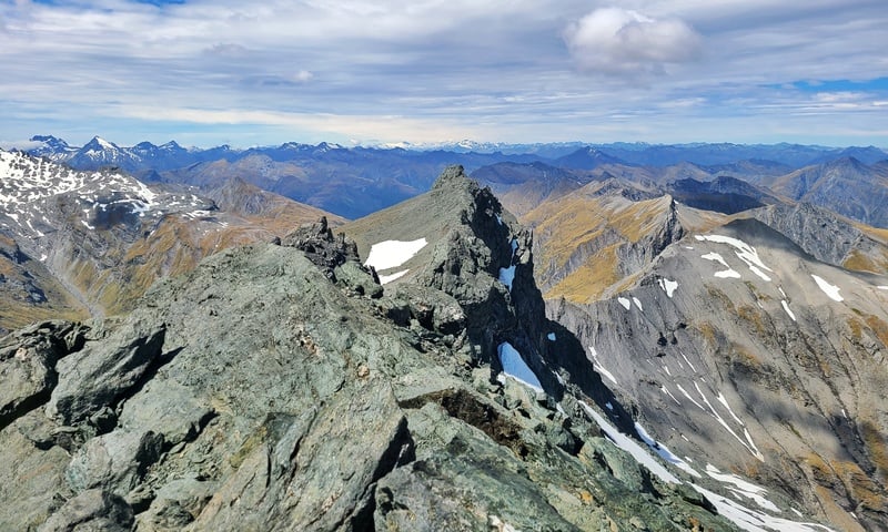
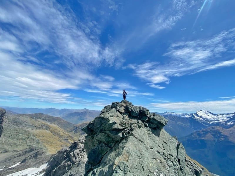
The views really are the best from the summit. You’ve got 360-degree views…we had no wind and perfect temperatures. We could have spent hours there, but I was conscious of time and wanting to get back before sunset (we did have head torches).
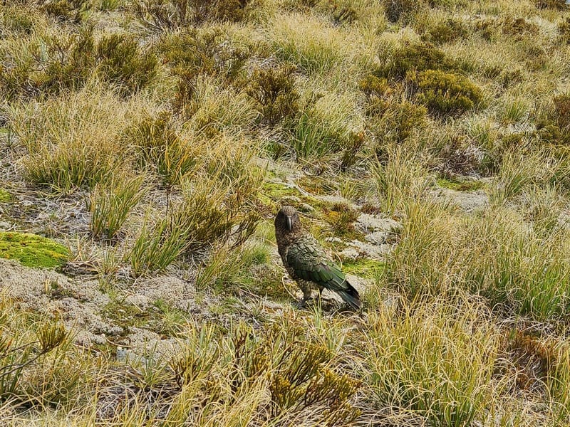
The descent down to Whare Kea Chalet was easier to spot a good line to go down, and the track seemed easier to follow towards the East Matukituki Track too. We even walked past a kea.
The GPX file I used saw us taking a different line back which we tried to follow, but I zig-zagged a bit much. But I knew the direction we were heading so kind of bee lined for that. Perhaps there was a track to follow? I couldn’t see it though.
Once on the marked East Matukituki Track again, it was a nice break to just be able to follow the track back to the carpark. If you’re legs are still feeling good, you’ll be a bit faster than on the way in hopefully.
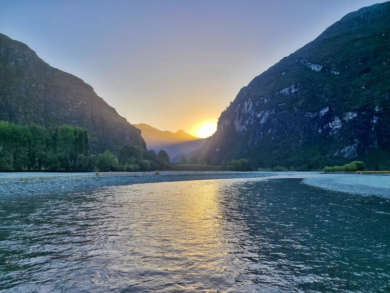
What a day, with a beautiful sunset as we made the final river crossing of the day.
If you love bagging peaks, then the Dragonfly Peak mission is one to put on your radar. If you’re not a fan of walking off track, and aren’t great with exposure, then you’ll prefer something like Liverpool Hut and/or French Ridge Hut.
If you’ve got any questions/comments about Dragonfly Peak…leave a message below or email jub@churnewzealand.com.
Chur.
BONUS DRAGONFLY PEAK PHOTOS
As usual I upload way to many photos before writing the article, so here’s some more views you’ll see along the way 🙂
p.s. you can find all the hikes I’ve documented in this map (clicking on the icons will provide more info):

Hey, it’s Jub here. I’m the guy behind Chur New Zealand, helping you have the best time hiking, trekking, walking…whatever you want to call it…in NZ. I’m based in Queenstown and am always out and about exploring trails, old & new. If you have any questions, reach out.
Nice write up and photos. Thinking about trying this one before the days get too short.
Cheers Tony! 100% go for it…I’ve noticed the days getting shorter already 🙁