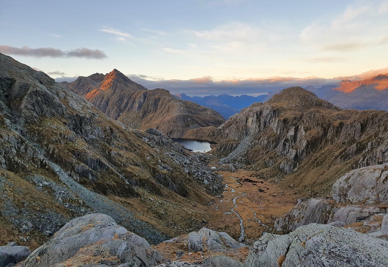
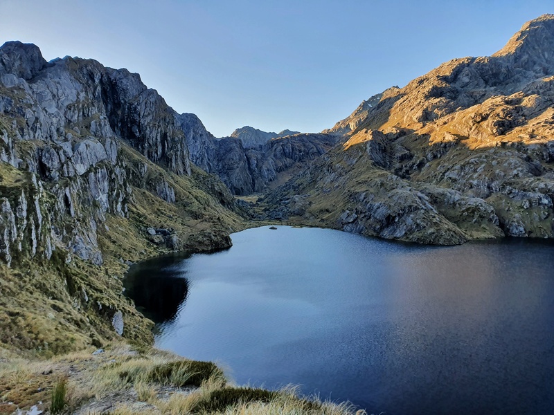
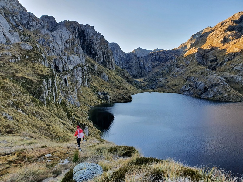
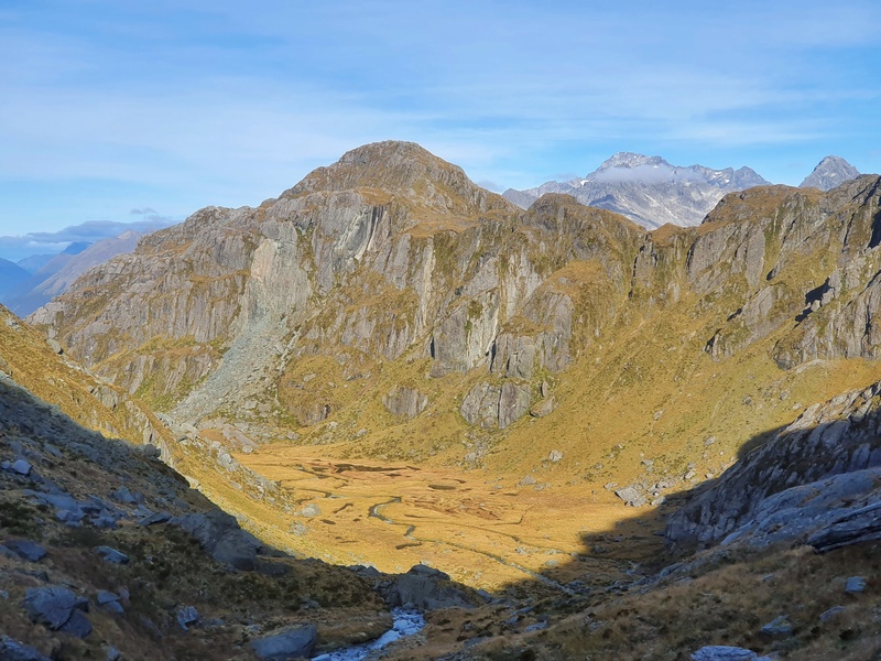
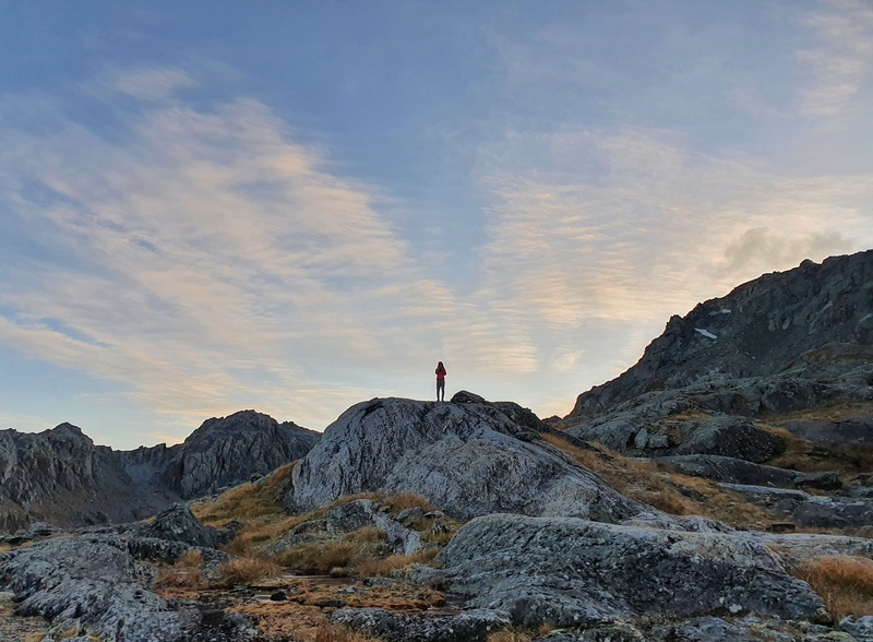
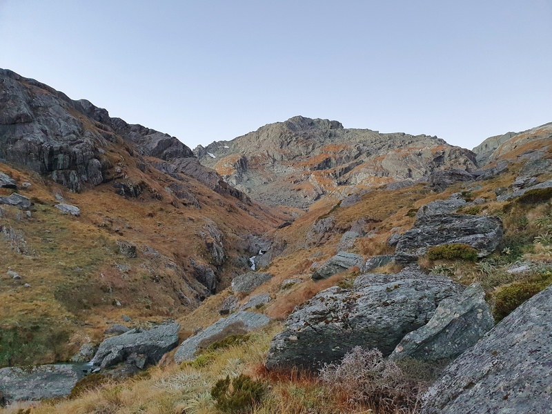
The Valley of the Trolls is easily accessed from the Routeburn Track. It’s an area a lot of people haven’t heard of, but once they have, and see a few photos like the one below, will put it towards the top of the list.
And you can add Lake Wilson to your Valley of the Trolls adventure. Here’s the GPX file
Getting to the Valley of the Trolls takes a little bit of effort, as it’s accessed about halfway along the Routeburn Track, but it’s not overly difficult and can be incorporated into your Routeburn Track hike as an extra night of camping, or as an additional Routeburn side quest between Routeburn Falls Hut and Lake Mackenzie Hut.
This post will give you all the details you need to know about exploring the Valley of the Trolls & Lake Wilson as a day trip, or overnight camping mission.
If you’re loving all the hikes in Mt Aspiring National you’ve done so far, this is a real gem.
TABLE OF CONTENTS
1. Details About Valley of the Trolls & Lake Wilson
2. Map & GPX Files
3. How To Get There
4. My Valley of the Trolls/Lake Wilson Experience
5. A Few More Photos
1. VALLEY OF THE TROLLS & LAKE WILSON DETAILS & FAQ
Note: We hiked to and from the Routeburn Shelter so that’s what the numbers will be based on.
How hard is the hike?
Medium. The hike to Lake MacKenzie is reasonably cruisey given you’re on the well-maintained tracks of a Great Walk. The track to the Valley of the Trolls is a bit trickier but there is a trail to follow (in fairness, it’s easily lost).
I wouldn’t recommend this hike a day or two after a rainy day as the Valley of the Trolls will be very swampy and not fun. And in winter the avalanche risk of going through the valley is not worth it whatsoever. Stick to visiting on a nice sunny summer/autumn day.
How far is the hike to Lake Wilson?
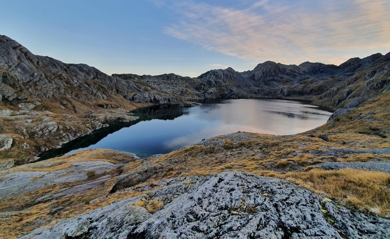
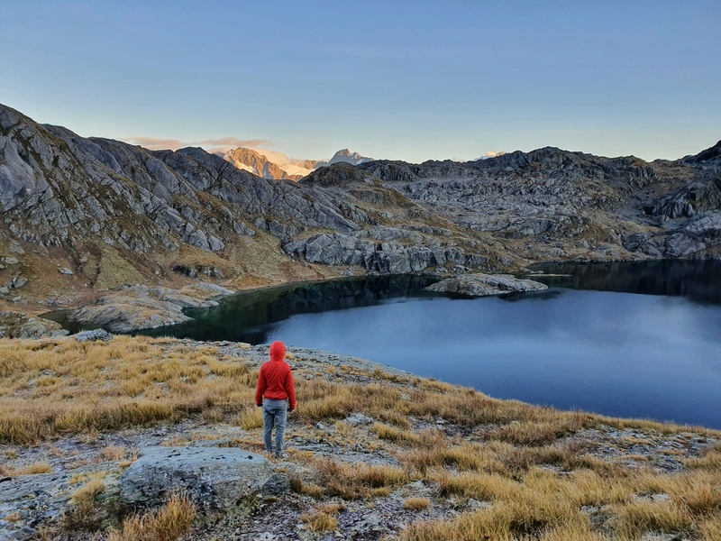
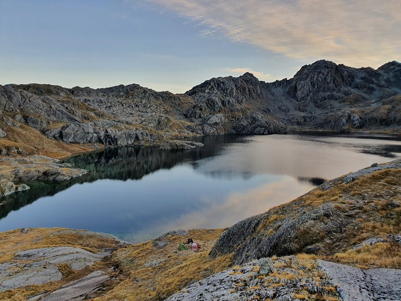
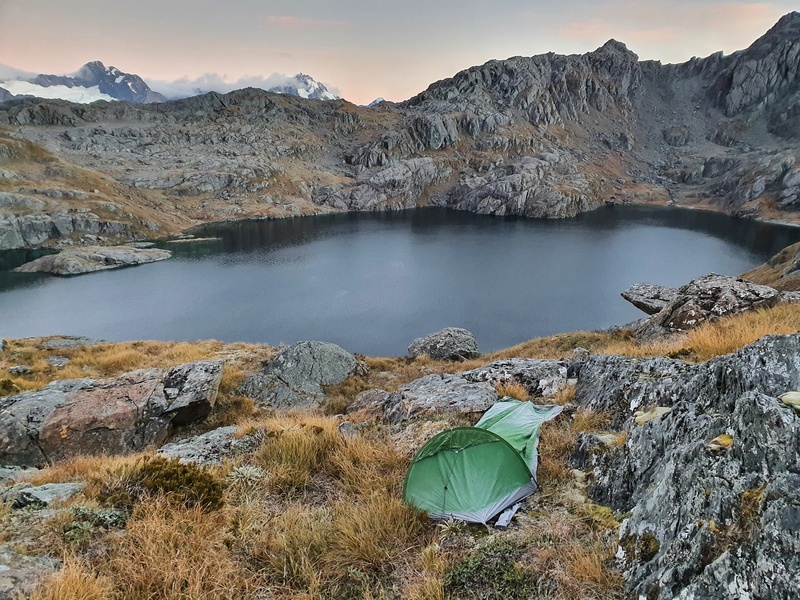
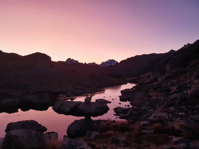
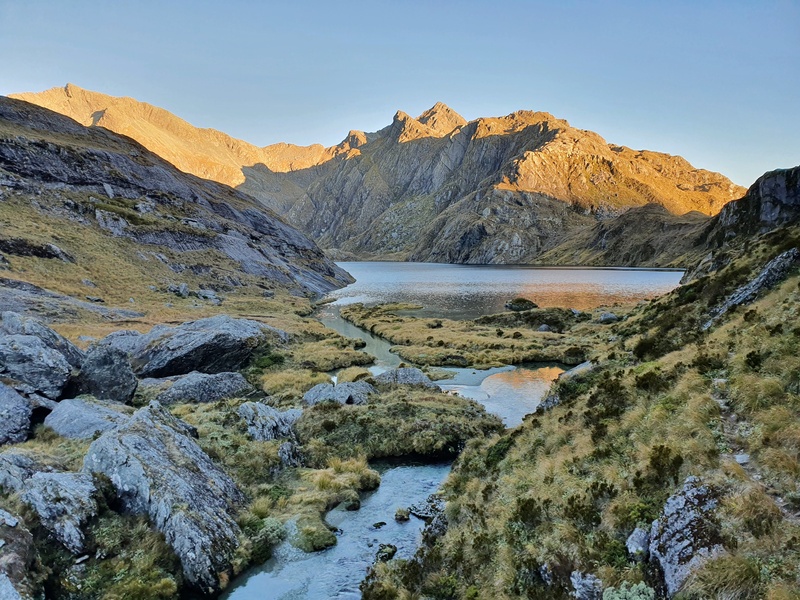
From Routeburn Shelter to Lake Wilson came in right around 16km. If you took the direct route from the valley up to Lake Wilson, it’d be a little shorter. So it’s easily doable in a day (or camp at the lake with a sunrise like the photo below).
What is the elevation gain to Lake Wilson?
From the Routeburn Shelter to our Lake Wilson camping site saw us gain ~1300 metres of elevation gain. This is spread out across the whole hike with no really extended steep section.
If you were to go up the steep waterfall to Lake Wilson, your total elevation gain will be slightly less.
How long does it take to get to the Valley of the Trolls and Lake Wilson?
It took us a little under 4 and a half hours to hike to our Lake Wilson campsite from the Routeburn Shelter. We weren’t going as fast as we possibly could but weren’t mucking around too much (we had a couple of short snack breaks and talked to people).
It was a little over 3 hours to Lake Harris, and another 75-80 minutes or so up to the hut.
And we didn’t exactly pick the best route at the end going up to Lake Wilson…as we found ourselves off track accidentally time and time again.
If need be, you could make it to the lake in 4 hours I reckon. That said, some people take 7-8 hours to get there…so make sure you leave on time based on your hiking speed.
Are you allowed to camp in the Valley of the Trolls?
Yes, as long as you’re at least 500 metres away from the Routeburn Track as per the Mount Aspiring National Park Bylaws 1981. This isn’t hard to do in the Valley of the Trolls and Lake Wilson.
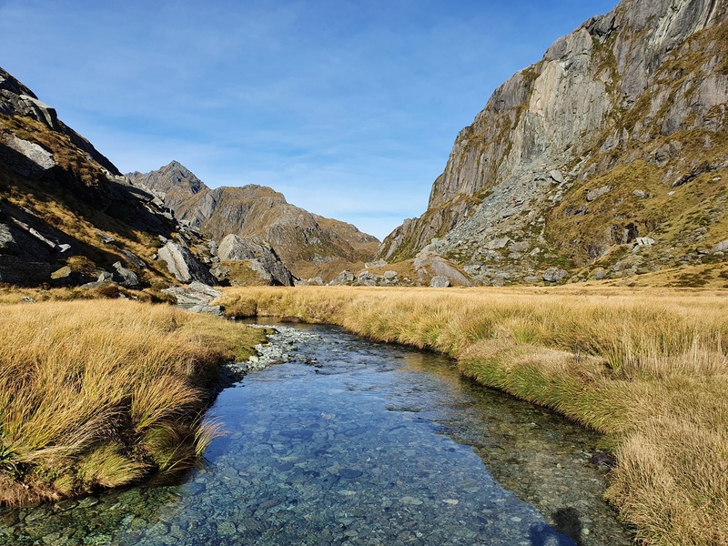
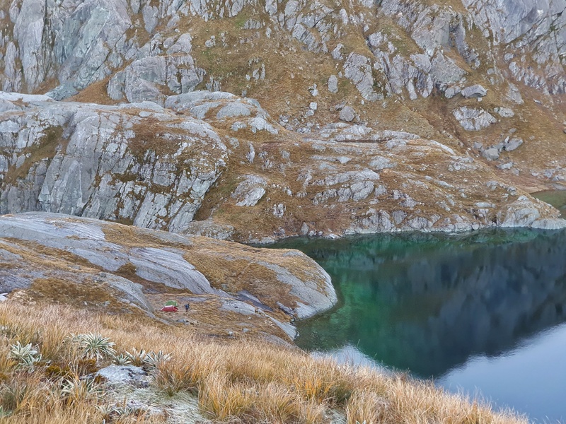
Given the swampy nature of the swampland in the Valley of the Trolls (there’s a river/creek flowing through the valley), picking a campsite is crucial if you are camping in the valley. The best spot seems to be next to the rock bivvy near the bottom of the waterfall…you can’t miss the rock. There’s only a little space for camping, so be prepared to head up to Lake Wilson to camp as well.
What about Lake Wilson?
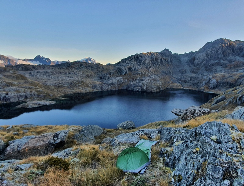
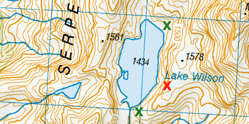
You sure can because of the bylaw above. We camped a little above the lake as we didn’t get there until a little after sunset. For a good spot to camp, I’d recommend somewhere near the two green crosses below. We were around about where the red cross is, and finding a flat spot was not easy.
We were definitely lucky we both had small tents/bivvy bags. I had a pretty good night’s sleep in the Macpac Bush Cocoon bivvy bag.
Can you walk around Lake Wilson?
You can! We didn’t but talked to others who did and they said it took them a little under 2 hours at a leisurely pace. And they did mention they took their shoes off at a couple of points.
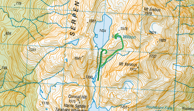
2. MAP & GPX FILES
Here’s the GPX file, it’s the route straight up the waterfall.
Before doing this hike, read about why I recommend paying for this NZ topo map app.
*clicking the image below will open the map in a new window.
The red line above is the route from the Routeburn Shelter to our campsite next to Lake Wilson. You can see you follow the Routeburn Track up to Lake Harris where you leave the trail and continue on to the valley.
There are slightly different routes you can take which I’ll talk about later in the post.
3. HOW TO GET THERE
In theory, you can get to the Valley of the Trolls from various points around Mt Aspiring National Park and Fiordland National Park, but the most practical way to get there is from the Routeburn Track, which you can start from both ends.
The turnoff point is next to Lake Harris right around here. You’ll see a small trail lead off the main track, and there’s an orange marker pole too.
From Routeburn Shelter: It’s the shorter option at around 13km to the turn-off.
From the Divide: It’s about 18km to the turn-off.
Once you get to the turnoff you’re on the way to the Valley of the Trolls and Lake Wilson.
RELATED READ: YOUR ROUTEBURN TRACK TRANSPORT OPTIONS
4. MY VALLEY OF THE TROLLS/LAKE WILSON EXPERIENCE
Note: We hiked to and from the Routeburn Shelter so that’s what my trip report will be based on.
Part 1: Routeburn Shelter to Lake Harris
Having hitchhiked to the Routeburn Track we knew we couldn’t take the walk super easy if we were wanting to arrive before sunset. Given we were planning to camp, we didn’t want to be walking around in the dark for long trying to find a campsite.
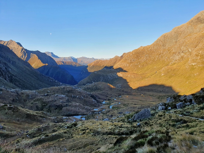
Starting from the Routeburn Shelter, the hike to Routeburn Flats is cruisey through the beech forest with a rise, but it’s not overly noticeable.
If you want you can pop into Routeburn Flats Hut but we continued on straight to Routeburn Falls. Between the Flats and Falls huts the track gets steeper, but the track is well maintained so while your pace will slow down but it’s no biggy.
Once you reach Routeburn Falls Hut, take a break, replenish your water and enjoy the falls if it’s your first time here. The view from the hut balcony is epic too.
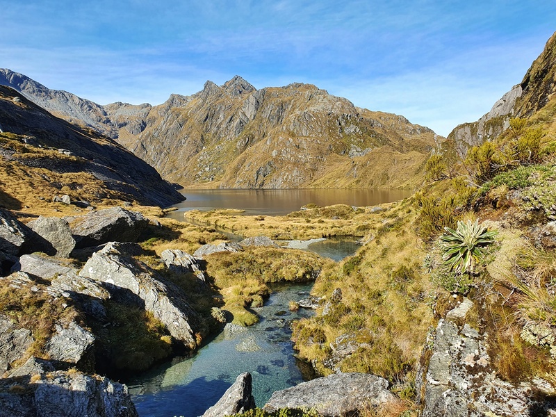
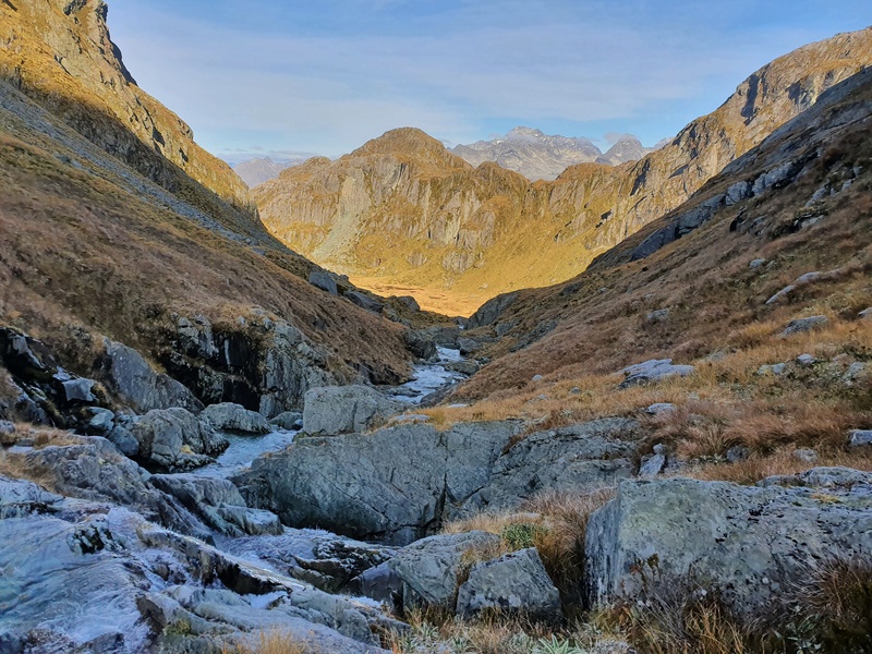
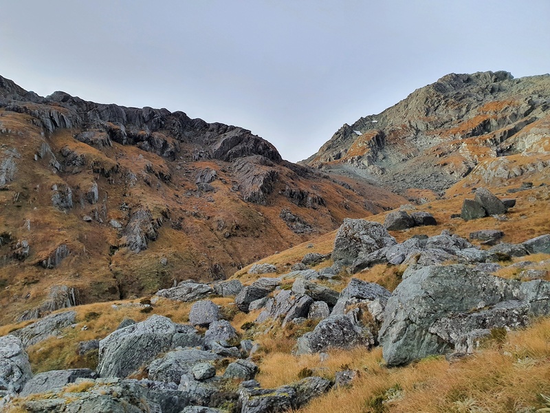
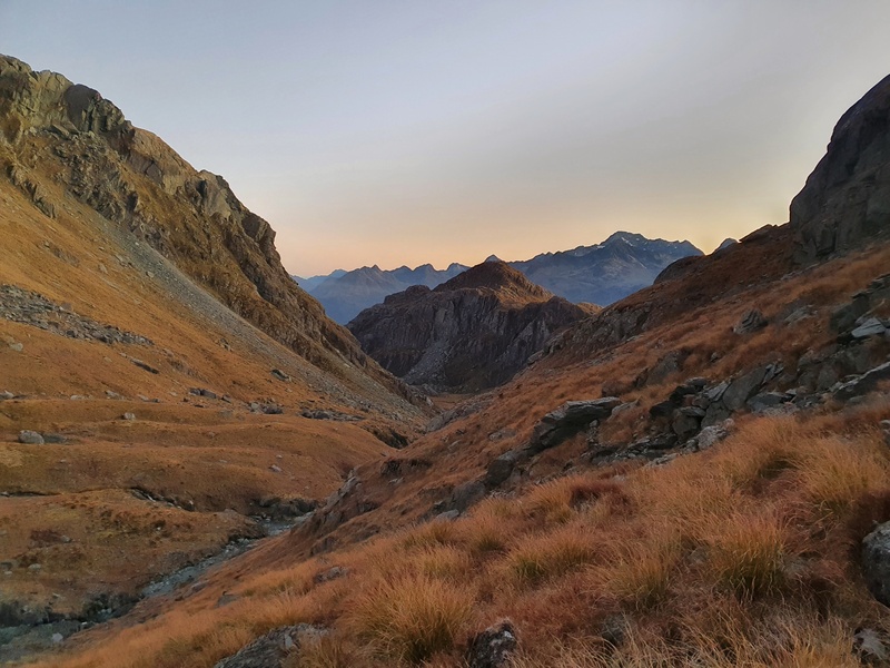
From Routeburn Falls to Lake Harris, wow! This is an amazing stretch of hiking. The terrain is a little more technical. The valley you cross is gorgeous, surrounded by mountain peaks. And once you cross the valley floor and hike up towards Lake Harris the views back over the valley are awesome!
Once Lake Harris comes into view things keep getting better as you’ll then feast your eyes on the next stage of the journey into the valley.
From Lake Harris to Lake Wilson via Valley of the Trolls
If you’re walking the Routeburn Track with no thought about heading to the Valley of the Trolls, you’d most likely never notice the turnoff you need to take. It’s pretty obvious though, and there’s even an orange marker.
It’s about 200-300 metres from the Harris Saddle Emergency Saddle (towards Lake Harris). You’ll drop down towards the lake then sidle around it. There’s enough of a track that there’s no risk of falling, but it’s a steep drop to the lake if it’s wet.
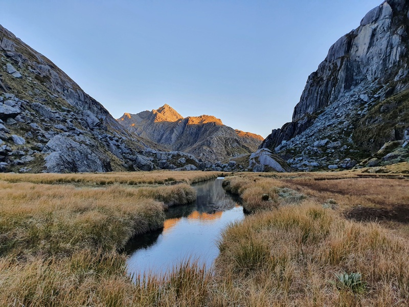
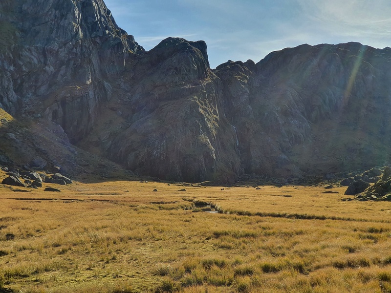
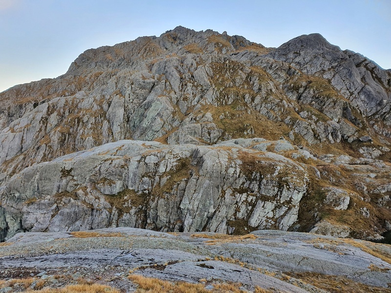
Towards the top of the lake, the terrain gets a bit trickier with some rocks to squeeze through. This section caught me off guard as the valley looks so flat. It’s short though and you’ll soon drop into the Valley of the Trolls! What a stunning spot. And it’s flat from there 😀
You’ll have seen a fairly obvious track you’ll ideally follow when you’re in the valley from when you were closer to the lake. The area is rather swampy, so depending on the rainfall lately, you might find your feet sinking into the ground as you make your way through the valley with steep rises around you.
The Valley is about 1km long, and even if you’re not planning to go to Lake Wilson I do suggest going at least partway up the steep waterfall section to get some views back along the valley in the other direction with Lake Harris at the end.
If you’re just visiting the Valley of the Trolls for the day, it’s time to head back the way you came 🙂
How to get from Valley of the Trolls to Lake Wilson?
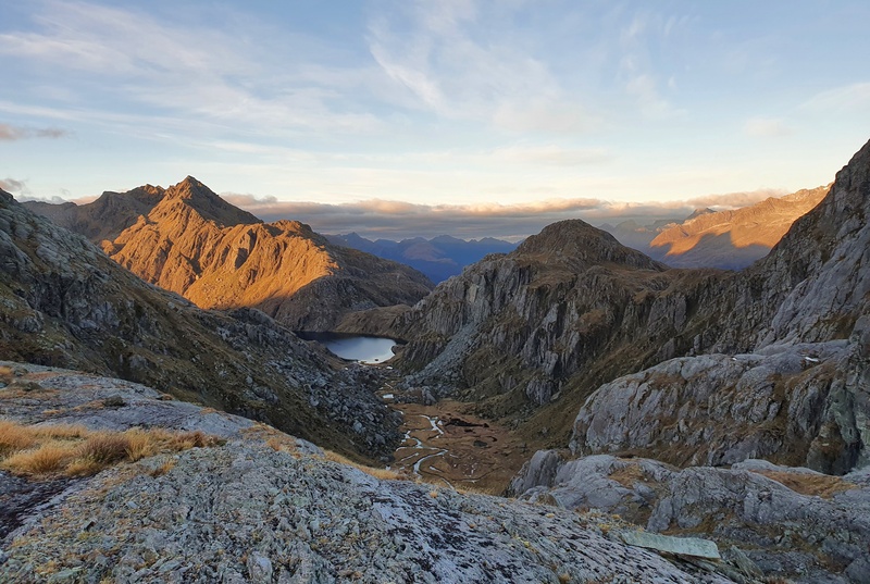
You’ve got a couple of options. It’ll be the easiest to show you in the image below.
We took the green line that veers right which is longer, but less steep. If you do take this option stick to the true right (left if you’re facing it) of the creek where there’s a trail. We went up the other side and it was tough going.
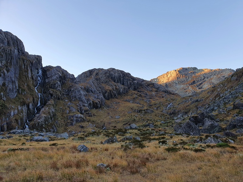
Or you can go the direct line up the steep waterfall route. Only take this route if you’re okay with exposure as there are a couple of slightly technical bits. You’ll follow the true left of the waterfall (right if you’re looking up at the waterfall).
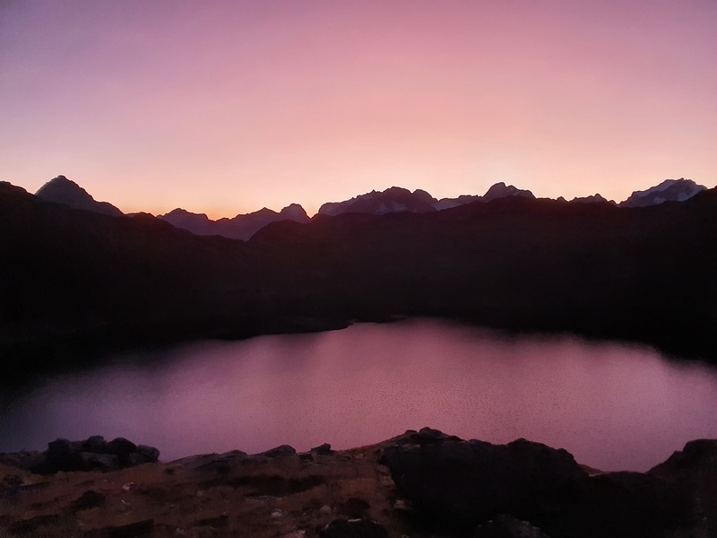
And then boom! We saw Lake Wilson just as the sunset colours were in full force. We were a fair bit above the lake but didn’t want to risk losing complete light getting a campsite next to the lake. There weren’t many flat spots that weren’t under rocks that’s for sure.
We figured it out though, and it was a cold night! But the sunset was lovely in the morning.
You won’t get much early morning sun with Mt Xenicus in the way, but it was fun to explore the rocks around the lake and look back over the Valley of the Trolls.
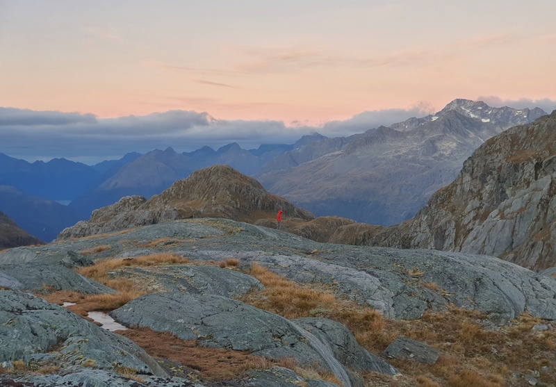
And I want to go back to explore the peaks and ridgelines surrounding Lake Wilson. They look beautiful!
After a couple of hours of hanging out, it was time to head back to Routeburn Shelter the way we came (with a detour to Conical Hill) to complete an epic overnight camping trip.
5. A FEW MORE PHOTOS
Hiking to the Valley of the Trolls and/or Lake Wilson is amazing! It’s not really a practical day trip on its own, but if you can camp there that’s awesome. Alternatively, you can add it to your Routeburn Track hike between Lake MacKenzie Hut and Routeburn Falls Hut.
If you’ve got any questions about heading out here, email jub@churnewzealand.com or leave a comment below and I’ll do my best to help.
RECOMMENDED READING
Amazing Walks in Otago
There’s no shortage of epic trails to explore in this region.
Amazing walks in Glenorchy
Glenorchy is a small settlement close (relatively) to the Routeburn Shelter. Here are a few awesome walks to do after your trolls mission.

Hey, it’s Jub here. I’m the guy behind Chur New Zealand, helping you have the best time hiking, trekking, walking…whatever you want to call it…in NZ. I’m based in Queenstown and am always out and about exploring trails, old & new. If you have any questions, reach out.
Just a quick note to say thanks for a great writeup! Lake Wilson has been on my wishlist for a few years now, and I’m finally doing it next week (fingers crossed this “summer” weather improves)
Wahoo! That’s exciting, Kanika. Thanks for the kind words. You’ll have an amazing time, fingers crossed for proper summer weather.
Chur,
Jub
Hi Chur, Have always enjoyed your articles. This sounds exciting though beyond my solo experience. However I would like to just get down to the lake from Harris Saddle. You said it is 200-300 m from Harris Saddle and there is enough of a track and no risk of falling but then said steep drop to lake if wet. So is track towards lake ok if dry weather only? Or do you have photos of track down?
Hey Maya,
Thanks for reading! Since I’ve written this, the track has become a lot more defined as it’s getting more popular. I wouldn’t want to go if it’s raining, mainly because the views wouldn’t be great (and I’m lucky to be able to choose nice days), but in wet weather (within reason) you can get down easily now.
100% check it out!
Cheers,
Jub
Hey! Thanks for all this info, very helpful! Just wondering, we’re planning on camping in the spots you recommend for two nights- would you know of anywhere we could go out to for a third night that would still allow us to return to the routeburn shelter within a day? Thanks!
Hey Layla, You could consider camping up on top of North Col! Would be a big day hiking, but it’s magical with plenty of spots to put a tent!
Hi Chub how long did it take you
Hey Debs,
I can’t recall, I’ve been a few times though. It’d take me about 4 hours I think, strictly hiking.
Have fun!
Cheers,
Jub
Hi Jub. Great photos. Will definitely have to add this to the list. Can you please provide the GPX file so I can follow it on my Topo50 app? Thanks heaps.
Hey Andrew,
Sorry for the delay..I’m guessing I was too late. Here it is: https://drive.google.com/uc?export=download&id=12IOIuW4wrt2hiuOy8dpTN-UJI7J9_Zvw
Chur,
Jub
Hi, thanks for this great information!
How deep does it get, and any chances to keep your feet dry if you’re careful? I’ll be heading there at the end of next week, and it’s probably going to rain in the days leading to it…
“The area is rather swampy, so depending on the rainfall lately, you might find your feet sinking into the ground”
Thanks!
Hey Alex,
Based on the rain over the last few days, it’s going to be sloppy. It’s not going to rain much over the next few days, so it should be okay…I’d say plan for wet feet, and be stoked if you come out dry.
If you’re going I’d try and sleep up there, I’d go near the lake as it should be a bit drier (though it looks like it’s dry most of this week). It’s going to be cold though, warmest of sleeping bags and all the clothes!
Chur,
Jub