If you’re looking for an off-the-beaten-path hike in the Queenstown area, Atleys Track might be just what you’re looking for.
It’s on the longer end of Queenstown day hikes at 18.2km with over 1100 metres of elevation gain on the loop. But you feel like you’re in the middle of nowhere. Not a 12-minute drive away from the heart of Queenstown!
This post will give you all the details of the Atleys Track, which shares the same trailhead, and part of the trail with Devil’s Creek Track.
Note: The photos in this post are taken from my various hikes/runs on Atleys Track. Not all from the same day. I still feel like the photos here don’t do the track justice!
TABLE OF CONTENTS
1. Atleys Track Details & FAQ
2. Atleys Track Map
3. How To Get To Atleys Track Trailhead
4. My Atleys Track Experience
1. DETAILS ABOUT ATLEYS TRACK DETAILS & FAQ
How hard is Atleys Track?
I’ll go with medium. It’s a decent length with a decent amount of elevation for a day hike. But the navigation is easy, and the majority of the track is on 4WD tracks.
What’s the distance of Atleys Track?
My Strava record came right in at 18.2km kilometres which is about right looking at other people who have also done the track.
How much elevation gain is there on Atleys Track?
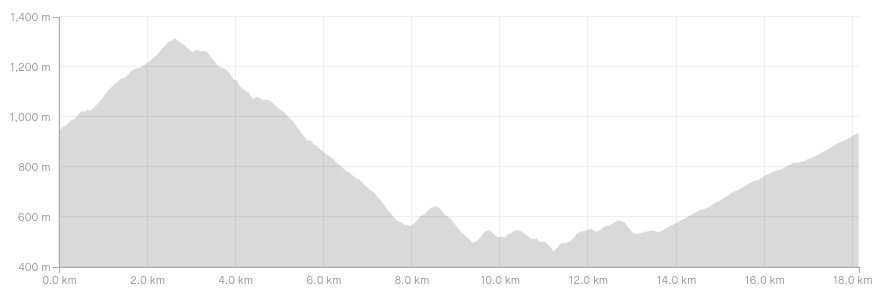
My Strava recording measures 1159 metres. To give this some perspective, the Ben Lomond Track has over 1500 metres of elevation. Here’s the elevation profile going in the clockwise direction:
How much time does the Atleys Track hike take?
The DOC website states 5 to 6 hours which is probably going to be about right for a lot of people once breaks are factored in.
We took 4 hours and 20 minutes, which felt like a solid pace and we only stopped for a 10-minute break at the hut and for a few intermittent photos.
I feel like putting aside 5 to 6 hours is going to be a good idea.
What’s the best direction to walk the Atleys Track?
I think clockwise is best. You’ve got a steep hike up to Mt Dewar to start, but it does mean you don’t have the really long hill to go up to Mt Dewar in the other direction. And coming down the other side in the clockwise direction means you get a better chance to see all the mountains surrounding you.
Can you stay overnight at Atleys Terrace Hut?
You sure can. It’s a small, not so glamourous historic 2 bunk hut. Even in the summer you’d have to be pretty unlucky to stay there when others are. But you might want to bring a tent with you just in case.
Is there internet reception on the track?
You’ll be able to get at least a weak cellphone signal on most of the track.
Is there water on the trail to fill up my bottles?
Not really! I don’t think the hut had a water source, and other than one small stream at about the 11km mark, there was no other source. Make sure to bring plenty of your own.
2. ATLEYS TRACK MAP
Clicking on the image below will open the map on www.topomap.co.nz.
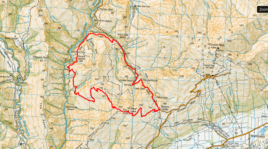
The track is not available on Maps.me or Google Maps, but it is on the NZTopo50S app which is one of the best hiking apps you need in NZ.
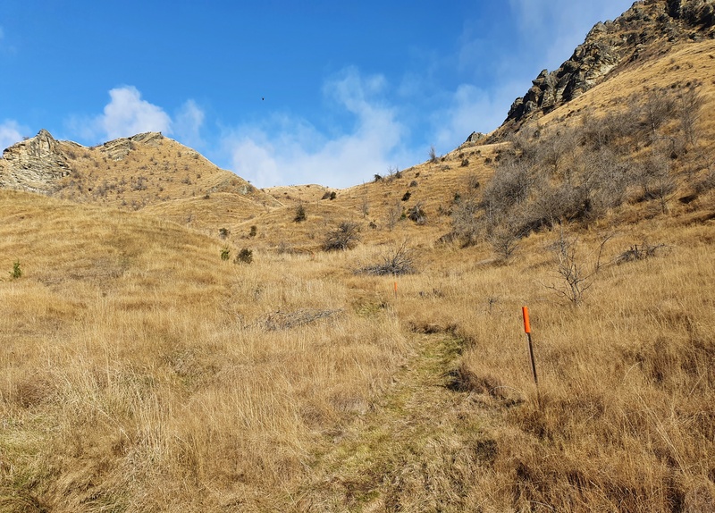
The track is easy to follow. In saying that, I did like having the topo app while on the hike to see what the ranges we were looking at are called. There is a sign on the track that will point many of them out.
3. HOW TO GET TO ATLEYS TRACK TRAILHEAD
The Atleys Track begins at Skippers Saddle where there’s a gravel car park with plenty of space.
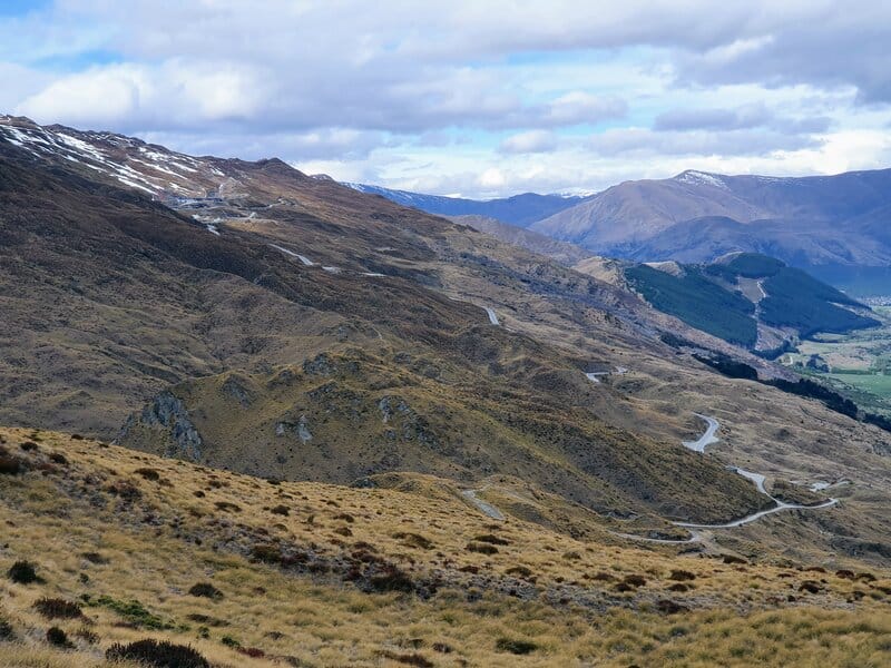
The easiest way to get there is via car. It’s a steady drive up the Coronet Peak Road, but most cars will make it no worries (it’s easier than driving up The Remarkables Road to get to the Lake Alta Track).
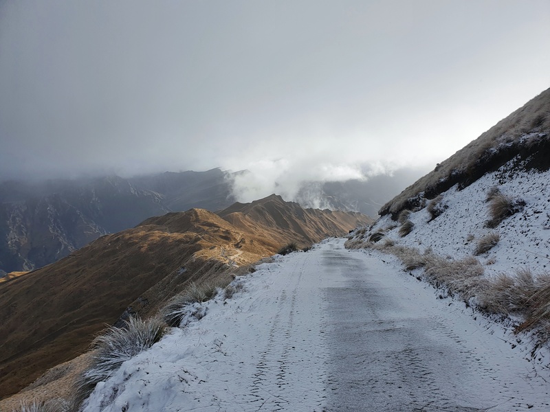
In the winter the road may be closed, or chains might be required. There’s a large board at the bottom of the road letting you know what the status of the road is.
The other option is to get the #2 bus to Arthurs Point (runs hourly during the day and half hourly during peak times). Get off at the last bus stop close to Cargo Brewery. You could walk the 6km to the start of the hike, or it’s usually an easy hitchhike up the road.
RELATED POST: HOW TO GET AROUND QUEENSTOWN
4. MY ATLEYS TRACK EXPERIENCE
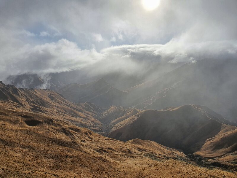
I’ve been on the Atleys Track a few times now, and love it every time. And I’ve seen it in a variety of weather conditions.
The perfect combination is to get a sunny day after some lower-reaching snowfall. That way you can get to walk in the snow which is always fun, yet get great views, particularly from the Dewar summit.
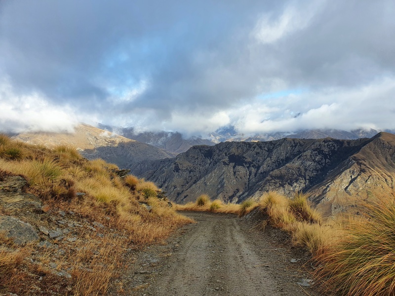
Starting from the car park, there’s no messing around as you begin the 2.6km long incline to the Mt Dewar summit. In that 2.6km you climb a little over 300 metres, but the ascent is fairly steady with no insanely steep sections…it’s a 4WD track after all.
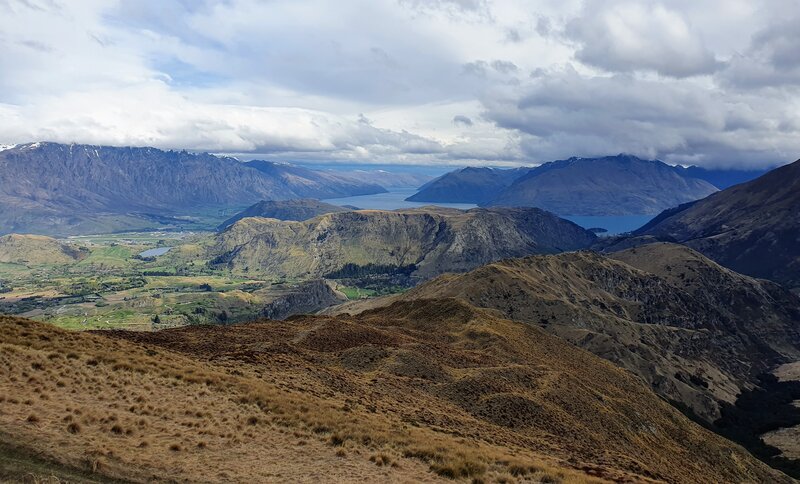
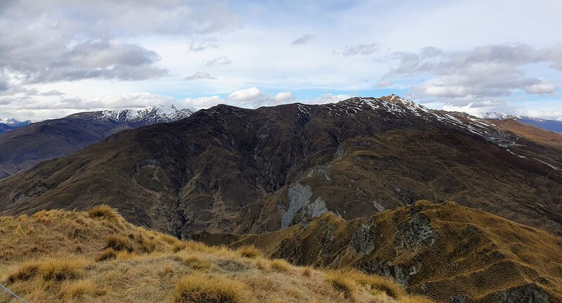
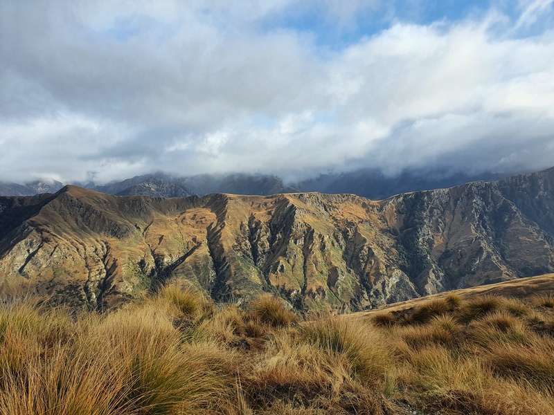
From the outset, you get great views over the Wakatipu Basin, towards the Remarkables and Lake Wakatipu comes into view. But the best view is from the summit, where there’s a small trig. You get some panoramic views all the way around, I love seeing Coronet Peak Road from here.
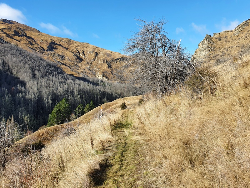
Heading down from the summit, you follow the track a bit longer before the track splits off from Devils Creek Track. It’s well signposted so you won’t miss it. From here, it’s a steady descent for a couple of kilometres.
The views are awesome (you can see the Moonlight Track at points) as you move along and try to work out what’s what…at least I did.
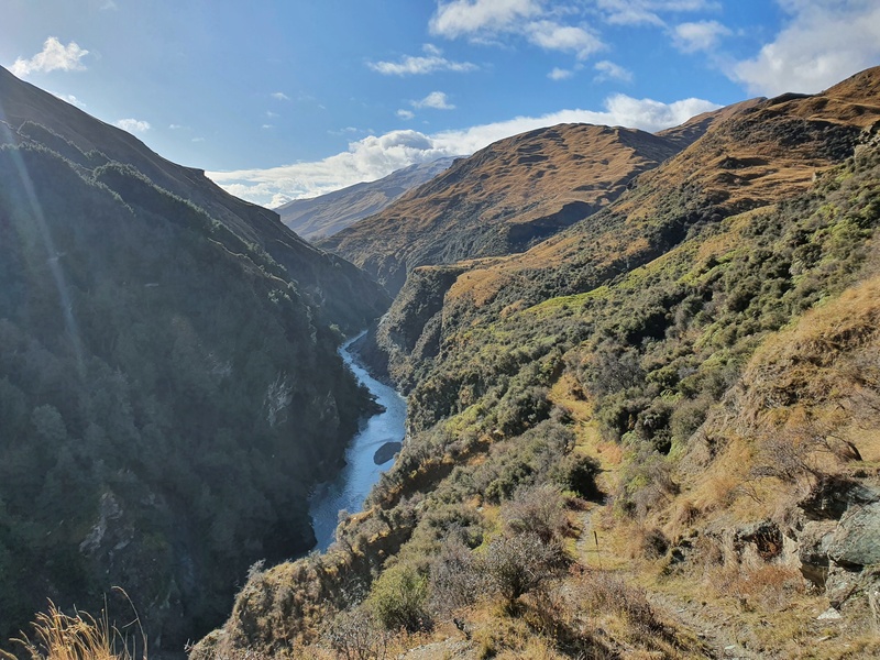
You then hit some switchbacks before you start to close in on the Shotover River. You won’t see many people out here, despite it being a mountain bike track. All I heard on my last hike were helicopters and distant calls of goats.
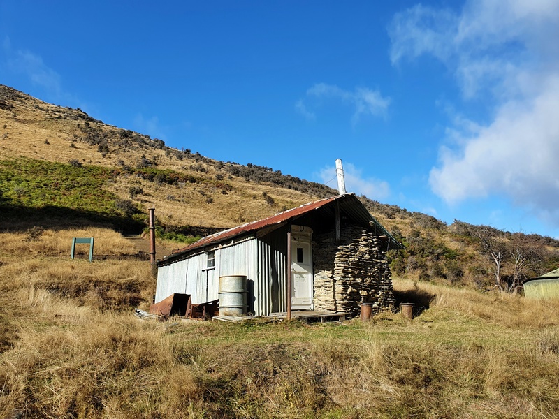
Continuing down the hill, out of nowhere pops Atley Terrace Hut. It’s an old historic hut you should pop your head into. I do think there are better huts to stay in overnight near Queenstown, but I’ll hopefully stay here one night.
The hut is about 9.4km into the hike, essentially halfway.
It’s worth a look around and a good time to have a break. Head over towards the river as well to see it flowing down below.
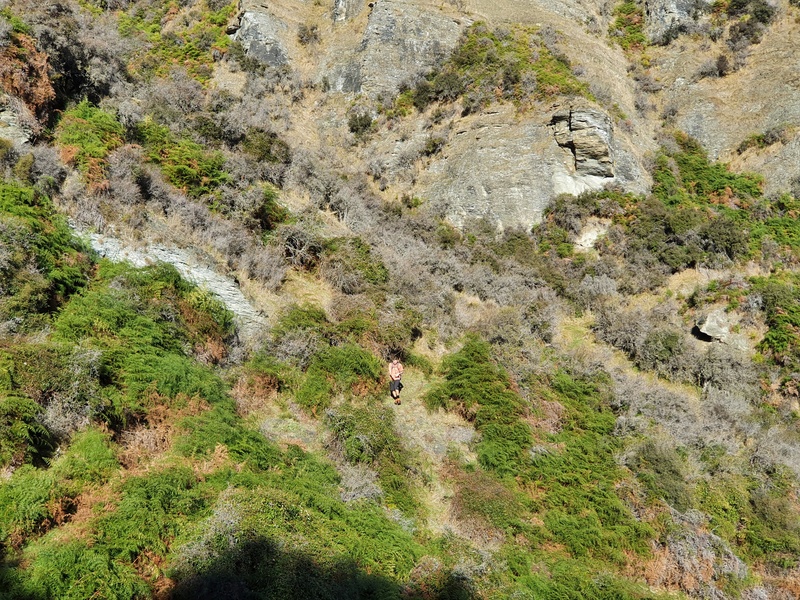
Leaving the hut you’ll be following the Shotover River from above for the next 2km. And you’ll say goodbye to the 4WD track for a bit. Hello single trail. There are a couple of slightly tricky bits, but it’s more the tracks kind of washed away more than anything. There are some orange markers along this section, but again you won’t get lost.
Eventually the track diverts away from the river, and you’ll then close in on Skippers Road which you can see from afar. Then out of nowhere, you’ll be on the Skippers Road.
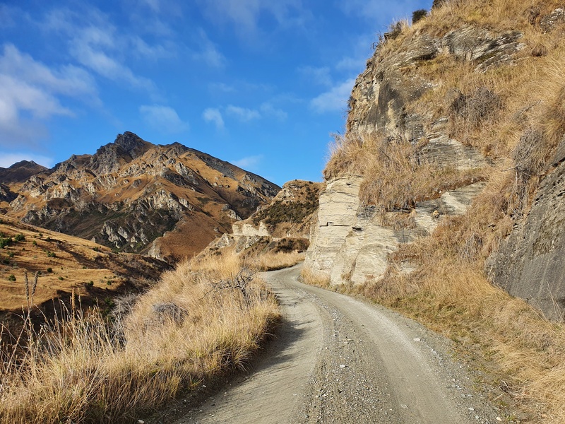
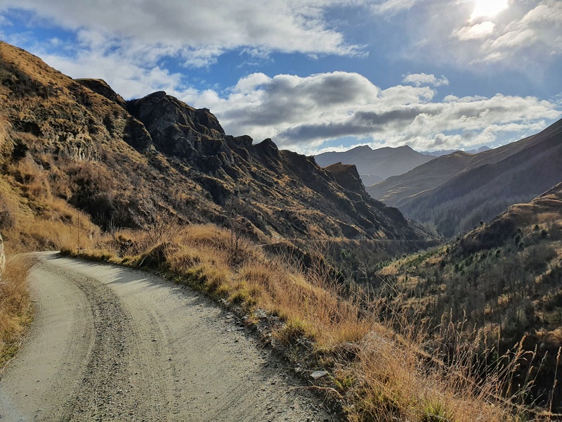
From here, it’s about 5km up the road at a steady ascent. But you’re back on a 4WD track again, so you can just keep chugging away and make reasonably quick ground. It’s a sneaky beautiful walk too (as is the drive) with some awesome rock formations.
That said if you’re battling away, you might get lucky and be able to hitch a ride up the hill. Or you might want to do the 2 car system.
Atleys Track is an awesome hike that gives you some different views than you won’t see in many other places around Queenstown. The Skippers Canyon area is a goodie.
If you’ve got any questions about hiking Atleys Track, email jub@churnewzealand.com or leave a comment below.
WHAT TO READ NEXT:

Hey, it’s Jub here. I’m the guy behind Chur New Zealand, helping you have the best time hiking, trekking, walking…whatever you want to call it…in NZ. I’m based in Queenstown and am always out and about exploring trails, old & new. If you have any questions, reach out.