The Lake Alta Track is a short 3.5 to 4km out and back walk that more or less anyone can do (including dogs).
You’ll get some awesome views on the drive to the trail, and the reward at the end of the hike is a beautiful glacial lake, Lake Alta.
This post will give you all the details you need to know about the Lake Alta walk.
Note: For reference, the photos in this post were taken at the end of May.
TABLE OF CONTENTS
1. Lake Alta Track Details & FAQ
2. Lake Alta Walk Map
3. How To Get There
4. My Lake Alta Walk Experience
1. LAKE ALTA TRACK DETAILS & FAQ
How hard is the walk to Lake Alta?
Easy to medium. If you’ve got a nice day in the middle of summer, it’s an easy walk to the lake. In the shoulder seasons (and winter), the snow can make the walk a little bit trickier in some spots.
In the winter, you can technically still do the walk, but with lots of snowboarders and skiers using the skifield, it’s not really advisable.
If you’re looking for the hard way to get to the lake in summer, check out the Wye Creek to Lake Alta route or the circuit around Queens Drive – Wye Creek.
How far is the Lake Alta Track?
If you’re walking from the car park straight to Lake Alta and back, you’ll end up with somewhere between 3.5 and 4km of walking. My Strava said 3.5km, but I missed a bit when I forgot to restart the watch. You can walk around the lake for a while, so you’ll probably end up around 4km or so max.
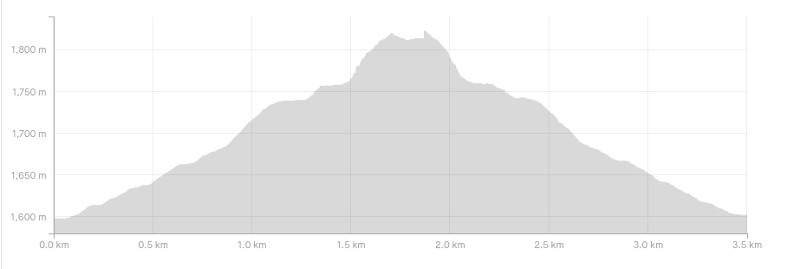
How much uphill is there on the Lake Alta Track?
My recording gave 230 metres of elevation gain, more or less all on the way to Lake Alta. Here’s the elevation profile:
How long does the Lake Alta walk take?
Of course, this will vary from person to person. But we spent about 1 hour 45 minutes in total, walking from the car park to the lake and back. And spend some time at the lake.
You can do the journey in less than this, but for most, I’d allocate 1.5 to 2.5 hours (not including transport) which gives you ample time to enjoy the lake.
Is the Lake Alta hike free to do?
Yes, the hike to the lake itself is free. But you’ll need to pay $10 to drive up the road. Details are further below in the post.
RELATED: ALL THE LAKES NEAR QUEENSTOWN ARE FREE TO VISIT, THOUGH SOME TAKE A GOOD HIKE TO REACH
Are dogs allowed on the Lake Alta walk?
They are. But please please please pick up their poop!
How cold is it up there? What should I take?
The weather can be super variable up here, from day to day, even hour to hour. I assume most people are going to be driving up to do the walk, in which case you can pack for all conditions. If you’re going when there’s snow up there, bring sunnies!
Shoe-wise, it’s a short walk so you can get away with anything really. On my last walk to Lake Alta when there was a little bit of snow, I saw people in everything from Converses to Mountaineering Boots. Me? Trail shoes, as always.
What will the conditions be like?
If you look at The Remarkables from Queenstown, you can get a rough idea, but it’s best to check out the website for conditions up at the ski field itself as they can be deceptive. This page gives you a weather report, and you can check the webcams to see the conditions for yourself (scroll down).
Is there internet reception there?
Yes, which is kind of annoying 😉 I did have reception next to Lake Alta (I use Skinny mobile).
2. LAKE ALTA WALK MAP
If you click on the map below, it’ll open in a new window.
As you can see, the Lake Alta track snakes through the Remarkables ski field. You can view he track on Google Maps, and it’s also on Maps.me.
That said, it’s a fairly straightforward hike. But I would download maps.me, in case you somehow get super lost.
RELATED: MY FAVOURITE APPS FOR HIKING IN NZ
3. HOW TO GET THERE
The Lake Alta hike starts from the Remarkables Ski Field car park. You can get there a few ways.
DRIVING
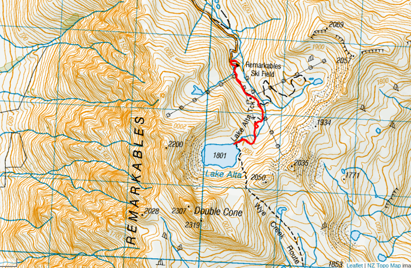
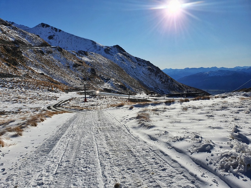
Most people are going to drive there via the stunning Remarkables Ski Field Access Road. It’s about 23km from Queenstown to the car park via Frankton.
The road isn’t for the faint-hearted, gaining 1500 metres in 13km or so. But the views on the way up are stunning and there are several places where you can pull over to look out at them (they’re signposted)!
This road isn’t for a car that has seen better days though. I went up with some friends once, and his backpacker-esque was overheating by the time we got to the top. It wasn’t pretty.
And if you’re going in the winter, snow chains are advisable, and sometimes must be put on to gain access to the road.
Access to the road over the summer months is also $10/vehicle. This seems silly, but it’s a private road, so they can charge this. They accept EFTPOS only, not cash.
GUIDED TOUR
With Alpine Luxury Tours
This guided tour might work for you if you’re not confident driving up the road (or would rather take in the views as a passenger). You’ll get the benefits of commentary from a guide to fill you in about the area too. And you get snacks! Enquire about booking here (available October to April).
With NZ Shred
If you’re looking for a unique experience, you can take a tour with a guide from NZ Shred and once you reach Lake Alta, go stand up paddleboarding on the lake. You can learn more about the tour here.
SHUTTLE BUS
In the winter months, you can book a ticket on one of the ski buses up the hill. You can book them here, starting from $20 for adults(under 7’s are free). But remember, it’s not a practical walk to do in the winter.
HITCHHIKING
This is easiest in the ski season when more people are going up, but you can hitchhike from the bottom of the access road to the summit relatively easily.
RELATED: HITCHHIKING IN QUEENSTOWN
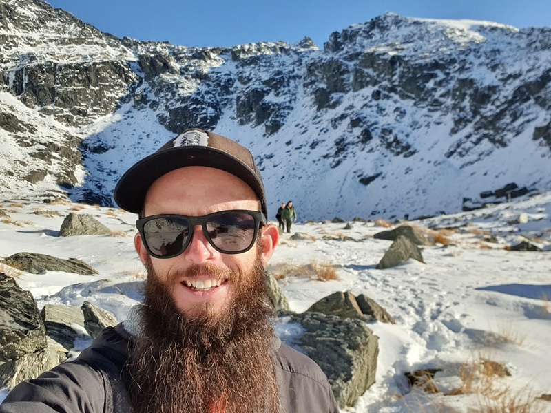
4. MY LAKE ALTA WALK EXPERIENCE
the Lake Alta Track is one of those that seems to me that it’s a lot of effort to go for a 4km walk. But it’s awesome.
The views on the drive are stunning. On the way up you get the best views from the left-hand side of the car, and on the right-hand side on the way back down.
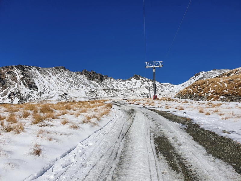
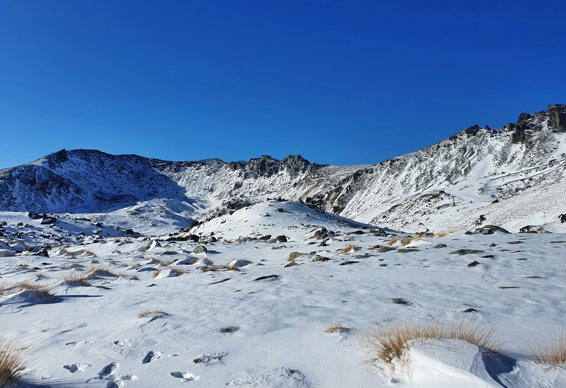
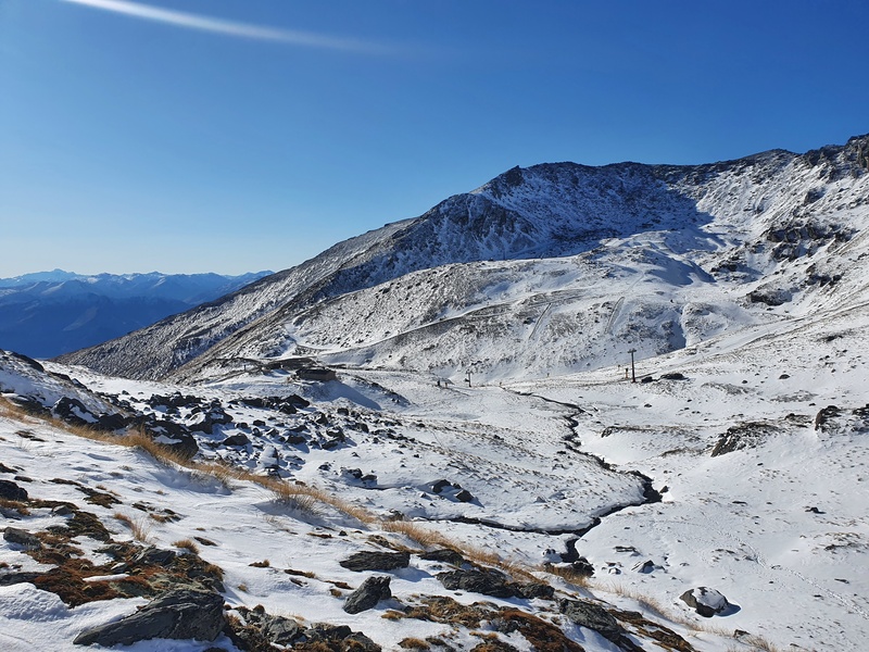
Once you get to the car park, there’s no information about the track as such. You’ll see the buildings from the car park, walk around them and you’ll see a gravel road leading up the ski field next to the chair lifts. This is what you need to follow.
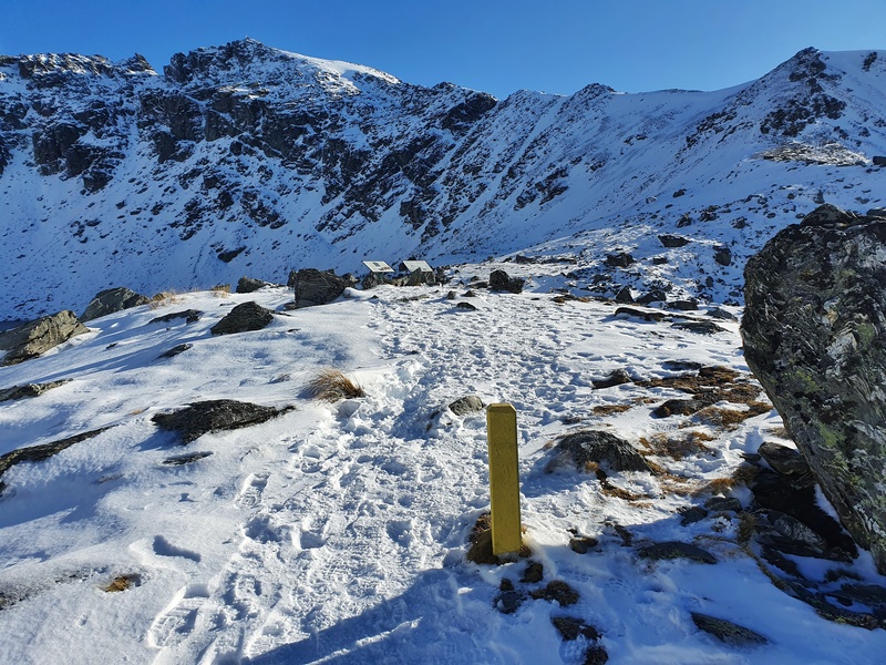
Then there’s enough of a trail that you can work out where to go until you eventually see some yellow posts, and circular signs marking the track.
The incline starts right away, but it’s fairly steady the whole way with only a couple of short steep sections broken up with some flat spots.
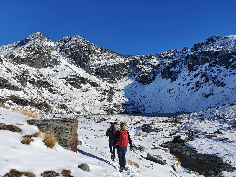
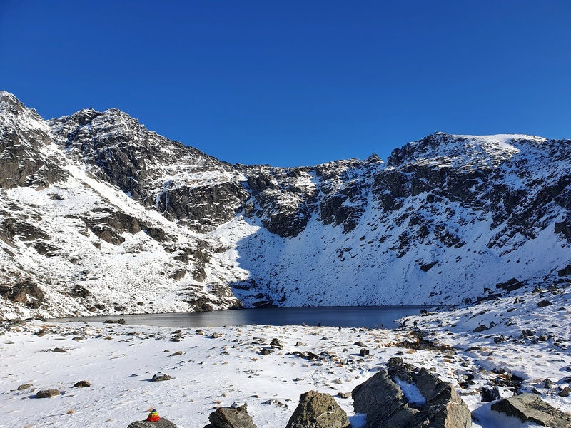
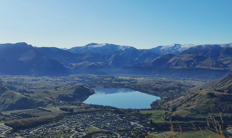
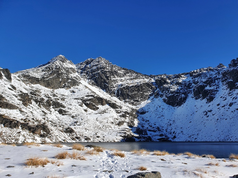
You won’t see the lake come into view until you’re at a little viewing point about 100 metres from the lake.
It’s awesome though, you get to look up at Double Cone (2319 metres). Perhaps you want to give the Grand Traverse a go sometime?
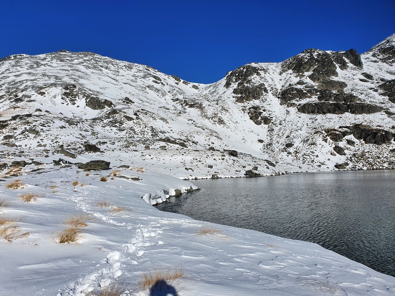
And then at the lake, it’s time to enjoy. Yes, you can swim in Lake Alta, 1801 metres above sea level, but it’s a bit cold for me 😀 In the winter the lake does freeze over too and people ski on it. Apparently people ice skate on there sometimes… which sounds fun.
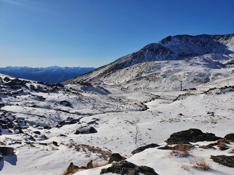
Anyway, after exploring the lake it’s time to head back the way you came and back to Queenstown for your next activity. And while it’s an out and back, the area is so beautiful it’s not one of those return walks you can sometimes dread.
The Lake Alta Track is a nifty little track that has the benefits of having a truly stunning drive to the trailhead.
If you haven’t experienced a glacial lake before and/or love scenic drives (the road to Glenorchy is scenic too), visit Lake Alta.
If you’ve got any questions, leave a comment below or email jub@churnewzealand.com
Here’s a few more photos to finish:

Hey, it’s Jub here. I’m the guy behind Chur New Zealand, helping you have the best time hiking, trekking, walking…whatever you want to call it…in NZ. I’m based in Queenstown and am always out and about exploring trails, old & new. If you have any questions, reach out.