If you’re looking to explore the Remarkables in a different way, and are comfortable with navigating and some exposure, consider hiking around the Queen’s Drive – Wye Creek Circuit starting at the Remarkables Ski Field carpark.
Note: Unless you have the right experience this route should only be done in the late summer/autumn months when there’s no snow/ice on the route.
This post will give you everything you need to know about completing the Queens Drive Wye Creek circuit the way I completed it. You can download the GPX file here.
TABLE OF CONTENTS
1. Queens Drive Wye Creek Circuit Details
2. Queens Drive Wye Creek Map
3. How To Get To The Trailhead
4. My Queens Drive Wye Creek Review
1. DETAILS ABOUT THE QUEENS DRIVE WYE CREEK CIRCUIT
How hard is the Queen’s Drive – Wye Creek Circuit?
It’s definitely on the harder side for most people. It requires some off-route navigation, being comfortable with exposure, and navigating over tough terrain.
And as mentioned earlier, this is a route only those with appropriate experience should attempt in icy/snow conditions.
It’s a lot shorter than the Wye Creek to Lake Alta Track, but a lot more experience an technical terrain is involved.
What distance is the route?
There are a couple of different routes you can take to complete the circuit. If you take a look at the circuit on WildThings.club, it’s 11.7km, but as I was short on time, I took a shorter route which was 9.3km.
I’ll focus on the shorter route as that’s what I’ve had experience with.
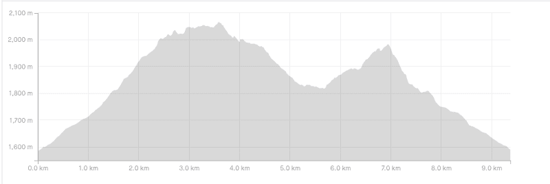
What is the elevation gain of the Queen’s Drive Wye Creek route?
The shorter route has about 720 metres of elevation gain.
You can see the elevation profile here:
How long does it take to hike the circuit?
When I did the hike we were short on time so kept moving consistently. It took us 3 hours and 25 minutes in total. You could do it slightly faster if you wanted, but for people who aren’t too experienced hopping over boulders and want to check their navigation consistently, I’d suggest up to 6 hours. Especially with a couple of picnic stops on the way.
If you’re starting the track with less than 6 hours of daylight, take a headtorch just in case it takes you longer than predicted.
2. QUEENS DRIVE WYE CREEK CIRCUIT MAP
*When you click on the map below, it’ll open in a new window on TopoMap.co.nz.
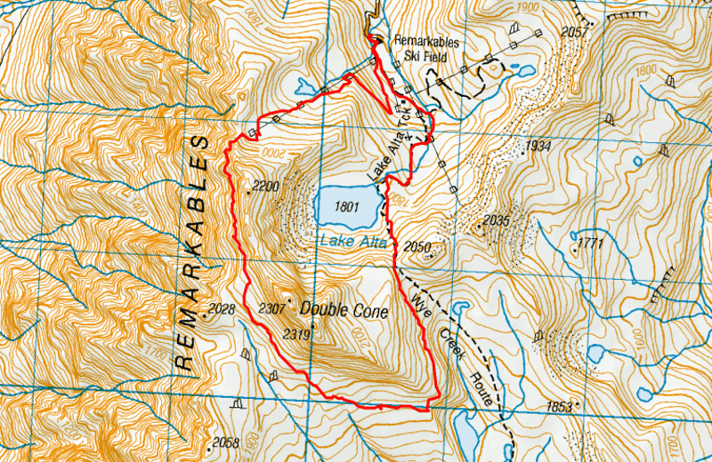
You won’t find this route available on Google Maps and/or Maps.me so make sure you download the GPX file and load it onto a good topo map app.
3. HOW TO GET THERE
The Remarkables car park is accessed via the ski field road just to the south of Queenstown. The easiest way to get there is via car in the summer months (during the ski season you can try and book a ski bus – but again, this route is for experienced persons only).
In the summer, you need to pay $10 to access the road which is payable by debit/credit card.
You can also hire shuttles to the top, although not all shuttles will take you to the carpark due to the steep road.
You can find the carpark here on Google Maps.
4. MY QUEENS DRIVE WYE CREEK CIRCUIT EXPERIENCE
It was a beautiful day when I finally got a friend to join me to give the full circuit an attempt. I’d been to the Queens Drive Viewpoint a couple of times but was excited to see what the full circuit entailed.
The hike starts off passing the base building, and rather than following the signs to the left for the Lake Alta track, you’ll take the 4WD road on the right that leads to the top of the Shadow Basin ski lift. You can follow the road all the way up, but we decided to veer off at some point and take the more direct route before rejoining the road up ahead. Keep an eye on the GPX route and you’ll be good as gold.
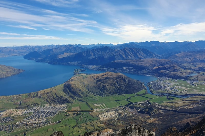
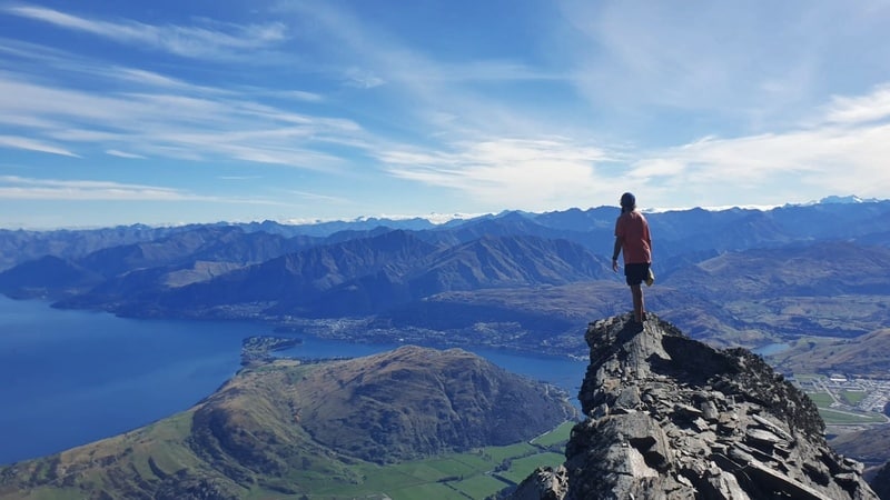
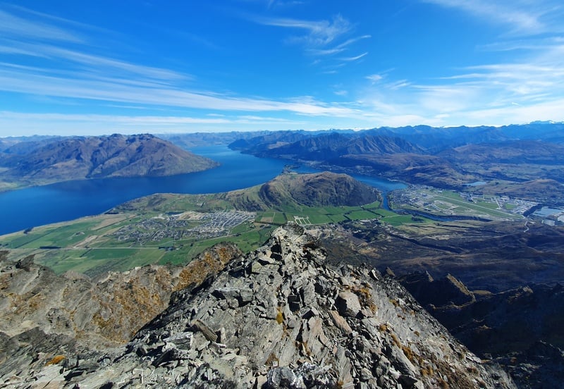
At the top of the ski lift, there’s an arrow on the ground that’s made of rocks but is hard to see. You need to continue past the lift where you’ll join a path for ~300 metres that takes you to the Queens Drive viewpoint. Even if you turn around at this point, you can’t argue about the views. So good!
Rhe trail around the front of the mountain can be hard to spot. BUta there are semblance of tracks that go up to a lip on your left, it’s not the most sturdy-looking trail but it’s solid. Again, follow the GOX file and you should be good.
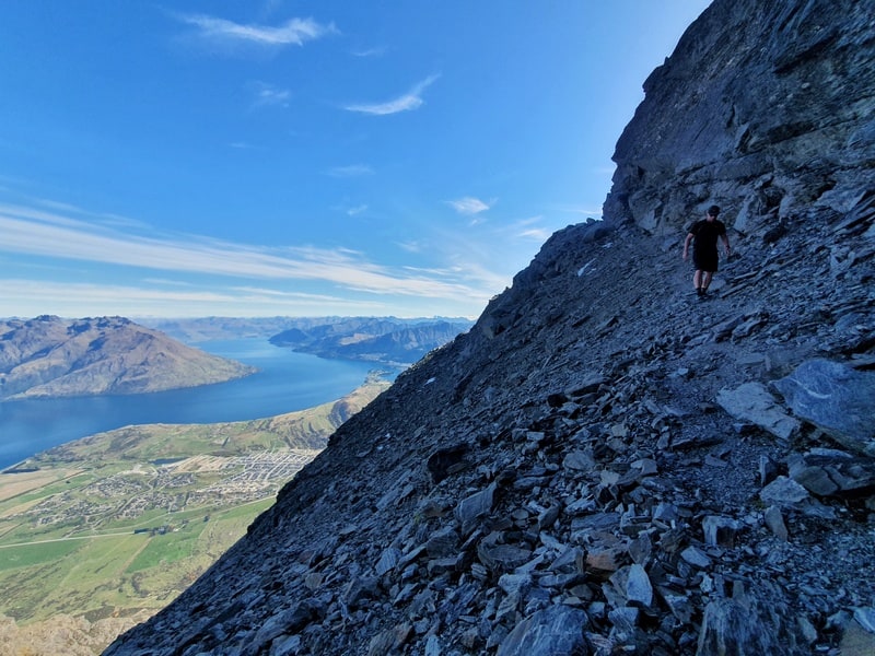
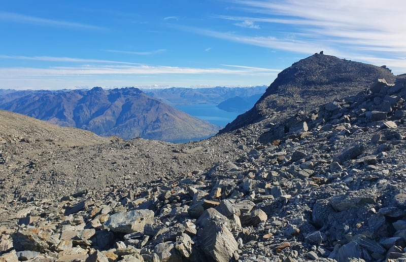
Once you get to the top of the next rise, you’ll see more of a track following the mountain around. It’s definitely a single track and you’ll want to concentrate. If you aren’t great with exposure, you’ll quickly find out. There’ll be little sections of rocks that jut out you can walk out onto and take in the view…be careful etc of course.
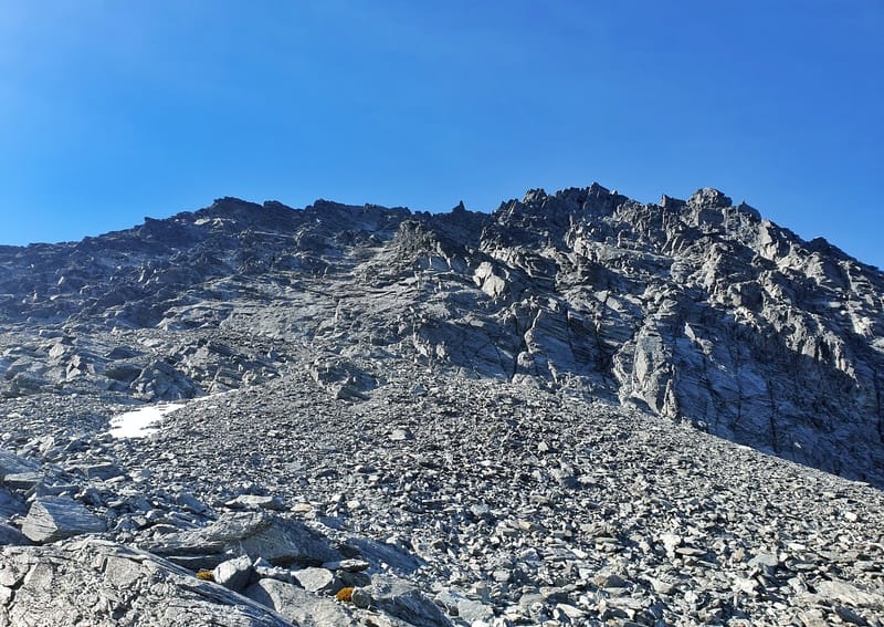
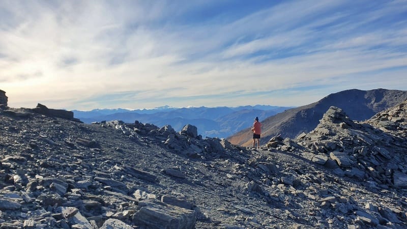
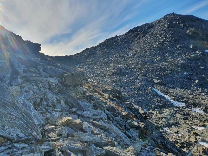
After walking for about 3.6km from the start, you’ll suddenly find yourself hopping boulders. The route isn’t marked, so we decided to just hop along as best we could trying to keep as close to the GPX file as we could. We definitely veered off it at times as it’s more of a ‘choose your best line’ and go with it.
Luckily we didn’t come across any ice, but definitely saw some further up the mountain.
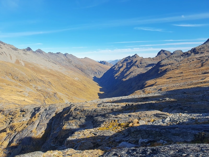
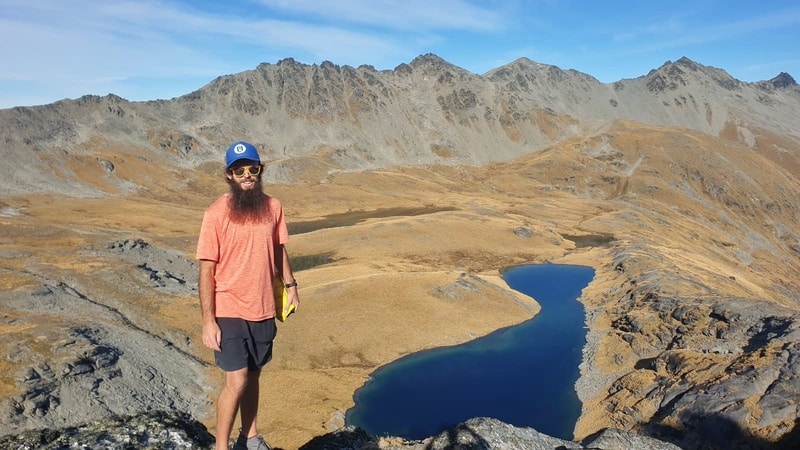
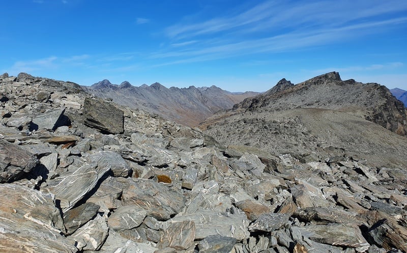
The views over the Wye Valley are pretty awesome, and you’ll know you’re making good progress when the tarns come into play.
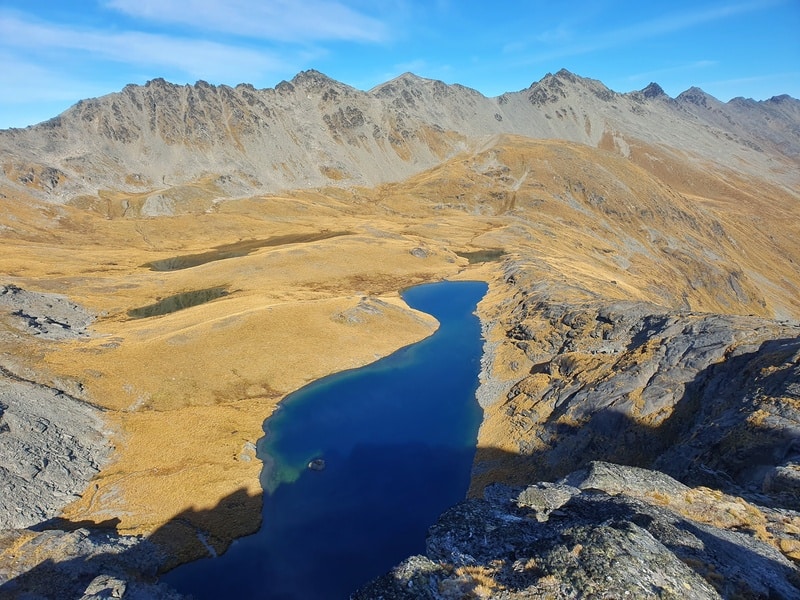
We got a good view of the tarns, then turned back to go up and around the big drop off down to them. It wasn’t long before we could see the saddle that takes you over into Wye Creek. That was great as it gave us a good bearing of where we were. We didn’t drop down below the saddle until we felt like we had too which was only a couple of hundred metres away.
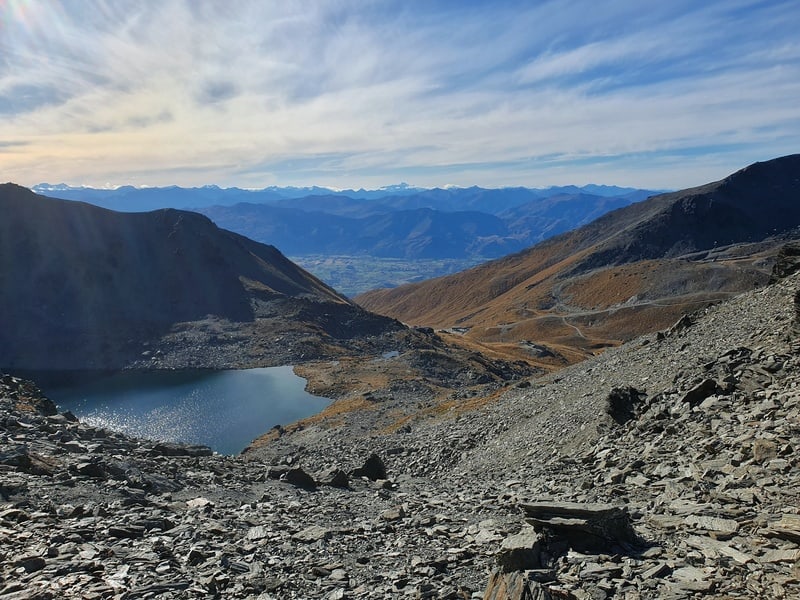
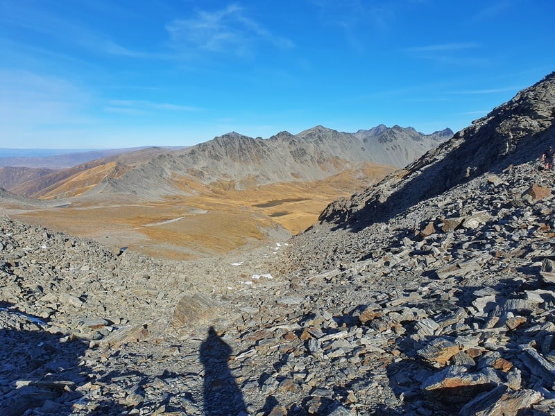
Once you reach the saddle, you’re on the home stretch. Take in the views of Lak Alta and the mountains rising up above…people ski down lots of the shoots! Crazy.
Now you’ve just got to pick your way down to the lake…there are tracks but I seem to lose them everytime! My mate had no issues. Once at the Lake, it’s time to join the Lake Alta track to the carpark.
There are views to appreciate throughout this whole hike. SO GOOD.
This is a tough hike and really does need to be done in the right conditions. And it’s not a hike you should do as your first hike that’s for sure.
But if you’re trying to learn how to navigate away from DOC tracks then this is a solid option.
If you’ve got any questions and/or comments about this hike, email jub@churnewzealand.com.

Hey, it’s Jub here. I’m the guy behind Chur New Zealand, helping you have the best time hiking, trekking, walking…whatever you want to call it…in NZ. I’m based in Queenstown and am always out and about exploring trails, old & new. If you have any questions, reach out.