The 15km Devils Creek Track isn’t the most popular walk in the area, but it’s gorgeous!
The location is one of the reasons it doesn’t get a lot of love, and well, there are so many amazing walks in Queenstown some will simply draw the short straw. That’s not a bad thing though 🙂
This post will give the Devils Track some love, with everything you need to know to have a great time on the Devils Creek Track.
Alternatively, you might want to look into Atleys Track which shares some of the track, and the same trailhead.
Note: The DOC website for this route says it’s 8km long. For the full loop, it’s about 15km…I’m assuming you’re not getting a helicopter to drop you off/pick you up 😉
TABLE OF CONTENTS
1. Details About The Devils Creek Track
2. Devils Creek Track Map
3. How To Get To The Trailhead
4. My Devils Creek Track Experience
1. DETAILS ABOUT THE DEVILS CREEK TRACK
Difficulty1: Medium. If it was a longer track it’d be tough, but the terrain, while hilly isn’t technical.
Hike Distance2: ~15km based on my Strava data (I used a couple of records to verify this).
Elevation Gain3: In total there’s between 950 and 1000 metres of elevation.
You can see the elevation profile here, starting from this point on Coronet Peak Road below (anti-clockwise):
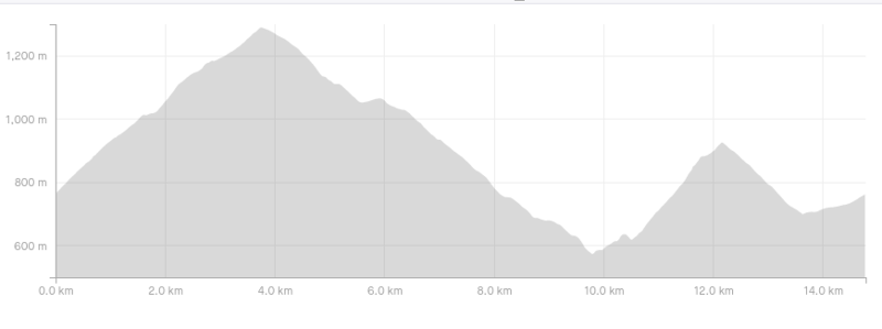
Hike Duration4: It’ll take most people between 3 and 5 hours to complete the hike. The walk up to Mt Dewar can be a real-time killer, so you’re probably best to tackle that section at the start of the hike. Hiking to the summit of Mount Dewar and ack is a great hike in it’s own right.
Quick tip: There’s minimal water on the track, so make sure to bring plenty with you.
Quick tip #2: This walk is best done in the anti-clockwise direction.
2. DEVILS CREEK TRACK MAP
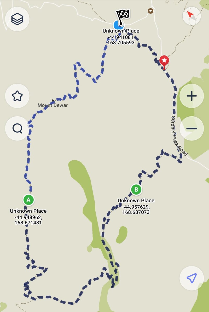
The track isn’t on Google Maps, but is on maps.me (that’s a screenshot from there above) and topomap.co.nz.
You shouldn’t need a map for the track as long as you’ve looked at the rough route beforehand. That said, downloading maps.me is never a bad thing for the offline maps feature.
3. HOW TO GET TO THE TRAILHEAD
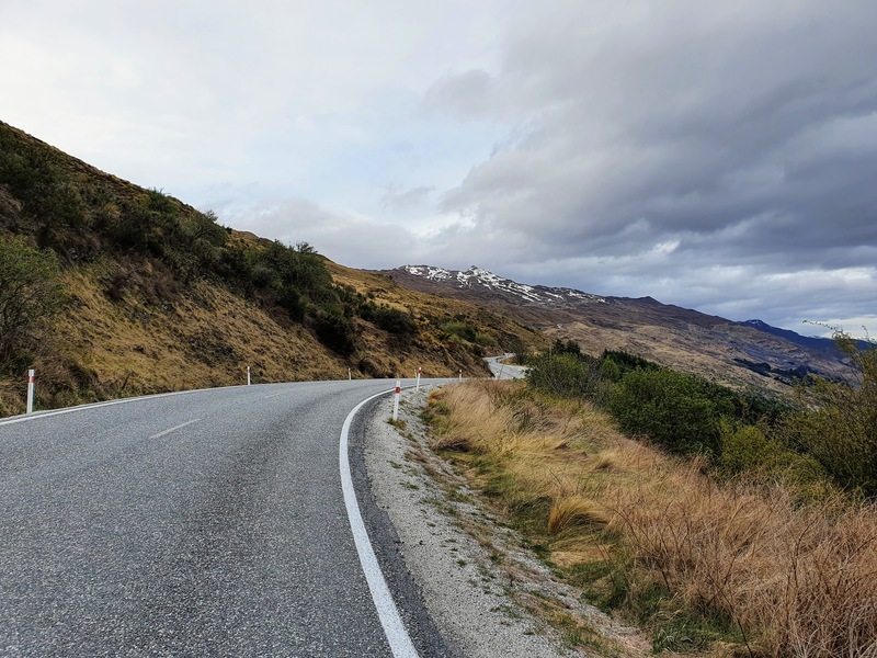
The easiest way to reach the Devils Creek Track is by car. Despite being up Coronet Peak Road, pretty much all cars, (except those that absolutely hate hills), should be good to go.
The other option to get there from Queenstown is to catch the public bus (#2) to Arthurs Point and get off at the last stop. From there you can walk to the start of the track, or hitchhike from the Coronet Peak Road turnoff (easy).
RELATED POST: HOW TO GET AROUND QUEENSTOWN
4. MY DEVILS CREEK TRACK EXPERIENCE
I’ve been around the Devils Creek Track a few times now. I’ll give a general trip report, it’ll be concise based on starting from the Skippers Saddle parking area (here on Google Maps).
Crossing the stile, you’ve got the steep section of the walk right away up to Mount Dewar. It’s a pretty well-maintained track, so other than being steep you won’t have any issues with the technicality of the track.
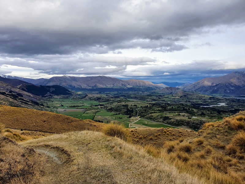
It’s about 350 metres of incline in 2.6km from the car park, but you’ll be distracted by the views of the Wakatipu Basin not long after you’ve got started. That’s ideal.
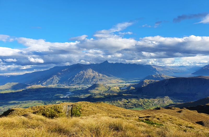
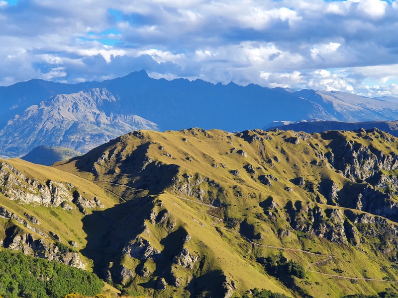
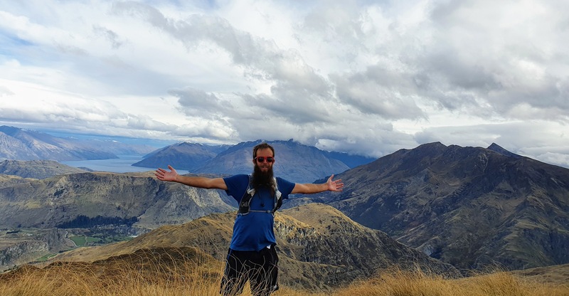
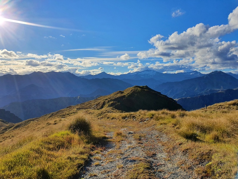
To get to the true summit of Mount Dewar (there’s the big radio station thing) you’ll need to detour off the main route for a little bit to reach the trig…make sure you do for the best panoramic views.
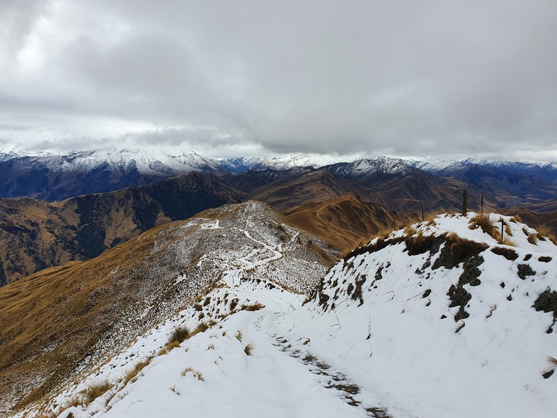
And then the descent begins. I did this once at the start of winter after the first good dump of snow, and it was pretty slippery going down!
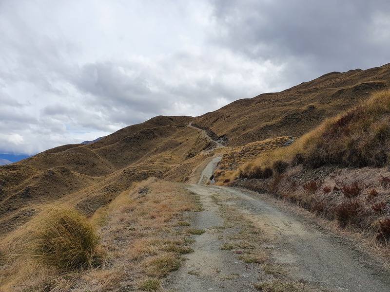
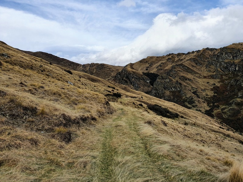
But when there’s no snow, you’ll be cruising down 4WD tracks that area pretty easy to follow (they can get a little overgrown in summer) as you plunge down the hill.
This is a cool descent, and I don’t really notice the switchbacks, they’re not true switchbacks I guess. And you get to see different angles of the surrounding hillsides which keeps me happy. You might well startle some sheep along the way too.
On my last visit (December 2021) there was a digger that had started to make the 4WD track wider… which could make the track a lot easier if that continues (what a cool job site that’d be).
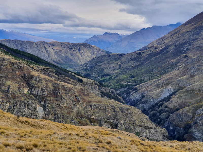
Eventually, you’ll hit the bottom of the valley where there’s a small creek (this is Devils Creek) to hop across (you should be sweet to keep your feet dry). And from there you’ve got a steady climb up to a pass.
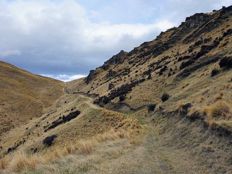
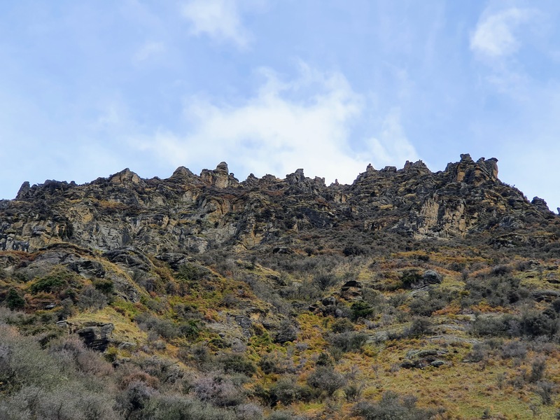
I find this hill a grind but you pass some cool rocks, and you’ll have seen the track you’re now walking on earlier in the hike which is always fun.
Once you get to the pass you can see the Wakatipu Basin again as you make the steady descent down to Coronet Peak Road (make sure to follow a couple of signs along the way).
From here you’ve got a slog back up Coronet Peak Road. THat’s not ideal, but you’ve got a couple of options if you want to avoid this. You could take two cars up to start and park one at each end of the road, or simply hitchhike up the hill when you can…hitching in Queenstown is easy.
Afterwards, spend some time doing some of the fun activities in Arthurs Point, or head to any one of the awesome breweries in Queenstown.
I hope this post helps you plan your hike around the Devils Creek Track. If you’ve got any questions etc., let me know in the comments below or email jub@churnewzealand.com .
Have fun!
OTHER AWESOME WALKS NEARBY
THE CORONET PEAK HIKING TRAIL
THE MOONLIGHT TRACK

Hey, it’s Jub here. I’m the guy behind Chur New Zealand, helping you have the best time hiking, trekking, walking…whatever you want to call it…in NZ. I’m based in Queenstown and am always out and about exploring trails, old & new. If you have any questions, reach out.