If you’re looking for a challenging off-the-beaten-path hike near Queenstown, the summit of Mount Crichton (I sometimes see it spelled Mount Creighton) should be on the shortlist.
There are various routes to take to reach the 1870 metre peak. But one thing is for sure, this is a hike you should only do in summer, and when the weather is looking good all day.
Note: I’ll be talking about going to the Mount Crichton summit from the Sam Summers car park (here) and returning the same way. I used to think going down to the Avalanche Creek car park (here) after the summit was best, but it’s not a fun descent. Check out the comment from Peter at the bottom of the post, you may like to try that route!
This post will get into the details about hiking to the summit of Mount Creighton. And no, it’s not the Mount Crichton Loop Track. That’s a lovely hike you can do all year round.
TABLE OF CONTENTS
1. Details About Hiking To Mount Crichton
2. Mount Crichton Hiking Map
3. How To Get To The Trailhead
4. My Experience Hiking To The Mount Crichton Summit
1. DETAILS ABOUT HIKING TO MOUNT CRICHTON
How hard is it to hike to the summit of Mount Crichton?
This is a hard hike. It took me five attempts to reach the summit (one of those things nothing seemed to go right). Crikey it was a relief when I made it. Others have also taken multiple attempts before summiting.
If you know where you’re going, you could potentially downgrade it to medium difficulty, but you’re on an unmarked route for the majority of the trip and will need to make some decisions that aren’t always easy to follow on a topo map even with a GPX file.
There’s also a couple of technical steps back in there.
That said, there’s no reason why anyone without a little fitness, nice weather, and lots of daylight can’t attempt the summit. As long as you’re prepared to turn back when things aren’t right.
How long is the hike to Mount Crichton?
The trip is in the 18-20km range, return.
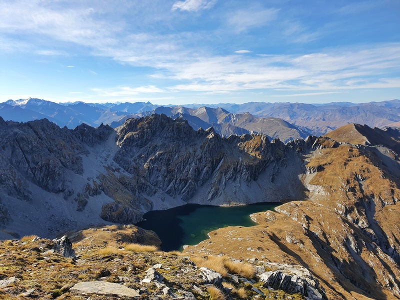
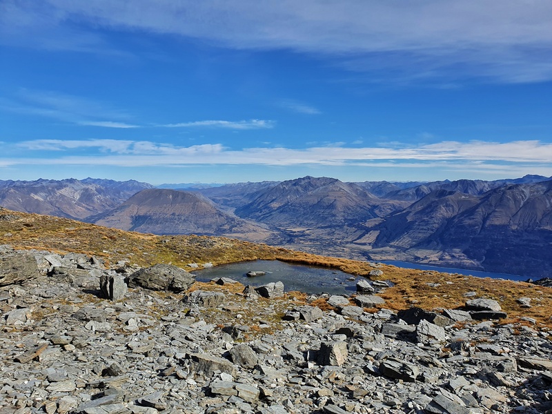
I feel like that’s a fairly accurate number, but don’t be surprised if there’s a difference as a result of taking different routes/lines on the ridgeline and descent. And you can add a bit of distance if you head to Lake Isobel (see photo below).
How many hours does the hike up Mount Crichton take?
This is going to vary a lot from person to person. And there are no DOC guidelines to give a base figure. Plan for a full day hike, starting earlier is better.
Once you know the route you can save a lot of time. But there’s some routefinding involved, and the steep parts are steep!
How much elevation gain is there?
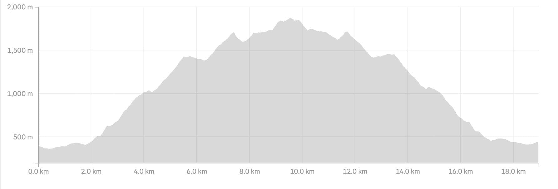
There’s generally about 2000 metres of elevation gain to be had, 90% of which is on the way to the summit. Different watches give different amounts, but be prepared for a big day out.
Here’s the elevation profile from a recent trip.
Is there reception on the track?
There is on some sections of the ridgeline and at the summit, but don’t expect the reception to be strong. You shouldn’t rely on it.
Should I take a PLB for this hike?
Yes, it’s 100% necessary on this attempt as while there’s some cell phone coverage, but it’s never a bad idea to carry a personal locater beacon with you. A PLB can be hired throughout NZ (Macpac and DOC visitor centres) if you haven’t got your own.
2. MOUNT CRICHTON HIKING MAP
Clicking the image below will open the route on topomap.co.nz.
The map above is the GPX file from my Strava recording on a topo map. Despite how long the hike feels, it’s crazy how small an area you cover is next to the Queenstown to Glenorchy scenic drive.
The route isn’t on Maps.me, Google Maps, or the topo maps. So I’d recommend downloading one of the best-hiking apps for NZ (app #3 in that post, NZTOPOS), download the GPX file above and keeping that on hand.
3. HOW TO GET TO THE TRAILHEAD
You’ve got a couple of options with most of them that take you between Queenstown and Glenorchy possible.
4. MY EXPERIENCE HIKING TO THE MOUNT CRICHTON SUMMIT
After four failed attempts at reaching the summit, I was stoked that I had three things going for me on what would be the day I finally summited:
- a great forecast
- a good mate who I knew would be able to summit
- friends who were ready to laugh at me if I didn’t make it :p
We started off at a reasonable 10 am on the Mount Crichton Loop track, one that both of us have done several times in the past. You turn left at the junction of the loop crossing the bridge. Enjoy the maintained track, it’s going to be a while until you see a decent trail again 🙂
Now, the trickiest part is to find the trail that takes you off the loop track and get started up the real guts of the track.
What I would suggest is you look at the topo map really close before you go, so you know roughly where the turnoff is going to be (~2km from the car park). The turnoff is not marked, and unless you’re really looking for it, you’d never know it’s there.
Walking from the car park (clockwise around the loop), the turnoff is on your left hand side. You won’t see the trail immediately, but if you feel like you’re at the right place, venture left for 5 – 10 metres and you’ll soon know if you’re on the correct trail or not. There is a trail that has formed which makes it a little easier.
It’s hard to explain…on my next trip I’ll take a photo of where the turn-off is. The turnoff is past the Maori Gully bridge, but do fill up your water bottles here as you won’t be having any water sources after this (you could drink from Lake Isobel).
Once you make a left, you’re in for a grueling climb of 1.5km up a single trail, which has some steeper sections, through the bush. But it’s quite a beautiful walk if you’re not too knackered to be able to appreciate it. And it’ll be the last time you’re in the bush for the rest of the trip.
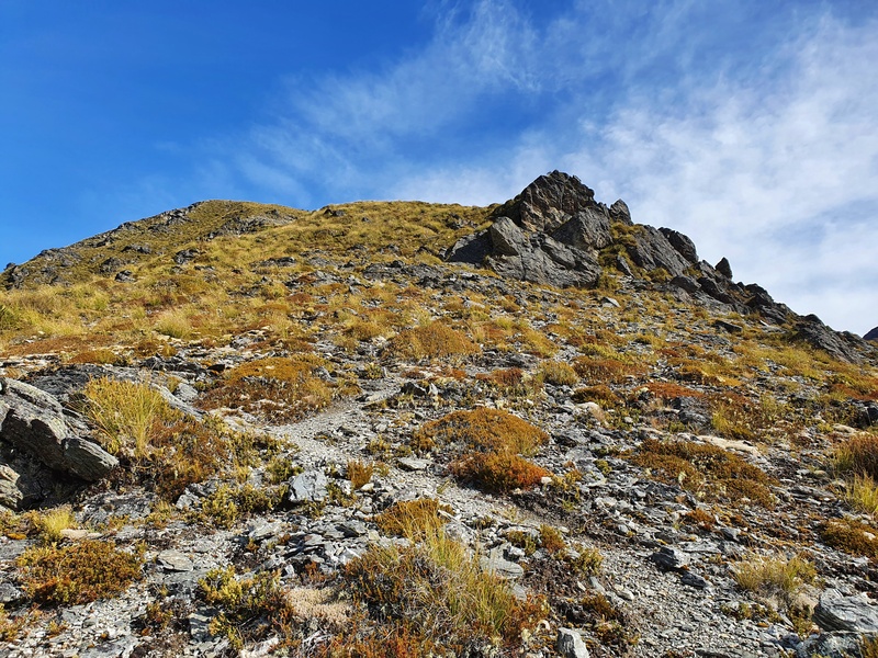
Once you’re above the bush line, you’ll be looking up a steep climb to get to the first great viewpoint which is about 900 metres or so. It’s not super easy to find the route all the time, but as long as you’re going up, you’re not going to be too far off track. Again, keep an eye on your topo map.
Take a break and enjoy the view 😀
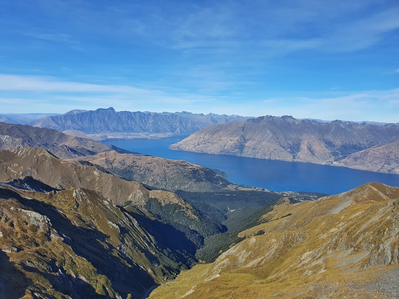
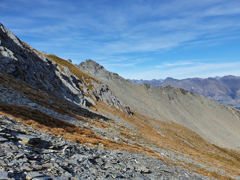
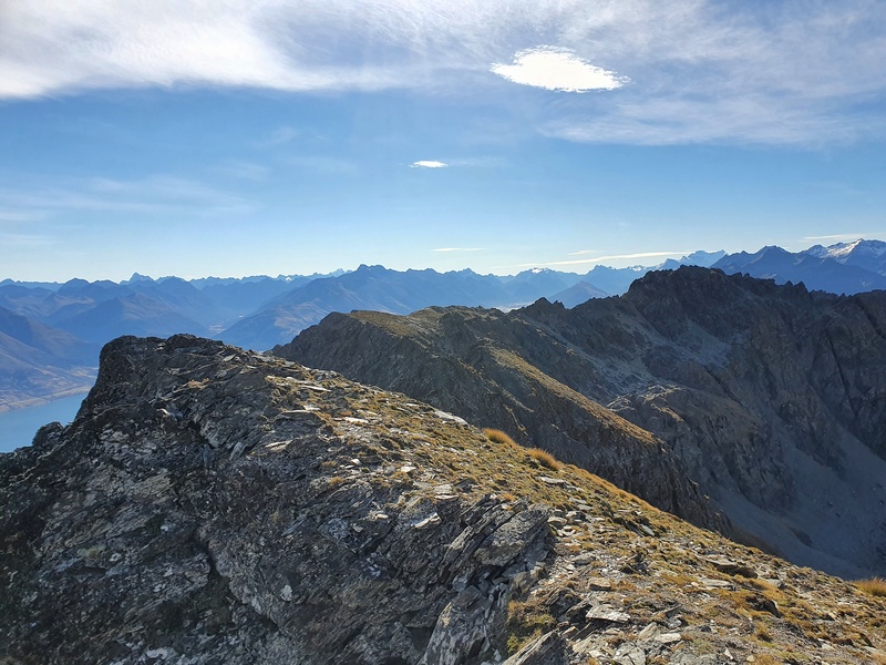
From here, the ridgeline is relatively easy to follow and you can see Mount Crichton in the distance, kind of. In theory, you could drop down to the valley on the right and follow that all the way up and you’d end up at lake Isobel. But ridgelines are the best!
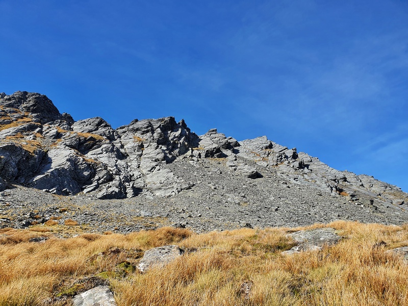
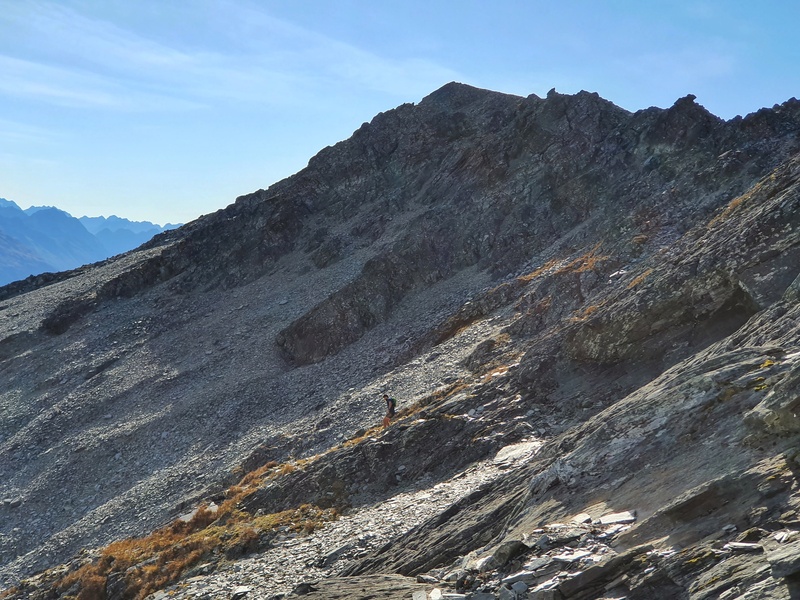
Once you get to 1300 metres you’ll have started climbing up some scree. The top of this section is just over 1432 on the topo map. My friend decided to sidle along as he was sick of going up. I loved going to the top of the ridge and following that though, I felt like it was faster.
Enjoy this next 1km or so to point 1390, as after that it’s going to get tough the rest of the way.
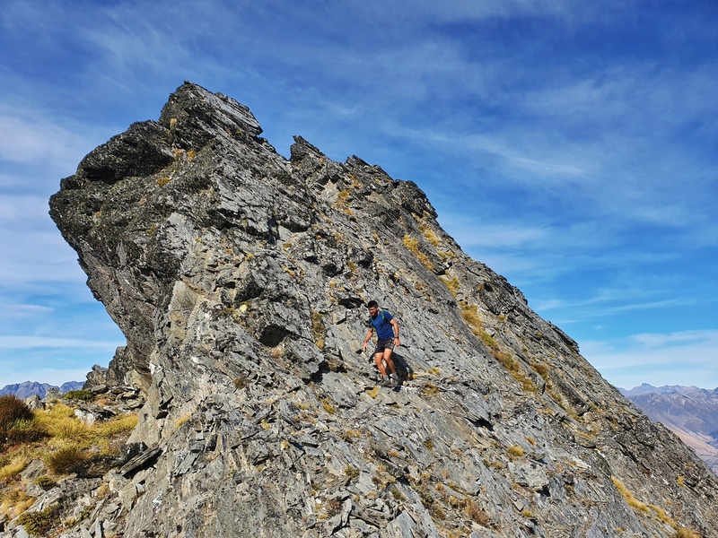
At this point, you’ll start going up steeply for a couple of hundred metres. There’s still a vague trail at times, but you’ll need to make your own judgment on many points as you’ll start to find the exposure levels a little niggly at times.
We both found that we were scrambling quite a bit but didn’t feel out of our depth. A few months earlier (November) I had turned back along this ridge as there was still some snow about and wasn’t confident about continuing.
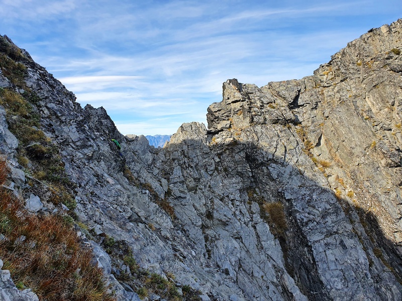
Don’t let your ego get in the way on this ridgeline.
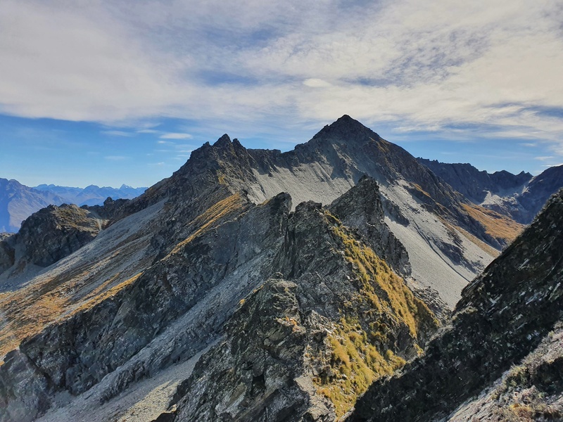
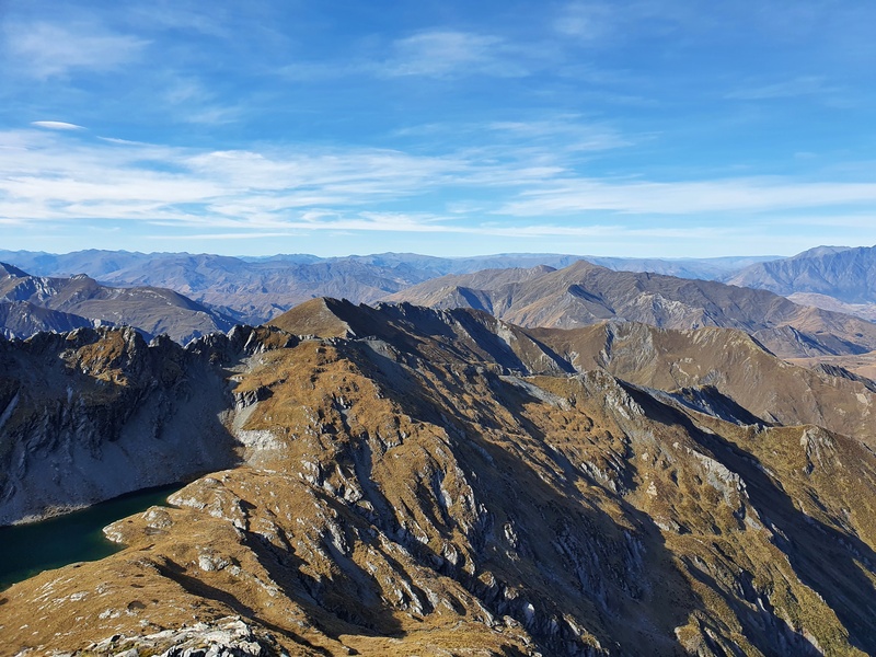
As much as I would have loved to keep scrambling, we did drop down to the Lake Wakatipu side of the ridgeline below the 1723 point. This isn’t an easy descent down some scree, but it was fun. You can kind of see a faint trail sometimes. Then from there, we continued following the ridgeline but below it on the way to Mount Creighton.
We were aiming for a small gap we could see close to point 1787. This is a point where two ridgelines meet and is close to Mount Creighton.
Once you see Mount Crichton you can tackle it from a few directions, but go past the peak along a relatively flat section that features some tarns (filter some water if need be) and came up around the other side. After a few summits, I think this is the best route.
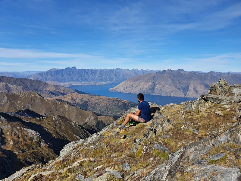
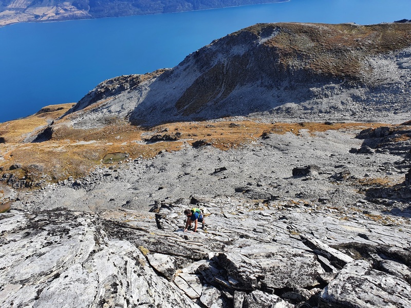
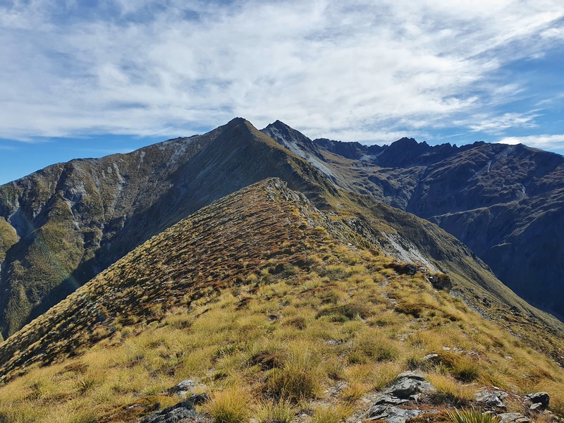
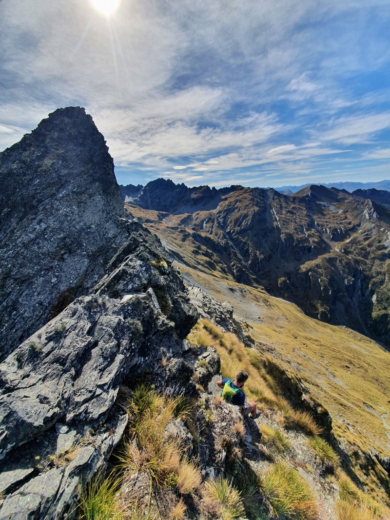
But it’s basically a choose your own adventure when you decide to turn up towards the summit (the summit is one of those in the photo above), things get steep. This is another reason it’s best tackled in good conditions. Where we popped onto the ridge, you can see Lake Isobel. Success.
But there’s a couple of hundred metres to go, with one or two spots that are technical. I’ve turned around once before on the ridge before the summit as it was starting to rain a little, so didn’t risk it.
Take your time and the route will present itself.
You’ve had some great views throughout the hike, but enjoy the full panoramic views, they’re glorious. And you might want to pop down to Lake Isobel for a swim. I haven’t done this after a few summits now…next time!
After you’ve enjoyed your summit time, it’s time to plunge down. I think it’s best to go the way you came, but you can attempt to descend an earlier shoot.
The descent is quicker as you’ll have more of an idea of directions and you’ve not got 1800 metres to climb, but it’s still not a fast descent. You’ll be a bit knackered, and the steepness might not be the most fun you’ve ever had.
Summiting Mount Crichton became a bucket list of sorts for me after I didn’t make it a few times.
If you’re planning to do the summit, wait for a summer’s day when the days are long and the weather is settled. This will give you the best chance at summiting and you’ll have time to go for a swim in Lake Isobel without being crazy cold.
If you’ve got any questions about summiting Mount Crichton, drop a comment below or email jub@churnewzealand.com.
OTHER HIKING POSTS NEARBY
Amazing Glenorchy Walks
Glenorchy is an absolutely gorgeous location! And there are lots of walks you can do in and around.
The Moke Lake Walk
Moke Lake is a gorgeous spot. But another great option, much like Mount Crichton summit is hiking to Ben More Peak.
The Ben Lomond Track
This is still the premier hike in Queenstown for me.
20+ Queenstown Walks
You could live here for 10 years and never run out of hikes to do. Honestly.

Hey, it’s Jub here. I’m the guy behind Chur New Zealand, helping you have the best time hiking, trekking, walking…whatever you want to call it…in NZ. I’m based in Queenstown and am always out and about exploring trails, old & new. If you have any questions, reach out.
Hello Jub,
I tried this traverse last weekend (January 12th 2025). I followed your advice of waiting for a summer day with perfect weather. Everything went pretty well until I got to point 1787. From there I looked at the ridge and I thought it was too difficult and turned back.
Now that I’m reading again your post you say “As much as I would have loved to keep scrambling, we did drop down to the Lake Wakatipu side of the ridgeline soon after the 1723 point. This isn’t an easy descent down some scree, but it was fun. Then from there, we continued following the ridgeline but below it on the way to Mount Creighton.”
So you actually droped down at 1723 point and not at 1787 point. My mistake.
When you say “we did drop down to the Lake Wakatipu side” I guess you mean to the East side since Lake Wakatipu is West, South and East.
When I click on the map with your gpx track it gives me an error that it cannot load the track, so I cannot zoom in to see the detail.
Thanks for sharing.
Hey Enrique,
THat’s impressive you made it to point 1787, it gets hairy that far eh! I’ll be updating this post again shortly as having done it a few times since I’ve got a great GPX file that’s what I think it the best route…including dropping off at 1723…which just makes life easier. You still got all the good views tho!
And I do mean dropping off on the west (left hand side) of the ridge towards the lake.
Chur,
Jub
Have you got the latest GPX file for this route? Cheers
Hey Joe,
I’ve added an out and back GPX file to the top of the post now. That’s the best route imo.
Cheers,
Jub
Hey Jub,
I’m considering trying this route this weekend if the weather holds up. Do you think you could send me the fox as the link is still not working in the article? I could send you my email address to send to? If not I can follow the description but I’d appreciate it if possible.
Chur
Hey Stan,
Sorry for not getting back to you before the weekend. Hopefully you made it? Have updated an out and back GOX route at the top of the post.
Chur,
Jub
Hi Jub,
Thanks for sharing the GPX with the latest route.
I did try that in December. Made it shy of the summit but had to turn around as I had started pretty late. Even then made it back to the treeline by nightfall so it was an interesting return…
Will attempt again with an early start soon.
Having seen the whole hike, I have even more appreciation for this post which details how difficult it can be at times and how much of a choose your own adventure it is.
Cheers!
Adrian
Hey Adrian,
Defo give it a go again, looks like you’ll need to wake up a but earlier haha. That’s a grind coming down the from the treeline in the dark 😮
Chur,
Jub
There is a much easier and quicker route . When you get to about pt 1390 , just sidle across traversing up easy slopes above Twelve Mile Creek to a bench at the 1550m contour (directly below and east of Mt Cricthton) which leads to the Lake Isobel outlet. Then there is a gentle walk SW up a prominent ridge to the summit . This avoids any scrambling and you get the added bonus of visiting Lake Isobel : a magic place to camp .
Hey Peter,
Thanks for the comment! I’ve gone this route oncce before, and didn’t seem to like the siddle so much! That was a few years back, so maybe I should give it a whirl again. You’re right though, easier access to Lake Isobel! Thanks for commenting, going to pop a mention in to check out your commnet, they may like it.
Chur!
Jub
Hi Jub
Agree with Peter, we sidled across and up to Lake Isobel, wherenwe had a delightful camp for the night. I enjoyed a cup of tea, while the others went up to the top of Mt Crichton with no difficulty.
Cheers Lindsay
Love that you went that way to. I’m probably done with Crichton for this season, will defo give that route a whorl again next summer!
Today I did a loop, going to Lake Isobel the way described by Peter and back as per your GPX file. Only difference: I sidled south of point 1723, saving a little elevation and scrambling. What an amazing day out!
My GPX file says 18.85 km and 2003 m elevation gain. Happy to share it.
Hey Massimo,
Stoked you could still do this so late in May, though where’s the snow? Thanks for sharing, it’s so good!
Chur,
Jub