Note: As of May 2026, the section from the Hydro Dam (waterfall) to the helipad has been closed. Press release here.
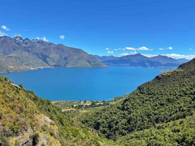
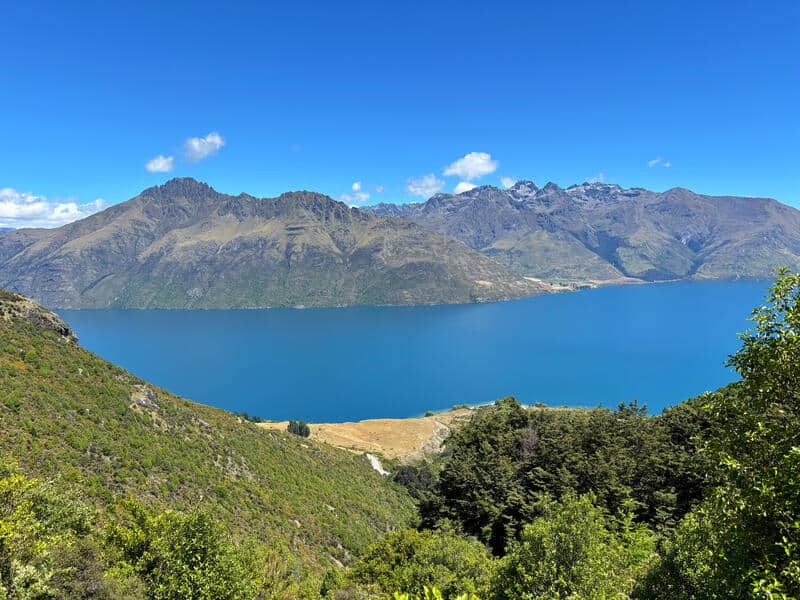
If you’re looking for an epic view of mountains, lake, and Queenstown, then hiking the Lower Wye Creek Track to the helipad is a great option.
While this has become a more popular Queenstown hike recently, there’s one turnoff that’s crucial to make to ensure you end up at the right spot…rather than trudging further and further up the hill. That’s unless you want to do the traditional Lower Wye Creek Track.
And yes, it’s under 4km return…meaning it’s under the 5km threshold I normally have for a track for me to put on Chur New Zealand, but this an exception to due its difficulty.
TABLE OF CONTENTS
1. Details About The Lower Wye Track
2. Lower Wye Creek Track Map
3. How To Get There
4. My Lower Wye Creek Track To Helipad Experience
1. DETAILS ABOUT THE TRACK TO THE HELIPAD
- QUICK DETAILS:
- Distance: ~3.8km return
- Elevation gain: ~310 metres total
- Difficulty: Hard
How hard is the track up Lower Wye Creek Track to helipad?
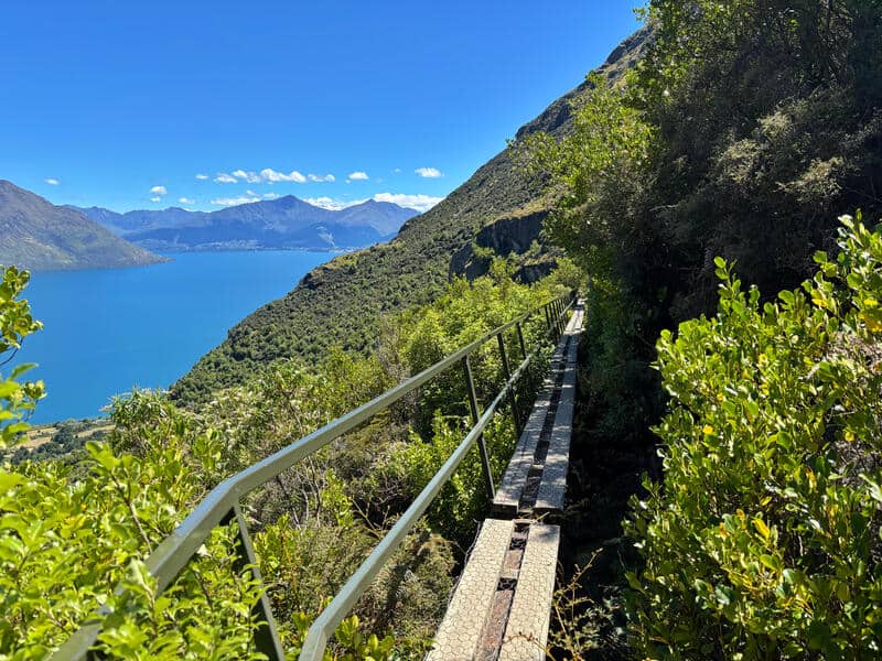
It’s hard. While not long, it’s steep and there’s a couple of short sections of technical terrain. Then there’s the wooden planks/suspended walkway leading to the helipad which may get your nerves going if you’re not great with heights.
What distance is the track to the helipad?
It’s about 1.9km to the helipad, and the same back down.
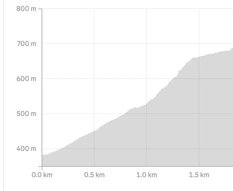
What is the elevation gain of the track to the helipad?
I registered about right on 300 metres of elevation gain. There’s essentially none on the way back down.
Here’s the elevation profile:
How long does it take to hike up and down?
This is tough to gauge, the return trip is less than 4km…but you’ll spend at least one hour total. Allocate 2 hours, including stoppage time and you should be sweet.
Do I need hiking poles?
If you’re doing this hike as a one-off hike in New Zealand, then don’t worry about it. But if you use them, and have them easily available it’s a good idea.
Can you do this in winter?
Yes, you can. You’ll rarely be above the snowline, but pending on the conditions it could be icy and wet…so be careful.
2. LOW WYE CREEK TRACK TO HELIPAD MAP
Here’s the GPX file if you want it.
The map below is the GPX file overlaid on topomap.co.nz (click the image to open in a new window). You can see where the track leaves the main trail to traverse over to the helipad.
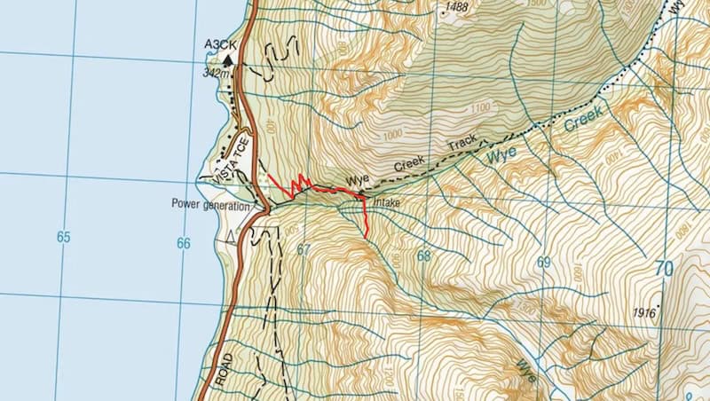
I always use the NZTopo50 app (it’s less than $10!) when hiking in NZ.
3. HOW TO GET THERE
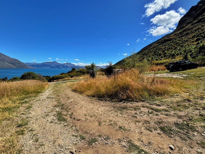
The easiest way to get there is by car. The carpark (above) is on the eastern side of the highway, right here.
Note, the pin above is the actual carpark which is a couple hundred metres up from the highway turnoff. The road up to the carpark isn’t in the best condition (pot holes at times, sometimes filled in), but at least try to get up the road to the formal carpark. If not, park on the road, just be road safe as the cars fly past here.
4. MY EXPERIENCE UP THE LOWER WYE CREEK TRACK TO HELIPAD
This trail is starting to get popular, and therefore you’ll likely see several others hiking this trail. While some will be aiming for the more ardous Wye Creek to Remarkables (or elsewhere) Route, most will be heading to the helipad.
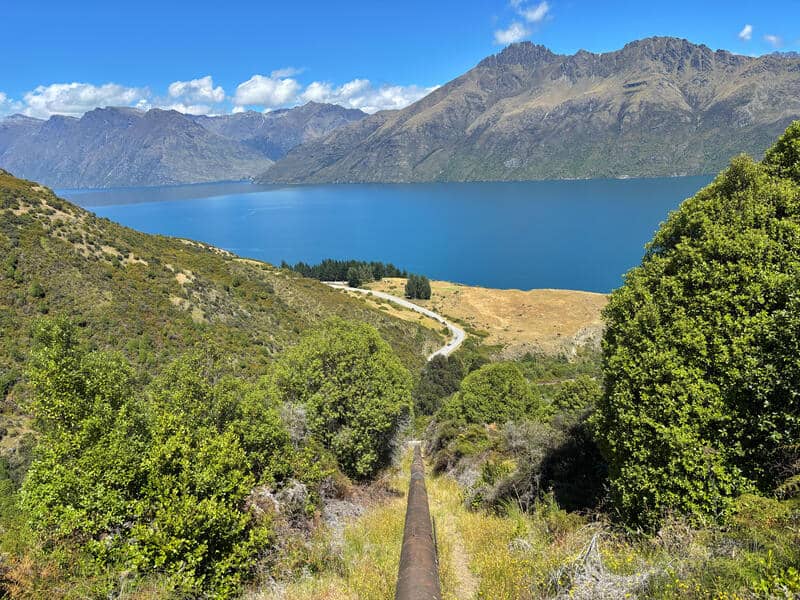
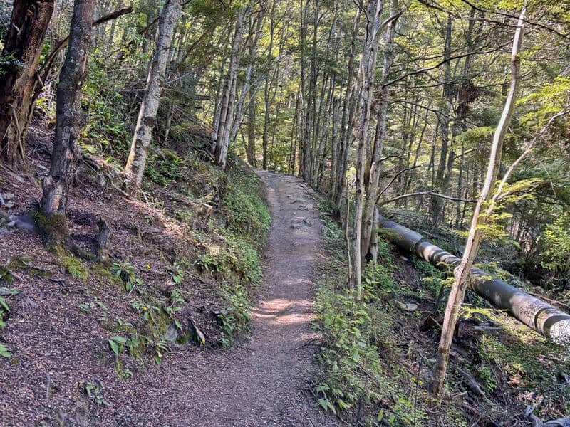
From the car park, you go around the gate and continue on the 4WD road, following the zig zags. Youll see a pipe early on, if you’re ambitious you can take the short (but steep) cut up there. But for the normal, the zig zags/switchbacks are the way to go.
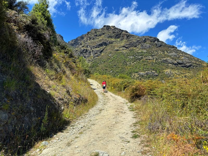
You’ll know when you’re nearly at the end of the 4WD track when you reach the toilets. From here, you’ll hit some single track which is a bit rocky in points, and there are some steep points. You won’t get lost though as the track is well trodden and easy enough to follow.
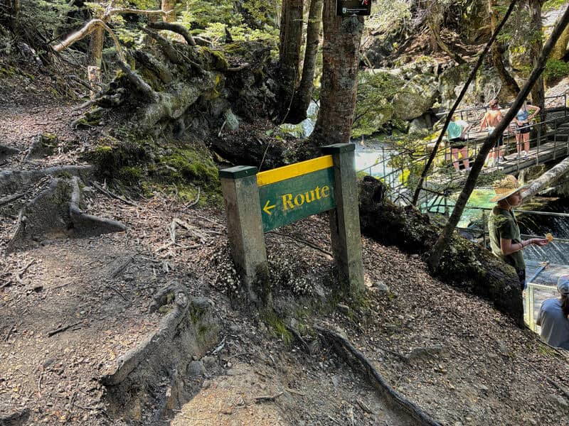
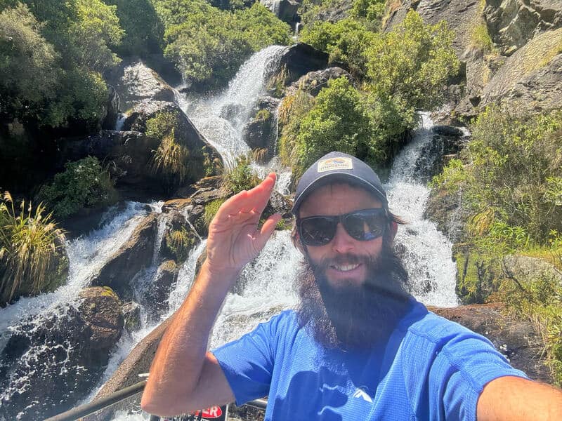
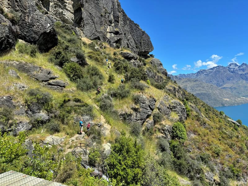
Don’t go left to get to the helipad, cross the waterfall over the path where the people in the photo are.
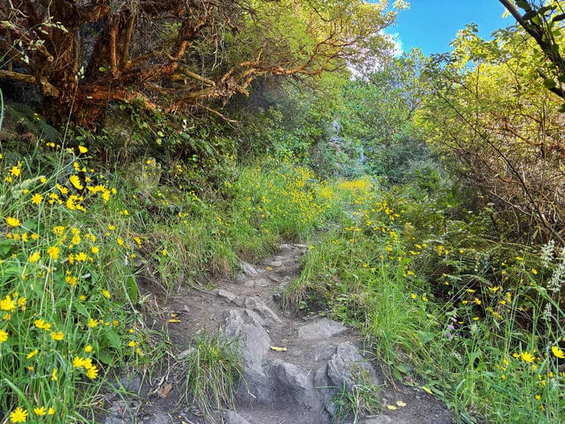
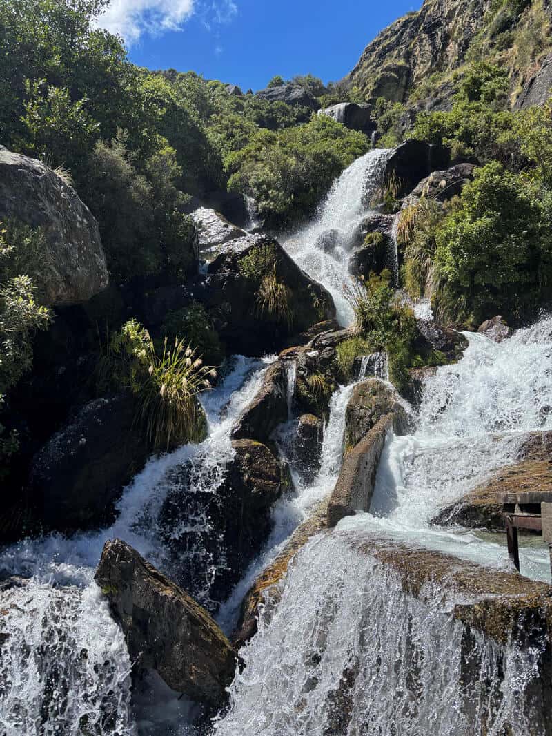
You’ll move into the forest which is a nice switch up, and plod away until you get to the above sign/waterfall.
At this point you turn right, crossing the waterfall. Going left continues up to the Wye Creek Basin where you can hike all the way through to the Remarkables Ski field (and Lake Alta), a grueling hike that can be done in one massive day or as an overnighter.
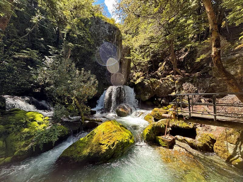
Anyhow, turning right, you’ll pass the pretty cool waterfall, then you’ve got a short flat (you’ll appreciate this) walk to the boardwalk thing. If you’ve got a fair of heights, you might be nervous walking along here, but there is a handrail which will help you stay steady.
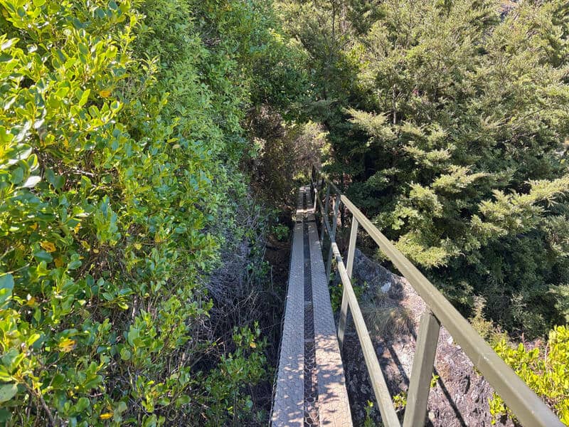
Passing people on the boardwalk can be awkward, but everyone is accommodating in my experience. There’s a view good viewpoints on the way to the helipad, but don’t worry about taking photos as the best views are from the helipad itself. And on the way back.
The helipad is just before the next waterfall. Do check out the waterfall, and if you want, there’s a steep track that continues for a couple of hundred metres to where people do rock climbing (second photo below). But most people aren’t going to bother with this.
The track up to the helipad is subtle, but you’ll see it just before the bridge over the waterfall (see photo below). There’s a couple of awkward steps up to it, but once you’re there…how good!
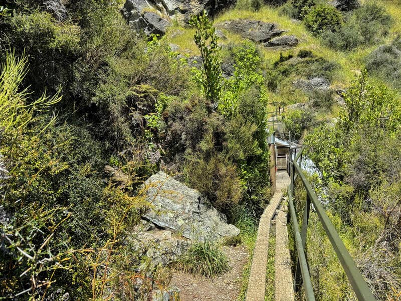
The track to the helipad is on the left hand side by this rock, just before the waterfall.
On the way back, it’s as easy as retracing your steps. It’s faster coming down, but do be careful of your footing.
Once you’re on the 4WD road, you’ll know you’re only a few switchbacks from home. Success 😀
This track has become popular! It’s less than 4km, so it’s acheivable for most. And it’s not going to take up much of your day.
Got any questions or comments about heading up to the Lower Wye Creek helipad? Leave a message below or email jub@churnewzealand.com.
Chur.
p.s. Here’s a map of all the hikes documented on Chur New Zealand. You can click the icon to see brief details, as well as a link to read more about the hike (like this post).

Hey, it’s Jub here. I’m the guy behind Chur New Zealand, helping you have the best time hiking, trekking, walking…whatever you want to call it…in NZ. I’m based in Queenstown and am always out and about exploring trails, old & new. If you have any questions, reach out.