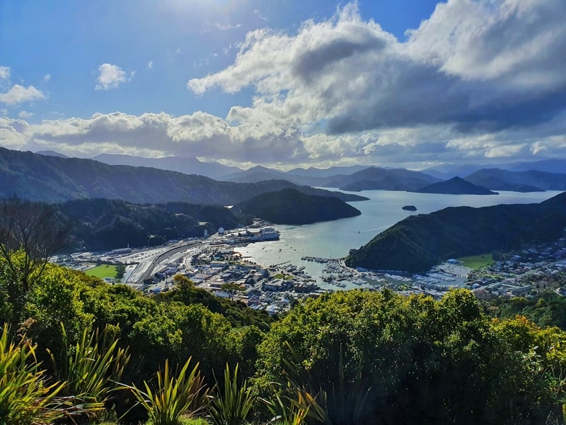
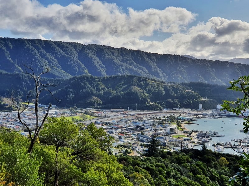
If you’re looking for a walk with a nice view over Picton, then the Tirohanga Track is for you.
It’s an end to end walk that starts and finishes on the edge of Pictons shopping district. You can leave your car in town or walk from your accommodation.
Fun fact, Tirohanga translates to view.
This post will let you know what to expect including total elevation and which way is steeper.

Proof from the Tirohanga Track (the photo quality gets better)
TABLE OF CONTENTS
1. Tirohanga Track Details
2. Tirohanga Track Map
3. How To Get There
4. Tirohanga Track Trip Report
1. TIROHANGA TRACK DETAILS
QUICK DETAILS:
- Length: 5.6km
- Elevation Gain: ~250 metres
- Loop Track
- 1 to 2 hours
The Tirohanga Track is one of several lovely tracks on Picton’s doorstep. If you look south while you’re in town, you’ll see a cross on a hill. That hill is where the Tirohanga summit is.
It’s nice that you get some views on the way to the summit, though it’s annoying to see the photos not turn out great in the middle of the day due to the sun. The track condition is great overall, – even in winter and the bench at the top is a nice touch. This is a great, high-value walk.
How long is the hike?
Based on my Strava data, it’s a 5.6km loop starting and finishing from Picton Library (it’s 5.7km on maps.me as you’ll see below). The track itself is 3.9km long.
How hard is the hike?
Easy – medium.
What’s the elevation gain on the Tirohanga Track?
Based on Strava, there’s 248 metres of incline.
How long does the hike take?
The total time to complete the loop was 1 hour 17 minutes. That was walking at a reasonable pace, though you can certainly walk it quicker if you needed to catch the ferry etc. On the safe side, allow yourself two hours in total to complete the full loop.
2. TIROHANGA TRACK MAP
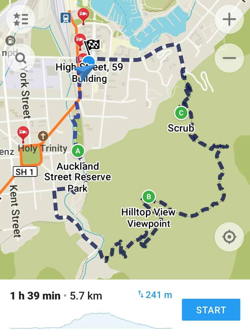
The Tirohanga Track map isn’t available on Google Maps (the pin for Tirohanga Track on Google is wrong, you don’t get any views of Ruapehu haha), but you’ll find it on the Maps.me app which is where the screenshot above is taken from, and of course this quality topo map app.
There’s only one point you could potentially get lost. But I’ll explain that in my experience below.
3. HOW TO GET THERE
Realistically the best way to get there is to park wherever you can in Picton, and walk to the trailhead. The most common direction (according to Mary at the Picton Museum) to walk is from the Newgate Street trailhead, but that takes you up the less steep side and down the slightly sleeper way.
On Google Maps, the trailheads are here for Newgate Street and here for the Garden Terrace trailhead
4. MY TIROHANGA TRACK EXPERIENCE
I’m going to talk about my recent experience rather than when I walked the track a couple of years prior. I was staying at Piwaka Lodge & Backpackers, so got to the library at the end of the block to start Strava and officially being my walk.
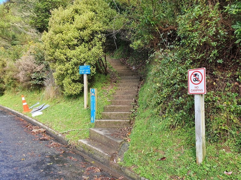
From the library I walk east along Waikawa Road for about 500 metres before turning right on Newgate Street where the trailhead is a couple of hundred metres up the street. There’s a sign at the entrance so you can’t miss it.
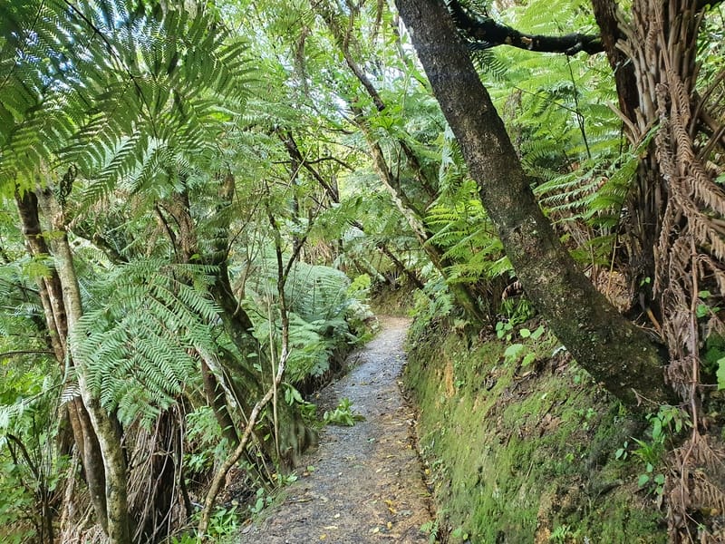
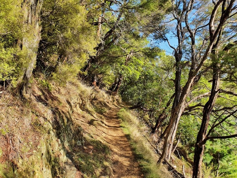
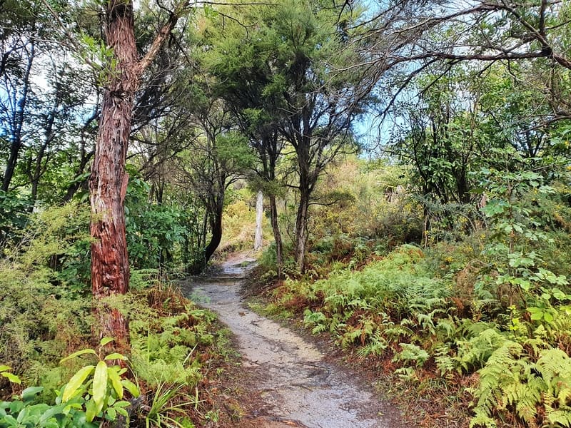
As soon as you hit the trailhead the incline to the summit begins. Apparently there’d been a lot of rain and the clay track is slippery, you wouldn’t want to be in your flipflops.
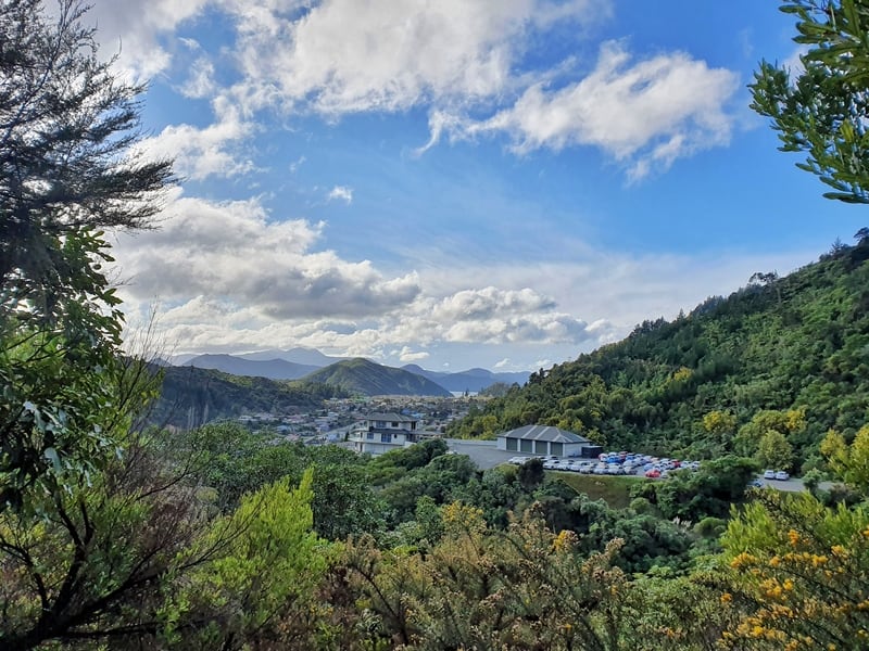
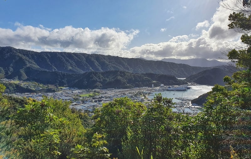
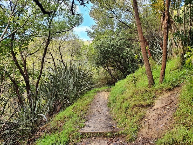
It only takes a few minutes until there’s a clearing in the bush to give you a view toward Waikawa and shortly after that you start to get views of Picton too. The series of switchbacks are great as they let you get above the tree level and get some clean shots looking at the views.
When you’re on the straight sections of the walk you’re usually surrounded by mature trees on either side that’ll block most of the view.
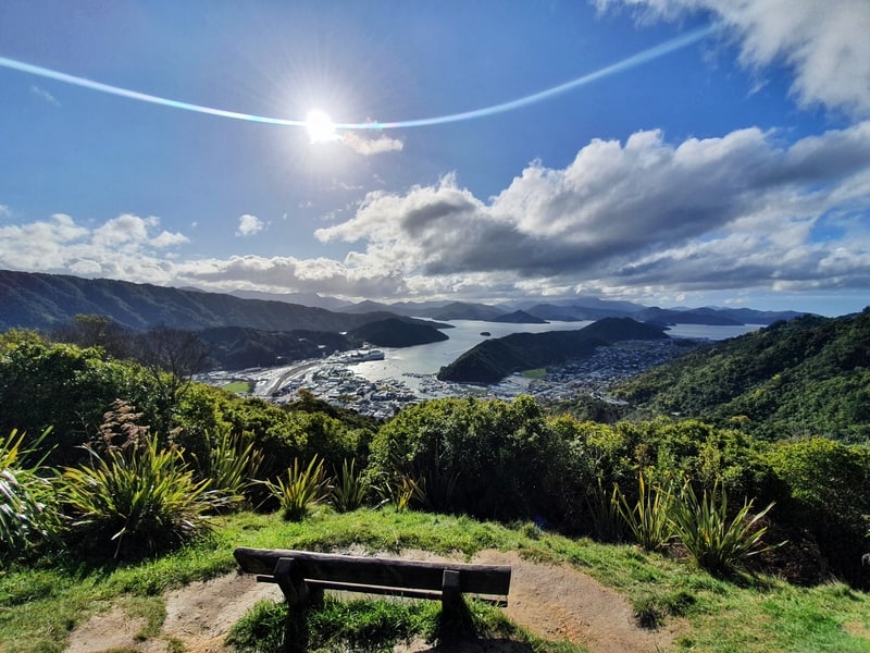
There’s not much to say really. You’ll know you’re getting to the top when the track distinctly flattens out and the summit viewpoint doesn’t have any big trees blocking your view which is awesome. On a warm day, bring some snacks up, you could easily spend an hour here taking it all in if you wanted.
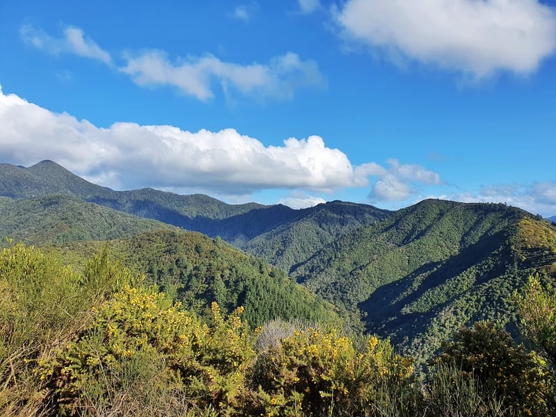
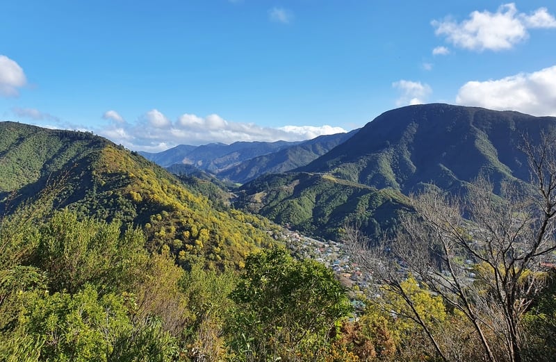
While you could head back the way you came, you may as well go down the other side. You’ll suddenly catch glimpses of the hills south of Picton covered in green which is cool. Soon enough you’ll get back into the thicker bush enveloping you, leaving you with no views the rest of the way. It’s a bit steeper this way and some short sections are muddy, but you shouldn’t have any issues keeping your feet, even in winter.
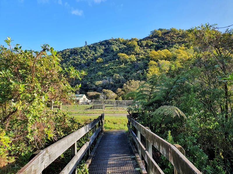
When you get to the end of the track you’ll see a small bridge you need to cross.
You then have two options, you can turn right and walk over the river. If the river isn’t flowing to high you can easily hop over the rocks to the other side without getting wet. Otherwise proceed straight and follow the road around. They lead to the same spot.
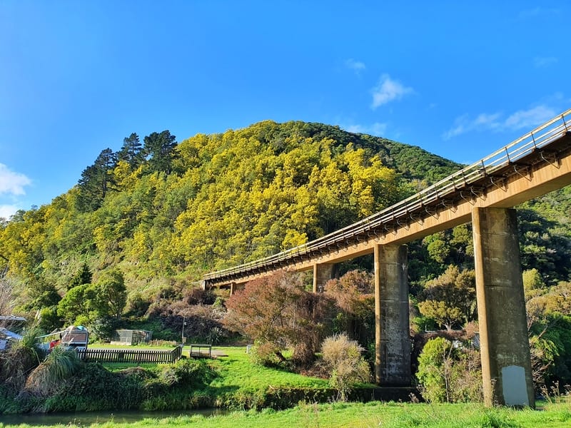
From here you can meander back to Picton any number of ways. Following Garden Terrace which changes to Devon Street, go under the viaduct then turn right onto Canterbury Street. At the end of the street you’ll cross a small bridge which leads to Auckland Street Reserve which takes you into town.
If you’re looking for a short adventure while in Picton, this is a great free option. Don’t forget to check out Picton’s other trails in the Esson Valley.
If you have any questions or experiences to share, let me know below or email jub@churnewzealand.com.
p.s. Here’s a map of all the hikes documented on Chur New Zealand. You can click the icon to see brief details, as well as a link to read more about the hike (like this post).

Hey, it’s Jub here. I’m the guy behind Chur New Zealand, helping you have the best time hiking, trekking, walking…whatever you want to call it…in NZ. I’m based in Queenstown and am always out and about exploring trails, old & new. If you have any questions, reach out.