The Essons Valley Tracks are less touristy than other Picton walks as they haven’t got views of Queen Charlotte Sound, but if you see the comments at the bottom, people enjoy these tracks…as did I.
But Humphries Dam & Barnes Dam play a role in the history of the region. When the land was sold to the Europeans in the 19th century the native forest was spared, though the two dams were built as Pictons demand for water increased.
Fast forward to today and the Humphries Dam is no longer in use and Barnes Dam is used when demand for water peaks in the summer.
For those looking for more walks in Picton, visiting these two dams is a great option.
This post will give you the details you need to know before you head out. And there’s plenty of photos too.
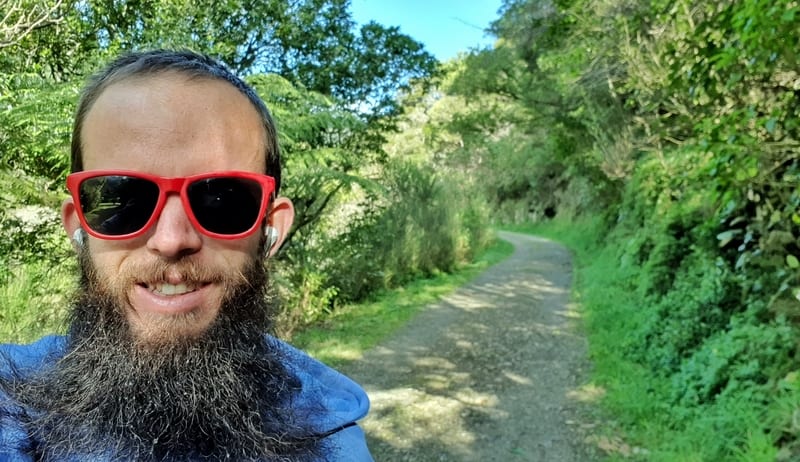
Proof that I’ve been on the Essons Valley Track. I forgot to take one until the very end!
TABLE OF CONTENTS
1. Essons Valley Details
2. Essons Valley Track Map
3. How To Get There
4. My Essons Valley Trip Report
1. HUMPHRIES DAM & BARNES DAM TRACK DETAILS
QUICK DETAILS:
- Length: 8.5 – 11.5km options
- Elevation Gain: ~160 metres
- Track Type: Out and back
- Time: 1h 45m to 3 hours
I wasn’t sure what to expect here as the walks are rarely mentioned compared to the Snout and Tirohanga Tracks.
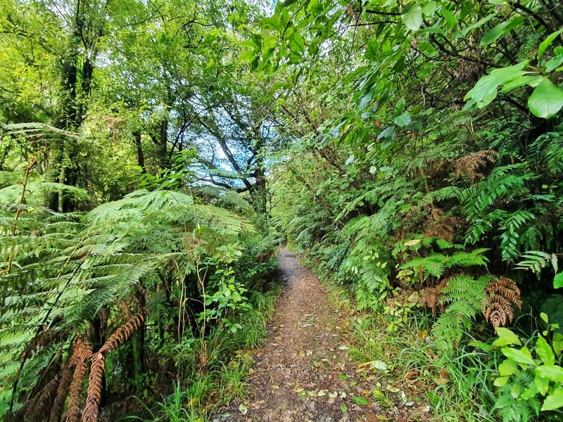
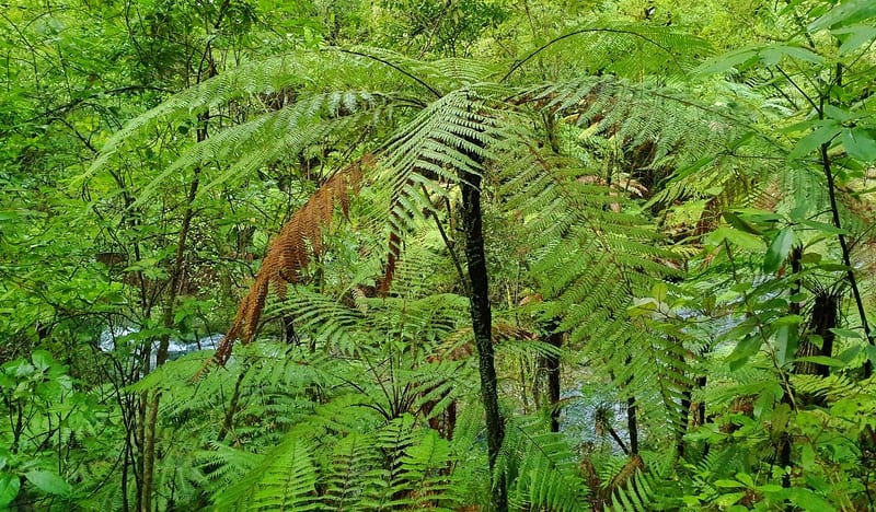
With that said, they’re great local walks. The greens are darker, the bush is denser. Yay for native forest.
It’s awesome how you can hear the streams flowing a lot of the walk. Humphries Dam feels very still (see photos) compared to Barnes Dam which has a nice waterfall which I didn’t expect. It’d be nice to have some information about the dams at the location, rather than at the trailhead.
How are the tracks?
Easy.
How long are the tracks in Essons Valley?
My Strava Data doesn’t start and finish at the trailheads, but when I take away the additional distances I’m left with about an 8.5km total (the same as Maps.me below) trip back to the starting point with a visit to both dams. It’s about 1.5km each way to the centre of town, so if you’re walking all the way you’ve got an ~11.5km trip total.
What’s the elevation/hills like?
The total elevation on the visit to both dams is about 160 metres. Considering this is spread out over 8.5km, this is very minimal (you’re never more than 100 metres above sea level).
How long will it take to hike the Essons Valley?
I spent about 1 hour and 45 minutes on the actual Essons Valley trails which was with very little time for breaks, just short pauses for photos. Most people will be able to complete the walk in 1h45m to 2h30m, plus the time you spend eating etc. And you’ll need to add time on if you’re walking from your accommodation too.
2. ESSONS VALLEY TRACK MAPS
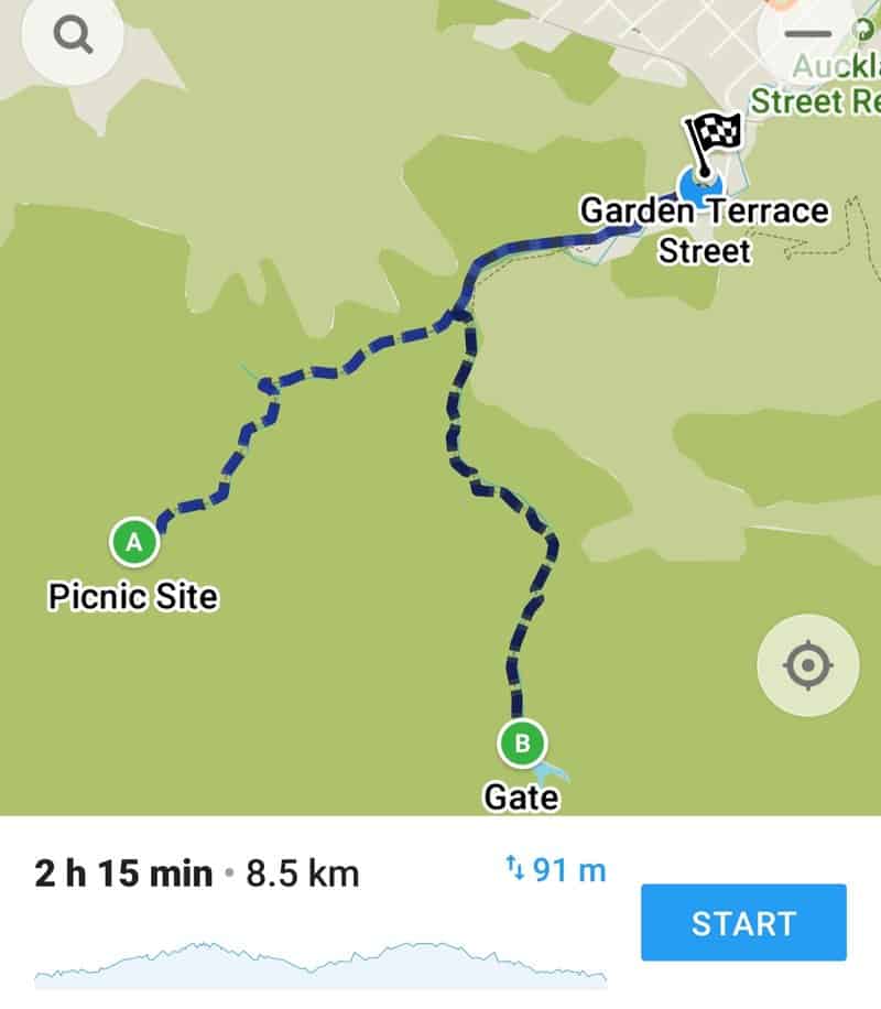
As expected, the tracks are not on Google Maps. With that said, you can see the tracks on Maps.me cleary as seen above.
A = Humphries Dam
B = Barnes Dam
Once you’re on the trails, you won’t have any issues with getting lost. The trails are well signposted and easy to follow.
3. HOW TO GET THERE
There is a car park of sorts next to the Essons Valley Tracks trailhead. It’s not a formal car park, but as you can see in the photo above, as long as you’ve parked on the side of the road where it’s expected, plenty of cars can fit.
Alternatively, it’s like 1km to walk from the centre of Picton via the Auckland Street Reserve which I can recommend doing.
4. MY ESSONS VALLEY TRACKS EXPERIENCE
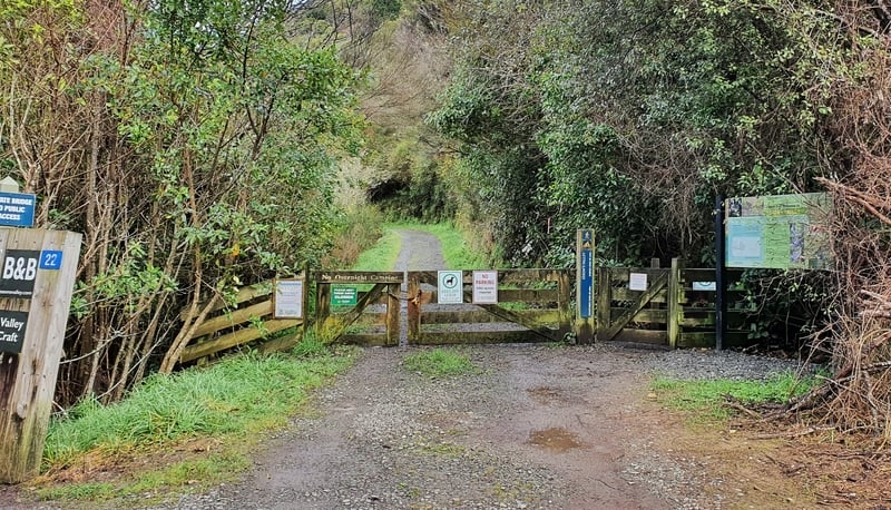
I walked to the trailhead via Auckland St Reserve and instantly noticed the dog sign. Dogs are allowed off-leash in Essons Valley but must be under control at all times. That’ll be why this is a more popular track for locals. They can walk their dog off-leash 🙂
The track starts off as a 4WD track with the forest getting closer to track before you feel like you really enter the forest after a couple of hundred metres. You’ll spot a picnic bench along here too.
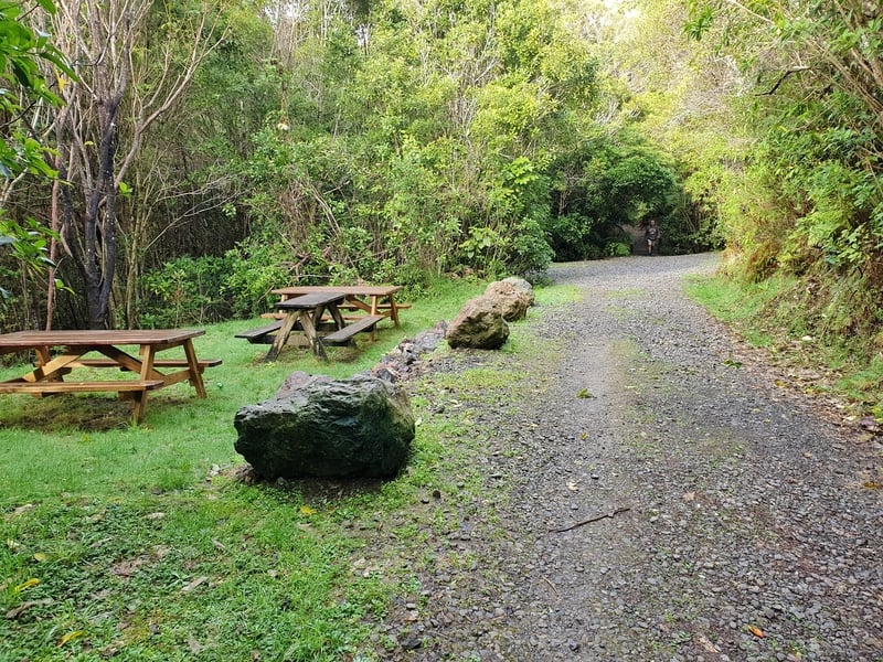
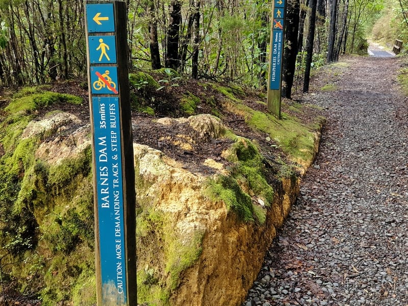
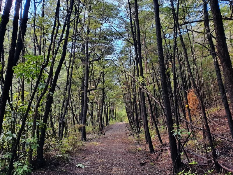
Eventually, a forest canopy forms above and the track turns into more of a dirt track. It’s maintained and well-trodden which is nice as you hit the junction. For Humphries Dam, keep straight or turn left for Barnes Dam.
Humphries is an easier track. There are warning signs on the track towards Barnes Dam. These signs are a bit over the top I feel, I wouldn’t call it a tramping track by any means.
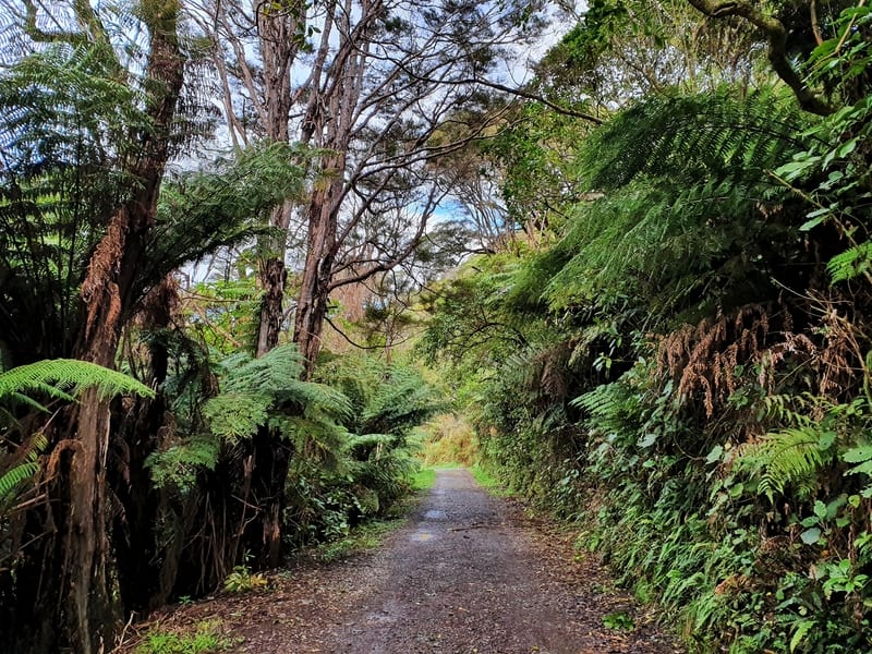
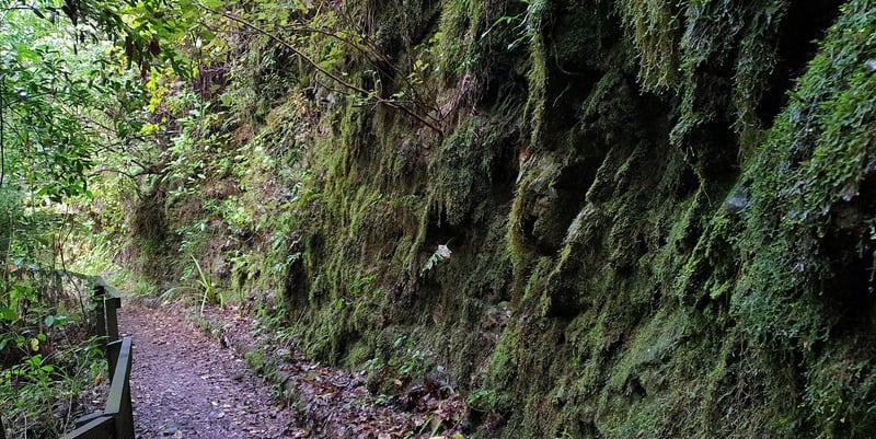
I went to Humphries Dam to start with, and the track continues with a slight ascent now. Nothing major. I did like how there were signs along the way talking about wildlife and nature and some of the moss and ferns growing on the side of the rock along one segment of the track was spectacular.
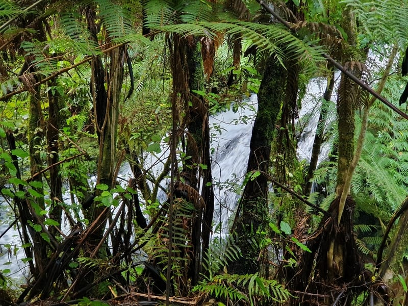
With about 50 metres of climbing after the junction to the dam (it’s ~1.5km beyond the junction), you’ll make good time and as the river becomes louder you’ll eventually here a nameless waterfall. You can catch a glimpse of it, but you can’t see it clearly through the trees and there was no track down to the river’s edge. This is right before the dam.
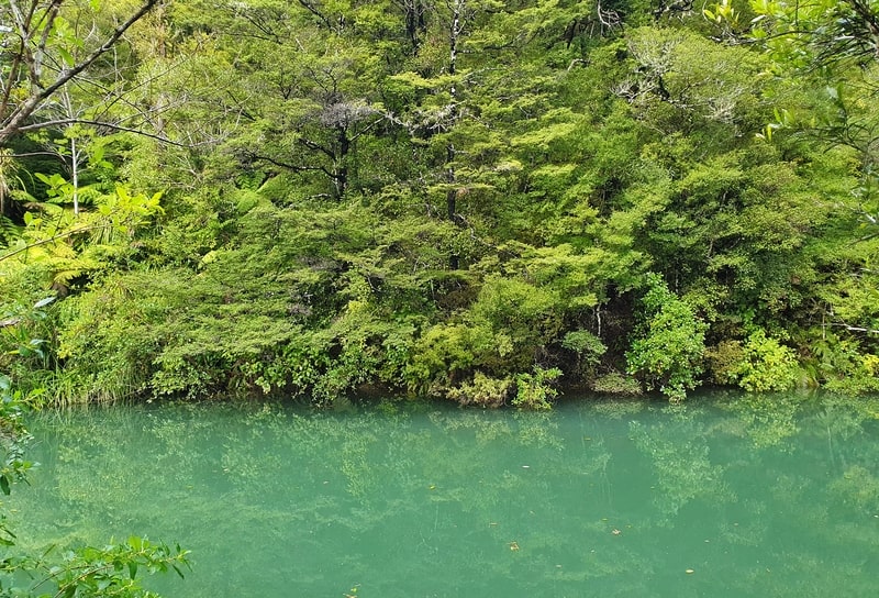
At the dam, the water is an interesting colour. It was very calm, and protected, ideal for those trees to reflect on the water. Another picnic bench was here if you’d like to stop for a break.
In terms of swimming, is it allowed? I’m not sure. It seemed so as there were no signs saying not too. But in the middle of winter? I wasn’t swimming.
Turning back (there are no tracks beyond Humphries Dam), I’d committed to visiting Barnes Dam so once I reached the junction again I turned off and was prepared for a more strenuous hike. According to the signs.
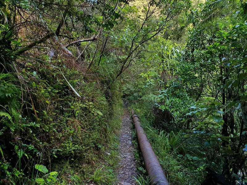
Well, whoever has made the signs are very cautious. The track started off super wide and easy, and while it does become a single trail with a few roots on the track, it’s not a technical trail by any means. The pipeline that follows the track is always nice too, and reminds me of a couple of the walks in Karangahake Gorge in the North Island.
And with less than 100 metres of climbing, it’s not difficult in any way shape or form I feel. It’s about 1.8km from the junction to Barnes Dam.
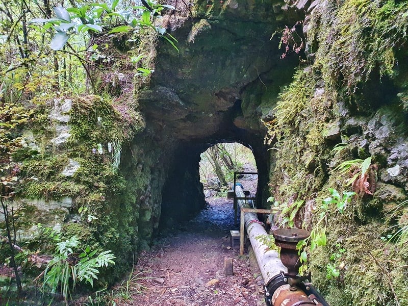
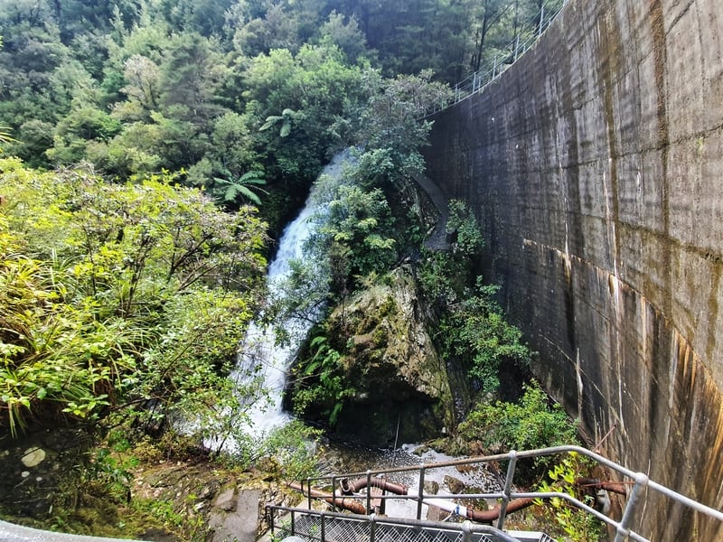
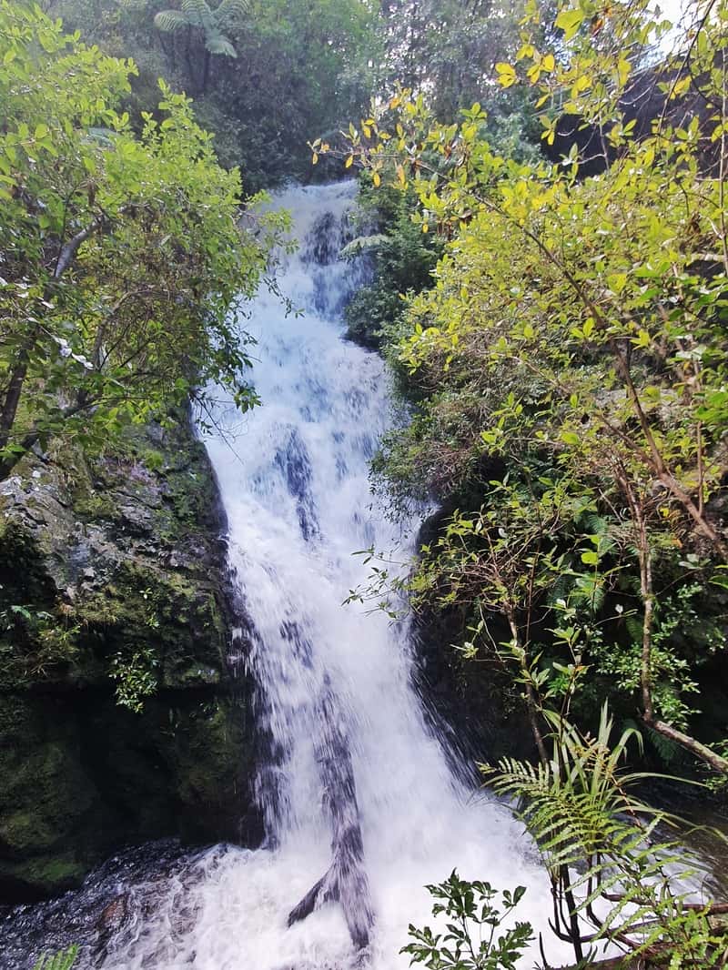
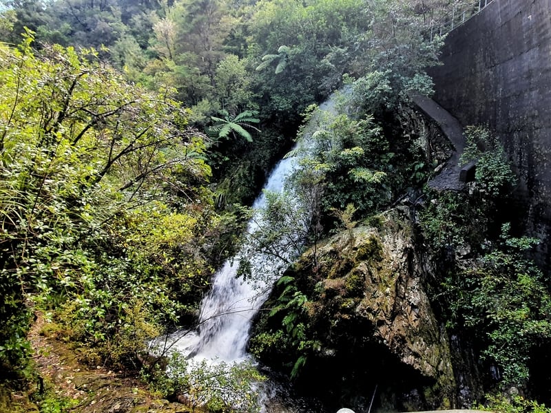
In the last 100 metres before the dam, there’s a nifty little waterfall (tiny), before you walk through a hole in the rock which is always cool. And that leads straight to the Barnes Dam Falls (my unofficial name I’ve given them). When I visited they were roaring, and they were very cool when you aren’t expecting anything.
There’s a large concrete dam wall which reaches above the falls which you can reach the top of by a set of metal stairs.You can’t go up onto the dam wall itself, that’s for staff only and locked. But at the top of the stairs, you do get a different view of the falls.
Once again there are no tracks beyond the falls, so it’s time to turn back the way you came and head back to Picton 🙂
The Essons Valley is stunning.
Sure you don’t get any view of the sounds from there, but if you’re spending a few days in Picton and mostly want to take it easy without killing your budget, definitely check out these tracks. It’s a great way to spend half a few hours.
I’d love to hear how you found the Essons Valley in the comments below or email jub@churnewzealand.com.
p.s. Here’s a map of all the hikes documented on Chur New Zealand. You can click the icon to see brief details, as well as a link to read more about the hike (like this post).

Hey, it’s Jub here. I’m the guy behind Chur New Zealand, helping you have the best time hiking, trekking, walking…whatever you want to call it…in NZ. I’m based in Queenstown and am always out and about exploring trails, old & new. If you have any questions, reach out.
You have a typo in your link to the snout track.
Your link is: “https://churnewzaland.com/snout-track/”
It should be:”https://churnewzaland.com/snout-track/”
(There’s an “e” missing from Zealand”
Whoops! Thanks for the heads up Adrian. Changed 🙂
What a fabulous journey into the unknown. Thank you for your very interesting description along the way – made me feel that I had been there myself.
Hey Debbie,
Thanks for the kind word. Hope you get to make it out that way sometime in the future 🙂
Cheers,
Jub
My husband and I just did the Barnes Dam walk from where we are staying in Picton. It was lovely! And yes, the waterfall is a pleasant view as you reach the end of the track. We took the stairs up to the top of the dam thinking there might be a loop walk… But back down we came, returning the same route. We met a lovely local lady as we walked back… It always adds to the trip when you meet nice people.
Thanks for your post. I enjoyed reading it.
Hey Valerie,
Stoked you guys went an di the walk…so good how they’re all a walk away from most accommodation options in Picton.
Good that you could confirm there isn’t a loop walk haha.
Enjoy the adventures.
Cheers,
Jub
Thanks Jub and we did this walk after coming across your site and pleased we did. A very accurate account of the walk and thoroughly enjoyable so highly recommend to see a bit of Picton history. Signs currently say closed but no issues. Barnes dam track all good and no obstructions. Humphries dam track had two trees to clamber across/through but not difficult unless you have some joiny in flexibility or mobility challenges!
Hey Mike,
Thanks for the comment about your experience. It’s a different walk to ones we often end up doing in NZ which is fun. Weird the sign saying it’s closed…tried to see if I could find out why but no luck. Glad you kept on going 🙂
Enjoy the summer ahead.
Chur,
Jub