
There’s no shortage of waterfalls in New Zealand. But what are the best?
The winner for me has to be Huka Falls near Taupo. I’m a bit biased as it’s the waterfall I recall the most from my childhood, we have history. But it is mighty impressive and it’s super easy to visit as well.
In terms of the best waterfall hike in New Zealand?
For me it’s hard to go past the Earnslaw Burn Track’s Gilkison Falls. The hike there is epic (and hard), it’s a neat waterfall, and the glacier views right alongside make it extra epic.
This post will be regularly updated with my what I think are the 9 best waterfalls in New Zealand. That I’ve visited. If I come across one that’s better, it’ll knock one off the list.
The order is to hard to do (it depends on the day of the week), so there’s no official ranking.
For each waterfall, I’ll mention important details, such as how to get there, where they are, what to expect and more.
9 BEST WATERFALLS IN NEW ZEALAND
1. Waireinga/Bridal Veil Falls
2. Huka Falls
3. Mount Damper Falls
4. Purakaunui Falls
5. Earland Falls
6. Whangarei Falls
7. Sutherland Falls
8. Gilkison Falls
9. Rainbow Falls
1. WAIREINGA/BRIDAL VEIL FALLS (NEAR RAGLAN)

Google Maps Location
Height: 55 metres
Type: Horsetail
Swimmable: No (bad water quality)
Time to get there: ~10-20 mins hike each way.
The carpark for Bridal Veil Falls is a 15 minutes drive from Raglan, making it a super easy visit if you’re visiting Raglan.
The walk follows the Pakoka River through some beautiful bush before you get to the top of the waterfall and it’s two viewing platforms in 10-15 minutes. How good! Then you’ve got the option of heading down the staircase to see the waterfall from the bottom too.
2. HUKA FALLS

Google Maps Location
Height: 11 metres
Type: Cataract
Swimmable: No
Time to get there: A couple of minutes up to a 6-7km return walk.
If you’re on a road trip around the North Island, you’ll live drive right past the main Huka Falls carpark which is only 167 metres away from the viewing point.
The viewpoint gives you the perfect view to see the water from the 100 metres wide Waikato River cramming into a 15 metre wide section of hard rock, with a depth of 10 metres. This creates the epic blue colour before the water tumbles off over the ledge.
If you’re after a bit more of a walk, you can take the 7km return track from Spa Park to Huka Falls.
And if you’re fascinated by Huka Falls and its power, there are two experiences you can take that’ll get you up close. The Huka Falls Jet (you can sometimes find discounts on BookMe) and the Huka Falls River Cruise.
3. MOUNT DAMPER FALLS

Google Maps Location
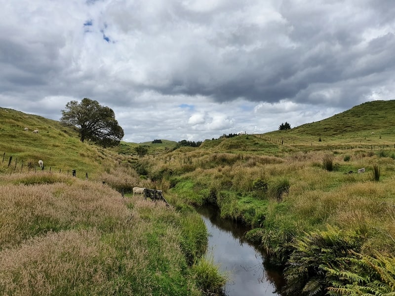
Height: 74 metres
Type: Punchbowl
Swimmable: No
Time to get there: ~15 – 20 mins walk each way
If you’re driving the Forgotten Highway, the Mount Damper Falls along with Whangamomona are two of the places you need to stop at.
Mount Damper Falls are a short detour off the main highway. Once at the carpark, you’ll still feel like you’re in the middle of nowhere (hello long drop toilet) with some picnic benches for you to enjoy.
Then the walk to the waterfall takes you across some private land (access allowed) before you enter the bush and before you know it you’ll be at the viewing platforms overlooking one of the higher waterfalls in the North Island.
4. PURAKAUNUI FALLS

Google Maps Location
Height: ~20 metres
Type: Three-tier cascading falls
Swimmable: No, you can soak your feet if you really want.
Time to get there: ~5 to 10 mins walk each way
The Catlins are a beautiful area of the country that’s one of the few places left on the South Island that can feel like you’ve escaped the tourist route.
There are several waterfalls you’ll likely visit on your Catlins itinerary with many of them just a few minutes off the main road, but the Purakaunui Falls are the most spectacular (with the Matai Falls a solid runner up). They are simply beautiful with the water cruising over the rock in a fairyland like style.
And it’s just a short walk from the carpark, winning.
5. EARLAND FALLS
Google Maps Location
Height: 174 metres
Type: Horsetail
Swimmable: No, you’ll likely get wet from the flow.
Time to get there: The distance is ~14km return. Allow up to 5 hours.
The Earland Falls awesomeness is enhanced by the fact they are on one the best hikes in New Zealand, the Routeburn Track. But at 174 metres high, they’re no slouch.
What’s great is that no two days are the same at Earland Falls, depending on the season, wind, rain, and various other factors, no two days are the same at Earland Falls. That’s part of there magic.
You don’t have to do the full Routeburn Track either, if you’ve got a longer day hike in you, you can hike the 7km into the falls and return (if you can, visit Key Summit too) for a great day out.
6. WHANGAREI FALLS
Google Maps Location
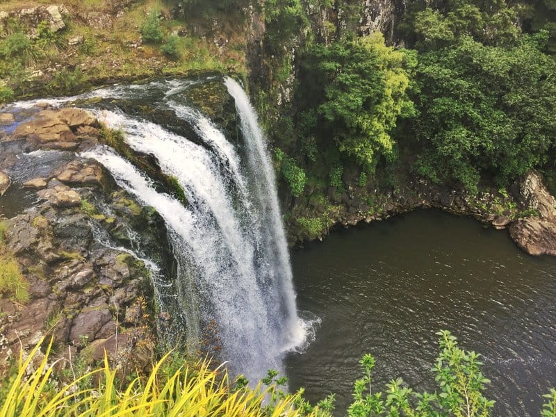
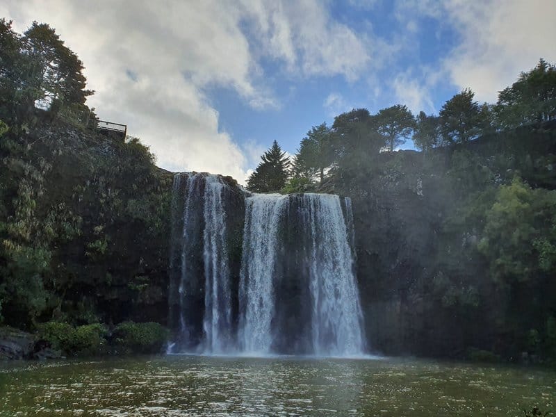
Height: 26 metres
Type: Curtain
Swimmable: Yes
Time to get there: ~10 mins each way or you can do the 13.6km return walk via the Hatea River Walk (you can do it one way).
The Whangarei Falls are one of the most popular tourist attractions in Whangarei, and they’re a must visit while you’re there. Sure, you could just head to the carpark and make the short walk to see them, but the Hawea River Track is a lovely way to spend a few hours in nature with the waterfall a nice reward. Hopefully it’s been raining a day or two before you goto them, it makes them that much better.
7. SUTHERLAND FALLS

Google Maps Location
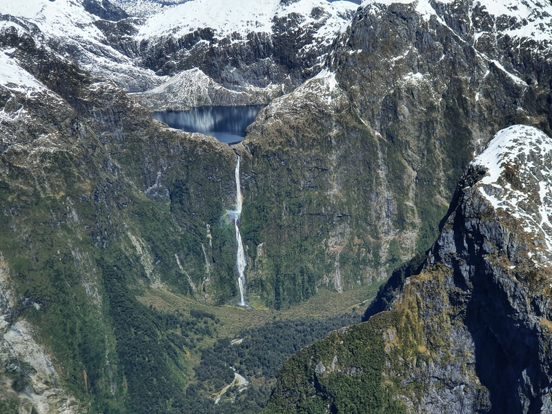
Height: 580 metres
Type: Multi-step
Swimmable: Not recommended
Time to get there: You will need to do the Milford Track, so up to 4 days.
You’ll have to hike the Milford Track to be able to see Sutherland Falls from the base. And not everyone will see them as it is a detour off the main track, but I think it’s worth doing the side trip. It’s hard to gauge just how big the are at 580 metres, but they are special.
If you don’t fancy hiking the Milford Track (or can’t get a booking), then you can also see the Sutherland Falls on most flights between Queenstown and Milford Sound (weather conditions can alter your flight path). As you can see in the photo above, it’s not a bad view.
8. GILKISON FALLS
Google Maps Location
Height: 140 metres
Type: Multi-step
Swimmable: You can take a wee dip!
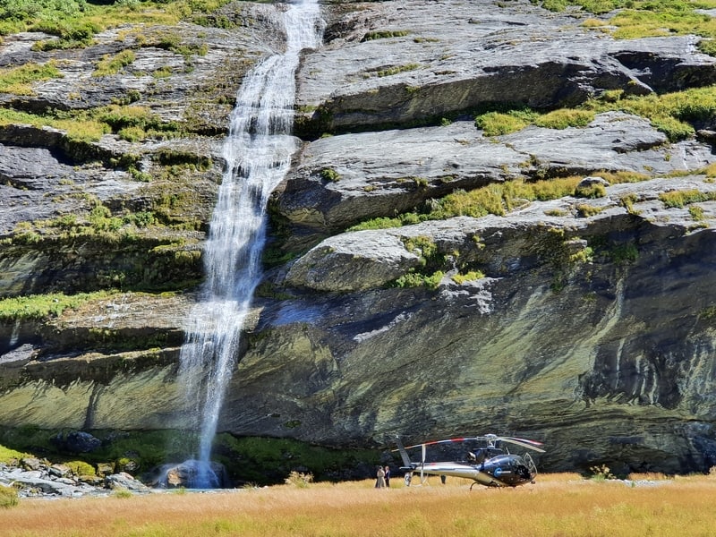
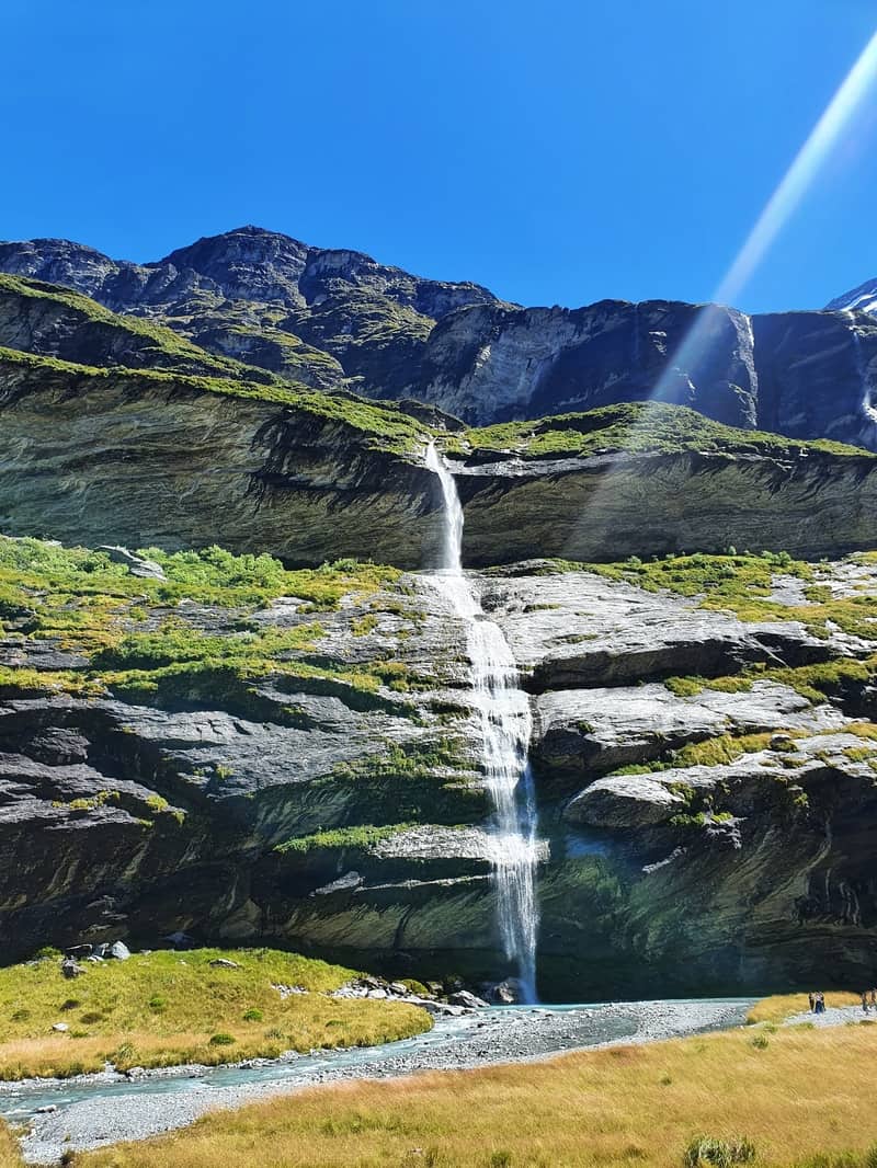
Time to get there: You could take a helicopter there, otherwise you’ve got an overnight hike or big day hike for 26km return.
The Earnslaw Burn Track isn’t just one of the hikes in Glenorchy, but in the South Island, thanks to social media. But its not to be underestimated, with Search & Rescue getting calls out to save people to often.
The track takes you through 8km of a bush track that’s slower going to start. Then you move onto private land (you can camp just before the private land starts), where you emerge from the bushline and get epic views all the way to the waterfall and glacier.
If you take the helicopter ride, you’ll be there in no time and get a pretty cool view of the Earnlsaw Glacier before landing at the base of the falls for the photo op. I’ve never been on the helicopter, but it does look pretty cool seeing them land while I’m on the track doing things the hard way.
9. RAINBOW FALLS
Google Maps Location
Height: 27 metres
Type: Curtain
Swimmable: Not recommended
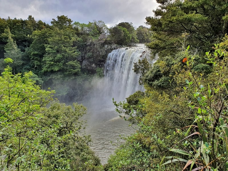
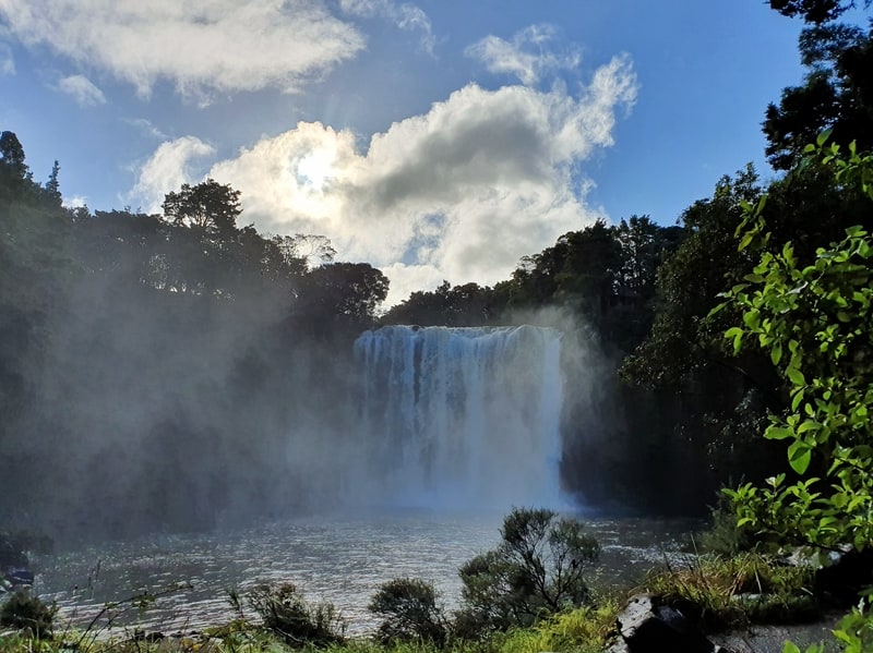
Time to get there: From 5 minutes, up to 3.5 hours for a return hike along the Kerikeri River Track.
There are three viewing points at the falls, which are a short distance from the carpark closest to the waterfalls. But if you’d like a longer walk that takes you along a beautiful river track, lined with bush and another waterfall, you’ll want to do the River Track mentioned above.
And that means you’ll have walked a section of the Te Araroa Track too.
While writing this post, it was interesting how little hiking you need to do to get to the majority of them. And it’s impressive how many of the best NZ waterfalls are in the North Island.
If you’ve got any questions about the visiting waterfalls in New Zealand, let me know in the comments below or email jub@churnewzealand.com.
p.s. here’s a map of all the hikes in New Zealand that are written about here on Chur New Zealand.

Hey, it’s Jub here. I’m the guy behind Chur New Zealand, helping you have the best time hiking, trekking, walking…whatever you want to call it…in NZ. I’m based in Queenstown and am always out and about exploring trails, old & new. If you have any questions, reach out.
Do the waterfalls run all year, or do they dry up in the dry season?
What’s the best time of the day to photograph – morning or afternoon – a waterfall?
Which direction does the waterfall face?
What’s the latitude and longitude?
Hey Dave,
Thanks for the suggestions! Need to revamp this page, so will keep these in mind!