The Kerikeri River Track from Kerikeri Basin to Rainbow Falls is a beautiful 8-9km out and back walk (you can make it shorter).
Read on for all the details you need to know about this walk to Kerikeri Falls (there’ll be plenty of photos too).
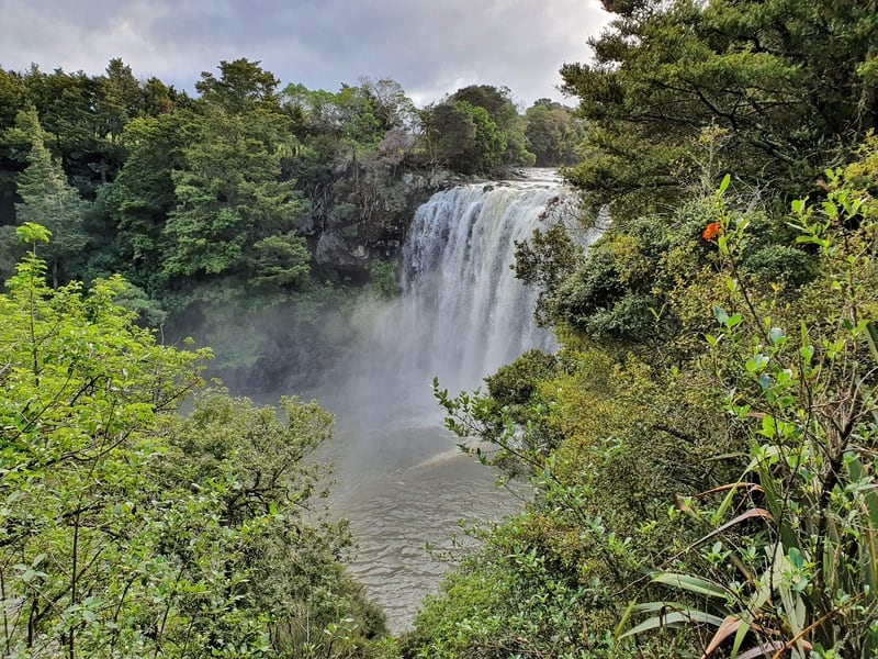
TABLE OF CONTENTS
1. Kerikeri River Walk Details
2. Kerikeri River Walk Map
3. How To Get There
4. My Trip Report To Rainbow Falls
1. KERIKERI RIVER TRACK DETAILS
QUICK DETAILS:
- Length: 7-9km return
- Elevation Gain: ~170 metres
- Track type: Out and back track
- Time: 2 to 3.5 hours
Maybe it’s related to having low expectations going in. Or maybe the company of friends was extra good on the walk? Or maybe the Kerikeri River Track really is simply awesome? I’m not sure what it was but I was swooning over this track!
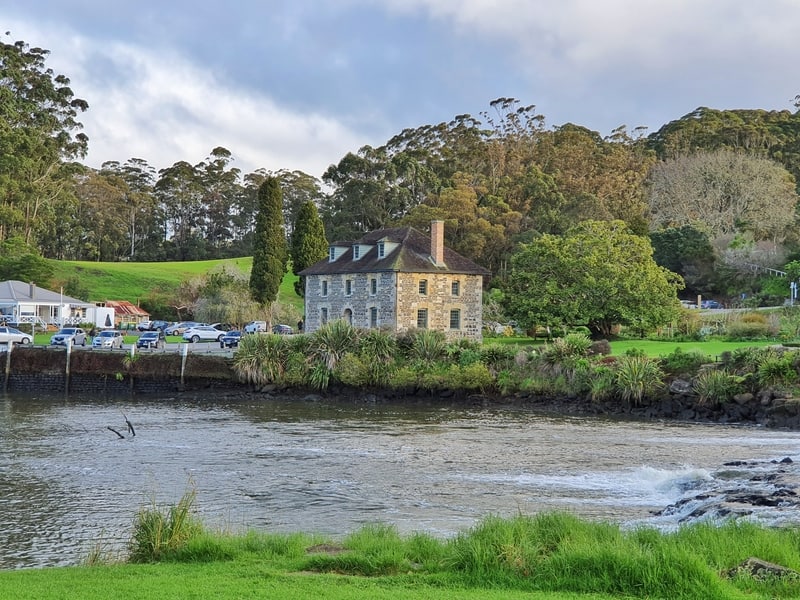
The track follows the Kerikeri River after starting near The Stone Store in the Kerikeri Basin. The kauri and totara lined forest track take you to the 27 metre Rainbow Falls. You’ll get to see Wharepuke Falls too, and there’s a couple of swimming holes for the brave.
Yes, you could drive to the car park that’s a one-minute walk away from Rainbow Falls but that’s no fun! It’s not a hard walk, and is super nice.
How hard is the Kerikeri River Track?
Easy.
How long is the track?
According to the Google Map below, it’s a 3.6km walk each way. That’s on the very low side by the time you walk to the upper Rainbow Falls Kerikeri lookout and around the Kerikeri Basin a little. My Strava Map finished at 9km on the dot which is the longest you’ll need to walk. So consider the walk in the 8-9km range.
What’s the elevation gain like?
From the Kerikeri Basin to Rainbow Falls is a small net uphill. Overall there’s very minimal elevation change overall with a few short undulations and the 20 metre or so incline to the upper lookout. It’s so little you don’t feel like you’re going downhill on the way back to the car park. The total elevation gained on the walk was 163 metres according to my Strava, but it felt less than that.
How long does it take to hike to Rainbow Falls?
The total walking time for us was 2 hours and 39 minutes. This included sitting on the benches watching the Rainbow Falls for 10 minutes, and a few minutes looking at the Wharepuke (Rainbow) Falls. We were walking at a steady pace, but it was by no means fast. You could walk the track in two hours if need be, and an easy pace should see you back within three and a half hours max.
2. KERIKERI RIVER WALK MAP
The walkway is more or less completely on Google Maps as you can see above. I’ll note the small difficulty with finding the track in my experience below, but once you’re on track there’s no issues with getting lost so you don’t really need a map.
The trail is on both maps.me and Topo Map NZ.
3. HOW TO GET THERE
DRIVING
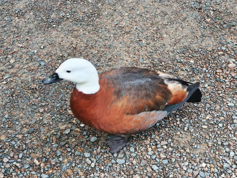
We parked at the Landing Road Carpark after the 20-minute or so drive from Paihia. The car park is free, and there was enough people around that it looked super safe. There were lots of roosters/chickens hanging out around the car park too 🙂
The carpark is a short walk away from The Stone Store and Rewa’s Village too.
PUBLIC TRANSPORT
There’s no public transport within Kerikeri but there are a few limited bus services that’ll take you to the centre of Kerikeri from Paihia/Waitangi. From the bus stop it’s a 2.8km walk to the trailhead via the Hongi Hika Scenic Reserve and the Stone Store.
It’s not the end of the world, but with limited bus services, you’d probably want to plan to spend a couple of days in Kerikeri itself. You can see the walking directions here.
WALKING
As I mentioned above, you can walk to the trailhead at the Kerikeri basin which is less than 3km from the town centre. And after reaching the Rainbow Falls, you can take the more direct route by walking back along the track, then coming off the track at the Heritage Bypass and walking into the town from there (directions here).
4. MY RAINBOW FALLS TRIP REPORT
After enjoying a few days in Paihia, a couple of friends invited me to join them for the afternoon in Kerikeri. They mentioned a walk, but I didn’t realise they’d planned to do the Kerikeri River Track and having done no research on it myself just had to go with the flow.
The car park on Landing Road wasn’t packed, but in the summer I can imagine you might find you need to find an alternative park.
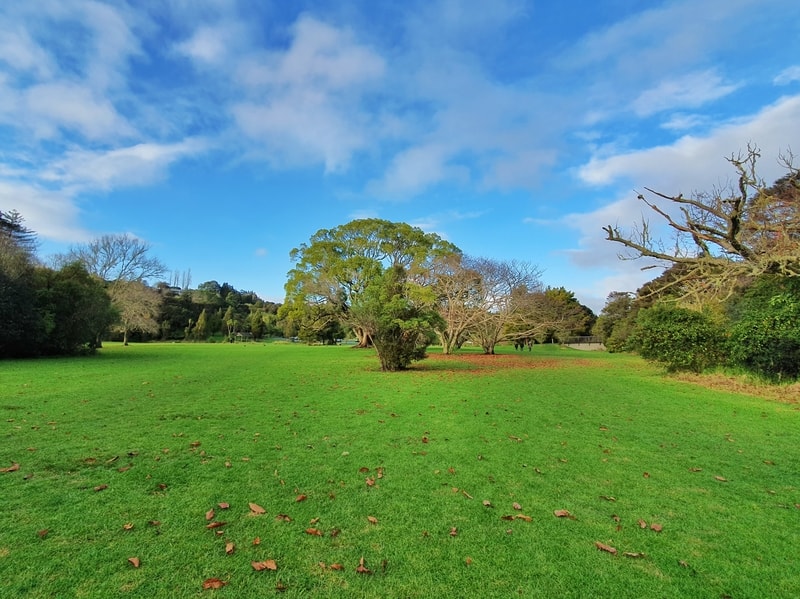
Starting our walk, we didn’t go the right way as we naturally gravitated towards the bridge over the river towards The Stone Store. That’s when we realised we needed to back track and walk across the Kerikeri Basin Reserve, where we could see a green DOC sign in the distance (you walk on the same side of the river as the Landing Road car park).
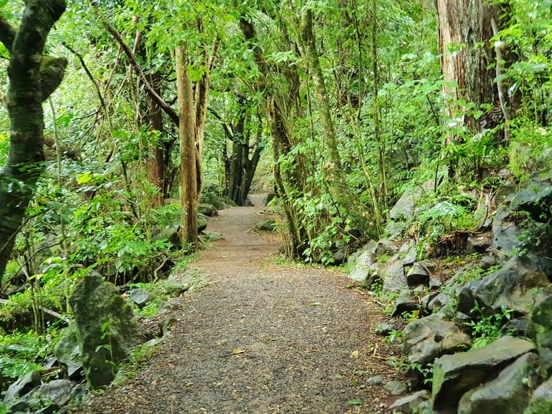
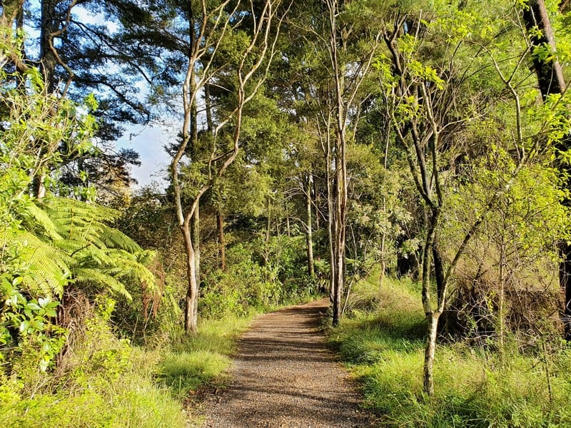
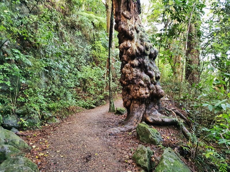
As soon as you leave the reserve and enter the actual track you’re on a tree lined forest track. The track is well trodden with minimal roots to trip over indicating that the kauri and totara are young.
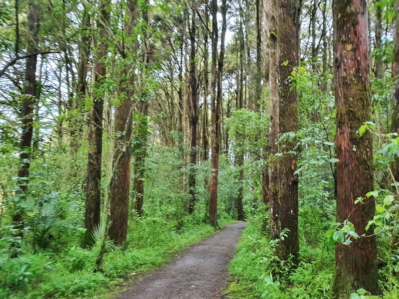
Speaking of kauri, make sure to give your shoes a good clean at the station when you walk through it.
The river is always present during the walk, but you’re never walkng on the river bed at any point outside of the waterfall viewpoints. The track has small undulations throughout, but they’re never anything you’re struggling on. You’ll also see an old hydro-election station you can go inside (it’s a two minute stop).
At about 1km into the forest path you’ll come across the Wharepuke Falls viewpoint. You don’t get super close to them, but it’s a nice view all the same and anytime you pass a waterfall on the way to the ‘main waterfall’ it’s a good thing, right?
There’s not much to say as the forest is simply gorgeous, and it makes for an awesome walk to do with people of all ages (we did see someone with their sturdy pram walking along).
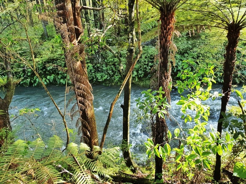
There’s also small rapids near where you walk under the Heritage Bypass crossing over the river (I feel it doesn’t disrupt the nature). There’s a seating area here too. There’s a couple of swimming holes along the river if that’s your thing…the water was far to cold for us.
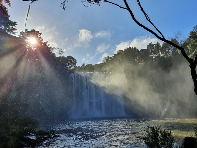
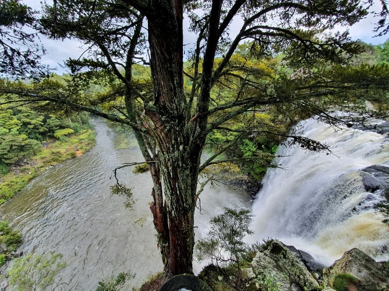
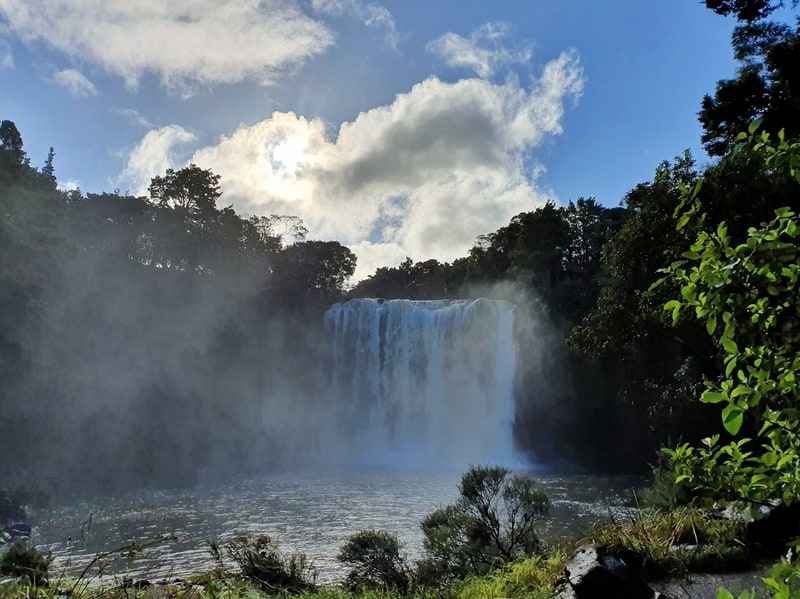
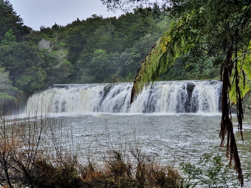
And then you come across the roaring Rainbow Falls. At 27 metres high, they feel bigger. The first viewpoint is from the bottom where you’re a decent distance awa so to the next two viewpoints and enjoy all their glory.
For the photographers out there, you’ll want to go early in the day for the best Rainbow Falls photos.
After you’ve finished up viewing the waterfall, it’s a simply mission of walking back the way you came.
The Kerikeri River Track is a beautiful walk through native NZ’s with two nice waterfalls as a reward.
If you’re heading up north, don’t write off Kerikeri. There’s a few other waterfalls to see in the town as well. If you visit after reading this post, please let me know in the comments below or email jub@churnewzealand.com.
p.s. Here’s a map of all the hikes documented on Chur New Zealand. You can click the icon to see brief details, as well as a link to read more about the hike (like this post).

Hey, it’s Jub here. I’m the guy behind Chur New Zealand, helping you have the best time hiking, trekking, walking…whatever you want to call it…in NZ. I’m based in Queenstown and am always out and about exploring trails, old & new. If you have any questions, reach out.