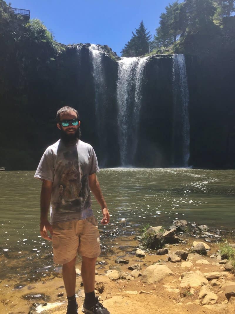
The Whangarei Falls are one of the cities icons.
While it’s not a waterfall people mention as the highlight of their NZ activities, the Whangarei Falls walk is a nice way to spend a couple of hours.
Given that there’s a car park right by the falls, most people don’t get to experience the few hours you can spend walking to Whangarei Falls walk from the city centre.
Whangarei Falls Tip #1: Avoid visiting in the middle of the day if you want great lighting for your photos
Officially called the Hatea River Walk, if you’re spending at least one night in Whangarei, you should walk the 6.8km trail at least one way.
You can then walk, bus, or hitchhike back to town.
This post will give you all the details you need to know about visiting Whangarei Falls.
TABLE OF CONTENTS
1. Details About The Whangarei Falls Walk
2. Whangarei Falls Walk Map
3. How To Get To The Falls
4. My Whangarei Falls Experience via The Hatea River Walk
1. DETAILS ABOUT THE WHANGAREI FALLS WALK
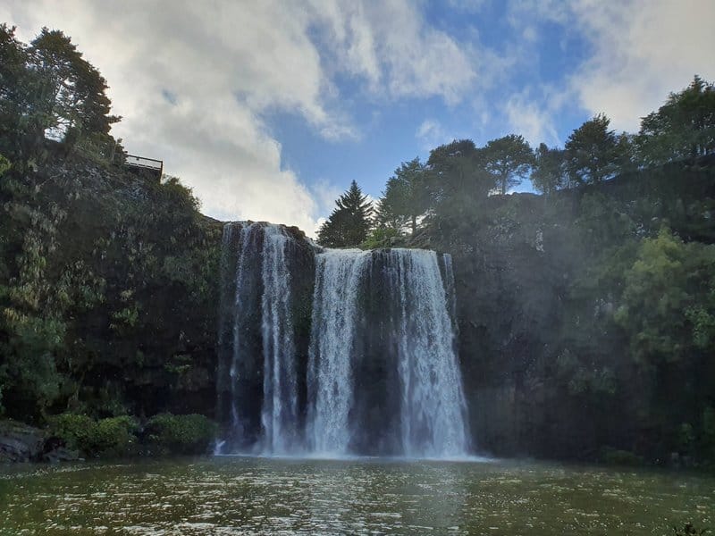
It’s a nice walk and the falls are cool, but it’s not a jaw-dropping adventure walk.
When1: September 2020 (have been twice)
Walk Distance2: Unfortuantely Google Maps doesn’t have the track marked, but according to Maps.me, to get from the Cell Block Backpackers to Whangarei Falls it’s 6.8km one way.
Difficulty3: Easy.
Incline: You’ll hardly notice the incline. It’s a slightly uphill walk from the city to the waterfall, but it’s so minimal it won’t effect you.
Walk Duration4: It took me just on 90 minutes to get from Cell Block to the Whangarei Falls. The Whangarei District Council brochure lists the walk at 2 hours and 30 minutes, so for most of you, it’ll be somewhere in that range.
2. WHANGAREI FALLS WALK MAP
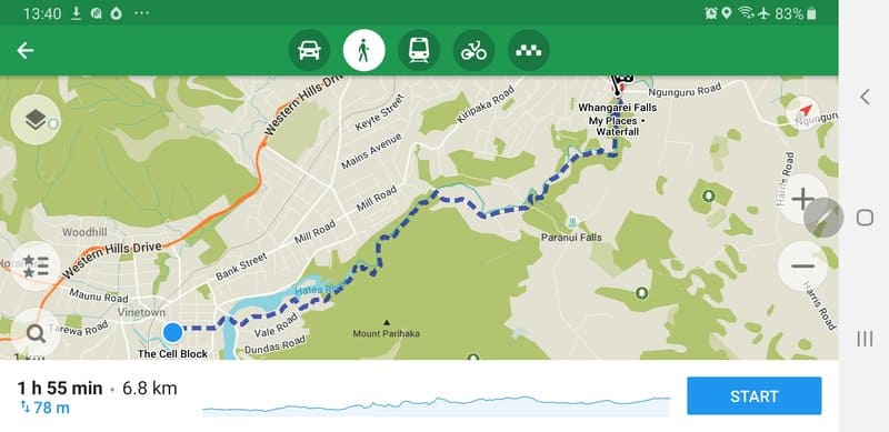
Unfortuantely the trail is not on Google (the falls are here). But, on Maps.me, if you enter the route ‘from’ Cell Block Backpackers ‘to’ Whangerei Falls, this is the way I went (see the screenshot above)..
HOW TO GET TO THE FALLS
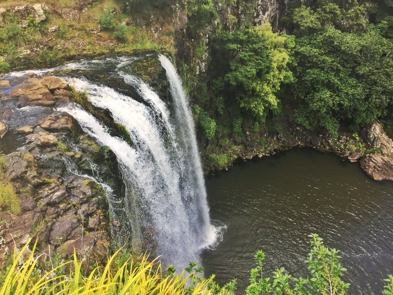
This was my favourite view point.
Getting to the Hatea River Walk trailhead: You can start from anywhere downtown Whangarei (yay) to get on the trail. I’m writing about my experience starting from The Cell Block Backpackers as that’s where I stayed. It’s in the city centre.
If you need to use public transport, this is the site to plan buses.
From the Whangarei Falls back to Whangarei: You can catch bus number 3 or 3A from Boundary Road and you’ll arrive back at Rose Street Bus Station in 20-30 minutes.
Timetable for bus 3 is here and 3A here. Note the departure times are very limited.
At the time of writing (December 2020) the cash fares were $2 for adults and $1 for children. Whangarei buses also use the Bee Cards for tagging on and off.
Driving: It’s a 10-minute or so drive (depending on traffic) to the Whangarei Falls car park. And from the car park it’s a short walk to the falls. You should complete the full Whangarei Falls walk though 😉
4. MY WHANGAREI FALLS EXPERIENCE VIA THE HATEA RIVER WALK
If this is your first activity in Whangarei, you’re in for a treat from the get-go. The marina is stunning and deserves a walk around itself (the Hatea Loop is great) but there’s no time for dilly-dallying just now so head over the Canopy Bridge.
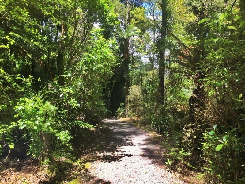
After the bridge, take the second left onto Vale Road and continue until the very end and you’ll see the path leading further north. The path follows the river and feels urban, but it’s definitely peaceful.
Once you reach Mair Park there are trails going in a few directions (I met a girl who was very confused on where to go).
Don’t cross the bridge on your left, stay straight on the path. It’s hard to describe (you want the river bank on your left throughout) but follow the maps.me app trail and you can’t go wrong.
You’ll see a sign for A H Reed Park, this is the path you want to take. Follow the trail until you reach Whareora Road. Turn right and follow the roadside path until you reach Paranui Valley Road which gives you access to AH Reed Memorial Park.
Explore the park a little if you like, just make sure you end up on the right route to Whangarei Falls.
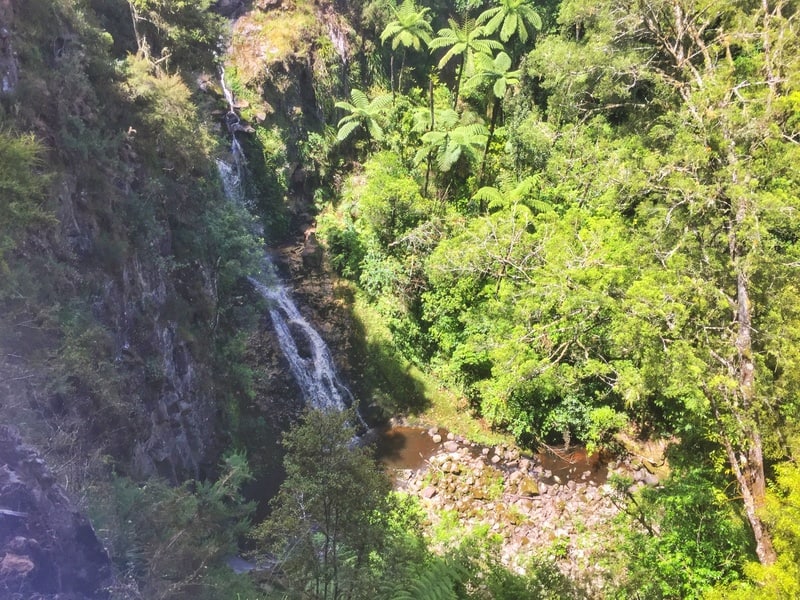
At the Memorial Park you can detour to Paranui Falls via the Canopy Walk
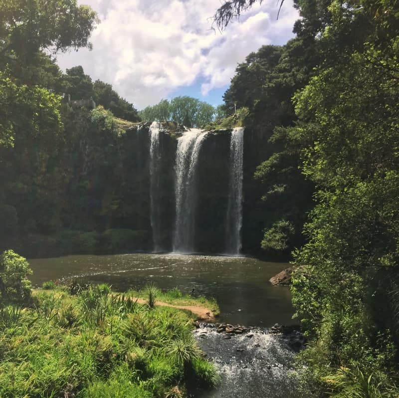
A snap from the bridge approaching Whangarei Falls
The rest of the walk is on a gentle path through forest and grasslands. As you close in on the waterfall, you’ll see a bridge crossing the stream.
Don’t cross that just yet, keep walking and you’ll come to a clearing in front of the waterfall which is perfect for a picnic. Table included.
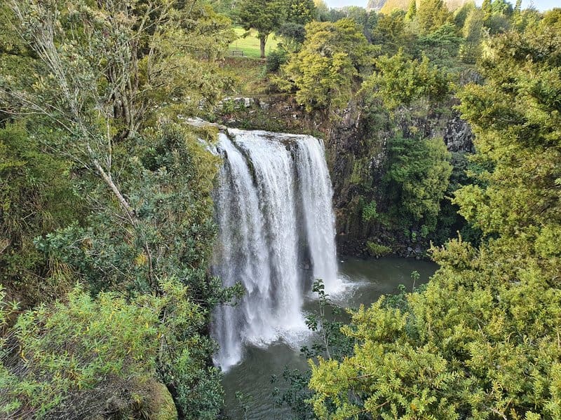
Can you swim at Whangarei Falls?
Yes, you can. But be aware it’s not to be taken lightly (it looks harmless) as there has been a death at the waterfall. Make your own decisions based on the conditions and your ability. Stay safe.
There’s a path you can take to do a 360 loop around the waterfall which you should do if possible. Head back to cross the bridge, follow the path and enjoy.
With Skip Travel (bus company) using Whangarei as its terminal station in the north, it’s as affordable as ever to get to Whangarei.
The Whangarei Falls is a stunning area, give it a chance!
As always you can email me jub@churnewzealand.com about the Whangarei Waterfall walk, or anything else (or comment below).
Now I just need to go and do some more of the Whangarei walks nearby.
RECOMMENDED READING
200+ Things to do in New Zealand
Ideas, ideas, ideas…ahh, the paradox of choice.
Hiking Mount Manaia in Whangarei Heads
Make the effort to spend at least a half-day here while you visit Whangarei
The Kerikeri River Track
The Kerikeri River Track a couple of hours further north is even better!
The Coast to Coast Walk in Auckland
Another great walk, but this one is back in the big city.

Hey, it’s Jub here. I’m the guy behind Chur New Zealand, helping you have the best time hiking, trekking, walking…whatever you want to call it…in NZ. I’m based in Queenstown and am always out and about exploring trails, old & new. If you have any questions, reach out.