Located on the peninsular south of Whangarei, the Mount Manaia track is a jewel of the region that’s got beautiful beaches and a few nice walks.
If you decide to do the Mount Manaia walk, you’ll be rewarded with panoramic views from the summit. On the way you’ll be walking under a canopy of nikau palms, kauri, rata, and pohutukawa.
And best of all, the walk won’t take you more than three hours there and back.
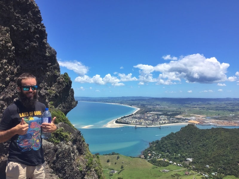
Proof of summiting mount Manaia
TABLE OF CONTENTS
1. Mount Manaia Track Details
2. Mount Manaia Track Map
3. How To Get To The Trailhead
4. My Mt Manaia Walk Experience
1. DETAILS ABOUT THE MOUNT MANAIA TRACK
This walk is incredible.
Even though the summit is less than 500 metres above sea level, the views from this summit are legit. I love the Mount Manaia Track and the only reason I don’t give it five stars is there are minimal viewpoints on the way up.
When1: December 2018
Walk Distance2: As often happens, Google Maps doesn’t have the trail on the map, but according to Maps.me it’s 1.8km from the carpark to the summit for a 3.6km return trip.
Difficulty3: Medium.
Incline4: The Mt Manaia Track starts about 100 metres above sea level with the summit at about 420 metres above seal level. Maps.me has the elevation change at 312 metres, with minimal decline on the way up this will be about the total elevation gain to.
Walk Duration5: It took me 45 minutes going up and 35 minutes going down, at a pretty good pace. I expect the total walking time (return) to be anywhere from 1-2 hours for 95% of people.
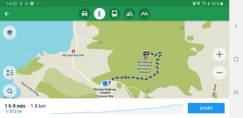
2. MOUNT MANAIA WALK MAP
I couldn’t find the trail on Google Maps the ‘normal’ Google Maps but was for Streetview. This gives you a look at what the track is like (you can click around to follow the trail).
On Maps.me the trail is marked which I’ve taken a screenshot of below.
3. HOW TO GET TO THE TRAILHEAD
The Mount Manaia Carpark
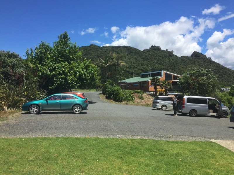
Driving (best option): The Mount Manaia carpark is a 28km drive (30-ish minute drive) from Whangarei. The carpark is large, so you should have no issues finding a space.
Shuttle: There’s no public transport around Whangarei Heads so your next option is a shuttle from Whangarei which you can book with Trail Drop Whangarei (they’re not always running). It’s not a cheap option, but it’ll get you to and from Whangarei on a good schedule if time is your priority.
Hitchhike: Hitchhiking in the Whangarei area is popular among backpackers and you shouldn’t have too many issues getting to and from Whangarei Heads. Hitchhiking in NZ is easy overall, and I got there starting at this BP station.
It took two rides with minimal waiting time to get there. Getting back to Whangarei took one ride.
What about accommodation? There’s isn’t a tonne of accommodation close to the trail head, with Manaia Cootage (that’s not a spelling mistake) the closest option on Booking.com.
4. MY MT MANAIA WALK EXPERIENCE
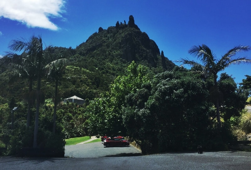
See those rocks at the top of the hill? That’s where you’re going.
As you approach Mount Manaia (it sticks out), you can see the big volcanic rocks jutting towards the summit. This was all the motivation I needed.
I hitched to the trailhead with a friend but there was plenty of space in the car park, and the toilets were in reasonable condition.
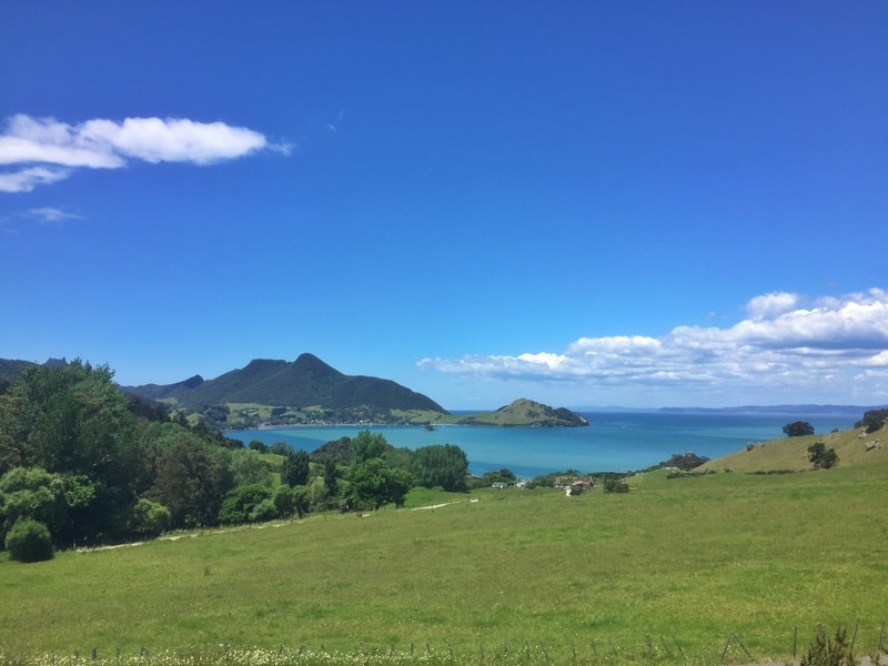
A view early on from the hike.
The well-manicured path takes you through some low shrub for the first few minutes of the hike before entering the native forest canopy. Once you hit the canopy, the views are minimal if any, and while it’s beautiful you’ll be asking yourself just how long to get to the top.
Note: There are lots of signs, and you won’t get lost along the way.
The toughest part of this hike is the pure number of stairs which increase in density the further into the hike you are. It’s nothing like the Paekakariki Escarpment Track, but they keep you honest.
Ultimately, the walk is less than 2km one way, so it’s not a day-long struggle.
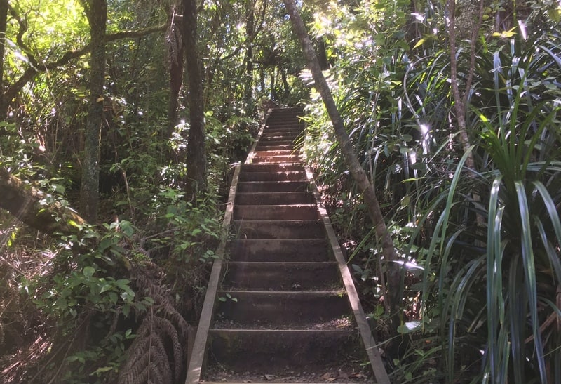
Up, up, up, up
We saw a super mum on the trail carrying two babies up. If she can do it, you can.
As I mentioned, you won’t get too many views on the way, but once you reach the top, you ARE rewarded. Do note, there’s no railing at the top so while you can explore around the top a little bit to find different vantage points, a fall wouldn’t be fun (keep an eye on your kids).
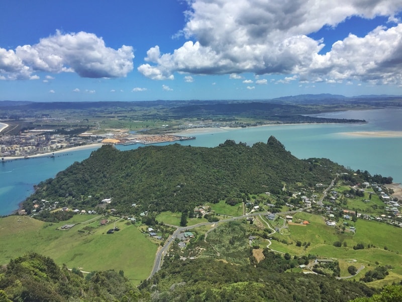
The main viewing point is large enough for a few groups to fit comfortably, and the best view is out towards the entrance of Whangarei Harbour (it reminds me of the Gold Coast for some reason). Absolutely beautiful!
In the other direction, you should be able to see Bream Head and the Hen and Chicken Islands offshore. An easy game to play…which island is which?
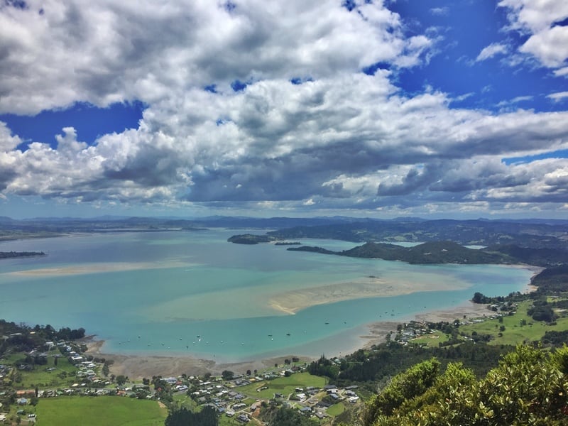
I could’ve spent an hour or more at the summit, watching the Whangarei Harbour activity and hanging with friends.
p.s. If you decide to picnic up the top, you won’t find much shade but VIEWS.
The return is easy enough, just go back the way you came. A super epic hike, with minimal effort overall. The Mount Manaia Track has a great effort to reward ratio!
If you’re exploring north of Auckland, Whangarei Heads might not seem worth it, but trust me, the region is epic and you can spend a great 2-3 days exploring the region. You won’t regret it.
Don’t forget to stop by the Whangarei Falls either.
If you’ve done any of the other Whangarei Heads walks, let me know too!
RECOMMENDED READING
200+ Things to do in New Zealand
For your inspirational needs
The Auckland Coast to Coast walk
Walk from one side of NZ to the other in a few hours
Tips for Travelling New Zealand
All of the quick hacks you need for NZ. Some are useful. Some not.

Hey, it’s Jub here. I’m the guy behind Chur New Zealand, helping you have the best time hiking, trekking, walking…whatever you want to call it…in NZ. I’m based in Queenstown and am always out and about exploring trails, old & new. If you have any questions, reach out.