
The Key Summit Track is a great option if you haven’t got time to do the full Routeburn experience but want to a taste of it.
This post will give you all the details about this Routeburn Track side trip you need to know.
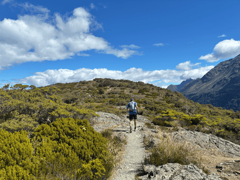
Side note: I don’t actually have a photo of myself at Key Summit (this is a photo I took of my friend on the way up), something I normally always put on the website. I have been here though!
Let’s get into it.
TABLE OF CONTENTS
1. Key Summit Track Details
2. Key Summit Track Map
3. How To Get There
4. My Key Summit Track Experience
1. KEY SUMMIT TRACK DETAILS
QUICK DETAILS:
- Distance: 8.2km return
- Elevation Gain: ~450m metres
- Difficulty: Easy to medium
- Download the GPX file here
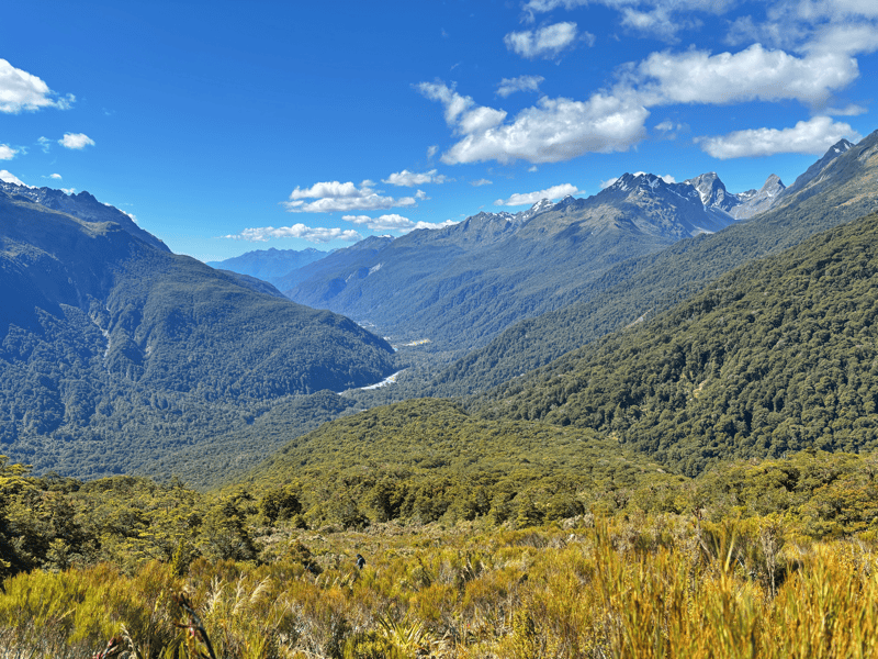
How hard is the Key Summit Track?
Easy to medium. It’s not a long hike, but there is some elevation gain and the terrain isn’t super smooth. That said, as long as you have suitable shoes/boots for hiking for a couple of hours you should be alright.
What distance is the Key Summit Track?
From the Divide to the Lake Marian Viewpoint is about 8.2km return. You can reduce it to about 7km by just going to Key Summit itself and not to the Lake Marian viewpoint.
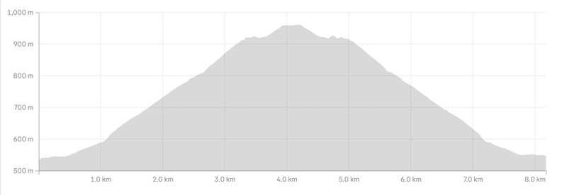
What is the elevation gain of the Key Summit Track?
There’s about 450 metres of elevation gain throughout the 8.2km. The majority of this is on the way out…you’ll get less than 50 metres of the total elevation on the way back.
Here’s the elevation profile:
How long does it take to hike Key Summit?
At about 8.2km with a reasonable amount of elevation gian, you can get this done in two hours…but I’d suggest putting aside three to four hours in total, which will include some time at the top where there’s some good place for picnics.
There’s plenty of hikes in Fiordland National Park with rougher, steeper terrain!
2. KEY SUMMIT TRACK MAP
You can click the image below to open the image in a new window.
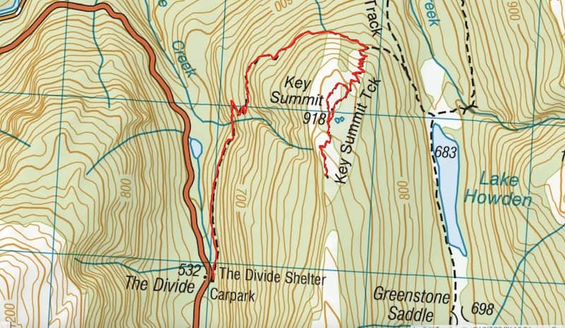
The map above is the GPX file overlaid on the map from topo.co.nz. Given you’re on a Great Walk Track, you won’t need a map for this adventure. You’d be doing really well to miss the turnoff to Key Summit!
3. HOW TO GET THERE
The start of the hike to Key Summit is the Divide Parking Lot. The most popular way to get here is to drive, while you’re on a trip to Milford Sound.
From Te Anau it is about a 84km drive, which will take over an hour (give yourself 90 minutes) and Milford Sound is about 33km, give yourself 45 minutes.
You can hitchhike the Milford Road pretty easy as it’s obvious which direction you’re going! But you’ll need to be flexible with your timings and start earlier in the day.
There are several bus options that can dropo you off from Queenstown or Te Anau, then you catch a bus later in the day. You’ll need to be confident on your timings just in case…but check out:
And there are guided tours available with Trips & Tramps or Fiordland Tours.
4. MY KEY SUMMIT TRACK EXPERIENCE
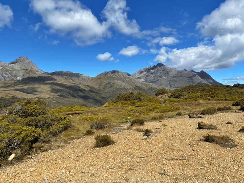
Starting from the carpark, the first 400 metres or so is your warmup on a gentle gradient before it starts to get steeper. You’re thrust into the forest, so you need to keep going if you’re to get the views.
Hopefully there’ll be a few birds bobbing about to keep you company, but if you haven’t been on any of the great walks before you might be surprised at how uneven the terrain is. That’s something I always remember along the Divide end of the track. You do need to focus on your steps.
The next 500 metres is a little bit steeper, but it’s when you take the hairpin turn at around 1km in that the track gets proper steep. There’s not much in the way of views along here, so just need to take in the beauty of the Fiordland forest and keep plodding along.
At about 2.6km, you’ll get to the turnoff to the track to Key Summit. From here, the terrain changes, and you’ll slower get out and above the forest into the subalpine terrain which is beautiful. I love it here.
Thankfully there are switchbacks, so you have a chance to keep moving at some kind of pace. Again, there are rocks and stones on the trail so it’s not easy easy…it’ll keep you working.
Then you’ll get to the top where it flattens out. Weeee! How good. You’ll start getting some views and feel the urge to stop, but wait until you get to the summit area where there’s the loop track, which is the flattest area of the hike.
Choose either direction (I’d suggest left if anything) and keep following it until you see the continuation of the track towards what on the map is ‘Lake Marian Viewpoint’.
Head here, then enjoy the views on the way back and choose your perfect spot for your hiking snacks. That’s what I suggest for the best.
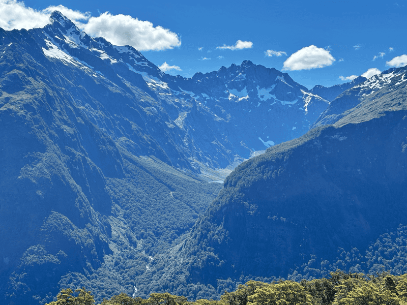
The view to Lake Marian is a wee glimpse (if the skies are clear), you have to stand just at the right spot to see some of it, but it’s cool all the same.
Make sure to read the information boards as it’s super interesting and will give you a greater appreciation of what you’re looking at.
Once you’ve finished up your picnic, you can make your way back the way you came. Take your time down the first part of the switchbacks…they can be a bit slippy in all conditions if you’re rushing.
Back to the carpark and it’s onto the next adventure.
Key Summit is perfect for those who don’t have time to do the full Routeburn Track but want to experience a little bit of Fiordland National Park.
Got any questions or comments about Key Summit Track? Leave a message below or email jub@churnewzealand.com and I’ll do my best to help you out.
Enjoy.
Chur,
Jub
p.s. Here’s a map of all the hikes documented on Chur New Zealand. You can click the icon to see brief details, as well as a link to read more about the hike (like this post).

Hey, it’s Jub here. I’m the guy behind Chur New Zealand, helping you have the best time hiking, trekking, walking…whatever you want to call it…in NZ. I’m based in Queenstown and am always out and about exploring trails, old & new. If you have any questions, reach out.