The Mueller Hut Track is an out and back hike in the 10-11km range.
With over 1000 metres of elevation gain, it’s going to be the hardest hike some of you have ever done…but is one of my favourite hikes in the South Island.
The track, while an alpine route that’s not maintained beyond Sealy Tarn, is doable for everyone with a little fitness in the summer.
In the autumn, and spring, it’s doable a lot of the time, but it’s best to check-in at the DOC visitor centre to see what the weather is like. In the winter, you’ll want to have a good amount of mountaineering experience along with all the top gear.
Many people will stay overnight in photogenic Mueller Hut. But with the hut often booked out well in advance, if you want to get a glimpse of the views you’ll need to hike the Mueller Hut Track in one day.
It’s possible to do a day hike to Mueller Hut but not easy. But that’s how I experienced the route and will be what the post focuses on.
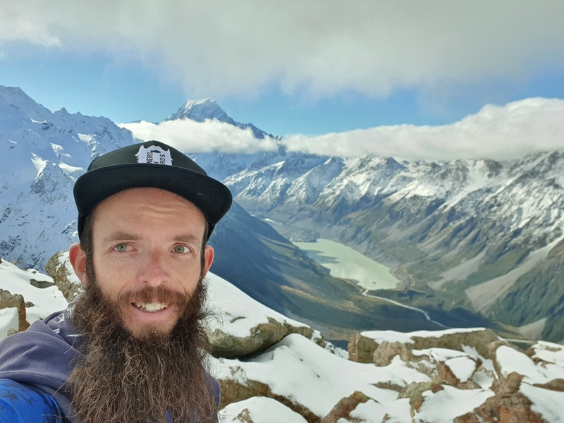
Proof I’ve been on the track, and this post is based on an actual experience.
Note: The terrain can change a lot throughout the different seasons. When I look at the photos from Dave’s trip report, it’s hard to believe that’s what it can be like (I was in the snow at the top).
TABLE OF CONTENTS
1. Details About The Mueller Hut Track
2. Mueller Hut Track Map
3. How To Get To The Trailhead
4. My Experience Hiking The Mueller Hut Track In One Day
5. More Photos
1. DETAILS ABOUT THE MUELLER HUT TRACK
When1: End of April 2021
Difficulty2: Hard. They way up is steep, particulary for the 2nd, 3rd, and 4th kilometre. You’ll want to have a little bit of hiking fitness at minimum before taking this one.
Hike Distance3: Starting from and finishing at the main carpark, my Strava shows 9.7km return for the hike. The DOC website has the track at 5.2km each way, so plan for a 10-11km return trip on the safe side.
Incline4: Strava registered 1143 metres of elevation gain. This feels about right with the DOC sign near the trailhead mentioning there’s over 1000 metres of elevation gain.
There’s only a couple of very minor inclines on the way back down.
Here’s the Mueller Hut Track elevation profile based on my recording:
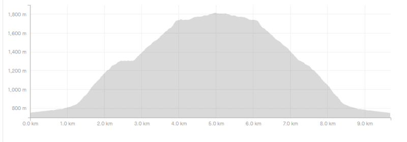
Hike Duration5: In total the return hike took me 4 hours and 6 minutes.
It took me just under 2 hours to reach Mueller Hut from the car park. I didn’t take any long stops on the way (for food etc.), but took lots of photos. I did take the minor detours to the Sealy Tarn picnic bench and the second viewpoint further up the track.
I spent ~20 minutes at the summit (I didn’t go to Mount Ollivier) before descending which took around 1 hour and 50 minutes.
Note: From mid-November to April 30th, you can’t stay at Mueller hut using your Backcountry Hut Pass.
2. MUELLER HUT TRACK MAP
The map above is the Strava file overlaid on a topo map. You can also see the full trail on Maps.me (available offline).
Google Maps also has the route. I appreciate the suggested walking time to the hut as 1 hour 5 minutes :p Yea right!
3. HOW TO GET TO THE TRAILHEAD
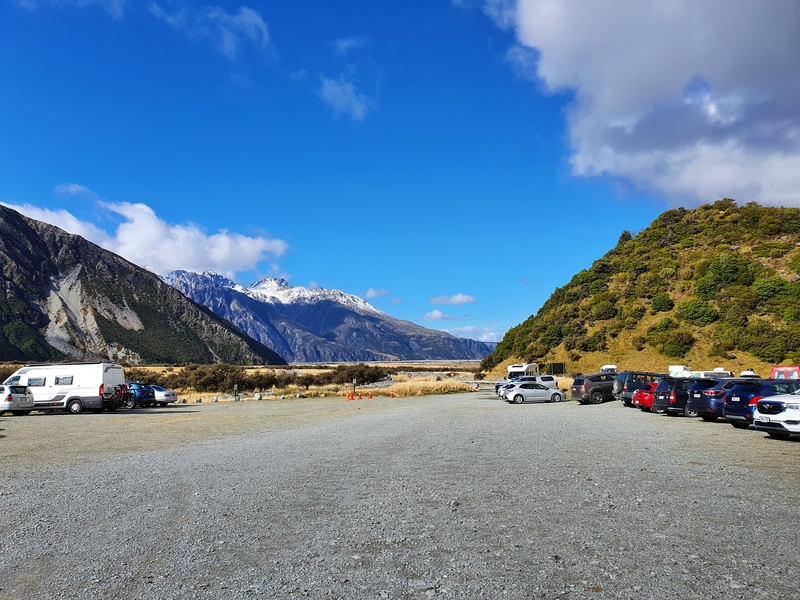
The most popular way to get to the Mueller Hut Track trailhead is by car. The car park is here, it’s called the White Horse Hill Car Park.
If you’re staying in Mount Cook Village, you can also walk to the trailhead via a nice track starting by The Hermitage/DOC visitor centre. This adds about 1.7km each way to the walk, but it’s a flat route.
4. MY EXPERIENCE HIKING THE MUELLER HUT TRACK IN ONE DAY
Having left Lake Tekapo in the morning, I was a bit slow with getting started on the hike. But finally was on my way after a quick chat with the staff at the visitor centre.
I recommend everyone pop into the visitor centre to have a quick chat with the staff about your intentions of hiking to Mueller Hut. You should do this with the Ball Hut route too.
They have cameras on the mountain to give you up to the minute weather conditions, and while we know the weather is unpredictable they can give you a reasonable idea of what to expect.
On my visit, they mentioned the fresh snow that fell the previous night but said I’d be okay with making it to the hut and back in a day. If I got to Sealy Tarn and the weather wasn’t looking great, that’s the spot to turn around as it becomes a route, rather than a maintained track from there.
I have a feeling they cater the advice to individuals as a couple of others who I chatted to who were recommended to bring crampons on the same day.
RELATED READ: 10 AWESOME MOUNT COOK WALKS AND HIKES
Anyway, I started the hike from the main car park (at the White Horse campground). The car park is pretty large, but you’ll find the trailhead easy enough next to the shelter.
The first kilometre of the hike is easy. You’ve got a gravel path, and you’re walking on what is essentially flat terrain. The metres tick over and it feels like you’ll be up to the hut in no time as you pass the Kea Point turn off about 800 meters in.
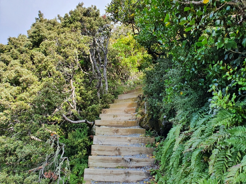
But then you’ll hit stairs about 1km in. And the stairs will be a part of your life for the next 40 to 100 minutes. They’re relentless. Apparently, there’s 1964? I didn’t verify this myself 😉
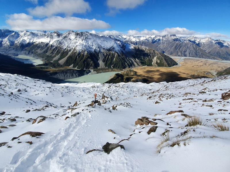
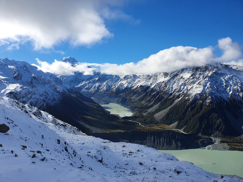
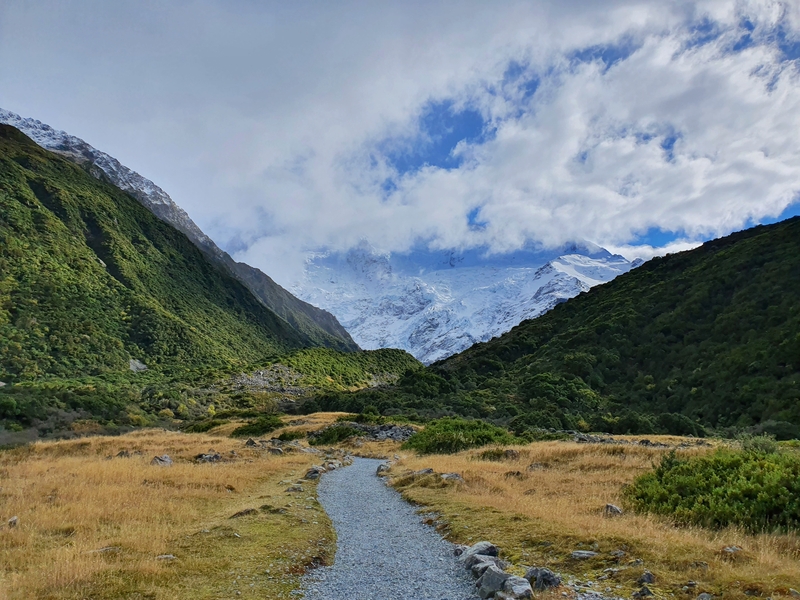
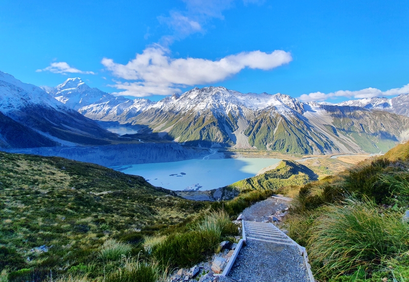
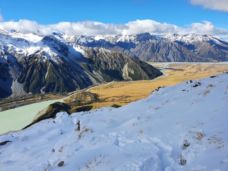
There’s a decent amount of bush on either side of the stairs but you’ll start to get some views early on of Mueller Lake, and the flat land back towards Mount Cook Village.
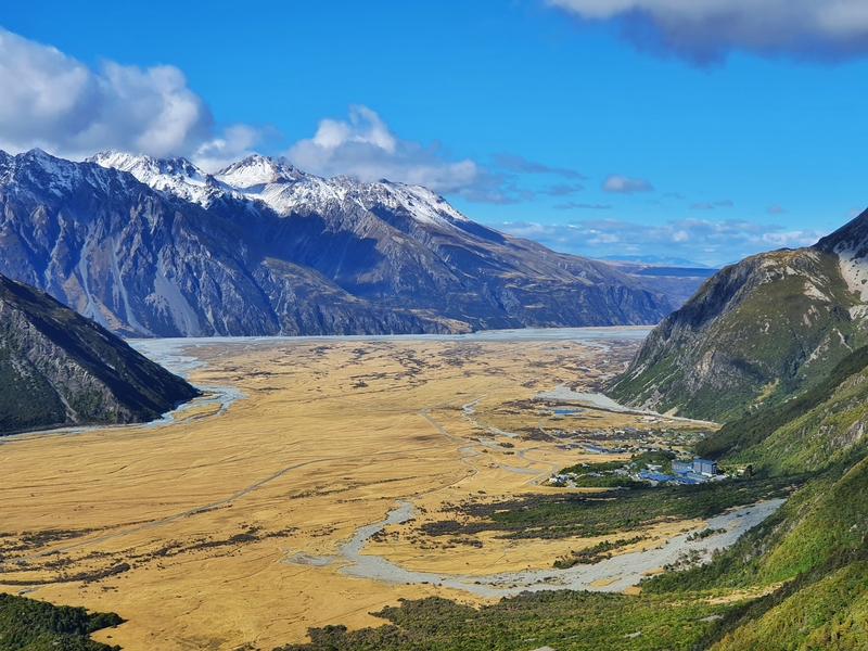
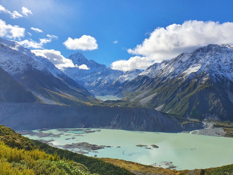
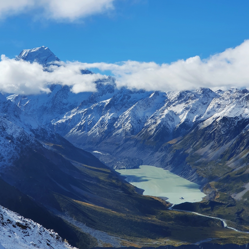
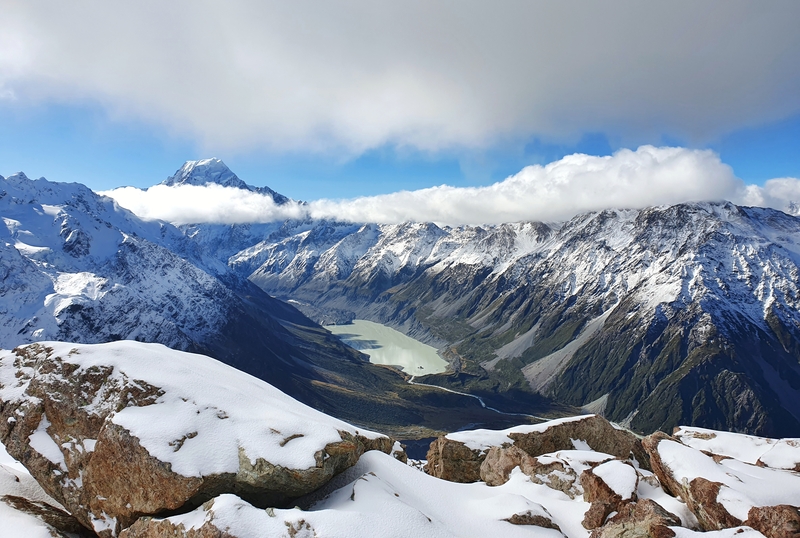
Hooker Lake will then come into view, and if you’re lucky you’ll have Aoraki/Mount Cook towering above. It can be confusing to know exactly which peak is Aoraki/Mount Cook, so I used the maps.me app to verify (you can also ask other hikers).
There was some cloud lingering around the Mount Cook summit at times, but the view was better than I could have hoped for so took a bunch of photos. Just in case Mount Cook was flirting with me and decided to hide behind the clouds for the rest of the day.
But the views just keep getting and better! And so I ended up taking way more photos than necessary!
I was on a mission and passed a few people carrying their overnight packs for their stay in Mueller Hut. I’ve got respect for anyone who hikes up that incline with a massive pack!
I was told there were some muddy sections when you get to Sealy Tarn, and they were accurate.
I’m guessing this was muddy as there was rainfall here the previous day rather than snow settling. Then before I knew it, I was at Sealy Tarns. The family having lunch at the picnic bench were so stoked on life. You can’t ask for a better view from a picnic bench!
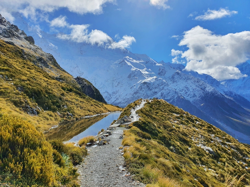
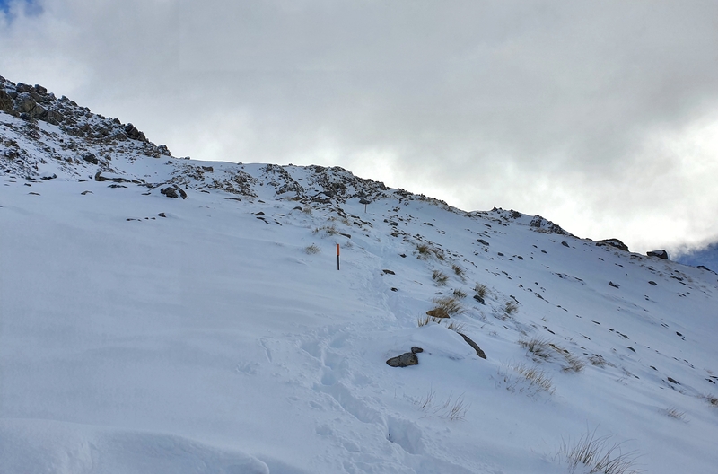
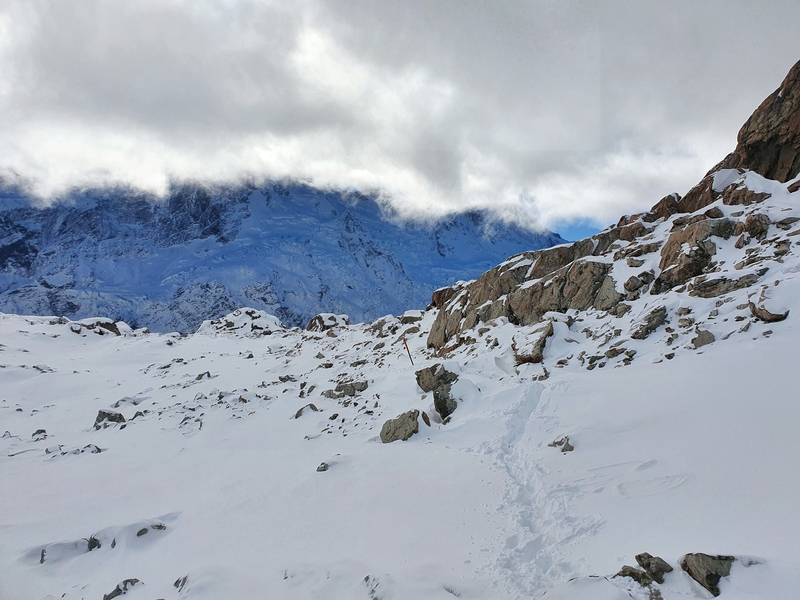
And from Sealy Tarn up, the track is not maintained. It gets rocky right away, but at least you don’t have to deal with any more stairs? It’s not any easier though.
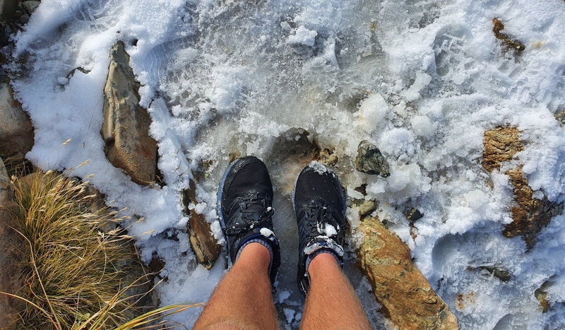
There were patches of mud here and there, and some of the rocks looked slippery. I took extra care in points to try not to slip.
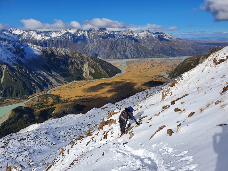
And then a little further up, the snow had started to settle.
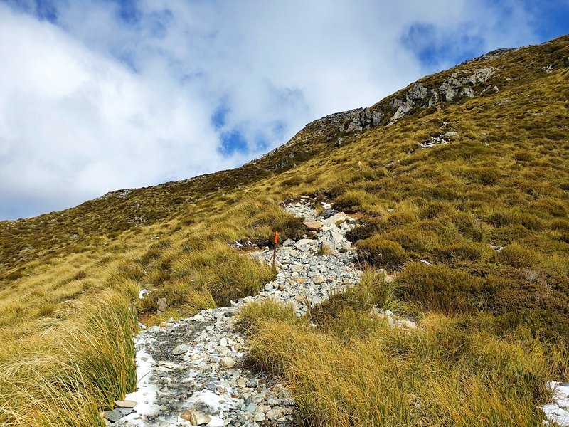
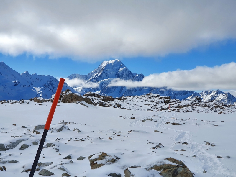
The track is poled, and they are easy to spot (on a clear day), but I found I was just following the footsteps in the snow from those who had set out earlier in the day.
A friend mentioned he hiked up at night a few weeks earlier (he went after finishing work) and really struggled with finding the poles.
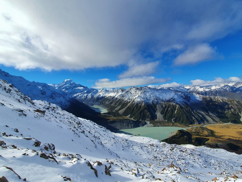
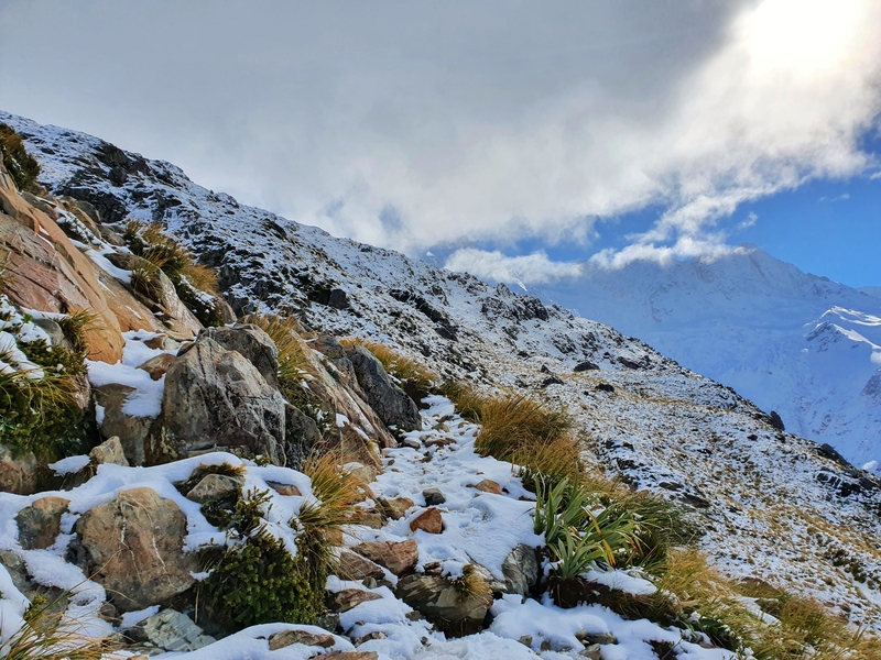
The next 1km or so was a slow trudge up the slope which was covered in a decent amount of snow. Look back for the views if you need more motivation 😉
Often the footprints I was stepping into were knee-deep. Fortunately, people in front of me had done the hard work and I just matched their footsteps, avoiding the occasional post hole.
I caught up to a family of five as we closed in on the ridgeline. Full credit to their kids, they were smashing out the hike!
I took the little detour to the viewpoint just as you swing around to the left, and that made me extra thankful to those who had created the footsteps before me all day. No one had made prints in the snow for this detour and towards the viewpoint, I found myself thigh deep in the snow between rocks a couple of times.
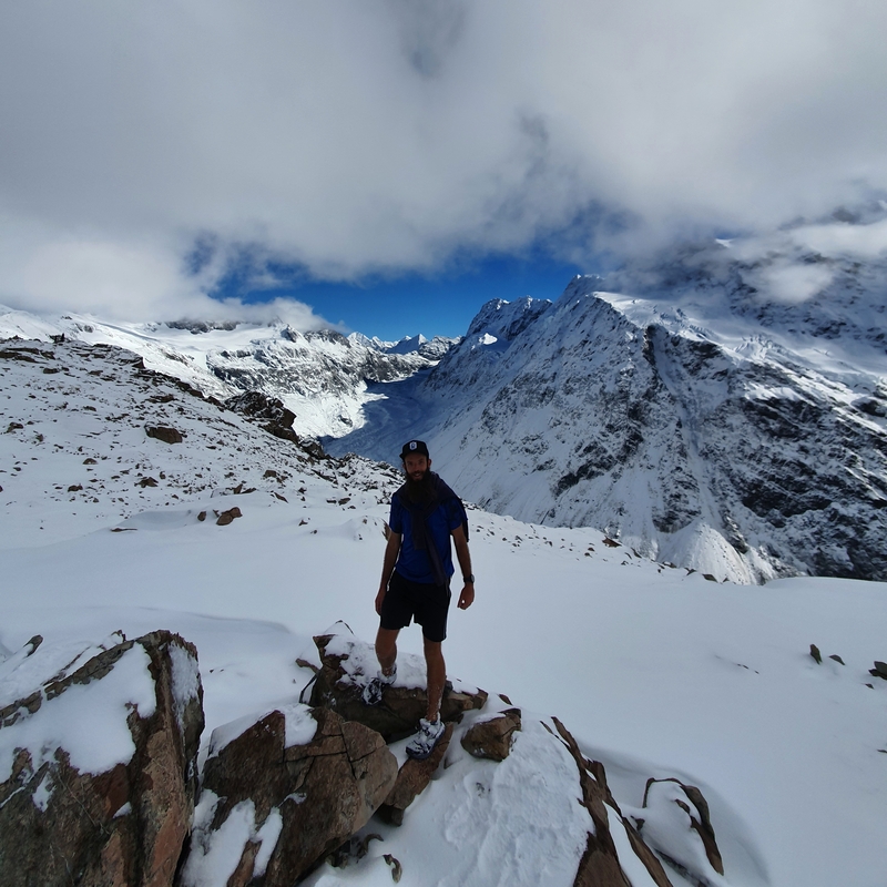
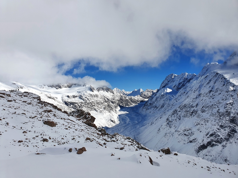
Back on track, and you hang a left around the bend where you get full views of Mueller Glacier, making it one of the great hikes to see a glacier in NZ.
I was hoping to see the hut in the distance as soon as we got around the bend but it wasn’t to be. On the plus side, there’s less than one kilometre to go from this point with less than 100 metres of elevation!
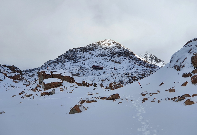
There were some little technical sections through here but as soon as the hut comes into view (can you spot the hut in the photo above?), the countdown is on! In the summer this section is all scree, so perhaps it was easier in the fresh snow?
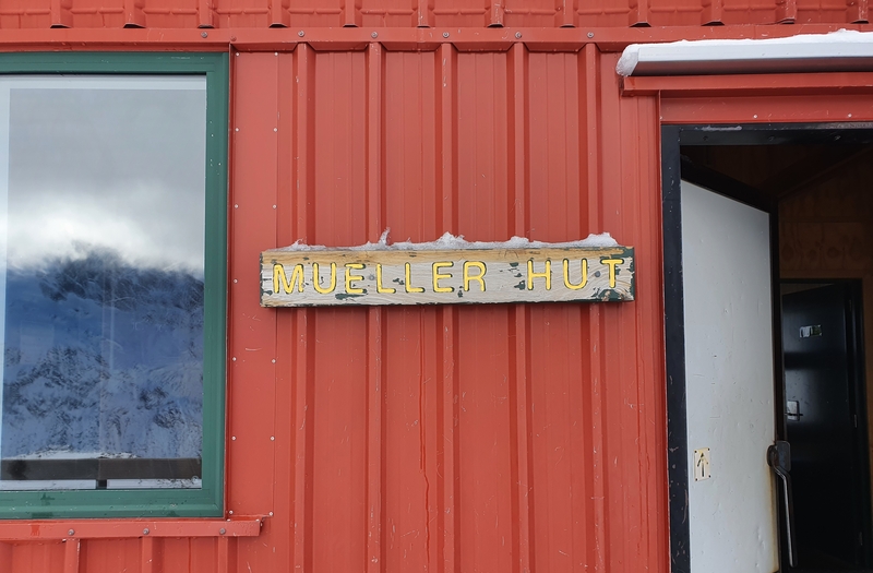
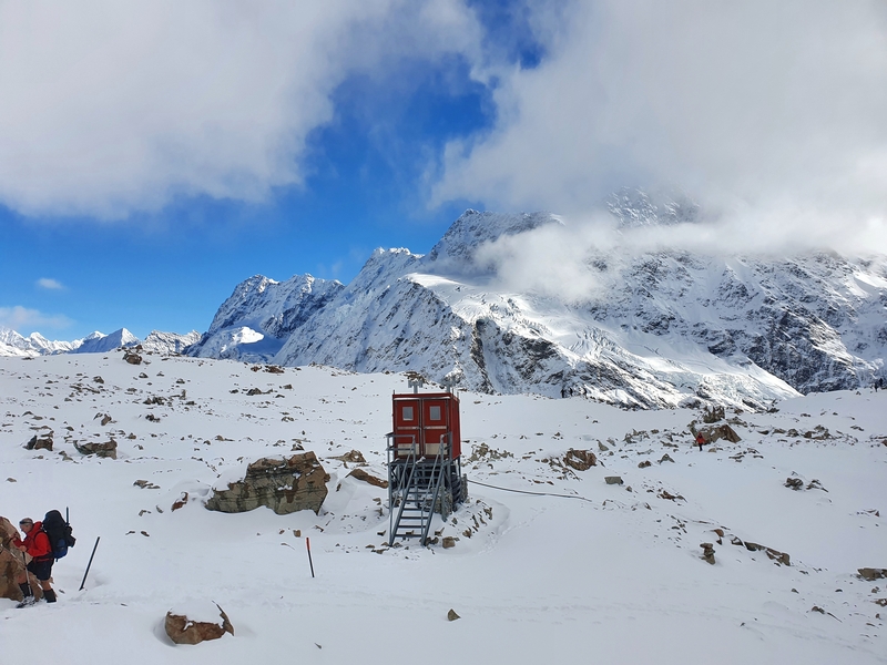
And then you’re at the hut! You’ve made it. Well done, congrats.
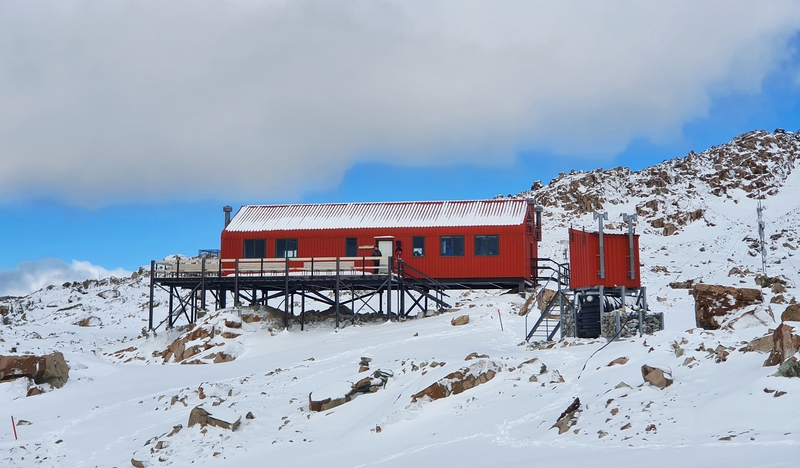
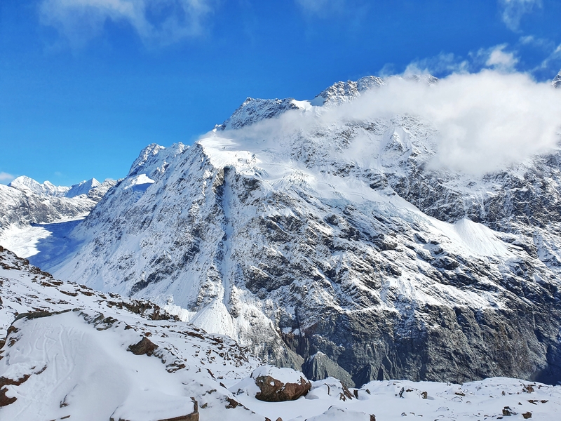
I stopped to eat and drink for 10 minutes before taking a little walk around admiring all the peaks and glaciers. While at the hut I saw a decent avalanche come tumbling down across the valley. Note to self. Avalanche safety is something I need to learn.
I initially wanted to go up to Mount Ollivier (the first peak Sir Edmund Hillary climbed), but no had been up there so far in the day and the snow was looking a little bit hectic (the route isn’t marked). I played it safe and decided not to go.
If you need to warm up, head into the hut for a little bit before descending.
And back down…
So after fluffing around, the hike back down starts. The first kilometres is easy (maybe not if it’s scree?) following the footsteps in the snow.
Then you’ve got the steep descent which was hectic at times…it felt like I had to leap down into the snow a couple of times, praying the snow wasn’t too deep where I was landing. It was almost easy to break out in a little jog and go with the snow breaking loose if anything.
Then you hit the section where the snow had started to melt already with the sun. The regular foot traffic just made thing more slippery. This was slow going at points.
From Sealy Tarn down, I got flashbacks of the last 8km of the Tongariro Alpine Crossing in Tongariro National Park. You know the views are amazing, but it’s a bit of a slog (in this case down almost 2,000 stairs) and you just want it to end. Those with dodgy knees would have 10x more nightmares no doubt.
And then you finish with the stairs and you can screech with joy from there on in!
5. MORE PHOTOS!
I didn’t want to put too many photos in between the text, so I’ll leave a bunch more here too.
The Mueller Hut Track had been on my list of things to do in NZ for a long time.
I was stoked to get this done as a day hike on a nice weather day too.
If you have any questions about the day hike to Mueller Hut and back, leave a comment below or email jub@churnewzealand.com .
RECOMMENDED READING
Hiking to Mount John
The goto hike when visiting Lake Tekapo.
The Roberts Point Track
A great hike to do when you’re in Franz Josef.
The Ball Hut Route
A great overnight hike close to the Mt Cook Village.

Hey, it’s Jub here. I’m the guy behind Chur New Zealand, helping you have the best time hiking, trekking, walking…whatever you want to call it…in NZ. I’m based in Queenstown and am always out and about exploring trails, old & new. If you have any questions, reach out.
hai dude. i am so glad i came across your blog. planning to do Mullers Track so definitely it was a great insight.
I am planning overnight but wanting to camp out instead of staying in the hut
you did this Track late April, do you think pitching tent is possible or still lots of snow
would appreciate your input.
Hey David,
Stoked you got this done 🙂 If you’re planning to pitch a tent there in the summer, no problem. In April based on my experience, you wouldn’t have any luck based on my experience, but it all comes down to when the first cold spell hits after summer really 🙂
We just did this hike a few weeks ago. Having read your article here, we counted the number of steps down from Sealy Tarn down to the next trail junction. If you count all the ‘steps’ – a discrete step down, mostly built wood or a placed rock… it counted out to 1999! I kept count up to a hundred and my daughter kept track of how many hundreds we had!
Hey Chuck,
Surely you could have found an extra step to reach 2000 haha. I like the system you’ve got going on there with your daughter! I’ll try count next time I’m there in a couple of months 😀
Cheers,
Jub